On our last day in St. Helena we cleared out in the morning for a weekend departure and spent the rest of the day on a custom island tour with Derek Richards of No Limits Travel and Tours. We generally don’t like the constraints of a guided tour and initially were planning to hire a car, but none were available with the holiday season. So we booked a custom tour with Derek and are really glad we did. Born and raised on St. Helena, Derek was an excellent guide and great company. We saw more and had a much better time than we would have had driving on our own. If you visit St. Helena, this is the way you want to tour the island.
Trip highlights from January 8th follow. Click any image for a larger view, or click the position to view the location on a map. And a live map of our current route and most recent log entries always is available at http://mvdirona.com/maps
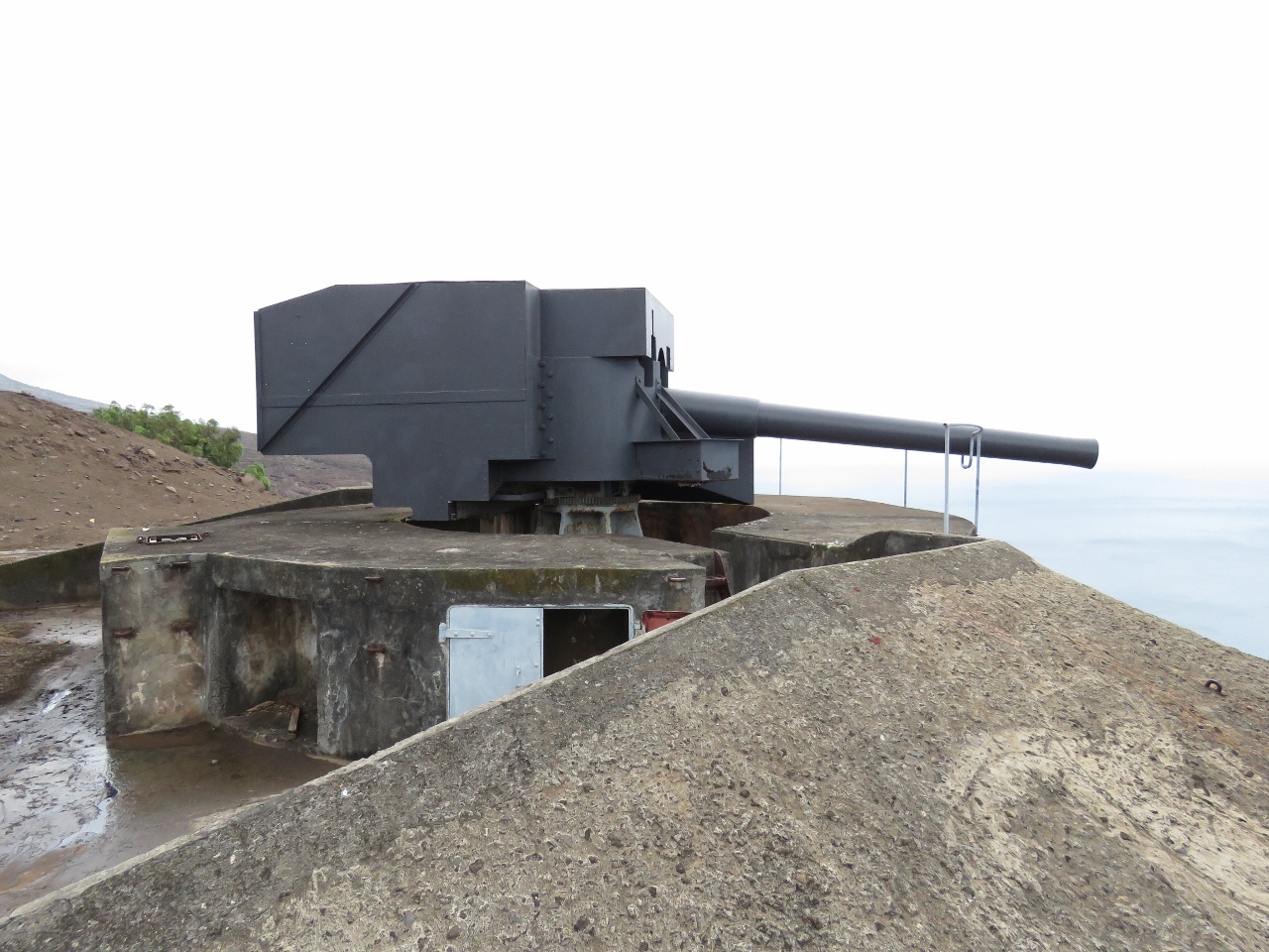 |
Ladder Hill Guns
Position: -5 43.36, -15 55.65
Our first stop was the restored World War I guns at Ladder Hill, just beyond the Ladder Hill Fort.
|
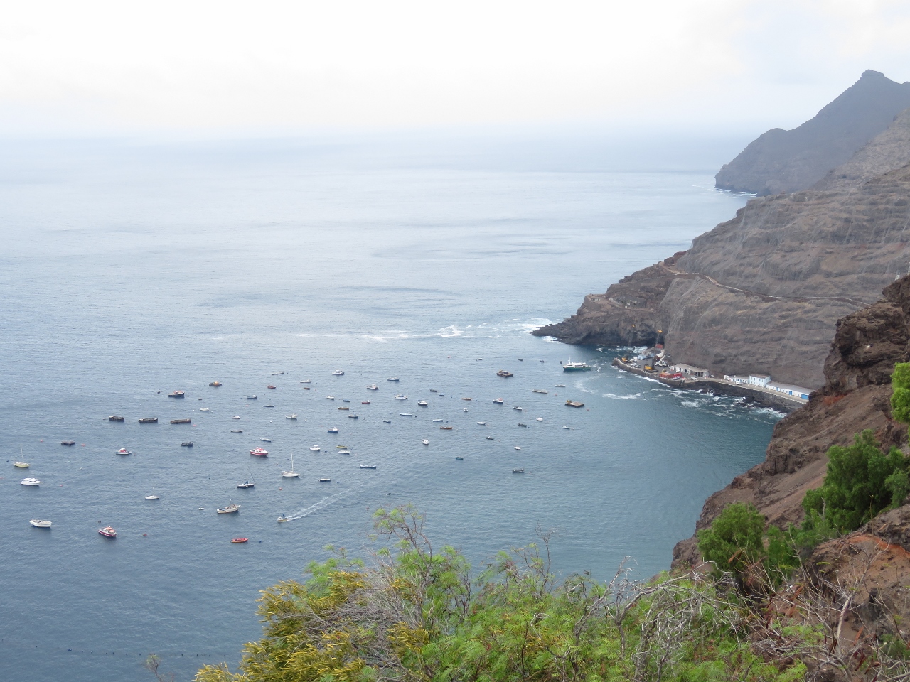 |
James Bay
Position: -5 43.35, -15 55.65
Gun emplacements always have great views, and this was no exception. This is looking to James Bay from the Ladder Hill Guns.
|
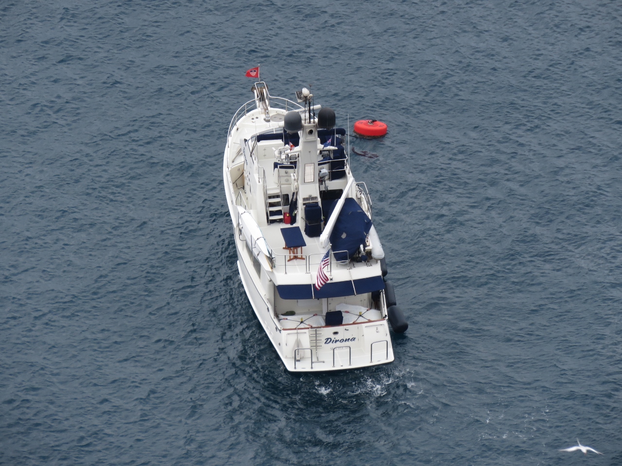 |
Dirona
Position: -5 43.36, -15 55.65
Dirona on the mooring far below the Ladder Hill Guns.
|
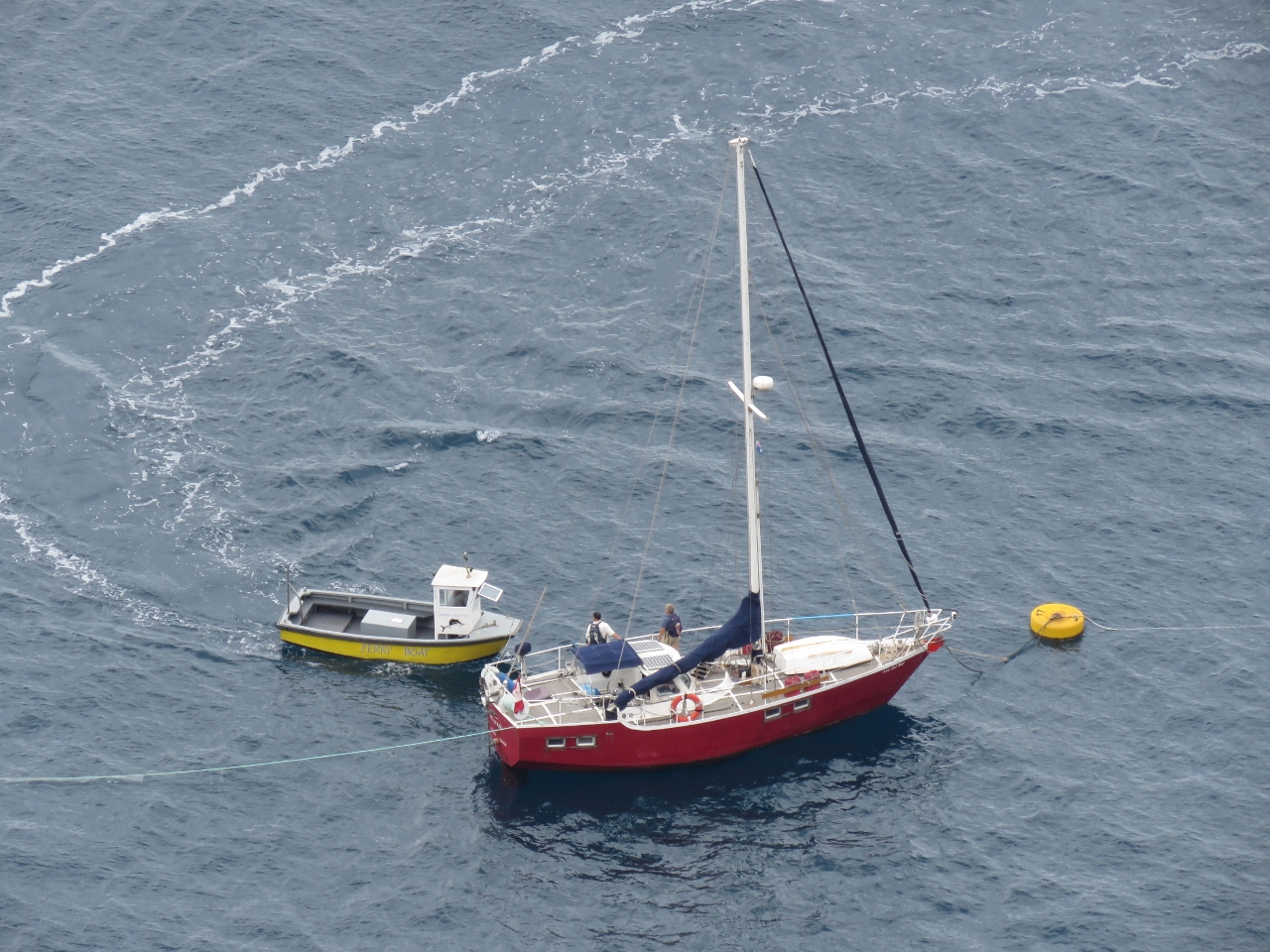 |
Ave del Mar
Position: -5 43.36, -15 55.65
The harbour ferry arriving to pickup the crew of Ave del Mar of Ottawa, Canada. We met them ashore earlier in the week–they set off on their circumnavigation from Nanaimo, British Columbia. Nanaimo is about fifty miles north of Victoria on Vancouver Island–we’ve visited there many times by boat and car.
|
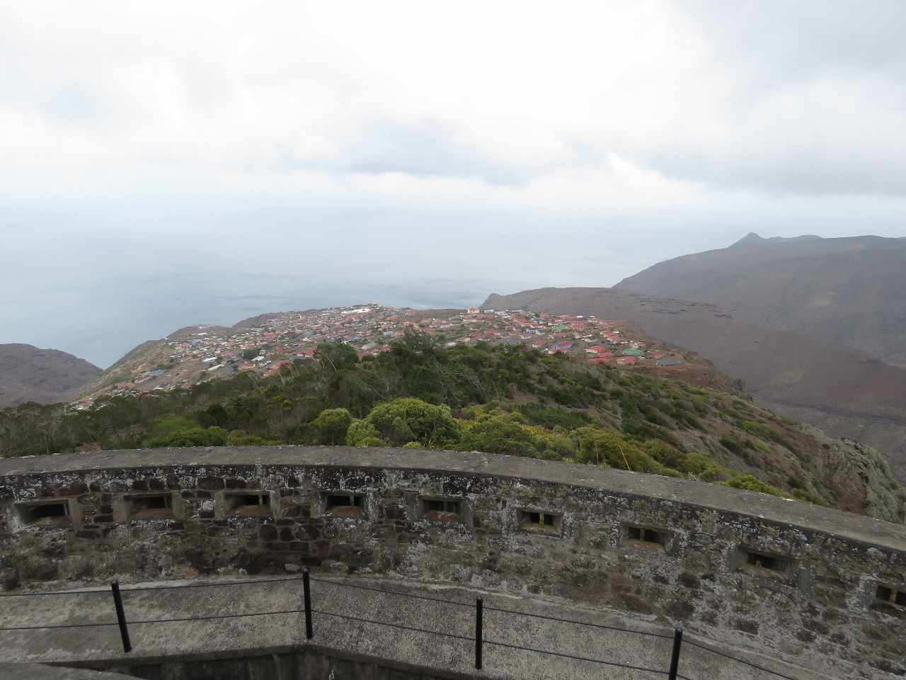 |
High Knoll Fort
Position: -5 43.00, -15 56.59
High Knoll Fort is a large military fort built in 1798 with sweeping views of the island. This is the view north across Half Tree Hollow–the largest community on St. Helena with a population of over 1,000.
|
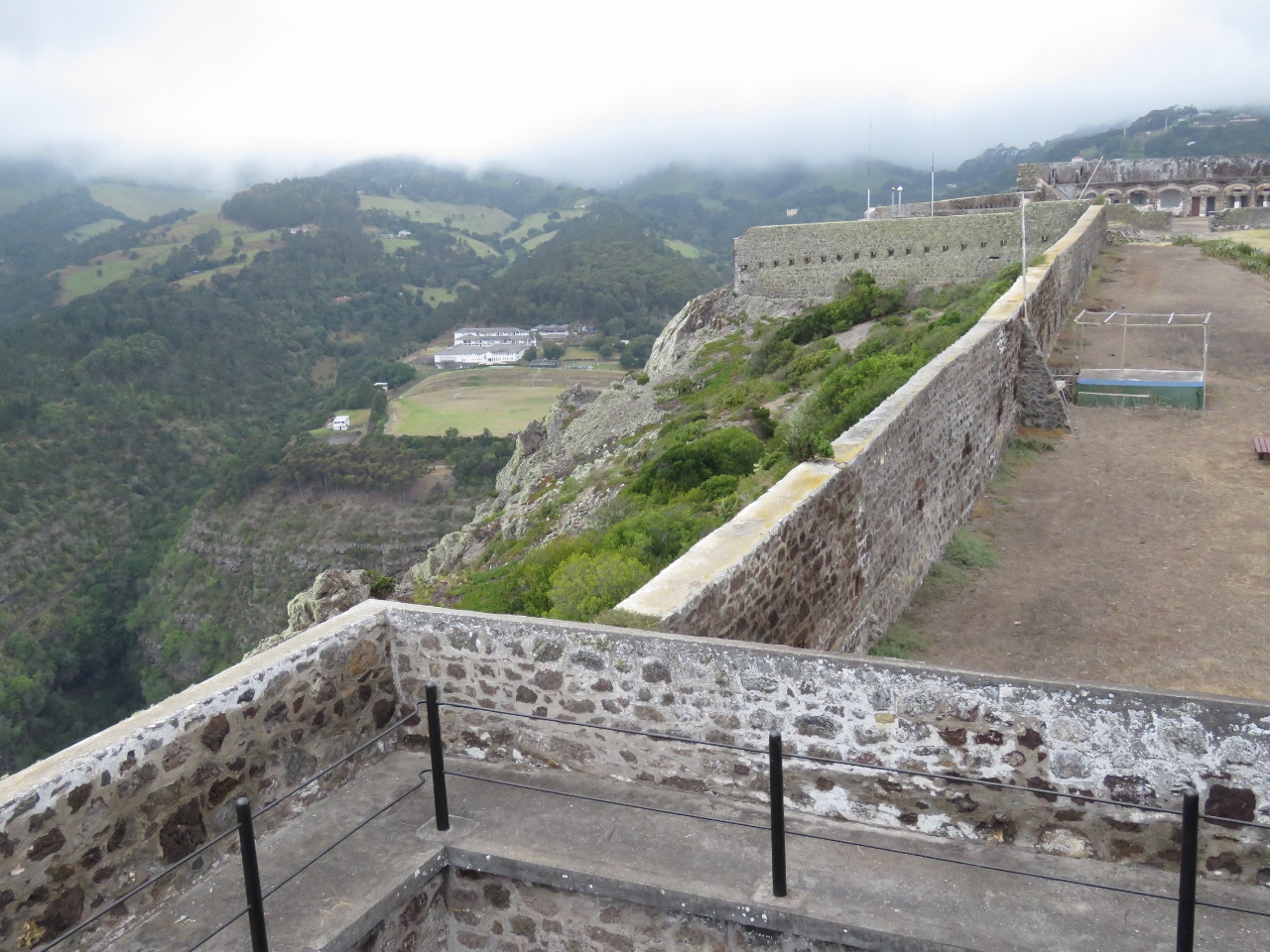 |
Prince Andrew School
Position: -5 42.99, -15 56.59
Prince Andrew School on the left viewed looking south from High Knoll Fort, with the fort extending in the distance on the right. This is the only high school on the island and they have the only sports field. St. Helena is one of the few places where flat ground is scarce. The school’s namesake, Prince Andrew, laid one of the cornerstones when he visited the island.
|
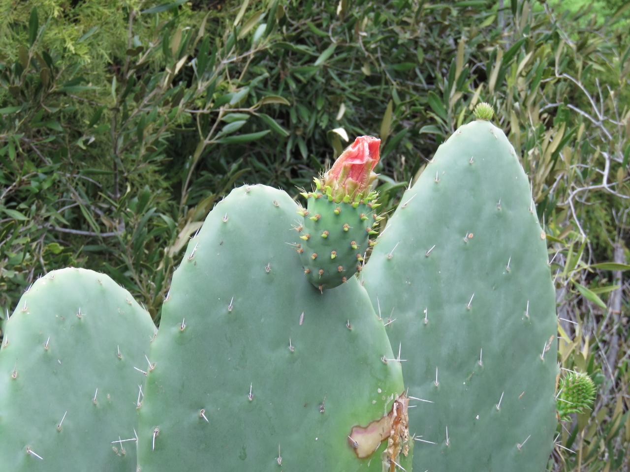 |
Tungi
Position: -5 43.06, -15 56.77
The small fruit below the blossom is used to make Tungi, the signature spirit of the St. Helena distillery.
|
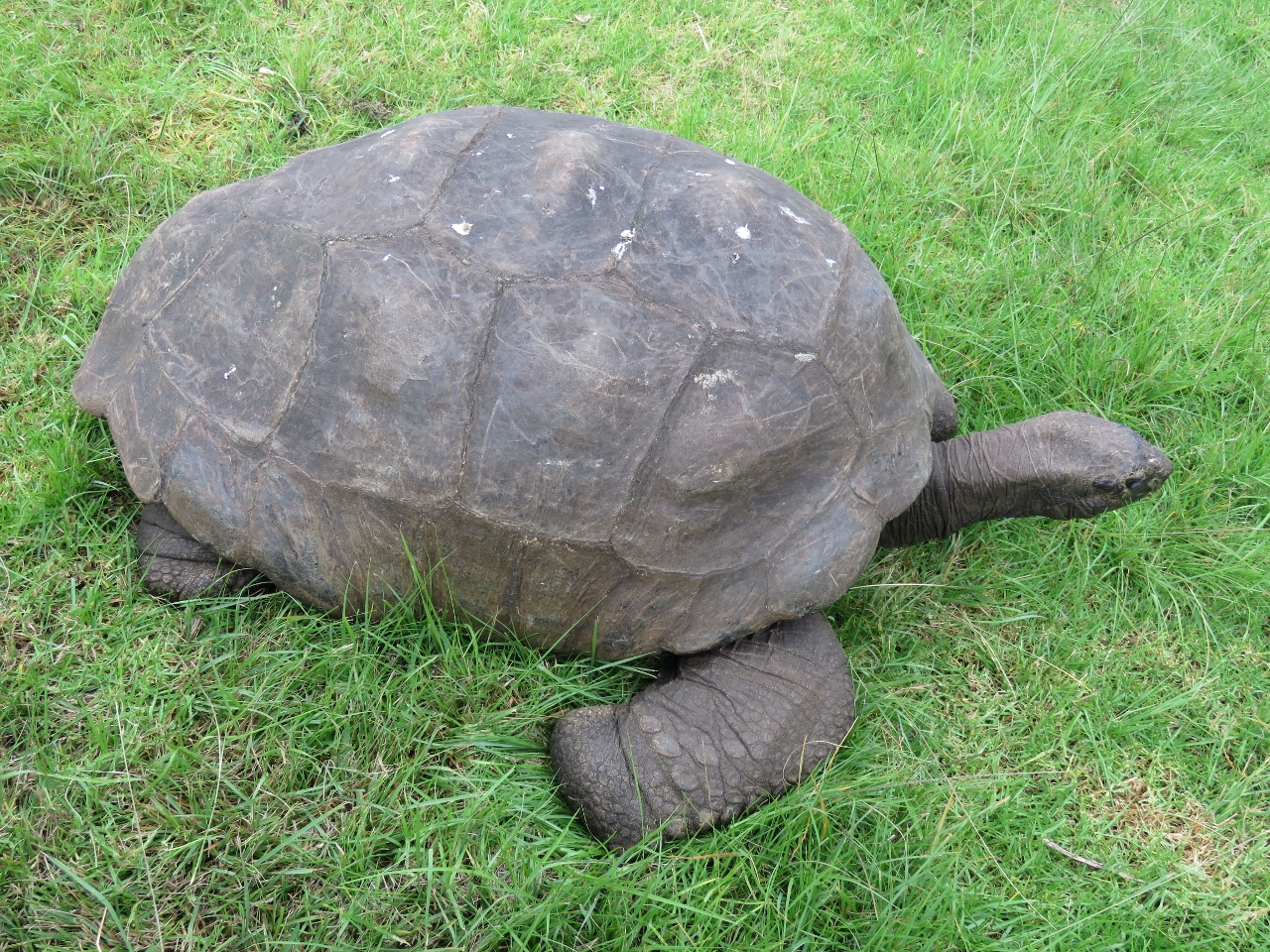 |
Jonathan
Position: -5 43.31, -15 57.30
Jonathan the tortoise, estimated to be between 170 and 200 years old, is St. Helena’s oldest resident. He lives at the Governer’s mansion, Plantation House, along with 4 other tortoises. He’s not native to the island, having arrived in about 1882, and is one of the few surviving Seychelles Giant Tortoise in the world.
|
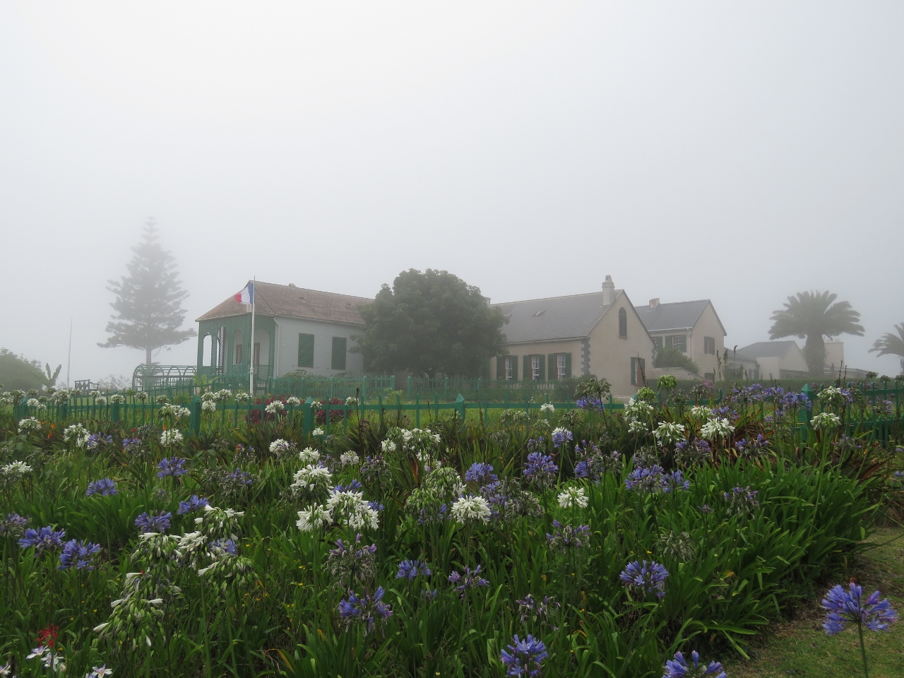 |
Longwood House
Position: -5 41.03, -15 56.98
Longwood House is where Napolean lived in exile until his death. No photography is allowed inside the house, so we’ve just got an outside shot before our tour. You can see we’re experiencing a somewhat visibility-challenged day. This is unusual for St. Helena, but not that unusual for those from the Pacific Northwest.
|
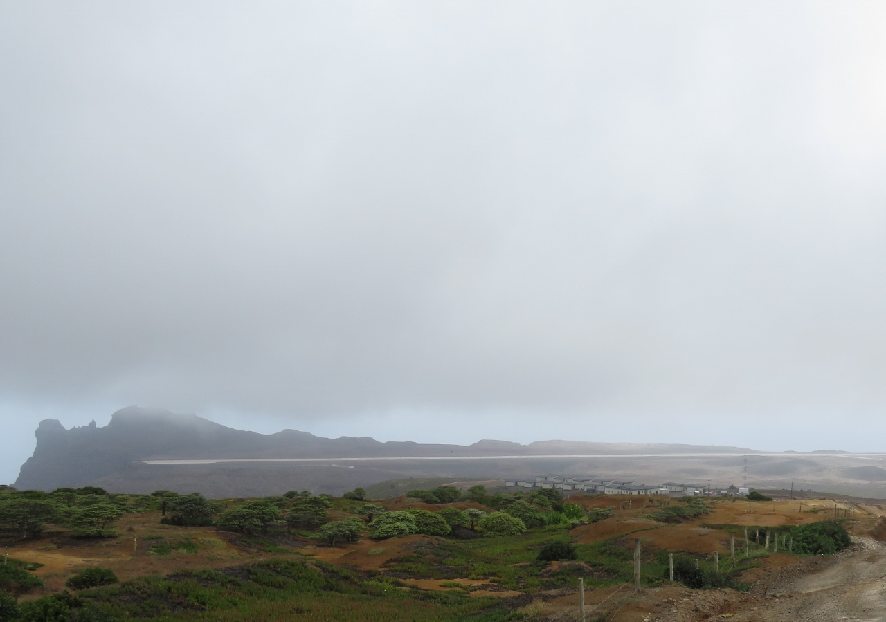 |
Airport
Position: -5 39.93, -15 56.75
Everything and everyone on St. Helena arrived by sea. That soon will change with the opening of the St. Helena Airport later this year. You can see the main runway across the center of the picture. Normally building a runway is not that big an engineering challenge, but when there’s not that much flat ground at all, a massive amount of earth must be moved to get a jet-capable runway.
|
 |
Derek Richards
Position: -5 40.98, -15 58.00
Our guide, Derek Richards, of No Limits Travel and Tours.
|
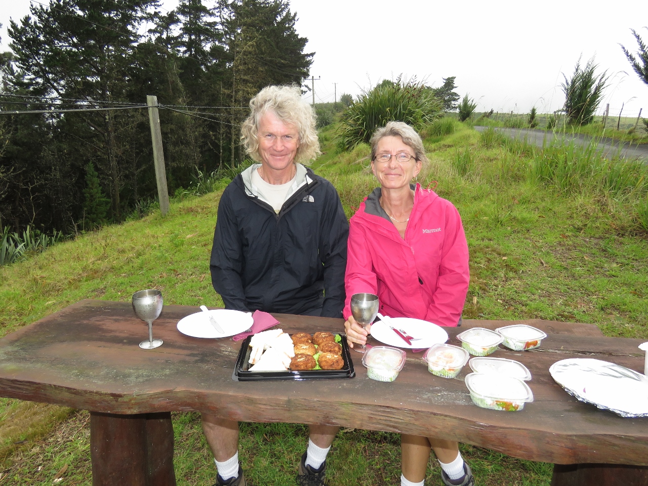 |
Lunch
Position: -5 40.98, -15 58.00
The tour price included lunch. We were expecting a sandwich, a coke and perhaps a bag of chips, but Derek laid out an amazing spread prepared by his wife Linda. We had fish cakes and tomato-paste tea sandwiches, both St. Helena specialties, plus devilled eggs and salad. Beveridges included a choice of beer or Chenin Blanc from the St. Helena distillery. We chose the Chenin Blanc served in chilled goblets–it was delicious. And for dessert we had chocolate cake, carrot cake and fresh plums and nectarines. The entire meal was fabulous, and made for an incredibly decadent picnic. We probably ate twice what we normally eat for lunch. Oh, … and we did get a bag of chips. :)
|
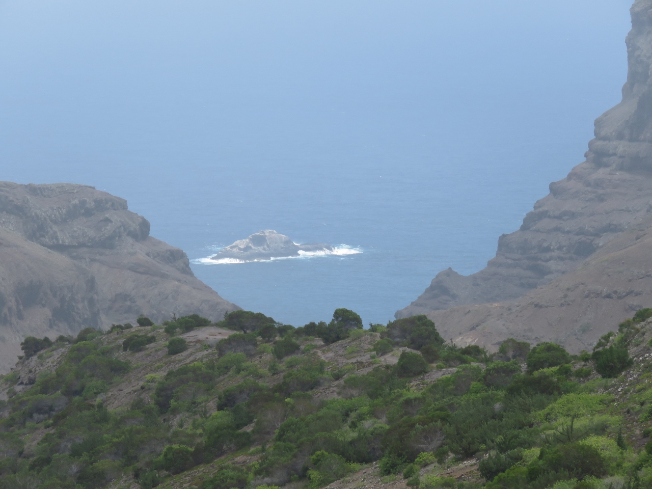 |
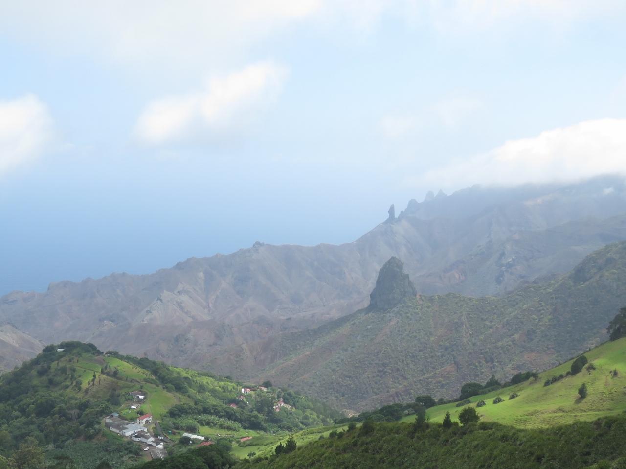
Silver Hill
Position: -5 40.68, -15 58.26
The weather cleared and we got some great views later in the day. This is Stone Top Bay viewed from Silver Hill. We believe that is George Island just offshore.
|
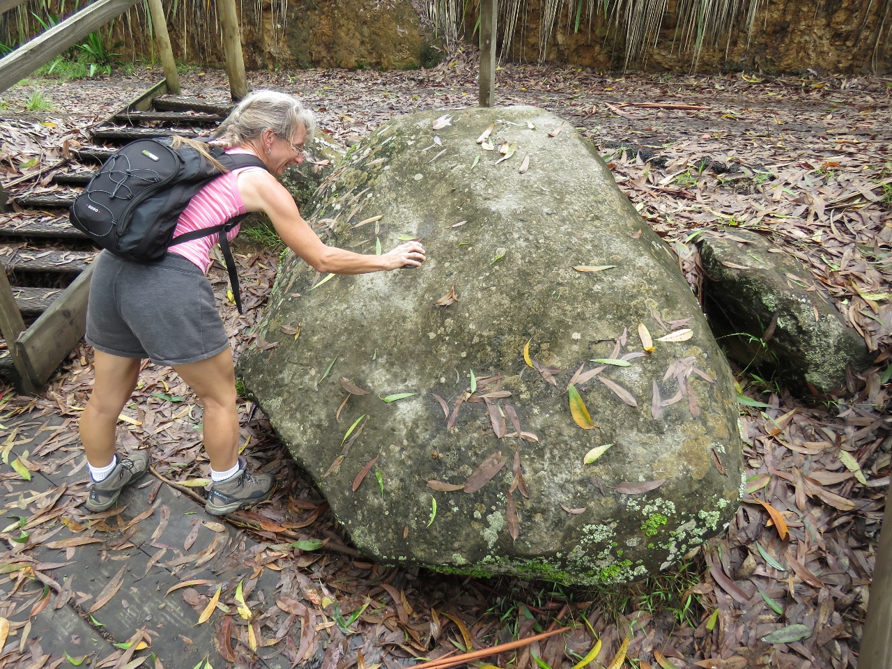 |
The Bellstone
Position: -5 40.96, -15 58.91
The Bellstone is a trachyandesite boulder that makes a bell sound when struck with a rock. Actually, even a sharp wrap of knuckle produced a bell sound. We were a little dubious, but it actually does ring when struck.
|
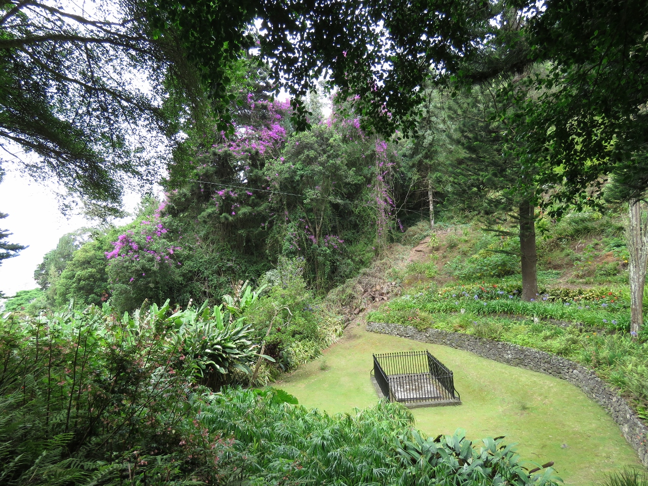 |
Napoleon’s Tomb
Position: -5 41.90, -15 57.55
Napolean chose this as his burial site if he had to be buried on the island. His remains later were transferred to France.
|
|
|
Lot
Position: -5 42.61, -15 58.21
The view southwest from Sandy Bay Ridge. The volcanically-formed formation in the foreground is called Lot, with Lot’s Wife visible directly behind in the distance. The formations to the right of Lot’s Wife are called “The Asses Ears”. The St. Helena scenery is incredible.
|
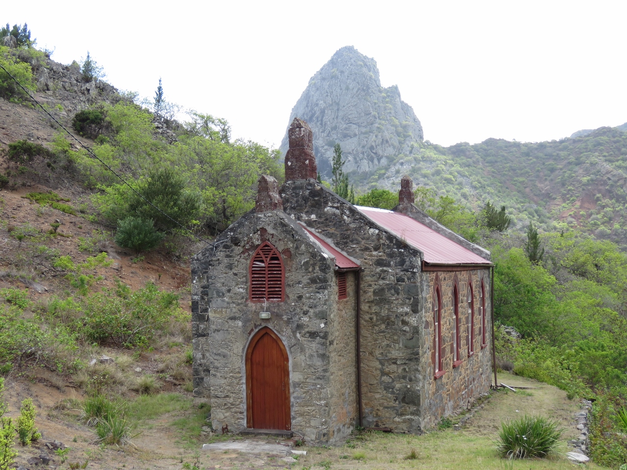 |
Church
Position: -5 42.93, -15 59.09
This one of at least ten churches on the island and still is in use today. That’s Lot in the background.
|
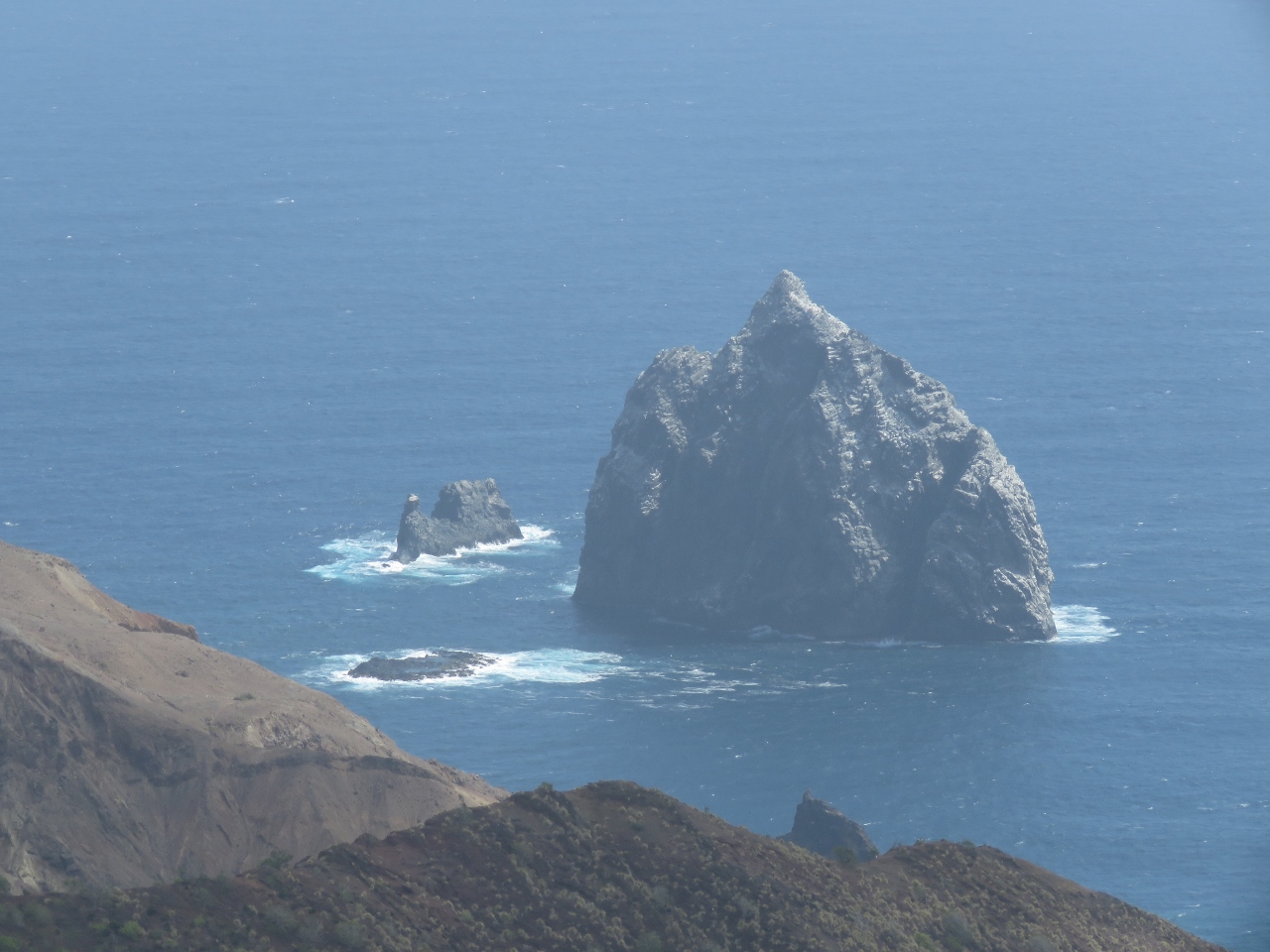 |
Speery Island
Position: -5 45.12, -15 59.92
We saw the south side of Speery Island when we arrived into St. Helena. Today we saw the other side.
|
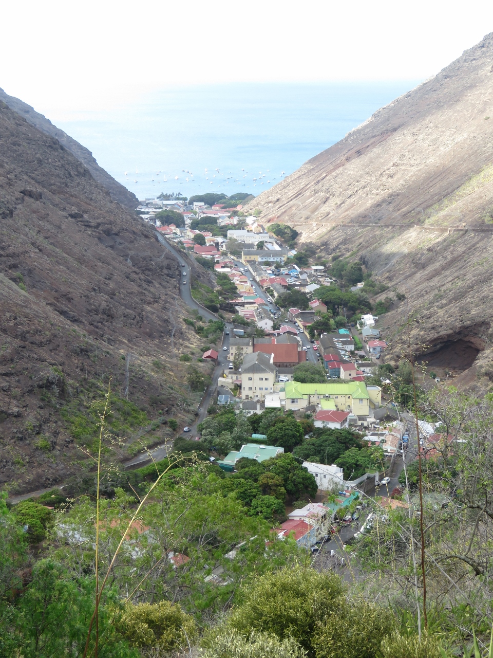 |
Jamestown
Position: -5 42.58, -15 56.29
Jamestown viewed from the high above on the east ridge.
|
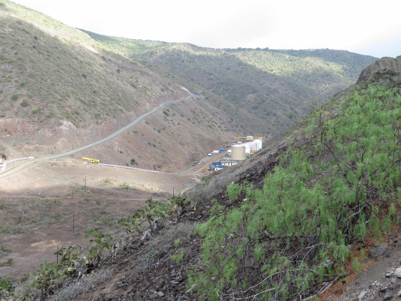 |
Haul road
Position: -5 42.57, -15 55.60
The heavy construction equipment for the airport couldn’t be moved along the narrow and twisting St. Helena roads. The “haul road” on the left was built from Ruperts Bay, where the equipment was landed, to the airport construction site and later will become a permanent road. The tanks on the right are the new storage facility for aviation fuel. A pipe, just visible at the left of the photo, will carry the fuel from the water delivery point to the storage tanks.
|
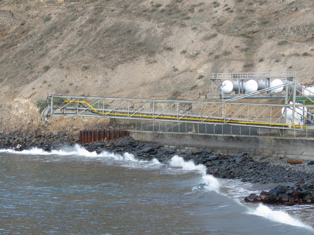 |
Fuel boom
Position: -5 42.78, -15 55.15
Fuel is delivered to the island by tanker. The tanker moors in Ruperts Bay with the stern towards shore just before the breaking waves. Fuel hoses are connected between this boom and the tanker to transfer fuel ashore.
|
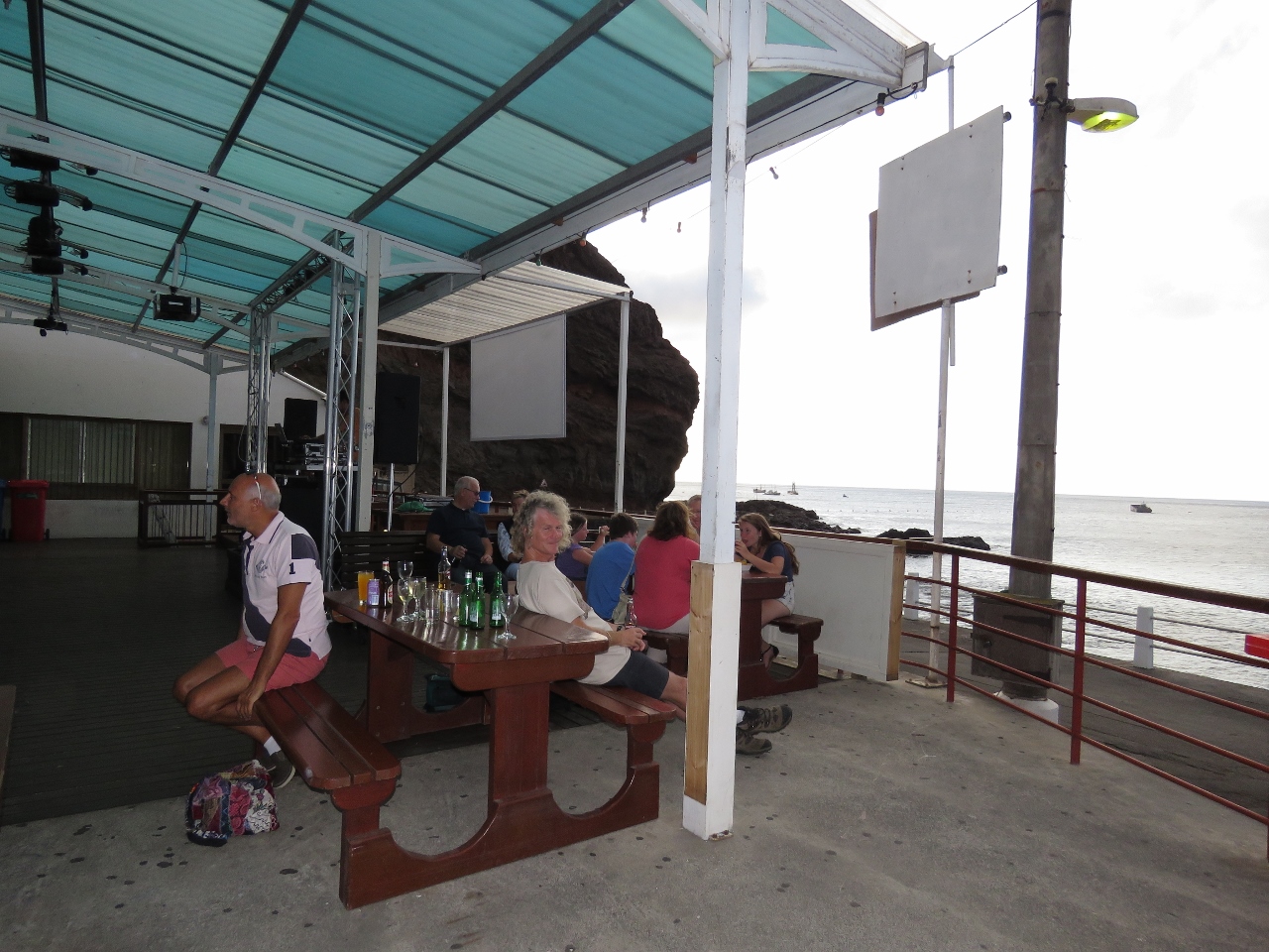 |
Donny’s Place
Position: -5 43.14, -15 55.47
We ended an excellent day with a drink surf-side at Donny’s Place.
|

|
Click the travel log icon on the left to see these locations on a map, with the complete log of our cruise.
On the map page, clicking on a camera or text icon will display a picture and/or log entry for that location, and clicking on the smaller icons along the route will display latitude, longitude and other navigation data for that location. And a live map of our current route and most recent log entries always is available at http://mvdirona.com/maps. |
If your comment doesn't show up right away, send us email and we'll dredge it out of the spam filter.
http://www.cnet.com/uk/news/one-of-the-remotest-places-on-earth-finally-gets-an-airport/
Now it’s open :)
The end of an era. You can now get to Saint Helena by air rather than only by sea. Some locals aren’t that excited about this but most see the value in the additional tourist revenue that will certainly flow in. The ability to get deliveries in hours to days rather than weeks has to be welcome to most locals.
James and Jennifer – It was an absolute pleasure being able to show you St Helena from a tour perspective. We hope that you enjoyed the day and all that the Island had to offer. Travel safely!!
Good hearing from you Derek. We have had a great run since leaving Saint Helena. We have been unusually good weather which makes the trip pretty easy. We expect the swell to go up and shorten over the the next few days but nothing much and it is predicted we will continue to see at least slightly better than average conditions.
Thanks for the memorable day in Saint Helena.