Rain was predicted to fall the entire day, but we really wanted to get out and explore more of the island. Cirque de Salazie is one of three volcanic calderas at the island’s center and the access road is full of impressive waterfalls, so we figured this would be a good day for a waterfall tour. The views wouldn’t likely be as good, but the waterfalls would be in full force.
Trip highlights from October 2nd follow. Click any image for a larger view, or click the position to view the location on a map. And a live map of our current route and most recent log entries always is available at http://mvdirona.com/maps
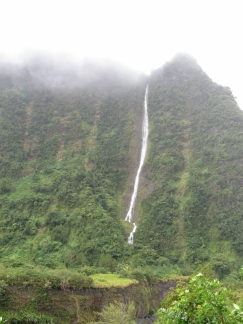 |
First waterfall
Position: 55 36.09, -21 0.06
We saw our first waterfall as soon as we got into the foothills of the Cirque de Salazie at Ilet Payet.
|
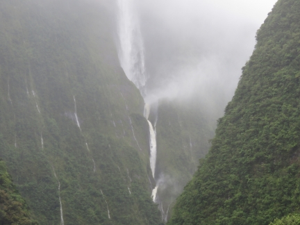 |
Cascade Blanche
Position: 55 35.06, -20 59.94
Cascade Blanche had enough force eject spray horizontally nearly 100 feet off the cliff.
|
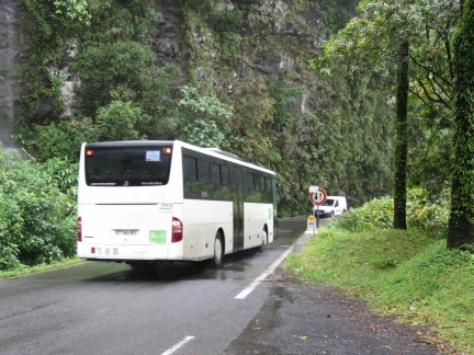 |
Tight squeeze
Position: 55 35.06, -20 59.94
The road into Cirque de Salazie is narrow and winding with many small bridges that are only wide enough for one vehicle at a time. The road also was busy with bus and truck traffic. At several points en route we had to stop to allow a larger vehicle room to negotiate a hairpin turn.
|
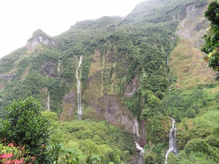 |
Waterfalls
Position: 55 33.88, -21 0.52
Waterfalls ribboned the slopes as we gained elevation and neared the town of Salazie. Rain had been falling most of the way, but we still got a decent view to the cliffs.
|
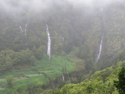 |
Bridal Veil Falls
Position: 55 32.09, -21 2.17
Cascade du Voile de la Mariee (Bridal Veil Falls) are the largest of the pictured falls, slightly left of center. The falls drop in several stages and continue down into the ravine at the bottom center of the picture.
|
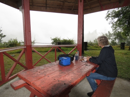 |
Marie a Vielle Place
Position: 55 30.31, -21 1.65
We stopped for a late breakfast at a picnic shelter at Marie a Vielle Place. The picnic area was on the edge of a gorge and the views down likely were fabulous in more clear weather, but it’s pretty socked in right now.
|
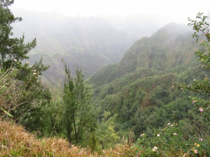 |
Gorge
Position: 55 30.31, -21 1.65
The gorge below the picnic area at Marie a Vielle Place was mostly obscured, but the clouds did clear slightly after we’d finished breakfast and we got a brief glimpse into the valley. The scenery here is simply amazing, even in these conditions. We were very happy to have made the trip.
|
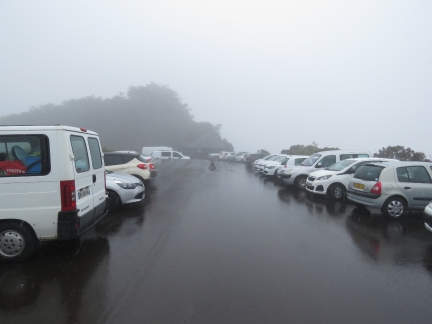 |
Cols des Boeufs
Position: 55 27.00, -21 3.75
We followed an incredibly steep, narrow and winding road past Grand Ilet to the end at Cols des Boeufs. The road was in excellent condition, but the hills dropped steeply on the outside, with few guard rails, and a 2-ft-deep, car-eating drainage ditch often ran along the inside. And oncoming traffic didn’t necessarily stay on their side of the road. We saw little traffic beyond Grand Ilet until we reached the parking lot at Cols des Boeufs, which was absolutely jammed. This is the start of the popular 4-day hike through Cirque de Mafete, the westward caldera adjacent to Cirque de Salazie. Had we any hope of a view, we would have taken the short path nearby to the Piton Marmite lookout. But a heavy rain was falling and visibility was so bad we were having trouble seeing the hood ornament.
|
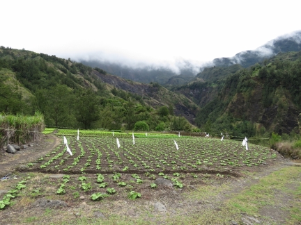 |
Farming
Position: 55 29.53, -21 1.90
Small farm plots were packed in the hills all along the route.
|
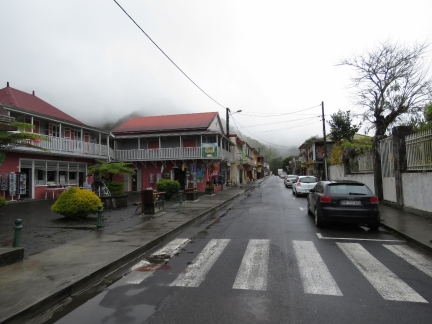 |
Hell-Bourg
Position: 55 31.19, -21 3.92
Hell-Bourg, named after former governor Amiral de Hell is a small hamlet tucked into the center of the Cirque de Salazie. This is looking up the main street pretty much from one end to the other. With its narrow streets and closely-packed buildings, the city felt very old-European.
|
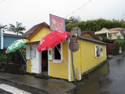 |
P’ti Koin Kreol
Position: 55 31.19, -21 3.92
We had a delicious lunch in Hell-Bourg at tiny P’ti Koin Kreol, which seats about 16 people. James had sauteed fish and Jennifer had chicken with the local vegetable, chouchou, a pear-shaped vegetable imported from Brazil in the early 1800s.
|
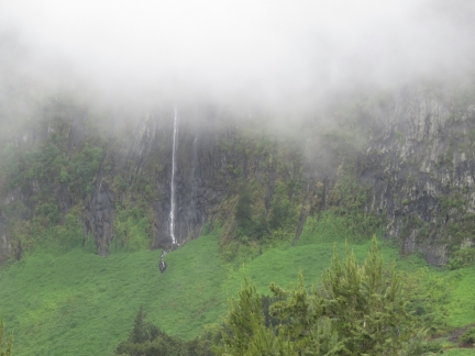 |
Another waterfall
Position: 55 31.81, -21 3.07
We’d missed this several-hundred foot waterfall just outside Hell-Bourg on the way up, possibly it was hidden in the mist. It was already starting to disappear as we looked for a place to stop and take a picture.
|
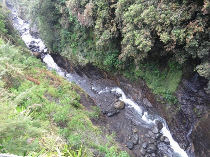 |
Riviere du Mat
Position: 55 31.93, -21 2.39
The road up to the Salazie runs mostly alongside the Riviere du Mat. The river wasn’t very high now, but judging by the canyon height and the distance above the water to the first growth, the flow can be impessive during the height of the rainy season.
|
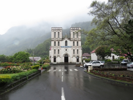 |
Salazie
Position: 55 32.34, -21 1.69
The Paroisse Notre Dame de l’Assomption (Parish of Our Lady of the Assumption) dominates the scene as we returned back through Salazie.
|
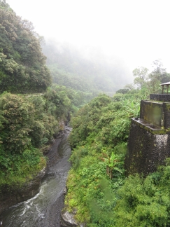 |
Bridge footing
Position: 55 34.75, -20 59.97
Two sets of substantial old bridge footings straddled the Riviere du Mat near Ilet Petit Trou. We frequently saw evidence of road construction and rerouting on our trips around the island. The roads all are well-built and in good condition–narrow, but impressive engineering to be there at all.
|
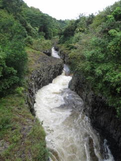 |
Rivieres des Roches
Position: 55 40.23, -21 1.39
After returning out from Cirque de Salazie at St. Andre, we continued our waterfall tour slightly to the south near Bras-Panon. The route was well-marked, but as we followed a single-lane road that barely cleared the sugar cane fields on either side, we were beginning to wonder if we were in the right place. The road ended in a parking lot and a bridge over the Rivieres des Roches, source of the waterfall at Bassin La Paix.
|
 |
Steps
Position: 55 40.16, -21 1.40
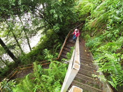
We crossed the river and followed a well-trod footpath to a set of steep stairs that led down to the north side of the waterway.
|
 |
Bassin La Paix
Position: 55 40.17, -21 1.38
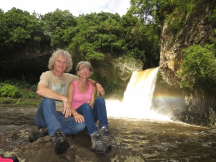
The spectacular falls at Bassin La Paix pour over a lip into the basin below.
|
 |
Niagara Falls
Position: 55 36.26, -20 55.18
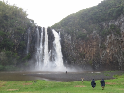
The last waterfall on our tour was Niagara Falls. While not quite as large as their namesake, the falls were beautiful and did throw an impressive amount of mist into the air.
|
 |
Road flooded
Position: 55 36.79, -20 54.98
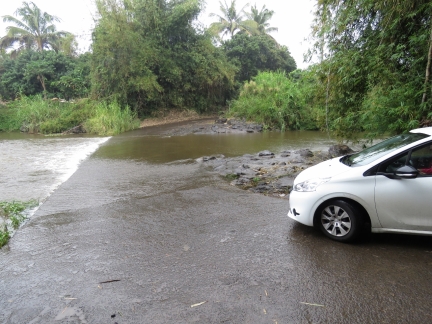
We’d tried to reach Niagara Falls through the exit just south of Ste-Suzanne, but the bridge at route N2002 was flooded and closed to traffic. So we’d had to drive through Ste-Suzanne at rush hour. Traffic was terrible and we were hoping to find an alternate route back out. But this road also was flooded. We probably could have made it across, but it didn’t feel worth the risk.
|

|
Click the travel log icon on the left to see these locations on a map, with the complete log of our cruise.
On the map page, clicking on a camera or text icon will display a picture and/or log entry for that location, and clicking on the smaller icons along the route will display latitude, longitude and other navigation data for that location. And a live map of our current route and most recent log entries always is available at http://mvdirona.com/maps. |
If your comment doesn't show up right away, send us email and we'll dredge it out of the spam filter.

Nice pictures and report