The viewpoints into the mountains of Reunion are best visited early in the morning as by mid-morning they often cloud in. So we left Le Port at 5:30am on the 39km drive to Le Maido to take in the sweeping views into the Cirque de Mafete. The panorama was astonishing, and even better than we were expecting. We spent ages walking along the viewpoint and feeling incredibly lucky to be there with such good visibility.
Trip highlights from October 3rd follow. Click any image for a larger view, or click the position to view the location on a map. And a live map of our current route and most recent log entries always is available at http://mvdirona.com/maps
 |
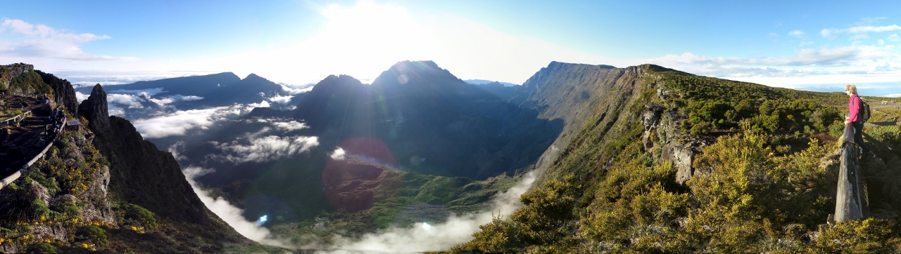
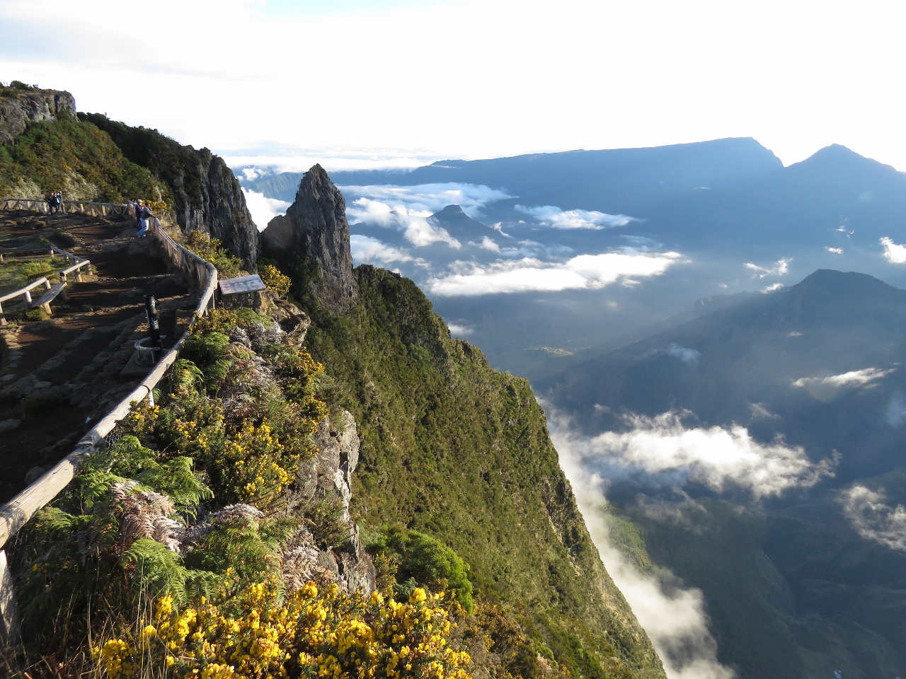
Le Maido
Position: 55 23.24, -21 4.27
Following another well-maintained, but incredibly steep and winding road, we reached the viewpoint by 7am. As we ascended, we passed into and above the clouds. From the parking lot, we couldn’t see the coast through the clouds, so we worried the cirque also would be obscured when we arrived.
|
 |
View
Position: 55 23.28, -21 4.26
We almost cheered when we reached the viewpoint–the cirque was clear and we could see all the way down inside. The view was just incredible.
|
|
|
Cirque de Mafate
Position: 55 23.28, -21 4.26
We spent ages walking along the viewpoint and feeling incredibly lucky to be here with such good visibility. The video https://youtu.be/wBf0Zjk2D3Q (1:38) shows the 360 degree view looking into the cirque, zooming in on two of the several villages inside the cirque. Hiking trails lead through some of the villages–hikers eat and sleep at walkers lodges along the way. The clouds over the coast had lifted while we were there, so we also got a good view west to the coastal town of St-Gilles les Bains.
|
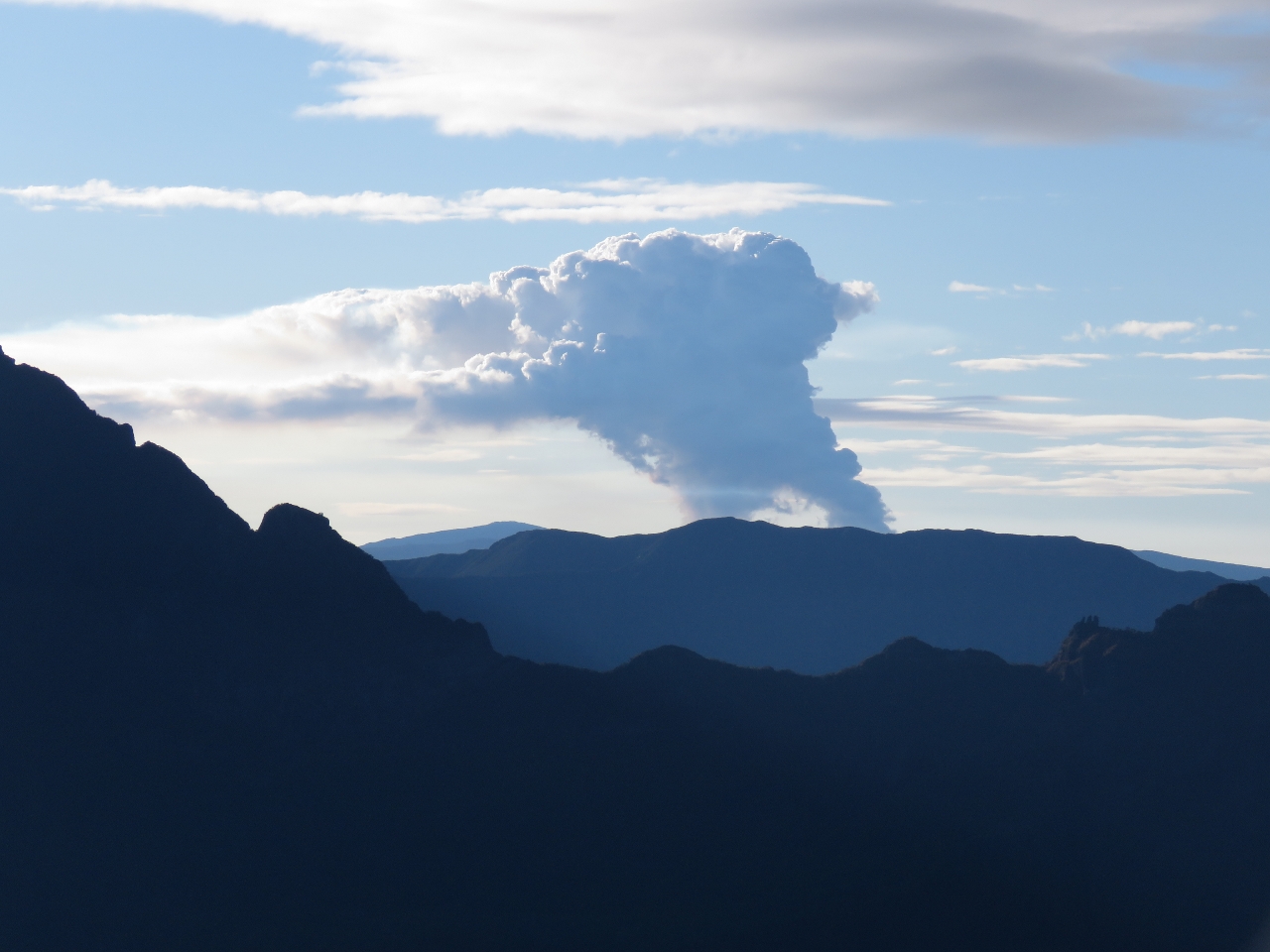 |
Piton de la Fournaise
Position: 55 23.26, -21 4.20
Among Reunion’s many natural wonders is Piton de la Fournaise, an active and asccessible volcano at the south end of the island. Smoke and steam from the volcano is clearly visible from Le Maido.
|
 |
Breakfast
Position: 55 23.29, -21 4.36
A picnic breakfast cliff-side overlooking the cirque.
|
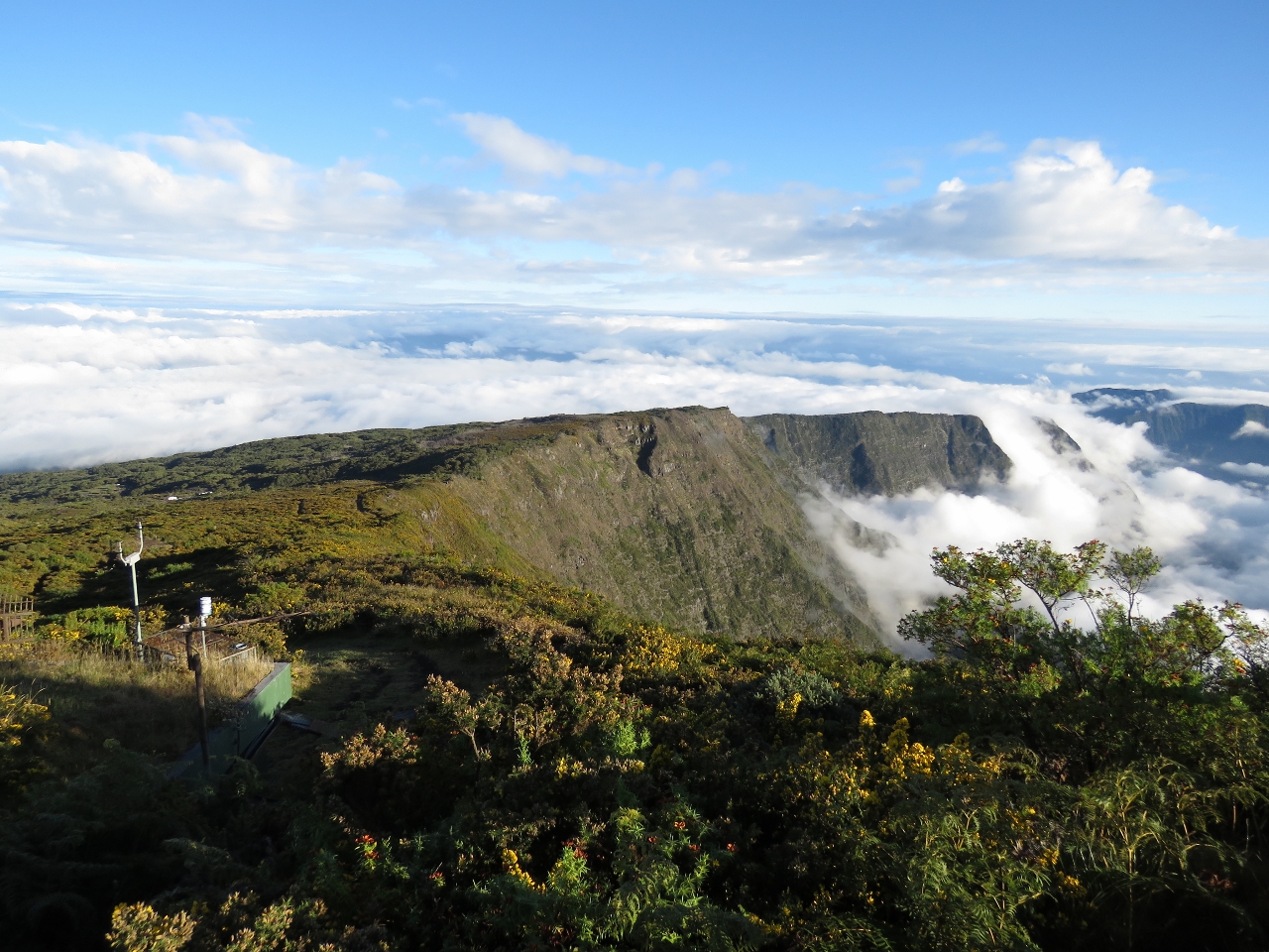 |
Clouds
Position: 55 23.25, -21 4.13
The scenery changed constantly as we watched with clouds flowing over the cirque lip, into the center and up the sides.
|
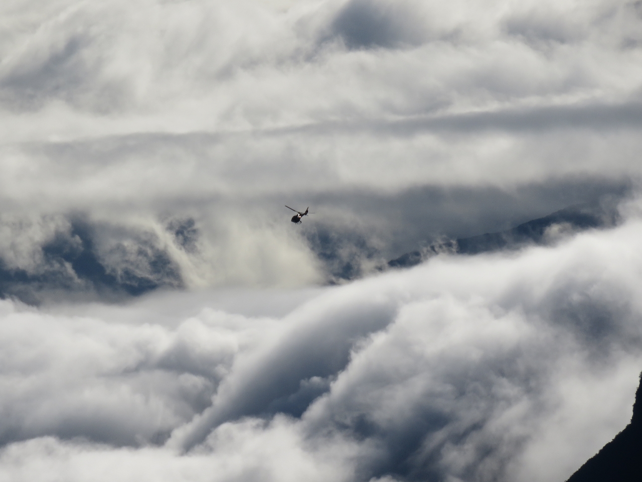 |
Helicopter
Position: 55 23.26, -21 4.18
Several helicopters and fixed-wing aircraft toured the cirque while we were there. We’re told the helicopter trip is a must-do experience. By 9am clouds were starting to obscure the cirque.
|
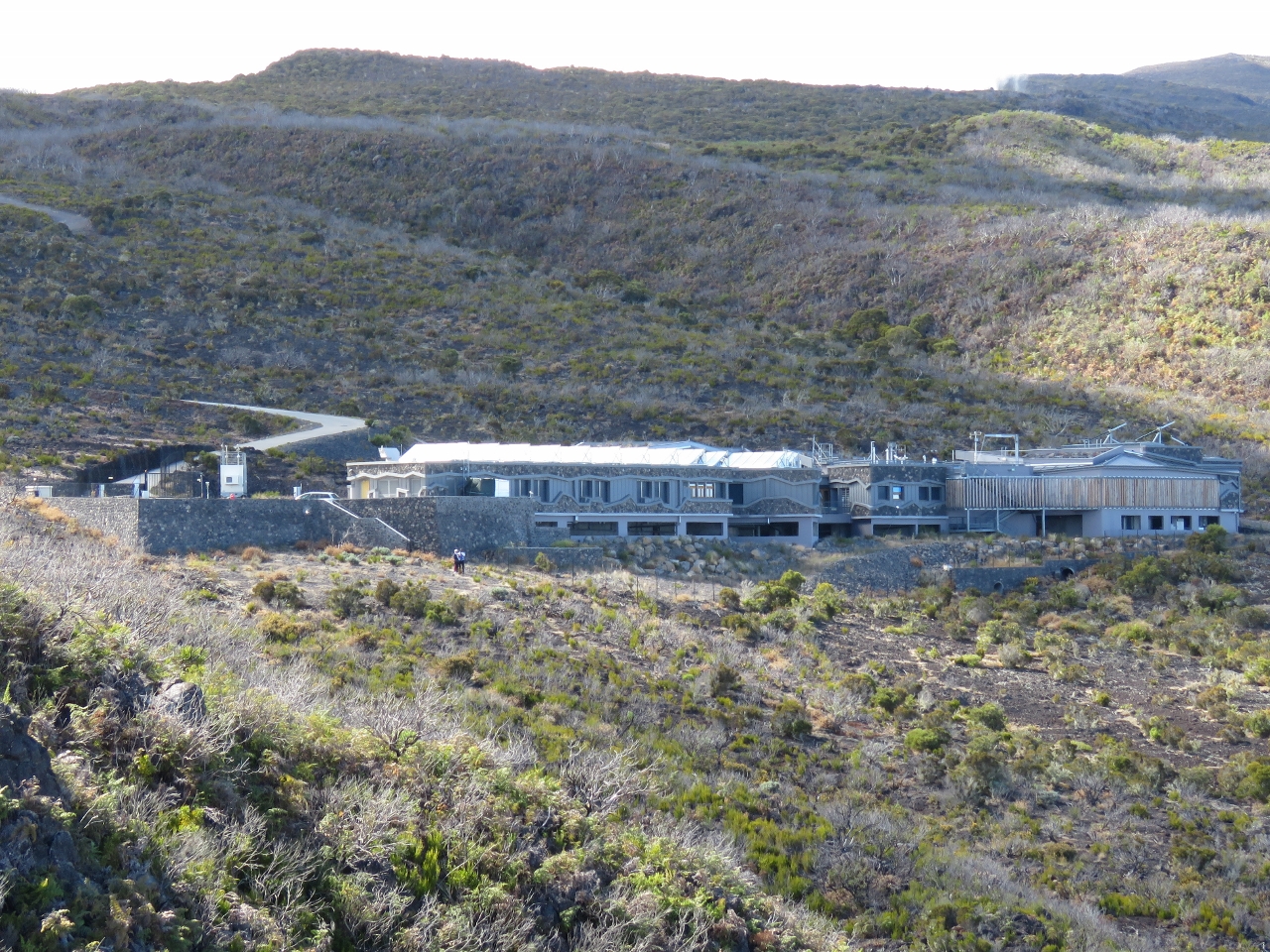 |
OPAR
Position: 55 22.85, -21 4.63
From the parking lot we walked a beautifully-built road to an observation tower we could see on a point to the southwest, hoping for a good view of the coast. The area around the tower was quite overgrown though, and the view no better than at Le Maido. More interesting was the building we noticed when we turned back east. This is one of three OPAR (Observatoire de Physique de l’Atmosphère à La Réunion or Atmospheric Physics Observatories) on the island. The other two are in Saint Denis and at the Gillot airport.
|
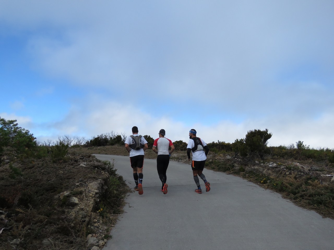 |
Le Grand Benare
Position: 55 22.97, -21 4.65
Several groups of runners passed us as we followed the road further. The path we are on leads to an excellent 360-degree viewpoint at Le Grand Benare and appears to be a popular running route.
|
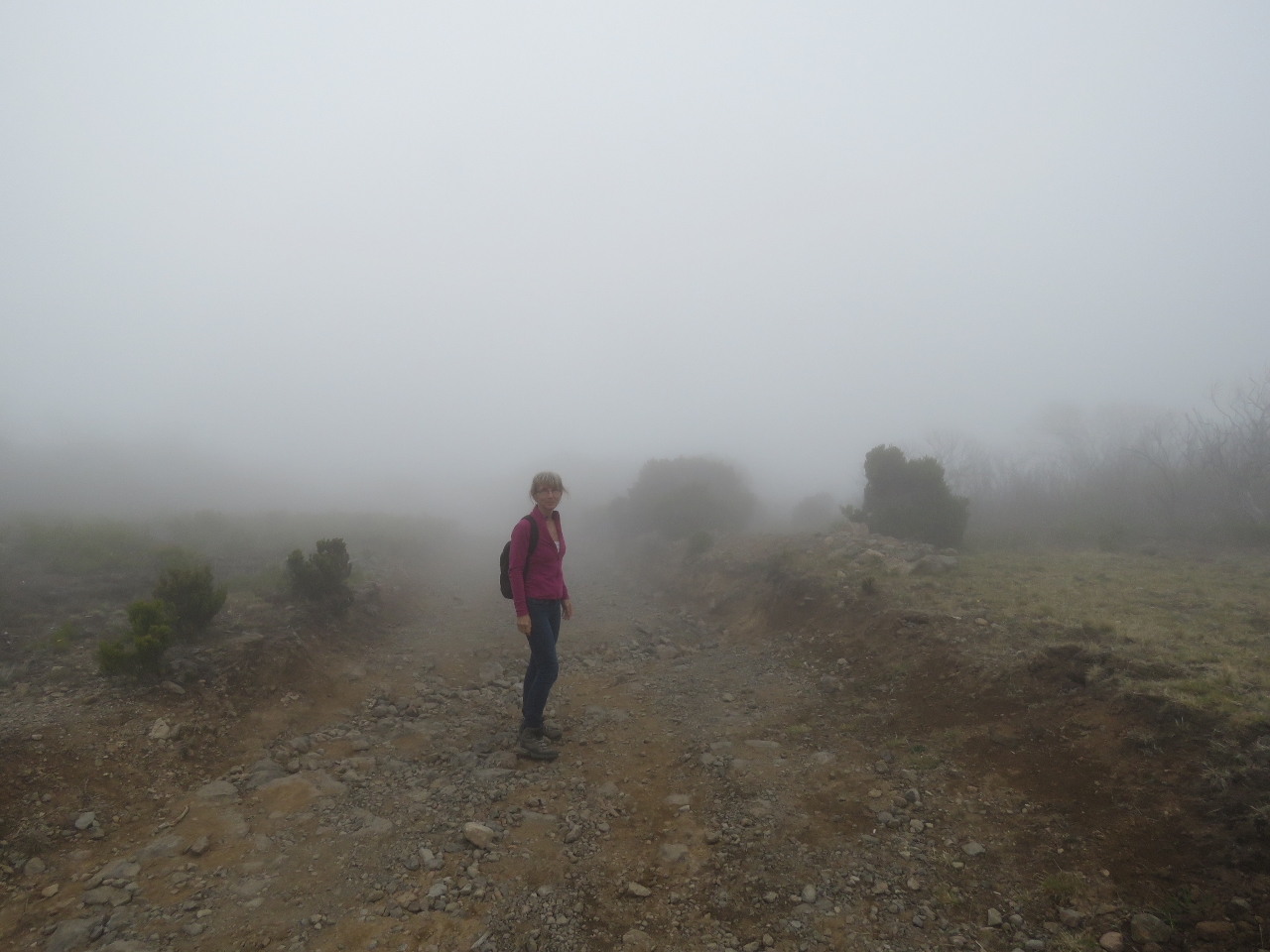 |
Visibility
Position: 55 23.38, -21 5.02
The paved road ends at the research station, about a quarter of the way to Le Grand Benare. Beyond the way is over a steep and rutted dirt track. We continued for a bit, but visibility deterioted to the point where we could hardly see the road in front of us, so we didn’t see much point in continuing.
|
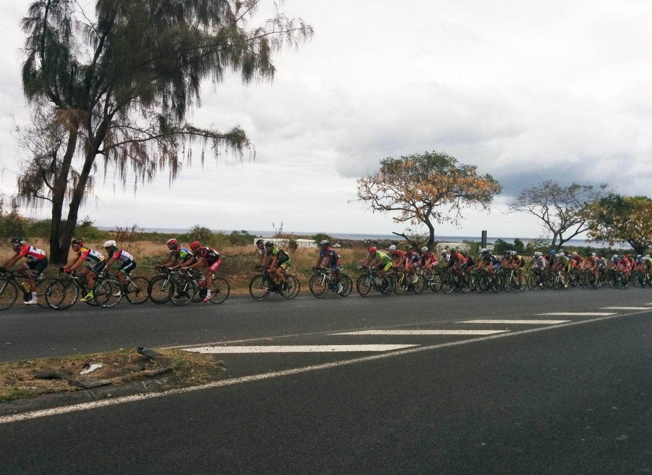 |
Tour Cycliste
Position: 55 17.44, -20 57.05
As we neared Le Port on our return back to Dirona, several police motorcycles approached in the oncoming lane and directed traffic off the road. Cyclists in the 69th annual Tour de La Reunion followed soon after. This was the 8th of 9 stages and runs 2 laps around Le Port before finishing in La Montagne in the mountains above St. Denis. The steep winding road to La Montange is challenging enough by car, we can’t imagine biking it.
|

|
Click the travel log icon on the left to see these locations on a map, with the complete log of our cruise.
On the map page, clicking on a camera or text icon will display a picture and/or log entry for that location, and clicking on the smaller icons along the route will display latitude, longitude and other navigation data for that location. And a live map of our current route and most recent log entries always is available at http://mvdirona.com/maps. |
If your comment doesn't show up right away, send us email and we'll dredge it out of the spam filter.
Thanks James, will keep an eye out for it.
Glad to see your system is back up and running. Better the graphic card then the motherboard. As I was looking at the photos I noticed you had marked your auto pilots as “primary” and “secondary” So it got me thinking how cool to see your layout in your helm and the locations of items. I have a 2 page diagram layout for what I will be wanting but curious as to how your layout is. Ken from San Souchi did a cool vid on his. Any chance you 2 could do one or some photos of it?
That is also some great country you are in right now and the views are just mind blowing sometimes. Be cool and keep enjoying.
Tim
Tim, doing a video tour of the helm area sounds like an interesting little projects. I like the idea. We’ll plan to do it over the next few weeks. Thanks for the suggestion.
Great pic’s, I’m interested to know if you cruise with a Drone camera setup as I’m seriously considering one for a cruise south… just love the blog… thanks for your efforts!
A drone would be an absolutely great addition and would allow us to get a different perspective on many pictures. We planned to do it and bought a DJI Phantom II before leaving Hawaii but I keep planning to learn to fly it but, generally, haven’t had the courage to fly it over water since I strongly suspect that would be the last we saw of it. I should just get going on this and learn to fly it. I think you are right that the pictures would be very cool.
that’s great! i’ll be looking forward to your first Phantom footage, i was inspired to recommend one by the incredible Drone footage by another vbloging circumnavigating boat called s/v Delos, currently in Madagascar… you can see Brian unpack and use the Phantom for the first time at timestamp 5:24 and there after get comfortable and shoot increasing better footage, if your interested it’s on youtube here: https://www.youtube.com/watch?v=BdOfwPXOvn8 – brings a whole new dimension to their vblogging when it arrives on scene… you might know/bump into those guys as they are also from Seattle and currently headed to Darwin… with best regards from Frankie & Ada on m/v Manatee currently in Liberty Landing Marina, Jersey City NJ
I’ll check out the Drone blog you referenced. Thanks Frankie.
Some incredible views. Those cloud “waterfalls” reminded me of pictures I’ve seen from the Canary Islands. Thanks for sharing.
Thanks Stewart. We were super lucky to get such favorable weather. I’m amazed that the small Island of Reunion can have so many incredible sites. It’s going to be very hard to leave.