
The tidal phenomena at Montgomery Reef is a product of the region’s extreme tidal exchanges. The 154 sq mi (400 sq km) reef is covered at high tide, but as the tide falls over 4m of reef can be exposed, and the water inside pours out in increasingly active waterfalls. It’s best seen from a channel that indents the reef, but is actually outside it. As the tide falls, boats in this channel are surrounded by active waterfalls and swirling current. We’d timed our departure from Doubtful Bay to arrive for the best viewing time, starting about two hours before low water on a spring tide, and enjoyed an incredible show. Afterwards, we stopped by Langgi to view the amazing weather-sculpted rock formations there. Once again in the Kimberley, and twice that day, we found ourselves saying “Amazing. We’ve never seen anything like it.”
Trip highlights from June 22nd follow. Click any image for a larger view, or click the position to view the location on a map. And a live map of our current route and most recent log entries always is available at http://mvdirona.com/maps
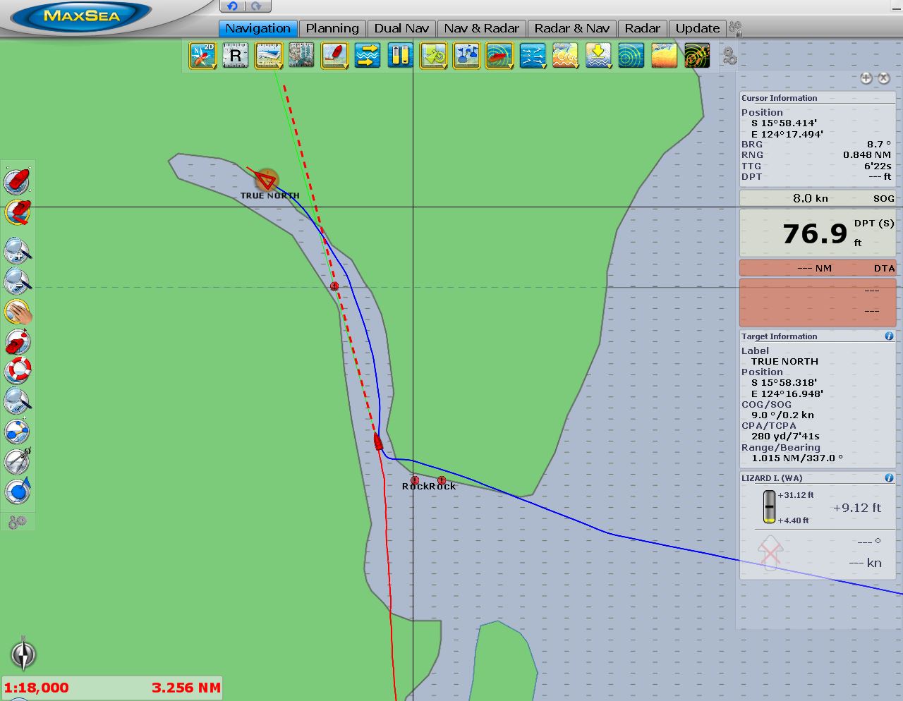 |
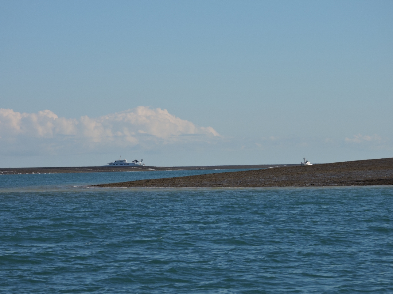
True North
Position: 124 17.38, -15 59.34
We left before sunrise this morning for Montgomery Reef. True North had arrived at Raft Point overnight and left shortly after we did, also for Montgomery Reef. We approached the reef channel along the route recommended in our cruising guide, but True North entered on quite a different path. They draw slightly more than us, so we recorded their AIS track and followed it on the way back out. Their route was much deeper–we saw 16ft coming in with 13.5ft of tide at Lizard Island, and no less than 33ft on exit with 9.6ft of tide at Lizard Island.
|
 |
Montgomery Reef
Position: 124 17.34, -15 59.09
We’re following a channel that indents Montgomery Reef. The reef is covered at higher tides, but about two hours before low tide on larger exchanges, it begins to uncover. As the tide level continues to fall, water cascades from inside the reef into the channel we’re in. We’ve arrived just as the reef was starting to uncover.
|
 |
At anchor
Position: 124 17.10, -15 58.43
Anchored at Mongtomery Reef with True North.
|
 |
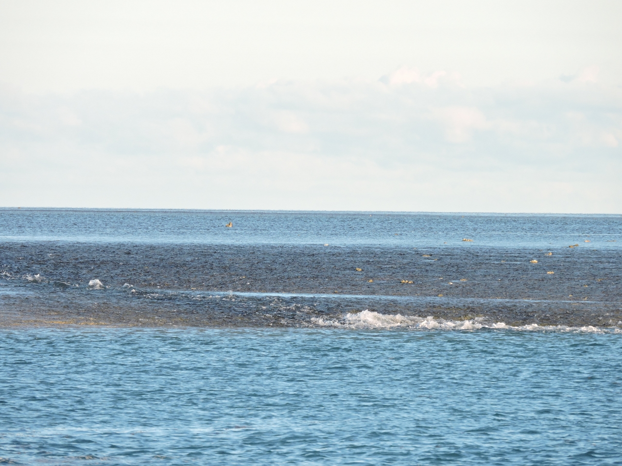
Reef
Position: 124 16.82, -15 58.32
More and more of the reef is exposed as the tide falls.
|
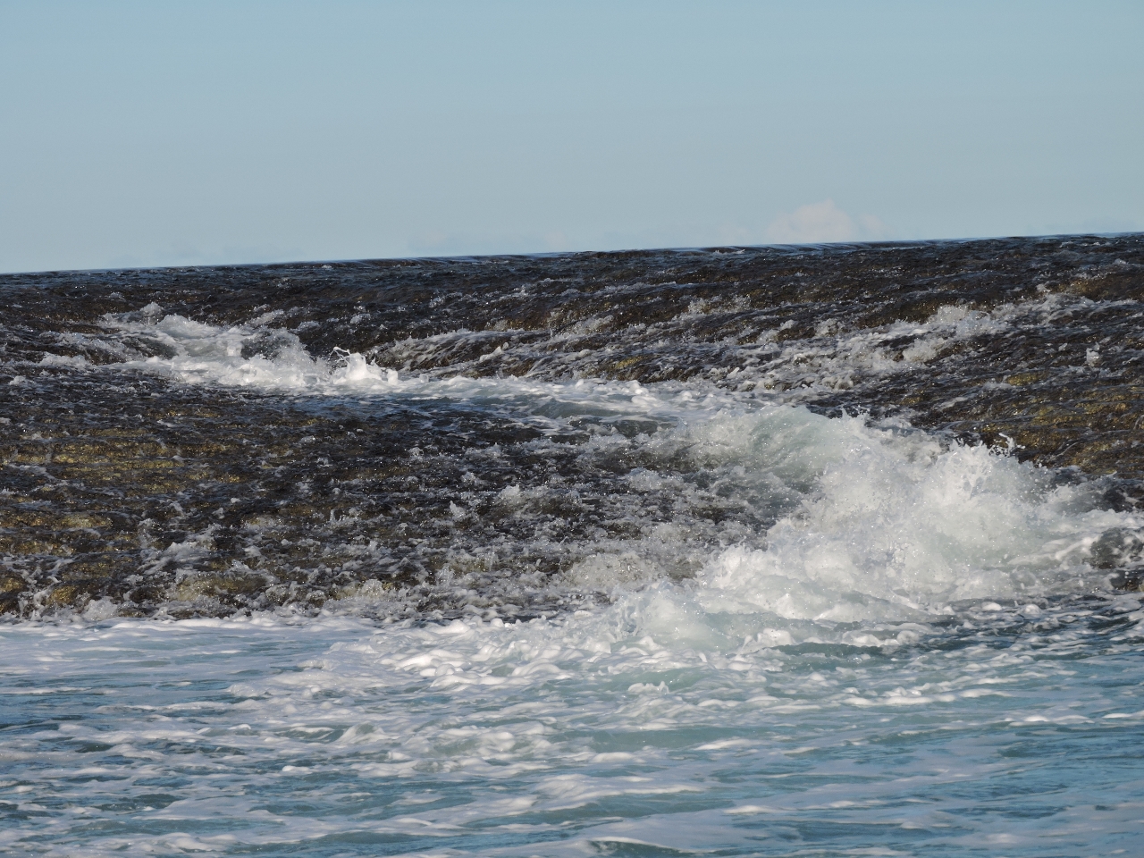 |
Waterfall
Position: 124 16.97, -15 58.39
Initially as the tide fell below the reef, water cascaded over from the inside in a continuous stream. As the tide level fell further, distinct waterfalls formed all along the reef.
|
 |
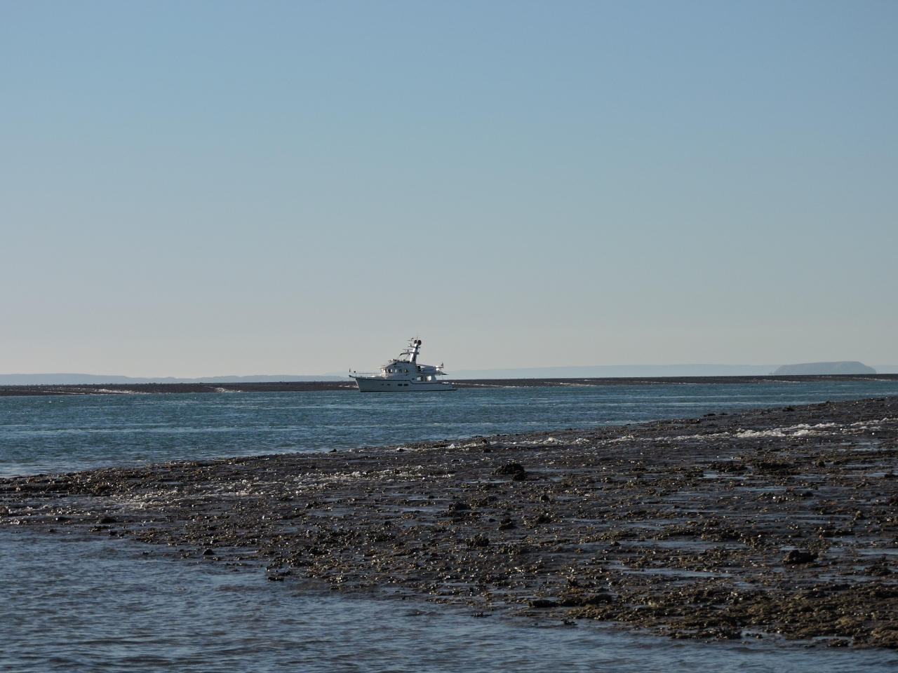
More reef
Position: 124 17.51, -15 59.35
True North and Dirona, starting to disappear behind the reef.
|
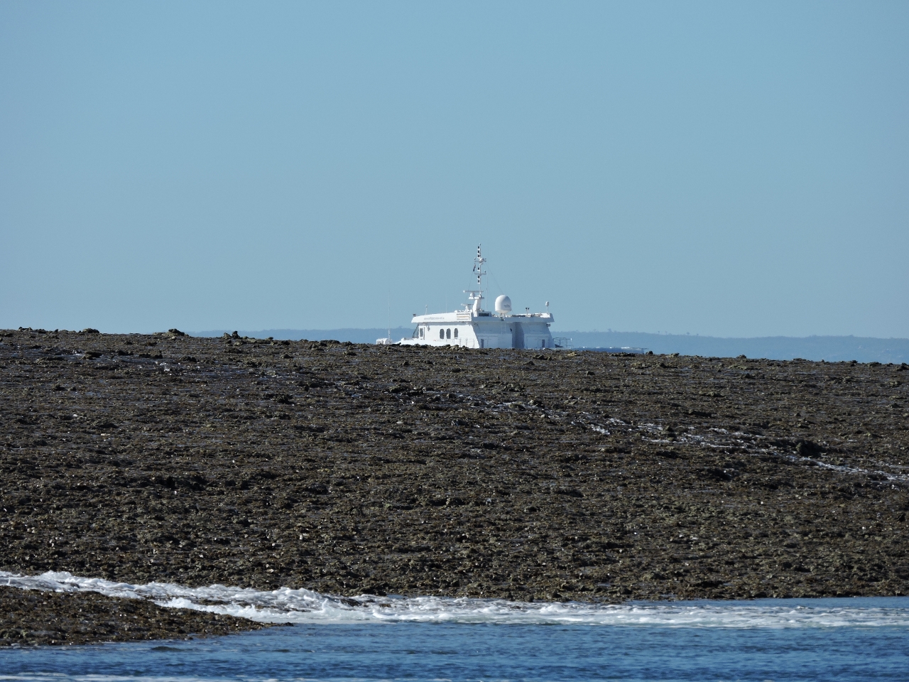 |
Lots of reef
Position: 124 16.44, -15 58.03
At this point, we can barely see True North as it sinks below the reef.
|
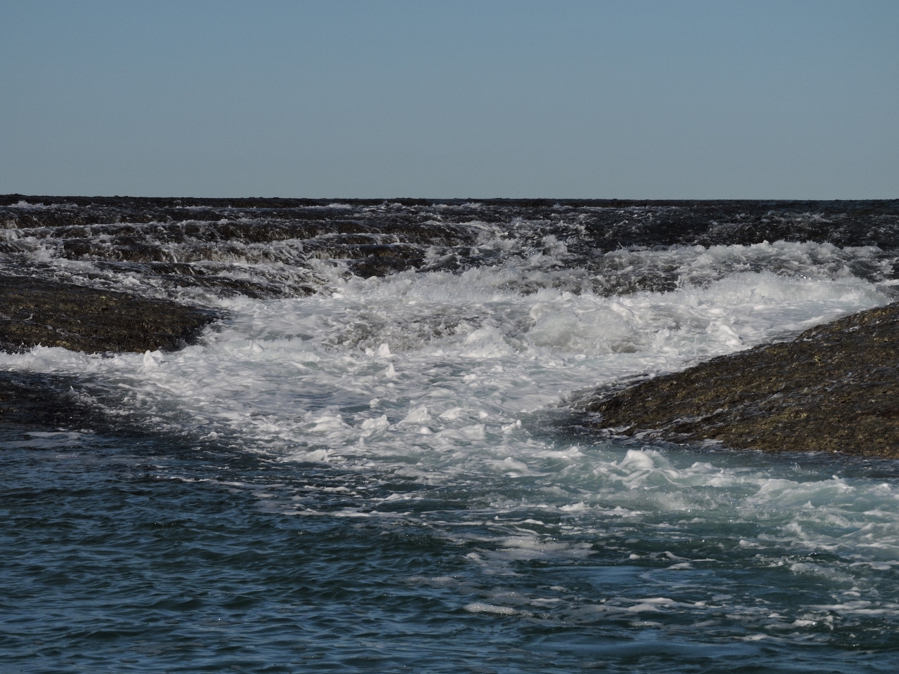 |
Low tide
Position: 124 16.50, -15 58.11
The video https://youtu.be/GUp6gSFsdgA (1:42) shows the waterfalls at various stages of the tide as we ran the tender several times through the narrow, shallow channel that extends north of the anchorage. Near the head of the channel, the current became quite strong as all the water poured in from either side and could only escape through this waterway. On each pass, the waterfalls were larger, and louder. There wasn’t much wind that day–most of the noise you can hear in the video is from the water motion. It was a wild experience being here. As with so many things in the Kimberley, we’ve just never seen anything like it.
|
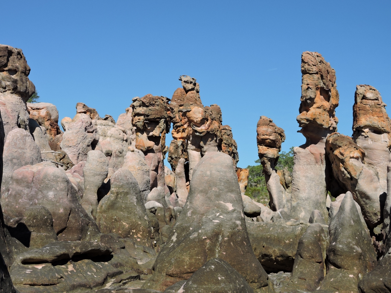 |
Langgi
Position: 124 24.06, -15 45.40
After leaving Montgomery Reef, we stopped at Langgi to see the weather-sculpted rocks. It’s recommended to visit during low tide, but nearing a high tide much of the interesting pieces are still exposed.
|
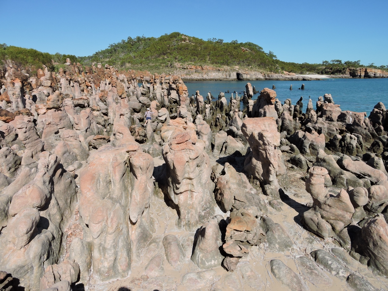 |
Formations
Position: 124 24.05, -15 45.39
Jennifer barely is visible in the huge field of sculpted rock. Once again in the Kimberley, and twice today, we found ourselves saying “Amazing. We’ve never seen anything like it.”.
|
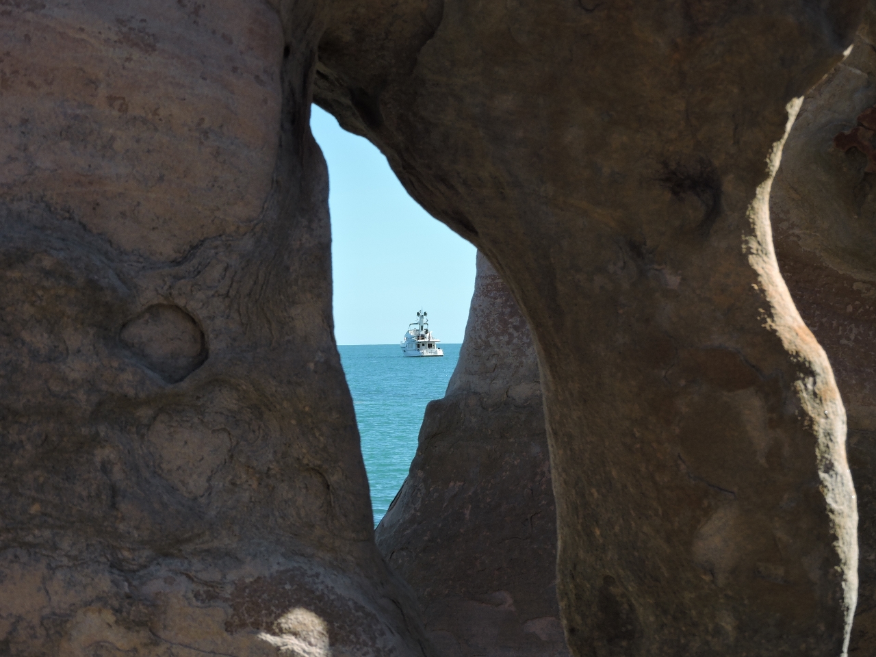 |
Frame
Position: 124 24.07, -15 45.42
Dirona framed by the sculpted rock.
|
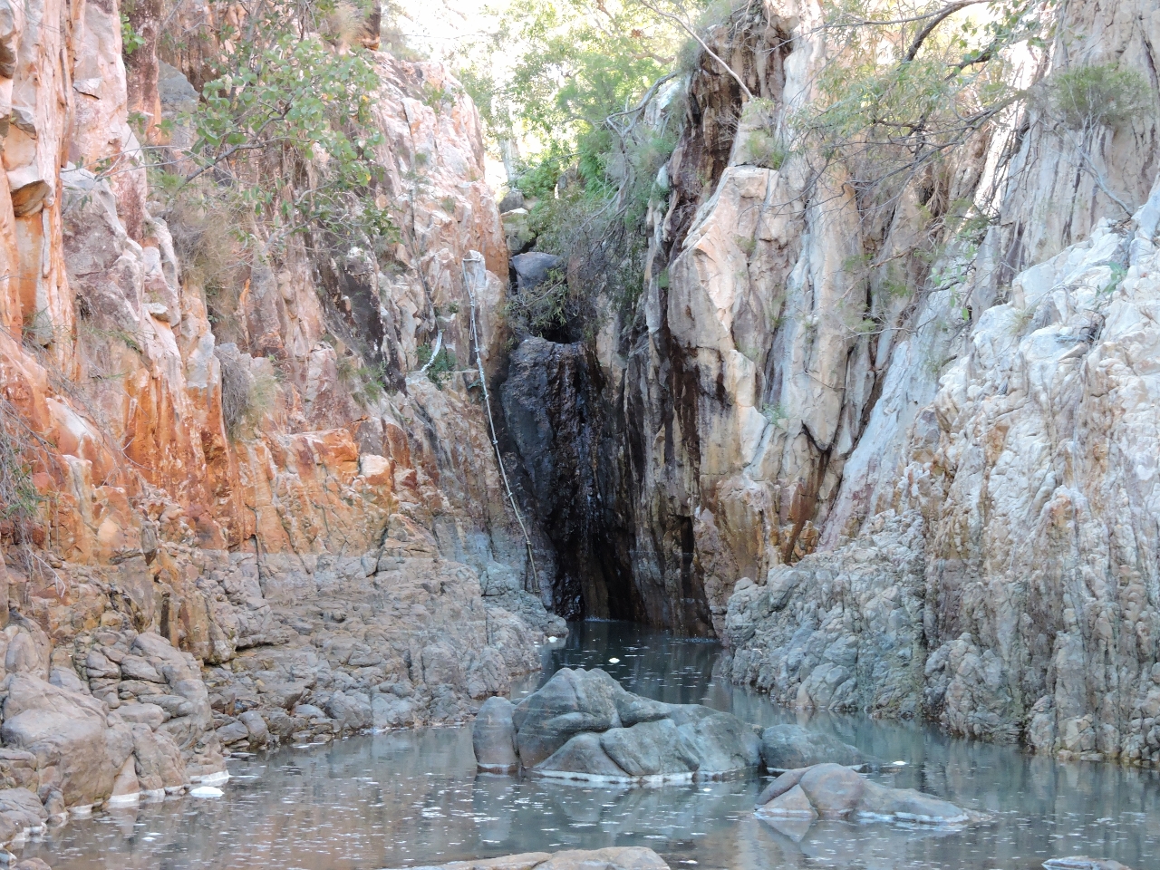 |
Gorge
Position: 124 24.22, -15 45.42
A narrow gorge led inland near the rock formations. We didn’t have quite enough water to reach the waterfall or the climbing rope visible beside it. Presumably the rope provides access to a freshwater pool above.
|

|
Click the travel log icon on the left to see these locations on a map, with the complete log of our cruise.
On the map page, clicking on a camera or text icon will display a picture and/or log entry for that location, and clicking on the smaller icons along the route will display latitude, longitude and other navigation data for that location. And a live map of our current route and most recent log entries always is available at http://mvdirona.com/maps. |
If your comment doesn't show up right away, send us email and we'll dredge it out of the spam filter.
Wow, pretty incredible sights. Glad you and Jennifer are really enjoying your voyage! Hoping for calm seas and a safe passage ahead.
Thanks Stewart. Our trip through the Kimberley has been a real highlight of the whole voyage. It’s the kind of place we really like–remote and wild with astonishing scenery.