A few days after our Karunda trip, we rented a car in Cairns and made another rainforest day trip, this time to the Daintree National Park. There we took in the rainforest at all levels–from the ground, midway up and all the way above the canopy–and flew through the trees via zipline. The Daintree is absolutely beautiful and we had an amazing day.
Click any image below for a larger view, or click the position to view the location on a map. And a live map of our current route and most recent log entries always is available at http://mvdirona.com/maps
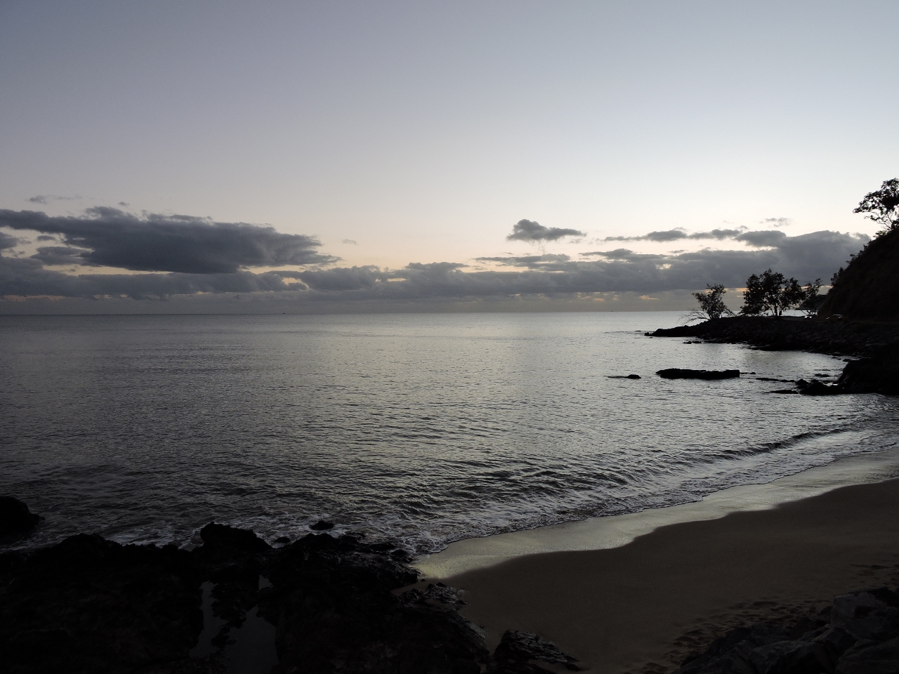 |
Ellis Beach
Position: 145 39.20, -16 43.85
We left Cairns before sunrise this morning on a 95-mile (154 km) drive to Cape Tribulation in Daintree National Park. This is the early morning view at Ellis Beach, about an hour north of Cairns.
|
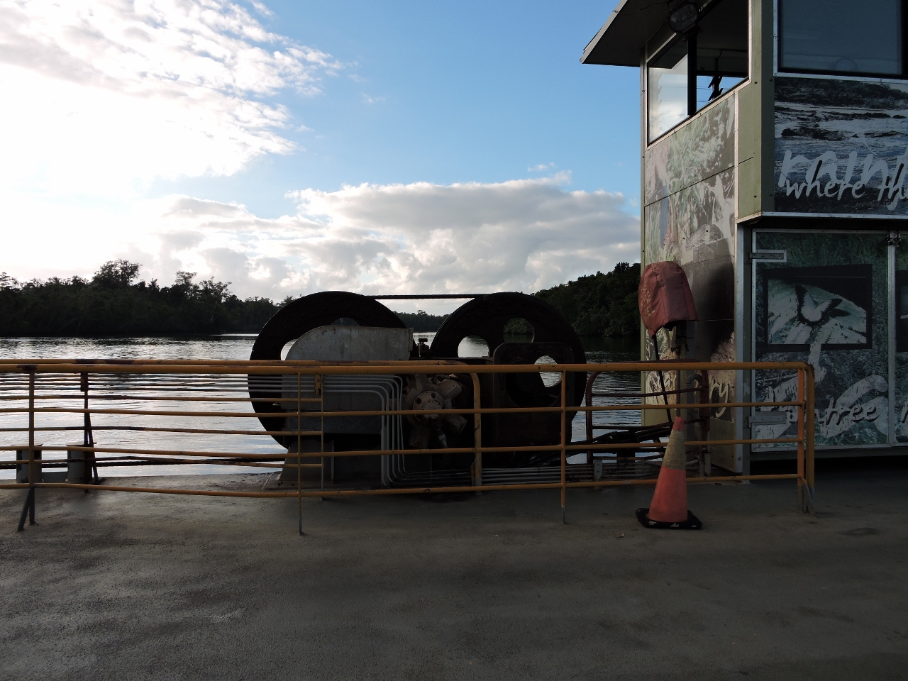 |
Daintree Ferry
Position: 145 23.92, -16 15.53
We’ve passed several cable ferries, but this is our first time riding on one. The service was exceptionally quick. We waited perhaps 2 minutes before boarding and barely had time to pay before we were across.
|
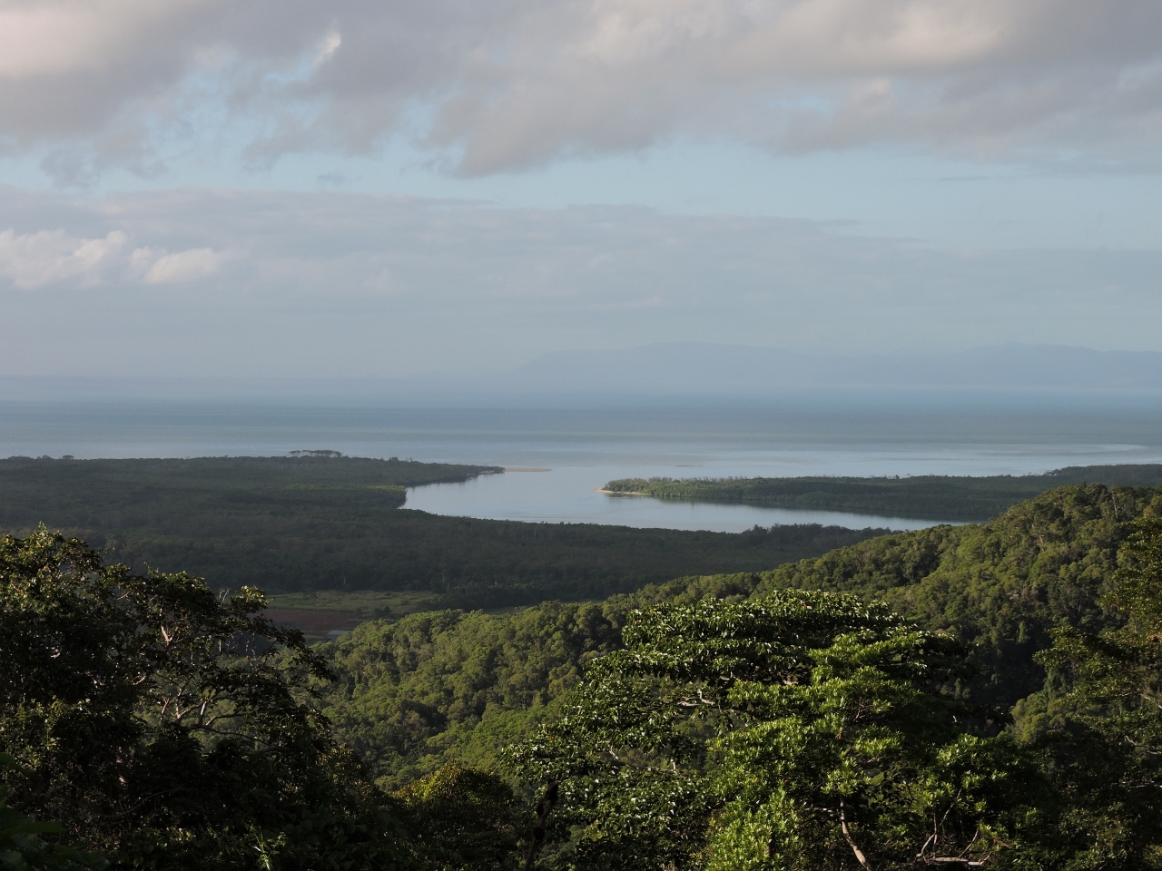 |
Alexandra Lookout
Position: 145 26.16, -16 14.75
Our plan was to drive direct to Cape Tribulation and work our way slowly back over the day, but we couldn’t resist stopping for the view from the Alexandra Range Lookout Point. This is the mouth of the Daintree River where it meets the sea.
|
 |
Cape Tribulation
Position: 145 28.19, -16 4.68
About three hours after leaving Cairns, we arrived at Cape Tribulation. The trip up was excellent with scenery ranging from beaches to rainforest. The road switches from paved to gravel here, so we won’t go any further. And the return trip is already going to more than fill the day.
|
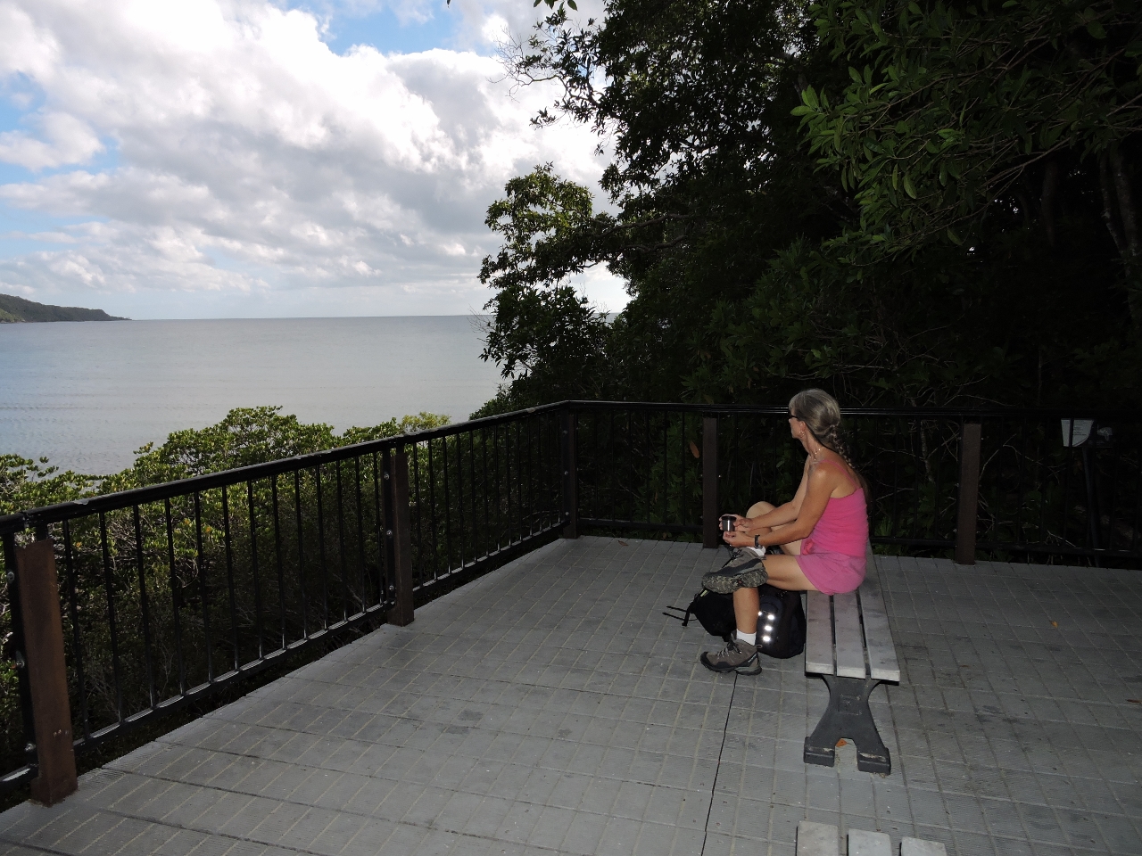 |
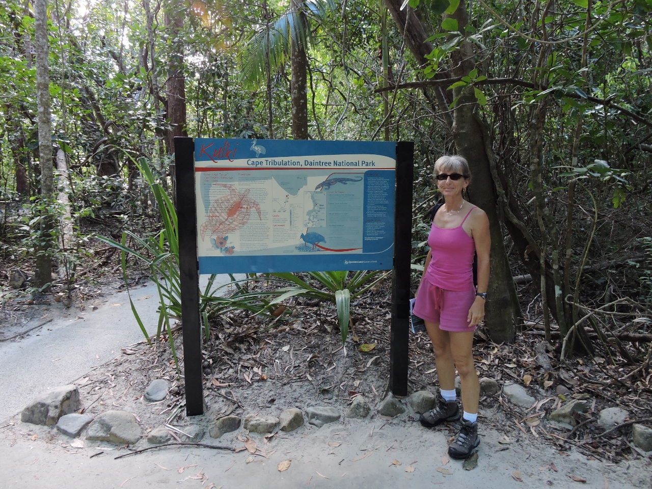
Kulki boardwalk
Position: 145 28.33, -16 4.59
We walked the short Kulki boardwalk through the rainforest and stopped for a cup of coffee while we took in the view from the Cape Tribulation lookout.
|
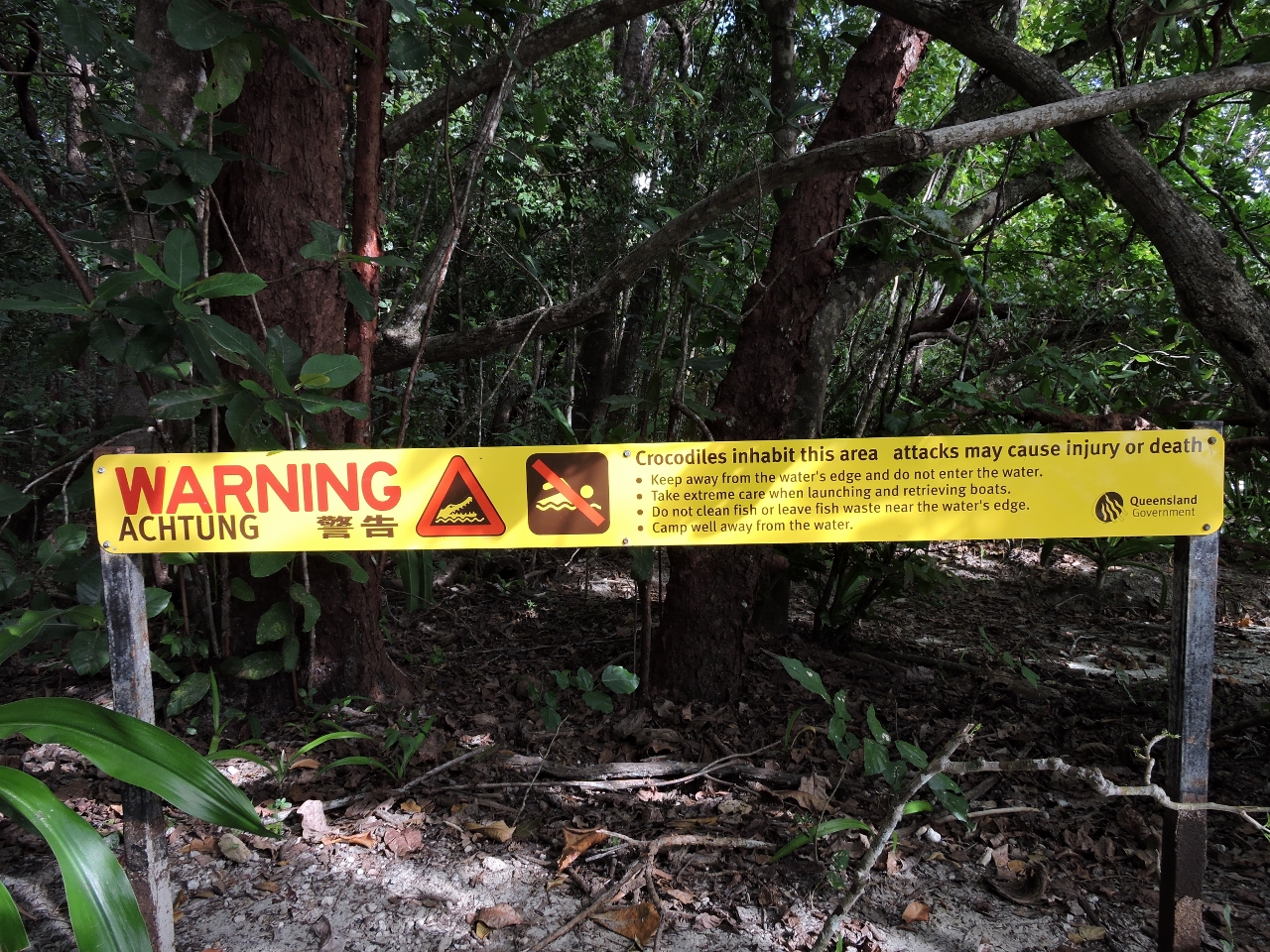 |
Crocodiles
Position: 145 28.20, -16 4.67
From the lookout we walked across a beach and back to the parking lot. This sign at the parking lot path to the beach warns visitors of crocodiles in the area we’d just walked through. Either we took the wrong path, or they need another sign.
|
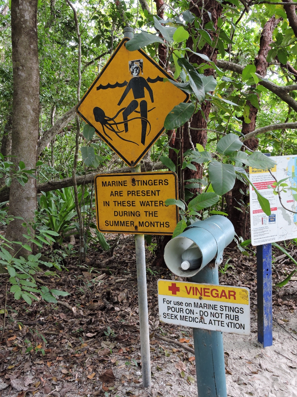 |
Marine stingers
Position: 145 28.20, -16 4.67
If the crocodiles weren’t enough to keep you out of the water, marine stingers (jellyfish), some of which are deadly, would be.
|
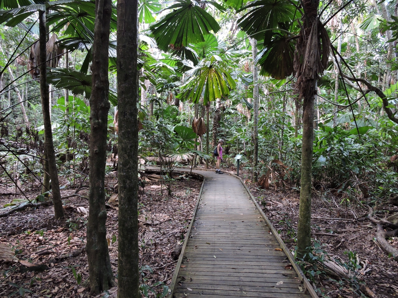 |
Dubuji boardwalk
Position: 145 27.76, -16 5.43
The 1-mile (1.4 km) Dubuji boardwalk goes deep into the rainforest and feels far removed from civilization. Interpretive signs along the way describe the plant and animal life and explain how the rainforest evolves.
|
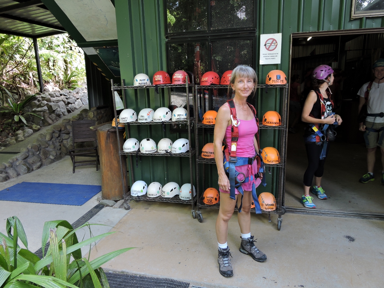 |
Jungle surfing
Position: 145 26.88, -16 5.05
At Jungle Surfing Canopy Tours for a two-hour zipline tour through the rainforest. The video https://youtu.be/QusB_Spyt2M (1:01) starts with the “Human hamster wheel” lifting riders up to the first platform. We rode in pairs for the about the first three or so platforms, and singly for the rest. Each of us wears a helmet with a nickname on it that the guides refer to us by–that is why Jennifer is called “Tinkerbell” near the end of the video. The zipline was yet another way to see and learn about the rainforest and we had an exciting time.
|
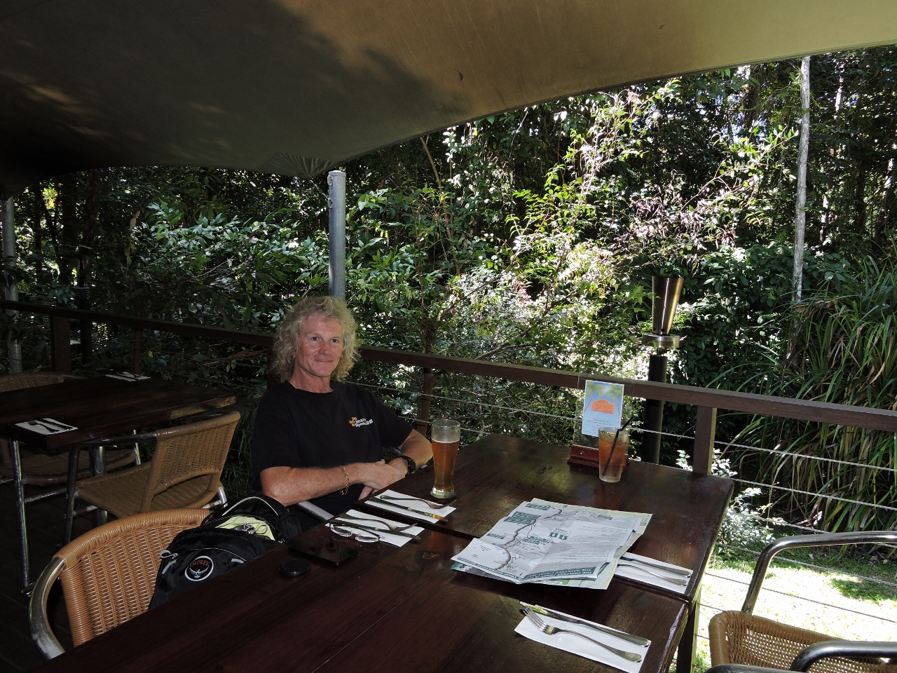 |
Whet
Position: 145 27.67, -16 5.43
We had an excellent lunch at Whet restaurant in Cape Tribulation. Besides the delicious food, they have a wonderful patio surrounded by rainforest.
|
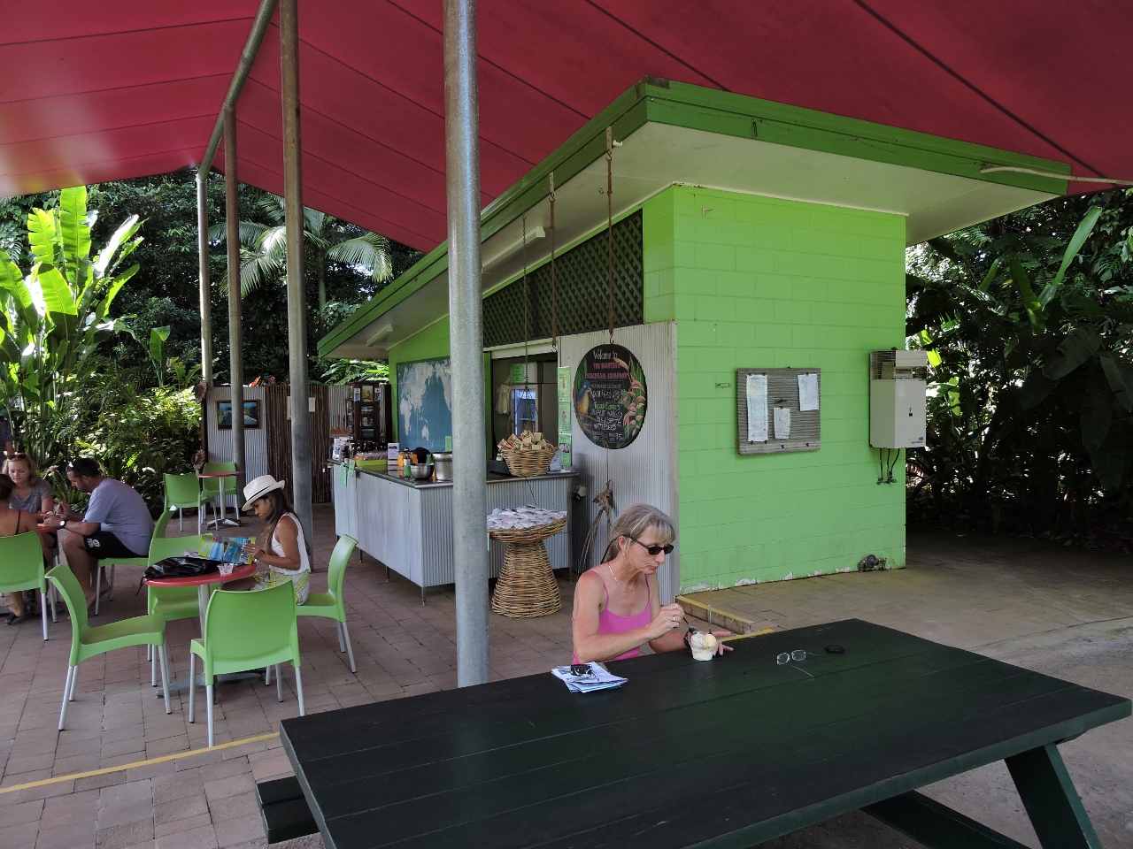 |
Ice cream
Position: 145 24.27, -16 12.83
At the Daintree Ice Cream Company we sampled their delicious homemade tropical fruit ice cream while sitting next to their orchards.
|
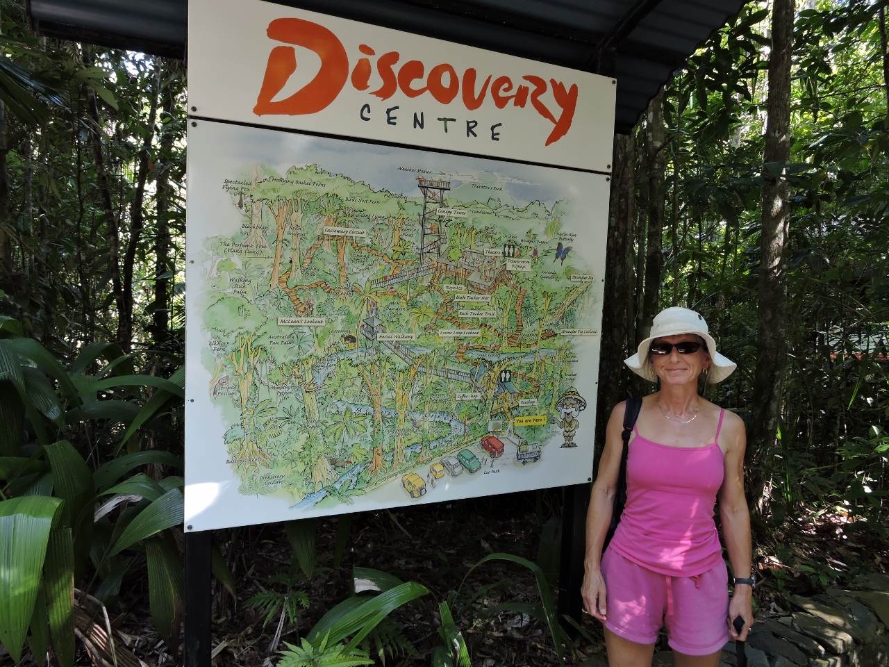 |
Daintree Discovery Center
Position: 145 25.71, -16 14.27
At the Daintree Discovery Center several boardwalks, some elevated, lead through the rainforest. Admission includes an audio guide that explains various aspects of the rainforst along the way.
|
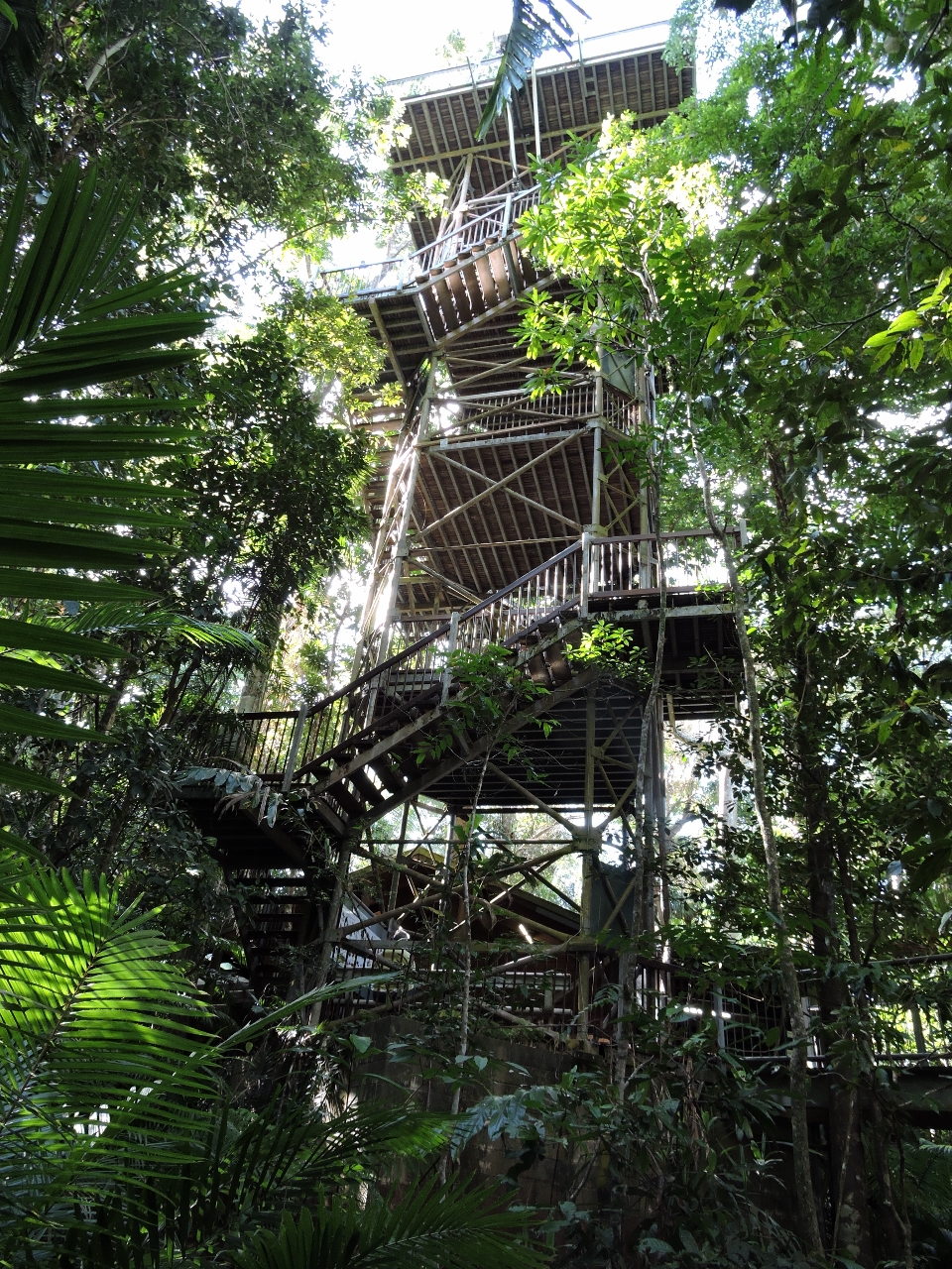 |
Canopy Tower
Position: 145 25.64, -16 14.27
The Canopy Tower is a highlight of the Daintree Discovery Center. After walking along ground and mid-level boardwalks, we climbed to the top for a view over the canopy.
|
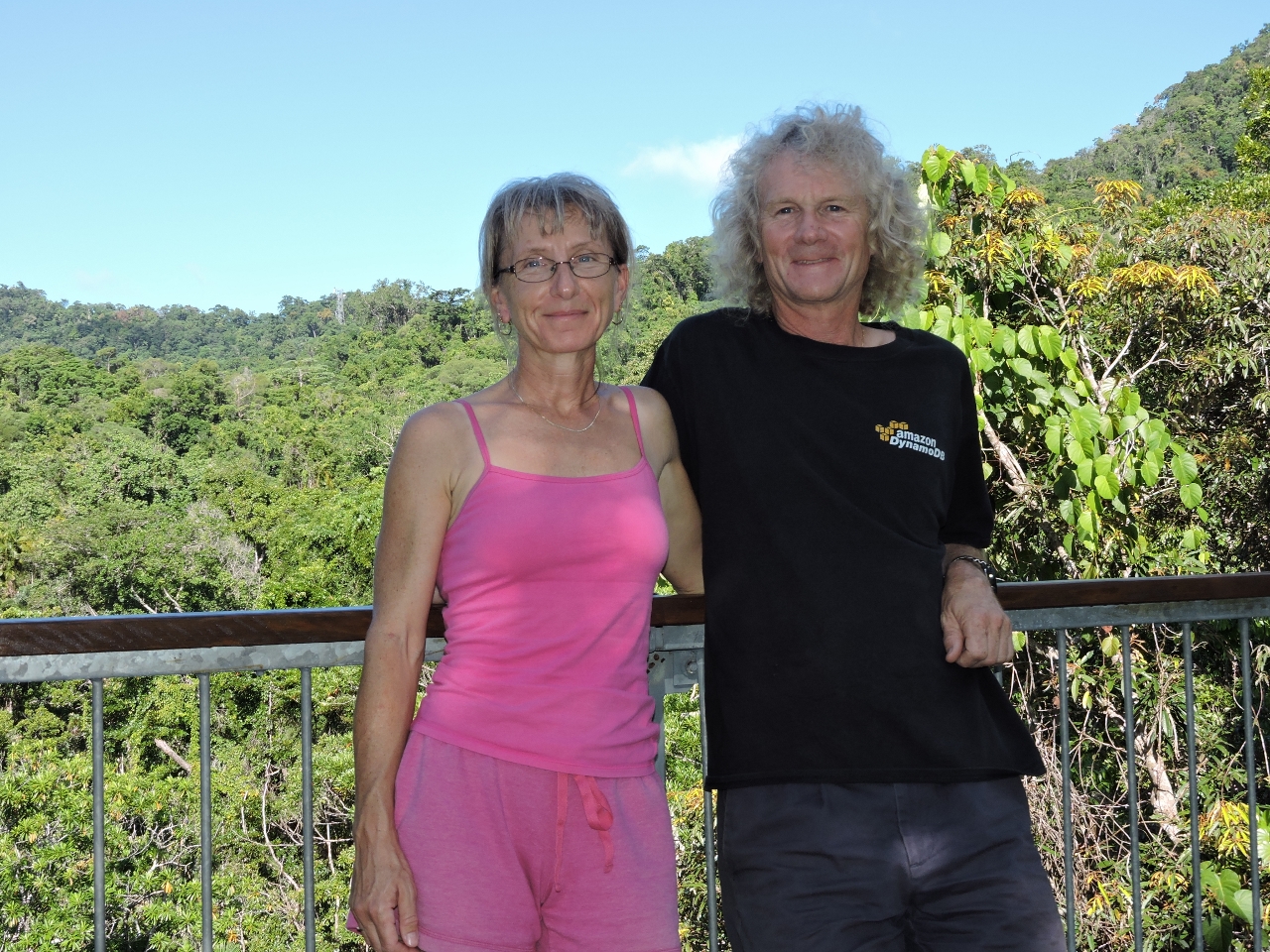 |
On top
Position: 145 25.64, -16 14.27
Enjoying the view from atop the Canopy Tower at the Daintree Discovery Center.
|
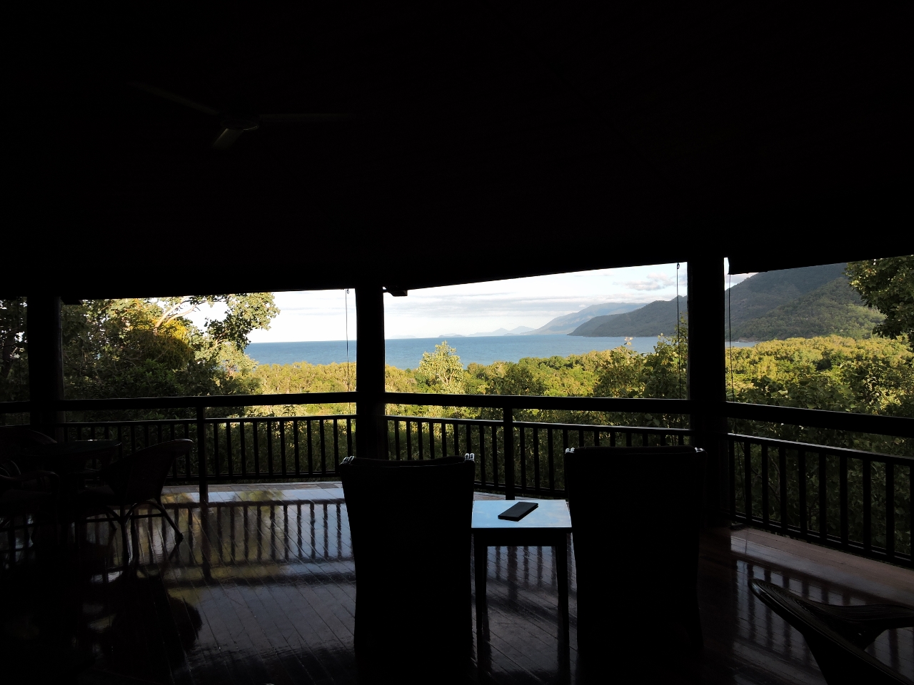 |
Thala Beach Lodge
Position: 145 31.09, -16 35.21
Our final stop for the day was at the Thala Beach Lodge. The beautiful resort is perched high on the cliff–we had a drink in their bar overlooking the coast.
|

|
Click the travel log icon on the left to see these locations on a map, with the complete log of our cruise.
On the map page, clicking on a camera or text icon will display a picture and/or log entry for that location, and clicking on the smaller icons along the route will display latitude, longitude and other navigation data for that location. And a live map of our current route and most recent log entries always is available at http://mvdirona.com/maps. |
If your comment doesn't show up right away, send us email and we'll dredge it out of the spam filter.