Highlights from the week of January 5th, en-route from Eden, New South Wales to Tasmania, and our first few days there. Click any image for a larger view, or the position to view the location on a map.
|
1/5/2015
|
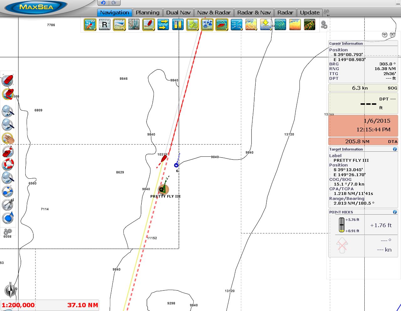 |
1/5/2015: Pretty Fly III
Position: -40° 10.19′, 149° 26.24′
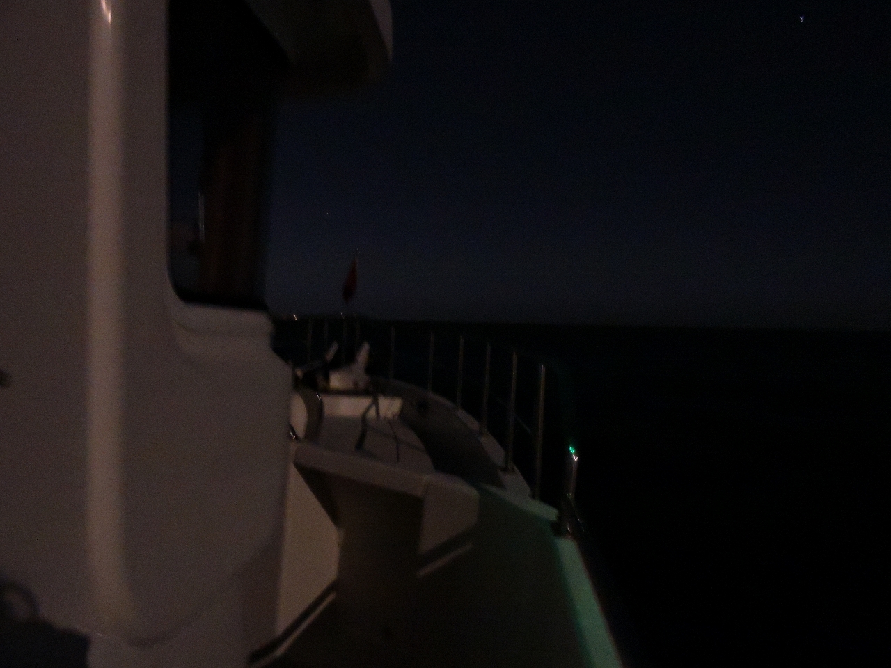
We had to alter course twice tonight to avoid oncoming traffic. Nearly a dozen boats, all likely returning Sydney-Hobart race contenders, were heading north on a near-reciprocal course. One was running AIS: Pretty Fly III, who placed 14th in line honours this year.
|
 |
1/5/2015: Sunrise
Position: -40° 23.97′, 149° 22.28′
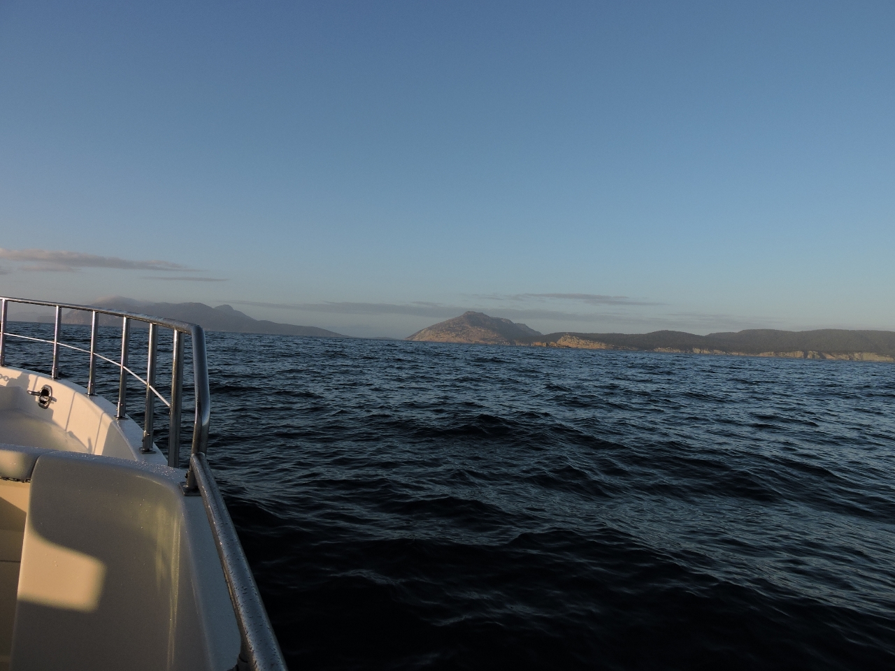
Conditions are excellent, with 10-15 knots wind from the SE and a low easterly swell. We’re nearly halfway to Freycinet Peninsula now and should arrive tomorrow morning. We originally were planning to make our first stop on the way south at Flinders Island, but decided to attend the last two days of Moth Worlds. We’ll be flying from Hobart to Melbourne on the first flight on January 15th, returning on the last flight of the day on the 16th. So we’re adjusting our stops to what fits between now and when we need to be in Hobart. Moths are 11′ foil-equipped racing sailboats capable of upwards of 30 knots. They’re incredible to watch. This year’s Moth Worlds have a record 150 registrants, including 3 Moth world champions, 8 Olympic medalists, and 15 America’s Cup sailors.
|
 |
1/5/2014: Conditions
Position: -41° 56.76′, 148° 49.90′
The winds have dropped further to just 10 knots from the NE with a gentle easterly swell. We’ve had a wonderfully calm day and expect these conditions to last well through tomorrow.
|
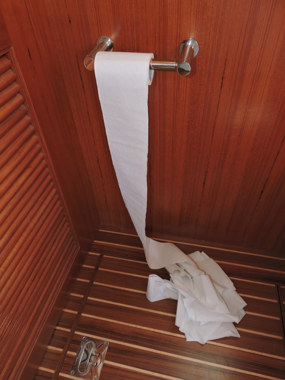 |
1/5/2015: Entertainment
Position: -41° 27.64′, 149° 0.14′
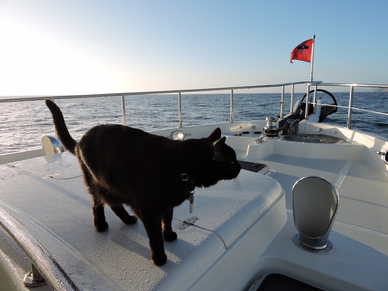
We all have ways to keep ourselves entertained at sea. One of Spitfire’s is to unravel the toilet paper roll.
|
|
1/6/2015
|
 |
1/6/2015: Moonlight
Position: -42° 48.51′, 148° 31.50′
At 4am, the moon is so bright it appears a spotlight is shining on the boat, and dolphins are chasing our bow. Conditions remain calm, and we’re only a few hours out now. We can see the Cape Tourville light flashing at the northern end of Freycinet Peninsula and the light of Bicheno to our west.
|
 |
1/6/2015: Landfall
Position: -43° 6.24′, 148° 23.80′
Approaching Wineglass Bay, our first anchorage in Tasmania. When we left Eden, we were planning to run around Freycinet Peninsula to Coles Bay for our first anchorage, expecting conditions to be too rough to anchor in Wineglass Bay. But conditions were better than forecast, and the anchorage was calm.
|
 |
1/6/2015: Cape Tourville
Position: -43° 7.44′, 148° 23.04′
The lighthouse perched on the cliff at Cape Tourville. A walking track leads to the lighthouse for sweeping views to sea.
|
 |
1/6/2015: Bow watch
Position: -43° 7.99′, 148° 22.75′
Spitifire out on his traditional landfall bow watch.
|
 |
1/6/2015: Mount Dove
Position: -43° 9.91′, 148° 19.25′
The shoulder of 485m Mount Dove dominates the scene as we approach Wineglass Bay. Mount Dove is the central of five granite mountains that make up the Hazards range.
|
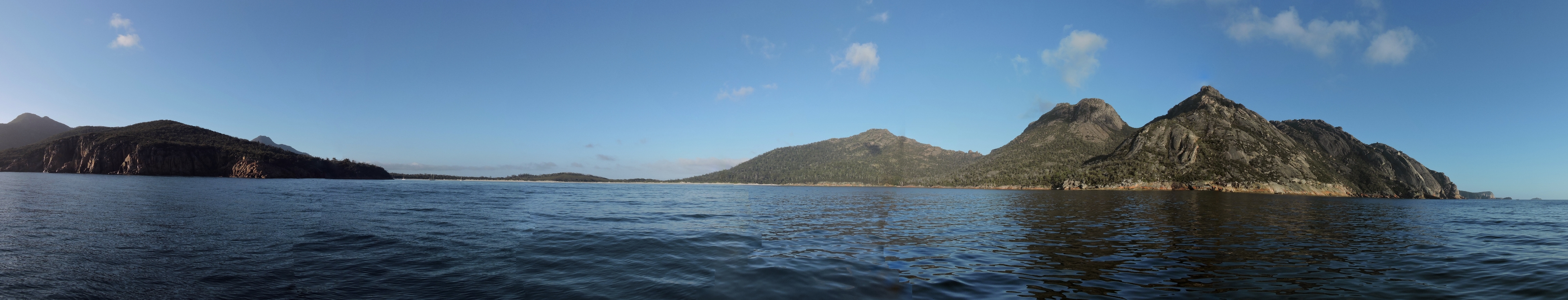 |
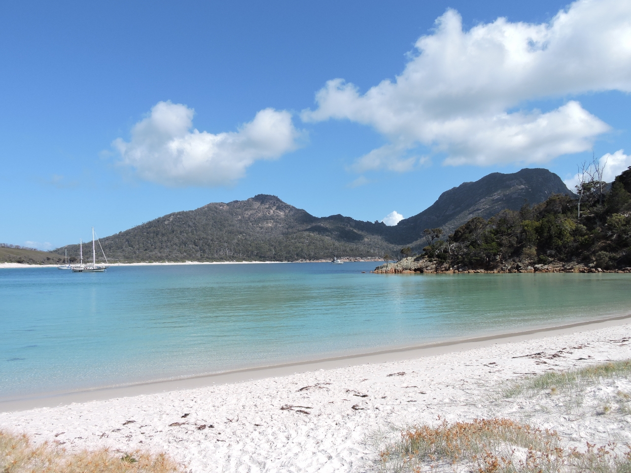
1/6/2015: Wineglass Bay
Position: -43° 10.13′, 148° 18.57′
The scenery as we approach Wineglass Bay is amazing. The 500m Hazard mountains are on the right and the beach at Wineglass Bay is straight ahead.
|
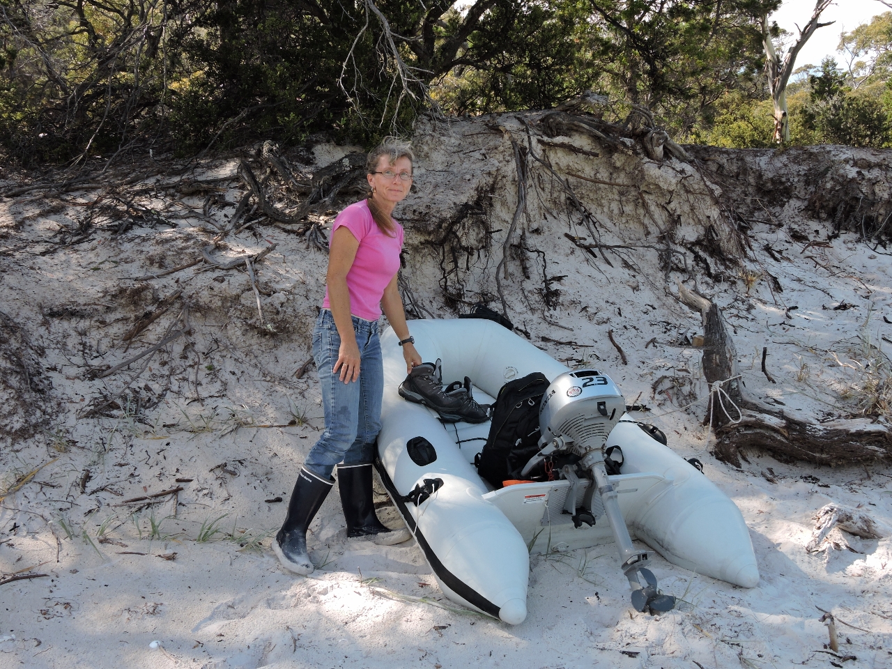 |
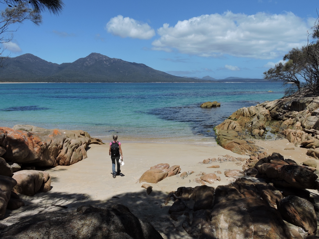
1/6/2015: Ashore
Position: -43° 10.49′, 148° 18.66′
We considered landing in the middle of the beach, but even gentle surf rolls in fairly hard, so we tucked around the sheltered south corner for an easy landing. There we traded rubber boots for hiking boots before setting off on foot. Temperatures are a lot cooler here–in the 60s F rather than the 80s we had in Sydney.
|
 |
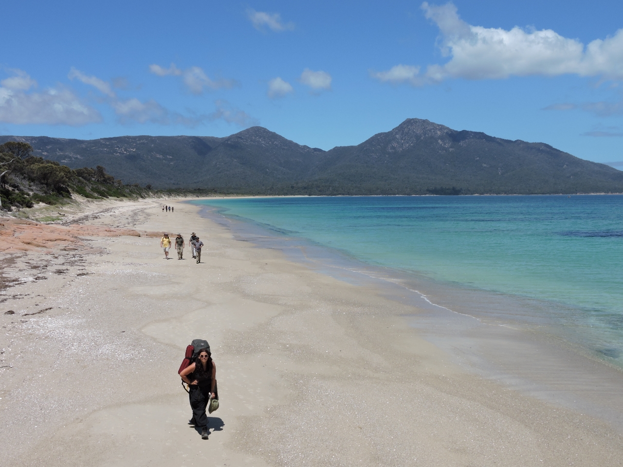
1/6/2015: Beach
Position: -43° 10.49′, 148° 18.65′
A beautiful squeaky and soft sand beach rings Wineglass Bay. This is looking north across the bay. Dirona is visible near the saddle between the two mountains (click the image for a larger view).
|
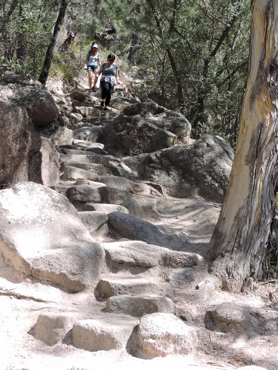 |
1/6/2015: Wineglass Bay track
Position: -43° 9.41′, 148° 17.59′
A steep track leads from the north end of the beach 636 feet up to the Wineglass Bay Lookout and then back down the other side to a car park. A surprisingly large number of people make the trek down the track to the beach, many with small children or infants. So the trail actually is quite crowded.
|
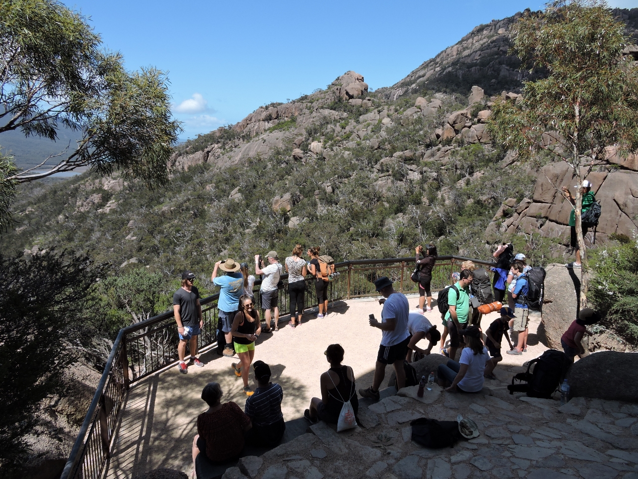 |
1/6/2015: Crowds
Position: -43° 9.28′, 148° 17.54′
This is the high season for tourism in Tasmania–the Wineglass Bay Lookout was busy, with more people arriving constantly despite the climb from the parking lot.
|
 |
1/6/2015: View
Position: -43° 9.29′, 148° 17.61′
This is why everyone has made the climb to the lookout: the panoramic view to Wineglass Bay on the left and a Promise Bay on the right. Dirona is the leftmost of the two anchored boats.
|
 |
1/6/2015: Lunch
Position: -43° 8.86′, 148° 16.61′
We followed the Wineglass Bay Track down to the parking lot and picked up the Hazards Beach Track to return to Wineglass Bay. The track had many excellent views into Great Oyster Bay. We stopped for lunch on a bluff with a view to Coles Bay at the right of the photo.
|
 |
1/6/2015: Pocket beach
Position: -43° 10.06′, 148° 16.29′
A small pocket beach at the north end of Promise Bay.
|
 |
1/6/2015: Hazards Beach
Position: -43° 10.11′, 148° 16.29′
Beautiful Hazards Beach rings Promise Bay. The many people on the beach likely were returning to the parking lot from the Wineglass Bay Lookout via Wineglass Bay Beach.
|
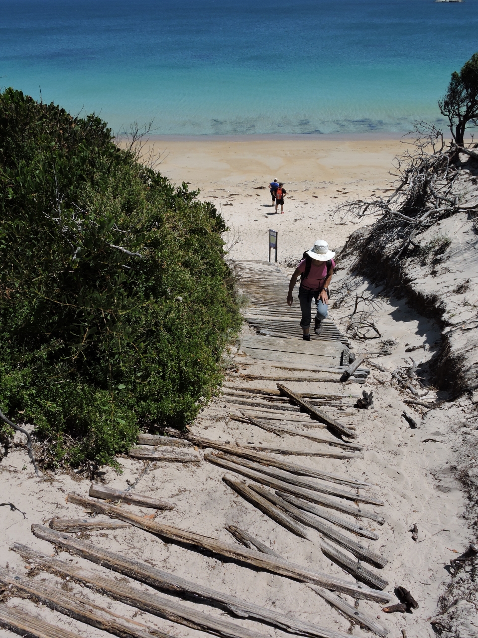 |
1/6/2015: Isthmus Track
Position: -43° 10.42′, 148° 16.83′
We took the Isthmus Track up the sand dunes towards Wineglass bays.
|
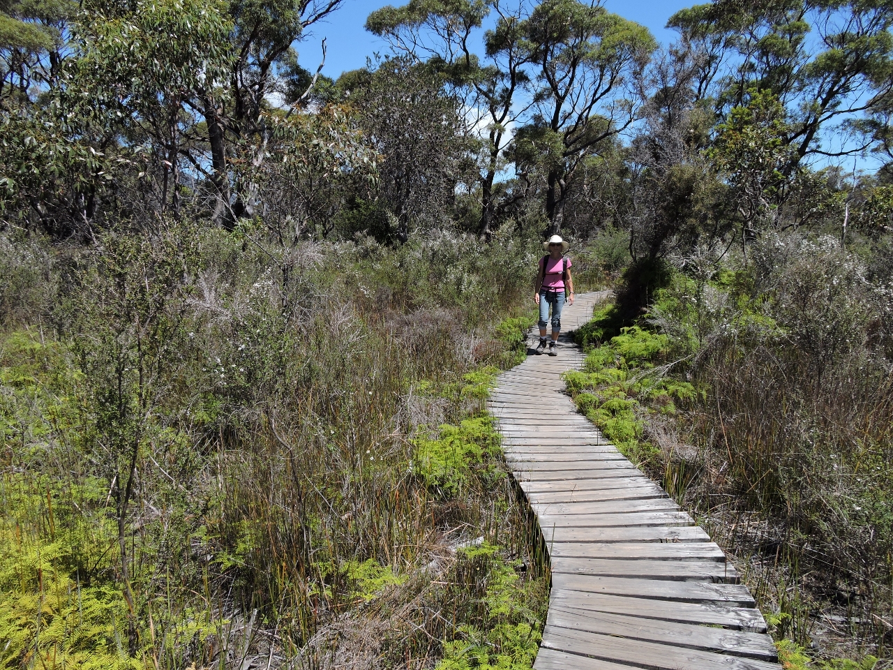 |
1/6/2015: Boardwalk
Position: -43° 10.29′, 148° 17.16′
A boardwalk runs through the marshier sections of the Isthmus Track.
|
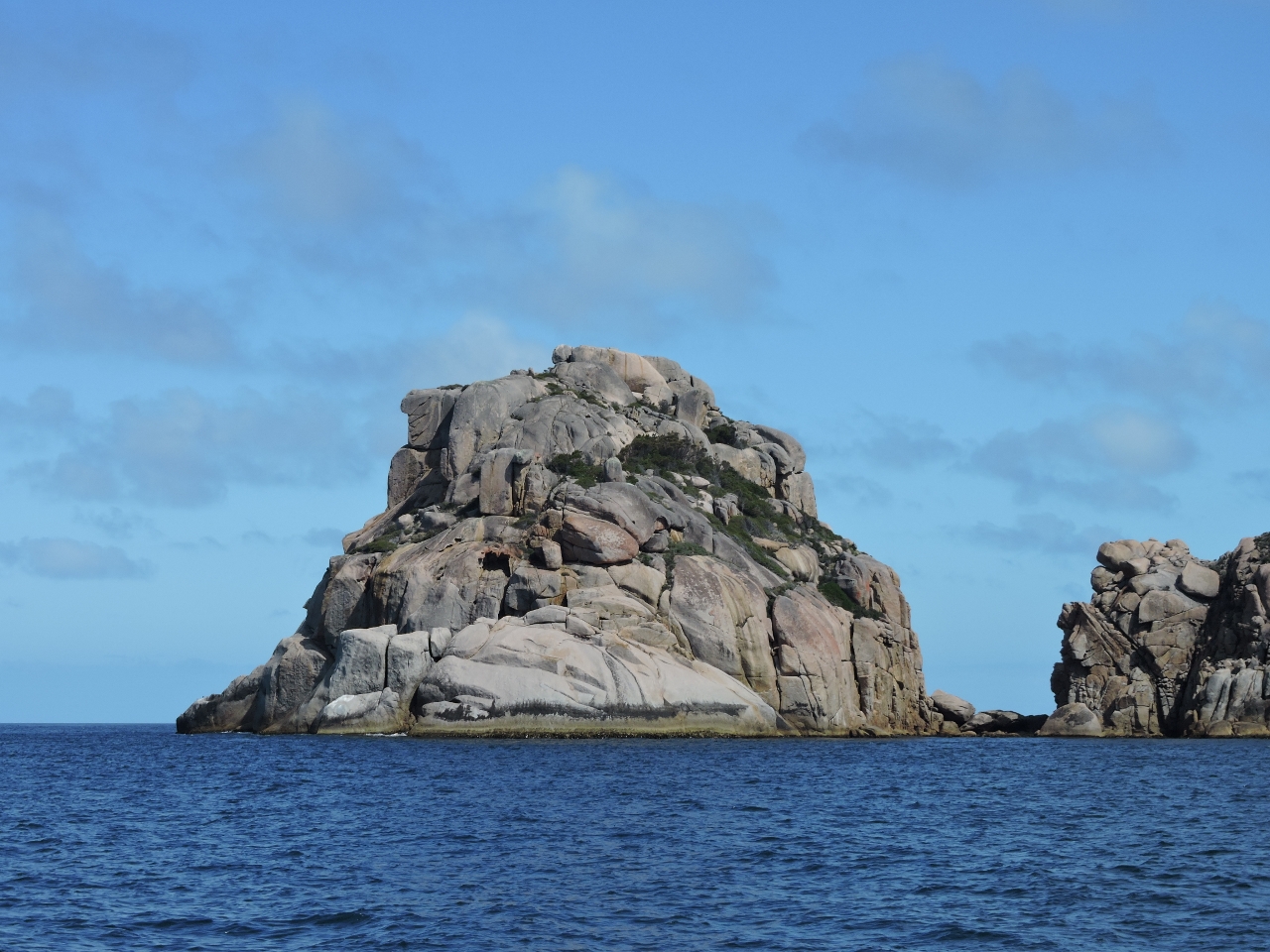 |
1/6/2015: Lemon Rock
Position: -43° 10.70′, 148° 21.68′
Lemon Rock off Cape Forestier. The winds were forecast to climb to 20 knots from the northeast overnight and since we wanted to be in Coles Bay the next day to possibly walk to the Cape Tourville lighthouse, we decided to go early.
|
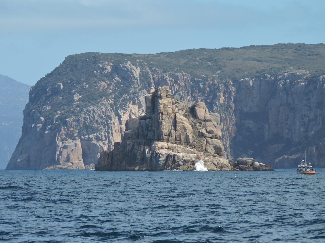 |
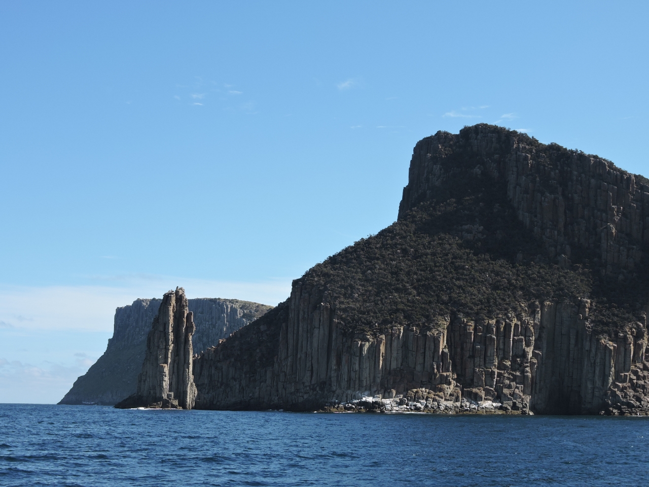
1/6/2015: Half Lemon Rock
Position: -43° 11.46′, 148° 21.84′
Dramatic Half Lemon Rock dwarfs the commercial fishing boat beside it. The outer coast is rugged, weatherworn and imposing.
|
|
1/7/2015
|
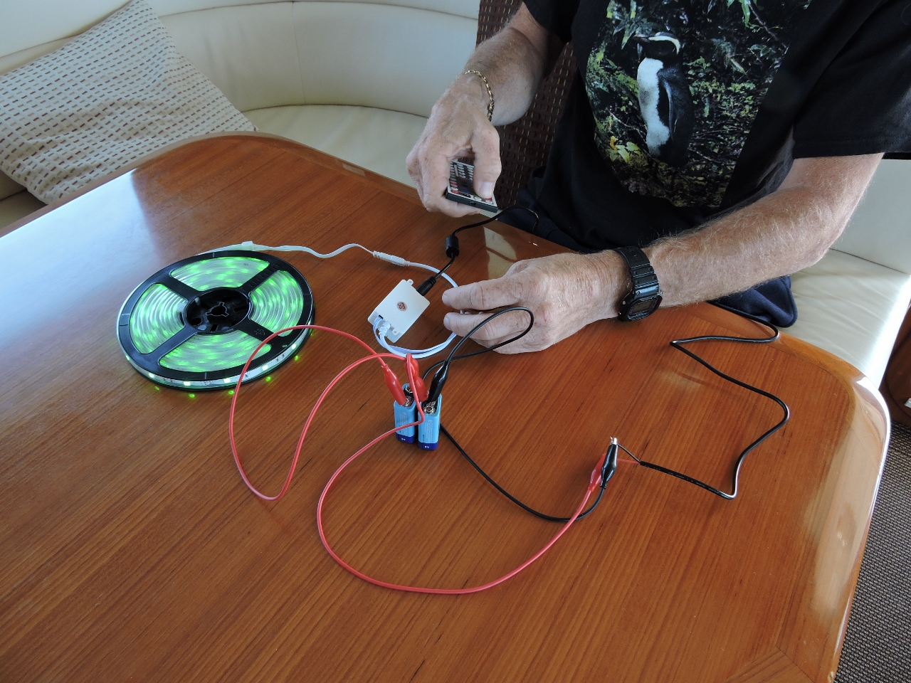 |
1/7/2015: Test system
Position: -43° 8.26′, 148° 17.68′
The outdoor LED strip lights were malfunctioning, so James built a test system to investigate. He found excess resistance at one strip, causing dim lights, and found broken wires at another, causing missing colors.
|
 |
1/7/2015: The Hazards
Position: -43° 8.28′, 148° 17.68′
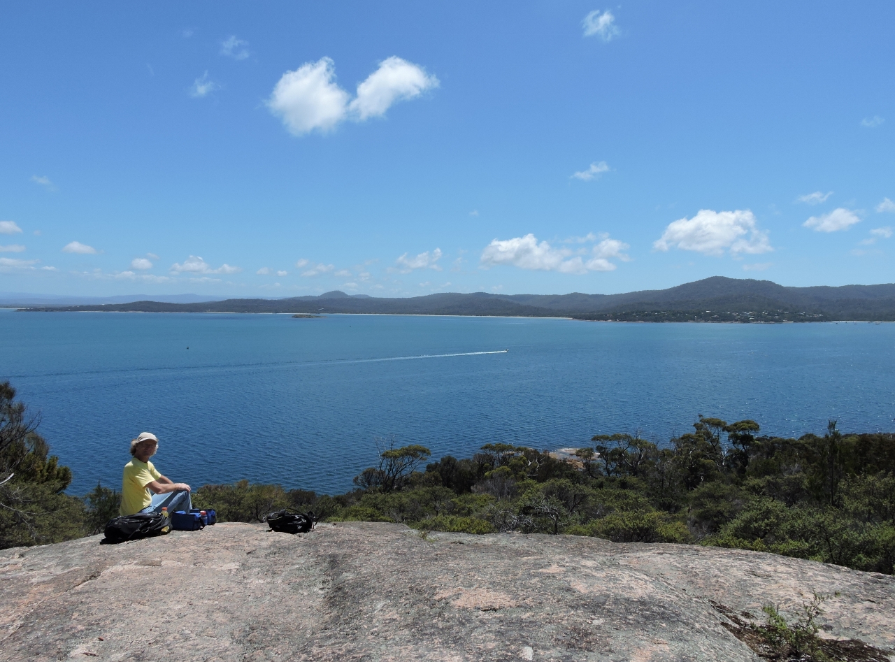
We were planning to walk to the Cape Tourville lighthouse today, but we were fogged in until this afternoon, so stayed on board and got some boat projects done. The is the view to the Hazard mountain range from the anchorage at Cole Bay when the sky finally cleared late in the afternoon.
|
 |
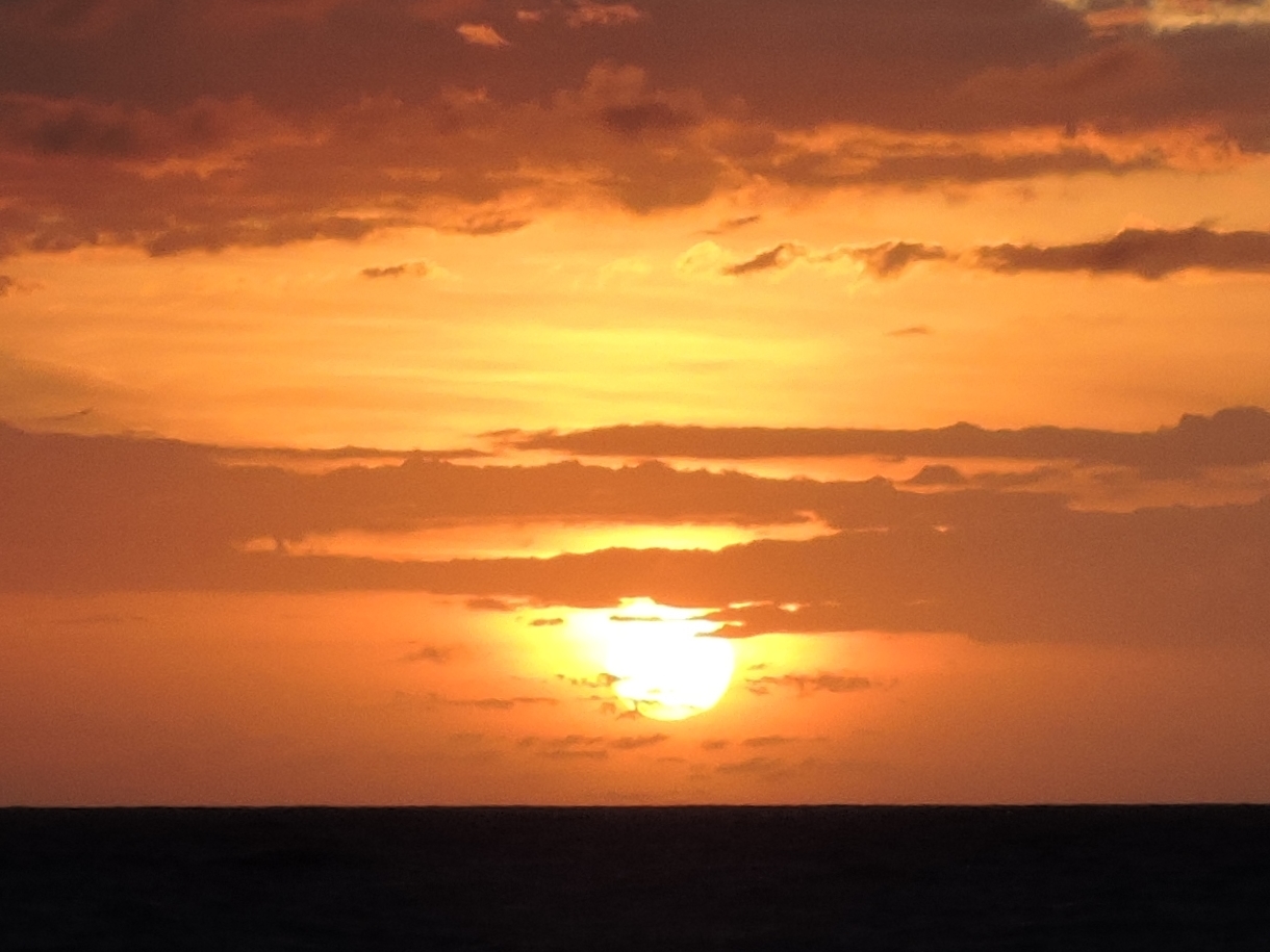
1/7/2015: Sunset
Position: -43° 8.29′, 148° 17.69′
.
|
|
1/8/2015
|
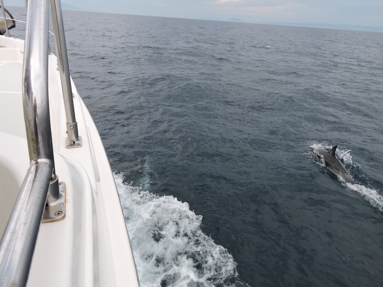 |
1/8/2015: Dolphins
Position: -43° 17.78′, 148° 11.79′
Dolphins chased our bow en route to Maria Island.
|
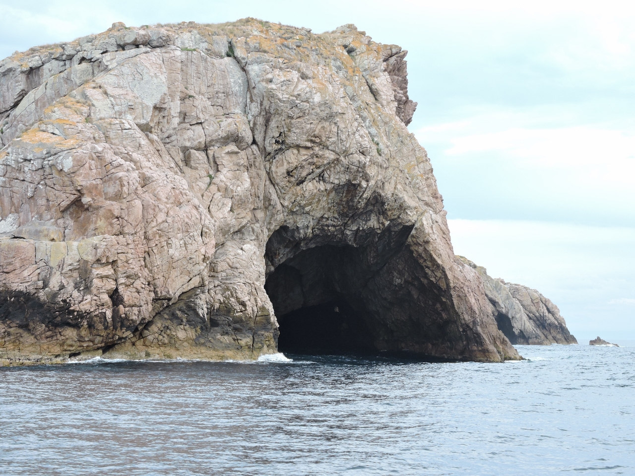 |
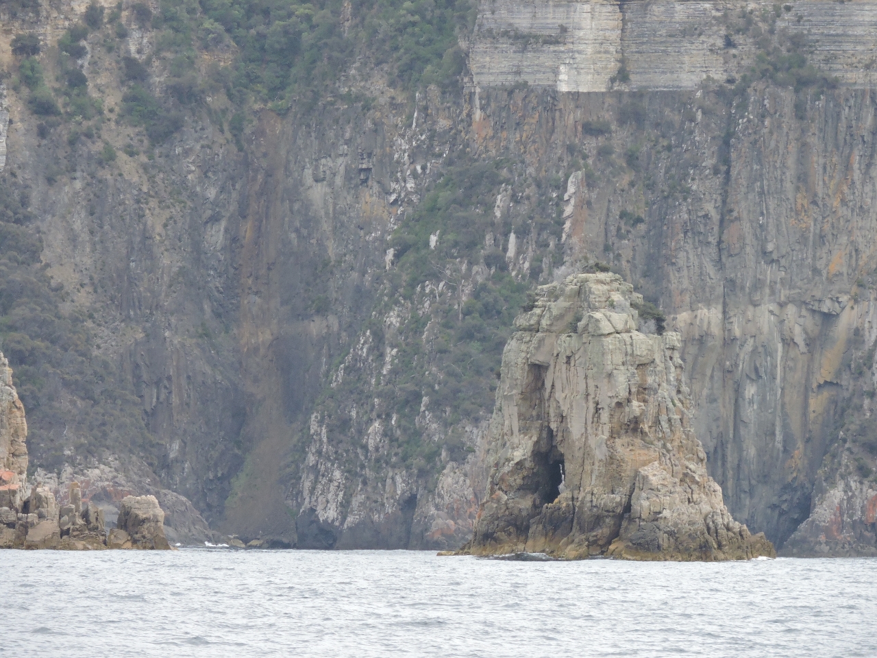
1/8/2015: Ile de Phoques
Position: -43° 25.33′, 148° 9.59′
Caves riddle tiny Ile de Phogues, similar to what we’ve seen at Dempster Island along Vancouver Island’s west coast. One at the tiny bay on the northeast side goes all the way through to the north end. This large one is at the south corner. Phoques means seal in French–several seals were perched on the rocks there.
|
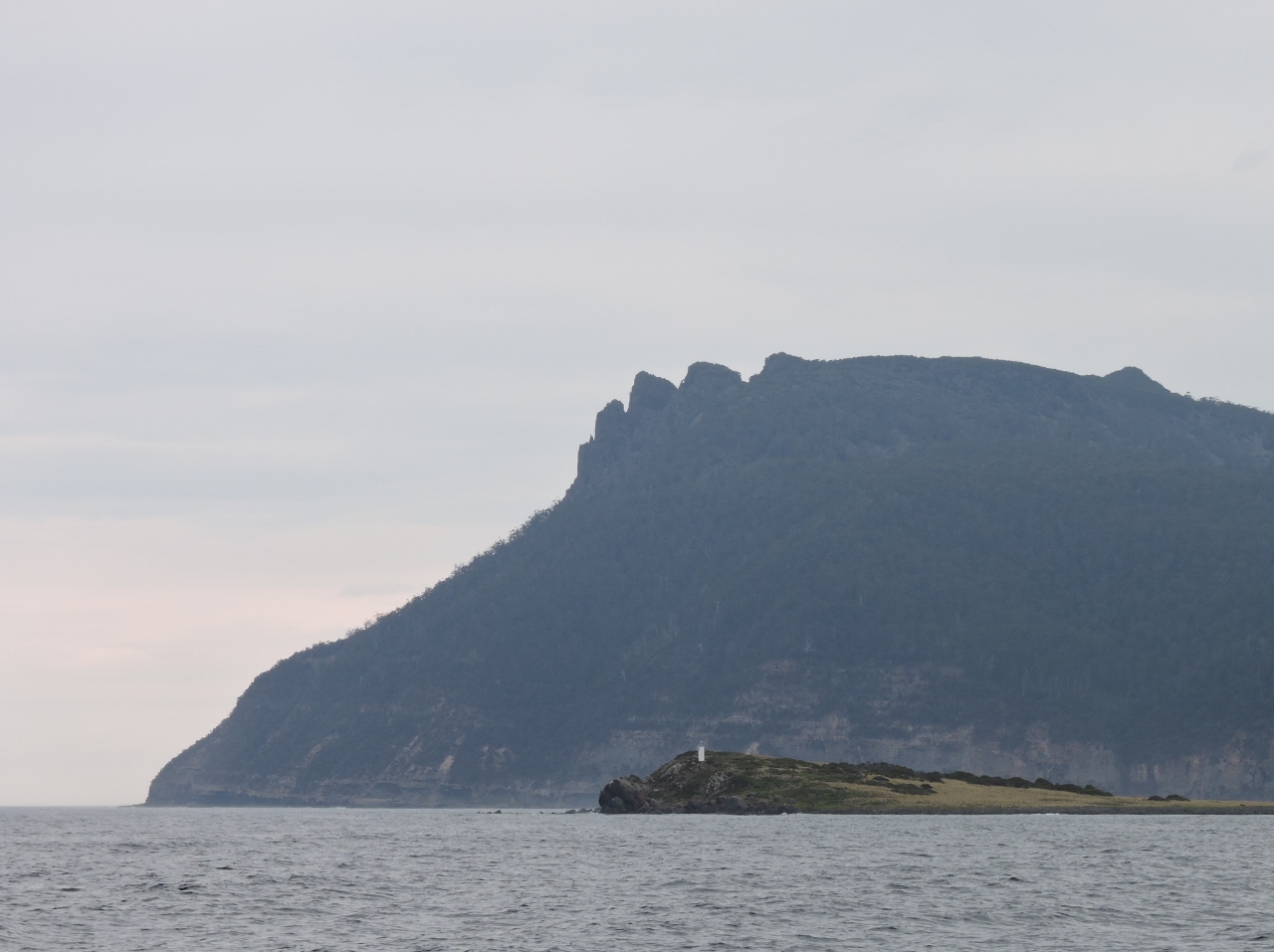 |
1/8/2015: Ile du Nord
Position: -43° 33.48′, 148° 3.40′
The light on Ile du Nord with the Bishop and Clerk ridge on Maria Island in the background. French explorer Nicolas Baudin named many of the area’s features in an expedition in 1802.
|
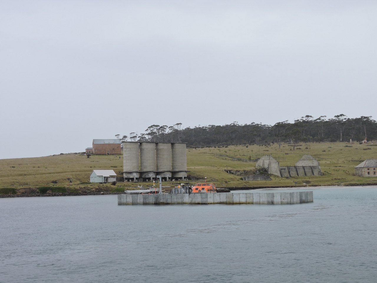 |
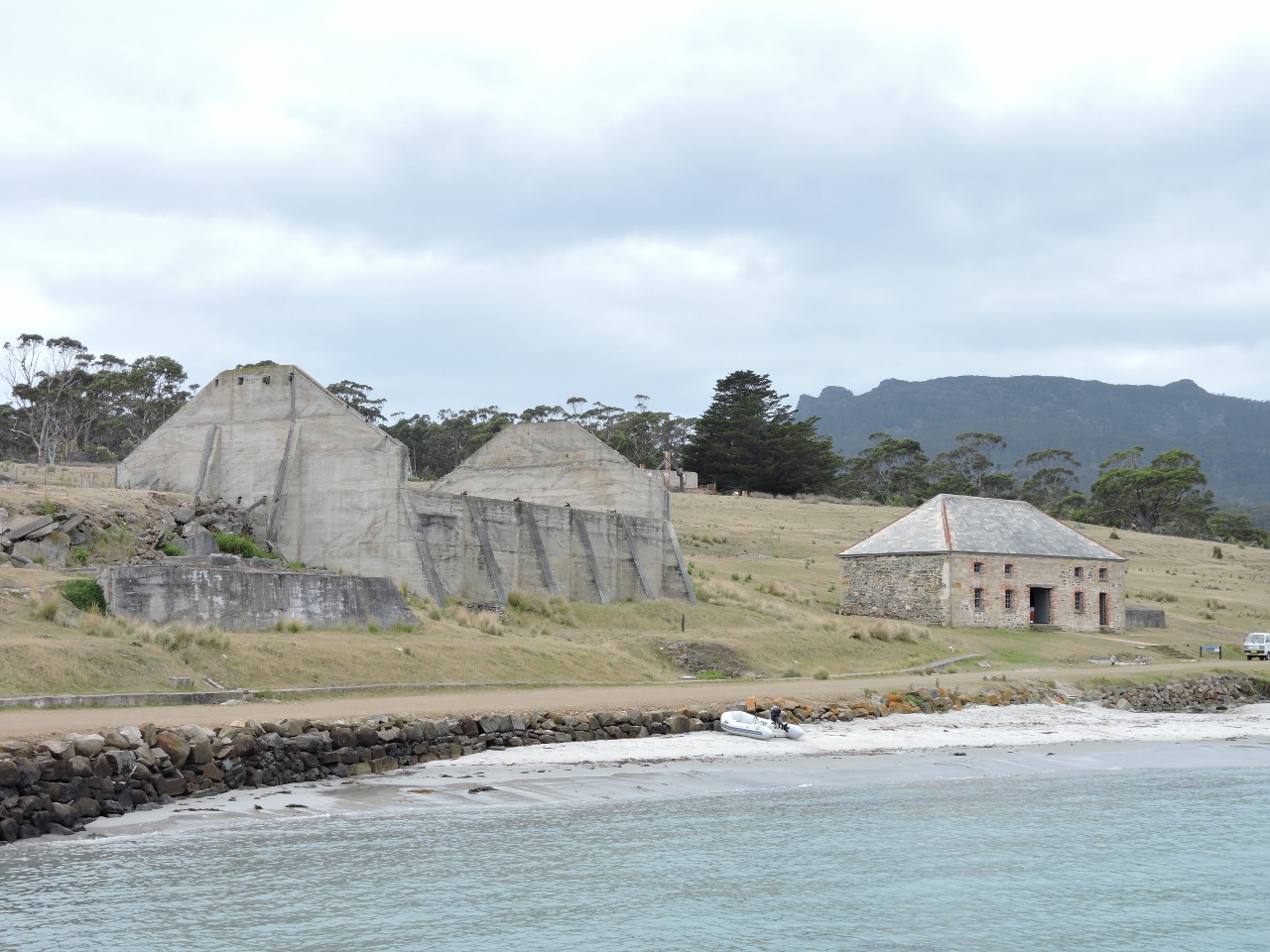
1/8/2015: Ruins
Position: -43° 34.70′, 148° 3.49′
Maria Island was a convict probation station in the 1800s. These are the ruins of a cement works from the island’s industrial era in the 1920s.
|
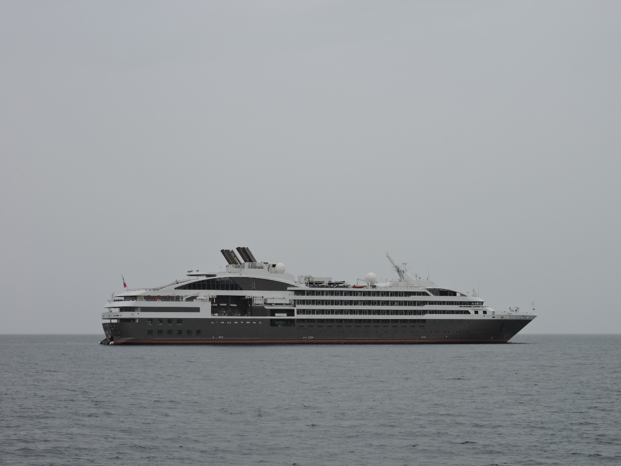 |
1/8/2015: L’Austral
Position: -43° 35.02′, 148° 2.76′
|
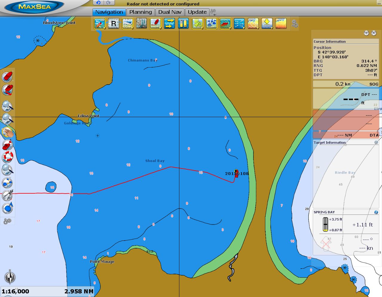 |
1/8/2015: Deep Hole
Position: -43° 40.36′, 148° 3.77′
The charts show depths of 8-13 feet through most of Shoal Bay. But on the satellite image, you can see what the Tasmanian Anchoring Guide calls the “Deep Hole”, with depths around 25 feet.
|
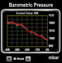 |
1/8/2015: Falling pressure
Position: -43° 40.34′, 148° 3.78′
We’ve got a front moving through today–the barometer has fallen from 1022 to 999 in 48 hours. The heavy rainfall is rinsing off the saltwater coating from our Bass Strait crossing.
|
 |
1/8/2015: Freshwater level sensor
Position: -43° 40.33′, 148° 3.78′
The freshwater level sensor stopped working after a failed firmware upgrade, so we installed a spare.
|
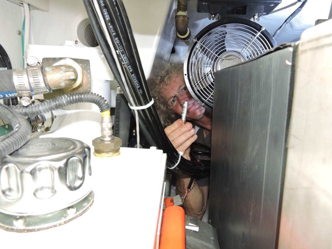 |
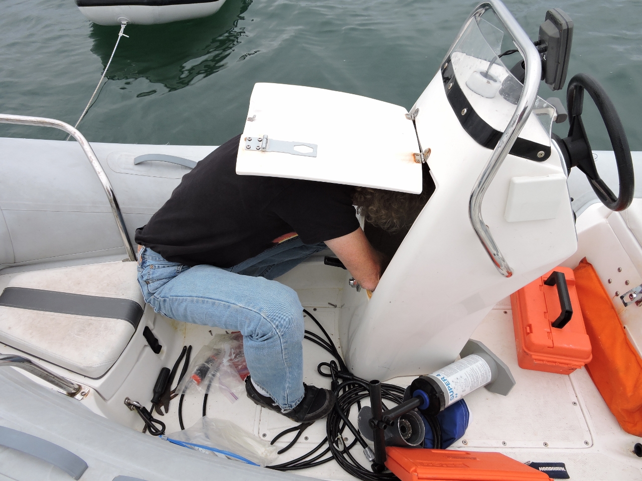
1/8/2015: Zincs
Position: -43° 40.34′, 148° 3.78′
James crawled behind the lazarette freezer to replace the pencil zincs in the hydraulic system heat exchanger.
|
 |
1/8/2015: Raw water strainer
Position: -43° 40.36′, 148° 3.77′
One of our raw water intake strainers was cracked and leaking, so we replaced it with Groco strainer (right). The new strainer was not drop-in compatible, but it seems much more durable than the originals (left) so worth the installation hassle.
|
|
1/9/2015
|
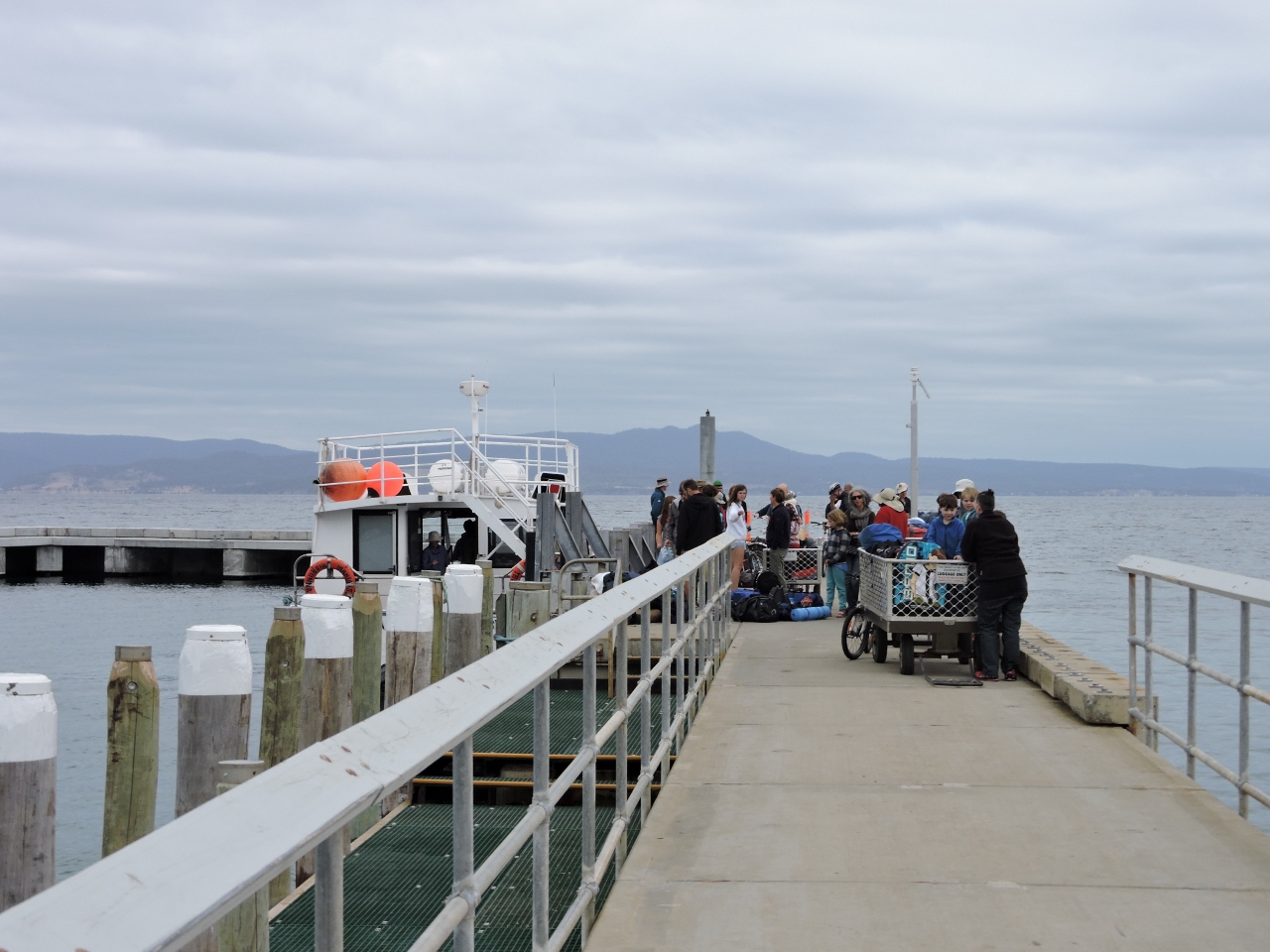 |
1/9/2015: Arrivals
Position: -43° 34.69′, 148° 3.91′
A ferry-load of passengers arriving at Maria Island National Park. The historic ruins and natural beauty make the park popular.
|
 |
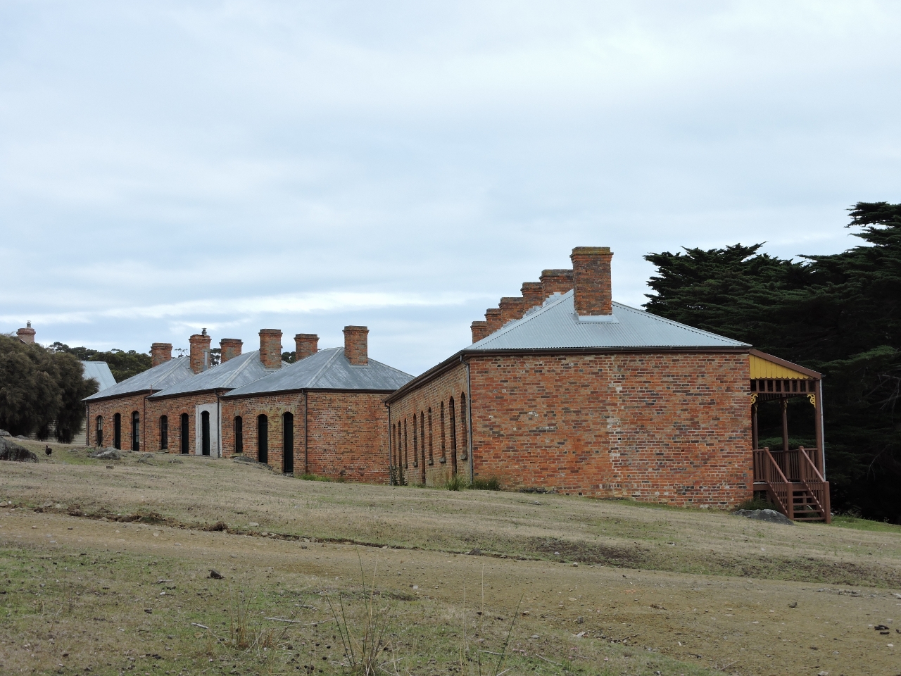
1/9/2015: Commissariat Store
Position: -43° 34.69′, 148° 3.91′
The Commissariat Store, on the right, is the oldest building on the island. It was built in 1828, during the island’s convict period (1825-1850). The structure on the left was part of the 1920s cement complex.
|
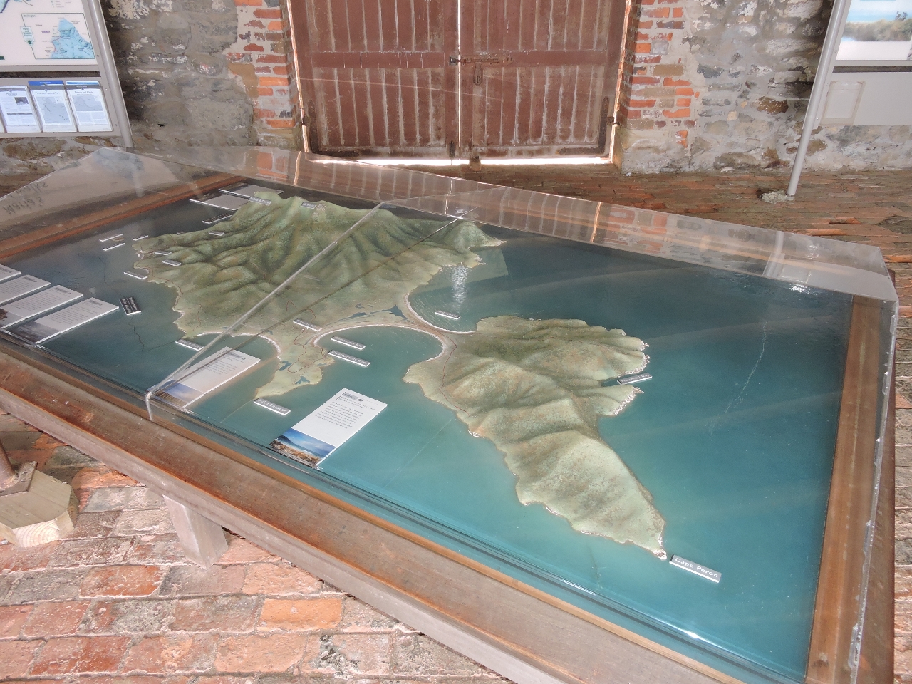 |
1/9/2015: Relief map
Position: -43° 34.81′, 148° 3.95′
The Commissariat Store is now a parks information center that includes this relief map.
|
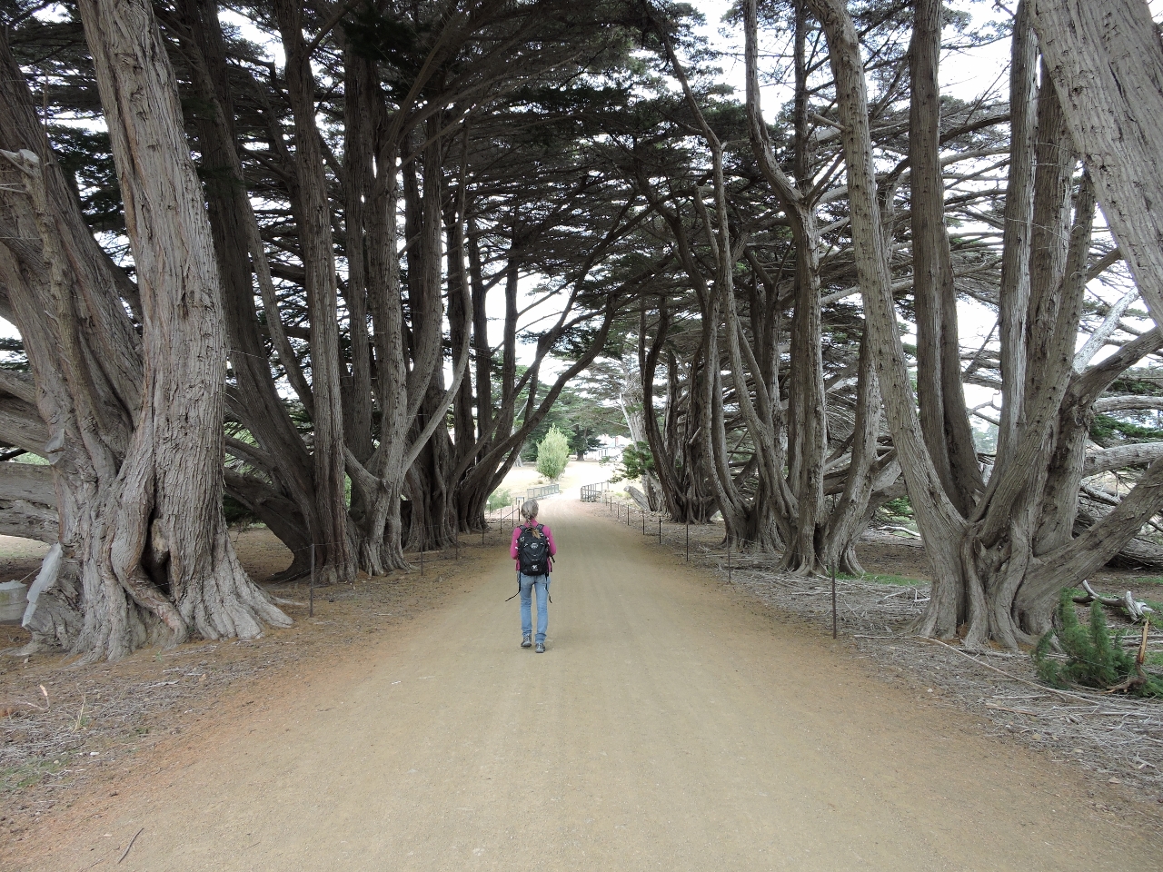 |
1/9/2015: On the road
Position: -43° 34.92′, 148° 3.94′
This tree-lined road led towards the old township of Darlington en route to the Bishop and Clerk track.
|
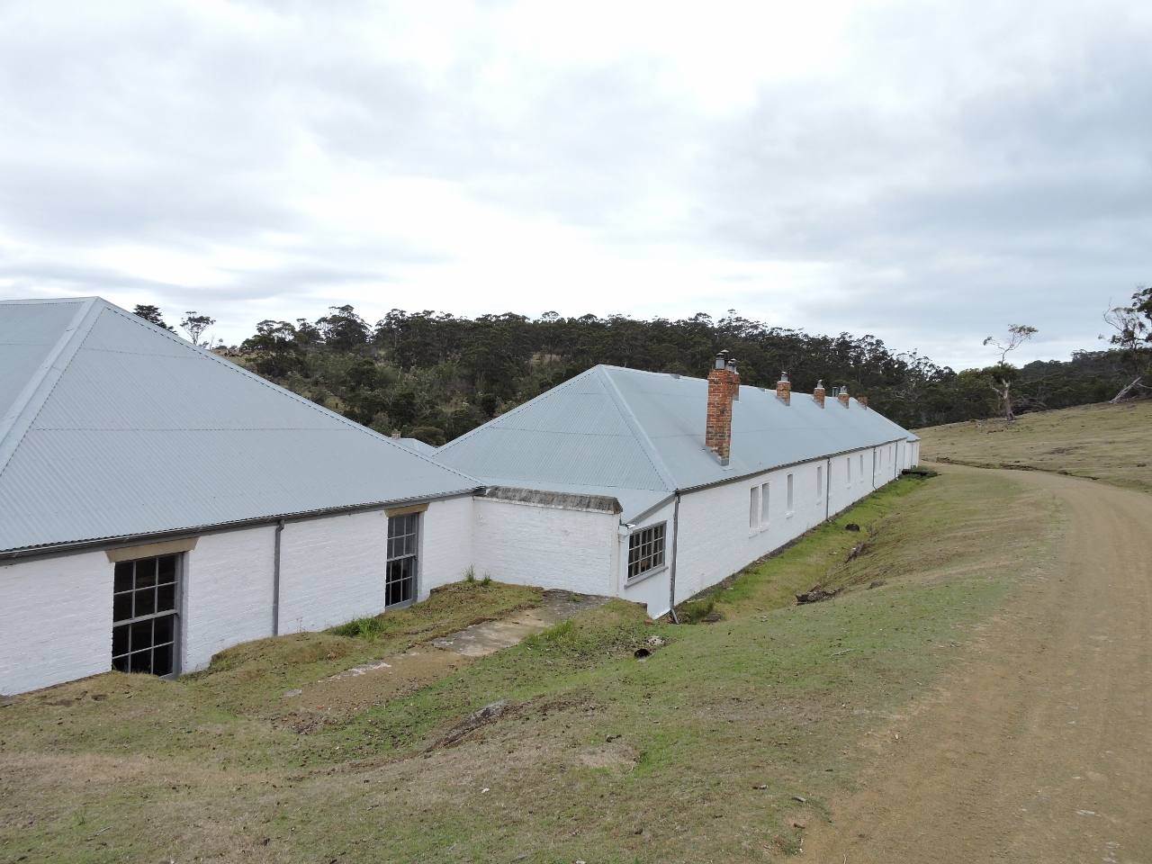 |
1/9/2015: Prisoner’s barracks
Position: -43° 34.88′, 148° 4.15′
Maria Island was a convict station for repeat offenders from 1825-1832, and then a convict probation station. These are the prisoners Barracks from the 1830s.
|
 |
1/9/2015: Cottages
Position: -43° 34.88′, 148° 4.15′
These cottages date from the 1890s, during the time Dieggo Bernacchi operated a winery on the island.
|
 |
1/9/2015: Cement works
Position: -43° 34.70′, 148° 4.74′
Ruins of the cement works, built in the late 1800s.
|
 |
1/9/2015: Skipping Ridge
Position: -43° 34.74′, 148° 4.90′
The view looking east from Skipping Ridge. Our destination, the Bishop and Clerk peaks, is visible in the far distance on the left.
|
 |
1/9/2015: Ile du Nord
Position: -43° 34.97′, 148° 5.13′
Ile du Nord in the distance, viewed from Skipping Ridge.
|
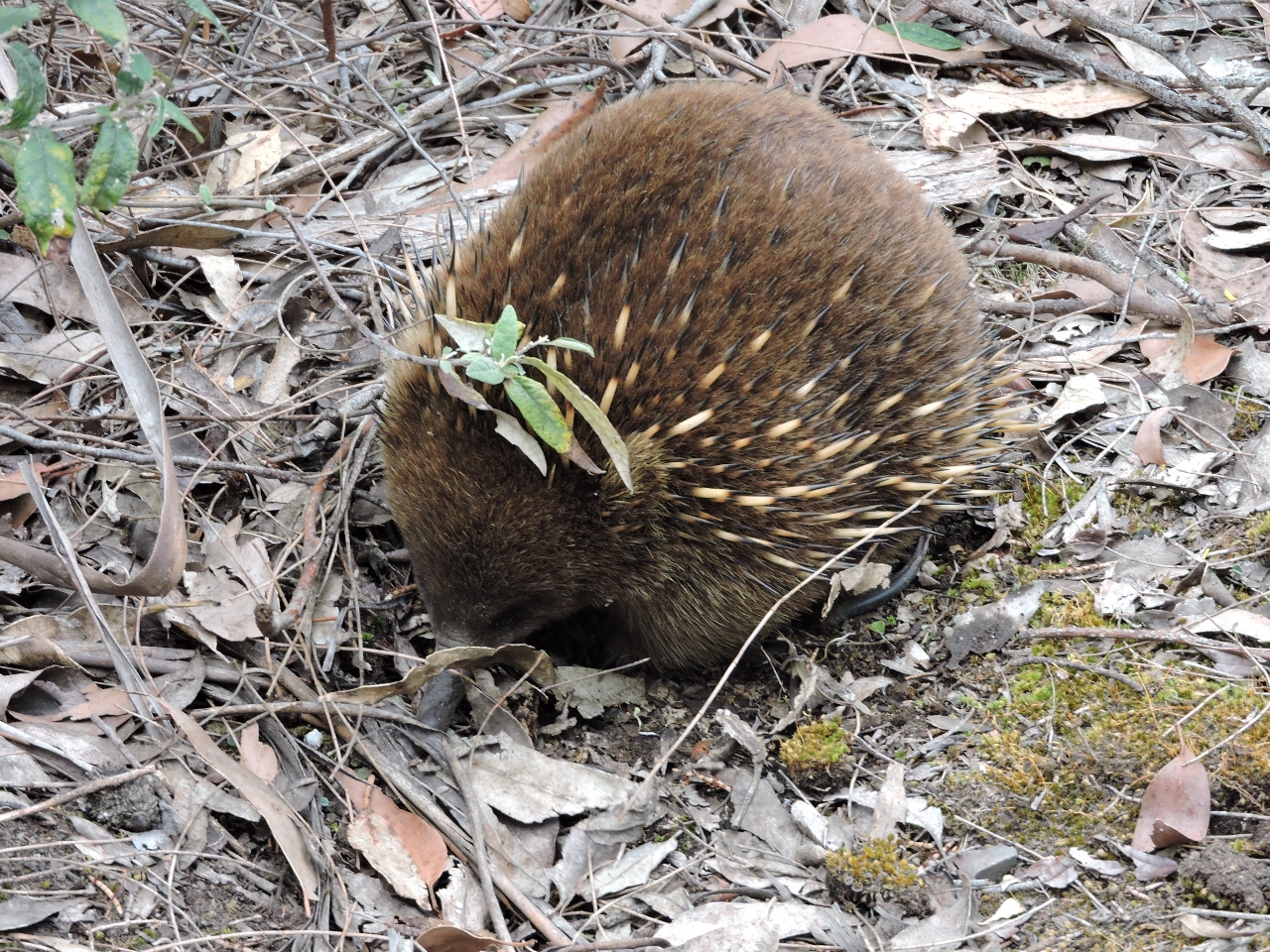 |
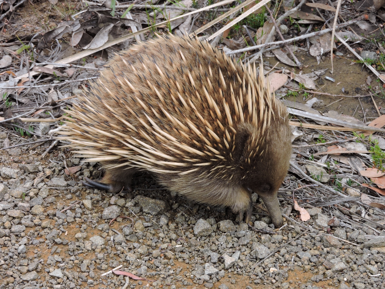
1/9/2015: Echidna
Position: -43° 35.22′, 148° 5.69′
A spiny echidna was foraging just off the track. Although it looks bothered by us being there, it actually is just digging for food in the ground below him and completely ignoring us.
|
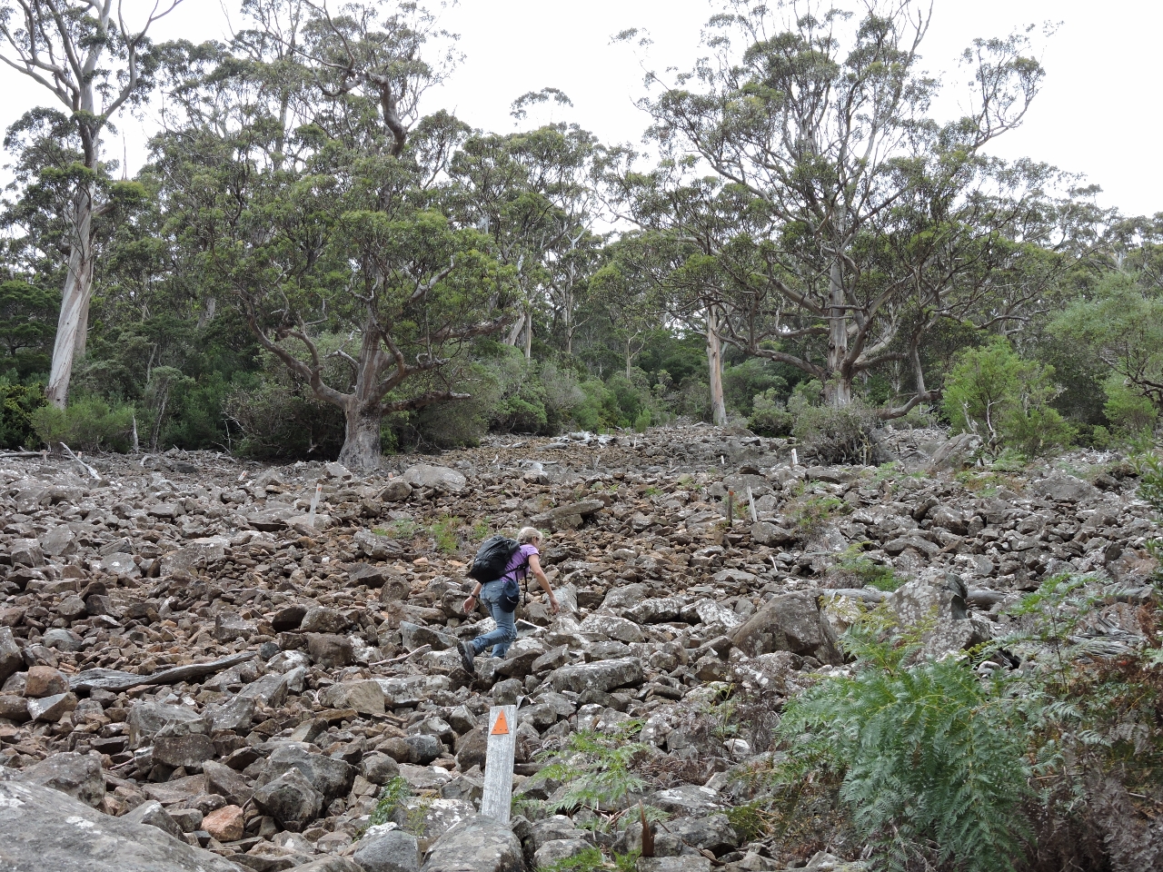 |
1/9/2015: Nearly there
Position: -43° 35.43′, 148° 6.64′
We’re 478 meters up and close to the top as the crow flies. But we still have to climb another 135 meters. Part of the track is a steep path laid through a rock slide. The white posts mark the way.
|
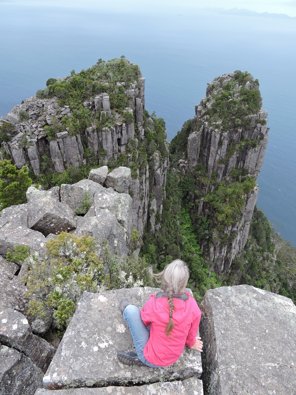 |
1/9/2015: Bishop and Clerk
Position: -43° 35.50′, 148° 6.86′
The twin dolerite columns in front of Jennifer are called Bishop and Clerk because they resemble a clergyman following a mitre-wearing bishop.
|
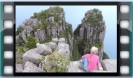 |
1/9/2015: Summit view
Position: -43° 35.50′, 148° 6.86′
This video shows the 360-degree view from 620-meter track summit starting with the view southeast to Mistaken Cape, then going clockwise towards the Darlington jetty and back to the summit with a view northeast to the Bishop and Clerk peaks.
|
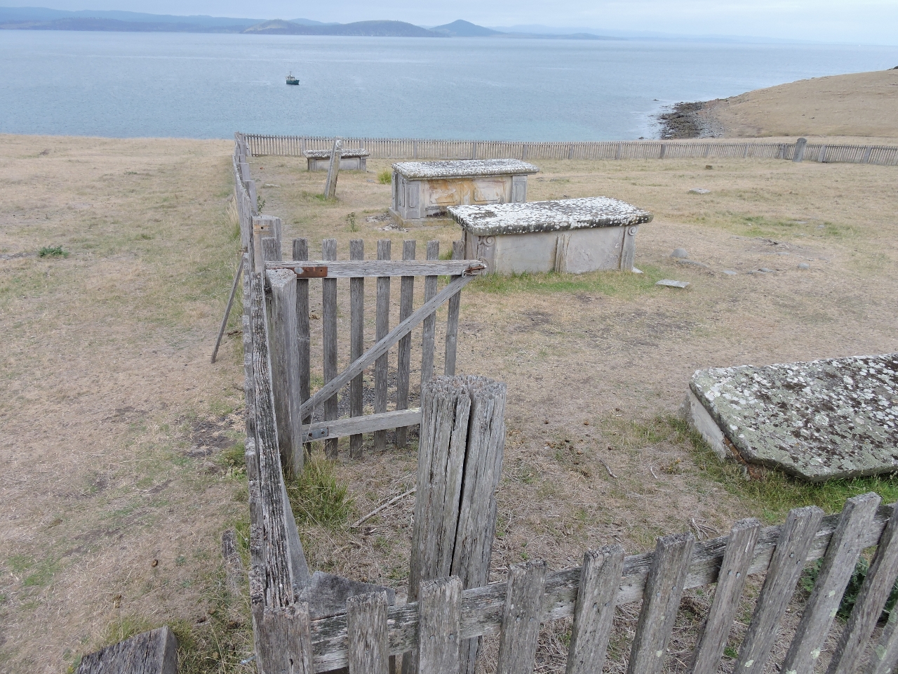 |
1/9/2015: Cemetery
Position: -43° 34.61′, 148° 3.93′
Free settlers were buried in this cemetery at the north end of the island between 1825 and 1942. Convicts and others were buried in unmarked graves elsewhere on the island.
|
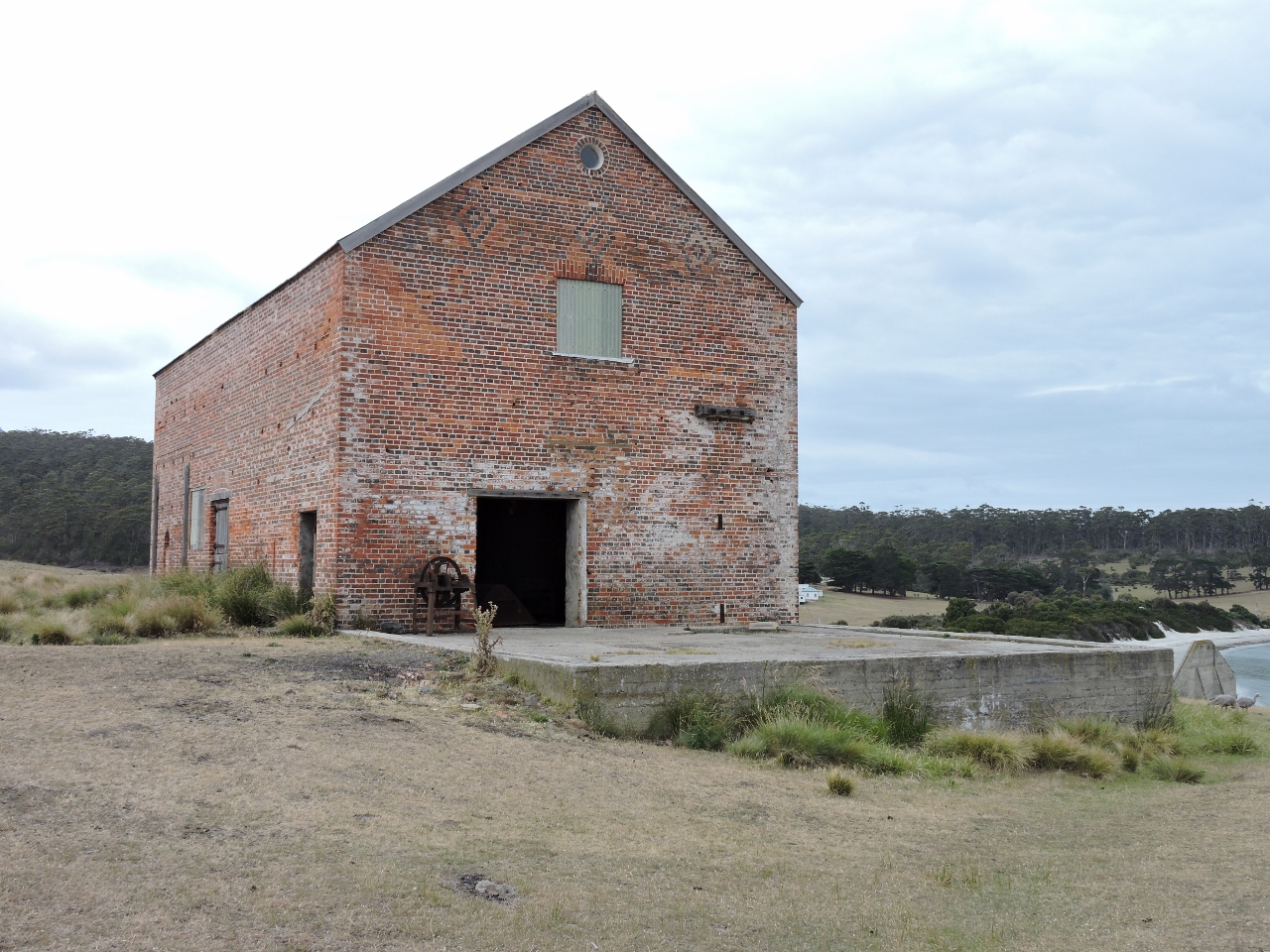 |
1/9/2015: Convict barn
Position: -43° 34.63′, 148° 3.92′
This convict barn was built in 1846.
|
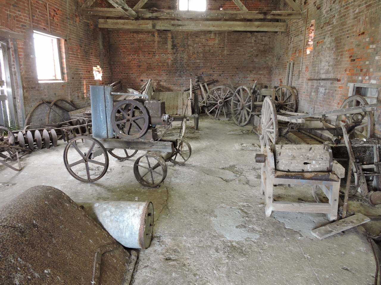 |
1/9/2015: Farm equipment
Position: -43° 34.63′, 148° 3.92′
19th-century farm equipment inside the convict barn.
|
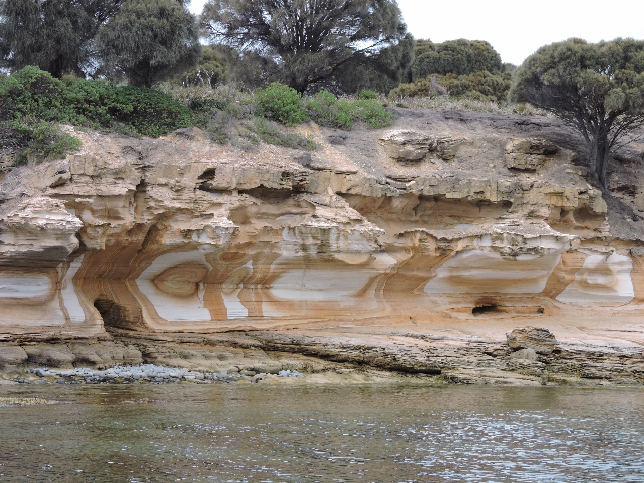 |
1/9/2015: Painted cliffs
Position: -43° 35.88′, 148° 2.64′
The striking Painted Cliffs at the west side of the island. The color comes from ground water that percolated down, leaving traces of iron oxides that stain the rock.
|
 |
1/9/2015: Dinghy repair
Position: -43° 40.33′, 148° 3.73′
The dinghy console had loosened because the screws securing it had pulled through the rotting wood floor. James re-attached it with larger screws. He also reattached the bow rails with larger screws–high load and vibration had pulled the screws loose there as well.
|
|
1/10/2015
|
 |
1/10/2015: The Sisters
Position: -43° 58.53′, 148° 0.51′
Looking north to one of The Sisters formations off Cape Surville. You can see right through this one.
|
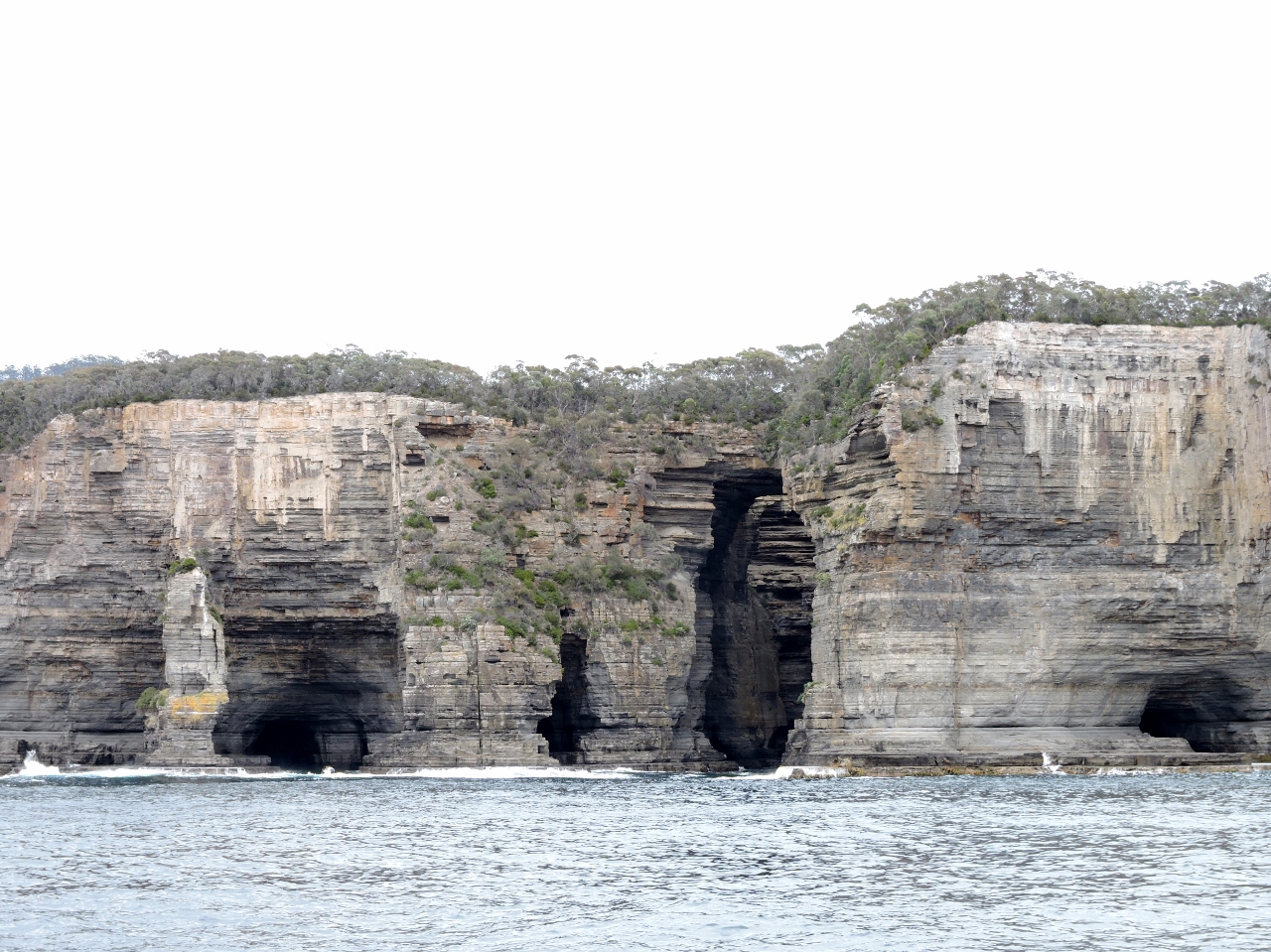 |
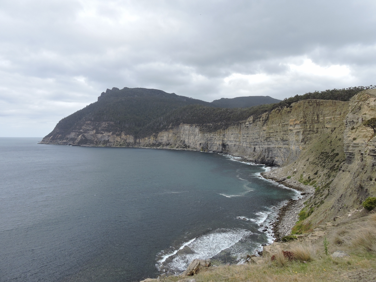
1/10/2015: Tasman Arch
Position: -44° 2.75′, 147° 57.29′
The Tasman Peninsula coast is incredibly dramatic with sea caves and arches carved into soaring cliffs. The large arch slightly to the right of center is the Tasman Arch–a short track leads along the cliffs to a viewpoint over this popular tourist attraction.
|
 |
1/10/2015: Superted
Position: -44° 7.46′, 147° 59.13′
Jean and Matt Findlay in Superted were leaving Fortescue Bay as we arrived. We plan to walk a track leading to an overview of the formations they are just passing.
|
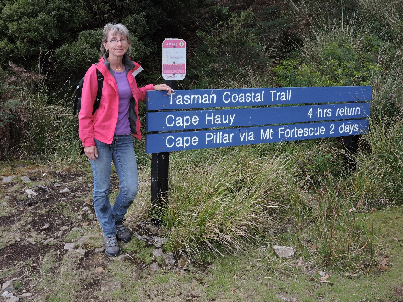 |
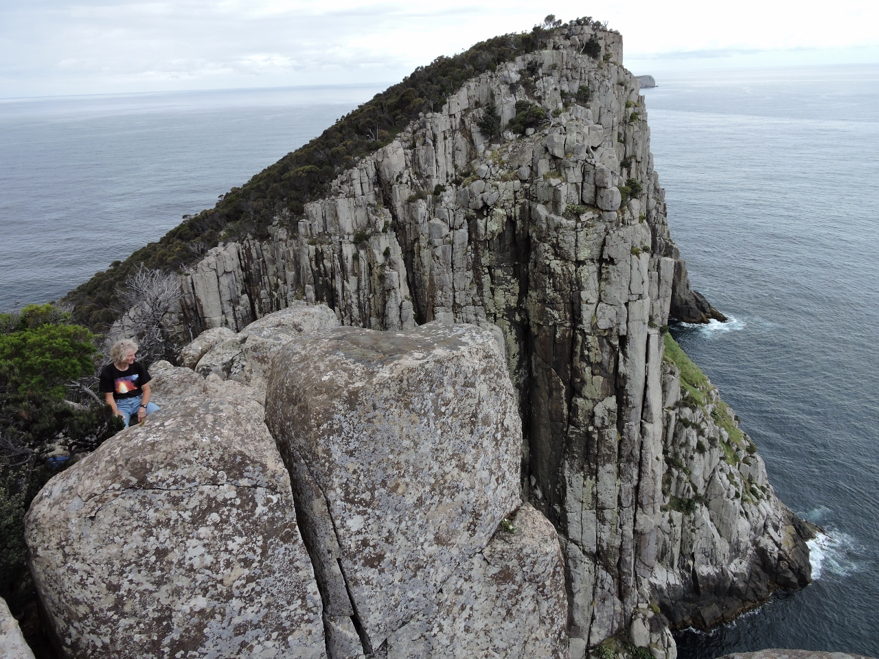
1/10/2015: Cape Huay Track
Position: -44° 8.42′, 147° 58.11′
At the trailhead of the Cape Huay Track.
|
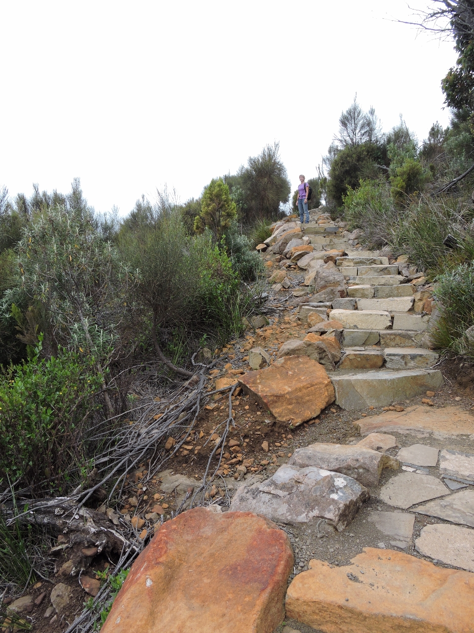 |
1/10/2015: Steps
Position: -44° 8.16′, 147° 58.46′
The track was beautifully built, with sandstone rock steps much of the way.
|
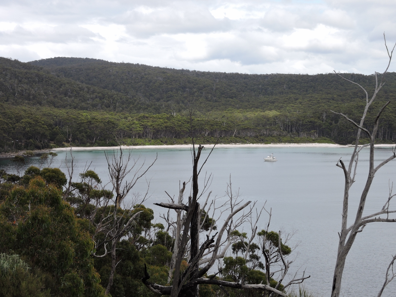 |
1/10/2015: Fortescue Bay
Position: -44° 8.20′, 147° 58.49′
The track had a nice view back to Fortescue Bay.
|
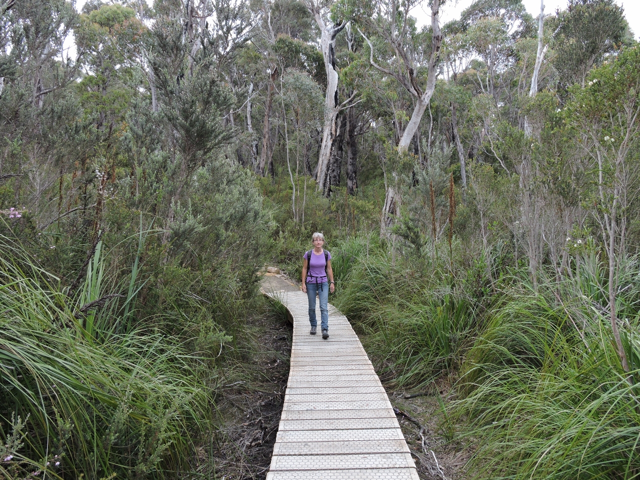 |
1/10/2015: Boardwalk
Position: -44° 8.71′, 147° 59.19′
Part of the track with through a bog over a sturdy boardwalk.
|
 |
1/10/2015: Echinda
Position: -44° 8.73′, 147° 59.52′
|
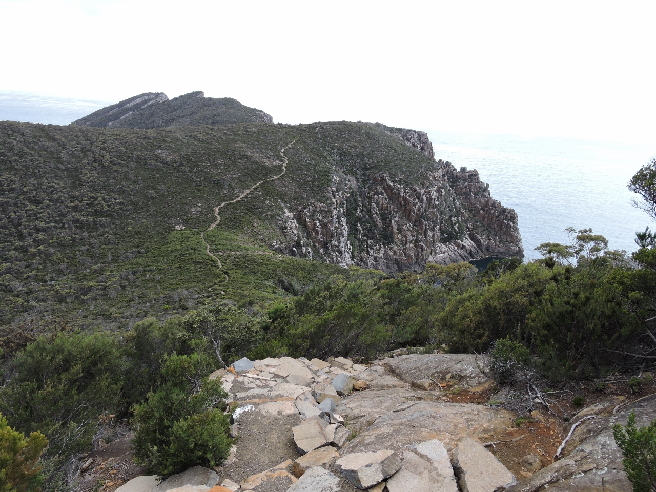 |
1/10/2015: Cape Hauy
Position: -44° 8.69′, 147° 59.70′
The track is visible in the distance leading to Cape Hauy.
|
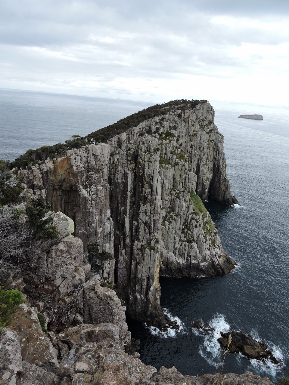 |
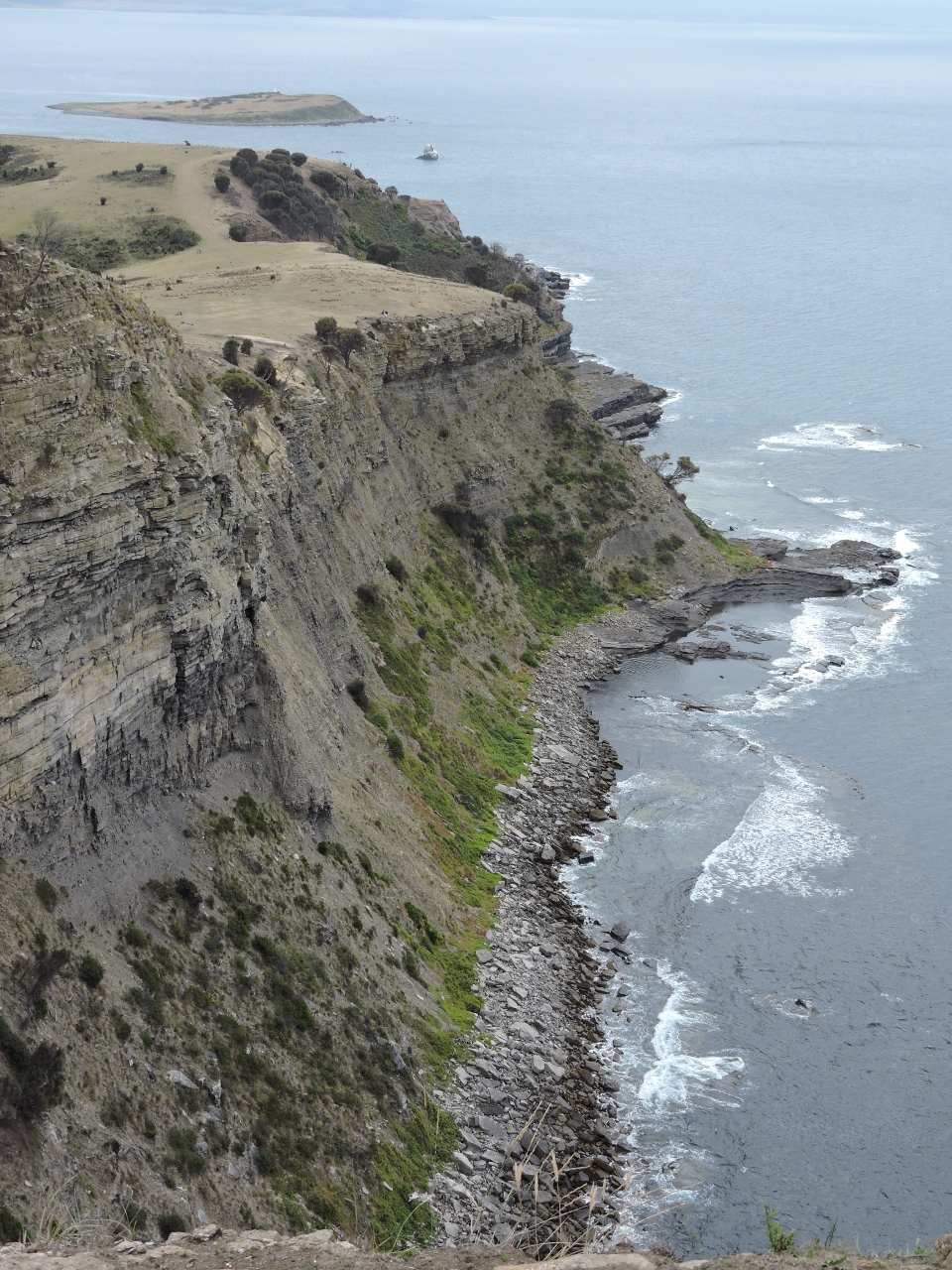
1/10/2015: Lookout
Position: -44° 8.38′, 148° 0.30′
Our destination is where the people are, on the cliff edge just slightly left of center. (Click the image for a larger view).
|
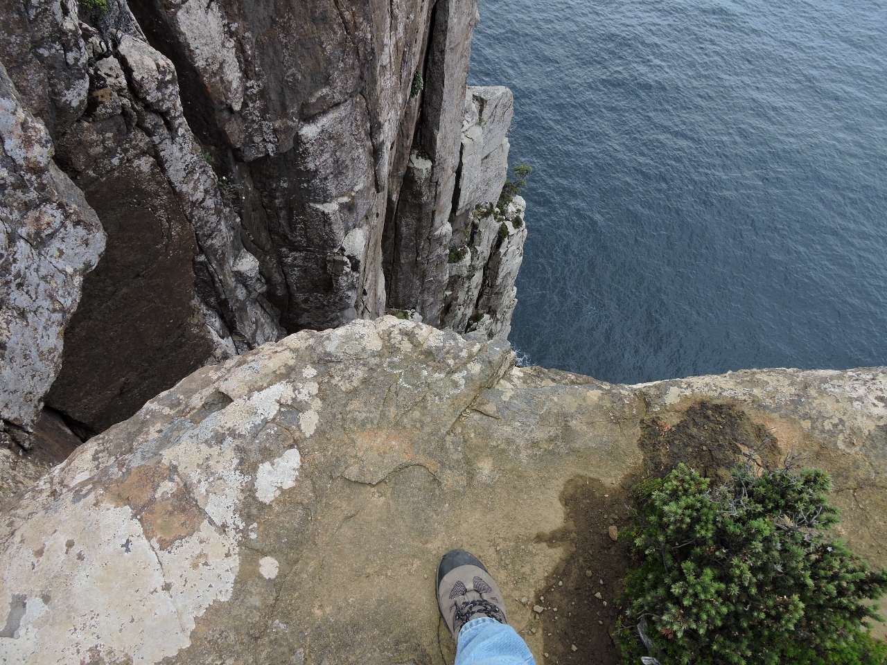 |
1/10/2015: Steep
Position: -44° 8.42′, 148° 0.28′
We’re 400 feet above sea level, but the sheer drop-off makes it feel much higher.
|
 |
1/10/2015: Lunch
Position: -44° 8.37′, 148° 0.32′
We had lunch perched on the cliffs with an amazing view of the formations.
|
 |
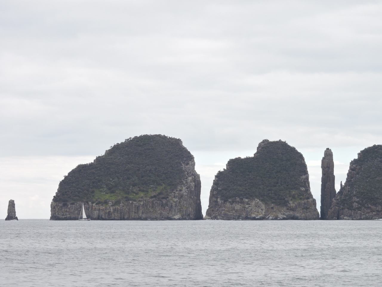
1/10/2015: Cape Hauy video
Position: -44° 8.36′, 148° 0.32′
This video shows the sea stacks “Candlestick” and “Totem Pole” between the mainland and Mitre Rock are.
|
 |
1/10/2015: Bilge pump
Position: -44° 8.41′, 147° 57.81′
The bilge pump started running continuously. James found the outlet valve had failed, so replaced it with a spare.
|
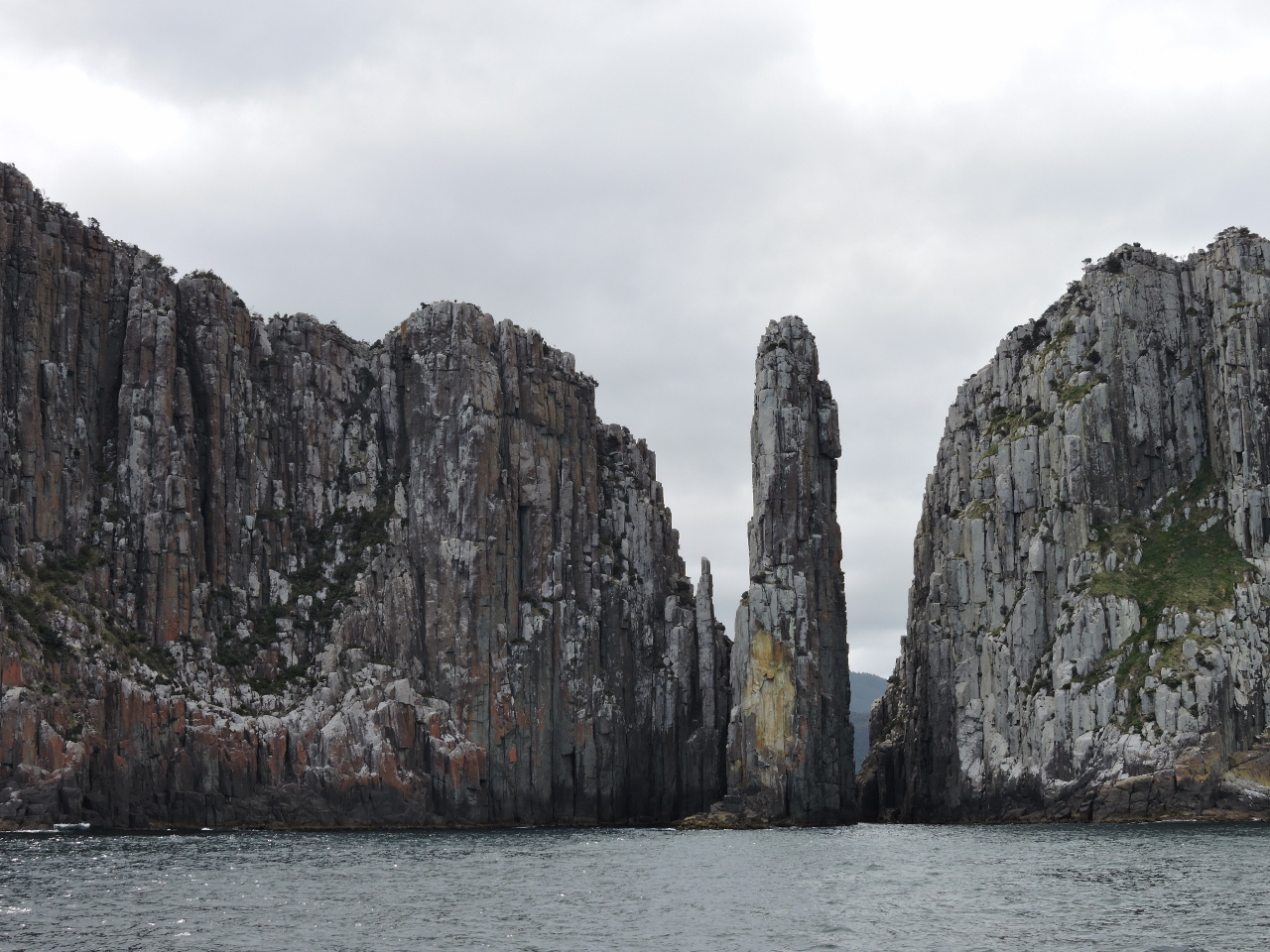 |
1/10/2015: Candlestick and Totem Pole
Position: -44° 8.97′, 148° 0.56′
Looking north to the “Candlestick” and “Totem Pole” sea stacks as we round Cape Hauy. We were planning to overnight at Fortescue Bay, but decided to run to Port Arthur due to a bit of swell, a lot of mosquitoes, and poor cell coverage when we wanted to watch the Seattle Seahawks playoff game the next day,
|
 |
1/10/2015: Cathedral Rock
Position: -44° 13.18′, 148° 0.88′
Cathedral Rock off Cape Pillar.
|
 |
1/10/2015: Flying Fox
Position: -44° 13.73′, 147° 59.73′
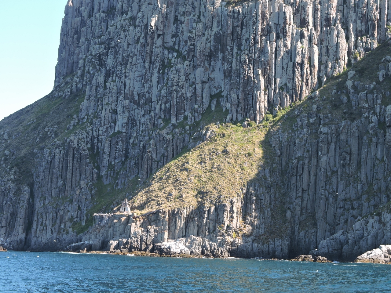
The Tasman Island lighthouse, at 900 feet above sea level, is one of the highest in Australia. Built in 1906 and de-manned in 1977, it also was one of the most remote. Goods and people were transferred between ship and shore using a flying fox, a conveyor suspended from an overhead wire. The hut-like structure ashore, about 100 feet above sea level, is the housing for the flying fox. The cable ran several hundred feet to a rock about 25 feet above sea level, possibly the one just at the edge of the picture on the left. The next stage of transport was an engine-driven tramway that ran up the slope behind the hut to 700 feet above sea level. A horse-drawn tramway was the final stage to reach the lighthouse.
|
 |
1/10/2015: Cape Pillar
Position: -44° 13.70′, 147° 59.21′
We pretty much ran out of superlatives after rounding Cape Pillar.
|
|
1/11/2015
|
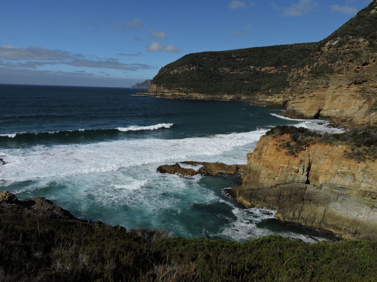 |
1/11/2015: Maignon Bay Lookout
Position: -44° 11.28′, 147° 50.71′
We’d anchored in Safety Cove to make the short walk across to Maignon Bay. This is the view looking out to the ocean from a lookout above the bay.
|
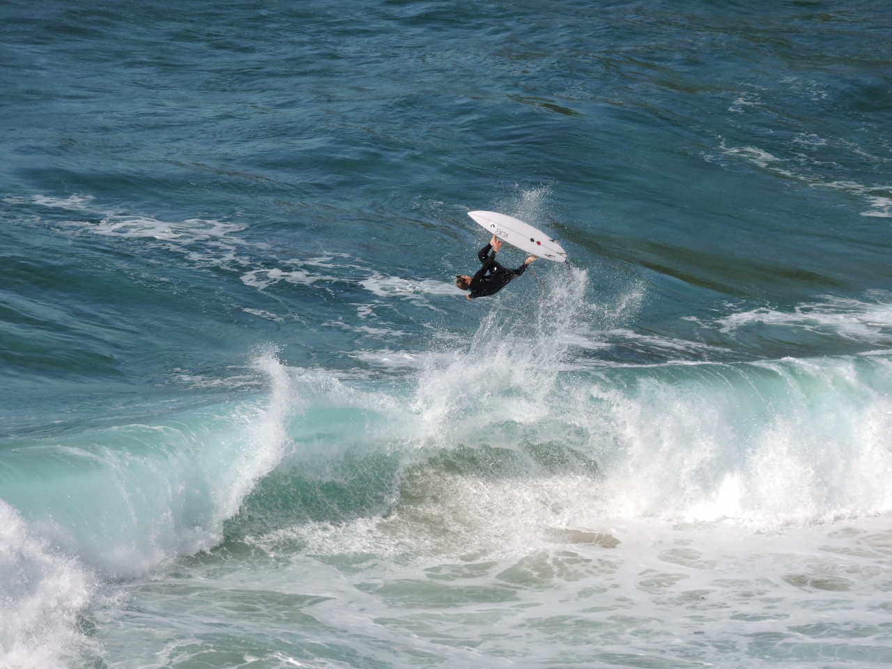 |
1/11/2015: Surfers
Position: -44° 11.28′, 147° 50.71′
Maignon Bay is a popular surfing locale. Several surfers were doing flips and other tricks.
|
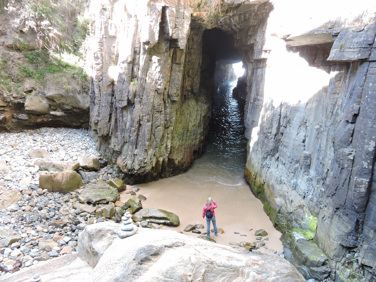 |
1/11/2015: Remarkable Cave
Position: -44° 11.25′, 147° 50.65′
The main reason we’d walked over was to visit Remarkable Cave. You can’t see it in the picture, but the cave forks at the end, with a second channel on the left. At extreme low tide, you actually can walk all the way through to the ocean.
|
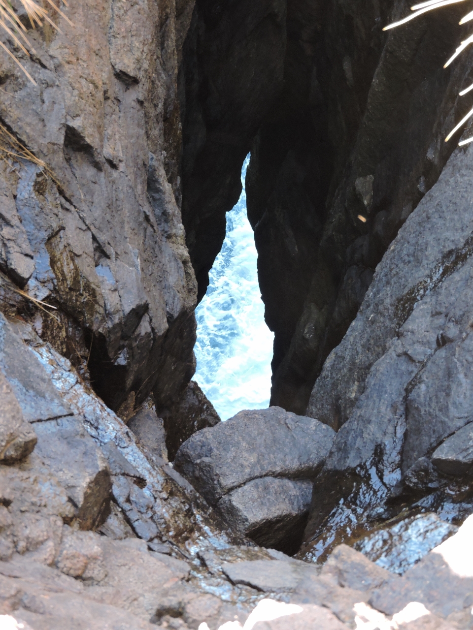 |
1/11/2015: Maignon Blowhole
Position: -44° 11.74′, 147° 51.19′
We followed a track alonshore to the Maignon Blowhole–this is looking down into the blowhole about 100′ above sea level. The seas were fairly calm today, so the blowhole wasn’t very active, but you could hear it gurgling below. And the view across to Maignon Bay and out to sea made a nice snack stop.
|
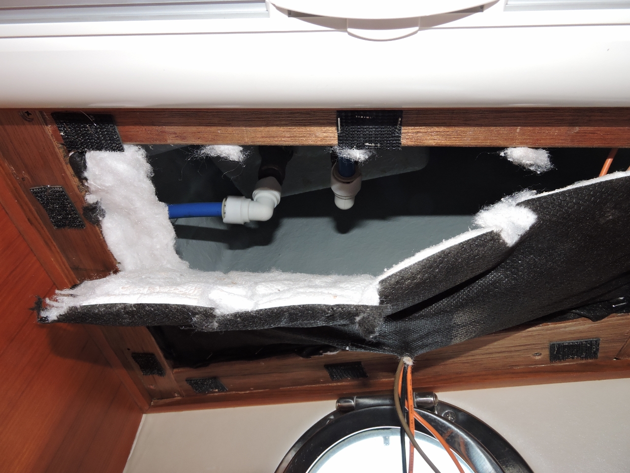 |
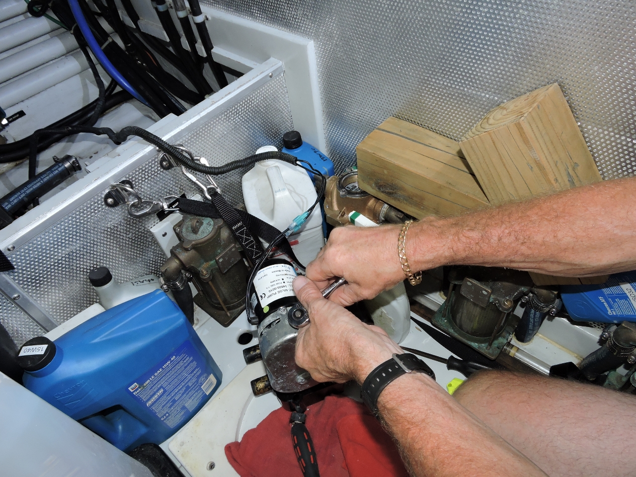
1/11/2015: Raw water leak
Position: -44° 10.87′, 147° 51.49′
There was a slight leak at the foredeck faucet. Unfortunately to replace the o-ring between the faucet and the rest of the plumbing, we had to open up the interior so that we could secure the bottom of the faucet to unscrew it.
|
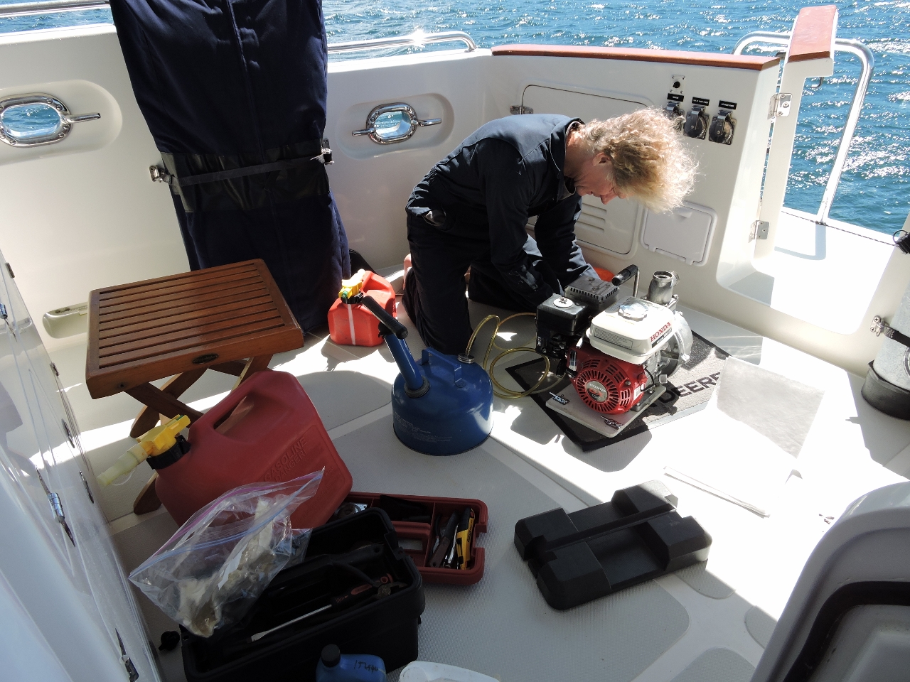 |
1/11/2015: Pump maintenance
Position: -44° 10.87′, 147° 51.49′
We carry a Honda WH15X high-powered water pump for emergency water evacuation and fire-fighting. So it’s always ready to go, we periodically take it out, test it, run it up to temperature, change the oil and fuel, and shut it back down again.
|
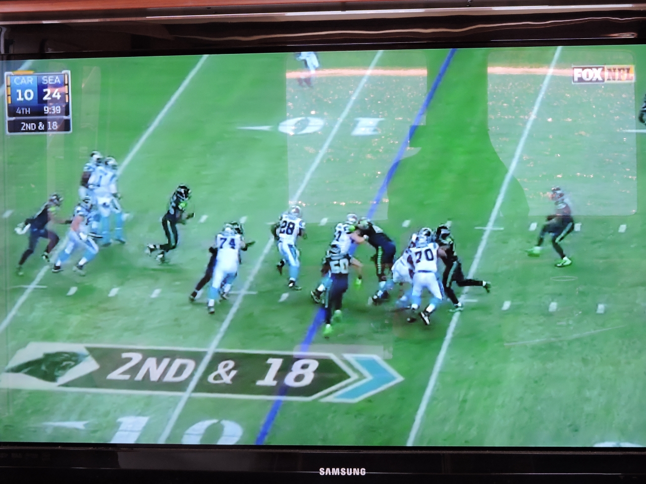 |
1/11/2015: Seattle Seahawks
Position: -44° 10.87′, 147° 51.49′
Over NFL Gamepass, we watched the Seattle Seahawks beat the Carolina Panthers in the first round of the American football playoffs.
|
 |
Click the travel log icon on the left to see these locations and more on a map. And a live map of our current route and most recent log entries always is available at http://www.mvdirona.com/maps/LocationCurrent.html. |
If your comment doesn't show up right away, send us email and we'll dredge it out of the spam filter.