Historic St. Kilda is on the edge of the edge. Lying 40nm west of the Outer Hebrides, the archipelago has no all-weather anchorage and is exposed to the full force of Atlantic storms. The islands are the first Scottish UNESCO World-Heritage Site and Scotland’s only Natural World Heritage site. The dramatic scenery there is enough reason to visit, but the major draw is an abandoned village whose dry-stone structures represent centuries of effort.
We had hoped to visit St. Kilda via the Sound of Harris, just north of Loch Maddy, but the winds were too strong. We saw 60-knot gusts while at anchor in Loch Maddy, so the weather wasn’t good for a trip out to St. Kilda. Conditions looked excellent when we were nearing the end of our stay in Stornoway, so we instead travelled around the top end of the Isle of Lewis to reach the archipelago.
Below are trip highlights from September 16th and 17th, 2017 in St. Kilda, Outer Hebrides, Scotland. Click any image for a larger view, or click the position to view the location on a map. And a live map of our current route and most recent log entries always is available at http://mvdirona.com/maps
 |
Air Traffic Services
Position: -6 10.49, 58 11.61
En route to St. Kilda, we spotted what looks like a large antenna on a hilltop on Eye Peninsula just outside Stornoway, but couldn’t find out anything about it. Paul Wood quickly gave us the answer. “It belongs to the National Air Traffic Services. Which means it’s an on-route navigational aid for aircraft—I think there used to be an RAF base up there, too.”
|
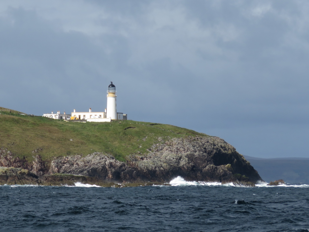 |
Lighthouse
Position: -6 7.29, 58 14.96
The Tiumpan Head Lighthouse, another distinctive Stevenson family design, began operation in 1900. In 1956, seven-year-old Queen Elizabeth visited and sounded the first blast on the station’s new fog siren. The light was automated in 1985 and the keeper’s buildings now are a kennel and cattery.
|
 |
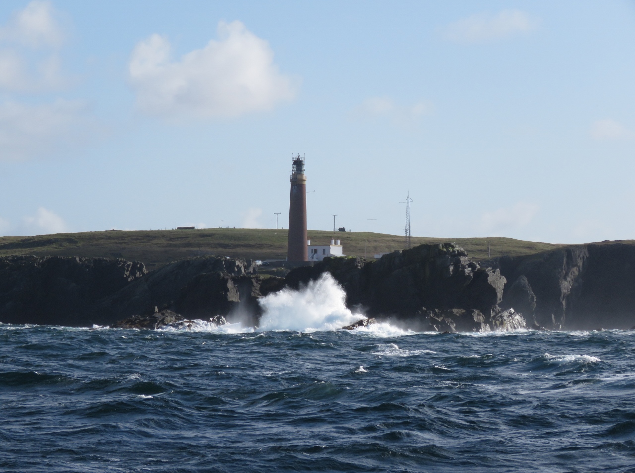
Butt of Lewis
Position: -6 13.14, 58 30.76
Nearing the Butt of Lewis, at the north end of the island, that we visited on our day trip. You don’t want to get too close in a boat with all those off-lying rocks and islets.
|
 |
Wind
Position: -6 15.42, 58 31.50
We were happy to finally round the Butt of Lewis to start heading on a more southerly direction. The forecast was for winds less than 20 knots, but we have been seeing steady 25-30 knots from the north and tight seas that have resulted in a significant pitching motion. The station made the Guinness Book of World Records as the windiest place in the UK and it certainly seems to live up to that reputation.
|
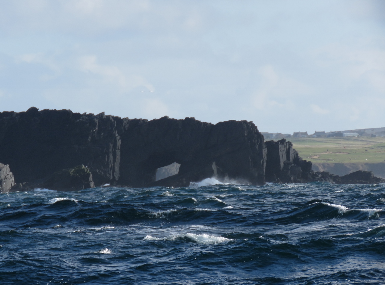 |
Arches
Position: -6 17.15, 58 31.27
Double sea arch in the cliffs on the northwest side of Lewis Island.
|
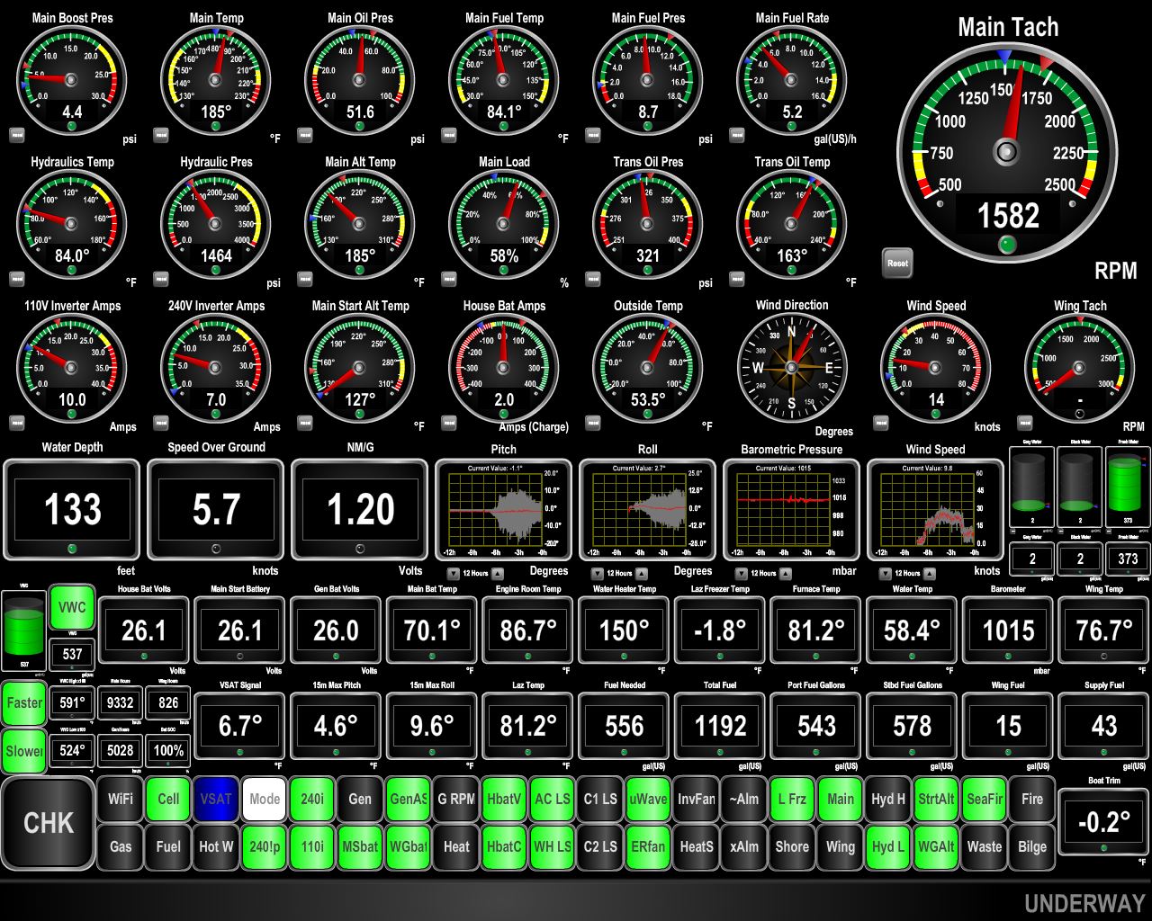 |
Conditions
Position: -6 27.15, 58 28.59
Conditions are thankfully improving now that we’ve rounded the Butt of Lewis and are heading southwest towards St. Kilda. The winds have dropped from the high twenties to below fifteen and the pitching motion (roughly center of screen) has fallen from 10-15 degrees to less less than 5. Taking those earlier conditions on the beam would be completely handled on the stabilizers and no problem at all, but on the bow it’s uncomfortable.
|
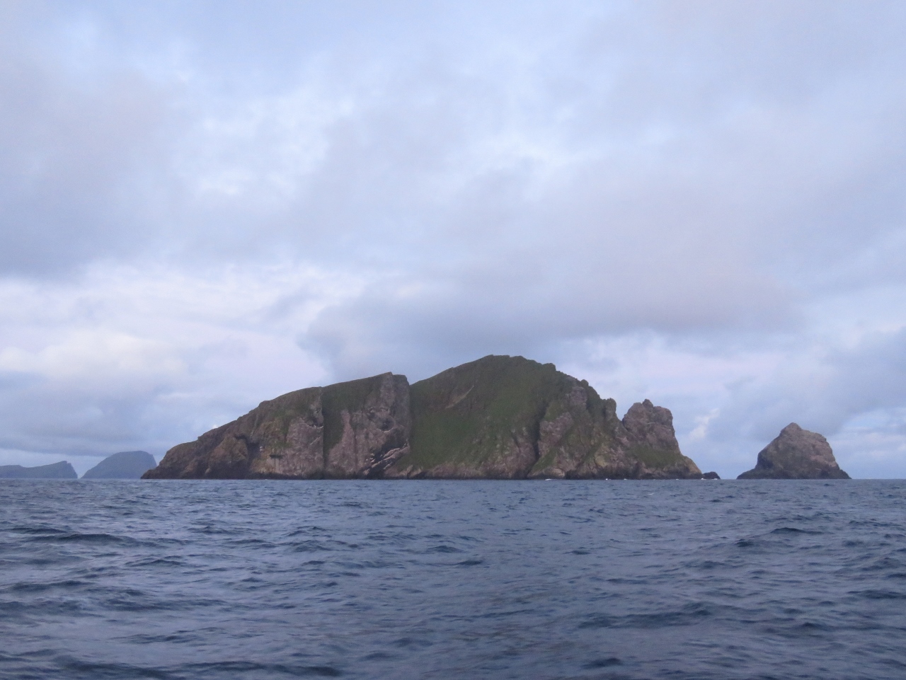 |
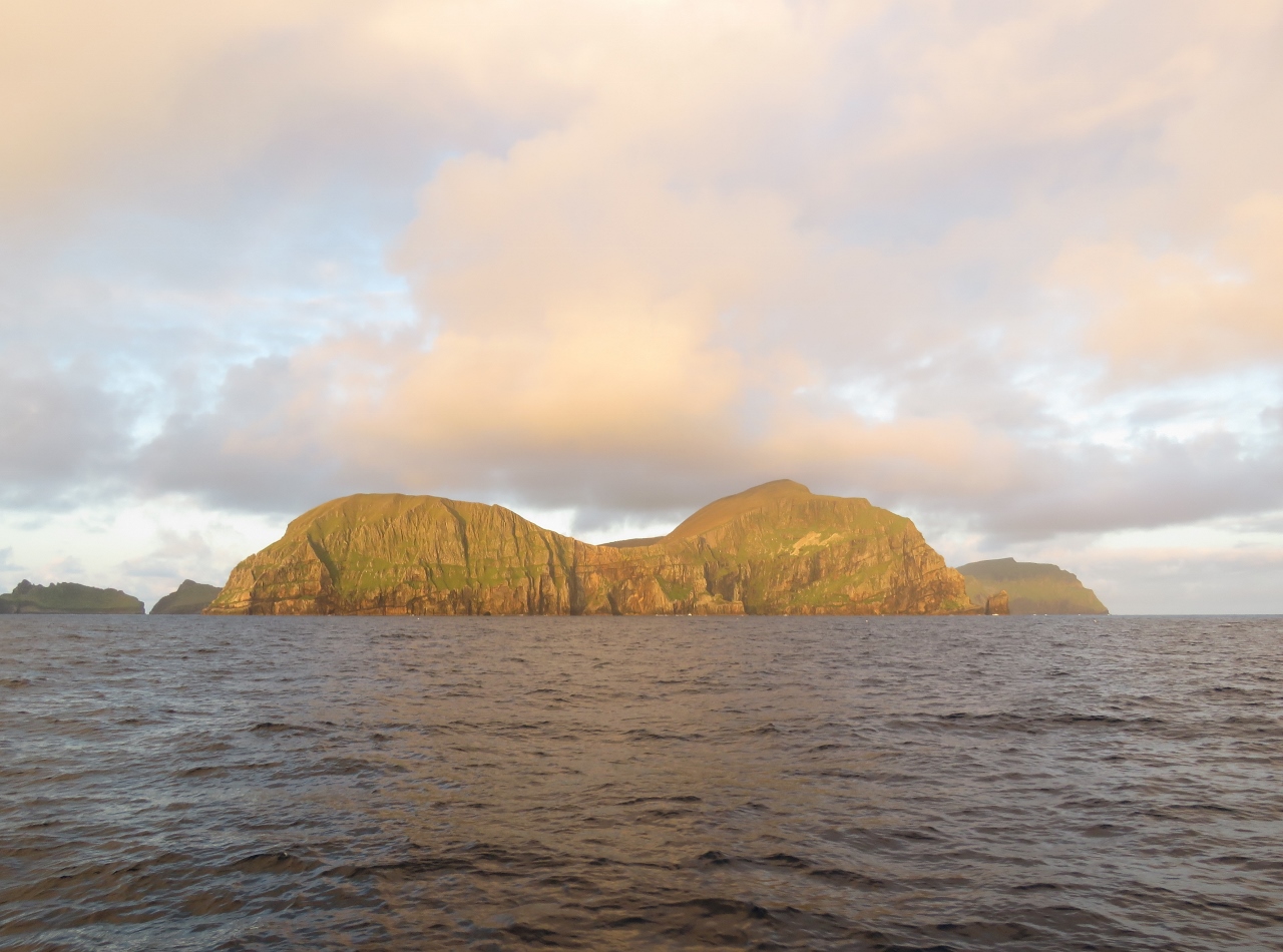
St Kilda Ho!
Position: -8 26.85, 57 52.31
After a relaxing overnight run from Stornoway, we’re off Boreray Island in the archipelago of St. Kilda. Our destination Hirta, the largest island in the archipelago, is in the distance on the left. St. Kilda is the first Scottish UNESCO World-Heritage Site and Scotland’s only Natural World Heritage site.
We’re super-excited to be here, as we’ve been wanting to visit since first arriving in the area. The islands are forty miles west of the main Outer Hebrides chain, exposed to the full force of the Atlantic Ocean, and have no all-weather anchorage. So calm conditions are needed to make the trip. We had hoped to visit via the Sound of Harris, just north of Loch Maddy, but the winds were too strong. We saw 60 knots while at anchor in Loch Maddy, definitely not a good time to visit St. Kilda. |
 |
Hirta
Position: -8 31.28, 57 49.44
The morning sun lighting up Hirta, the main island in the archipelago.
|
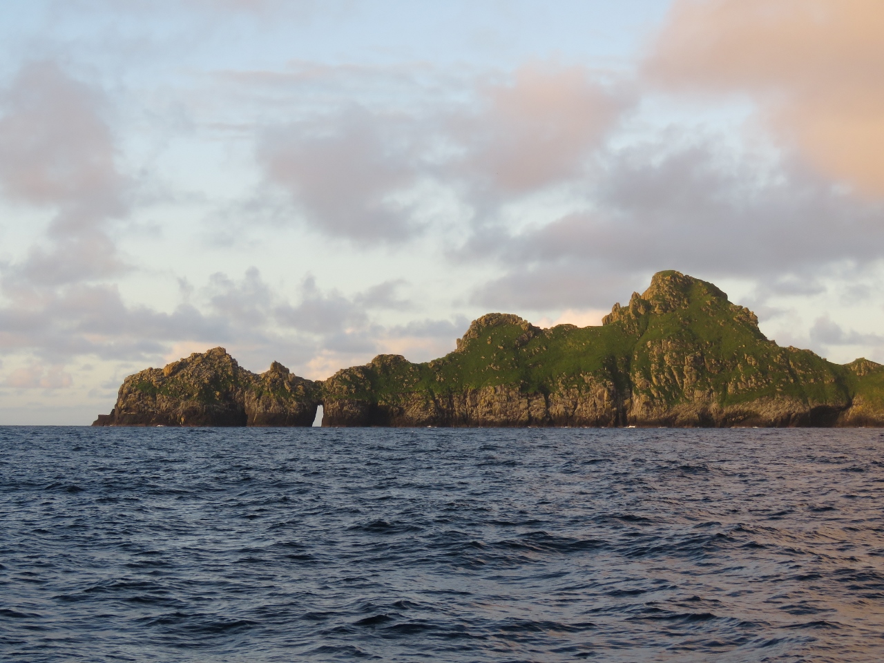 |
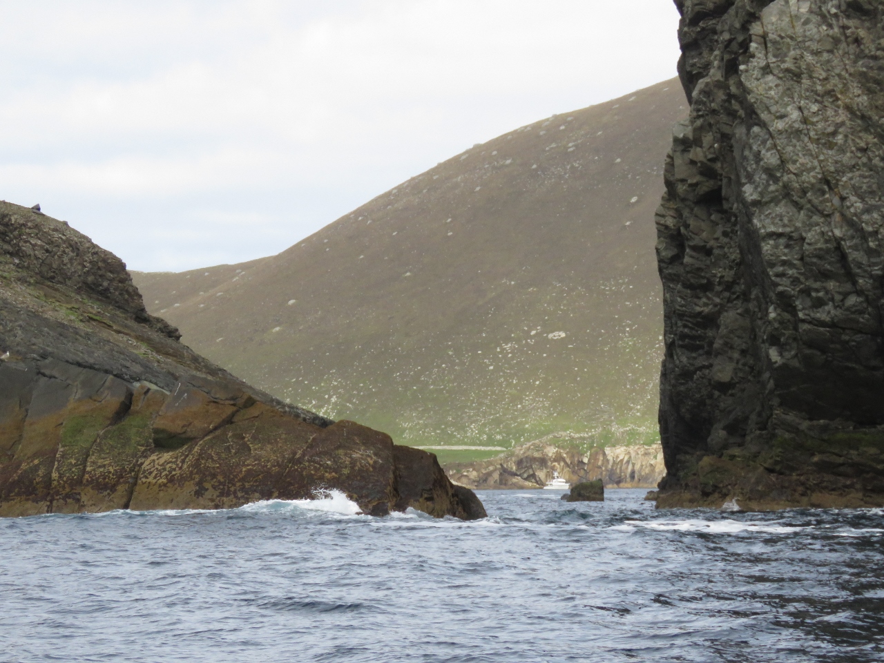
Dun
Position: -8 32.39, 57 48.65
Large sea arch at the west end of Dun Island. The scenery isn’t the only reason for visiting St. Kilda, but it certainly is enough of a reason for us.
|
 |
Arch
Position: -8 33.41, 57 48.39
Smaller sea arch on Dun Island.
|
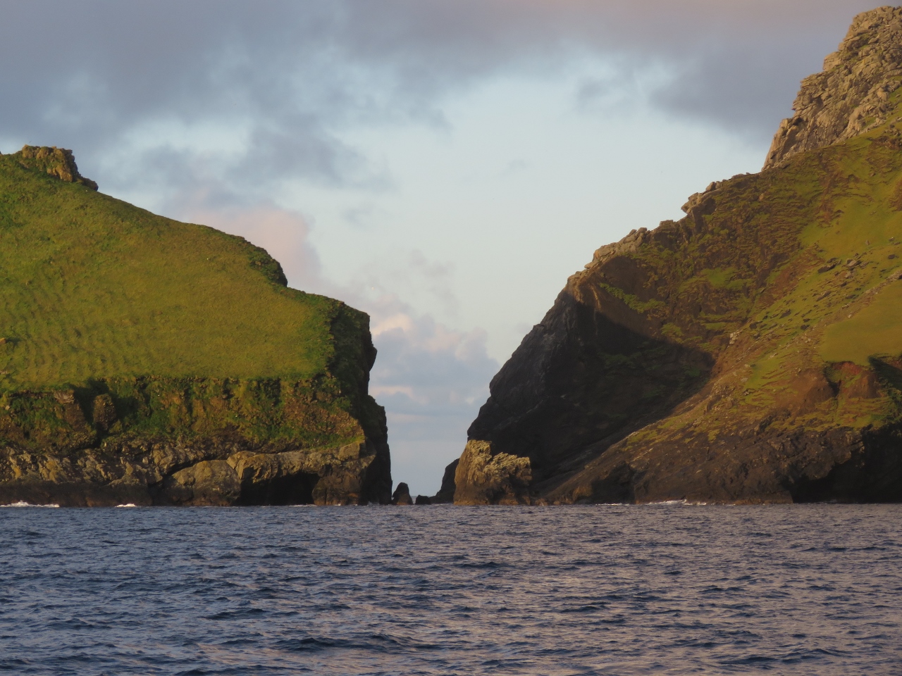 |
Caolas an Duin
Position: -8 33.41, 57 48.39
Looking south through Caolas an Duin, the narrow rock-strewn passage between Dun (left) and Hirta islands.
|
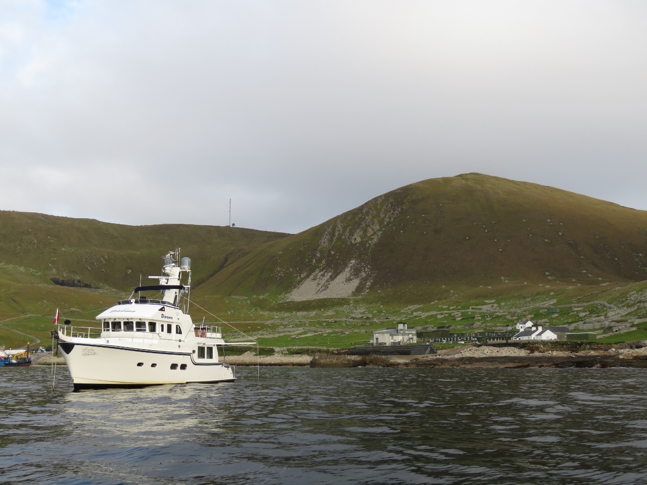 |
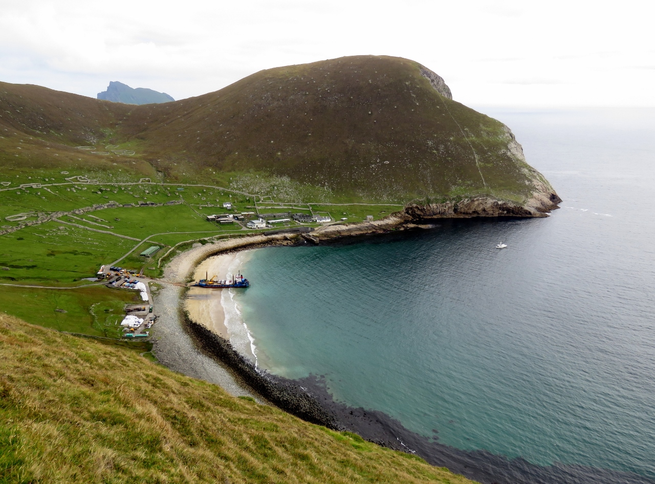
Anchored
Position: -8 33.85, 57 48.53
Dirona at anchor in Village Bay at Hirta. Even though conditions are extremely calm, with winds below 10 knots, a constant swell enters the bay. So we put out the flopper stopper.
In the background on the left is a military radar station atop 1,187ft (362m) Mullach Mor, with 1,410ft (430m) Conachair to the right. At the base of Conachair, directly right of Dirona, are village ruins. The large grey building is a power station and the just-visible green buildings to the right is the rest of the military base that the power station feeds. The large white building at the far right is the old village church. On shore to the left of Dirona, a partly-visible barge is offloading construction supplies and equipment for the military base. (Click image for larger view.) |
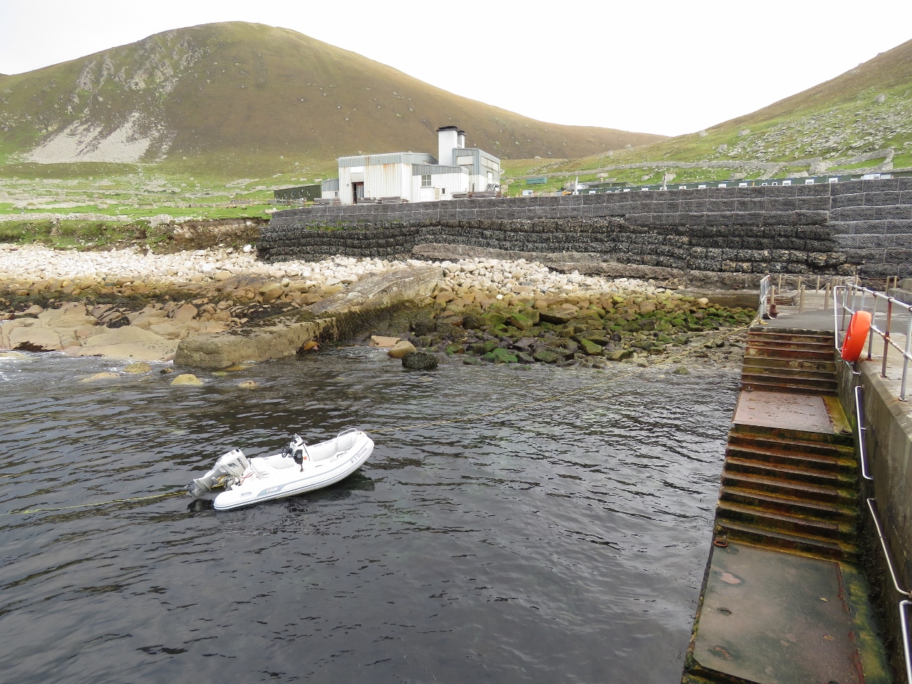 |
Pier
Position: -8 33.99, 57 48.64
Our tender tied off to the pier. The yellow line of our Anchor Buddy is visible to the left, keeping us off the pier. We used the Anchor Buddy partly to keep the tender from being bashed against the pier in the swell, but also to be out of the way of any tour boats that may need to use the pier.
|
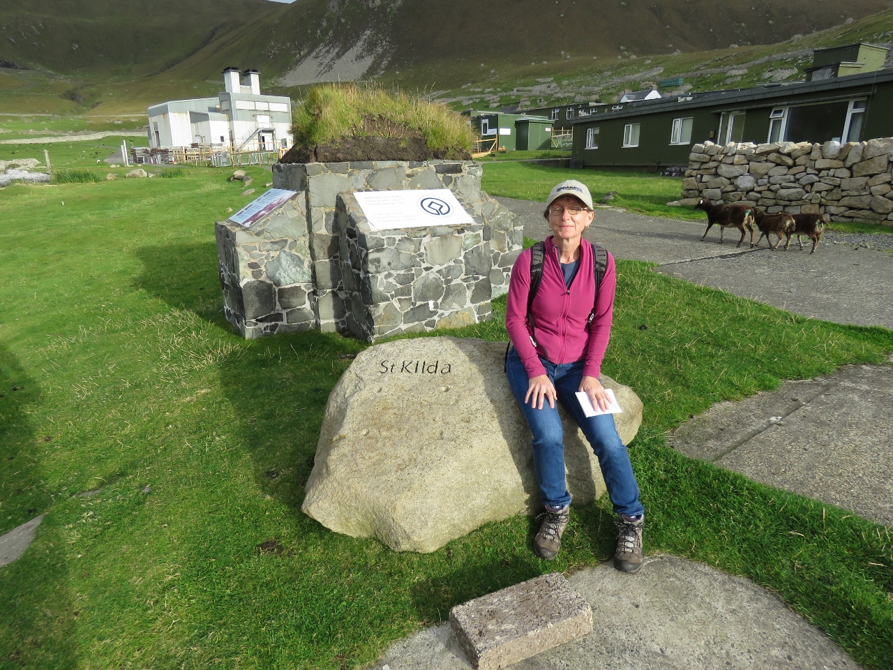 |
St Kilda
Position: -8 33.93, 57 48.65
A happy Jennifer, finally on shore at St. Kilda. Our cruising guide recommends landing immediately upon arrival as the weather here can change quickly and you might have to leave suddenly.
|
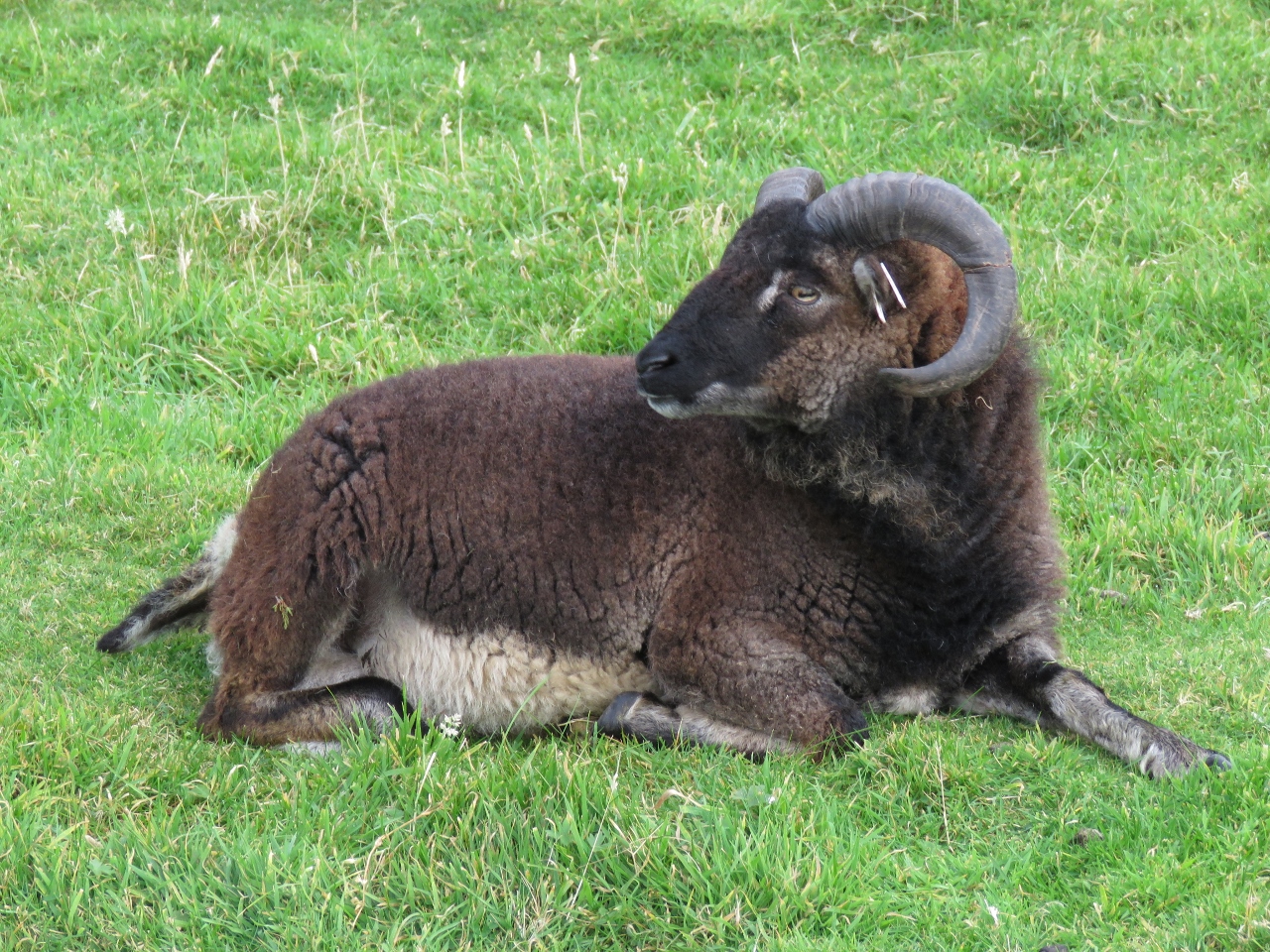 |
Soay Sheep
Position: -8 34.09, 57 48.70
Soay Island in the St. Kilda Archipelago is home to a primeval yellow-eyed sheep that until the 1930s were found nowhere else in the world. In 1930, 107 were collected from Soay and released on Hirta. We saw the sheep, that somewhat resemble a mountain goat, throughout the island. They seemed unbothered by our presence unless we surprised them or got a little close.
|
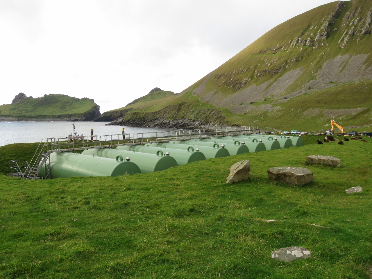 |
Fuel Tanks
Position: -8 34.14, 57 48.71
Looking from Hirta toward Dun across a field of fuel tanks for the military base.
|
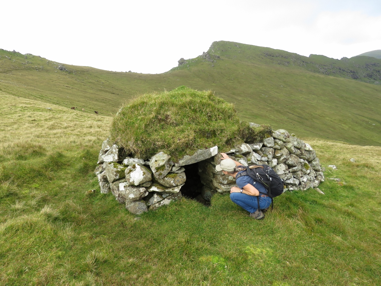 |
Cleit
Position: -8 35.22, 57 48.66
Archaeological evidence indicates St. Kilda was inhabited for at least 2,000 years. We saw dozens of these turf-roofed, dry-stone structures throughout the island, both near the village site and high up on the hills. Called “cliets”, they were used mainly as larders to store sea-birds and eggs, and also to store gear such as ropes and fishing tackle. The islanders relied heavily on abundant seabirds for their survival—St. Kilda is the most important seabird breeding station in north-western Europe with around one million birds.
|
 |
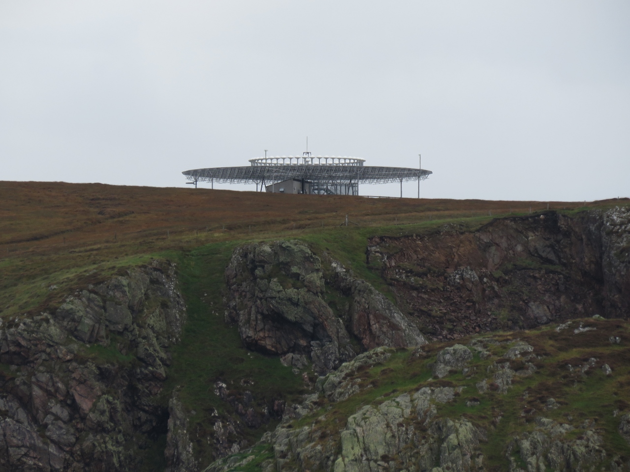
Radar Station
Position: -8 35.30, 57 48.62
In 1957, a military base was established on Hirta, with a missile-tracking station radar station on the summit of Mullach Mor. When we later visited the station, we could see evidence of several radar generations.
|
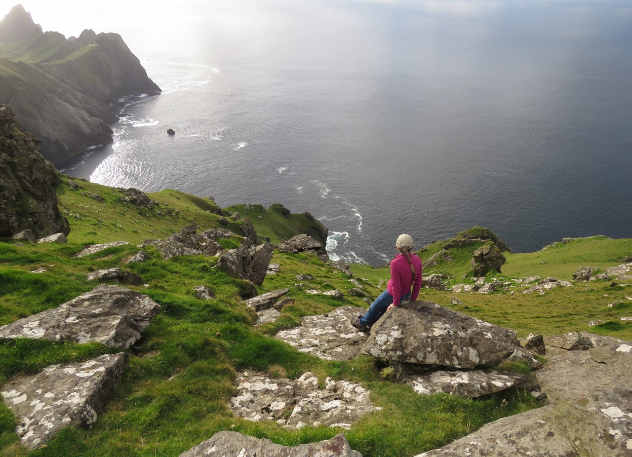 |
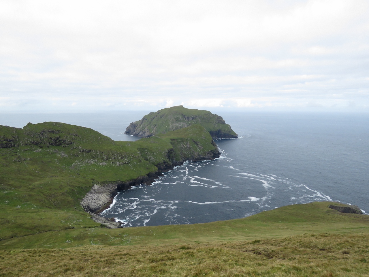
Mullach Bi
Position: -8 35.62, 57 48.51
Jennifer taking in the fabulous view southeast from 1,181ft (360m) Mullach Bi. The Tiny islet of An Torc is just off southwest end of Hirta, with Dun in the distance. The scenery here is astonishing.
|
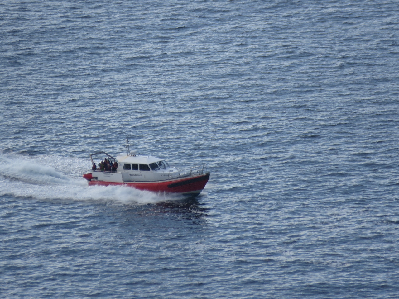 |
Enchanted Isle
Position: -8 35.09, 57 48.54
The Sea Harris tour boat Enchanted Isle passing far below along the southwest shore of Hirta Island. The capable-looking vessel is a Redbay Stormforce 1650, purpose-built in Northern Ireland for the St. Kilda run based on a pilot boat design.
|
 |
Village Bay
Position: -8 34.61, 57 48.40
Looking north to 961ft (293m) Oiseval towering above Dirona and Village Bay, with Boreray visible in the distance to the left.
|
|
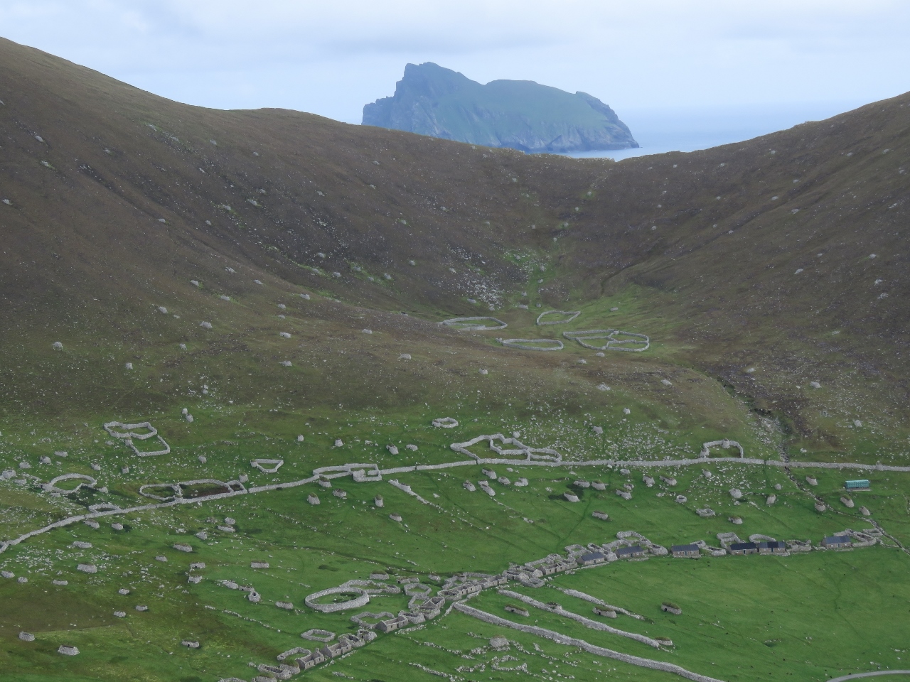
|
Village
Position: -8 34.65, 57 48.45
The village ruins viewed from the ridge southwest of Village Bay, with Boreray beyond. The dry-stone structures here represent centuries of effort and are a good example of Stone Age culture. In the 1800s much of the houses, strung along the lower part of the picture, were replaced by cottages built using mortar to Victorian standards.
|
 |
View East
Position: -8 35.00, 57 49.15
Looking east across Hirta from the summit of 1,187ft (362m) Mullach Mor. Boreray is visible on the left, 1,410ft (430m) Conachair is just to the right, 961ft (293m) Oiseval is just beyond Conachair to the left of Village Bay, the sea stack of Levenish is in the distance about 2 miles beyond the bay, and Dun is on the right side of the bay.
|
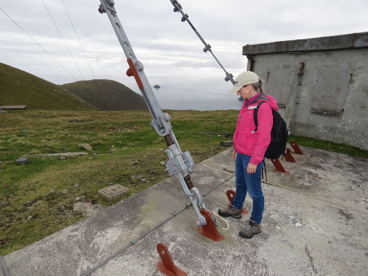 |
Tie Downs
Position: -8 35.06, 57 49.16
Several radio towers are at the radar station atop Mullach Mor. The towers are held down with incredibly robust-looking tie-downs, a good indication of how strong the winds get up here. A 2014 December storm brought 125-kt winds.
|
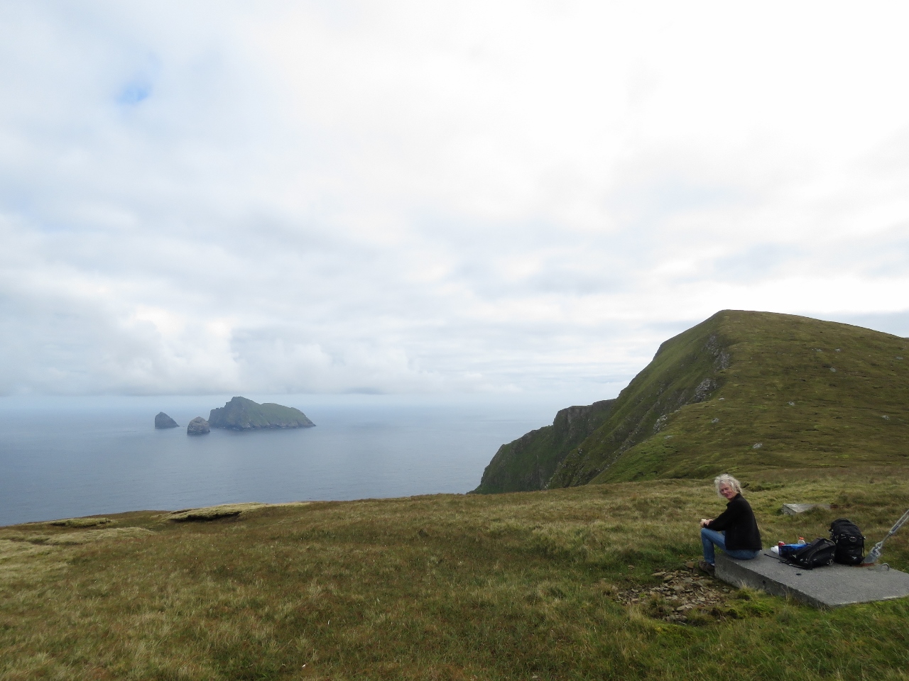 |
Mullach Mor
Position: -8 35.01, 57 49.25
Lunch atop Mullach Mor with a view to Boreray.
|
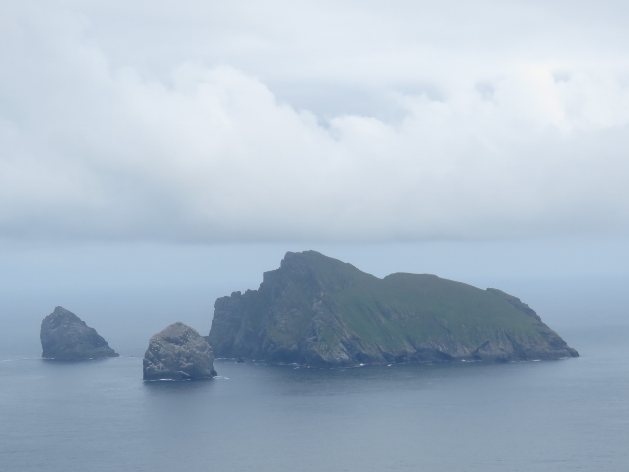 |
Boreray
Position: -8 35.01, 57 49.25
A more detailed view to 1,259ft (384m) Boreray, with sea stacks 643ft (196m) Stac an Armin (left) and 564ft (172m) Stac Lee.
|
 |
Soay
Position: -8 35.12, 57 49.20
Looking across The Cambir peninsula at the northwest end of Hirta to Soay Island, where the Soay sheep originated.
|
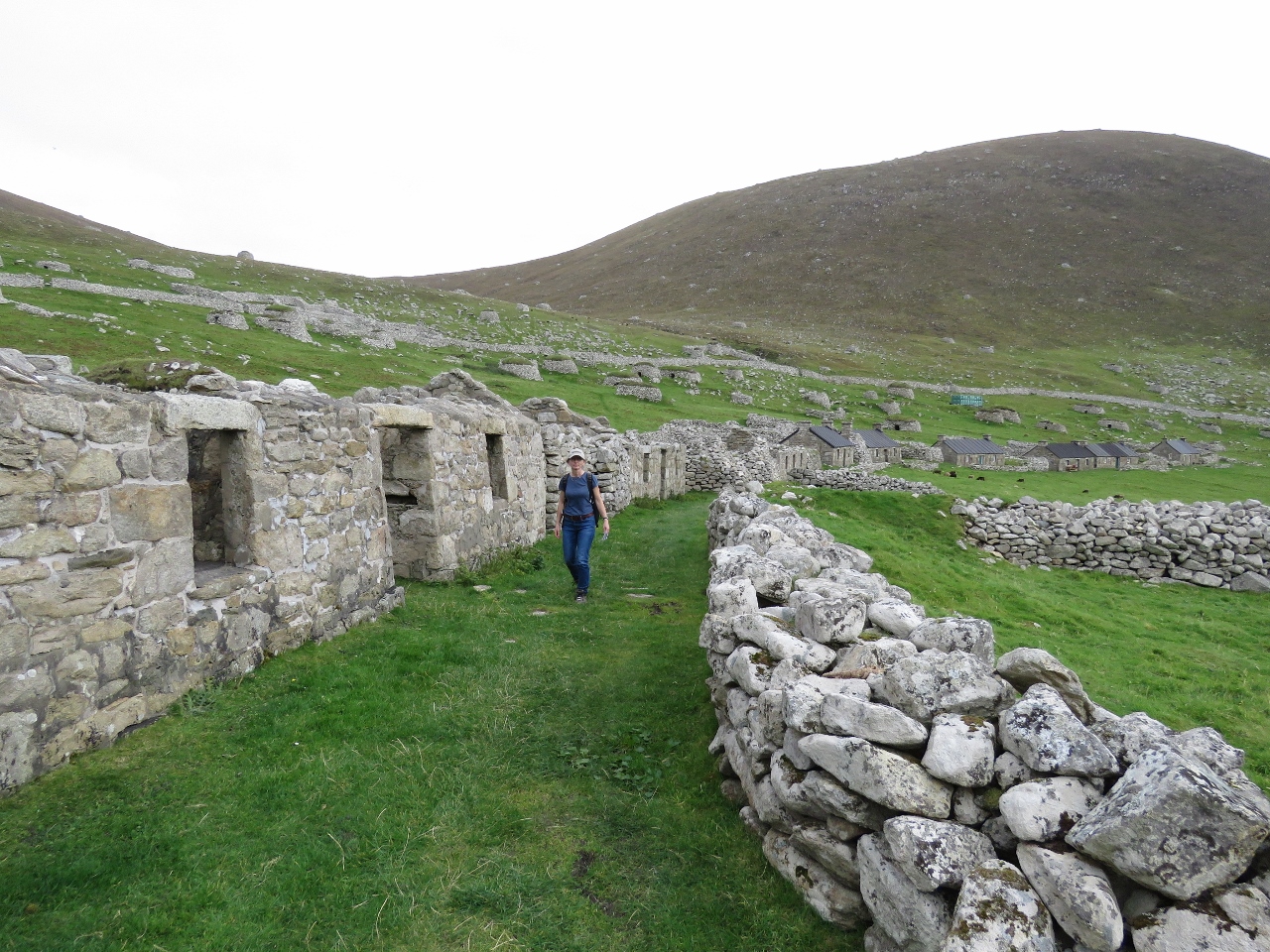 |
Main Street
Position: -8 34.23, 57 48.79
Jennifer walking along the Main Street down in the village. The village population numbered about 180 in the late 1600s, but declined rapidly starting in the 18th-century due to introduced diseases, emigration, and a breakdown of island society and self-sufficiency that brought acute food shortages. These islanders also had to pay rent to the MacLeods of Dunvegan in Skye. Having toured the lavish Dunvegan Castle, it’s clear the taxes were high. In 1930, the remaining 36 residents requested evacuation to the mainland.
|
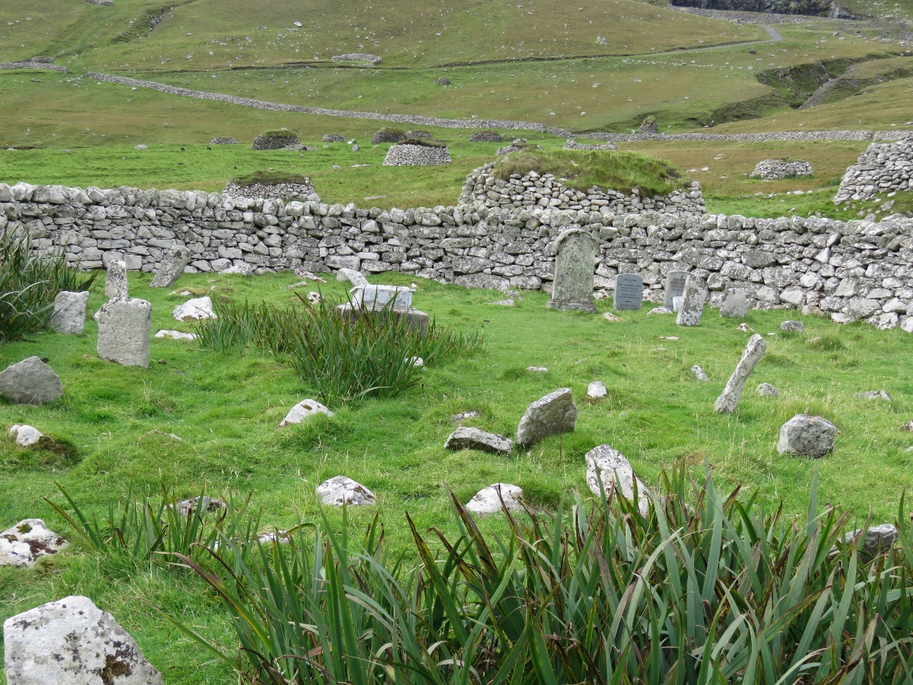 |
Graveyard
Position: -8 34.22, 57 48.80
The small graveyard surrounded by an oval stone wall. We saw gravestones dating from the 1800s to as recent as 2010. Since the evacuation in 1930, several St. Kildans have been buried here.
|
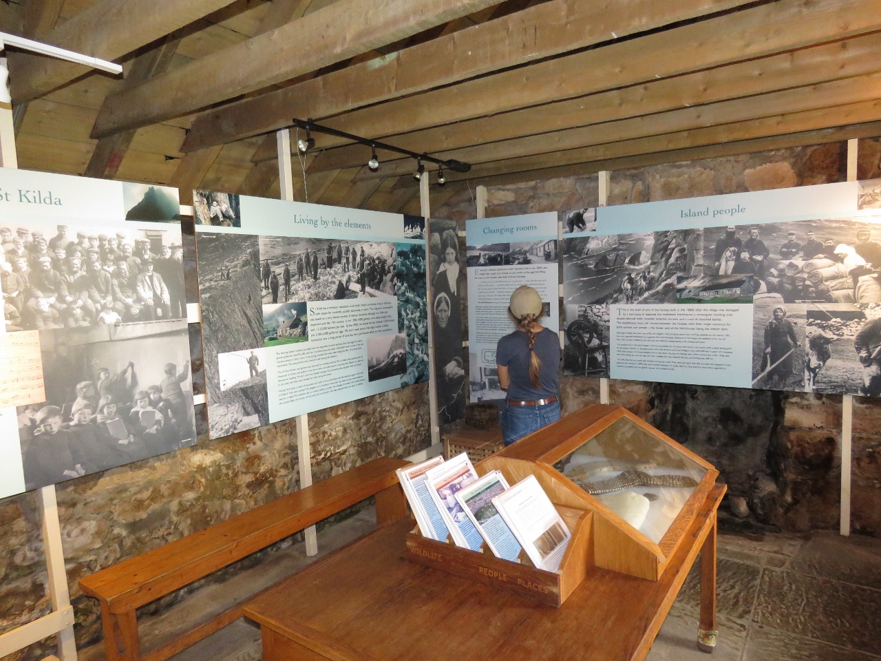 |
Museum
Position: -8 34.07, 57 48.78
The National Trust for Scotland is restoring the village and has created an excellent museum in one of the cottages, detailing the island’t history, geology and wildlife.
|
 |
The Kirk
Position: -8 33.90, 57 48.67
Inside The Kirk, the village church, built in the 19th-century. Religious fervor contributed to the breakdown of society on the island when crusading Christian ministers coerced the villagers to spend so much time in church they weren’t able to grow and gather sufficient food to survive.
|
 |
Schoolroom
Position: -8 33.90, 57 48.67
The small schoolroom adjacent to the church was built in 1884.
|
 |
Gun
Position: -8 33.83, 57 48.63
After a German submarine shelled the island during World War I, a gun was installed just east of the village, but was never used.
|
 |
Arch from South
Position: -8 33.28, 57 47.65
After touring the island, we took the tender over to Dun Island to check out the sea arches we’d seen when arriving. This is looking from the south side of Dun through the larger arch with Boreray visible beyond.
|
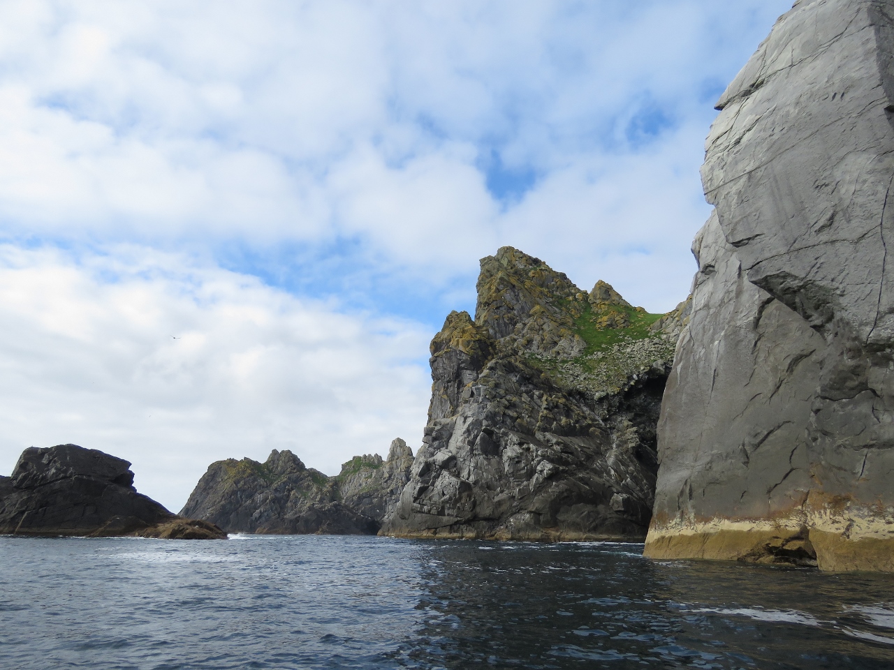 |
Cliffs
Position: -8 33.38, 57 47.61
Rugged sea cliffs along the west coast of Dun. Conditions were reasonably calm, but we still felt pretty out-there along this exposed coast. And little did we know, our tender was about two operating hours away from blowing a tube. This would not have been a good place for that to happen.
|
 |
Dirona
Position: -8 34.40, 57 47.81
Looking north through Caolas an Duin between Dun and Hirta islands to Dirona anchored in Village Bay.
|
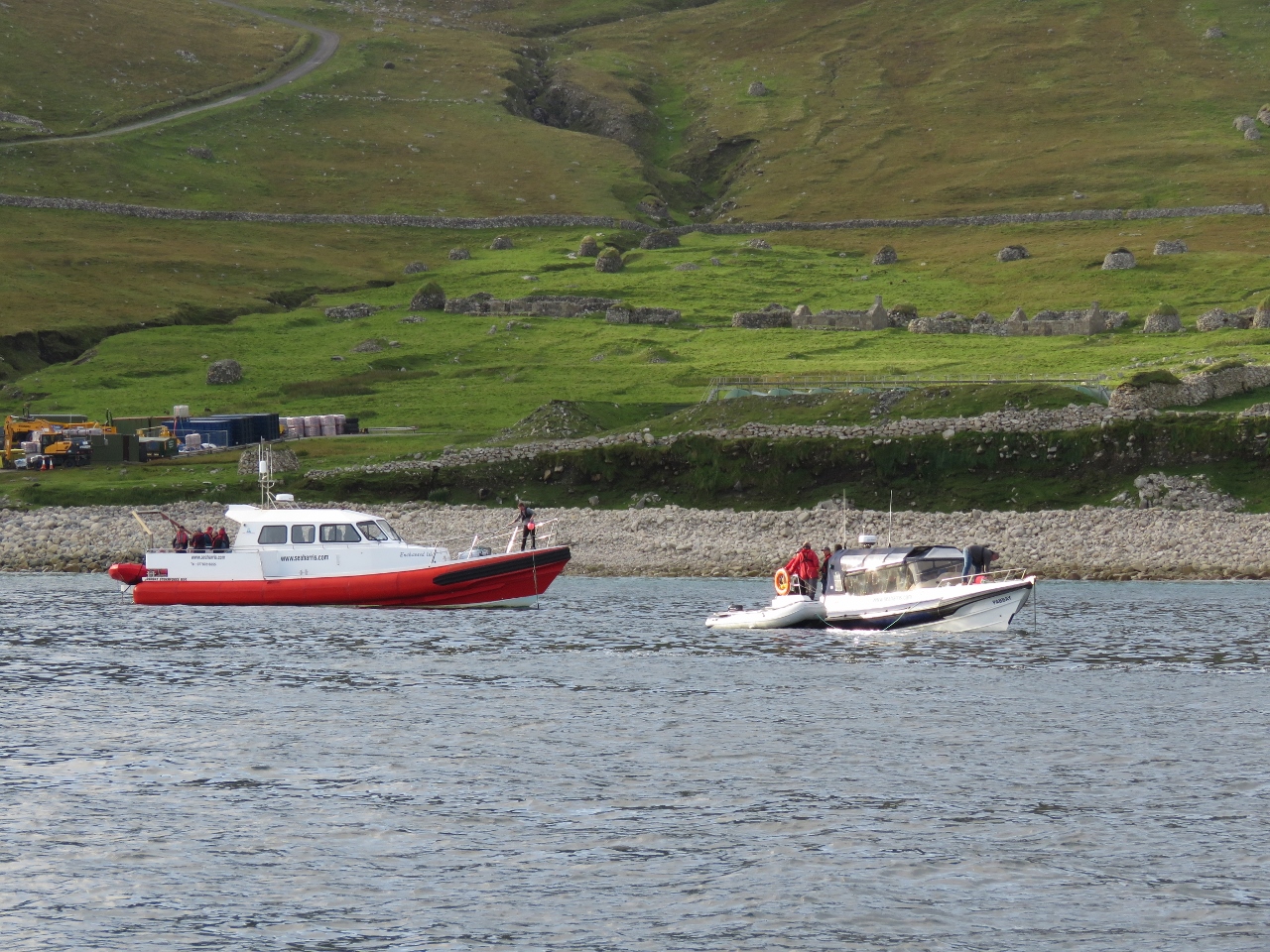 |
Island Baggers
Position: -8 33.87, 57 48.51
We’d seen two tour boats in the area and later that evening they both arrived and tied to mooring further in the bay. Both were Sea Harris vessels from the Isle of Harris. While in Stornoway, we’d been corresponding with owner Seumas Morrison to get advice on St. Kilda and by chance he also had been following our blog. He came over to say hello and explained that he was carrying a group of “Island Baggers” who would be spending three days trying to land on as many island as possible and camping for the night on Hirta. The “Island Baggers” phenomenon is driven partly by Hamish Haswell-Smith’s The Scottish Islands, a book that has influenced our trip as well.
|

|
Click the travel log icon on the left to see these locations on a map, with the complete log of our cruise.
On the map page, clicking on a camera or text icon will display a picture and/or log entry for that location, and clicking on the smaller icons along the route will display latitude, longitude and other navigation data for that location. And a live map of our current route and most recent log entries always is available at http://mvdirona.com/maps. |
I think your blog is incredibly detailed and a joy to read both the technical and geographical articles. You refer to the book “The Scottish Islands” which I consider as a “native” to be the most pleasant and informative guide to the islands of Scotland I have aboard. Fairwinds and thanks for your excellent blog.
Thanks Iain. We agree “The Scottish Islands” is an amazing book.
10.23.2017
Hi James
Your small Anchor Buddy article shows big
benefits! In the photo: did you use the yellow line more for visibility ? While land anchoring utilizing
anchor buddy system did you have any challenges
maintaining bungee tension while exiting/or boarding your dingy ? Did you use a mushroom
anchor with the anchor buddy system ? Was a double bungee w/looped main nylon line more beneficial on your larger dingy ? How has the bungee type material been reacting to the cold water temp. ? Where did you recruit your Anchor Buddy ? Amazon ! E-Bay !
We purchased ours from Amazon: https://www.amazon.com/gp/product/B003L8R1BO/ref=oh_aui_search_detailpage?ie=UTF8&psc=1
We use either a folding grapple-type anchor or a small aluminum danforth-type anchor depending upon conditions. Usually the Danforth unless the bottom is large rock. We have noticed no changes in operation based upon temperature. It does require some judgement when setting the anchor to ensure that you are far enough from shore that it is exerting tension but close enough to shore that it will reach within the maximum stretch of the bungee.
Dear James
These are some of the strongest wind that the UK gets. Your boat is showing gusts of 122kts and the record wind speed at sea level in the UK is 123kts. You are also just about to break cover from the islands and will have Atlantic rolling waves to add to the storm. I have been through those waters once before on a cruise ship and the increase in waves was noticeable.
I wish you all the best. As long as you are safe.
There are secondary ports in the area to get cover. I already hold you in the highest regard for being out there.
Rgs
Robert
I look forward to seeing this on the blog.
Ps Julie says have fun.
The winds yesterday were in the 20s. What you saw was the weather instrument failing and producing some crazy wind and barometer readings before locking up entirely. The 120+ kt winds and crazy high and low barometer readings were the weather instrument failing rather than poor conditions here. I rebooted the weather system and it returned to normal and correct readings. I’ll keep an eye on it.
We removed the erroneous weather readings from the log entries. Sorry about the confusion.
Today we actually do have some wind so we’ll wait a day before proceeding to Belfast. It’s blowing 20 to 30 with gusts to 40 kts.
I am suitable impressed with your trip and the winter crossing of the Atlantic I assume you are about to undertake. You must confidantes in your boat. I would be happy just to match your cruse around the UK never mined the Atlantic crossing. I will be working on persuading my other half in the morning. I shall check your logs as our boat only has 125 mile range. All the best and happy cruising
Robert & Julie
Thanks Robert. The crossing was completed prior to the summer and we have been enjoying cruising in Ireland and Scotland since. You can see current updates on where we are at: //mvdirona.com/maps. A video from the North Atlantic crossing is here: https://www.youtube.com/watch?v=guEnTp2a6Sc and there is lots more information on the crossing up at: //mvdirona.com/Trips/atlanticocean2017/atlanticocean4.html.