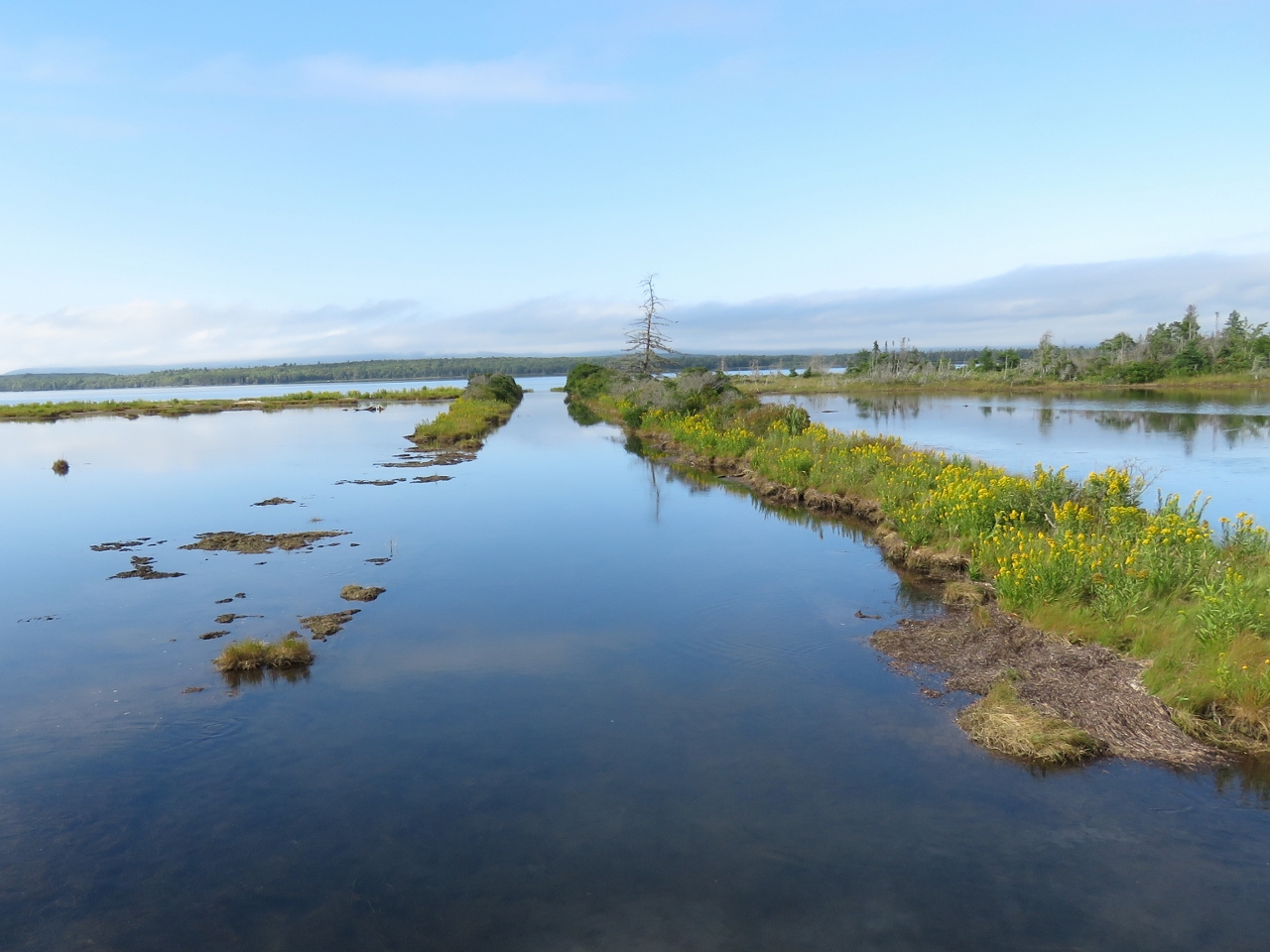
In the late 1800s, locals built a canal between Malagawatch Harbour to Denys Basin. Via a portage from Little Harbour into Malagawatch Harbour and then through the canal into Denys Basin this safer route took 20 miles off the trip between Marble Mountain and Orangedale. The canal was 1,000 ft long, 17 ft wide and 4ft deep. A wooden bridge with 4-ft clearance carried land-based traffic between the mainland and Big Harbour Island. With the advent of good roads and vehicles, the bridge was removed, and the breach filled with solid material. But the outline of the canal still is visible.
From our River Cove anchorage in Malagawatch Harbour, we visited the canal site by tender and also ran to Little Harbour for an excellent meal at the Cape Breton Smokehouse restaurant. We also suffered the worse bug attack we’ve ever seen, waking up in the morning to find the walls and floors covered with millions and millions of mostly dead mosquitoes.
Trip highlights from September 6th and 7th, 2016 follow. Click any image for a larger view, or click the position to view the location on a map. And a live map of our current route and most recent log entries always is available at http://mvdirona.com/maps
 |
River Cove
Position: -60 58.94, 45 52.25
At anchor in sheltered River Cove. We found the charted depths on entry quite different from either the chart or the chartlet in Cruising Cape Breton and had to backtrack a couple of times to avoid uncharted shallows that came up suddenly. Before anchoring we made a complete circle around where we intended to set the anchor to look for uncharted shallows.
|
|
|
Malagawatch Canal
Position: -60 59.50, 45 52.81
Looking north from the isthmus between Big Harbour Island and the mainland through the remains of the Malagawatch Canal.
|
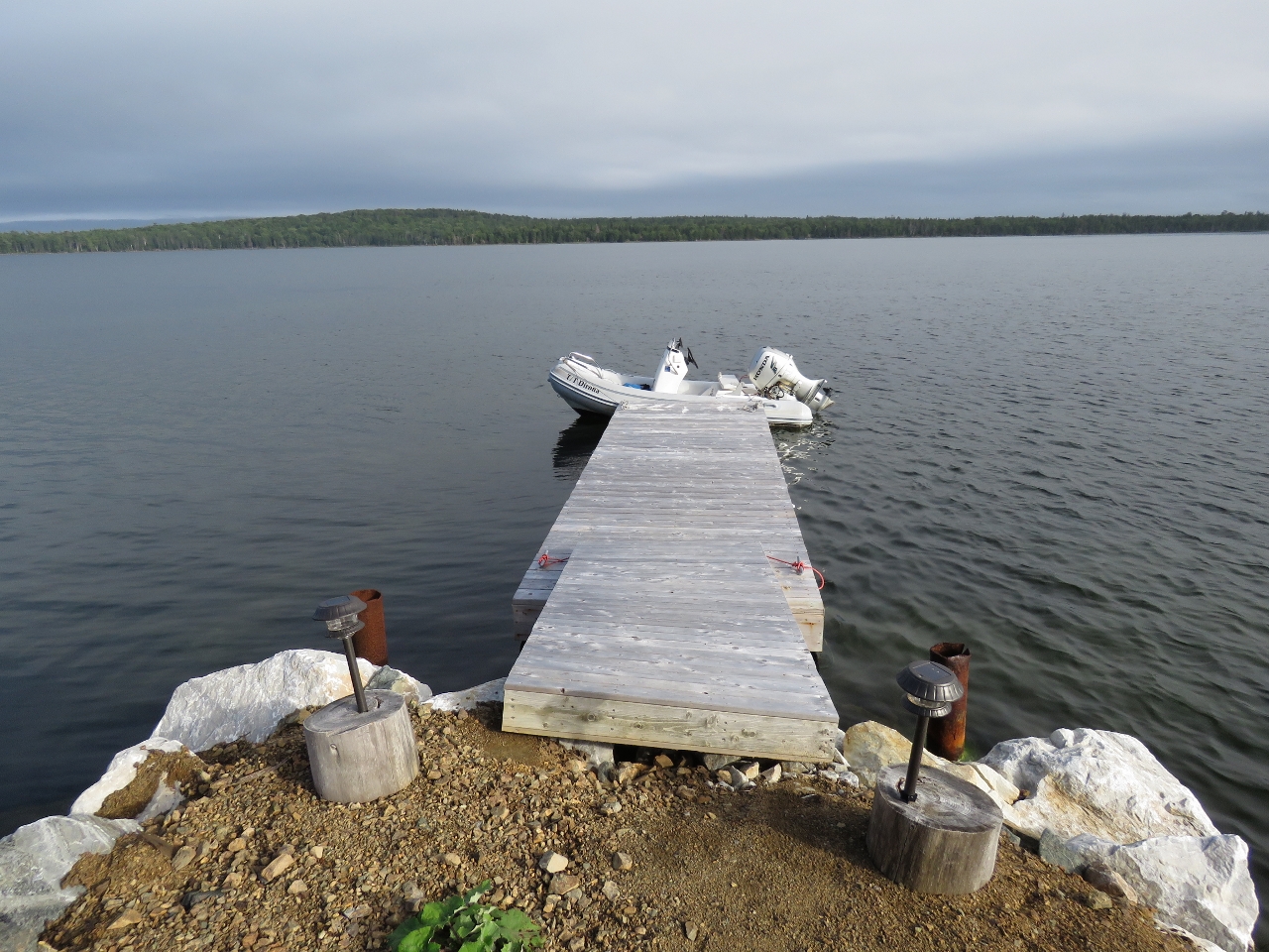 |
Little Harbour
Position: -60 58.54, 45 51.11
We ran the tender from Malagawatch Harbour and west into Little Harbour to have dinner at the Cape Breton Smokehouse restaurant. This is looking east down their dock into Little Harbour.
|
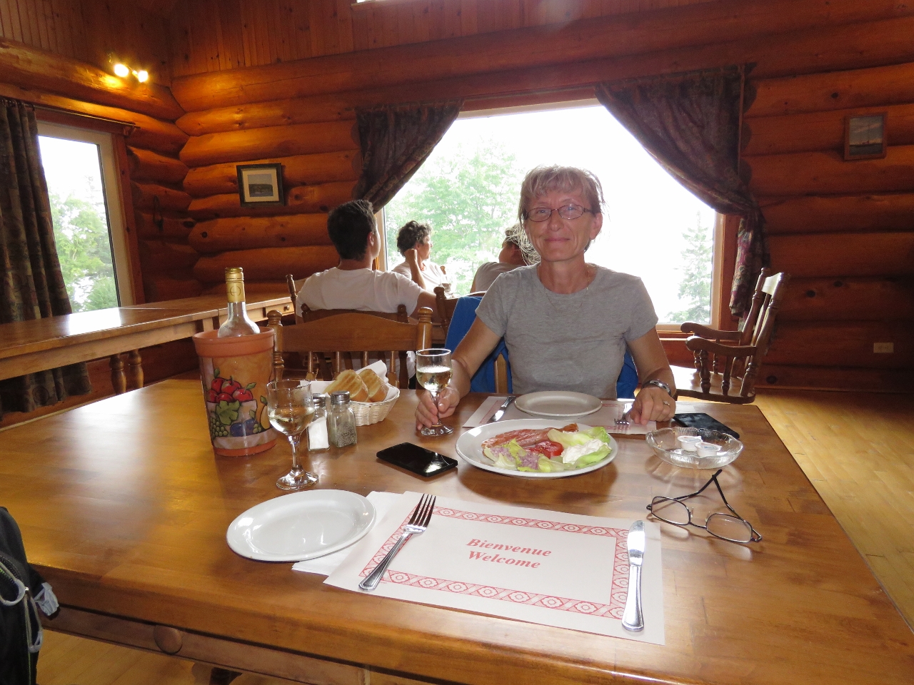 |
Cape Breton Smokehouse
Position: -60 58.54, 45 51.14
We had an excellent meal at the Cape Breton Smokehouse. Here we are sharing an appetizer of smoked salmon, the house specialty. The owners’ sailboat is moored outside. They sailed around the world from Germany and 18 years ago landed in Nova Scotia and decided to stay and build the Cape Breton Smokehouse. The building is beautifully-made, with huge solid wood beams throughout and excellent views of the harbour.
|
 |
Tower
Position: -60 58.07, 45 52.20
While returning to Dirona we noticed a tower sticking out above the trees at Campbell Point and went ashore to check it out.
|
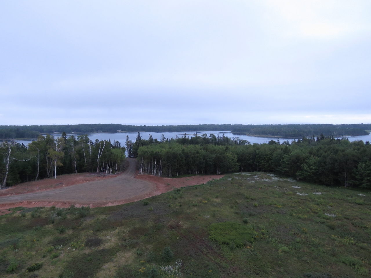 |
View
Position: -60 58.07, 45 52.20
The view from the top of the tower. Campbell Point is being developed and the tower allows prospective buyers to get a view for the area. We didn’t stay long at the top because hungry mosquitoes were in clouds so thick we had trouble not breathing them in. If the developer wants to sell any lots at all, they won’t show them in the evening when the mosquito clouds are thickening.
|
 |
Beach Peninsula Estates
Position: -60 58.07, 45 52.20
Jennifer pointing to our anchorage on the aerial photograph of the area on the Beach Peninsula Estates marketing sign at the tower base.
|
 |
Bugs
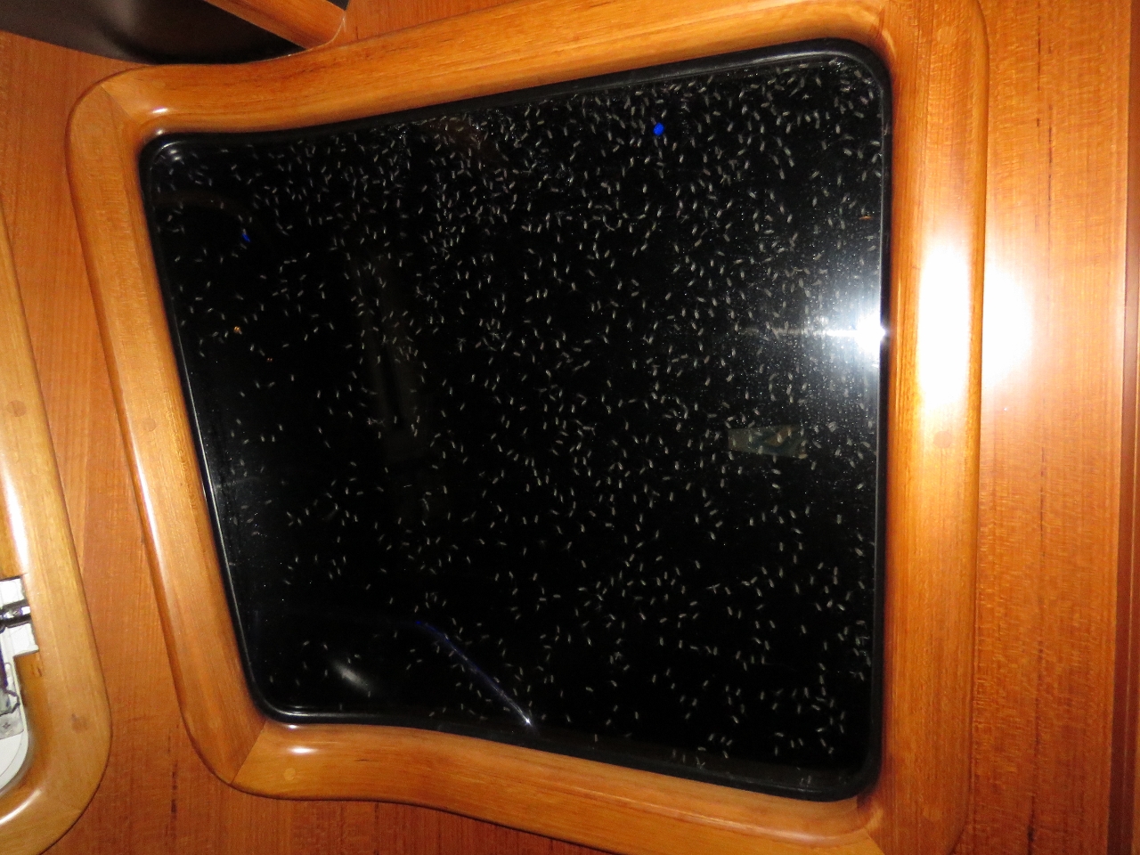
Position: -60 58.95, 45 52.26
That evening we were sitting in the cockpit with a couple of large Citronella candles burning when we could hear a humming that sounded like equipment running. We realized it was the sound of thousands, if not millions, of hungry bugs surrounding the boat. The candles were effective, but we eventually retreated inside and this is the view looking out one of the pilot house windows. We felt like we were in a Hitchcock story.
|
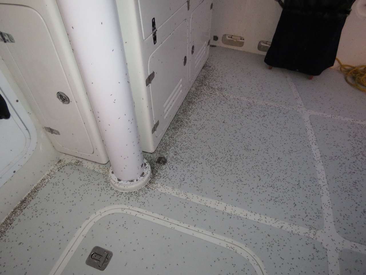 |
Bugs
Position: -60 58.93, 45 52.26
This morning the boat was covered, walls and floors, with millions and millions of mostly dead mosquitoes. Yuck. They were sticky and hard to remove—it took us over an hour to get the boat cleaned up again.
|
 |
N2k Meter
Position: -61 1.10, 45 49.11
Several NMEA 2000 devices had dropped off the bus and we were getting alarms due to missing data. We plugged our N2KMeter into the bus and it flagged 10 to as many as 70 errors per second on the bus, indicating that a device likely was faulty and producing bad data. We narrowed it down to a DSM250 monitor in the master stateroom. Once we unplugged it, we saw zero errors per second for hours at a time. We later took out the “faulty” DSM250 that was producing all the bus errors and it tested out fine. The problem cause was a poorly fabricated field installable cable between the main bus and the DSM250 producing the errors. That is two connection problems in the last 6 months. One a loose knurled connection between a Tee fitting and the power lower inserter and the other was this bad drop cable. Good news across the board.
|

|
Click the travel log icon on the left to see these locations on a map, with the complete log of our cruise.
On the map page, clicking on a camera or text icon will display a picture and/or log entry for that location, and clicking on the smaller icons along the route will display latitude, longitude and other navigation data for that location. And a live map of our current route and most recent log entries always is available at http://mvdirona.com/maps. |
If your comment doesn't show up right away, send us email and we'll dredge it out of the spam filter.