We completed our three-cirque tour at Cirque de Cilaos. The road up was the most winding, steep and difficult Reunion road we’d driven so far. And that is saying a lot. The scenery en route and inside the cirque was incredible, with views into deep river gorges and soaring peaks.
Trip highlights from October 14th follow. Click any image for a larger view, or click the position to view the location on a map. And a live map of our current route and most recent log entries always is available at http://mvdirona.com/maps
 |
Cirque de Cilaos
Position: 55 27.60, -21 15.30
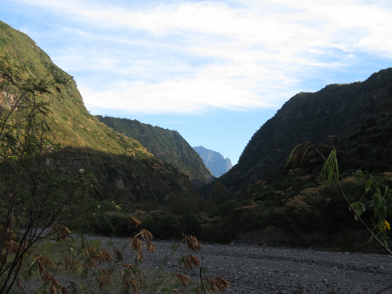
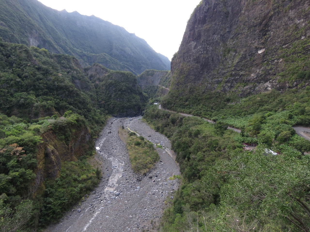
We left the marina at 5:30 this morning to drive up to the Cirque de Cilaos, completing our three-cirque tour. This is the first glimpse to the cirque as we pass through the dramatic gorge of the Bras de Cilaos (the river Cilaos Arm) at of elevation 676 ft (206 m).
|
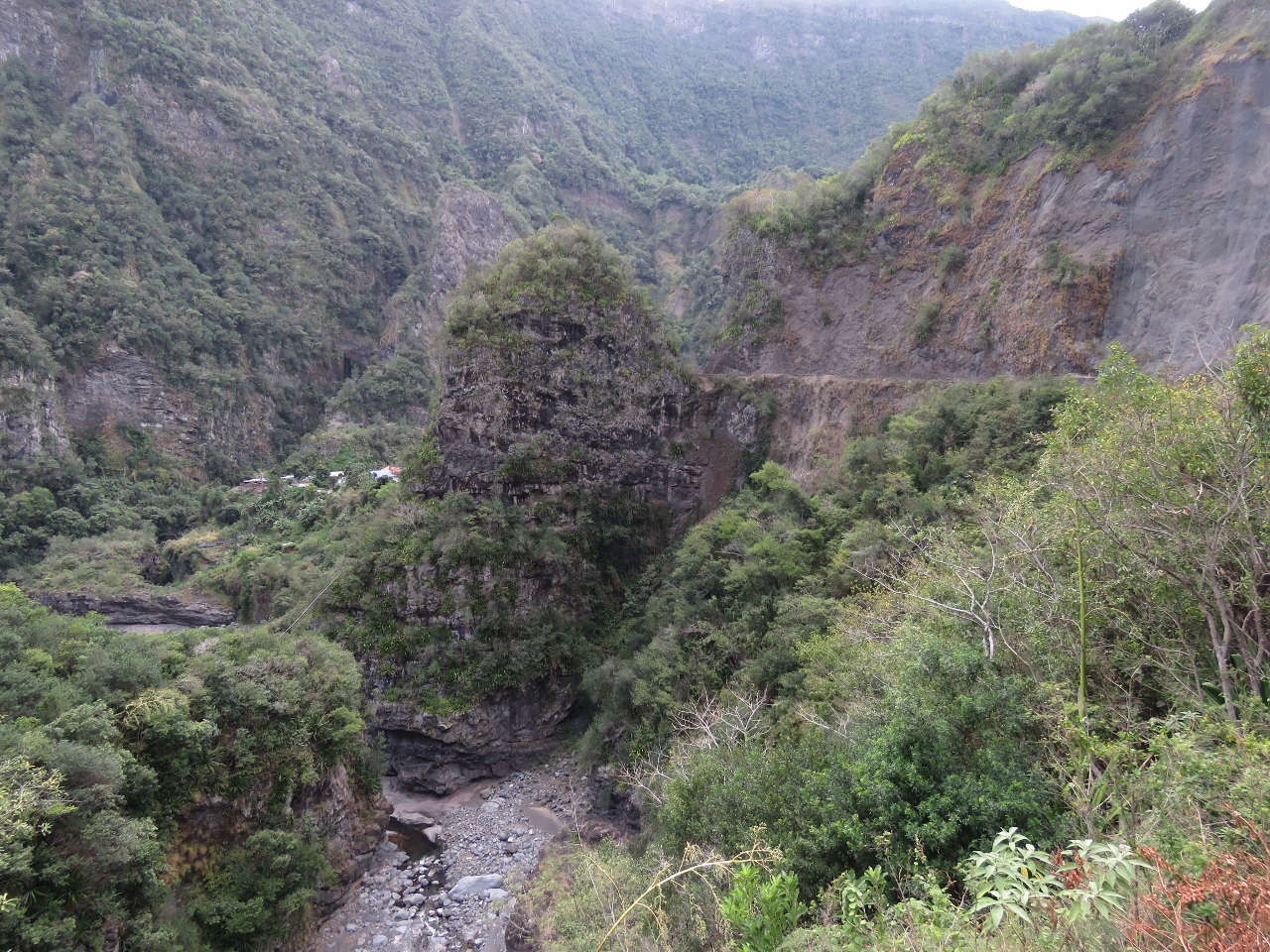 |
Islet Augustin
Position: 55 27.14, -21 12.63
A few buildings in the village of Islet Augustin are just visible about halfway up on the left of the photo. The road we just travelled on passes between the spire at center and the bluff to the right. We’re now at elevation 1,254 ft (382 m).
|
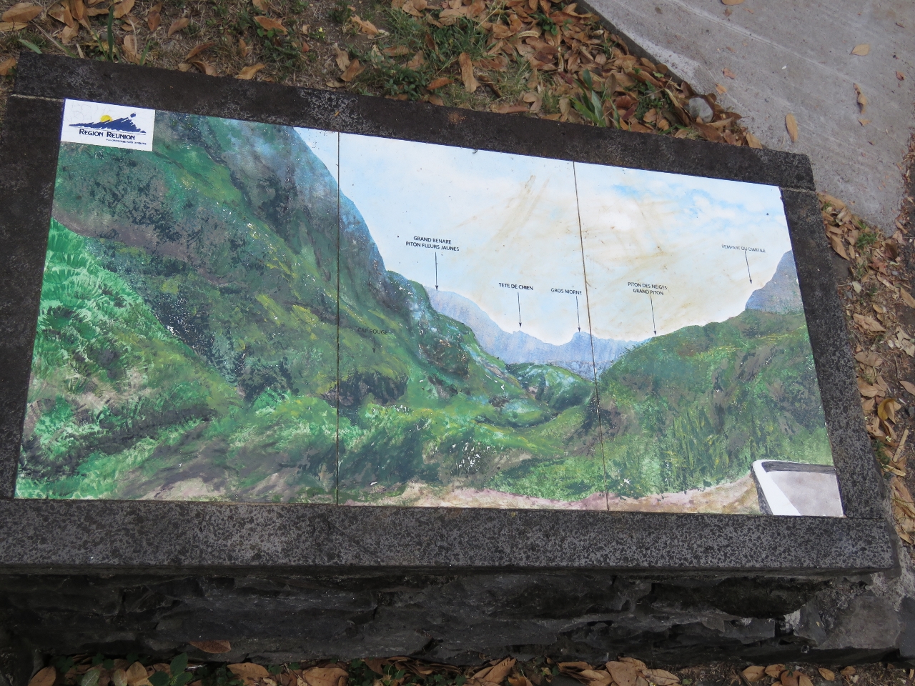 |
Viewpoint
Position: 55 26.96, -21 12.15
Several formal viewpoints were on the route, with beautifully painted interpretive signs labelling the towns and natural features.
|
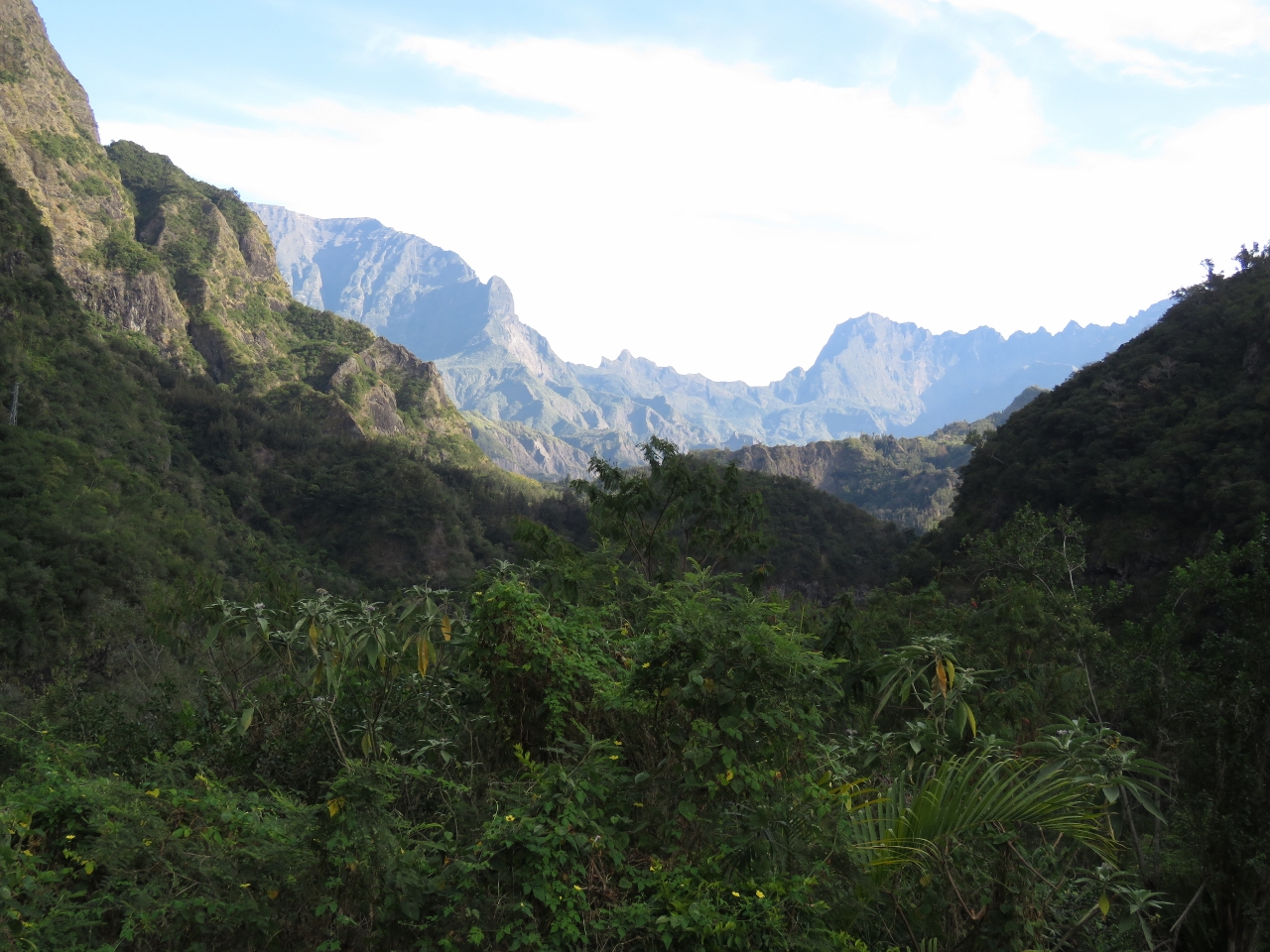 |
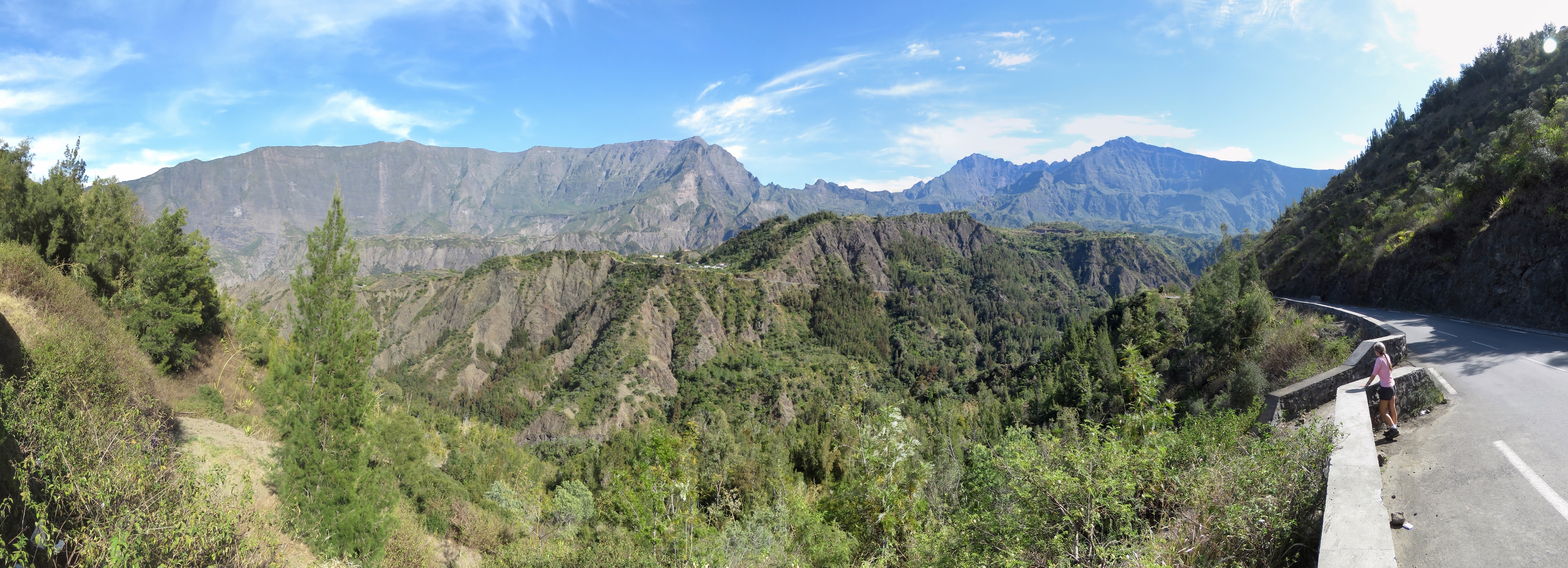
Grand Benare
Position: 55 26.96, -21 12.15
The mountain on the left in the distance is (2,898m) Le Grand Benare and in the center is 9,905ft (3,019m) Gros Morne at the itersecetion of the three cirques of Salazie, Mafete and Cilaos. We last had a view to Le Grand Benare looking across La Plaine des Cafres on our way up to the volcano.
|
 |
Bras do Cilaos
Position: 55 26.96, -21 12.15
The Bras de Cilaos isn’t carrying much water now, but looks as if it can flow a torrent.
|
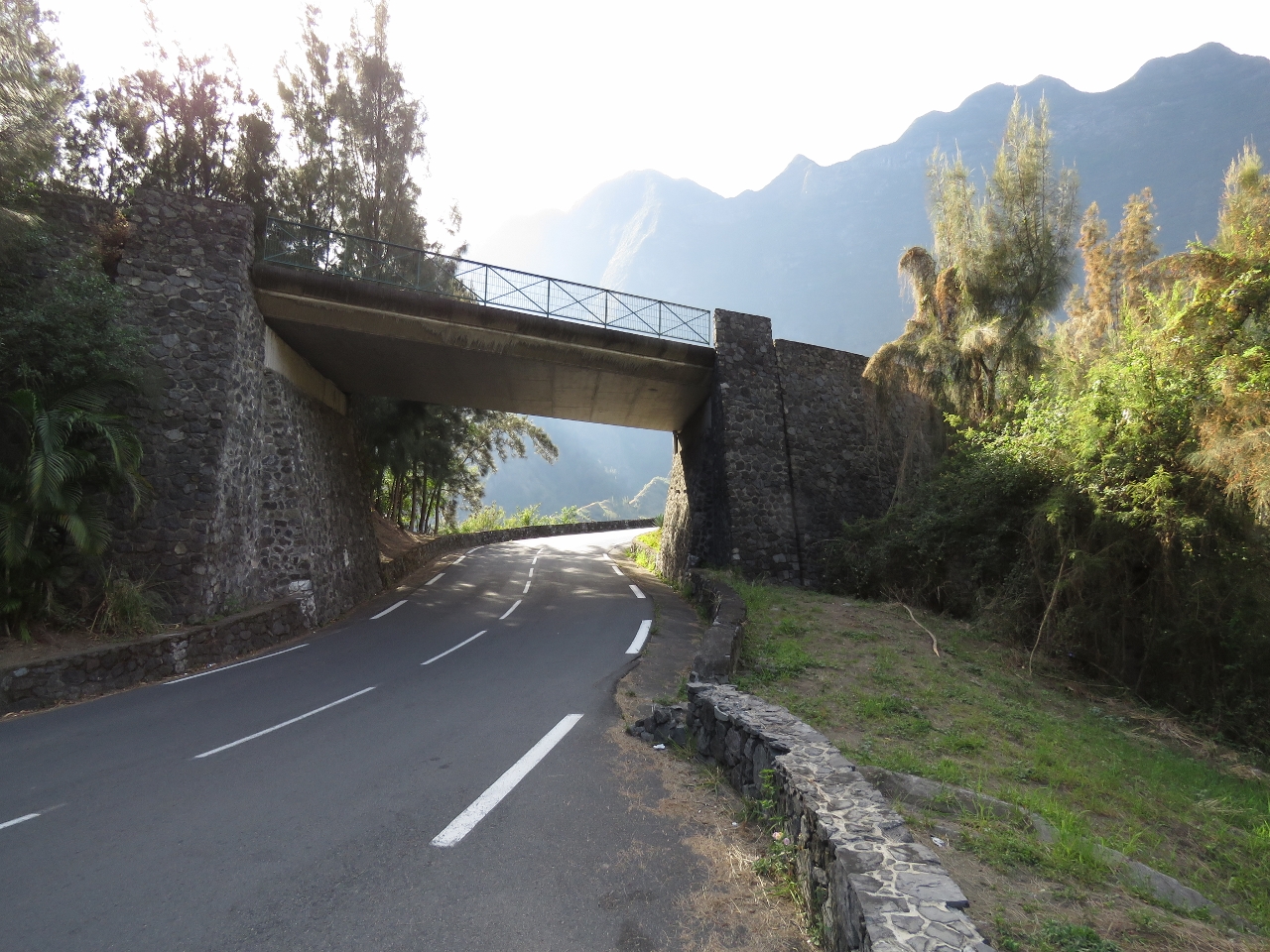 |
Pont de la Boucle
Position: 55 27.28, -21 10.87
The road up to Cirque de Cilaos was the most winding, steep and difficult Reunion road we’d driven so far. And that is saying a lot. At several places, the road narrowed to one lane with blind corners where cars honk their horns before passing through to alert any oncoming traffic. Here at Pont de la Boucle (Loop Bridge), the road actually loops back over itself after a hairpin turn. We’re now up to elevation 2,200 ft (670 m).
|
 |
Tunnel de Peter Both
Position: 55 27.85, -21 10.30
Drivers must wait outside the single-lane Tunnel de Peter Both for any oncoming traffic to pass through before entering.
|
 |
Le Palmiste Rouge
Position: 55 28.10, -21 10.12
We stopped for breakfast at a viewpoint overlooking the town of Le Palmiste Rouge. We’re now at elevation 3,274 ft (998 m).
|
 |
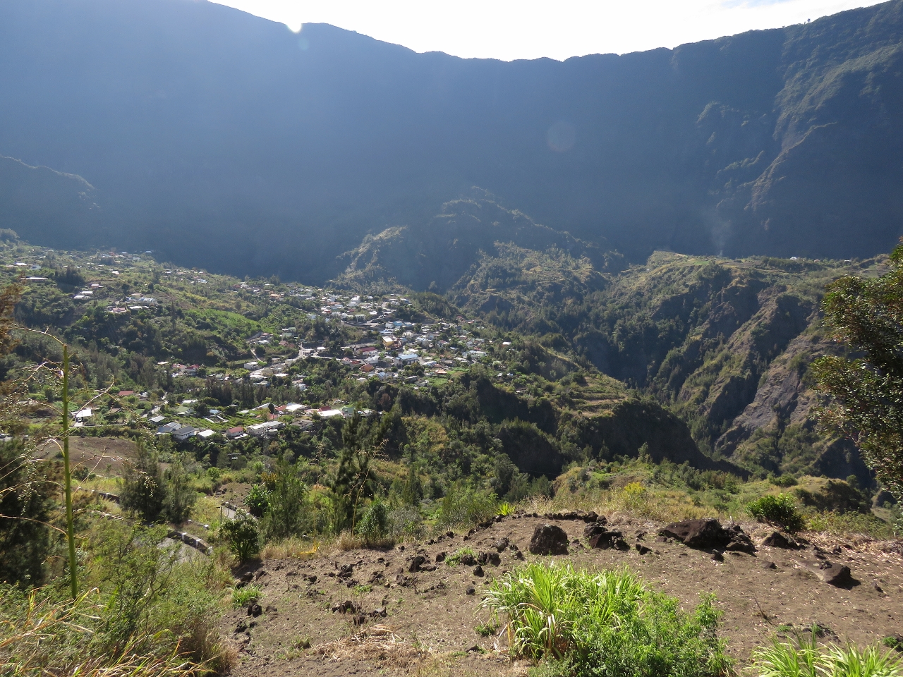
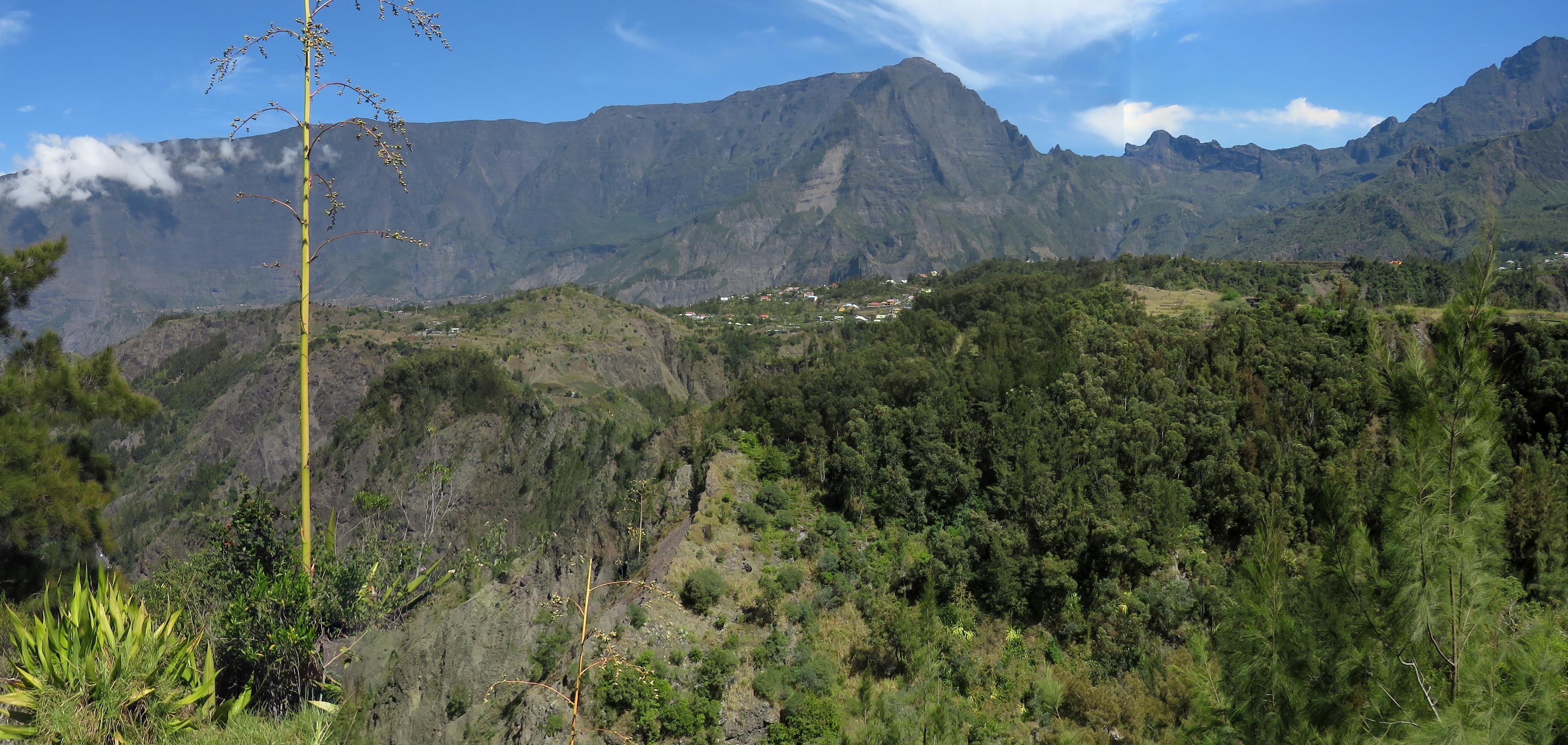
Mare Seche
Position: 55 28.37, -21 9.49
The small village of Mare Seche is visible on the plateau in the middle distance, with Le Grand Benare directly behind and the Cirque du Mafete in the distance at center. The road we’re on passes between Mare Seche and the hill to the right of the village. We’re now at elevation 5,816 ft (1,772m).
|
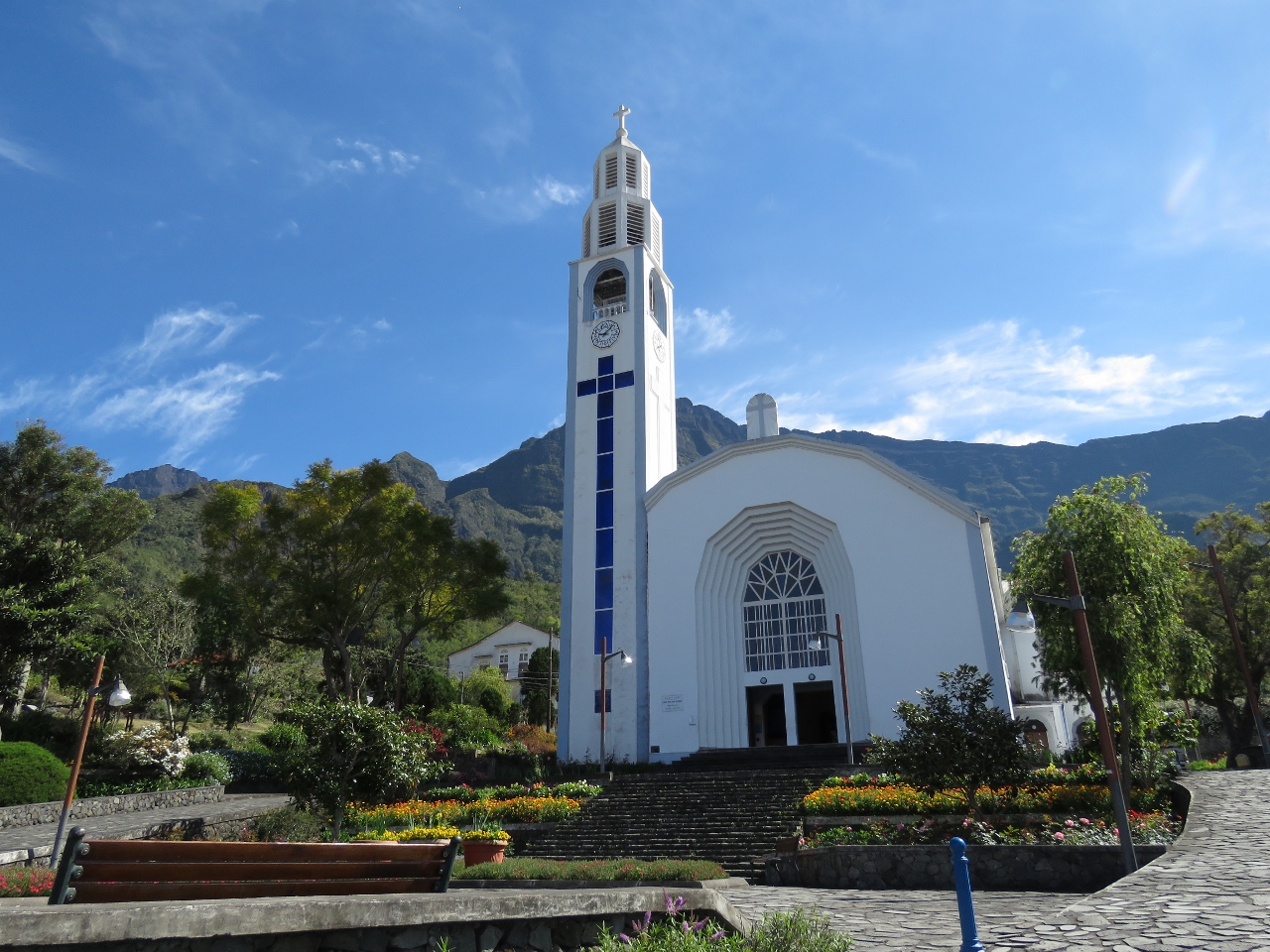 |
L’Eglise Notre-Dame-des-Neiges
Position: 55 28.35, -21 7.89
The striking church Notre-Dame-des-Neiges at the northern end of the town of Cilaos is a prominent landmark throughout the cirque. The church was completed in 1942 and is on the list of Reunion historical monuments. At Cilaos we’ve dropped down to elevation 4,000 ft (1,220m).
|
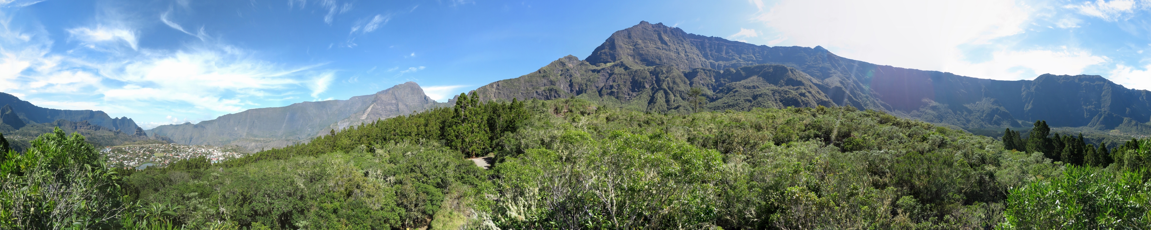 |
La Roche Merveilleuse
Position: 55 28.77, -21 7.56
The panoramic view to the Cirque de Cilaos from 4,700ft (1,432m) La Roche Merveilleuse. The town of Cilaos is on the left with Piton des Neiges at center.
|
|
|
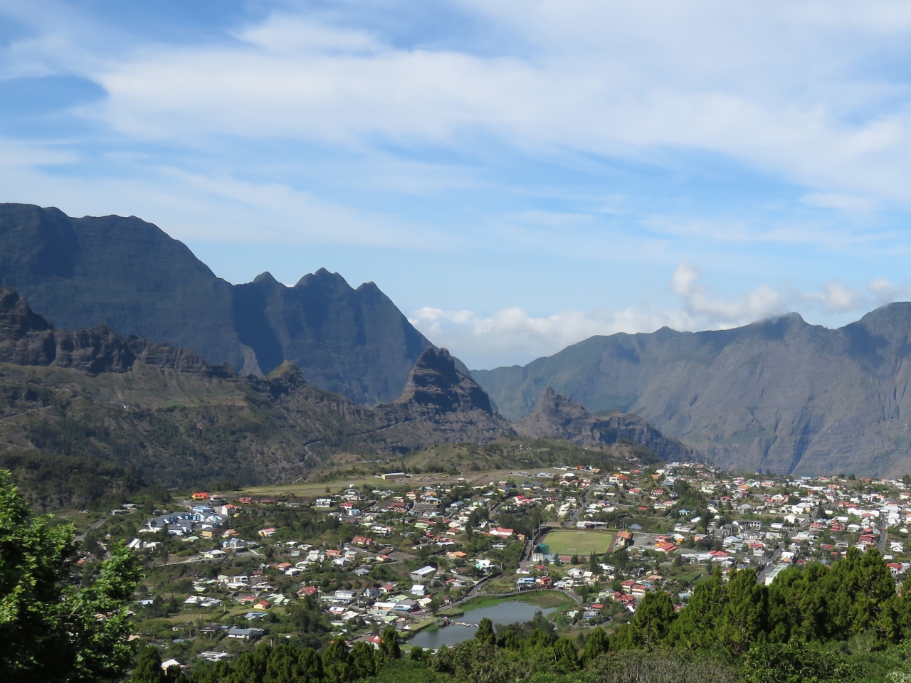
Cilaos
Position: 55 28.77, -21 7.56
Close-up to the town of Cilaos from La Roche Merveilleuse. We passed through that central mountain directly behind the town, Gros Morne de Gueule Rouge, in one of the two tunnels on the way up. The dip in the distant hills at the right is a viewpoint into the cirque called La Fenetre (The Window) that we are planning to visit sometime later this week.
|
 |
Bras Sec
Position: 55 29.05, -21 8.86
Looking west across the cirque from a viewpoint outside the village of Bras Sec. The paved road ended here—we followed the dirt road a short distance, but it didn’t look likely to yield any good views.
|
 |
Bassin des Salazes
Position: 55 28.04, -21 7.77
We drove a short distance down steep switchbacks on the road towards the village of Ilet a Cordes but turned back after taking in the view across Bassin des Salazes.
|
 |
Rue de Pere Boiteau
Position: 55 28.20, -21 8.16
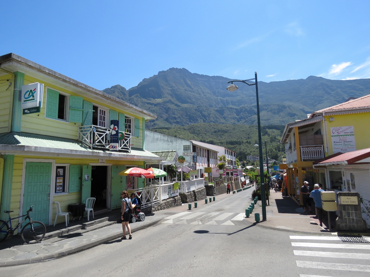
The town of Cilaos is a mecca for hikers and we constantly saw people setting off on various hikes as we drove around the cirque. This is looking down the main street of Rue de Pere Boitea with Piton des Nieges in the background. The hike to the 10,072ft (3,070m) summit of Piton des Neiges is extremely popular–the parking lot at the start of the track was packed. The return trip takes about 10 hours and normally is done over two days with an overnight stop at a guesthouse en route.
|
 |
Market
Position: 55 28.18, -21 8.14
Cilaos had lots of restaurants, and various shops catering to tourists and hikers, but didn’t feel overly commercial. A few cars had followed us through earlier in the day, but a constant stream was arriving now and the streets were getting busy with pedestrians as well. This market off the main street was jam-packed with shoppers and local bottled products inside, with boxes of dried seeds and beans throughout. Outside was a selection of fruit and vegetables, with firewood and more dried beans. Cardboard signs giving prices and availalbity covered any available wall space.
|
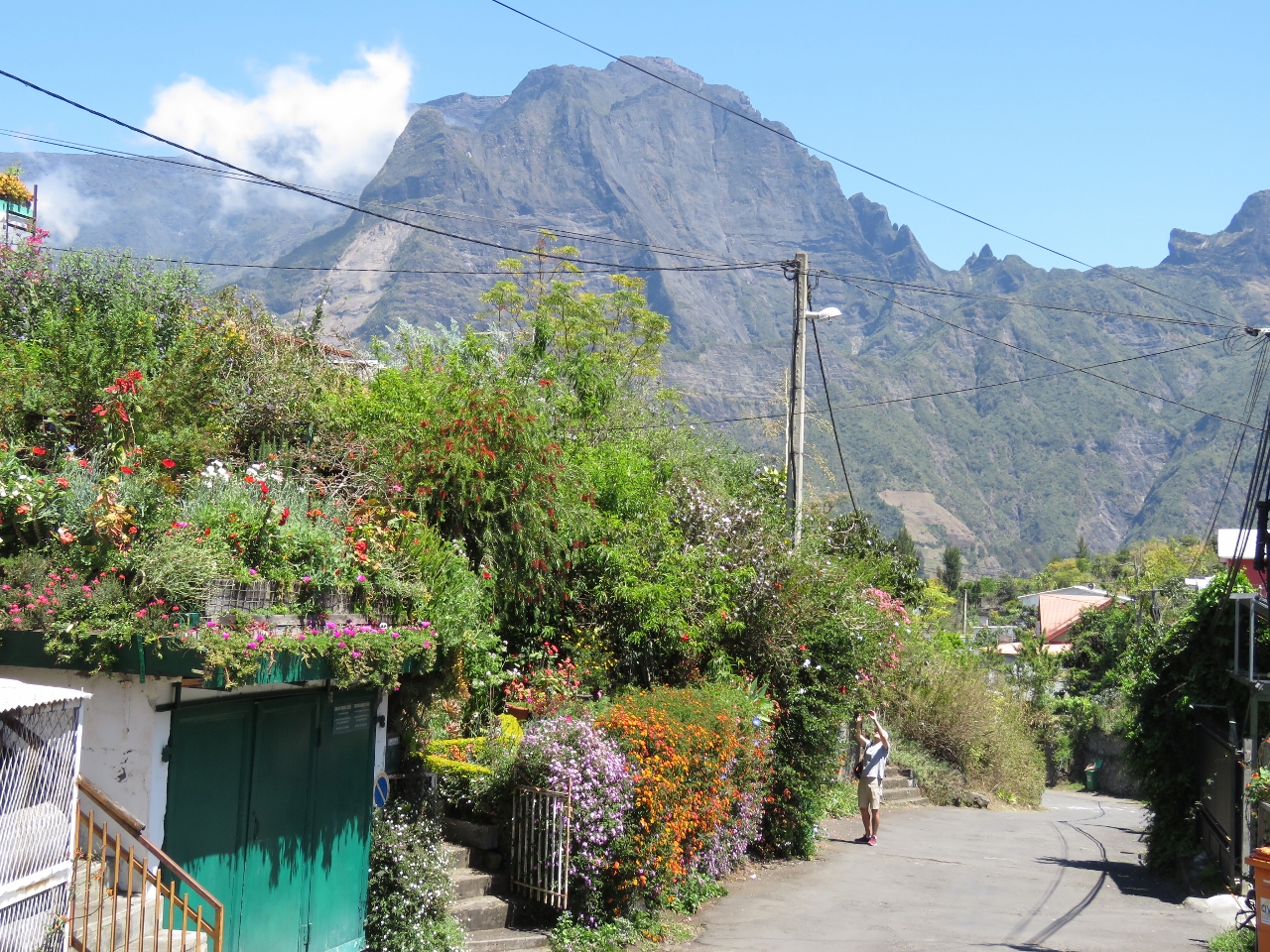 |
Garden
Position: 55 28.18, -21 8.19
Some of the Cilaos houses had exceptional gardens that stood out even against the surrounding scenery.
|
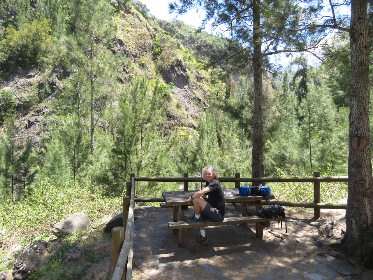 |
Lunch
Position: 55 28.62, -21 9.03
We had a picnic lunch on the way back at a small park on the other side of the valley from the Bras Sec viewpoint.
|
 |
Tunnel de Gueule Rouge
Position: 55 28.14, -21 9.70
Exiting the single-lane Tunnel de Gueule Rouge through Gros Morne de Gueule Rouge. As we’d passed partway through on our way to Cilaos, oncoming traffic also entered the tunnel. With a car behind us, we couldn’t back up and were almost playing chicken for a bit there until we came to a brief wider section in the middle of the tunnel where oncoming traffic can pass.
|
 |
Superted!
Position: 55 17.00, -20 56.50
Superted V arrived into Reunion this morning. We last saw Jean and Matt in Darwin, and weren’t expecting to meet up again until Cape Town as they would be reaching Rodrigues a couple of weeks after we did. But they also opted to skip Mauritius and so we had a few days overlap in Reunion. Boats longer than 17m can’t berth in the new marina, so they’ll likely remain along the sea wall. At 16.5m, we’re lucky to have squeezed in.
|

|
Click the travel log icon on the left to see these locations on a map, with the complete log of our cruise.
On the map page, clicking on a camera or text icon will display a picture and/or log entry for that location, and clicking on the smaller icons along the route will display latitude, longitude and other navigation data for that location. And a live map of our current route and most recent log entries always is available at http://mvdirona.com/maps. |
If your comment doesn't show up right away, send us email and we'll dredge it out of the spam filter.