MV Dirona travel digest for South to Trondheim, Norway 2018

|
Click the travel log icon on the left to see these locations on a map,
with the complete log of our cruise. On the map page, clicking on a camera or text icon will display a picture and/or log entry for that location, and clicking on the smaller icons along the route will display latitude, longitude and other navigation data for that location. And a live map of our current route and most recent log entries always is available at //mvdirona.com/maps/LocationCurrent.html. |
 |
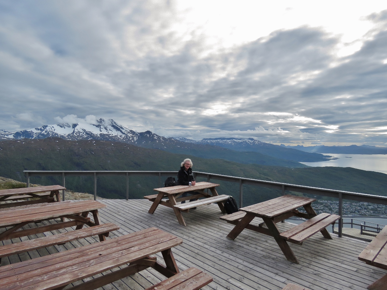
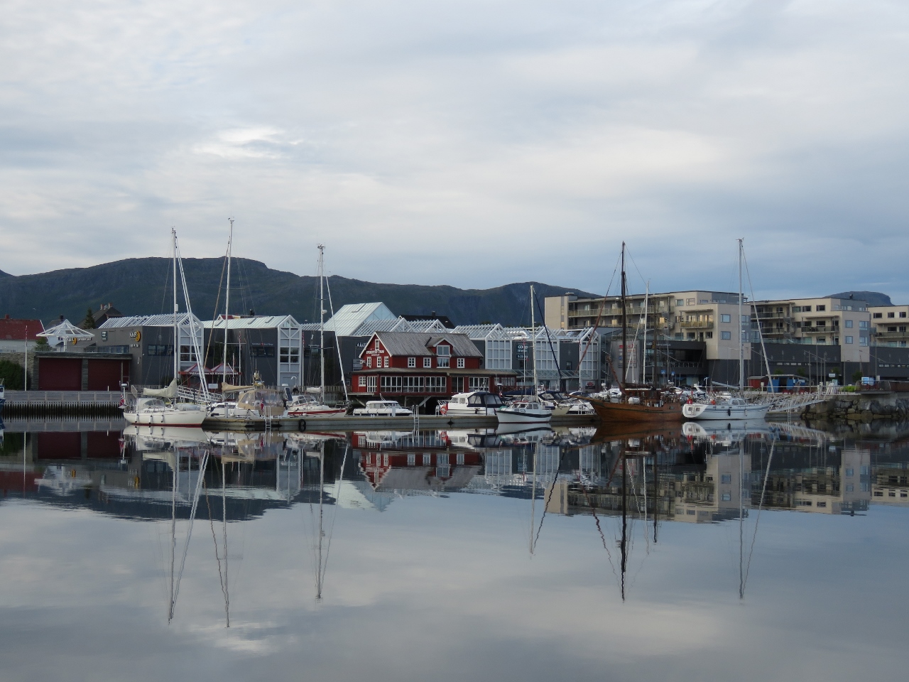
6/24/2018: Tromsø
Position: 69°38.98'N, 18°57.92'E
A last look at Tromsø Haven before we depart for points south. We had an excellent two-week stay.
|
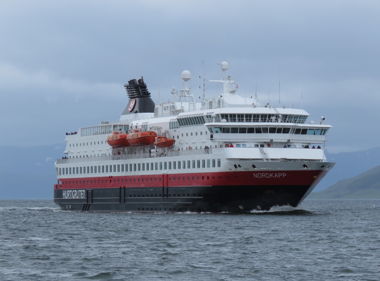 |
6/24/2018: Nordkapp
Position: 69°30.64'N, 18°23.72'E
The Hurtigruten Nordkapp heading north to Tromsø.
|
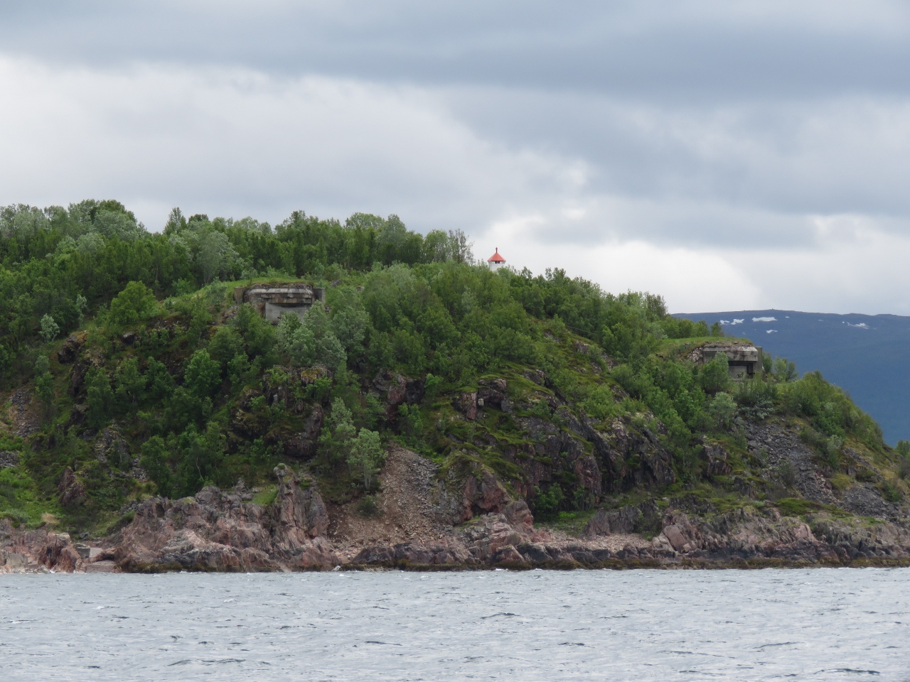 |
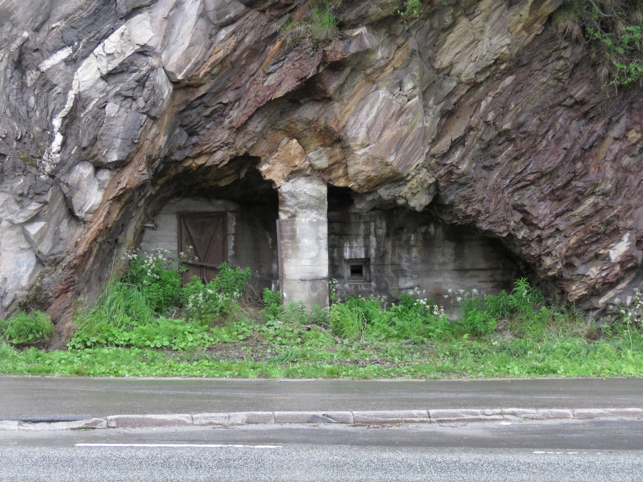
6/24/2018: Fortifications
Position: 69°27.68'N, 18°7.65'E
Coastal fortifications on the hill at we run south near Ansnes. These likely were built by Germany during their occupation.
|
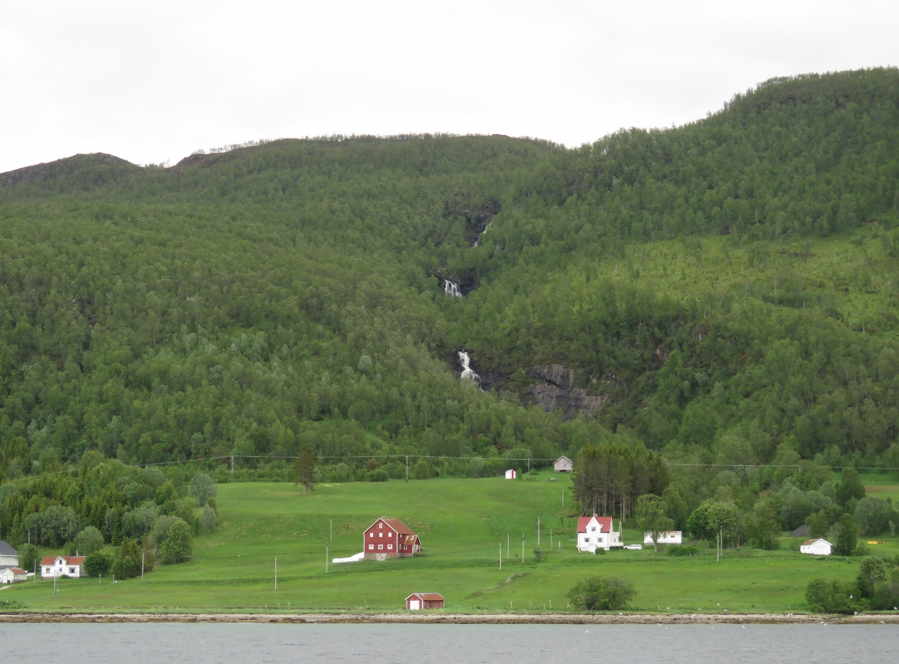 |
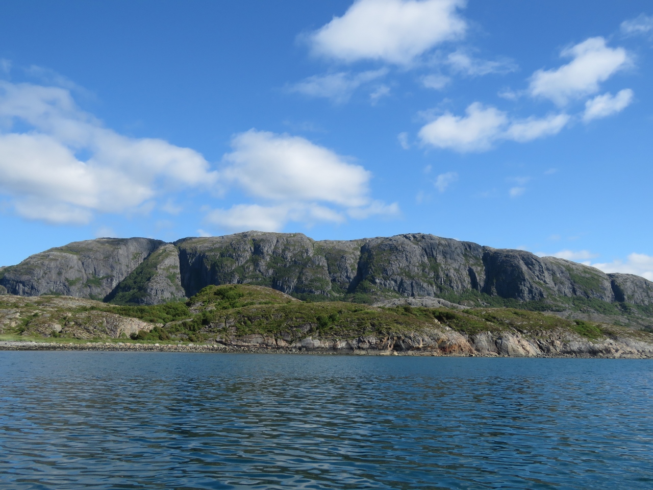
6/24/2018: Waterfall
Position: 69°21.34'N, 18°5.58'E
Waterfall and lots of green along the west shore at the north end of the channel Gisundet along the west coast of Senja.
|
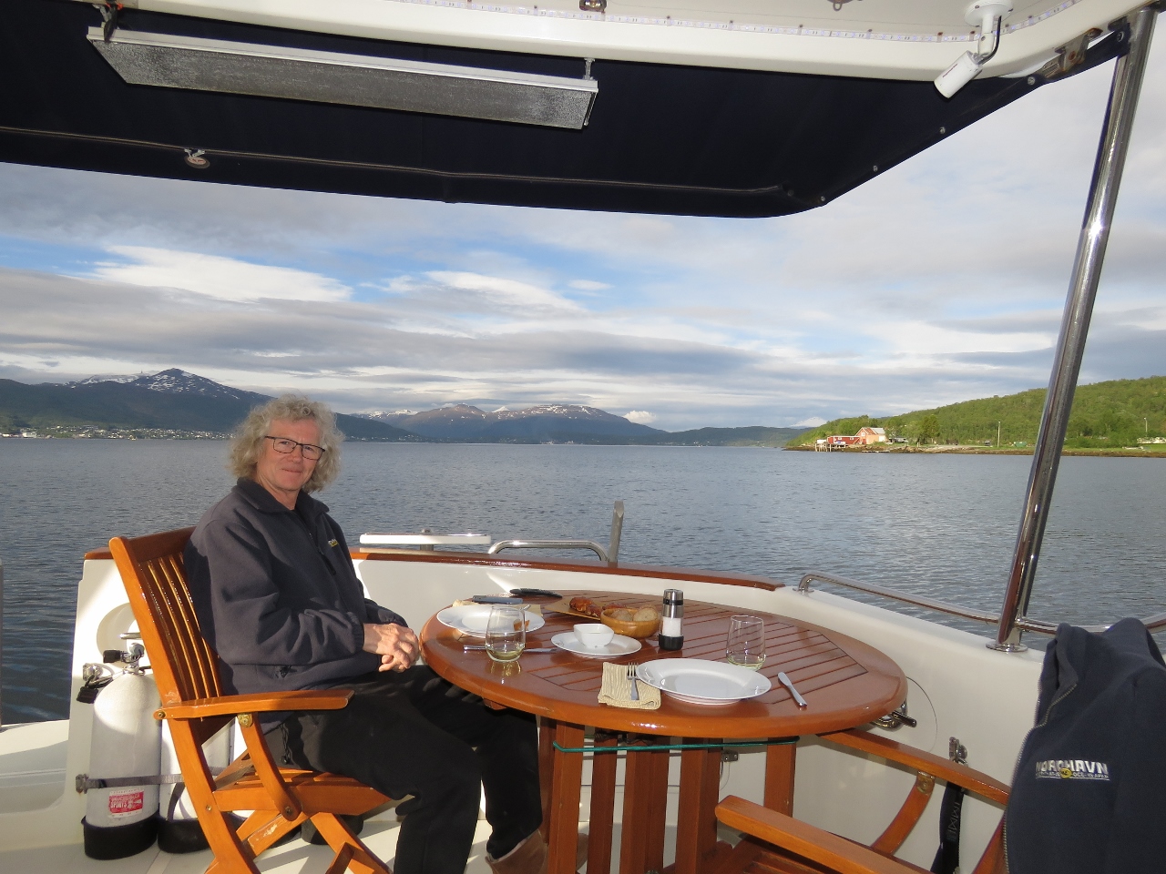 |
6/24/2018: Vågan
Position: 69°11.90'N, 17°56.41'E
A relaxing dinner on deck at Vågan with a view north toward Finnsnes.
|
 |
6/24/2018: Prinsendam
Position: 69°11.90'N, 17°56.40'E
The cruise ship Prinsendam, that we saw on our Hurtigruten trip, running south off Finnsnes.
|
 |
6/25/2018: Lofoten
Position: 69°11.89'N, 17°56.38'E
The Hurtigruten Lofoten, viewed from our anchorage at Vågan, heading south after a 4:45am departure from Finnsnes.
|
 |
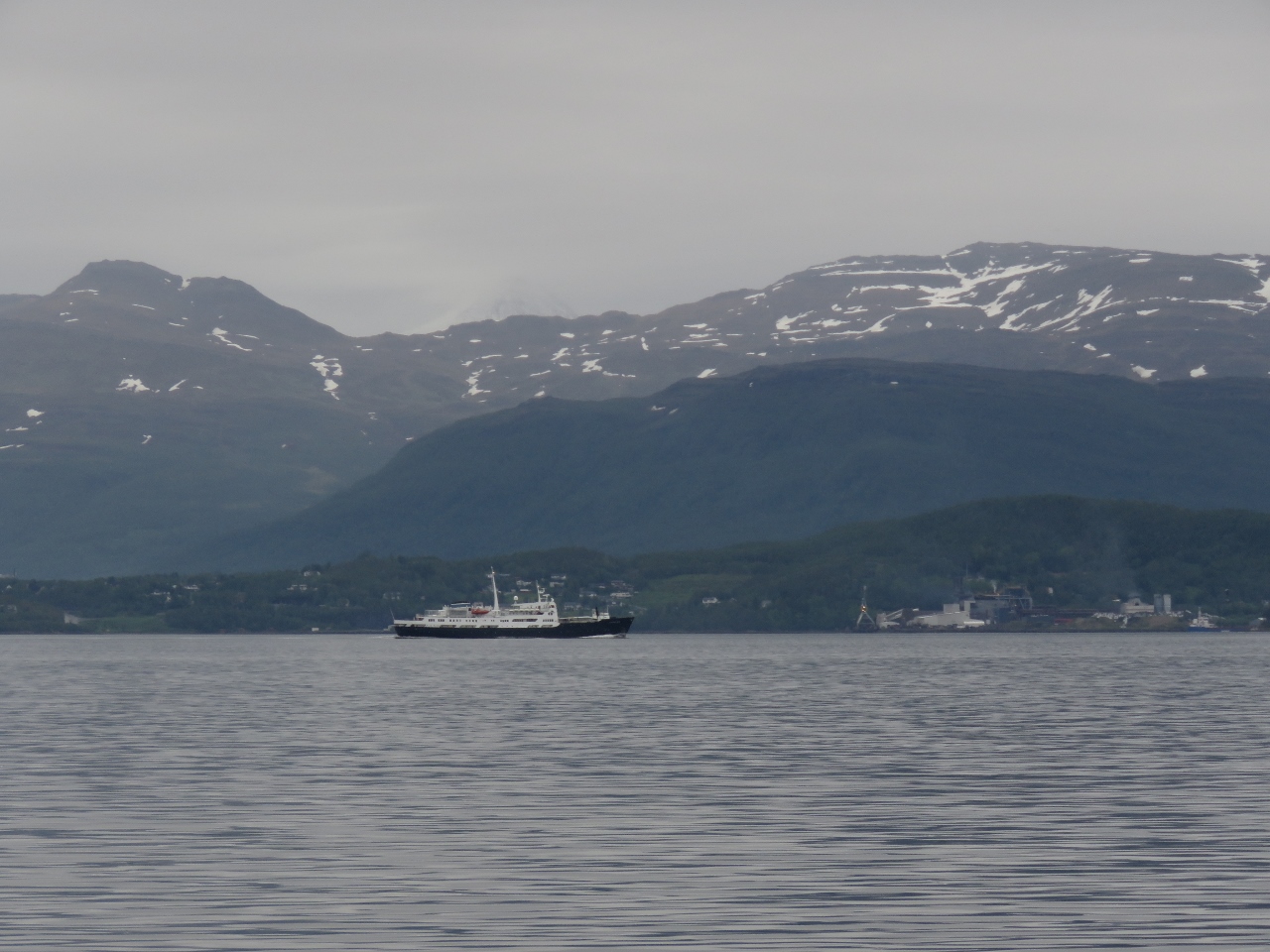
6/25/2018: Finnmarken
Position: 68°56.39'N, 17°5.88'E
The Hurtigruten Finnmarken running north for a 11:00am arrival into Finnsnes.
|
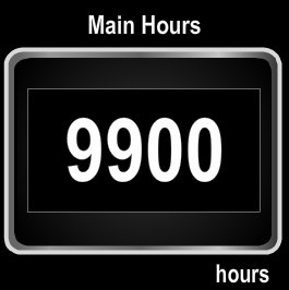 |
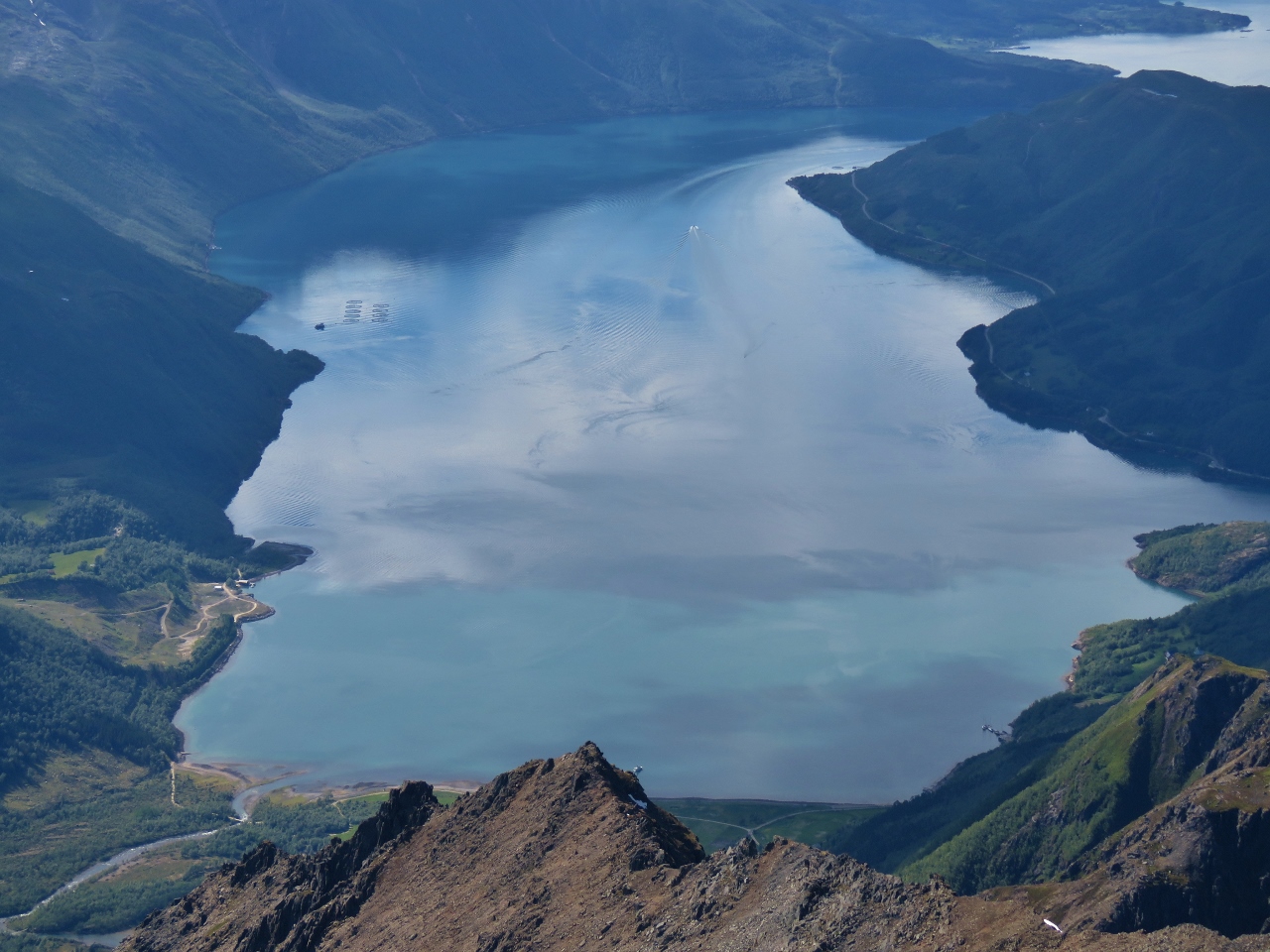
6/25/2018: 9,900 Hours
Position: 68°39.40'N, 16°37.75'E
We just reached 9,900 hours on our John Deere 6068AFM75. This engine has been impressively good and, in 7 years and over 9,900 hours, it's had almost nothing other than standard consumables/replacement items like oil filters. The Cam Position Sensor was replaced during warranty at under 1,000 hours (probably just a bad connection) and the injectors were changed at 9,522 hours. This 266 HP Deere 6068 has simply been amazing and continues to operate with absolute no evidence of any wear as we near 10,000 hours.
|
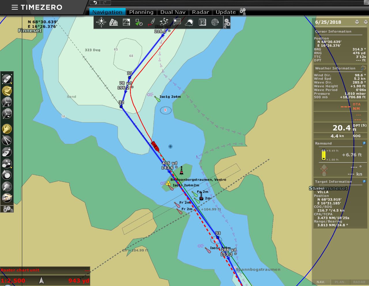 |
6/25/2018: Charts
Position: 68°30.35'N, 16°27.08'E
Rocks don't usually move, but we've found several places in Norway where islands or rocks are have been moved. Our older charts show a drying section just north of the bridge across the channel Ramsund, but the newer charts show depths of at least three meters through this area where a deeper channel has been blasted out.
|
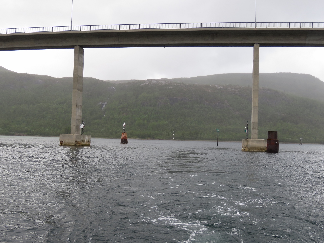 |
6/25/2018: Ramsund
Position: 68°30.35'N, 16°27.08'E
Looking back to the multiple markers guiding us past shallows and under the bridge across Ramsund.
|
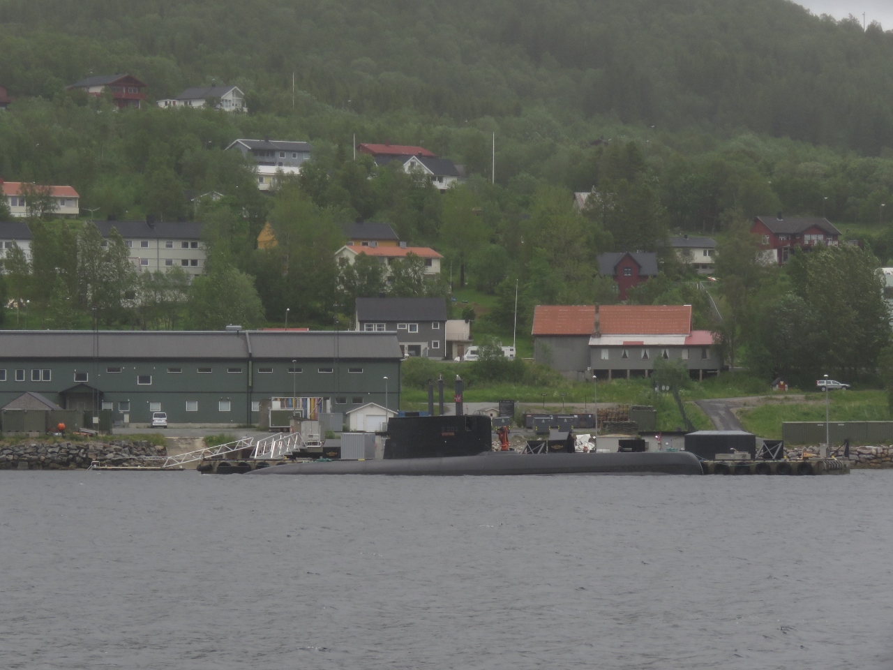 |
6/25/2018: Ramsund Naval Base
Position: 68°29.23'N, 16°30.45'E
Submarine moored at Ramsund Naval Base to our east. Pleasure craft can now pass through the formerly off-limits military zone in the channel Ramsund, but are not allowed to stop anywhere in the restricted area.
|
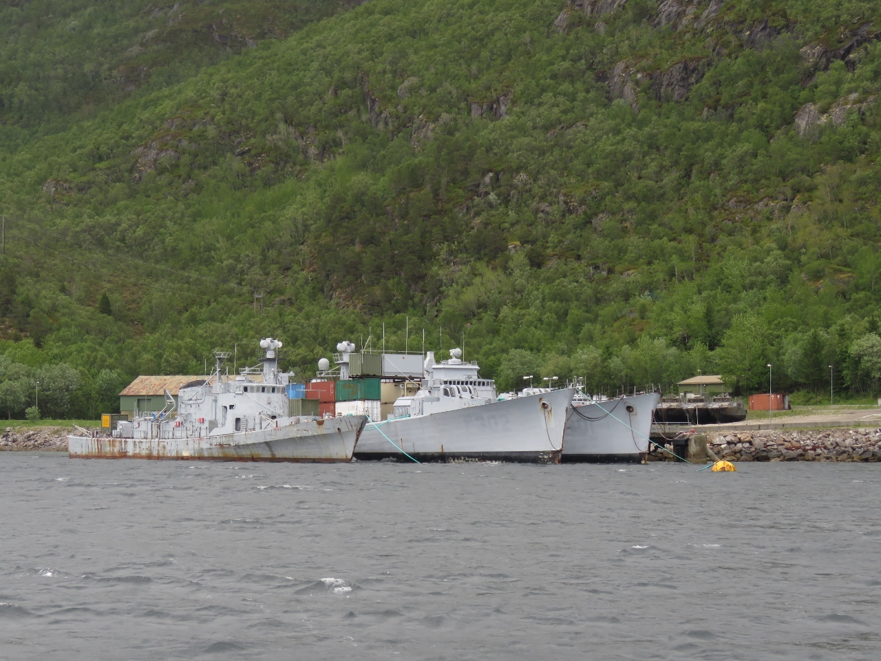 |
6/25/2018: Marinejegerkommandoen
Position: 68°27.94'N, 16°31.17'E
The Norwegian Maritime/Special warfare unit, Marinejegerkommandoen, is based at Ramsund Naval Base. Several high-speed landing-craft painted with camouflage are ashore to the right of the ships.
|
 |
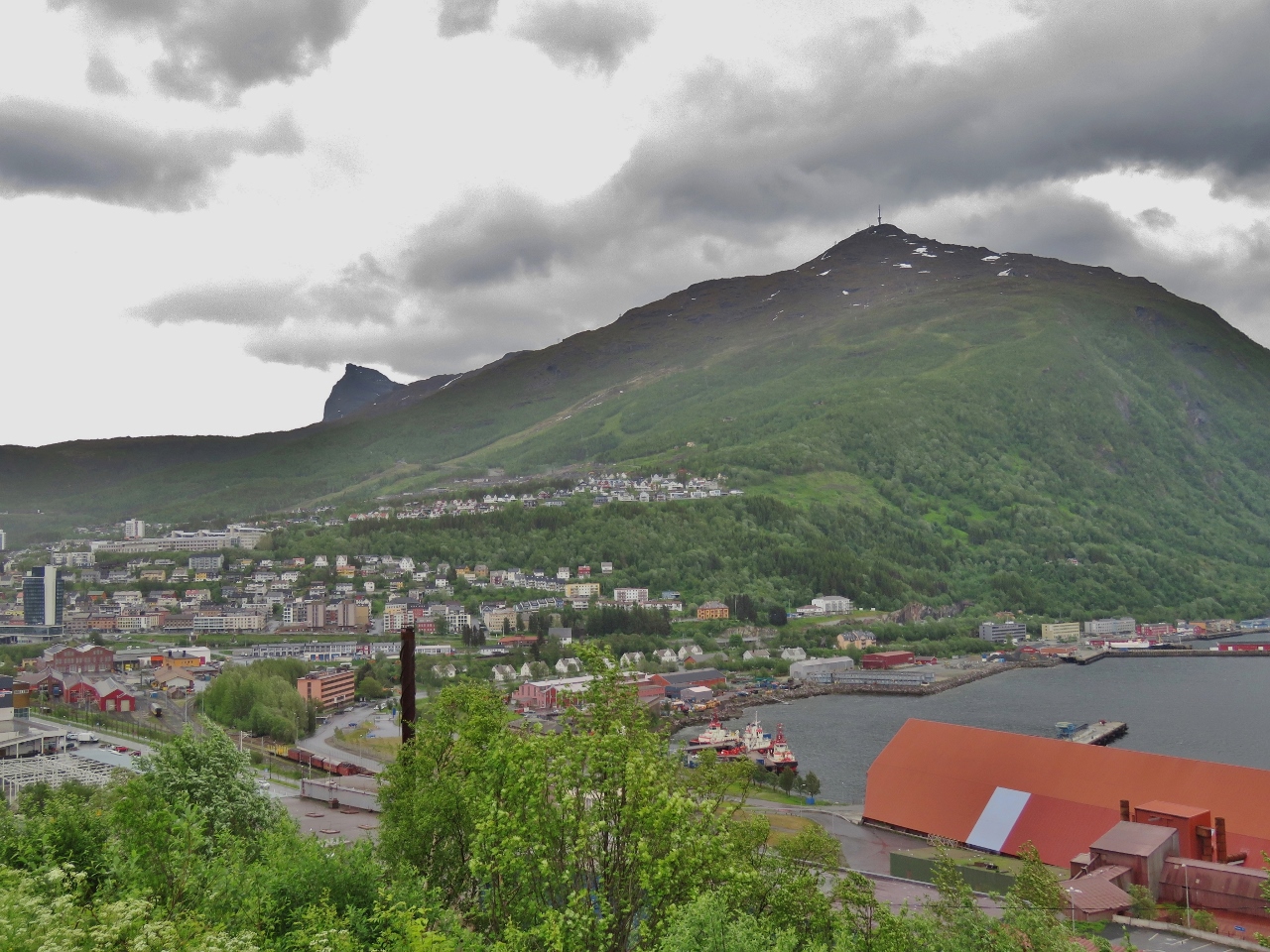
6/25/2018: Narvik
Position: 68°25.55'N, 17°23.53'E
The view as we arrive in Narvik to the city's reason for being: the LKAB iron ore shipping terminal. Narvik is ice-free year-round due to the warm waters of the Gulf Stream that run along the west coast of Norway all the way to Svalbard. This makes it an ideal port to ship the iron ore that LKAB mines in Sweden. The scenic Ofotbanen railway that transports the ore from Sweden to Narvik is one of the reasons we're here.
|
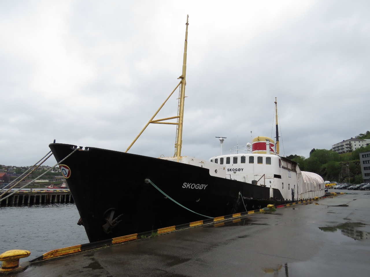 |
6/26/2018: Skogøy
Position: 68°25.72'N, 17°25.47'E
MS Skogøy was launched in 1953 and ran coastal routes for the Ofotens Steamship Company, based in Narvik. The ship was sold out of the country to Sweden in 1983 and eventually foundered in 2009. A group of local enthusiasts purchased the ship and brought it back to Norway in 2012, where it is being restored.
|
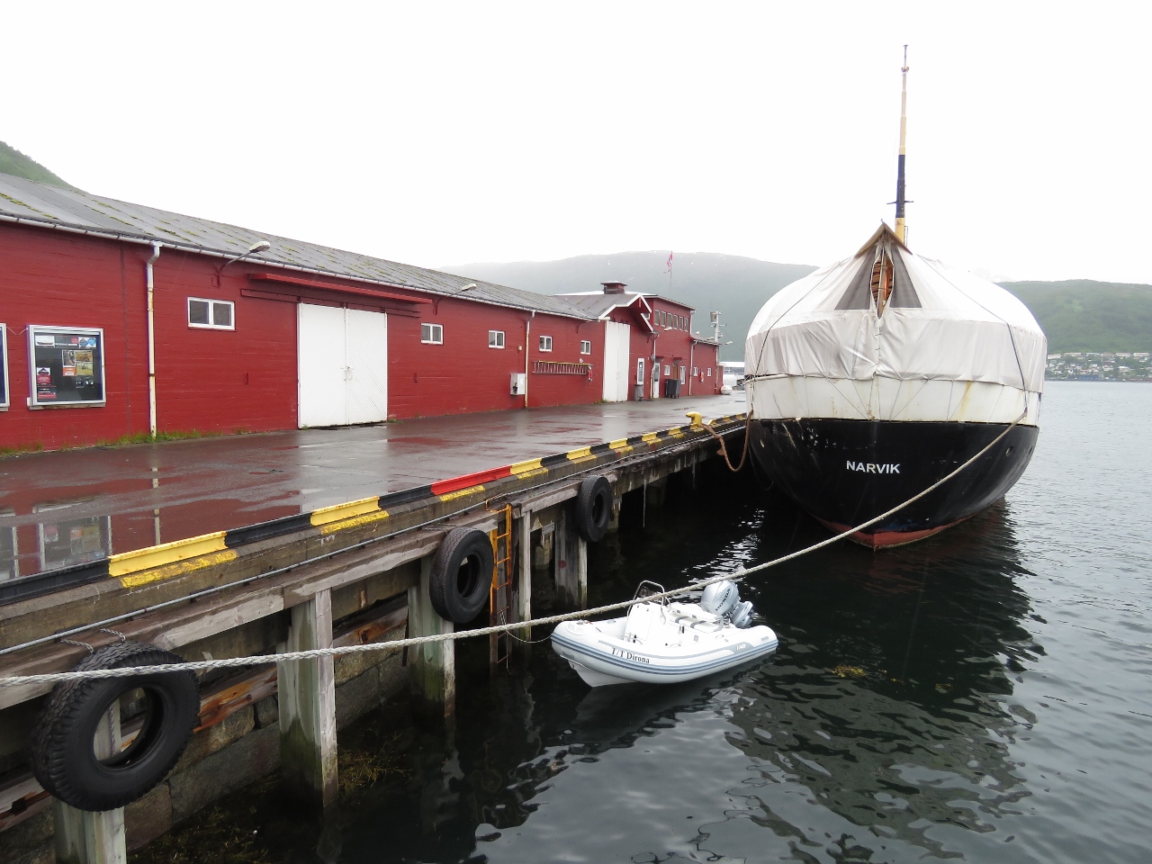 |
6/26/2018: Tender
Position: 68°25.76'N, 17°25.47'E
The tender tied off behind Skogøy in the Narvik commercial docks.
|
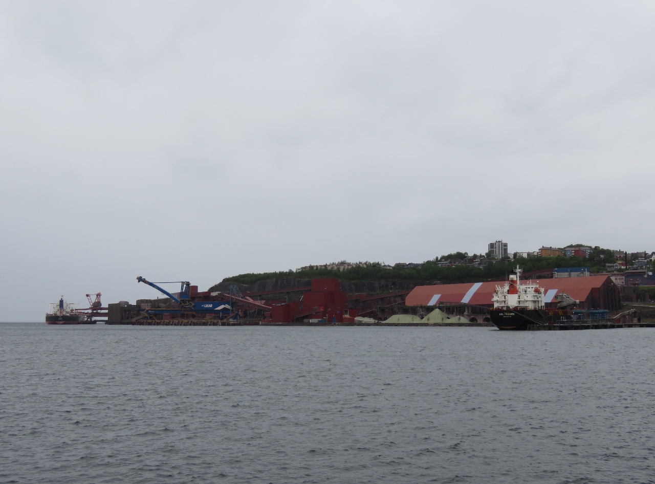 |
6/26/2018: LKAB
Position: 68°25.74'N, 17°25.38'E
A view from shore to the massive LKAB iron ore shipping terminal—it dominates the town.
|
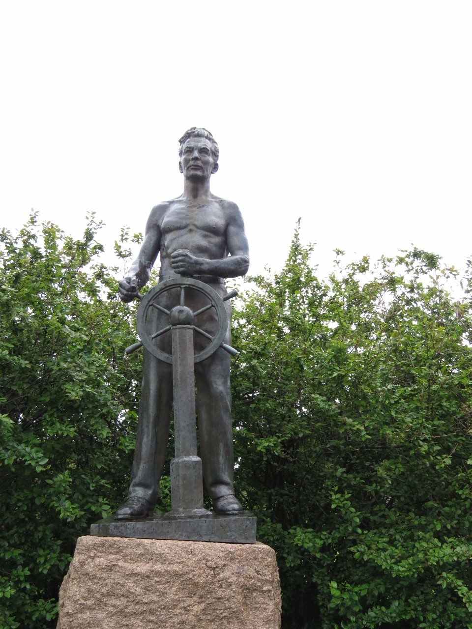 |
6/26/2018: Statue
Position: 68°25.79'N, 17°25.46'E
Narvik is full of sculptures, many related to World War II. This unnamed one might be in memory of merchant mariners who lost their lives.
|
 |
6/26/2018: Shelters
Position: 68°25.87'N, 17°25.39'E
World War II air raid shelters built into the rocks near the port of Narvik.
|
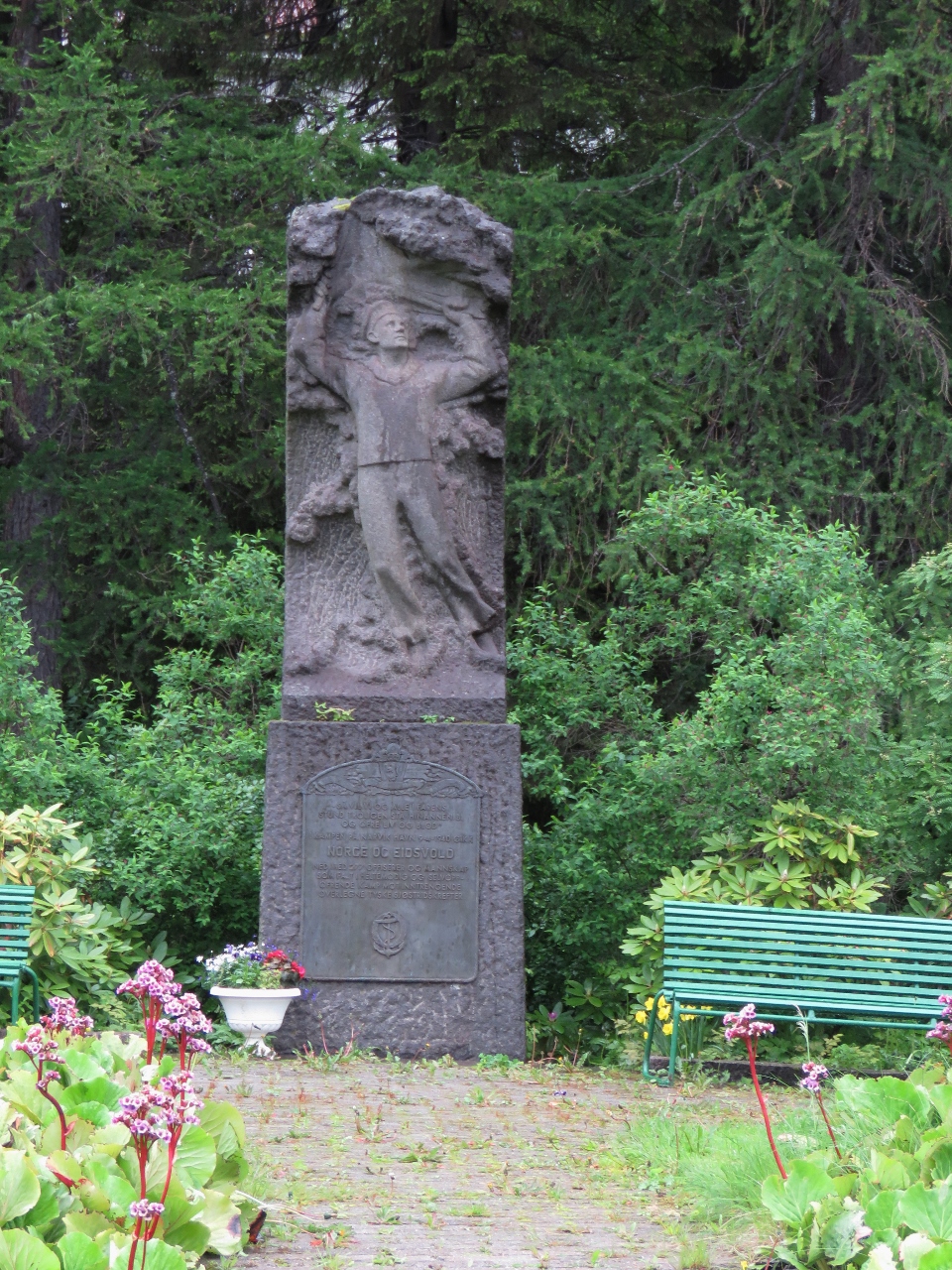 |
6/26/2018: Memorial
Position: 68°25.99'N, 17°25.47'E
A memorial to those lost in HNoMS Norge and HNoMS Eidsvold which were sunk Apr. 9, 1940 in Narvik Harbor during the German invasion. (HNoMS means "His/Her Norwegian Majesty's Ship").
|
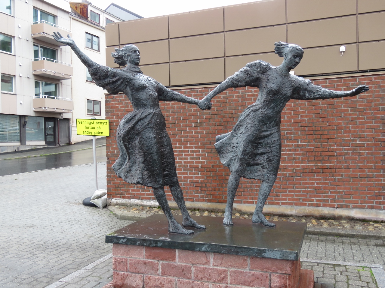 |
6/26/2018: Windy
Position: 68°26.11'N, 17°25.55'E
Another unnamed statue in downtown Narvik depicting two women leaning into the wind. It apparently can get pretty blustery here.
|
 |
6/26/2018: Life out of Chaos
Position: 68°26.30'N, 17°25.71'E
The peace sculpture Life out of Chaos in downtown Narvik was created by Narvik's sculptor Gunnar Olaf Finn Eriksen and unveiled in 1956.
|
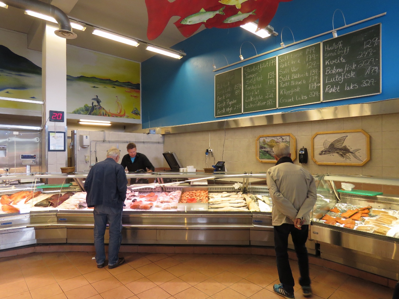 |
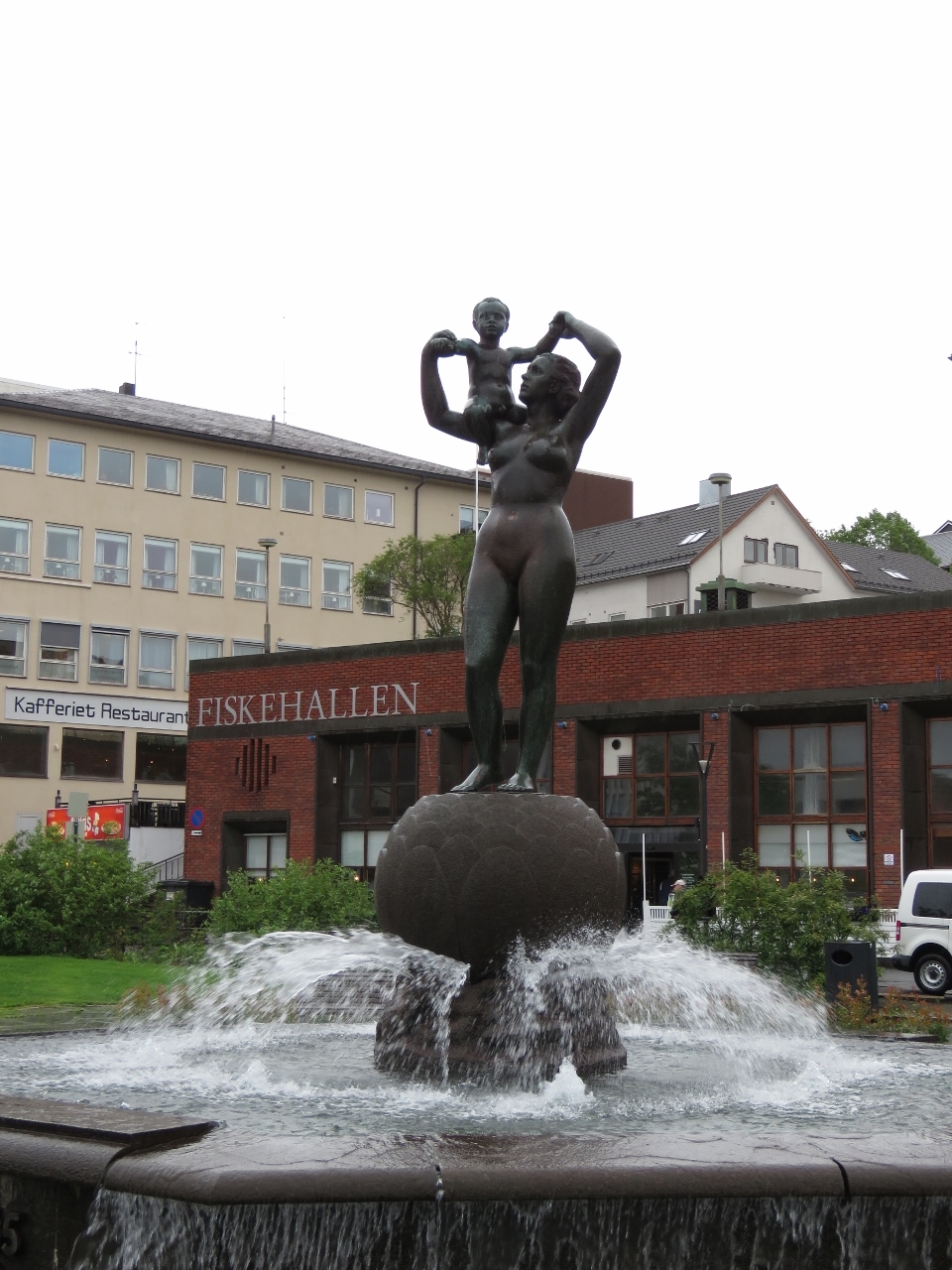
6/26/2018: Fiskehallen
Position: 68°26.30'N, 17°25.71'E
We had an good, and very fresh, seafood meal at Fiskehallen, a cafe attached to a fish market.
|
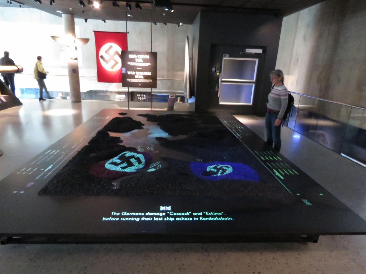 |
6/26/2018: Battles of Narvik
Position: 68°26.27'N, 17°25.53'E
In World War II, Germany and the Allies fought fierce battles for control of the ice-free harbour at Narvik with it's access to the valuable iron ore from Sweden. The Battles of Narvik were fought between April 9-June 8, 1940. 34 ships were sunk and hundreds of lives lost. Narvik's modern new War Museum opened in 2016 and has excellent displays detailing the World War II Battles of Narvik, the impact of the war on the area and war in general.
|
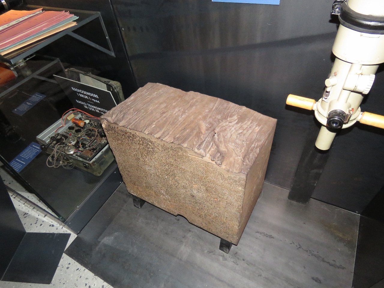 |
6/26/2018: Tirpitz
Position: 68°26.27'N, 17°25.53'E
Section of the armoured plate from the German warship Tirpitz. The massive and modern warship, covered with near-impenetrable armoured plates and huge cannons, was one of the most feared on the Arctic Front. The Allies eventually sunk the Tirpitz not far from where we anchored the night before arriving into Tromsø.
|
 |
6/26/2018: Ore Carts
Position: 68°26.35'N, 17°25.37'E
Empty ore carts heading out on the Ofotbanen Railway toward Sweden from the LKAB terminal.
|
 |
6/26/2018: Dirona
Position: 68°25.98'N, 17°23.43'E
Dirona at anchor along the east shore of Narvikbukta, viewed from above the LKAB terminal. The local marina is too shallow for us, so we anchored in the large harbor instead. Swell from Ofotfjorden does reach the anchorage, but it worked well for our visit to Narvik.
|
 |
6/26/2018: Narvik
Position: 68°26.09'N, 17°23.92'E
The view northeast across Narvik. Our tender, not visible, is moored behind the Skogøy at the right of the picture. Our anchorage is farther to the right, outside the shot.
|
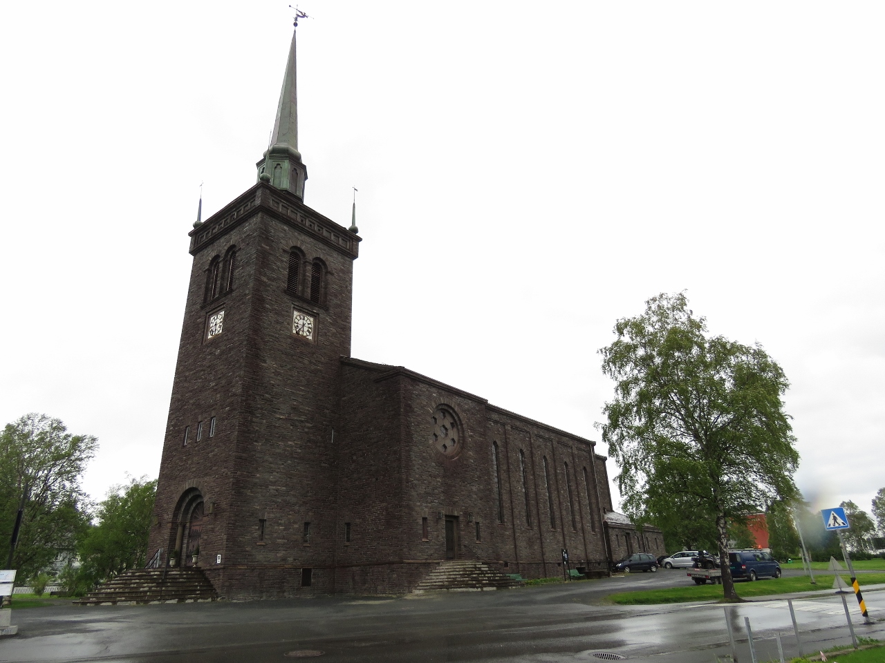 |
6/26/2018: Narvik Kirke
Position: 68°26.34'N, 17°24.84'E
Narvik Kirke, built in 1925, fortunately managed to survive the World War II battles.
|
 |
6/26/2018: Iron Ore
Position: 68°26.34'N, 17°25.41'E
Iron ore arriving from LKAB's mine in Kiruna, Sweden.
|
 |
6/26/2018: Mall
Position: 68°26.30'N, 17°25.40'E
A pass through Narvik's downtown mall.
|
 |
6/26/2018: Stranded
Position: 68°25.71'N, 17°25.47'E
We returned to the harbour to find our tender stranded on a shelf that wasn't visible below the water when we landed with at least three hours before the tide would float it again. What to do?
|
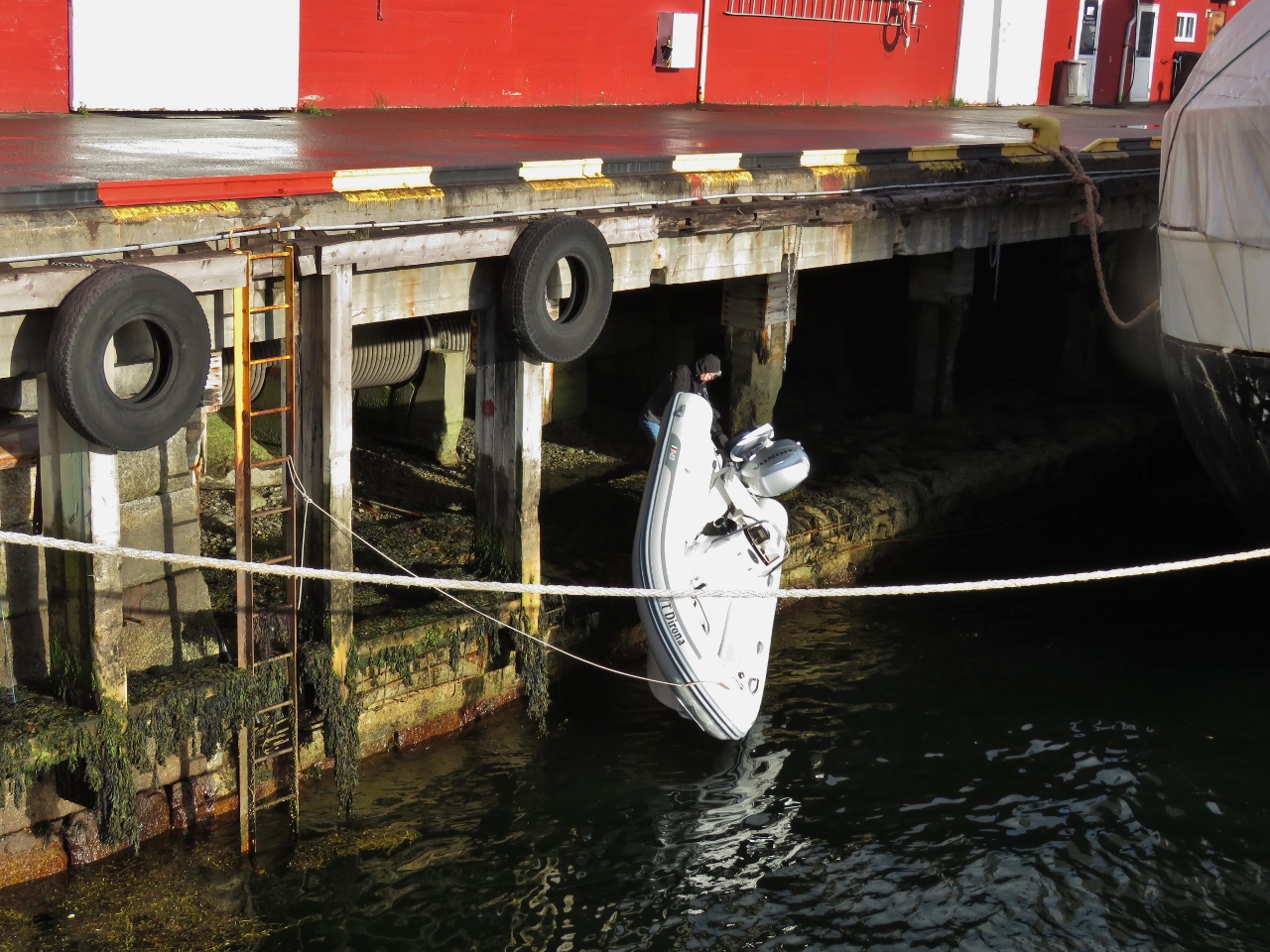 |
6/26/2018: Relaunch
Position: 68°25.71'N, 17°25.47'E
James managed to slide the 700-pound (370 kg) tender over to the edge and push it in to get us floating again. A short video showing the process is at https://www.youtube.com/watch?v=YPinTB5XBFM. At the end, James is indicating that the splash of landing has almost filled the tender.
|
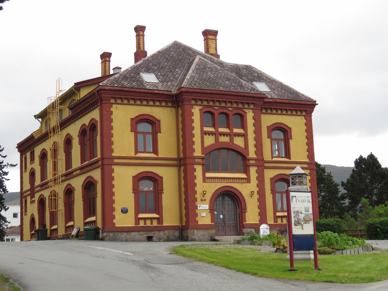 |
6/27/2018: Museum Nord
Position: 68°25.91'N, 17°25.50'E
The Museum Nord is Narvik's second museum, and focuses on the town's history. We were particularly interested in the development of the LKAB iron ore shipping terminal and the railway to Sweden, as we'd be riding it later that day.
|
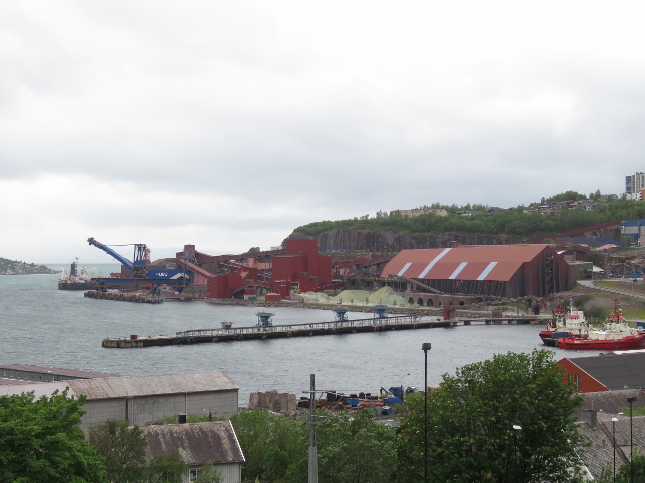 |
6/27/2018: LKAB
Position: 68°25.91'N, 17°25.49'E
A great view to the huge LKAB iron ore pellet shipping terminal from the Museum Nord.
|
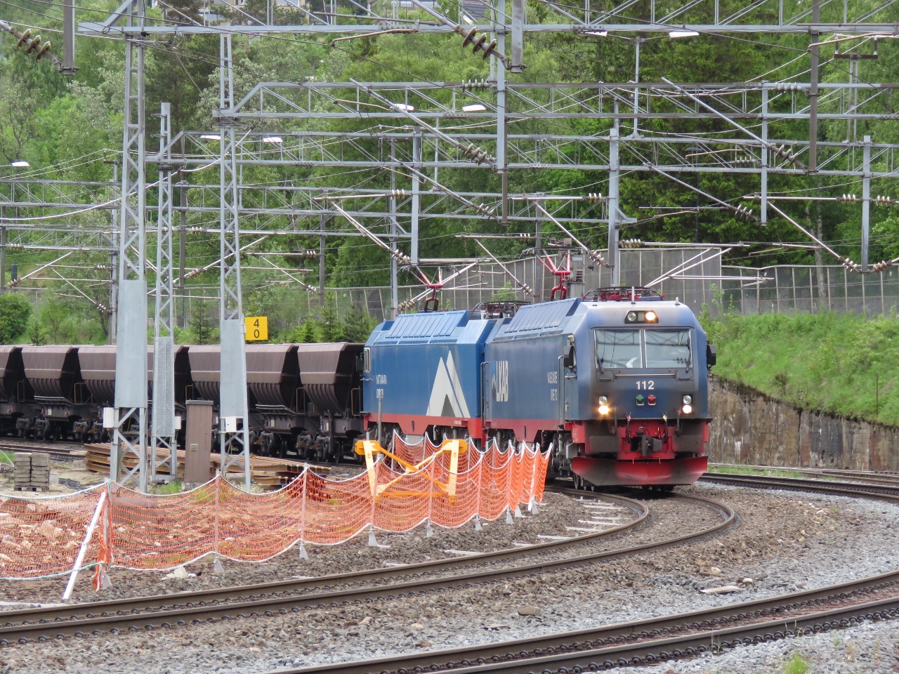 |
6/27/2018: Ore Train
Position: 68°26.49'N, 17°26.70'E
An LKAB iron ore train from Kiruna, Sweden passing through Narvik station as we are waiting for our own train to Kiruna. We'll be taking the same route to Kiruna: the Ofoten Line to the Swedish border, then along the Iron Ore Line through Sweden. Roughly a dozen trains run daily in each direction from Kiruna. Each train has 68 cars, is 2,460 ft (750m) long and weighs 8,600 tonnes.
|
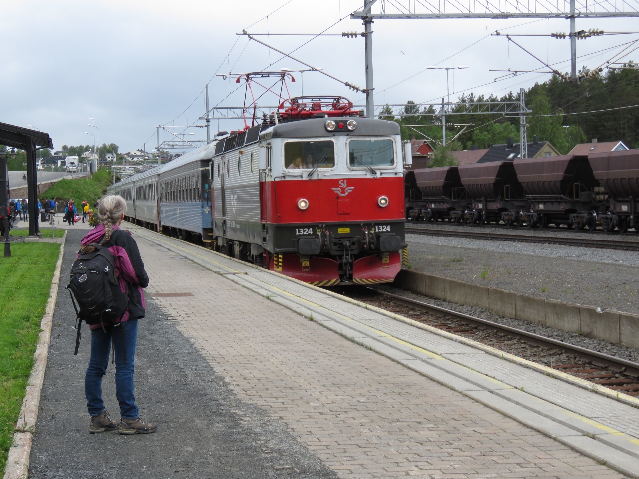 |
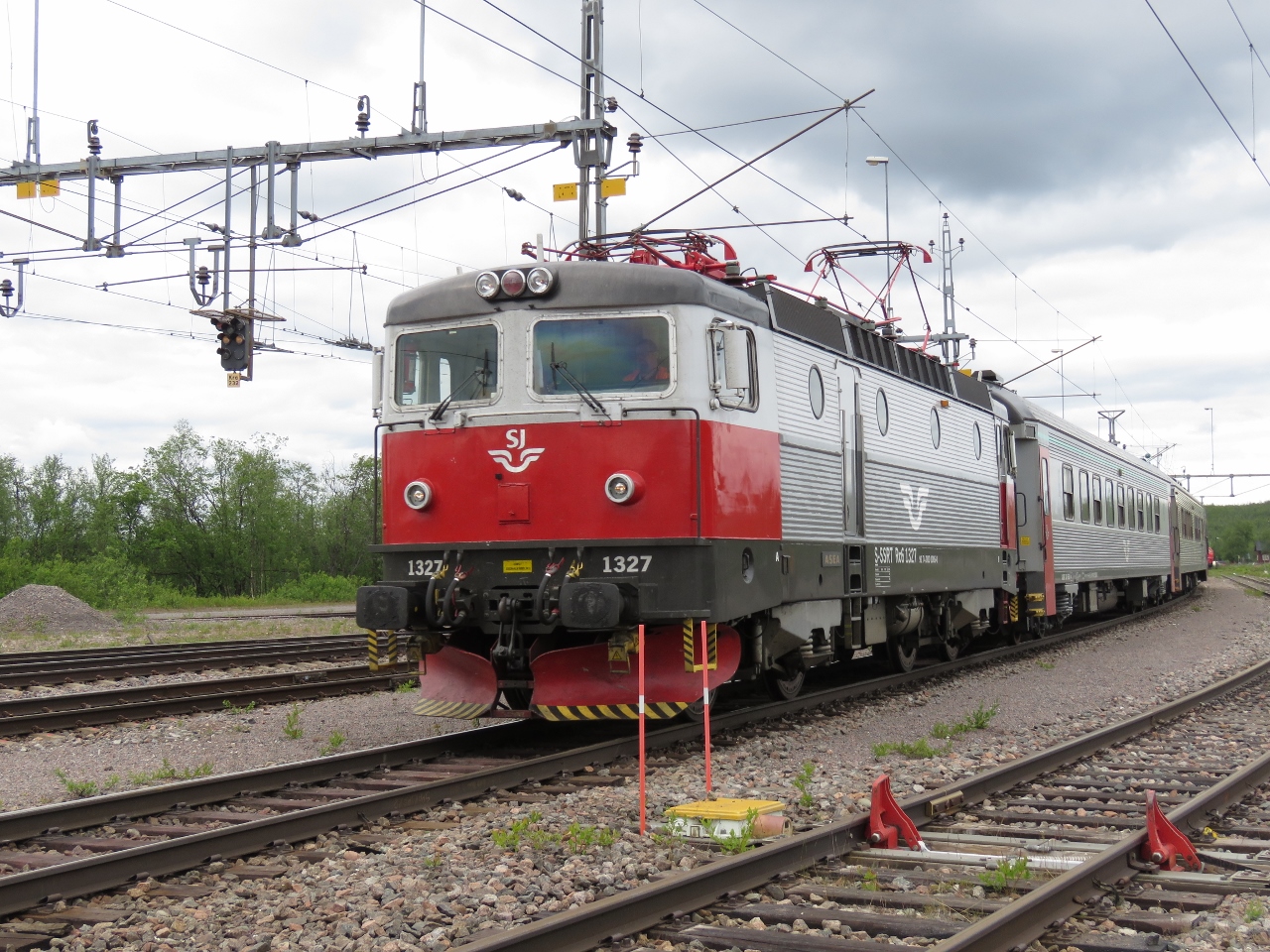
6/27/2018: SJ
Position: 68°26.50'N, 17°26.55'E
Our Swedish State Railways (SJ) train arriving into Narvik.
|
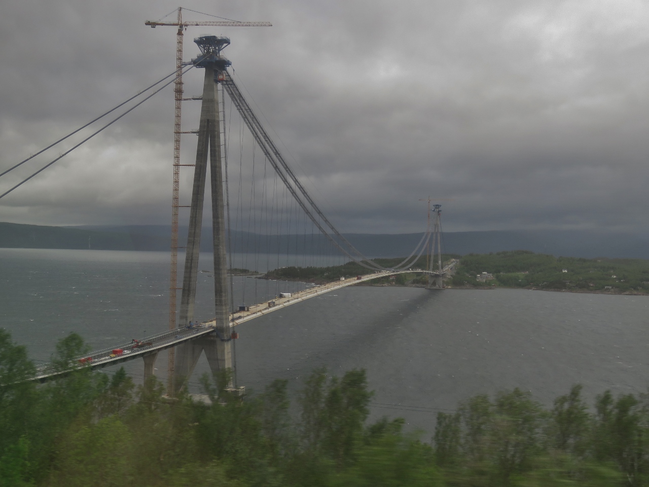 |
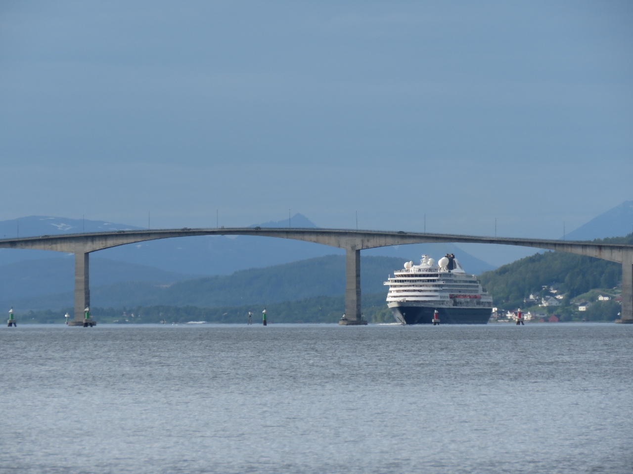
6/27/2018: Hålogaland Bridge
Position: 68°26.94'N, 17°31.12'E
A view to the new Hålogaland Bridge suspension bridge being built over Ofotfjorden that will be the second longest bridge in the country.
|
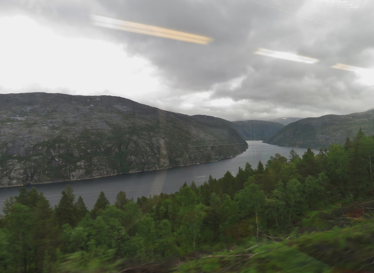 |
6/27/2018: Ofoten Line
Position: 68°24.46'N, 17°46.49'E
The Ofoten Line climbs above the sea and through the mountains to reach the Swedish border and is one of the most scenic in the country. This is the view down Rombaksfjorden from 900ft up.
|
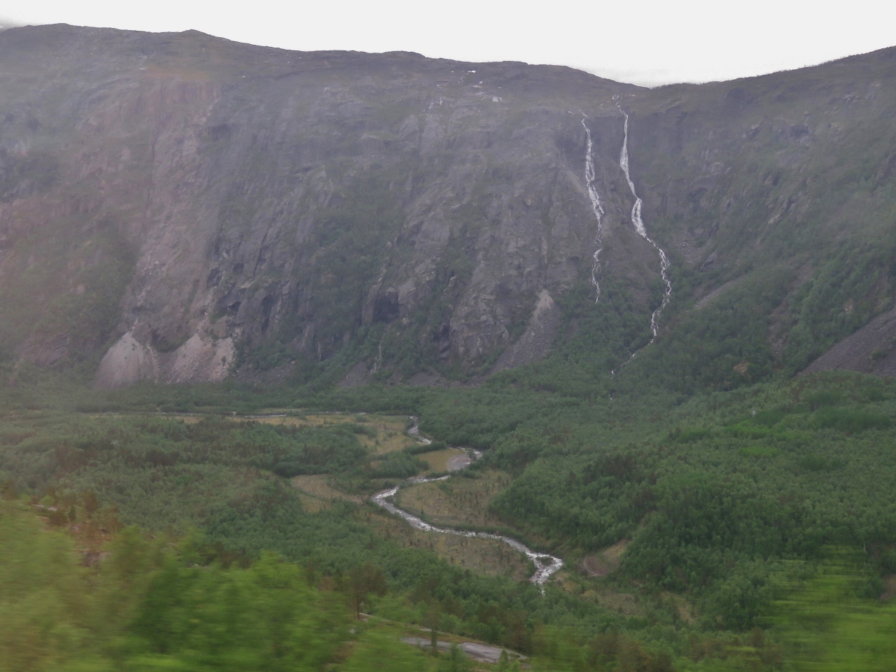 |
6/27/2018: Waterfalls
Position: 68°23.94'N, 17°56.37'E
Waterfalls and river at the head of Rombaksfjorden.
|
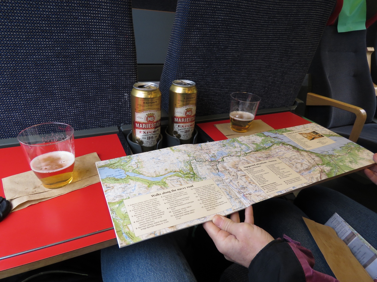 |
6/27/2018: En Route
Position: 68°26.62'N, 18°3.17'E
We picked up a guidebook on the Ofoten Line at the Museum Nord and are following along as we travel. We're about to cross into Sweden and onto the Iron Ore Line, which runs 247 miles (398 km) from the border with Norway to Boden in Sweden.
|
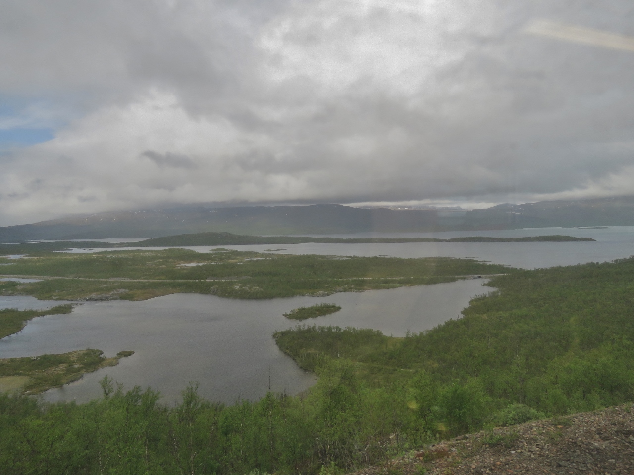 |
6/27/2018: Sweden
Position: 68°25.76'N, 18°38.71'E
At 1,500ft up, we're passing through a major lake district in Sweden. Since Norway and Sweden are both part of the Schengen area, there are no passport checks on crossing the border. We just passed directly through from one country to the next without a visible border.
|
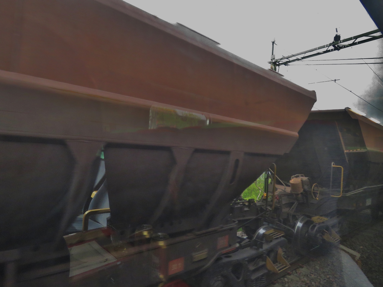 |
6/27/2018: Ore Carts
Position: 68°17.10'N, 19°18.32'E
Passing an ore train heading the other way to Narvik.
|
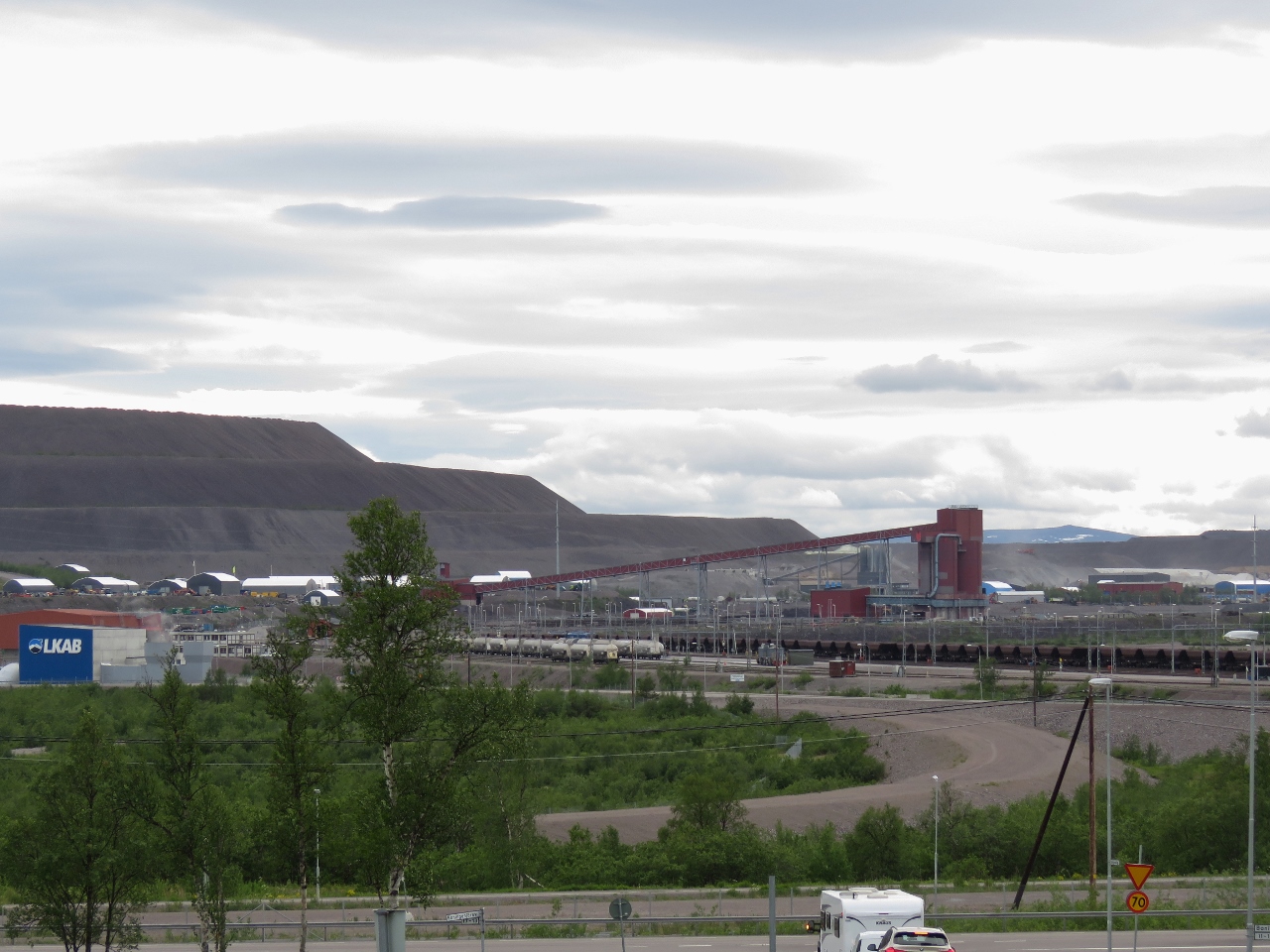 |
6/27/2018: LKAB Kiruna
Position: 67°51.49'N, 20°12.96'E
About three hours after departing Narvik, we're in Kiruna, Sweden where LKAB operates the world's largest underground iron ore mine. This is the view southwest from the edge of town to the mine property.
Kiruna, with a population of about 17,000, made the headlines in 2004 when it was announced the town center would need to move 3 km east due to the town slowly settling into the underground mine. |
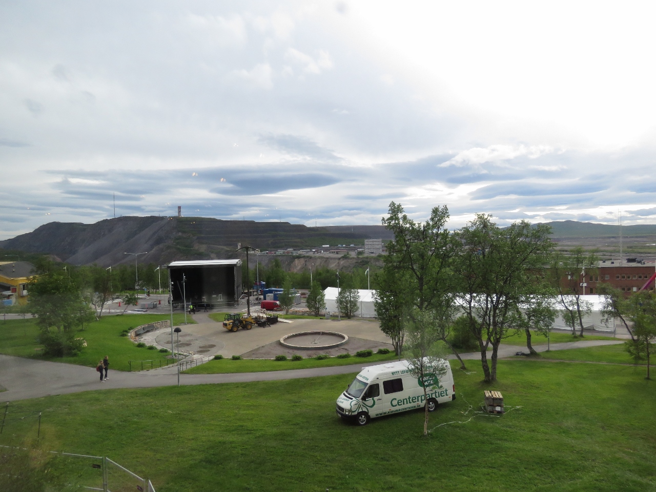 |
6/27/2018: Kirunafestivalen
Position: 67°51.39'N, 20°13.48'E
We'd arrive the day before the start of Kirunafestivalen and crews were busy setting up the stages for the event. The omnipresent LKAB mine is visible in the background.
|
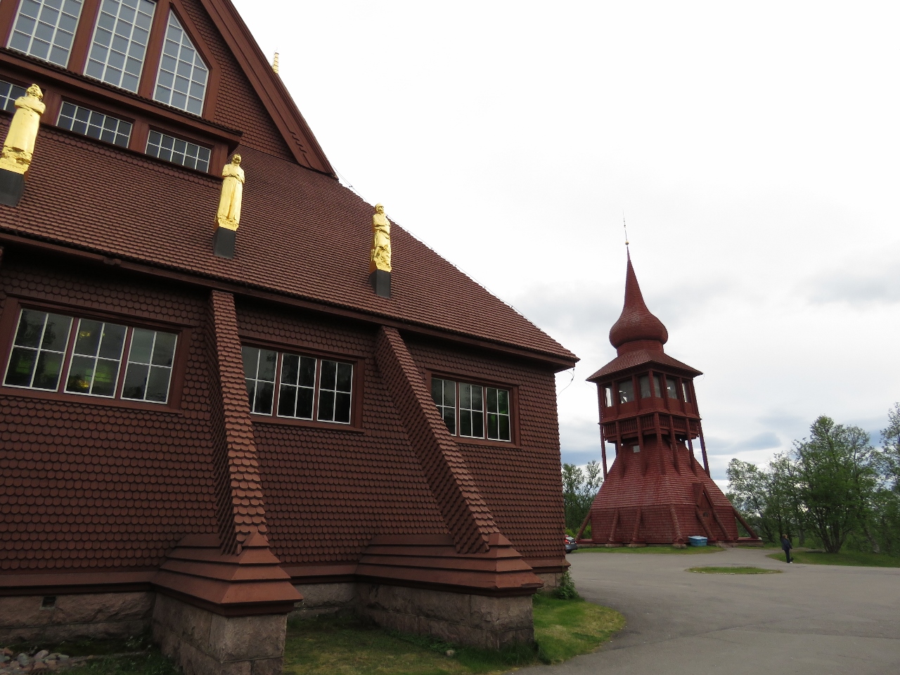 |
6/27/2018: Kiruna Church
Position: 67°51.15'N, 20°13.87'E
The Kiruna Church, built in 1909-1912, will be relocated to the new town site.
|
 |
6/27/2018: SPiS
Position: 67°51.24'N, 20°13.84'E
We had an exceptional steak dinner at SPiS in Kiruna.
|
 |
6/27/2018: Solsidan Lounge
Position: 67°51.38'N, 20°13.45'E
An after-dinner drink at the Solsidan Lounge in our hotel, Scandic Ferrum, with view to the LKAB Kiruna mine in the distance. We've got a tour booked for tomorrow and are really looking forward to it.
|
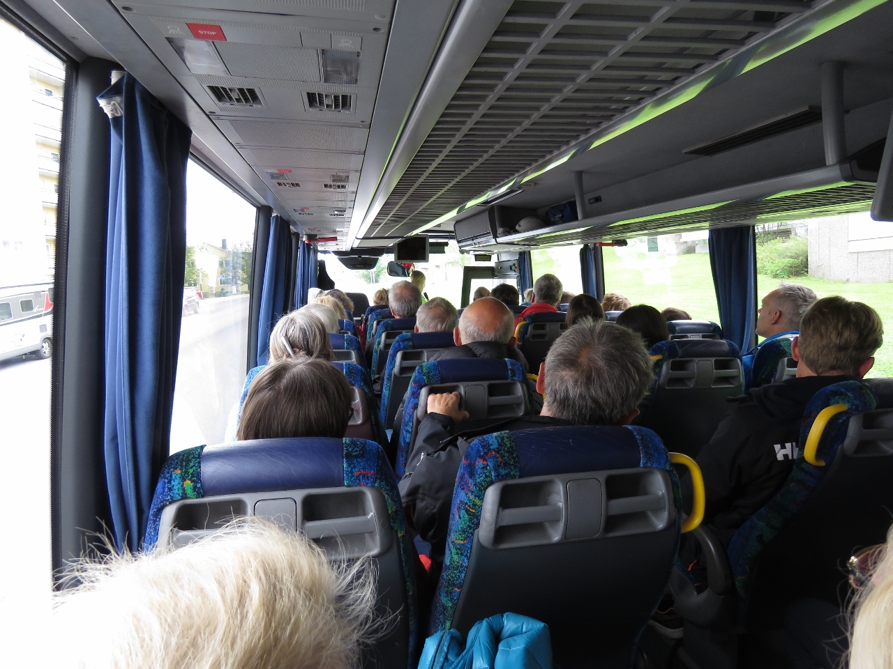 |
6/28/2018: Bus
Position: 67°51.45'N, 20°13.35'E
On the bus in Kiruna, just starting our drive from the visitor center to the a third of a mile below the surface of the earth. We’re heading to the LKAB Kiruna iron ore mine visitor center, built deep into the operating mine.
|
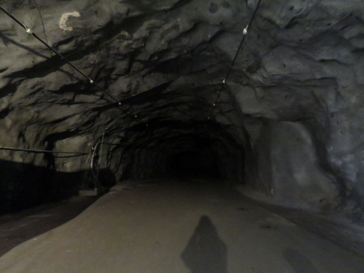 |
6/28/2018: Tunnel
Position: 67°50.82'N, 20°12.04'E
The LKAB mine visitor center is part of the live mine. At some time in the past, this is where the work was being done but the mining has been completed at this level and the real work is 3,428 ft (1,045 m) below the original mine surface. Just the bus ride alone, down the busy road down into the mine was exciting and kind of an interesting adventure in and off itself.
|
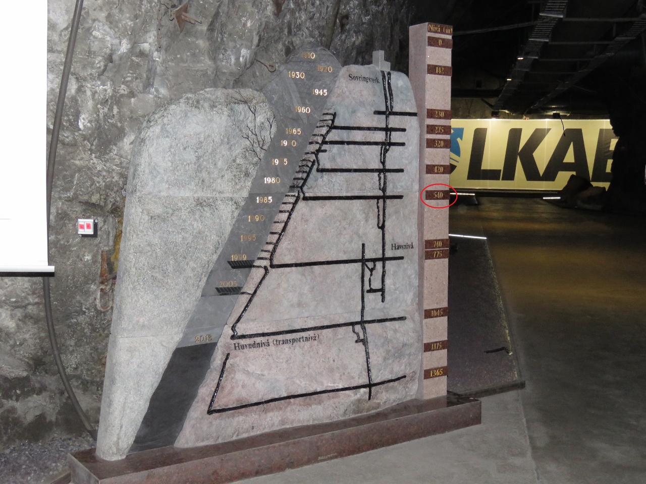 |
6/28/2018: 540m Down
Position: 67°50.81'N, 20°12.03'E
Here we are 540m (1,771ft) down into the Kiruna LKAB iron ore mine. This maps shows the entire mine and our location is circled in red (click image for a larger view).
The mine follows the rich iron ore seam on the left, heading deep down into the mountain. Even LKAB doesn’t know how far it goes. Most iron ore is mined in open pit mines, whereas this one is continuing deep below the surface. In fact, it’s the largest underground iron ore mine in the world. Clearly this is much more expensive than open-pit mining, so presumably the purity of the seam is what makes it economic. The annual production capacity of the mine is over 26 million tonnes of of ore and over more than 950 million tonnes have been removed from the site since 1898. All the ore is brought up through vertical elevator shafts, pictured on the right of map. The horizontal sections that head toward the iron ore seam are where the ore is transferred from the seam to the elevators. At night, explosives placed in holed holes drilled deep into the iron ore seam are triggered, breaking up the rock so that it can be removed the next day. |
 |
6/28/2018: Relocation
Position: 67°50.81'N, 20°12.03'E
The red line on this map shows the portions of the town that are at risk as the ground subsides due to mining operations and will need to be rebuilt or relocated to the new town center 3k east. The hotel we're staying at, Scandic Ferrum, and the Kiruna Church both are inside the line.
|
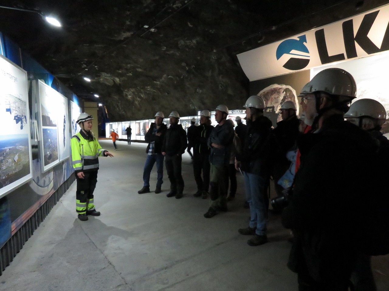 |
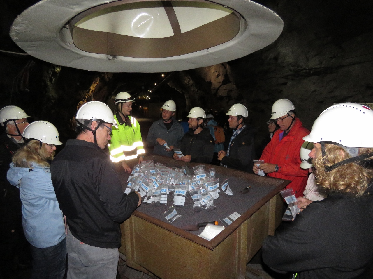
6/28/2018: Tour
Position: 67°50.81'N, 20°12.03'E
The LKAB tour guide explaining mine operations. Everyone is wearing a hard-hat because we’re in a live, fully-operational mine.
|
 |
6/28/2018: Elevator Shaft
Position: 67°50.81'N, 20°12.02'E
Now this is an elevator. All the iron ore that comes out of the LKAB Kiruna mine comes up through this elevator. That’s 11 trains a day of 68 cars each weighing 8,600 tonnes, all coming up through this shaft
|
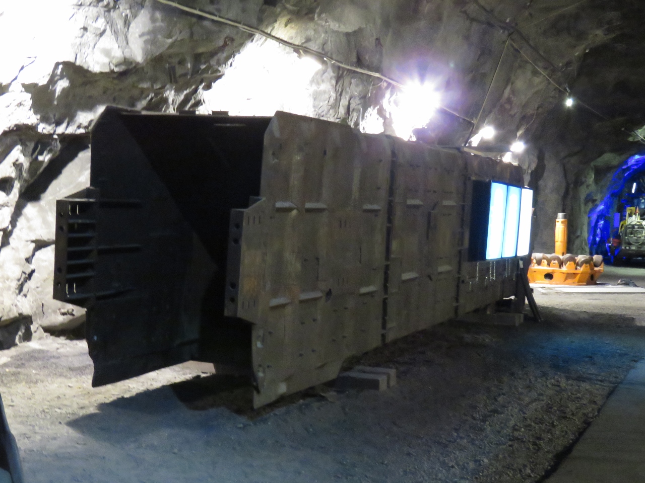 |
6/28/2018: Elevator
Position: 67°50.81'N, 20°12.00'E
This is an elevator car that is suspended in the elevator shaft in the previous picture. We watched a car pass in the elevator shaft, but the car speeds are so high that it’s impossible to figure out how big it is. This massive car lying on the ground will pass in just the blink of an eye when you’re watching the elevator shaft.
|
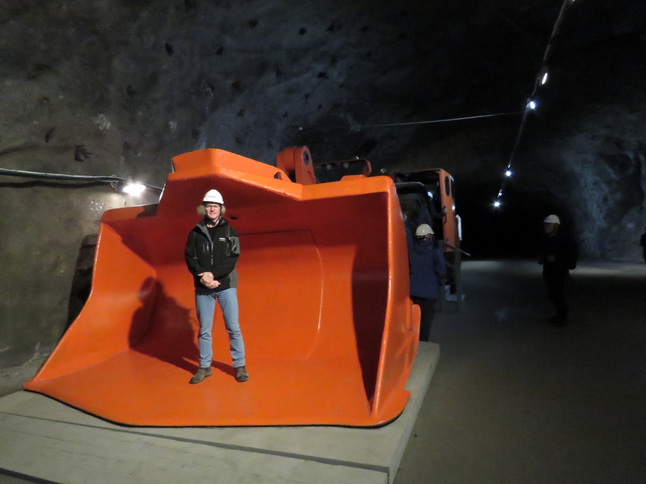 |
6/28/2018: Shovel
Position: 67°50.82'N, 20°12.04'E
The visitor center has most of the equipment used in the facility on display. Here James standing in the shovel that attacks the freshly-exploded rock and iron ore.
|
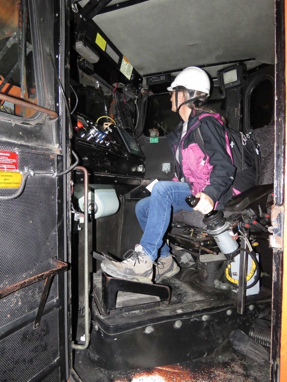 |
6/28/2018: Controls
Position: 67°50.82'N, 20°12.04'E
Jennifer at the controls of the shovel shown in the previous picture. All the equipment is gigantic, but unusual in that they have limited vertical clearance, so they’re large but low. After the blasting the previous night, once the fumes have gone down and its safe for people, these vehicles are sent in to transfer the ore to the elevators.
|
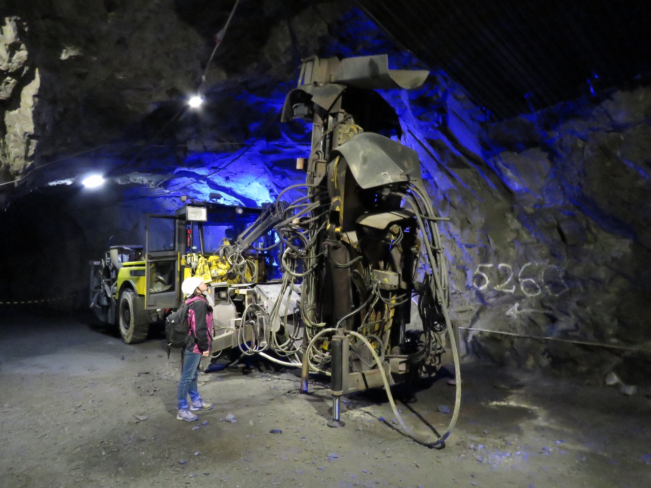 |
6/28/2018: Drill
Position: 67°50.81'N, 20°11.97'E
Before the hydraulic shovel shown earlier can transfer the broken-up rock and ore to the elevators, it first must be blasted free. This is the drill that will punch the holes that will later be loaded with explosives and then detonated overnight. Then it will be picked up by the shovels and loaded in the elevators. The nocturnal blasts can be felt nightly in the town.
|
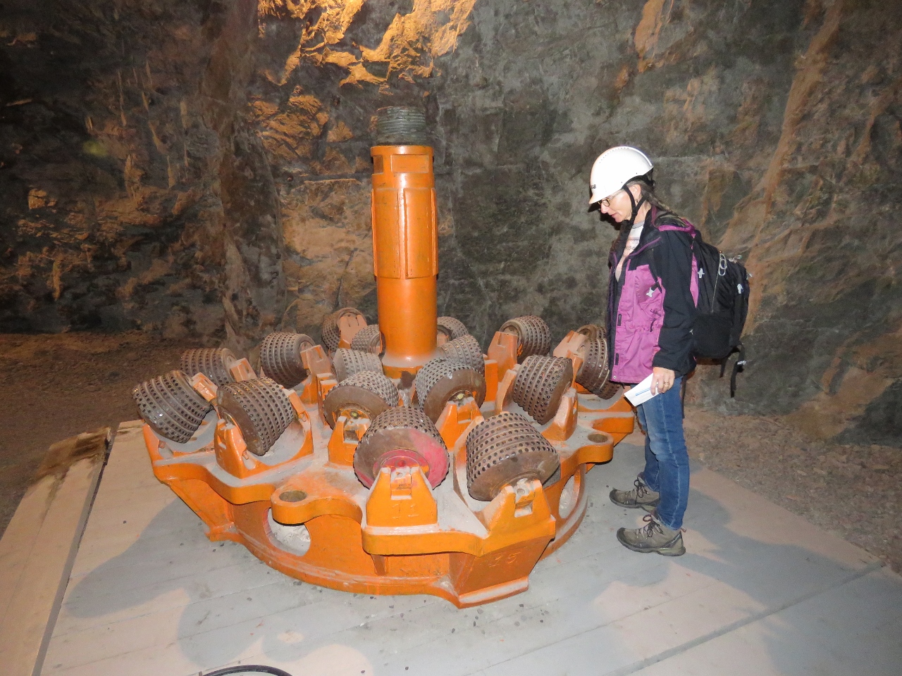 |
6/28/2018: Drill Bit
Position: 67°50.81'N, 20°11.97'E
More than 54 miles (87km) of tunnels run through in the LKAB Kiruna mine. This drill looks too small to be cutting any of the tunnels that we’ve seen or been in.
|
 |
6/28/2018: Souvenir
Position: 67°50.81'N, 20°11.98'E
A take-home souvenir of the LKAB mine’s final product: iron pellets. The Bell Equipment model mining truck on Dirona now carries a payload of real iron-ore pellets.
|
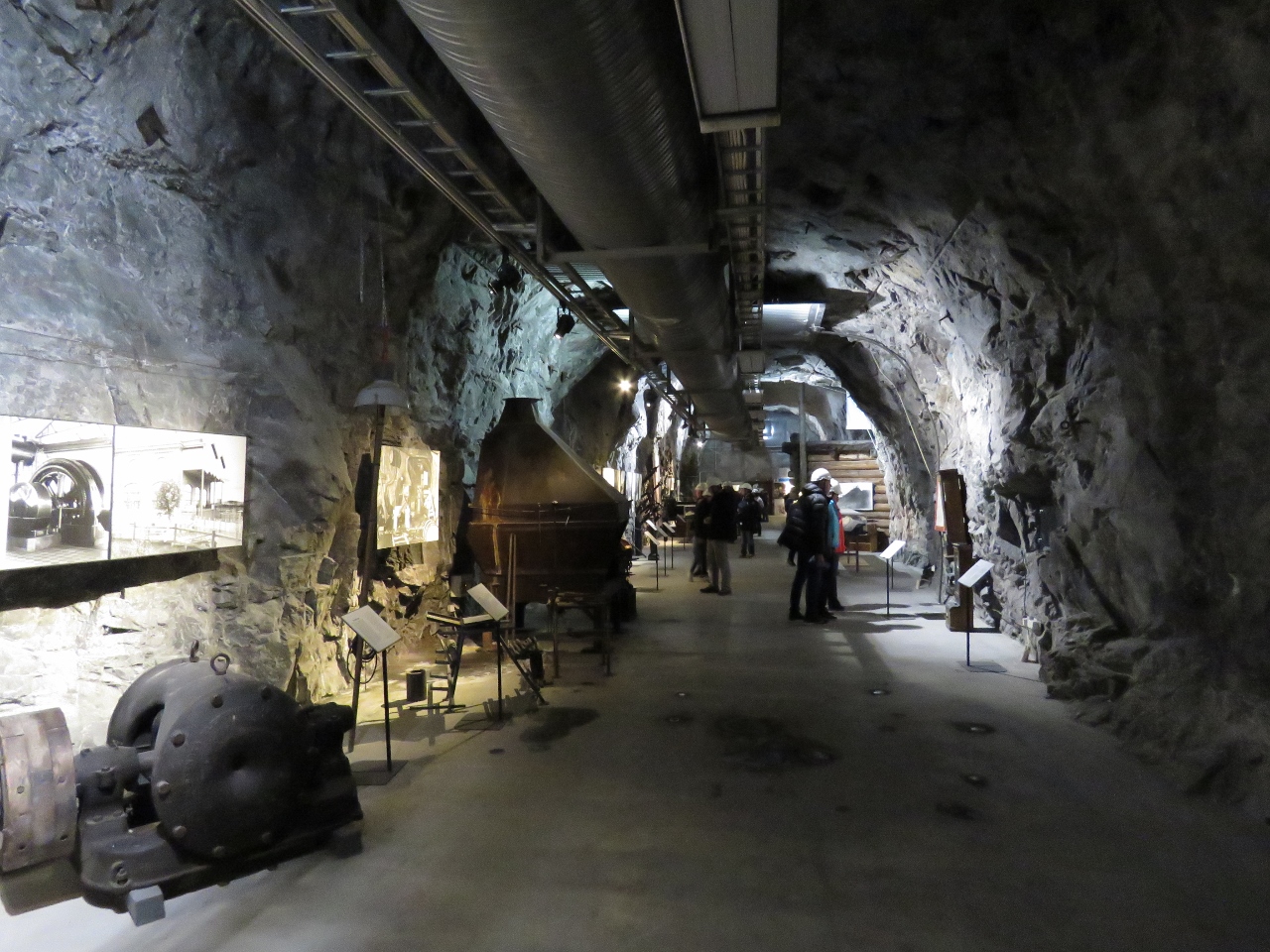 |
6/28/2018: Museum
Position: 67°50.81'N, 20°12.02'E
Our final stop on the tour was a visit to the LKAB museum, with a wide array of artifacts from the century of mining in Kiruna.
|
 |
6/28/2018: LKAB
Position: 67°50.81'N, 20°12.02'E
We had a fabulous time on the LKAB mine tour. The idea of putting the visitor center deep inside the mine was brilliant. Nothing explains the scale of the operation than being in a small part of it.
|
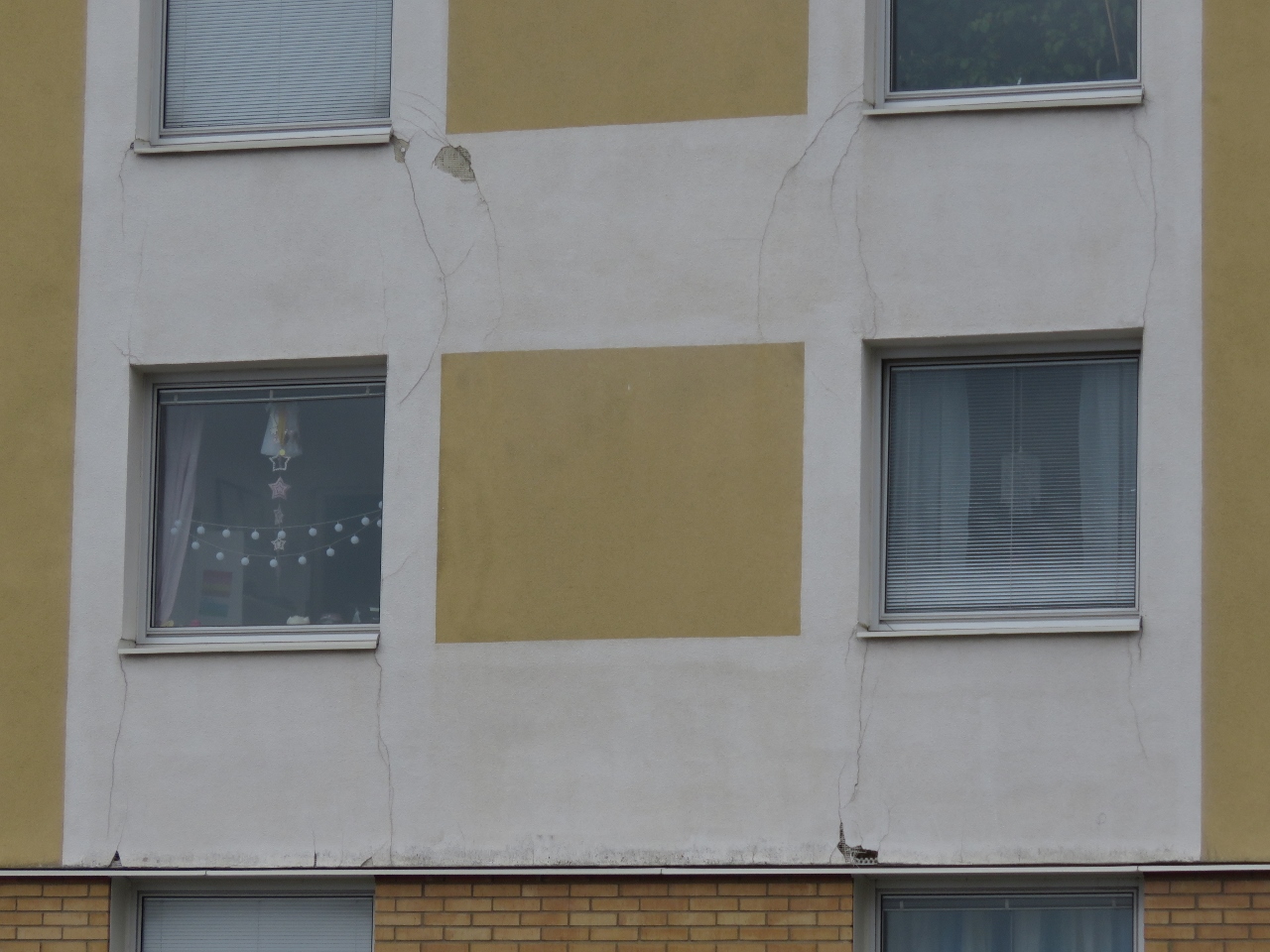 |
6/28/2018: Cracks
Position: 67°51.95'N, 20°12.85'E
After the mine tour, we walked back to the train station through the condemned part of town and saw many buildings with cracks in them due to the mine subsidence.
|
 |
6/28/2018: SJ
Position: 67°52.11'N, 20°11.95'E
Our Swedish State Railways (SJ) ride back to Narvik arriving into Kiruna station.
|
 |
6/28/2018: Norddalsbron
Position: 68°25.23'N, 17°59.97'E
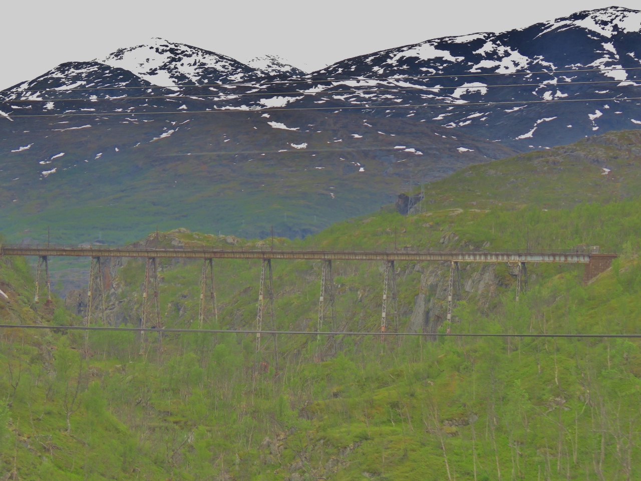
The bridge Norddalsbron was the only bridge on the Ofoten line and was replaced in 1889. The bridge not necessary, but was included in the original design to allow a sabotage point should the line fall into enemy hands. During the German occupation in World War II, an attempt to blow up the bridge failed because the cold weather compromised the explosives. The Germans easily repaired the minimal damage from the attempted destruction of the bridge.
|
 |
6/28/2018: Georg Thiele
Position: 68°23.98'N, 17°50.31'E
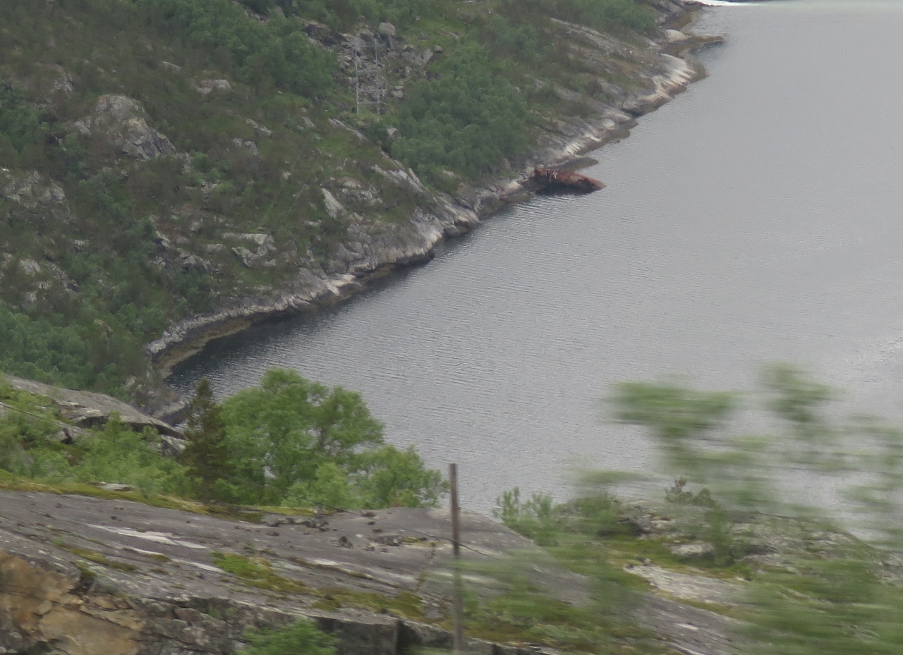
The wreck of the German destroyer Georg Thiele along the south shore near the head of Rombaksfjorden. The ship was beached there on April 30th, 1940 to allow the crew to abandon ship after taking heavy damage during the Battles of Narvik.
|
 |
6/28/2018: Cable Car
Position: 68°26.24'N, 17°26.96'E
From the Narvik train station, we walked up to the cable car to take in the views from the top of Narvikfjellet (Narvik Mountain).
|
 |
6/28/2018: Narvik Harbor
Position: 68°25.36'N, 17°27.17'E
Jennifer enjoying the view from Narvikfjellet to Narvik harbor. Dirona is anchored, but not visible, directly below her.
|
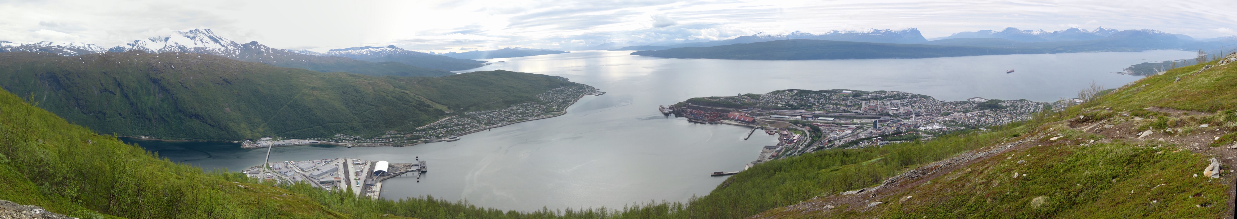 |
6/28/2018: Narvikfjellet
Position: 68°25.36'N, 17°27.17'E
The exceptional view across Narvik harbor to Ofotfjorden from Narvikfjellet.
|
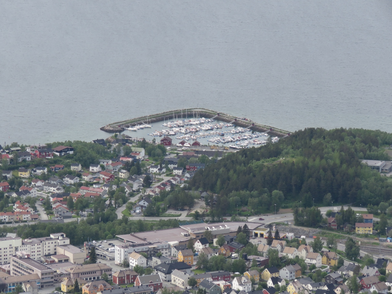 |
6/28/2018: Marina
Position: 68°25.38'N, 17°27.18'E
The Narvik marina, along the south shore of Ofotfjorden, viewed from Narvikfjellet. The maximum depth in the harbor is 1.5-2m, not enough for our 2.1m draft.
|
 |
6/28/2018: Break
Position: 68°25.33'N, 17°27.47'E
Taking a break with mountain views atop Narvikfjellet.
|
 |
6/28/2018: Dirona
Position: 68°25.32'N, 17°25.62'E
Our anchorage on the east shore of Narvik harbor.
|
 |
6/28/2018: Port Control
Position: 68°25.29'N, 17°25.66'E
Shortly after we returned to Dirona, we got a visit from the Port Control asking us to move to make room for a cargo vessel arriving later in the day. It’s annoying their web site said there’s no restriction on anchoring for boats of our size and no permission is required, and then be asked to leave at 9pm.
We had some concerns that the bottom would be fouled with debris considering how many ships had been sunk here during the Battles of Narvik. We’d deployed a trip line, but that wouldn’t have helped should the anchor be fouled as it was in the Orkney Islands, Scotland. The anchor came up cleanly though and we made a trouble-free and efficient departure. |
 |
6/28/2018: Øysundet
Position: 68°28.80'N, 16°54.24'E
We found an excellent anchorage at Øysundet on the north side of Ofotfjorden from Narvik. This is the view south and down Ofotfjorden at 11pm. 24-hour daylight still is a bit of a novelty for us.
|
 |
6/29/2018: SBI Phoenix
Position: 68°25.98'N, 16°38.17'E
The 652-ft (199m) bulker SBI Phoenix en route to Narvik at the mouth of Ofotfjorden.
|
 |
6/29/2018: Tysfjorden
Position: 68°22.70'N, 16°13.61'E
Dramatic bald cliffs to our south as we pass Tysfjorden.
|
 |
6/29/2018: Barøy Lighthouse
Position: 68°21.59'N, 16°5.16'E
The 90 ft (27.5-metre) Barøy Lighthouse was built in 1903 and automated in 1980.
|
 |
6/29/2018: Silver Pearl
Position: 68°19.53'N, 15°58.25'E
The freighter Silver Pearl to our west, with the mountains of the Vesterålen islands visible in the distance beyond.
|
 |
6/29/2018: Cape Heron
Position: 68°19.02'N, 15°56.88'E
The 948ft (289m) bulker Cape Heron en route to Narvik. We seem to be back on the main shipping channel and are seeing a lot more commercial traffic than we have in the past month or so.
|
 |
6/29/2018: Tranøy Lighthouse
Position: 68°11.48'N, 15°32.43'E
The 89 ft (27-metre) round cast iron tower of the lighthouse on the island of Tranøy. The lighthouse has been developed as a tourist attraction and has superb view across to the Lofoten Islands.
|
 |
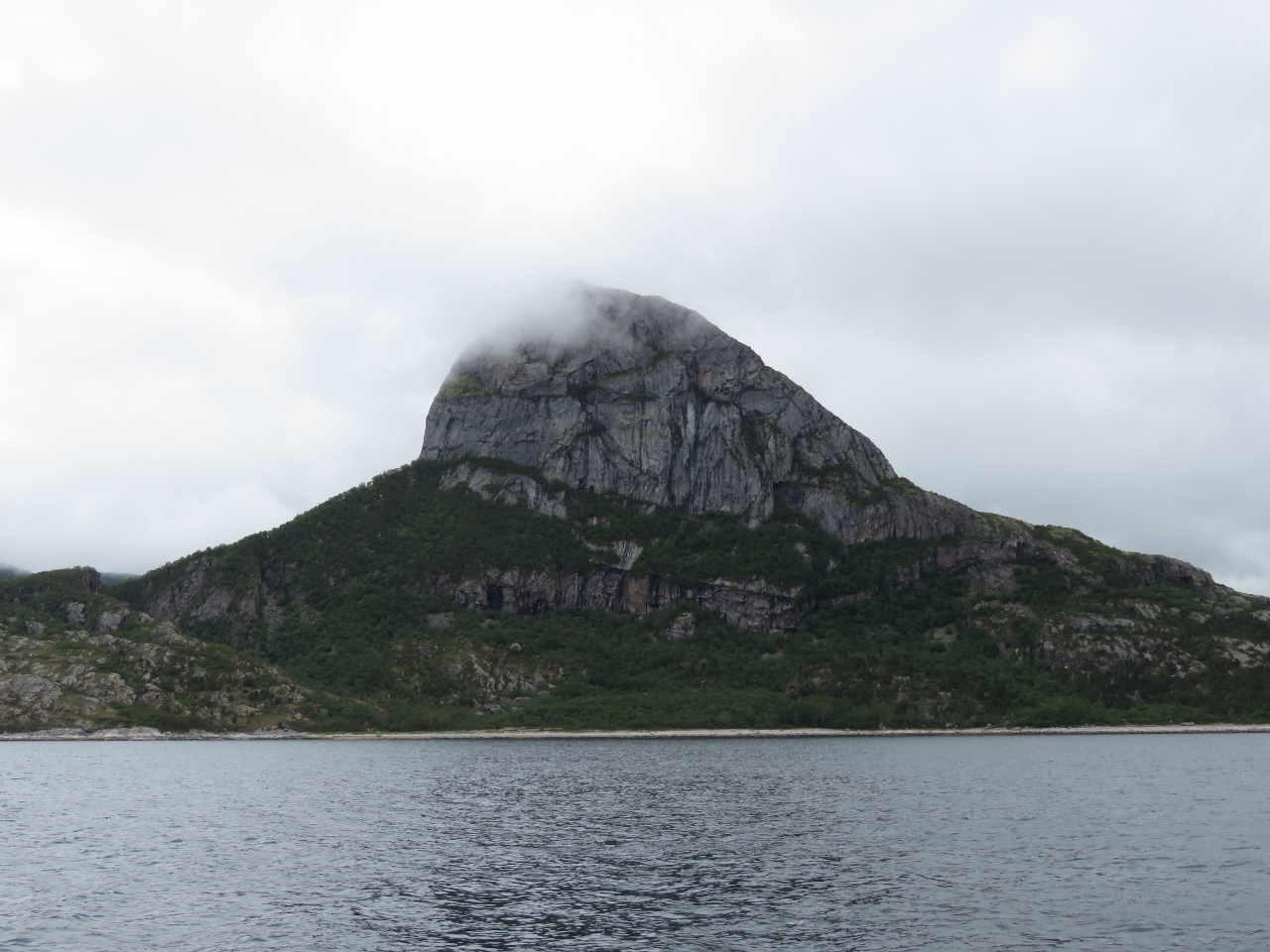
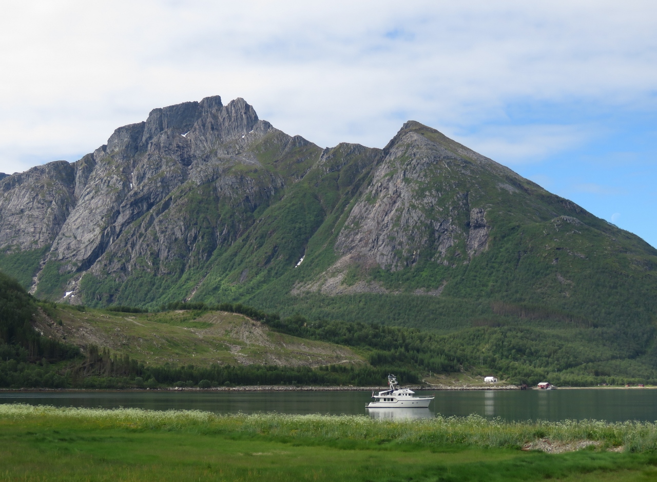
6/29/2018: Stetind Mountain
Position: 68°7.15'N, 15°19.34'E
Spectacular Stetind ("Anvil of the Gods") mountain in Tysfjorden.
|
 |
6/29/2018: Flatøya
Position: 67°55.35'N, 14°48.18'E
A fleet of replica Viking boats moored beneath the lighthouse on the island of Flatøya.
|
 |
6/29/2018: Cabins
Position: 67°50.16'N, 14°47.26'E
Two beautiful cabins overlooking the anchorage at Nordskot.
|
 |
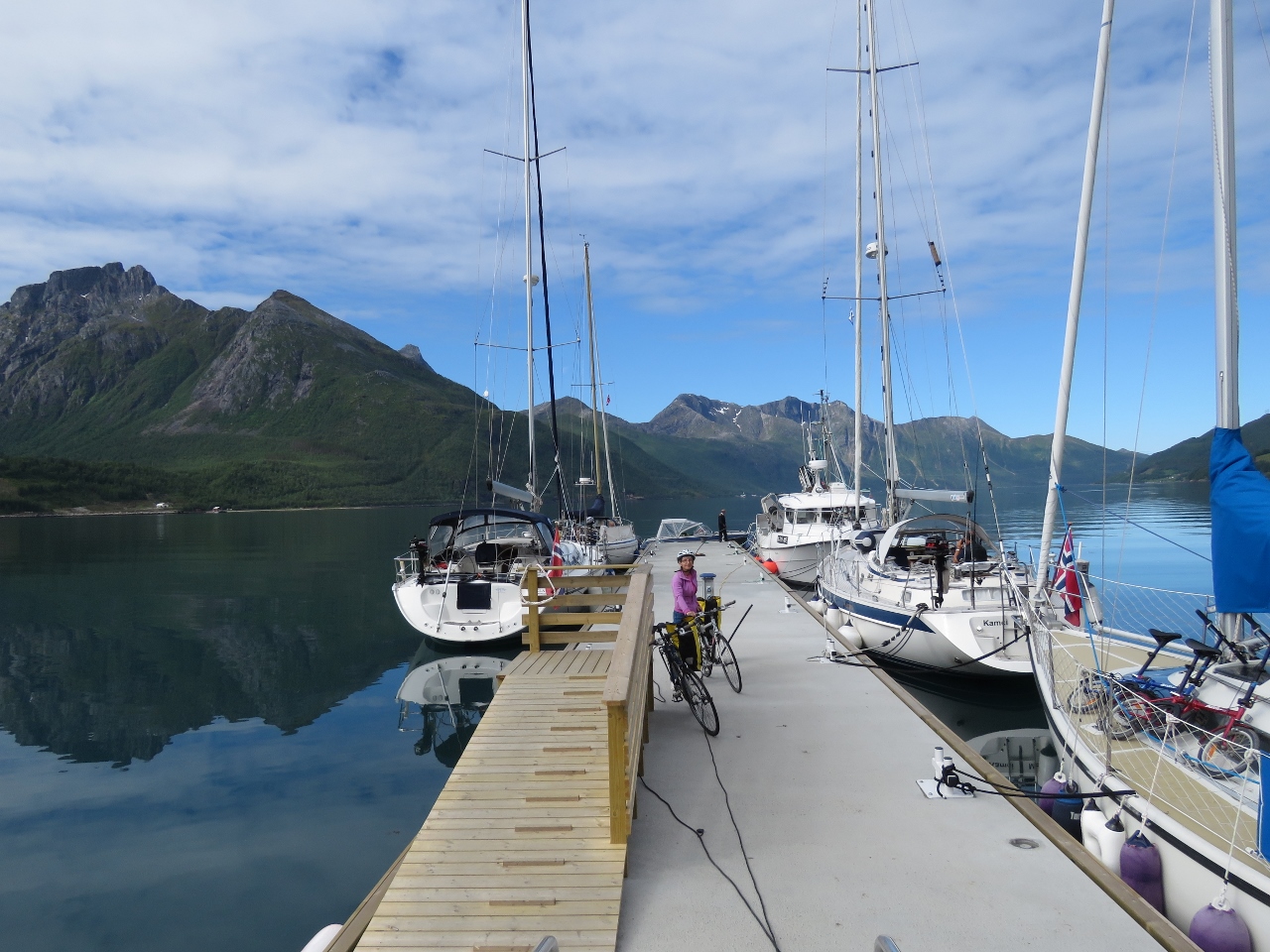
6/29/2018: Rafted
Position: 67°50.17'N, 14°47.26'E
When we first arrived at Nordskot, several pleasure craft were on moorings with a few spaces open in the marina. Over the course of the evening at least a dozen more arrived, rafting five deep on the moorings in places and three deep on the docks. We’re told rafting on Norway is commonplace, but we’ve not seen anything like this so far. Norwegians typically take vacation in July, so perhaps this is the start of the busy season.
|
 |
6/29/2018: Vikings
Position: 67°50.16'N, 14°47.25'E
The fleet of Viking boats we'd passed earlier at Flatøya also arrived and moored against the commercial dock at Nordskot.
|
 |
6/29/2018: Steigtind
Position: 67°50.16'N, 14°47.26'E
We’d anchored several hundred yards off the commercial dock, but it still felt pretty close when the fast ferry Steigtind loomed through our port windows.
|
 |
6/29/2018: Cliff
Position: 67°50.16'N, 14°47.26'E
The evening sun lighting up the cliffs north of the anchorage at Nordskot.
|
 |
6/30/2018: Landegode Lighthouse
Position: 67°26.90'N, 14°28.35'E
The 95-ft (29 m) iron tower of the Landegode Lighthouse was erected in 1902.
|
 |
6/30/2018: Bremnes Fortress
Position: 67°17.33'N, 14°21.83'E
Bremnes Fortress was built in World War II by the occupying Germans to protect the entrance to Bodø harbor.
|
 |
6/30/2018: Kong Harald
Position: 67°17.03'N, 14°22.17'E
Our 'Gruten, the Kong Harald, arrived into Bodø shortly after we did. Since dropping us off in Tromsø six days ago, the Kong Harald has completed the trip south to Bergen and now is returning north.
|
 |
6/30/2018: Bodø Havn
Position: 67°16.93'N, 14°22.12'E
Looking across the recreational docks in Bodø Havn. Dirona is just visible on the other side of the marina at center (click image for a larger view).
|
 |
6/30/2018: Fast Ferries
Position: 67°17.00'N, 14°22.20'E
Bodø is the terminal for several fast ferries that run to the Lofoten and Vesterålen Islands.
|
 |
6/30/2018: Guest Dock
Position: 67°17.01'N, 14°22.40'E
Dirona moored on the guest dock at Bodø Havn.
|
 |
6/30/2018: Lunch
Position: 67°16.98'N, 14°22.37'E
We had a good lunch with a great harbor view at Bryggerikaia.
|
 |
6/30/2018: Nordland Museum
Position: 67°16.91'N, 14°22.95'E
The small but information-packed Nordland Museum on Bodø details the towns history, particularly the destruction during World War II when a 1940 German bombing attack levelled much of the town center.
|
 |
6/30/2018: Sardines
Position: 67°16.91'N, 14°22.95'E
A display at the Nordland Museum showing various brands of canned herring, once a major Bodø export.
|
 |
6/30/2018: Dry Aquarium
Position: 67°16.91'N, 14°22.95'E
Dry aquarium in the basement of the Nordland Museum. The display was created to teach fishers how to identify fish found in the ares.
|
 |
6/30/2018: Bodø Cathedral
Position: 67°16.94'N, 14°22.84'E
Bodø Cathedral was completed in 1956. It replaced an earlier church that was destroyed during the World War II bombing.
|
 |
6/30/2018: City Hall
Position: 67°16.97'N, 14°22.96'E
Bodø's city hall also was destroyed in the World War II bombing and rebuilt in the 1950s. A dramatic new city hall building is now under construction.
|
 |
6/30/2018: Street Art
Position: 67°17.01'N, 14°23.16'E
Wonderful street art in Bodø showing a youngster painting the Northern Lights onto the sky.
|
 |
6/30/2018: Værøy
Position: 67°17.04'N, 14°22.14'E
The ferry Værøy arriving into Bodø from Moskenes, just south of Reine in the Lofoten archipelago.
|
 |
6/30/2018: Pontoons
Position: 67°17.72'N, 14°23.36'E
After walking around town, we took the tender on a tour of the harbor. This is a small pontoon at the north end of the harbor.
|
 |
6/30/2018: Barentshav
Position: 67°17.68'N, 14°23.36'E
The 305 ft (93 m) Norwegian Coast Guard vessel Barentshav moored at Bodø Harbor. Delivered in 2009, the Barentshav is the coast guard's first LPG vessel and can reach speeds of 20 knots.
|
 |
6/30/2018: Saltstraumen Maelstrom
Position: 67°13.85'N, 14°37.06'E
Spectators gathered along the shore near Bodø to watch the Saltstraumen Maelstrom, among the fastest in the world. When the moon is full, the rapids can run at nearly 20 knots. The video https://youtu.be/rAMC4hlXtgM shows us making a pass through the channel with the rapids running at maximum ebb, creating huge whirlpools and upwellings.
|
 |
7/1/2018: Lofoten
Position: 67°17.04'N, 14°22.14'E
The Hurtigruten Lofoten arriving into Bodø on a northbound run.
|
 |
7/2/2018: Midnight Sun
Position: 67°17.04'N, 14°22.14'E
Bodo's midnight sun period ends in ten more days, and we'll be out of the midnight sun zone sooner as we continue south. We woke up around 2am and snapped this photo of the sun rising back up above the horizon.
|
 |
7/2/2018: F-16
Position: 67°17.04'N, 14°22.14'E
F-16 fighters from the nearby Bodø Main Air Station made frequent passes over the area while we were there.
|
 |
7/2/2018: Fish
Position: 67°17.03'N, 14°22.17'E
The water in the harbor is incredibly clean and clear with a healthy fish population.
|
 |
7/2/2018: Egon
Position: 67°16.86'N, 14°22.34'E
Under a clear sky with the temperature nearly 70°F (21°C), we had a wonderful meal al fresco at Egon overlooking the harbor.
|
 |
7/2/2018: View Northwest
Position: 67°17.05'N, 14°22.50'E
After dinner, we went up to sky bar in the Scandic Havet for 360° views of the area. (At 18 floors high, this is northern Norway's tallest building.) This is the view looking northwest to the channel we came through before entering Bodø Harbor. Bremnes Fortress is just out of the picture on the left.
|
 |
7/2/2018: Marina
Position: 67°17.03'N, 14°22.50'E
The view looking southeast from the Scandic Havet sky bar. We had dinner at Egon, across the street from the yellow buildings about center in the picture.
|
 |
7/2/2018: View South
Position: 67°17.04'N, 14°22.49'E
Dirona moored on the guest dock, viewed looking southwest from the Scandic Havet sky bar.
|
 |
7/3/2018: Saga Sapphire
Position: 67°17.04'N, 14°22.15'E
The 655ft (200m) cruise ship Saga Sapphire arriving into Bodø.
|
 |
7/3/2018: F-16
Position: 67°16.50'N, 14°23.95'E
F-16 fighter taking off from Bodø Main Air Station.
|
 |
7/3/2018: Norwegian Aviation Museum
Position: 67°16.59'N, 14°24.78'E
Bodø has an exceptional aviation museum that we've been looking forward to visiting for months. This is the vast commercial aviation section, with displays ranging from the early days of flight to modern times. On the left is the recovered wreck of a German Junkers Ju-88 A-4 that was found in the Norwegian mountains and transported piece-by-piece to the museum.
|
 |
7/3/2018: Aerial Footage
Position: 67°16.56'N, 14°24.83'E
We spent ages at the Norwegian Aviation Museum watching aerial footage from a jet flight over northern Norway, recognizing many places we've visited. This shot is approaching Svolvaer from the south.
|
 |
7/3/2018: U-2 Spy Plane
Position: 67°16.59'N, 14°24.77'E
A U-2 spy plane is one of the feature displays at the Norwegian Aviation Museum. The U-2 program gained international attention in 1960 when the Soviets shot down and captured American pilot Gary Powers while he was making a high-altitude surveillance pass en route from Peshawar, Pakistan to Bodø, one of the permanent stations for the U-2 operations. The excellent movie Bridge of Spies describes the events leading up to Powers' capture and ultimate release.
|
 |
7/3/2018: Mail Drop
Position: 67°16.54'N, 14°24.80'E
We loved this photo at the Norwegian Aviation Museum of a 1965 Christmas mail drop to Bjørnøya, a remote Arctic island. Two men, roped to the plane, are opening the door mid-flight to push mail and freight out as they fly past.
|
 |
7/3/2018: Insomnia
Position: 67°17.06'N, 14°22.91'E
More fabulous street art in Bodø, this one Insomnia by the Italian street artist Millo.
|
 |
7/3/2018: Summer Star
Position: 67°17.02'N, 14°22.41'E
Docked bow-to-stern Nordhavn 57 Summer Star in Bodø. We've not seen a single other US-flagged vessel since leaving London.
|
 |
7/3/2018: Kristina and Atle
Position: 67°17.08'N, 14°22.68'E
We've been corresponding with Nordhavn 57 Summer Star owners Kristina Thyrre and Atle Moe for years, and much more so recently since we've both been in Norway. They are heading north as we are returning south, and we'd been hoping to cross paths and finally meet in person. We had an exceptional evening with them, first on Summer Star, then over dinner at Hundholmen Brygghus and Gastropub, then later on Dirona.
|
 |
7/4/2018: Kleiva Light
Position: 66°55.57'N, 13°29.82'E
The Kleiva light tower, prominent to our east as we round the Stott peninsula.
|
 |
7/4/2018: Horntinden
Position: 66°54.52'N, 13°30.79'E
Dramatic 1489ft (454m) Hortinden rising just west of Reipa.
|
 |
7/4/2018: Ruins
Position: 66°42.38'N, 13°39.18'E
We haven't seen many ruins in Norway. People seem to rebuild or tear down anything that is no longer functional.
|
 |
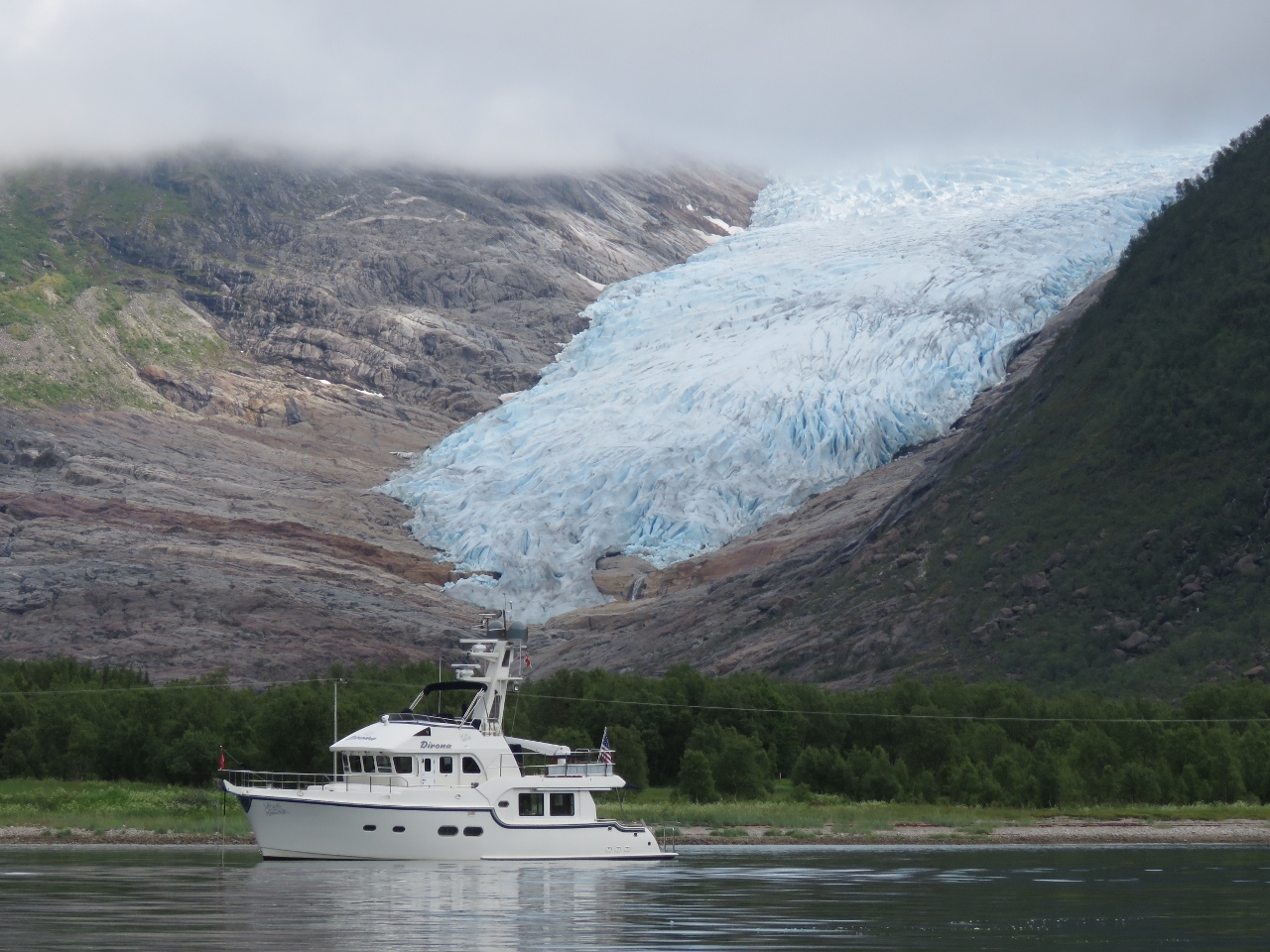
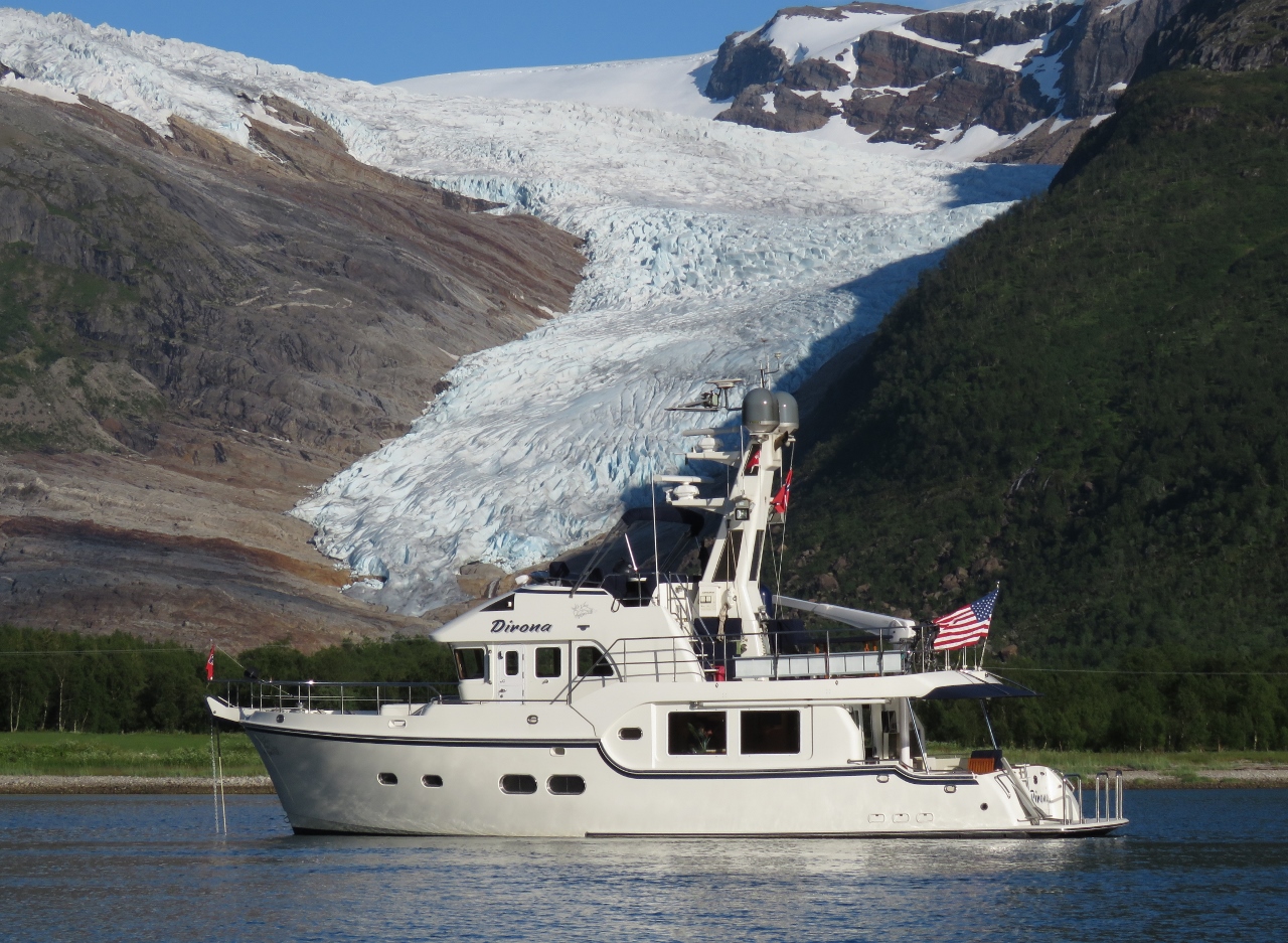
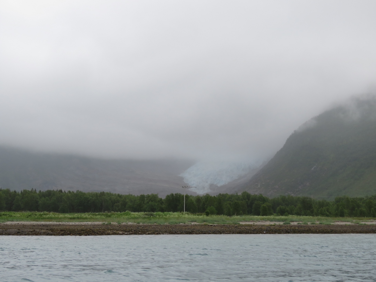
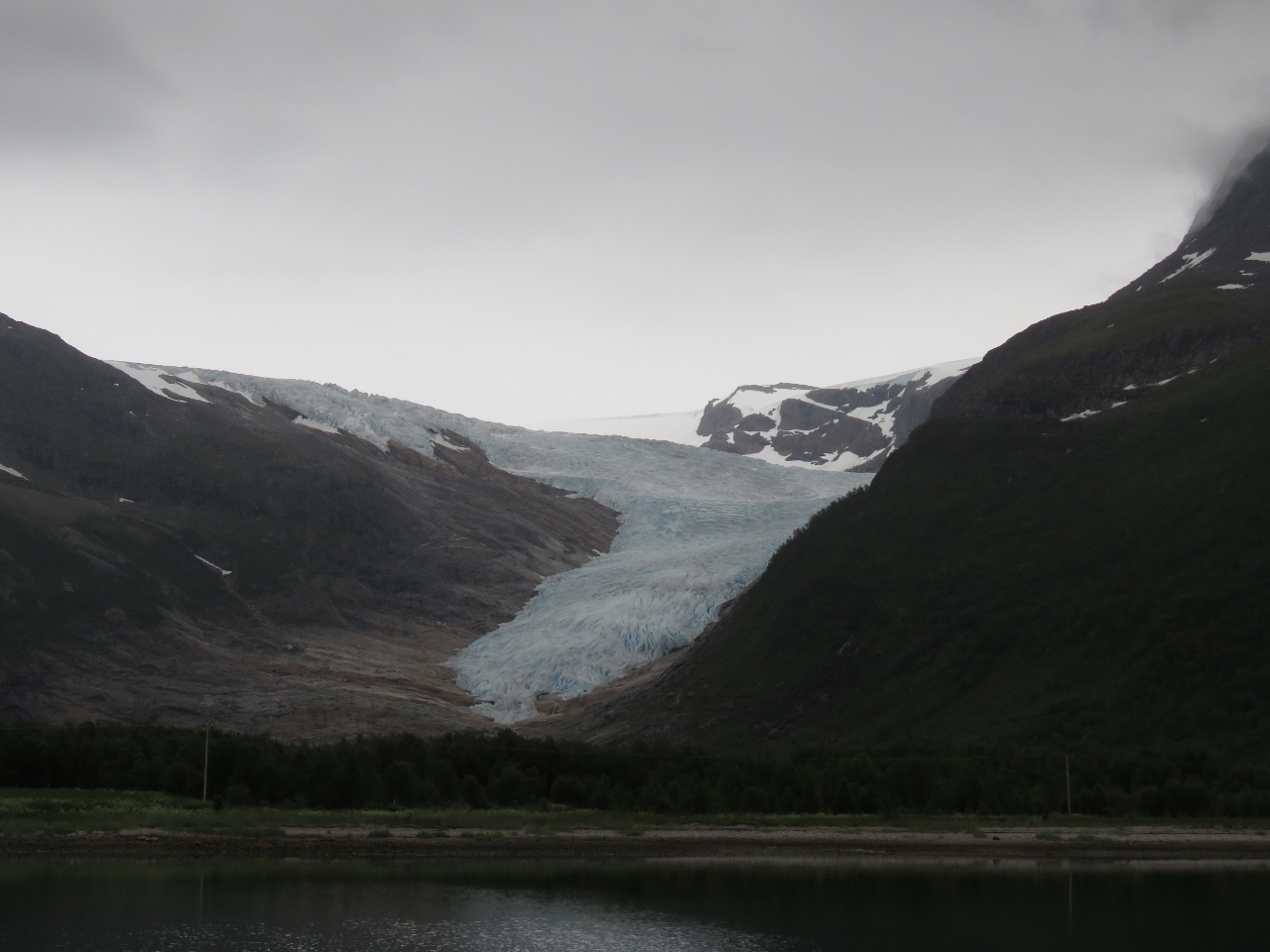
7/4/2018: Svartisen Glacier
Position: 66°42.39'N, 13°42.54'E
Svartisen Glacier is the second largest in mainland Norway after Jostedalsbreen, and one of the most dramatic sights on the coast. Cruising up Holandsfjorden, Svartisen suddenly looms into view at the head. It ends at only 65 ft (20m) above sea level, the lowest of any mainland European glaciers.
|
 |
7/4/2018: Holandsfjorden
Position: 66°42.31'N, 13°42.68'E
The guest dock at the head of Holandsfjorden was full, and even if there was a spot, we weren't keen on the likelihood of rafting. Like most fjords, the head of Holandsfjorden is initially very deep and then shelves off quickly at the head, making anchoring difficult. But we found an anchorage in 113ft that had a reasonably even bottom, room for 350ft of rode, and excellent holding with a fabulous view to the glacier.
|
 |
7/5/2018: Morning Calm
Position: 66°42.31'N, 13°42.70'E
The clouds lifted a bit this morning for an even more dramatic view to Svartisen Glacier.
|
 |
7/5/2018: Guest Dock
Position: 66°42.59'N, 13°42.65'E
The view east down Holandsfjorden is pretty spectacular even without the draw of Svartisen Glacier. We'd brought our bikes ashore to cycle the roughly 2 miles (3km) to the Helgelandsbukken trailhead at the base of Svartisen Glacier. The ramp on the left is for a ferry boat that provides regular summer service from Holandsvika near the main highway across Holandsfjorden.
|
 |
7/5/2018: Dirona
Position: 66°42.33'N, 13°43.47'E
View to Dirona anchored at the head of Holandsfjorden.
|
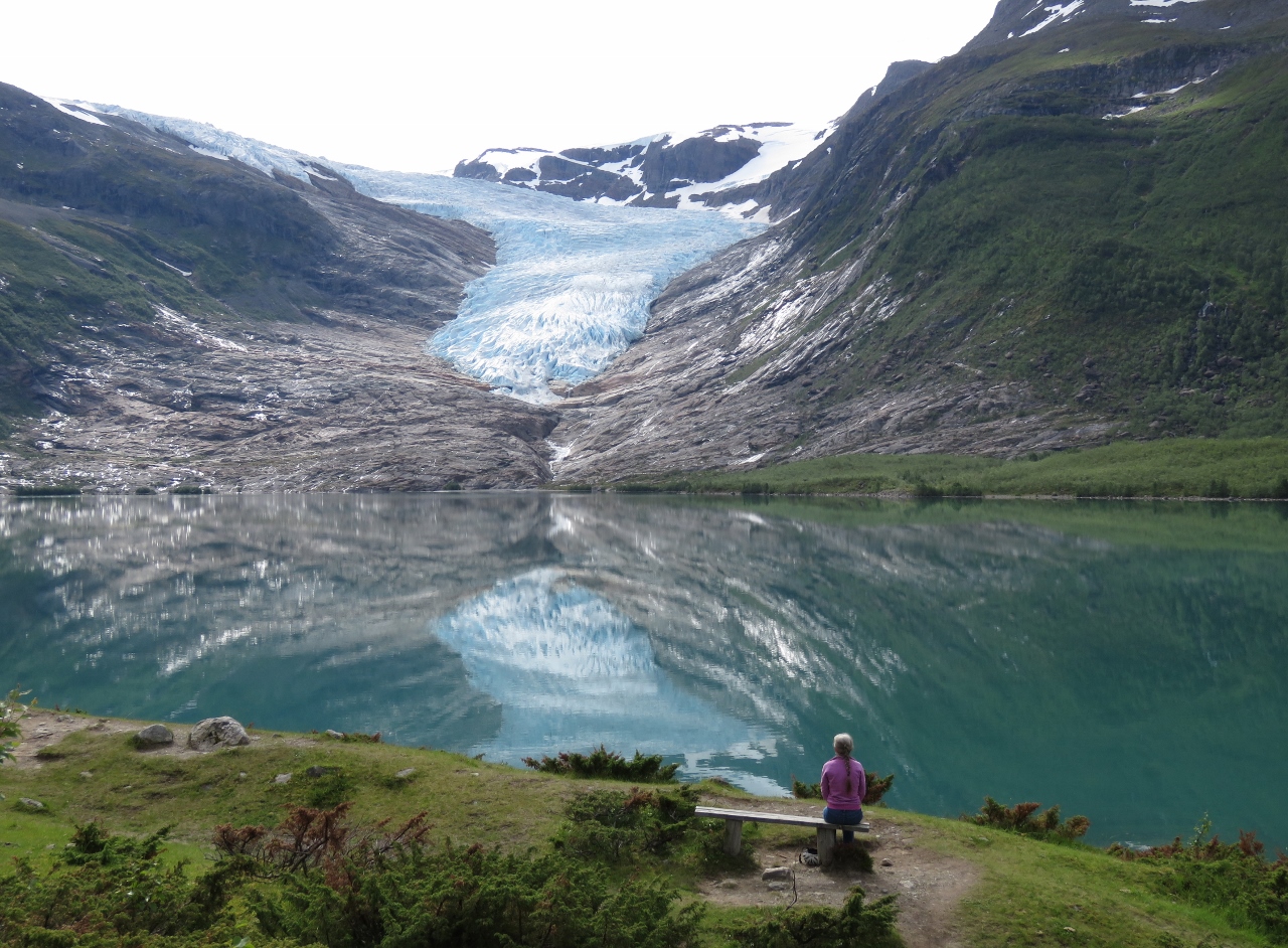 |
7/5/2018: Svartisvatnet
Position: 66°42.19'N, 13°44.04'E
A spectacular view to Svartisen Glacier reflected into the lake Svartisvatnet. The visitor center here is very popular, with cafe that has views to the lake and glacier. A bus often runs to collect visitors arriving by ferry.
|
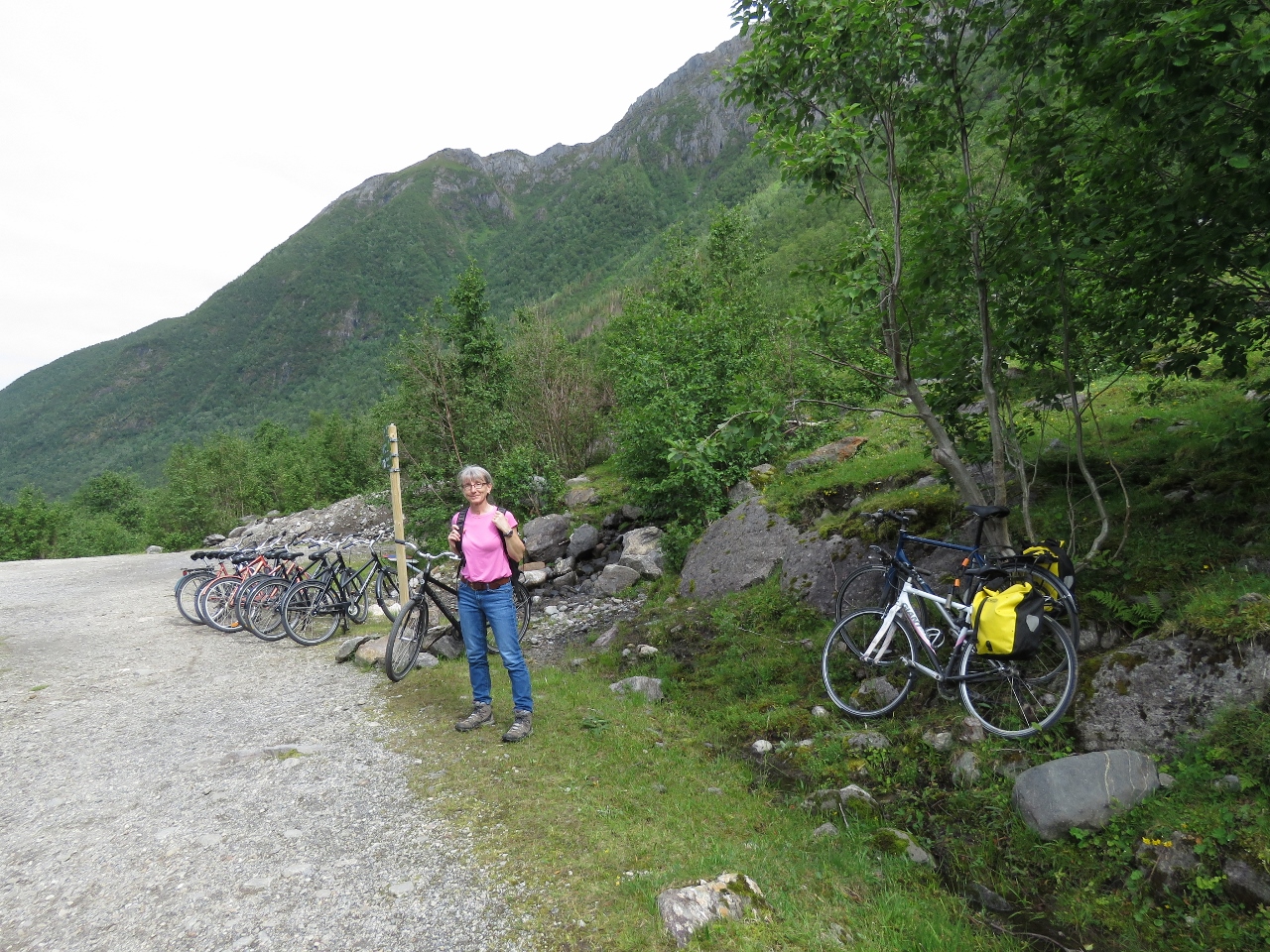 |
7/5/2018: Trailhead
Position: 66°41.73'N, 13°46.02'E
Leaving our bikes with at least a dozen others at the trailhead to Helgelandsbukken. Most are rentals from a company at the ferry dock.
|
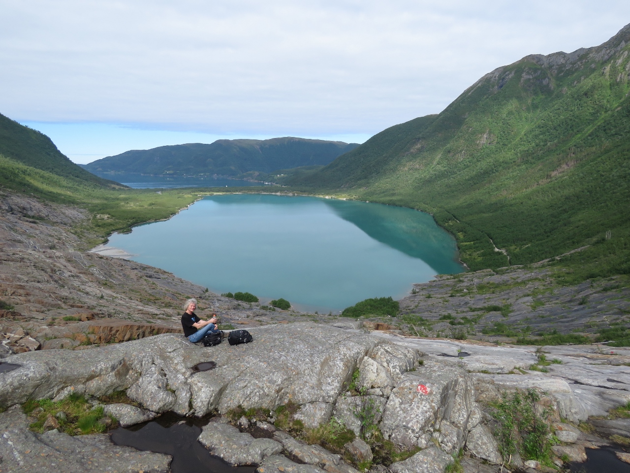 |
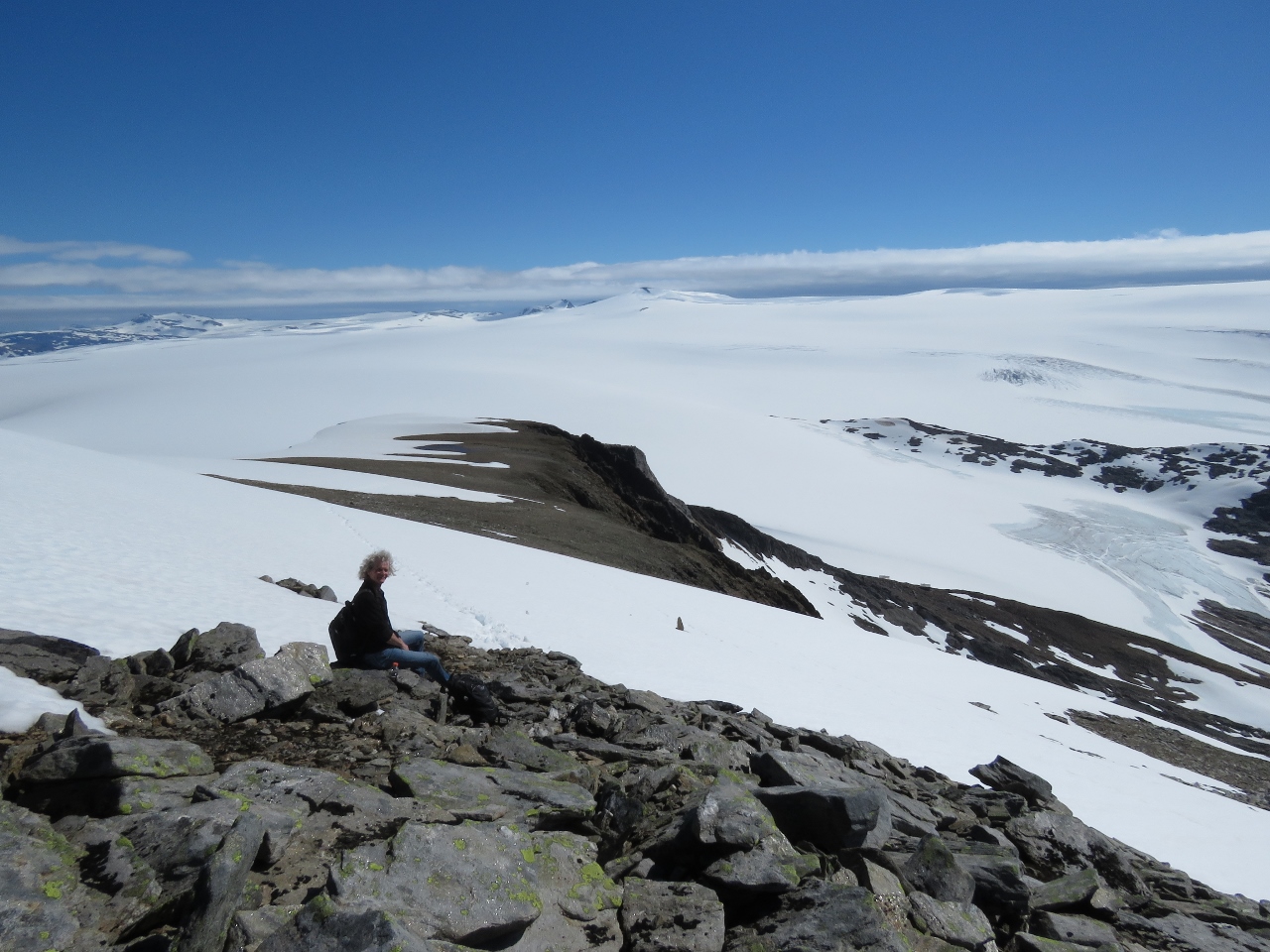
7/5/2018: Above Svartisvatnet
Position: 66°41.39'N, 13°46.31'E
Enjoying the view across the lake Svartisvatnet to Holandsfjorden from 523 ft (159 m) up. Dirona is the white speck just visible across the isthmus between the lake and the fjord (click image for a larger view).
|
 |
7/5/2018: Engabreen
Position: 66°41.32'N, 13°47.05'E
The view to Engabreen, the extension of Svartisen visible in Holandsfjorden, from 1510 ft (460 m) up. We're gaining altitude quickly—1000ft (300m) in under 45 minutes.
|
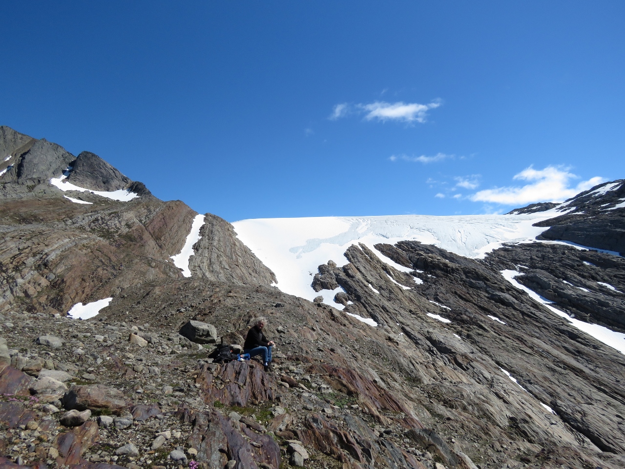 |
7/5/2018: Upper Glacier
Position: 66°41.48'N, 13°48.68'E
Taking a break beneath the main portion of Svartisen Glacier. We're climbed 2,891 ft (881 m) in just under two hours.
|
 |
7/5/2018: Hiking Cabin
Position: 66°41.49'N, 13°48.51'E
We expected we were getting pretty close to our intermediate goal of the Tåkeheimen hiking cabin, but rounded a corner and realized we still had a ways to go. The cabin is just visible in the saddle at roughly the center of the picture (click image for a larger view).
|
 |
7/5/2018: Runner
Position: 66°41.48'N, 13°48.68'E
At 2,891 ft (881 m) up we were feeling pretty good about our progress until this middle-aged man literally ran past us.
|
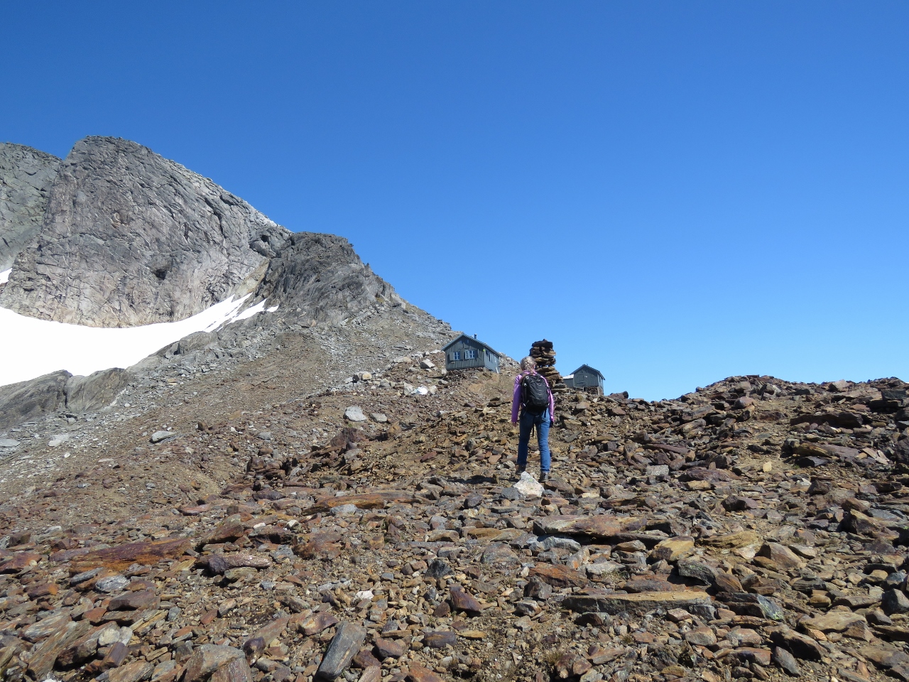 |
7/5/2018: Cabins
Position: 66°41.63'N, 13°49.69'E
Almost to the Tåkeheimen cabin at altitude 3475 ft (1059 m). It turns out there are two cabins.
|
 |
7/5/2018: Cabin View
Position: 66°41.65'N, 13°49.79'E
The impressive view down Holandsfjorden and out to sea from the Tåkeheimen cabin at altitude 3524 ft (1074 m).
|
 |
7/5/2018: Cabin Interior
Position: 66°41.65'N, 13°49.81'E
The interior of a Tåkeheimen cabin. Long-distance hiking is extremely popular in Norway, and the Norwegian Trekking Association has built some spectacular cabins throughout the country.
|
 |
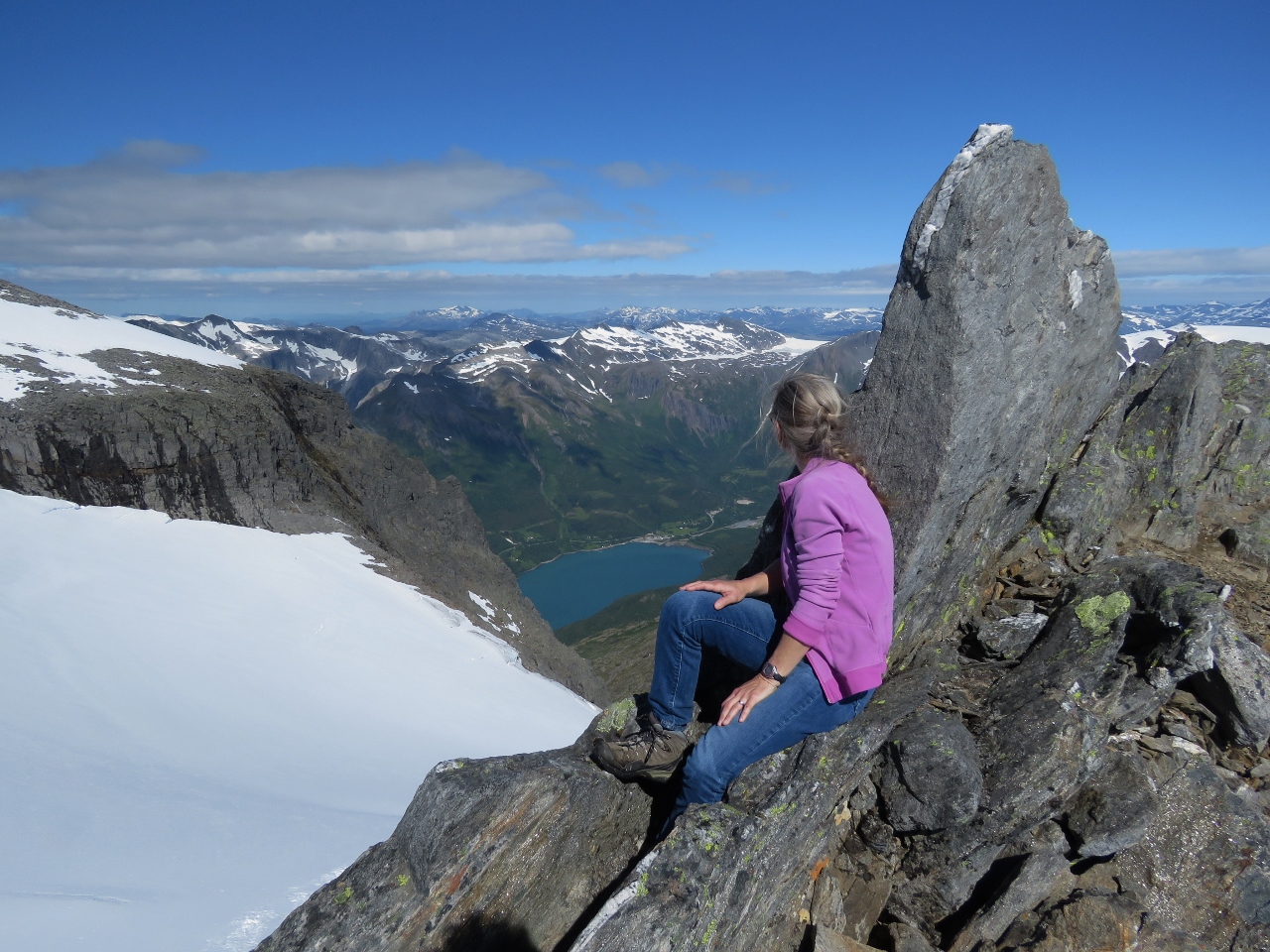
7/5/2018: Litlebreen
Position: 66°41.75'N, 13°50.03'E
Reaching the Tåkeheimen hiking cabins was only the first part of our hike. The ultimate goal is 4770 ft (1454 m) Helgelandsbukken. This is the view from above the hiking cabins to Litlebreen, another outlet of Svartisen Glacier. The cabins are hidden by the ridge just right of center (click image for a larger view).
|
 |
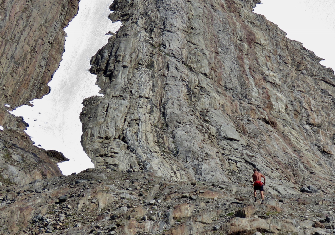
7/5/2018: Climbing
Position: 66°41.76'N, 13°50.05'E
This one small section of the climb was pretty much straight up over huge boulders.
|
 |
7/5/2018: Snow
Position: 66°41.85'N, 13°50.11'E
At altitude 4151 ft (1265 m), we're back hiking in the snow again. But its warm enough for us to be wearing just T-shirts.
|
 |
7/5/2018: View West
Position: 66°41.93'N, 13°49.83'E
A fabulous view over Holandsfjorden at altitude 4239 ft (1292 m).
|
 |
7/5/2018: Break
Position: 66°42.07'N, 13°49.51'E
Taking a break at altitude 4419 ft (1347 m).
|
 |
7/5/2018: Ridge
Position: 66°42.13'N, 13°49.33'E
At 4567 ft (1392 m) we reached a ridge where the mountains to the north burst into view.
|
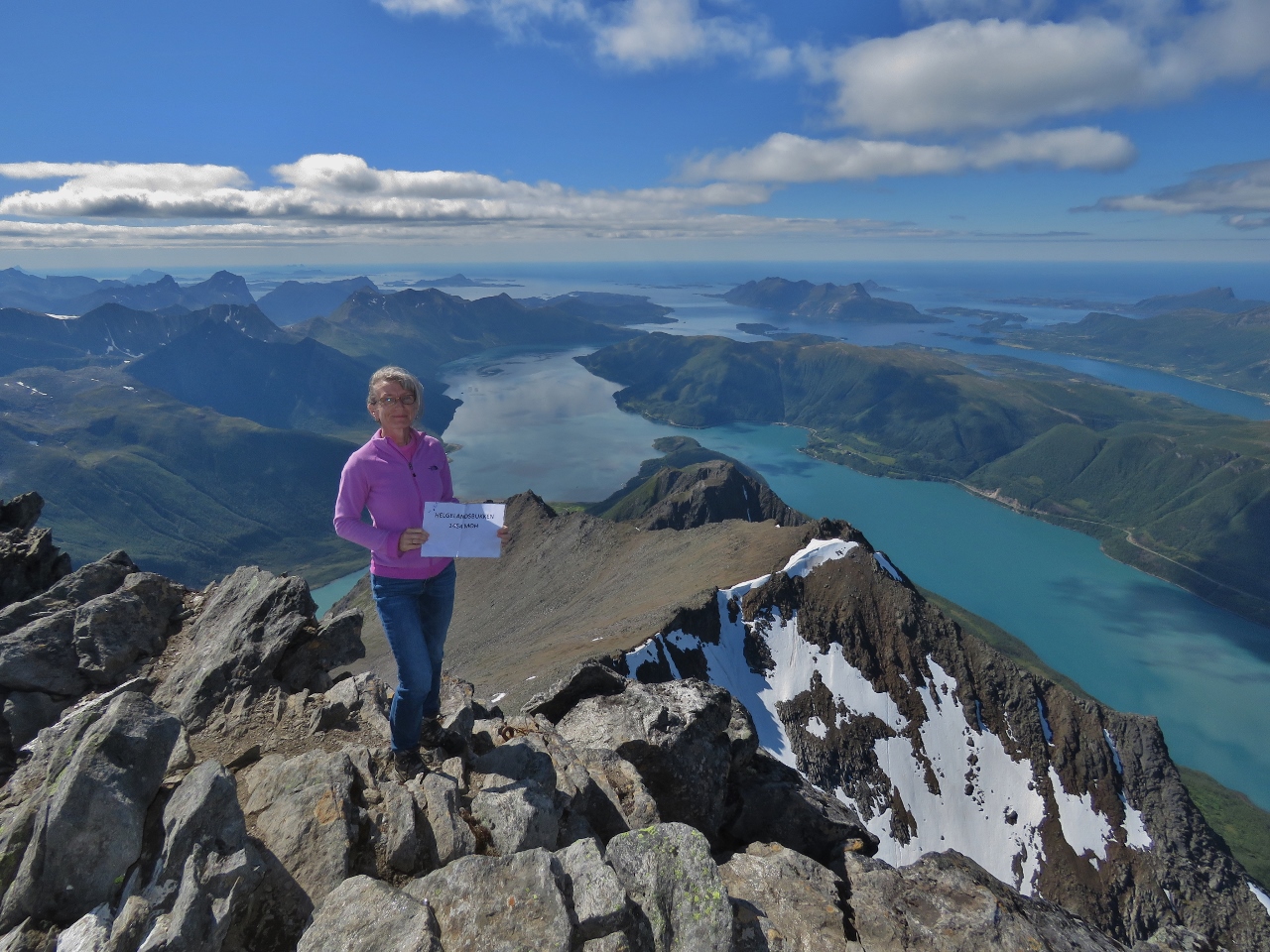 |
7/5/2018: 1,454 meters
Position: 66°42.31'N, 13°49.11'E
Success! Tired, but super-excited, we reached the summit of Helgelandsbukken at 4770 ft (1454 m).
|
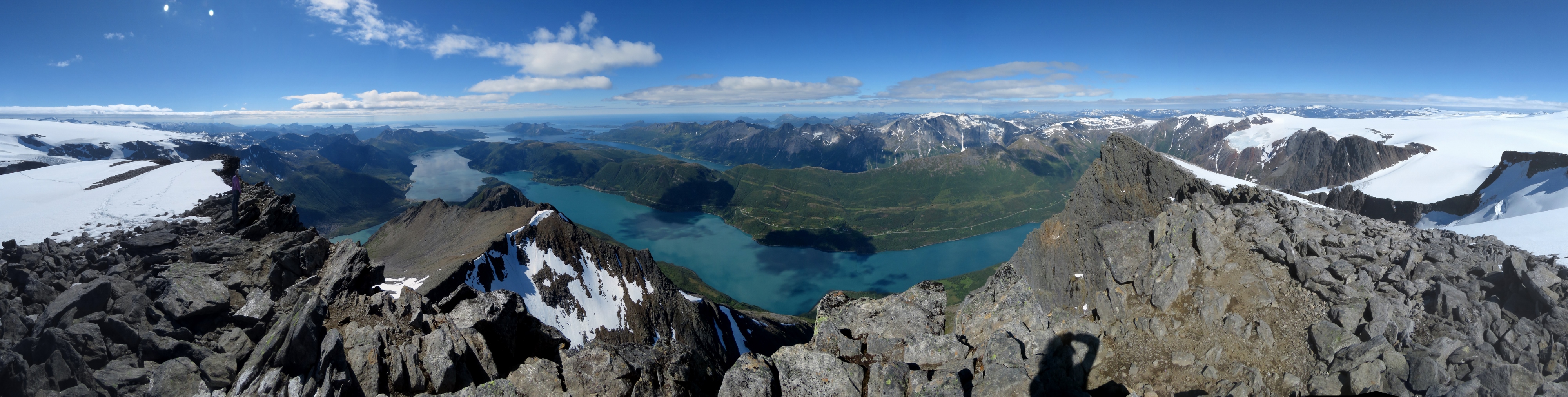 |
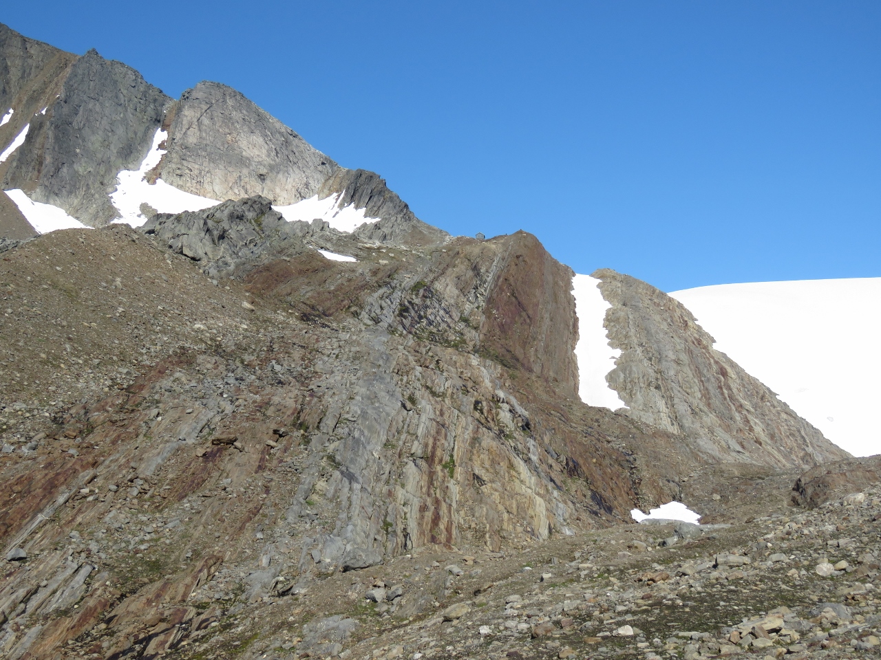
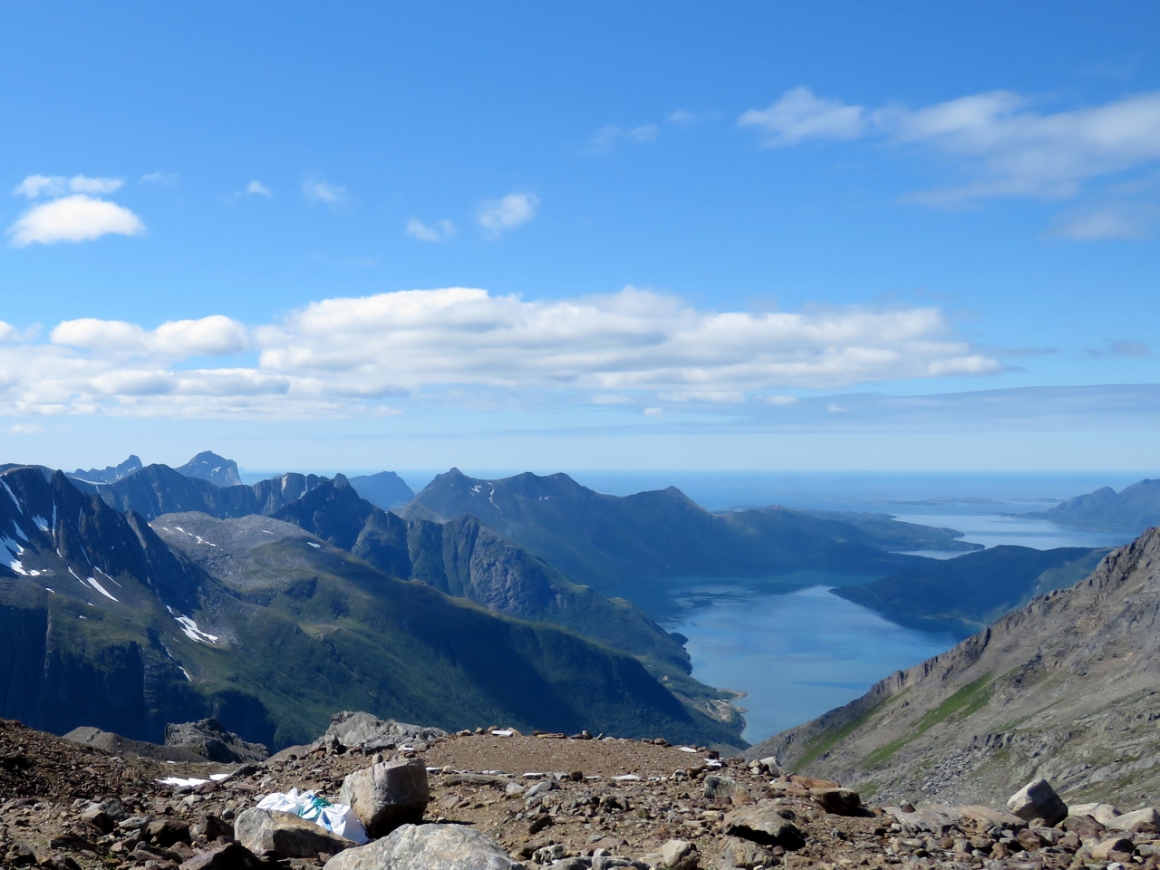
7/5/2018: Helgelandsbukken
Position: 66°42.31'N, 13°49.11'E
The view from Helgelandsbukken was astonishing. We could see all the way to Lovund and Traena to the west and the Lofoten archipelago to the northwest (click image for a larger view). We didn't think anything could top Dronningruta, but Helgelandsbukken definitely is more spectacular, and more strenuous.
|
 |
7/5/2018: Dirona
Position: 66°42.31'N, 13°49.11'E
Dirona is just barely visible way below us, right of the foreground peak at lower center (click image for a larger view). The guest dock where we landed the tender is farther to the right.
|
 |
7/5/2018: Trail
Position: 66°42.31'N, 13°49.11'E
Our trail back down snaking off through the snow at the right of the photo.
|
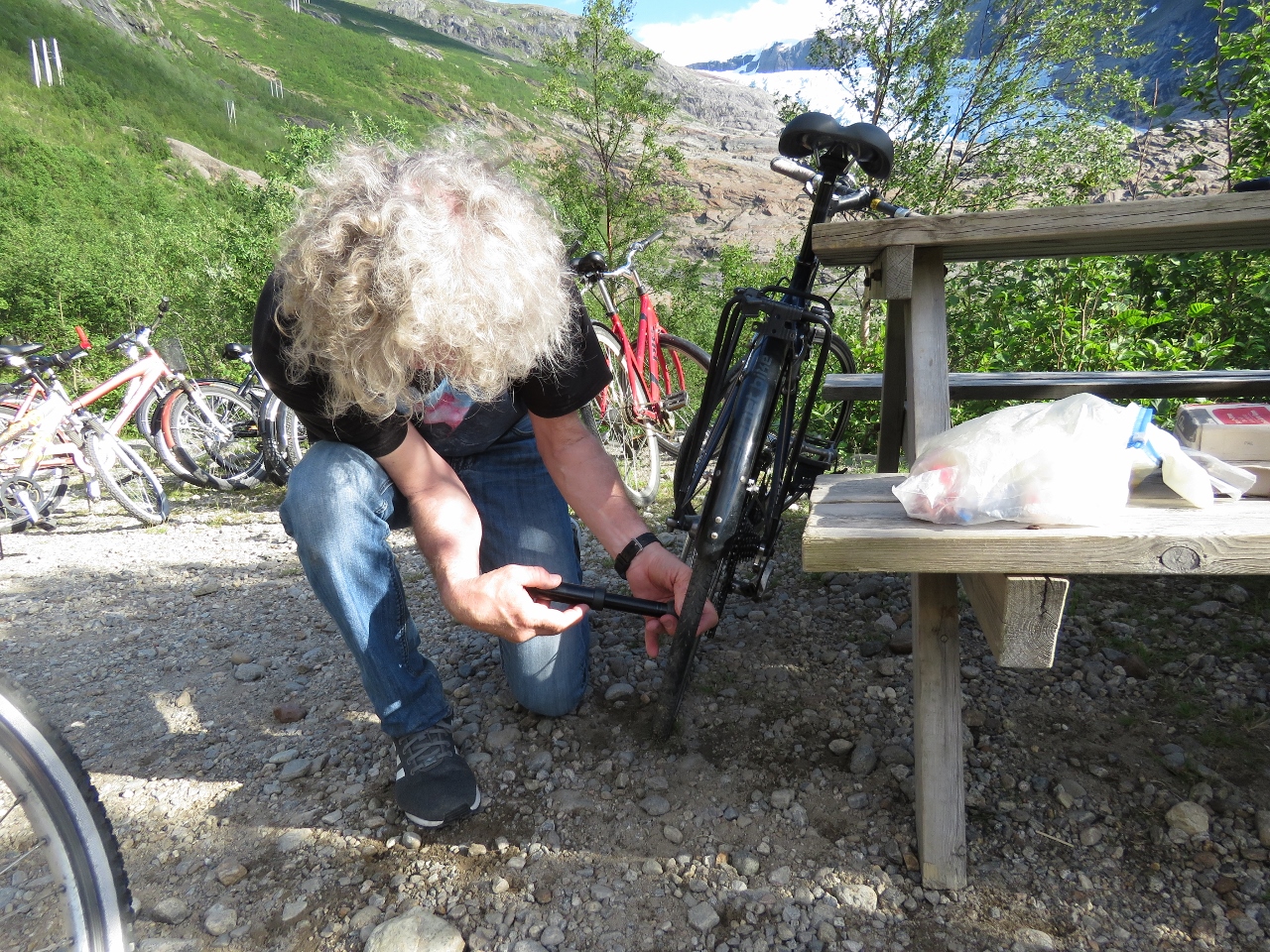 |
7/5/2018: Low Air
Position: 66°41.77'N, 13°45.94'E
We were pretty tired when we arrived back at the trailhead—we'd gone pretty hard both ways, particularly on the return. It had taken us five hours to reach Helgelandsbukken from here, but only half that to return back down. Here James tire is low on air, so we filled it with a portable pump from our emergency bicycle repair kit. We'll replace the tube when we get back to the boat.
|
 |
7/5/2018: Svartisen Glacier
Position: 66°42.32'N, 13°42.69'E
The view to Svartisen Glacier as we return to Dirona. What an incredible anchorage.
|
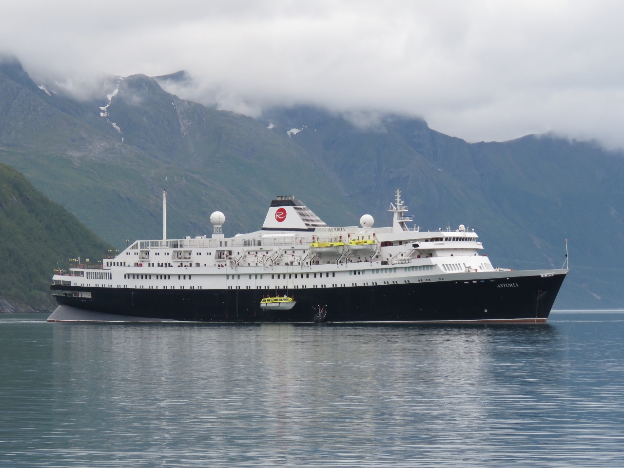 |
7/6/2018: Astoria
Position: 66°42.30'N, 13°42.63'E
We woke up early this morning to a loud clanking sound—the cruise ship Astoria was lowering anchor. Shortly after they began ferrying passengers ashore and for the next several hours a constant stream of people were visible walking back and forth to the visitor center overlooking the lake
|
 |
7/6/2018: Overcast
Position: 66°42.31'N, 13°42.70'E
With the cloud line so low, it wasn't much of a day for glacier-viewing compared to yesterday.
|
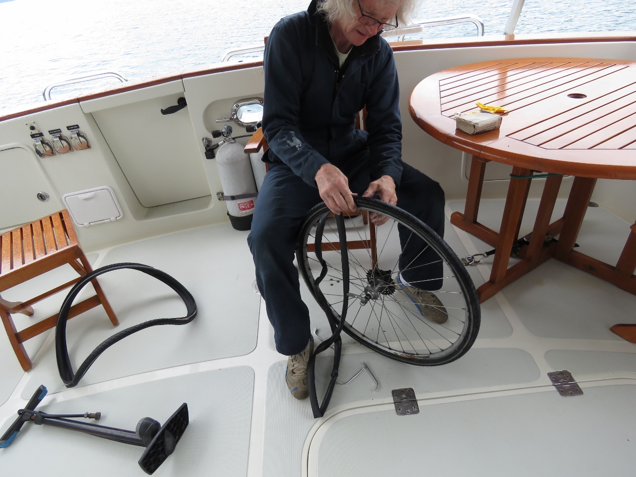 |
7/6/2018: Tire Replacement
Position: 66°42.32'N, 13°42.62'E
James' rear bicycle tire went low on air during our ride to the Helgelandsbukken trailhead yesterday. The tube needed replacing, but the tire was also pretty worn, so we replaced both. We've gone through a few tubes, but this is the first time we've used one of the spare tires that we've been carrying since leaving Seattle.
|
 |
7/6/2018: Svartisen Glacier
Position: 66°42.31'N, 13°42.63'E
We enjoyed the anchorage so much that we ended up staying for three nights. That glacier view is spectacular.
|
 |
7/7/2018: Vesterålen
Position: 66°36.80'N, 13°3.99'E
The Hurtigruten Vesterålen running north.
|
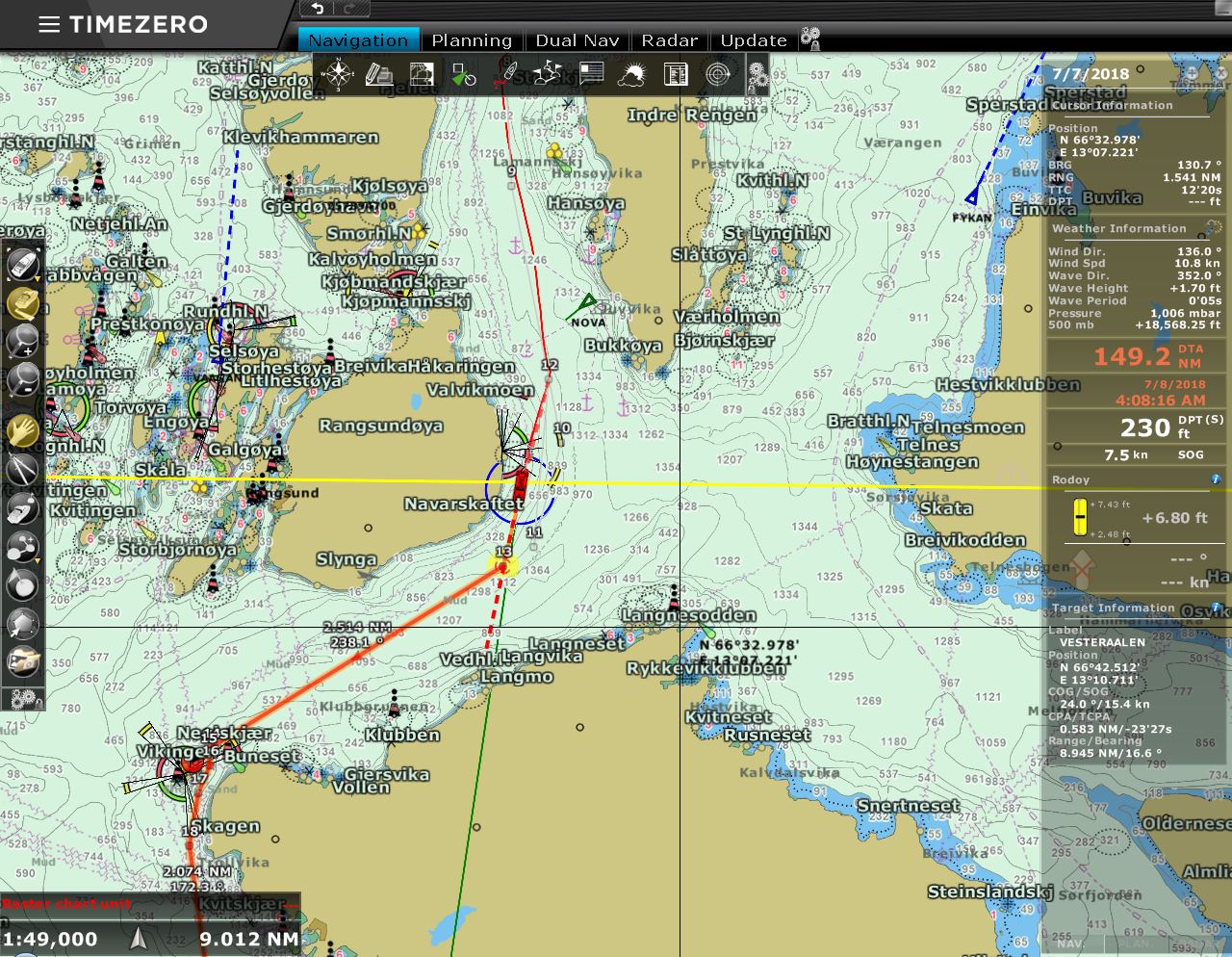 |
7/7/2018: Arctic Circle
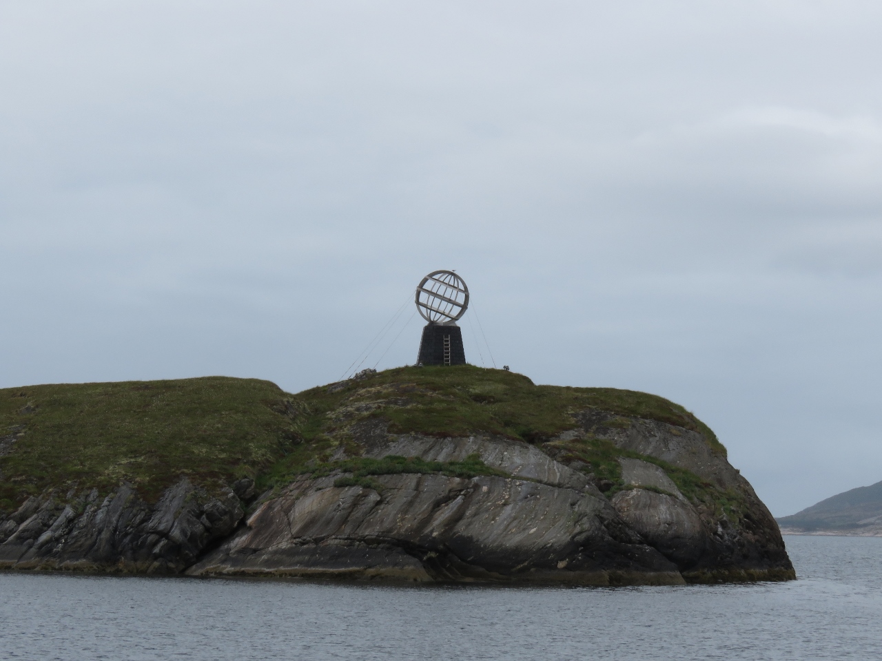
Position: 66°34.06'N, 13°4.34'E
We've been north of the Arctic Circle (the yellow line on the chart) for nearly two months north, after first crossing en route to Røst from Træna. What a fabulous adventure.
|
 |
7/7/2018: Arctic Circle Monument
Position: 66°31.92'N, 12°58.52'E
An Arctic Circle Monument, similar to the one on Træna, for those in the inner lead route north.
|
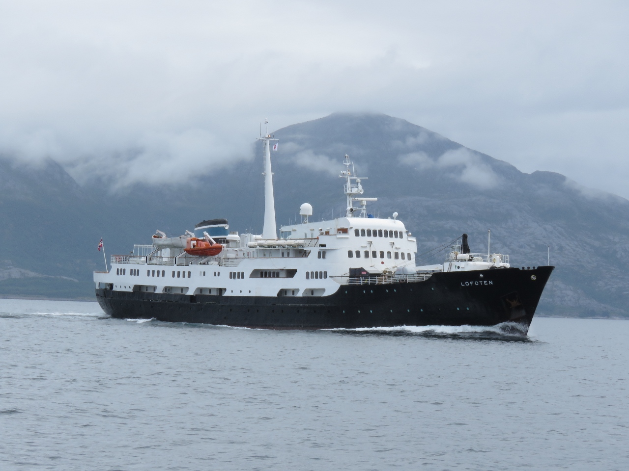 |
7/7/2018: Lofoten
Position: 66°17.15'N, 12°55.13'E
The Hurtigruten Lofoten heading south. We ended up seeing the ship two more times today as they made stops and we caught up again.
|
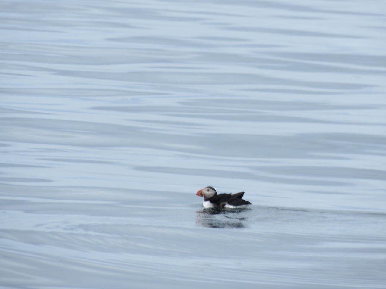 |
7/7/2018: Puffin
Position: 66°10.11'N, 12°50.00'E
We're southwest of the island of Lovund, a major puffin breeding ground, and spotted one in the water.
|
 |
7/7/2018: Seven Sisters
Position: 65°58.81'N, 12°28.59'E
The 1,000m Seven Sisters mountain range. It's hard to believe we hiked even higher than that, to 1545m on Helgelandsbukken.
|
 |
7/7/2018: Hamnøya
Position: 65°40.17'N, 12°10.56'E
The view east to the island of Hamnøya and the mountains beyond from our anchorage off Vega. We passed just west of this anchorage on our route north two months ago, but we've yet to actually intersect.
|
 |
7/8/2018: Vega
Position: 65°40.17'N, 12°10.53'E
View west from the anchorage to the ferry docked at Vega as we get underway just after 5am.
|
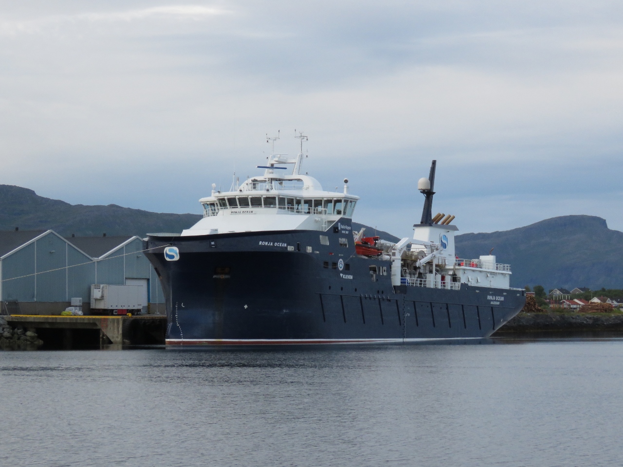 |
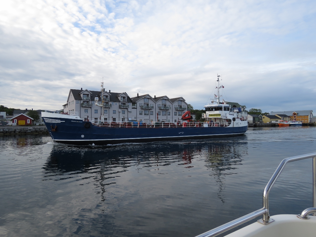
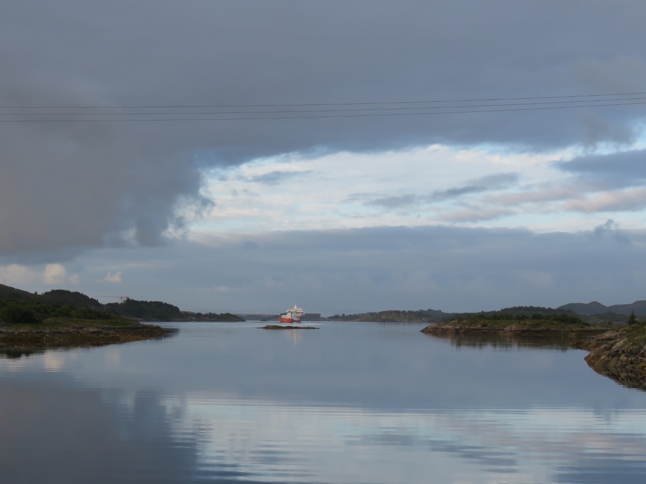
7/8/2018: Ronja Ocean
Position: 65°29.60'N, 12°13.23'E
The fish carrier Ronja Ocean moored just outside Brønnøysund. We've seen several Ronja ships during our time in Norway.
|
 |
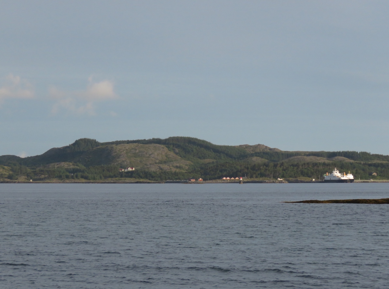
7/8/2018: Waterway
Position: 65°28.58'N, 12°12.54'E
Beautiful calm waters in the channel along Brønnøysund.
|
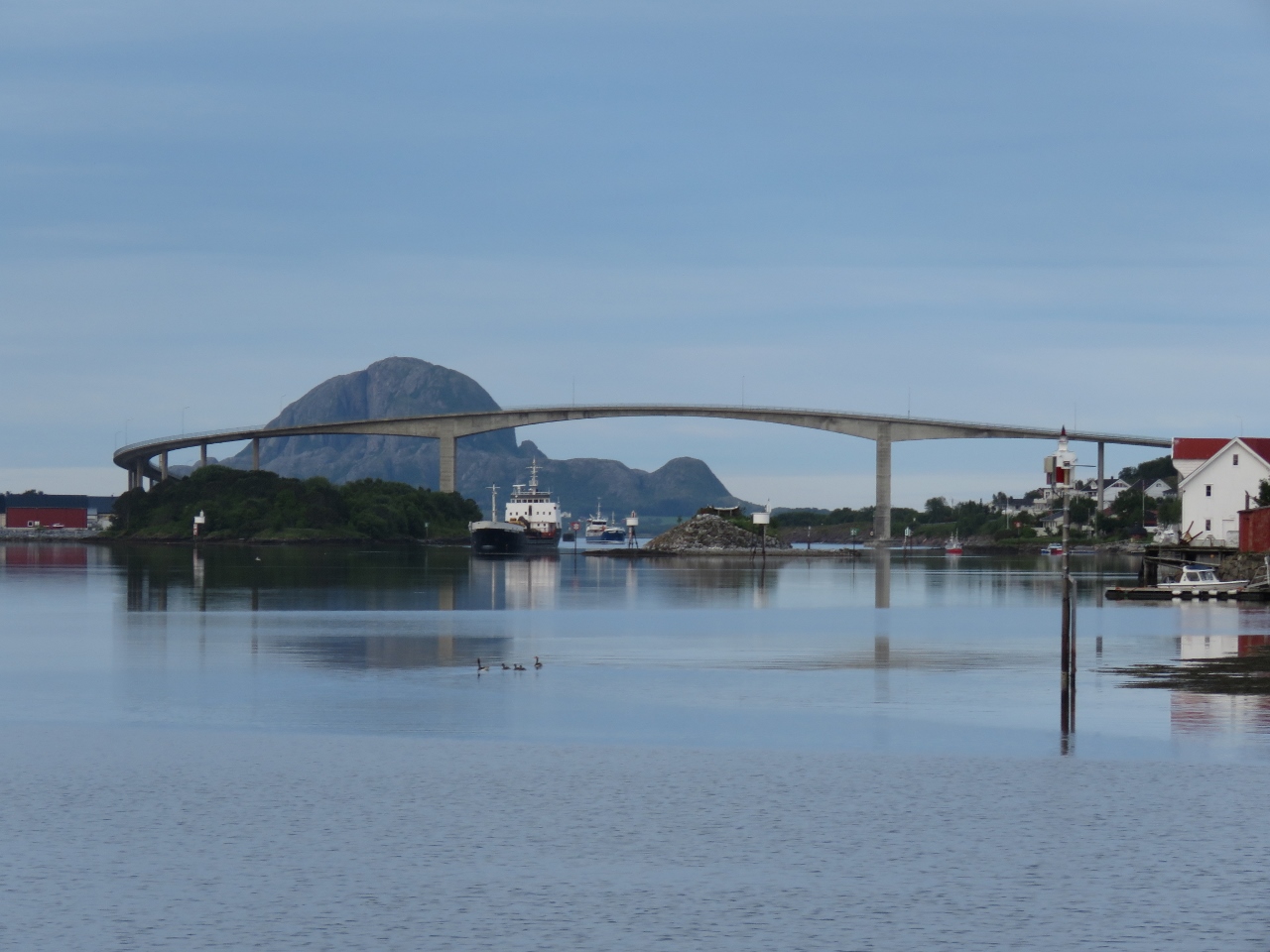 |
7/8/2018: Brønnøysund Bridge
Position: 65°28.58'N, 12°12.54'E
In the distance, we could see opposing traffic approaching under the Brønnøysund Bridge. In the distance is with the mountain with the hole through it, Torghatten.
|
 |
7/8/2018: Guest Dock
Position: 65°28.39'N, 12°12.22'E
Brønnøysund looked so appealing that we considered stopping at the guest dock, but it was only 7am, so a little early to call it a day.
|
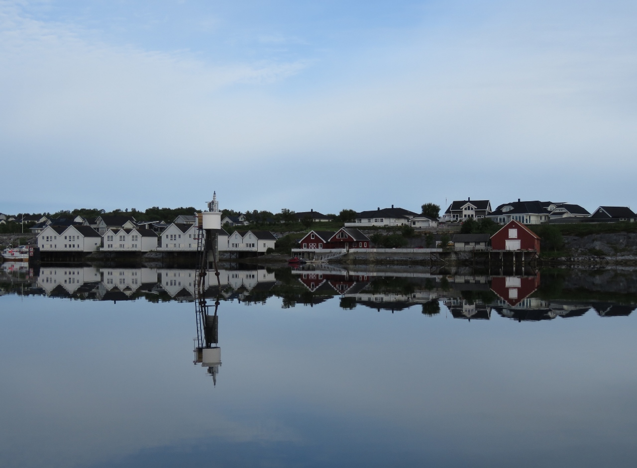 |
7/8/2018: Reflections
Position: 65°28.20'N, 12°11.93'E
Traditional-looking buildings reflected in the calm waters off Brønnøysund.
|
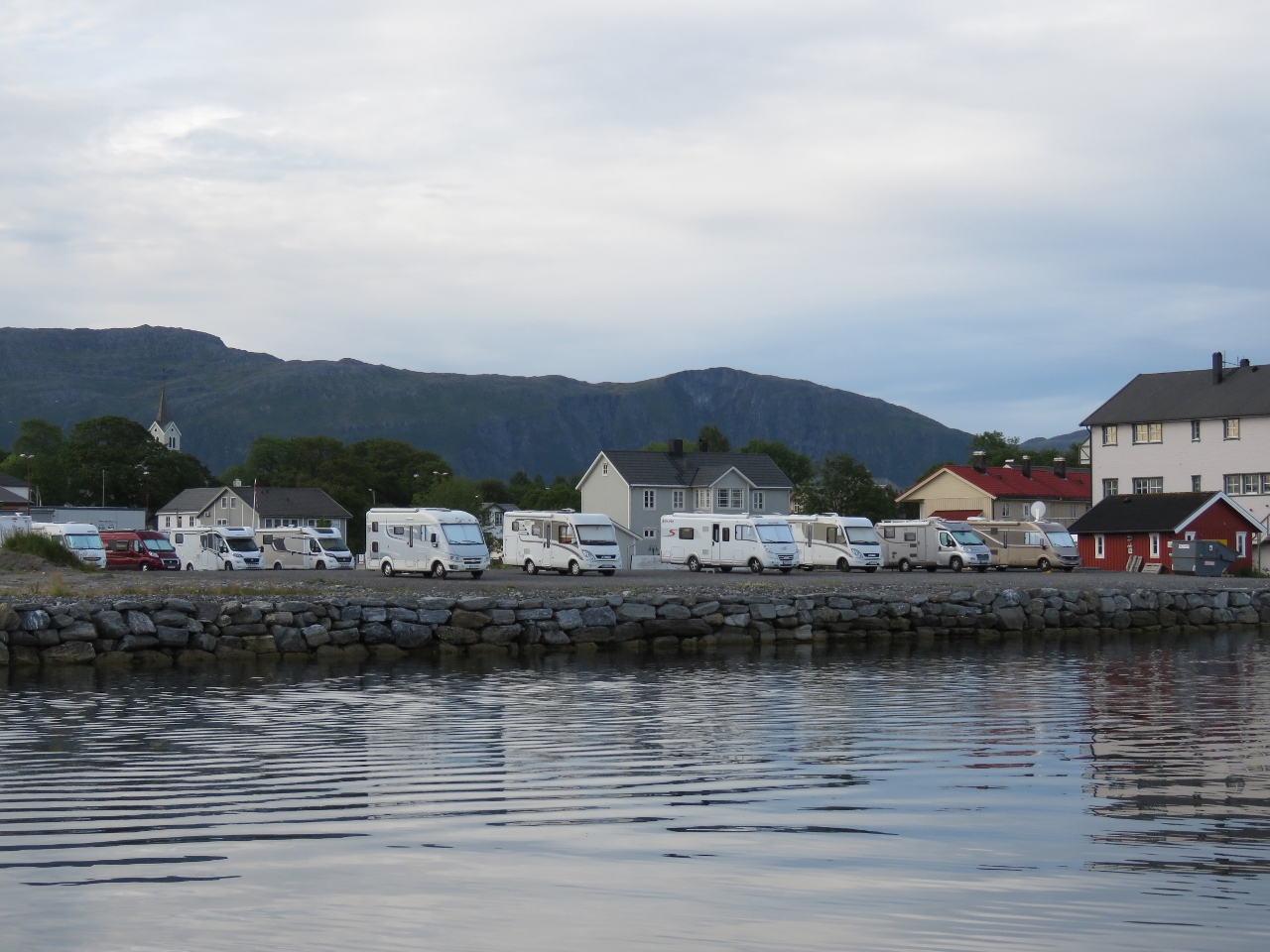 |
7/8/2018: RVs
Position: 65°28.20'N, 12°11.93'E
We've often seen RVs as we've cruised Norway—it's a popular way to explore the country.
|
 |
7/8/2018: Close Quarters
Position: 65°28.12'N, 12°11.75'E
Passing the oncoming traffic off Brønnøysund, with not much space to give.
|
 |
7/8/2018: Torthaggen
Position: 65°25.01'N, 12°8.66'E
From this side, we can only barely see the hole through the mountain Torghatten.
|
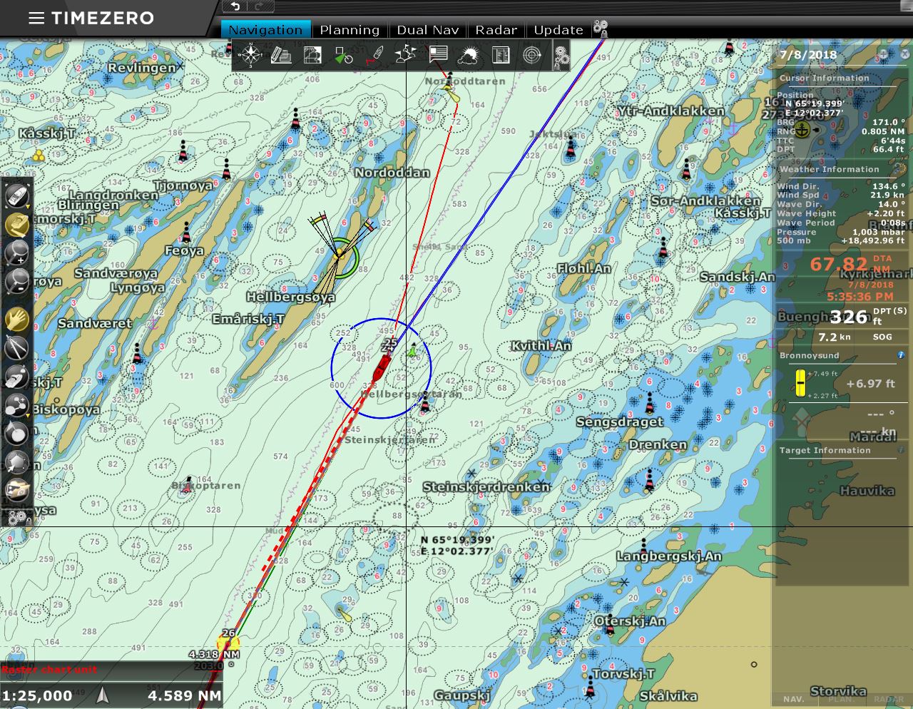 |
7/8/2018: Rejoining Route
Position: 65°20.25'N, 12°2.16'E
We're finally rejoining our route north from May 14th along Norway's sheltered inner lead.
|
 |
7/8/2018: Bungee
Position: 65°4.00'N, 11°45.08'E
The bungee in one section of our canvas cover for the tender needed replacing, so we built a new piece from bulk bungee.
|
 |
7/8/2018: Database Error
Position: 64°56.13'N, 11°26.03'E
In Bodø we realized that the OS hard drive in our navigation computer was failing. We've got a new computer on order that we'll pick up in Seattle, so aren't keen on investing a lot of time on the old system and have been trying to keep it limping along until we reach Trondheim. To reduce the stress on that disk, we moved our main database onto an external USB drive. We thought the transfer had gone smoothly until we attempted to backup the database underway and got this message indicating data corruption. Fortunately we were able to recover the data from backups and get things running again, but it took more time than we wanted to invest.
|
 |
7/9/2018: Kråkøysundet
Position: 64°53.20'N, 11°17.49'E
The view south as we depart that anchorage at Kråkøysundet, just north of Rørvik. On our charts and the satellite imagery, the channel appears exposed to the north and south. But the newer charts show a breakwater across the north end, creating a snug and protected anchorage.
|
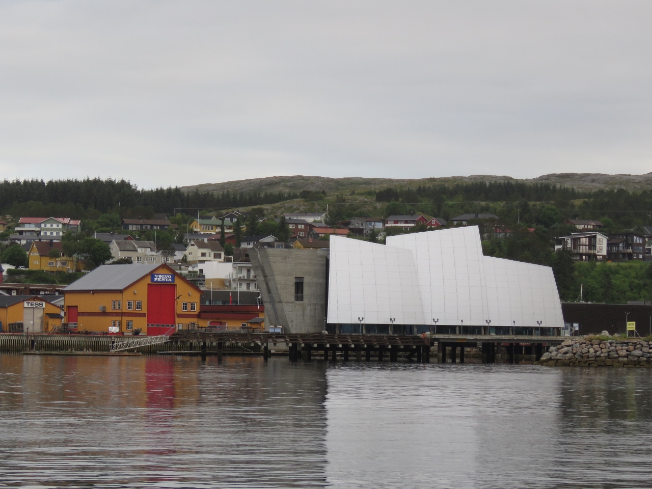 |
7/9/2018: Coastal Museum Norveg
Position: 64°51.32'N, 11°14.00'E
Rorvik's award-winning coastal heritage museum.
|
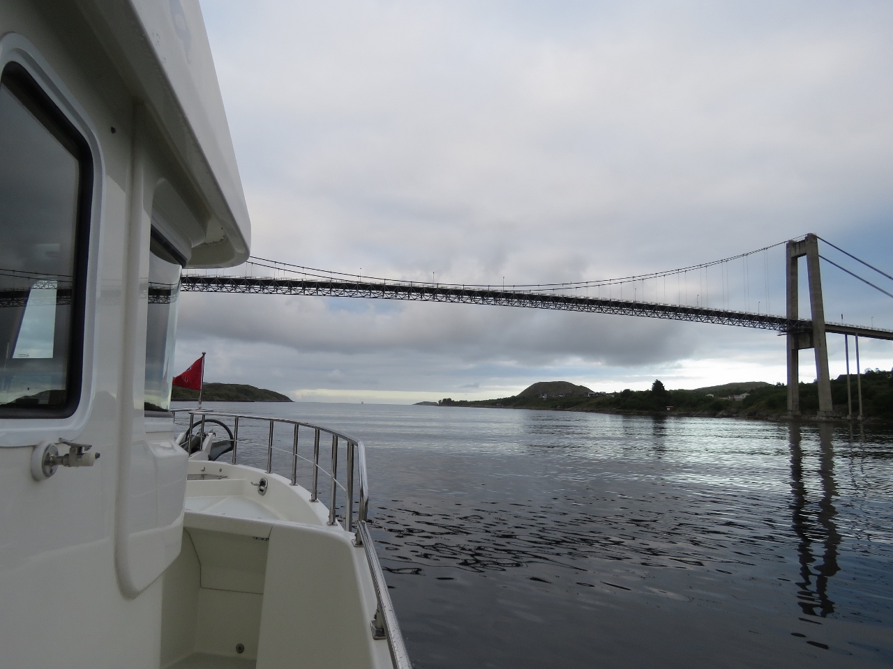 |
7/9/2018: Nærøysund Bridge
Position: 64°50.98'N, 11°13.03'E
Passing back under the Nærøysund Bridge just south of Rorvik.
|
 |
7/9/2018: Villa Lighthouse
Position: 64°33.85'N, 10°40.14'E
The old coal-fired lighthouse on the island of Villa was in operation from 1839 to 1890.
|
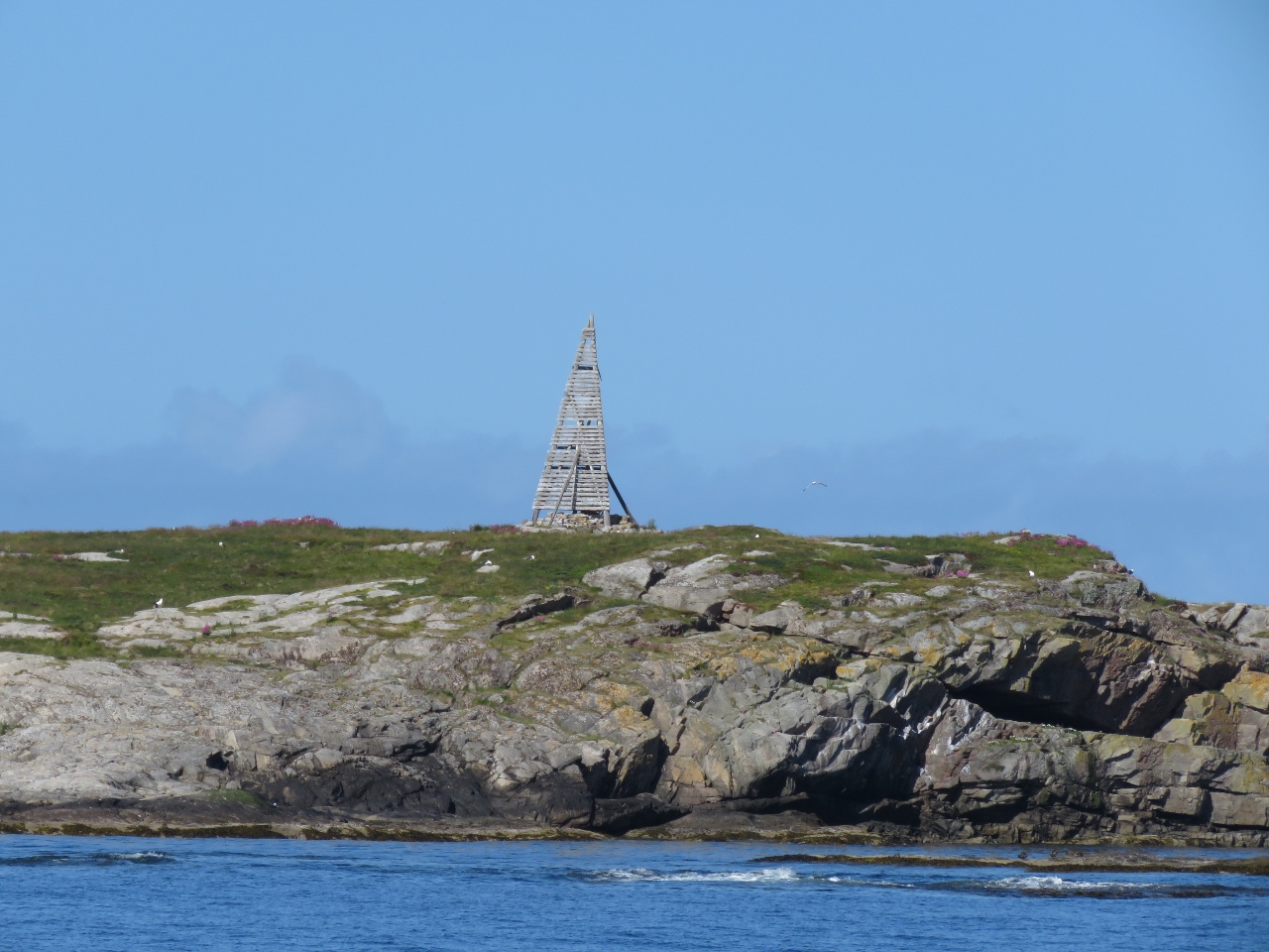 |
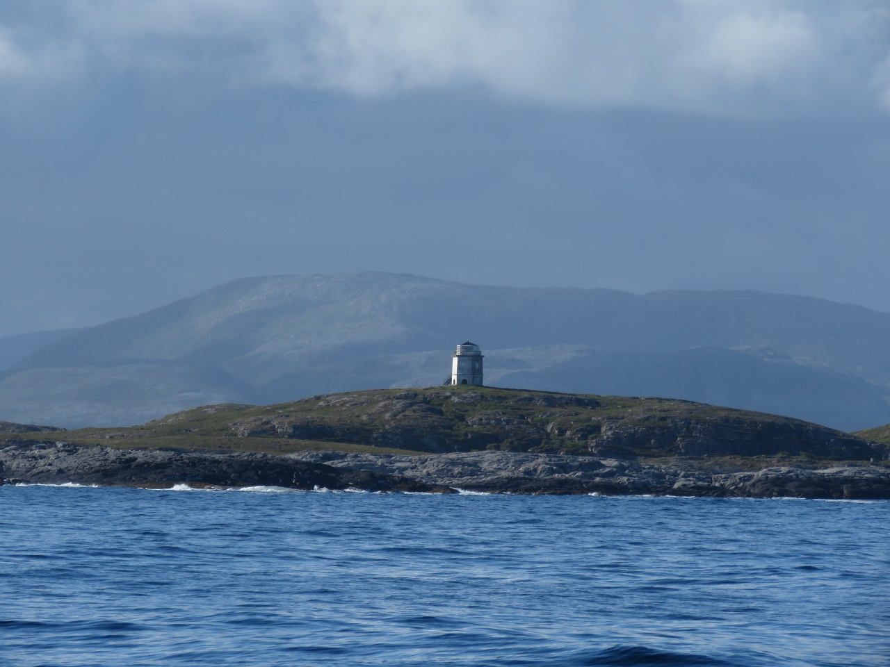
7/9/2018: Navigation Aid
Position: 64°24.82'N, 10°26.37'E
Old-style navigation aid on an islet to our west.
|
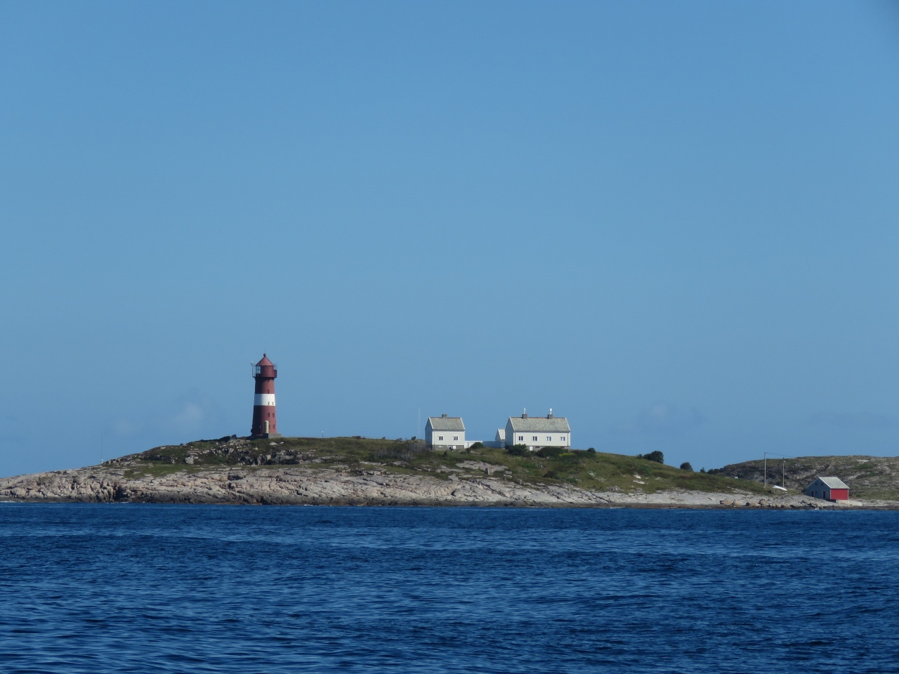 |
7/9/2018: Sønnaholmen Lighthouse
Position: 64°23.03'N, 10°26.89'E
The red-and-white striped tower of the Sønnaholmen Lighthouse to our north.
|
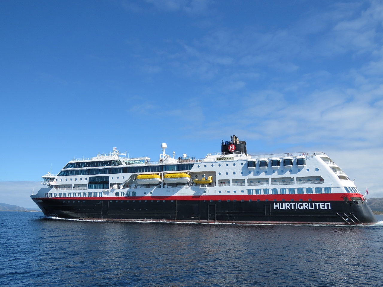 |
7/9/2018: Trollfjord
Position: 63°53.92'N, 9°45.79'E
The Hurtigruten Trollfjord running north. Now that we've spent some time on one, we're noticing that they have a wide variety of ship designs.
|
 |
7/9/2018: Anchorage View
Position: 63°47.72'N, 9°36.42'E
The view east from our anchorage at Hellesvika. Tomorrow we arrive into Trondheim.
|