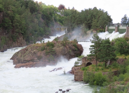
The Trollhattan Falls have been a tourist attraction since the 18th century, but no longer flow since the Gota Alv river was dammed for power in the early 1900s. At scheduled times in the summer, the falls are released as a tourist attraction, sending over 300,000 liters of water pour second gushing into the gorge.
From Hindens Rev on Lake Vanern, Sweden, we passed through the northernmost lock of the Trollhatte Canal at Vanersborg and continued to Trollhattan where we had a berth reserved for a few nights. That afternoon we viewed the falls release and walked along both sides of the the Gota Alv river, taking in the spectacular scenery and the historic Olidan Hydroelectric Station.
Below are trip highlights from August 21st, 2019. Click any image for a larger view, or click the position to view the location on a map. And a live map of our current route and most recent log entries always is available at mvdirona.com/maps.
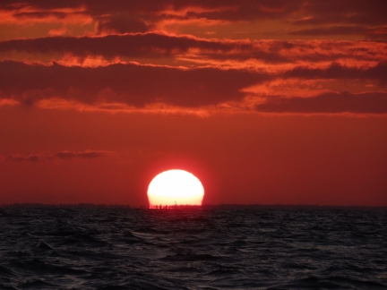 |
Sunrise
Position: 58°36.21’N, 12°48.87’E
Spectacular sunrise from Hindens Rev in Lake Vanern.
|
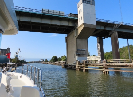 |
Dalbobron Bridge
Position: 58°23.28’N, 12°18.87’E
Passing under the Dalbobron Bridge at Vanersborg as we enter the 51-mile (82km) Trollhatte Canal. The canal will bring us down 143.7ft (43.8 m) from Lake Vanern to sea level on the west coast of Sweden.
|
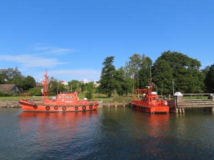 |
Pilot Boats
Position: 58°23.00’N, 12°18.69’E
Pilot boats at Vanersborg. The Trollhatte Canal is an important commercial transportation route, with 3.5 million tons of cargo shipped annually through the waterway.
|
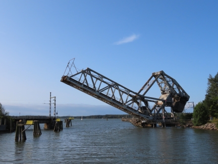 |
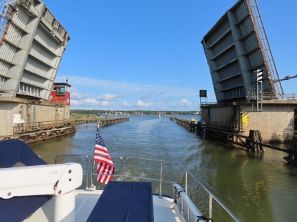
Vanersborg Railway Bridge
Position: 58°22.80’N, 12°18.59’E
The Vanersborg Railway Bridge opening for us to pass through.
|
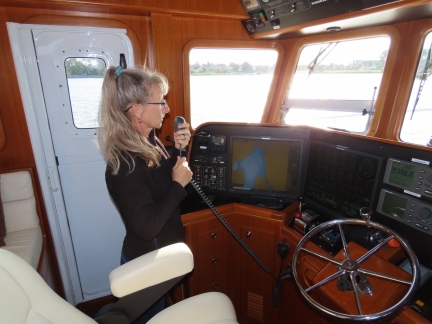 |
Calling Bridge
Position: 58°22.59’N, 12°18.51’E
Calling the Gropbron Bridge to request an opening.
|
 |
Gropbron Bridge
Position: 58°22.09’N, 12°18.97’E
Passing through the Gropbron Bridge lift bridge with another pleasure craft behind.
|
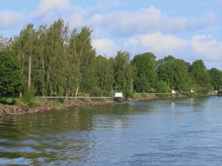 |
Channel Marks
Position: 58°21.95’N, 12°19.09’E
The channel marks in the Trollhatte Canal are mounted on long poles extending into the waterway. They are numbered, and are illuminated at night.
|
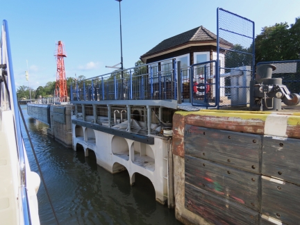 |
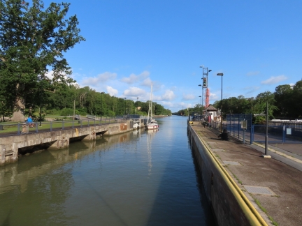
Brinkebergskulle Lock
Position: 58°20.65’N, 12°20.91’E
Entering the Brinkebergskulle Lock with lots of paint scrapes visible on the sides. The maximum dimension for a ship to pass through the Trollhatte Canal is 291 ft (89 m) long, with a 44-ft (13.4 m) beam and a 17.7 (5.4 m) draft and many of the commercial ships barely fit in the locks.
|
 |
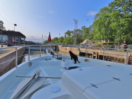
Amalie
Position: 58°20.65’N, 12°20.91’E
The pleasure craft Amalie entering the locks behind us. These locks are huge compared to the those along the Gota Canal.
|
 |
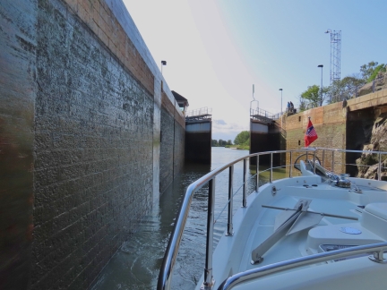
Spitfire
Position: 58°20.46’N, 12°21.07’E
Spitfire on deck to monitor our progress as we enter the Brinkebergskulle Lock.
|
 |
Doors Opening
Position: 58°20.44’N, 12°21.09’E
The doors to the Brinkebergskulle Lock opening after we descended 16ft (4.9m). We’re now at 127.6ft (38.9m) above sea level.
|
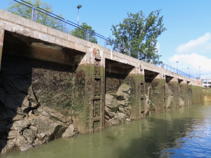 |
Rough Side
Position: 58°20.44’N, 12°21.09’E
Several of the locks along the the Trollhatte Canal have only one smooth side appropriate for pleasure craft to moor against. The other side is rough, presumably because it was cheaper to not finish both sides. The rough side isn’t always on the same side—the Cruising Association Cruising Guide to Sweden has a helpful list that shows which side to tie to.
|
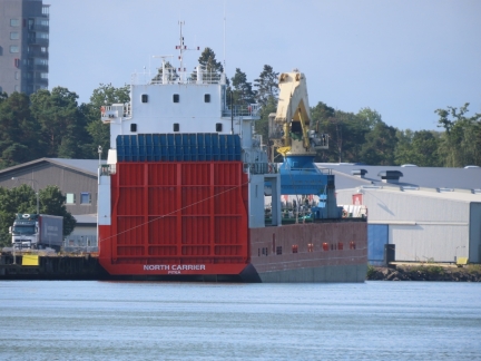 |
North Carrier
Position: 58°18.75’N, 12°19.14’E
The 287ft (87.5m) by 42.9ft (13.06m) cargo ship North Carrier moored at Trollhattan. The ship is only 4 feet shorter and barely a foot narrower than the maximum allowable dimensions for the Trollhatte Canal.
|
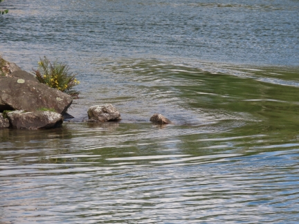 |
Current
Position: 58°17.60’N, 12°17.66’E
Currents in the Gota Alv river can run at 1.5 to 3 knots. We’ve not noticed it much yet, but the current is clearly visible
|
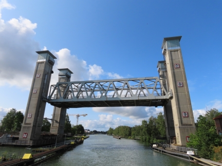 |
Trollhattan Railway Bridge
Position: 58°17.58’N, 12°17.62’E
The Trollhattan Railway Bridge lifting for us to pass. Once it’s up to 10m we can pass through, but it’s lifting higher to allow the sailboat Amalie to pass through as well.
|
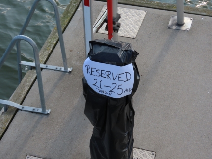 |
Reservation
Position: 58°17.23’N, 12°17.13’E
Our reserved berth at Spikon Gasthamn in Trollhattan. Reservations aren’t necessary, particularly in the off-season, but we called ahead to be sure we’d have a spot as Dirona can only fit in a couple of places there.
|
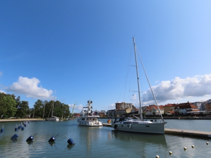 |
Spikon Gasthamn
Position: 58°17.25’N, 12°17.10’E
We’re glad we reserved a berth. The two other boats visible are travelling together and almost certainly have tied off one behind the other on the main pontoon.
|
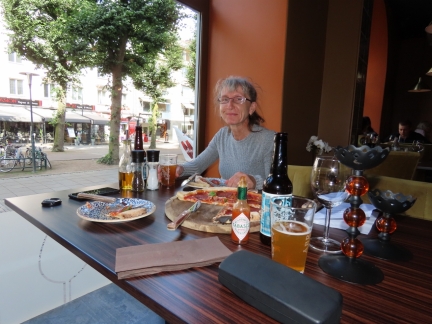 |
Pizza Napoli
Position: 58°17.06’N, 12°17.35’E
We were planning to have lunch at one of the several restaurants along the canal, but all were serving only a buffet or a fixed menu that didn’t appeal to us. We instead had a great meal at Pizza Napoli on the pedestrian mall Kungsgatan.
|
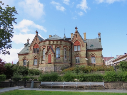 |
Villa Stranna
Position: 58°17.00’N, 12°17.22’E
Villa Stranna, built in the early 1900s, was once the town hall and now is a restaurant and hotel complex.
|
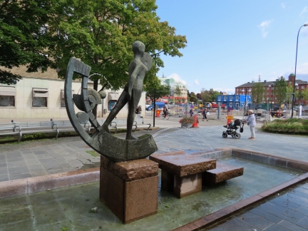 |
Materia et Motus
Position: 58°17.00’N, 12°17.17’E
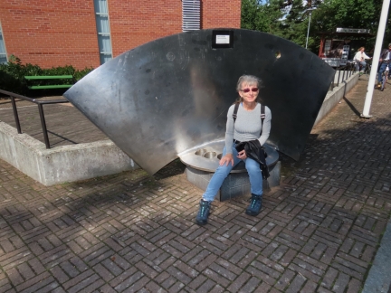
The statue Materia et Motus by artist Ake Jonsson was inspired by Swedish scientist, industrialist, inventor and Trollhatte Lock designer Christopher Polhem whose motto was “Materia et Motus”: “The whole of nature, with everything there is, consists only of two things, namely, Materia (the subject) and Motus (the movement).”
|
 |
Gate
Position: 58°16.89’N, 12°16.87’E
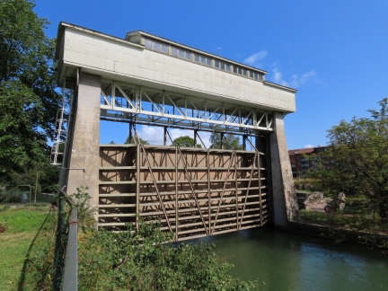
Large gate on the feed to the Olidan Hydroelectric Station. It’s not normally in use, but can be used to limit or shut off water flow.
|
 |
Trollhattans Kyrka
Position: 58°16.79’N, 12°16.72’E
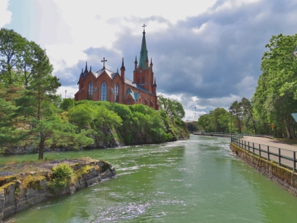
Trollhattans Kyrka, consecrated in 1862, is built on an island in the middle of the canal system.
|
 |
Kungsgrottan
Position: 58°16.81’N, 12°16.66’E
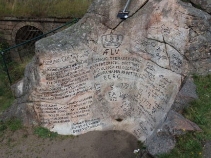
Kungsgrottan (the King’s Cave) contains the signatures of dozens of visiting monarchs, starting with Adolf Fredrik in 1754.
|
 |
Turbine Blade
Position: 58°16.56’N, 12°16.42’E
A large turbine blade near the Olidan Hydroelectric Station.
|
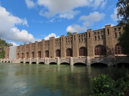 |
Olidan Hydroelectric Station
Position: 58°16.45’N, 12°16.35’E
The Olidan Hydroelectric Station, opened in 1910, was the first large-scale hydroelectric plant in Sweden and is one of the country’s oldest industrial buildings still in use.
|
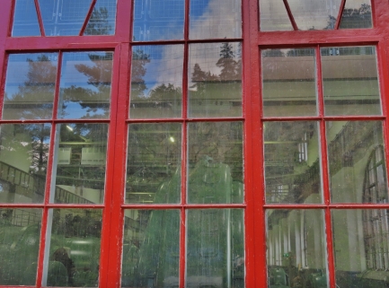 |
Engine Hall
Position: 58°16.55’N, 12°16.37’E
Looking through the window into the engine hall at Olidan Hydroelectric Station in Trollhattan. Initially four turbines were installed, and this increased to 13 by 1921, each with a 10-megawatt capacity.
|
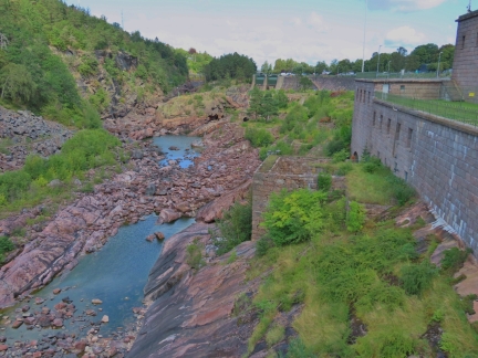 |
Dry Falls
Position: 58°16.82’N, 12°16.64’E
The Trollhattan Falls have been a tourist attraction since the 18th century, but no longer flow since the Gota Alv river was dammed for power in the early 1900s.
|
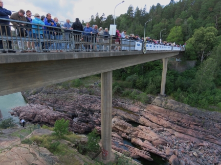 |
Crowds
Position: 58°16.82’N, 12°16.68’E
At scheduled times in the summer, the Trollhattan Falls are released as a tourist attraction. We weren’t the only ones who knew. :)
|
 |
Trollhattan Falls
Position: 58°16.81’N, 12°16.69’E
When the falls are released, over 300,000 liters of water pours through every second. It took surprisingly long for the water to actually reach and fill the gully. Watching the water pour into the gully was a fabulous experience. The ruins visible are of industry that used to operate along the rapids before the flow was dammed.
|
 |
Kopparklinten
Position: 58°16.59’N, 12°16.27’E
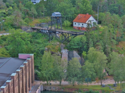
After watching the falls, we walked along the Gota Alv river up to the Kopparklinten lookout for a great view to the Olidan Hydroelectric Station the river. At the far right is a pedestrian bridge that we’ll cross on our return walk (click image for larger view).
|
 |
Portal Crane
Position: 58°16.58’N, 12°16.28’E
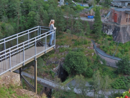
Remains of a 42-ton portal crane built for the construction of the Olidan Hydroelectric Station. Goods were brought by regular rail to the portal crane then lowered 111 ft (34m) down to the power station level where another set of train tracks and two turntables allow rail cars to turn more tightly then would be possible on tracks.
|
 |
Viewing Platform
Position: 58°16.58’N, 12°16.26’E
Jennifer enjoying the view from viewing platform at Kopparklinten.
|
 |
Pedestrian Bridge
Position: 58°16.49’N, 12°16.00’E
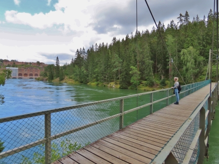
Crossing the Gota Alv river on a pedestrian suspension bridge with a great view to the Olidan Hydroelectric Station.
|
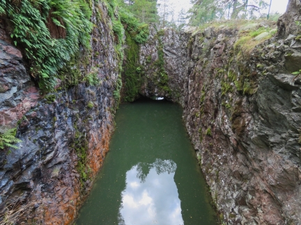 |
Elvius’s Lock
Position: 58°16.45’N, 12°16.02’E
The lowest of a lock system constructed in 1749. To help reduce the pressure on the gates, the lock was built in the form of a tunnel so that the overhead rock would take some of the pressure and only boats with low air draft would be able to pass through. After an construction accident killed nine workers, the project was abandoned due to lack of funding.
|
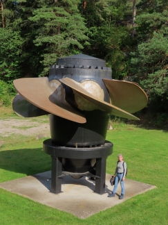 |
Impeller
Position: 58°16.71’N, 12°16.64’E
An old impeller from the Hojum power station that opened in the area in 1943. In 2008, the impeller in one of the generators was upgraded and the old one put on display. The impeller is 17-ft (5.3m) in diameter and could discharge 600 cubic feet (170 cubic meters) per second.
|
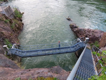 |
Outflow
Position: 58°16.77’N, 12°16.65’E
Jennifer standing on a bridge above the outflow from Hojum power station.
|
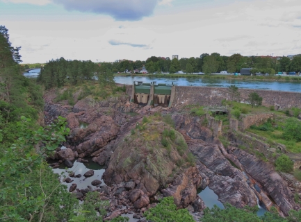 |
Gota Alv River
Position: 58°16.89’N, 12°16.63’E
Looking across the now-dry Trollhattan Falls to the dammed Gota Alv River.
|
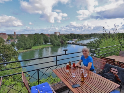 |
Drink
Position: 58°17.14’N, 12°16.80’E
A local IPA on the deck of the Albert Kok Hotel with an awesome view to the Gota Alv River.
|
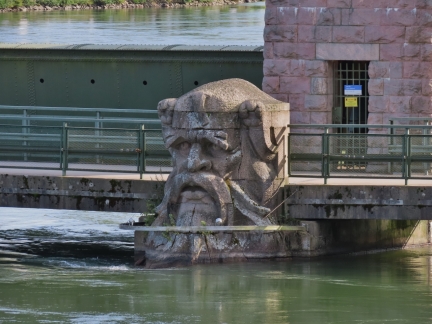 |
Stromkarlen
Position: 58°17.08’N, 12°16.77’E
The sculpture Stromkarlen, a water spirit in Scandinavian folklore, was erected in 1911.
|
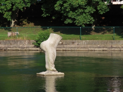 |
Touch
Position: 58°17.04’N, 12°16.88’E
The park near our marina has several large-scale sculptures. This is Touch by Viktor Korneev, depicting a foot touching a sculpted, polished water surface surrounded by real water.
|
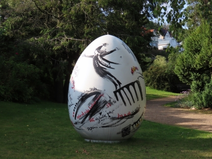 |
Painted Egg
Position: 58°17.17’N, 12°17.02’E
One of several large painted eggs around Trollhattan, this one in the sculpture park near our marina.
|
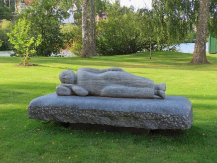 |
Pa Vag
Position: 58°17.23’N, 12°17.13’E
Pa Vag (Swedish for “En Route”) by Ann Carlsson Korneev is of a figure resting on a bed, en route to new thoughts, insights and dimensions.
|
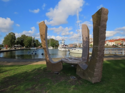 |
Kraftsamlare VI
Position: 58°17.23’N, 12°17.13’E
Kraftsamlare VI (Power Collector No. 6) by Ingemar Lolo Funck Andersson with Dirona visible in the background at Spikon Gasthamn.
|
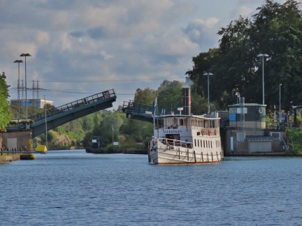 |
Elfkungen
Position: 58°17.23’N, 12°17.13’E
The canal cruise boat Elfkungen passing under the Trollhattan road bridge to dock in town for a short time.
|
 |
Click the travel log icon on the left to see these locations on a map, with the complete log of our cruise.
On the map page, clicking on a camera or text icon will display a picture and/or log entry for that location, and clicking on the smaller icons along the route will display latitude, longitude and other navigation data for that location. And a live map of our current route and most recent log entries always is available at mvdirona.com/maps. |

Love the sculpture! Stromkarlen especially appealing.
After seeing the photo of Jennifer hailing a bridge tender, I wondered how you communicated if the bridge tender did not speak English? Or is English speaking a requirement for bridge tenders?
Wonderful photos and descriptions as always.
Totally agree. The Stromkarlen sculpture is very striking.
On the use of English, some countries are super easy for uni-lingual English speakers and a few are challenging but we always seem to manage. The Netherlands, Norway, Sweden, and Finland are all super easy and there is just about never a problem. Germany, especially in smaller centers, can be more difficult. France has a reputation of being difficult but seems fine in the bigger centers like Paris. At restaurants there have been times when other patrons notice see we are struggling a bit with the menu and offer to help.
English is the language of navigation so it’s rare when it’s not possible to communicate with a ship, lock, or bridge operator. Most marine related officials are comfortable with English. On inland waterways outside of normal international shipping, I suspect there might be times when English won’t work well but we’ve not had problems where were unable to communicate thus far.
I know so little of this part of the world. Thanks for these posts- Very interesting.
Thanks Bruce. We’re really enjoying our time in the area as well.