While in Falmouth, we made a day-trip to Plymouth to visit our friends Jean and Matt Findlay and tour the town. We first met Jean and Matt in 2014 on their Beneteau 57 Superted V on Stewart Island in southern New Zealand and crossed paths an amazing number of times after, but haven’t seen them since Cape Town in December of 2015. Jean and Matt sold Superted V after completing a circumnavigation and now live near Plymouth, where the Mayflower sailed from in 1620 to bring settlers to New Plymouth in the New World. We visited ‘New Plymouth’ and toured a replica of the Mayflower while we were in Boston in 2016, so now we’ve seen both ends of the journey.
Below are trip highlights from December 21st in Plymouth, UK. Click any image for a larger view, or click the position to view the location on a map. And a live map of our current route and most recent log entries always is available at http://mvdirona.com/maps
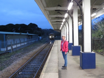 |
Falmouth Docks
Position: -5 3.35, 50 9.05
Waiting at the Falmouth Docks train station on a day trip to Plymouth. The station is the end of the line, so the train you can see arriving will stop here and then the engineer switches ends to depart.
|
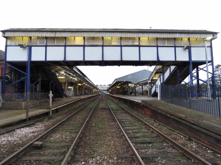 |
Truro
Position: -5 3.78, 50 15.84
To reach Plymouth from Falmouth, we had to change trains in Truro so we took a bit of a walk around in between trains.
|
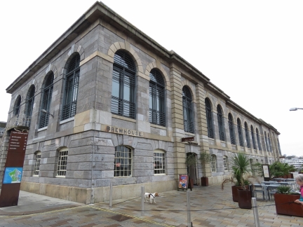 |
Royal William Yard
Position: -4 9.96, 50 21.72
Jean and Matt Findlay met us at the station and took us around to see some of the sights. The 16-acre Royal William Victualling Yard was completed in 1835 and was the main victualling yard for the Royal Navy. The original buildings now are being converted into upscale apartments and restaurants. The area reminded us very much of the Charlestown Navy Yard in Boston, built by the US Navy in 1801.
|
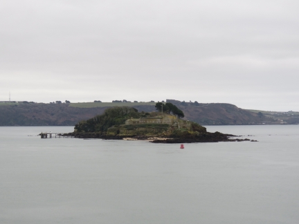 |
Drake’s Island
Position: -4 9.83, 50 21.59
Drake’s Island is named after Sir Francis Drake, whose home port was Plymouth. The visible structures are a defensive battery built in the late 1800s.
|
 |
Dovetailing
Position: -4 9.04, 50 22.06
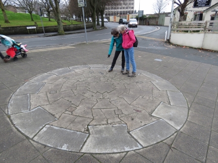
Jean Findlay showing Jennifer a reproduction of how the Smeaton’s Tower, a lighthouse, was built using granite blocks arranged in a dovetail fashion.
|
 |
Sir Francis Drake
Position: -4 8.59, 50 21.90
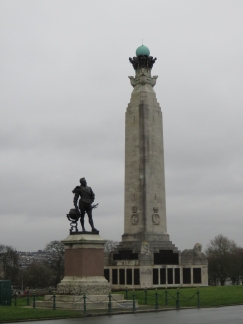
Memorial to Plymouth resident Sir Francis Drake with the Plymouth Naval Memorial in the background. Between 1577 to 1580, Drake completed the second circumnavigation of the world in a single expedition.
|
 |
Smeaton’s Tower
Position: -4 8.51, 50 21.86
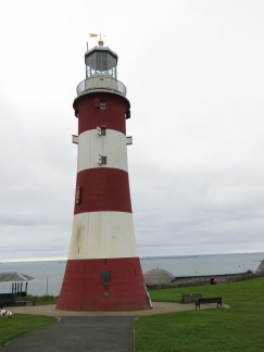
Smeaton’s Tower was the third of four lighthouses built on treacherous Eddystone Reef, 14 miles southwest of Plymouth. The first light, completed in 1698, was swept away in the ‘Great Storm’ of November 1703. The second light operated from 1708 until 1755 when the lantern caught fire and destroyed the lighthouse. Smeaton’s Tower was completed in 1759 and operated until 1882. The sea was undermining the rock it stood on, so the fourth and current light replaced it in 1882, built at a slightly different location. The original Smeaton’s Tower was dismantled and moved to its current location.
|
 |
Tinside Lido
Position: -4 8.52, 50 21.81
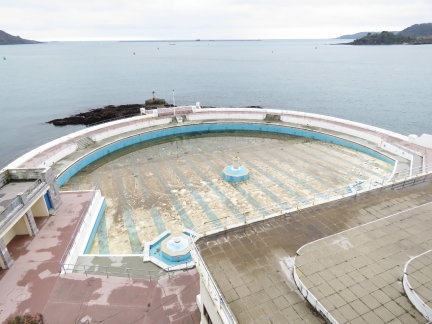
We’ve not seen an outdoor saltwater pool since the Wave Lagoon in Darwin, Australia. The Tinside Lido at Plymouth is apparently quite popular in the summer, but the water has to be awfully cold.
|
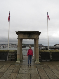 |
Mayflower
Position: -4 8.03, 50 21.97
Jennifer standing at the Mayflower gate. The Mayflower sailed from Plymouth UK in 1620 to bring settlers to New Plymouth in the New World. We visited ‘New Plymouth’ and toured a replica of the Mayflower while we were in Boston in 2016, so now we’ve seen both ends of the journey.
|
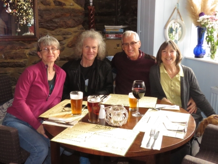 |
Jean & Matt Findlay
Position: -4 8.10, 50 21.96
We first met Jean and Matt Findlay on their Beneteau 57 Superted V in March of 2014 on Stewart Island in southern New Zealand. We crossed paths an amazing number of times after, but haven’t seen them since Cape Town in December of 2015. Jean and Matt sold Superted V after completing a circumnavigation and now live near Plymouth. It was wonderful to see them again, and we had a great time catching up and exploring the town.
|
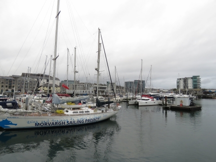 |
Inner Harbour
Position: -4 8.08, 50 22.06
The Plymouth inner harbour is packed with marinas and boats.
|
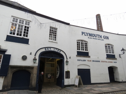 |
Plymouth Gin
Position: -4 8.26, 50 22.07
Black Friars Distiller currently is the only producer of Plymouth Gin, a Protected Geographical Indication pertaining to any gin distilled in Plymouth, England.
|
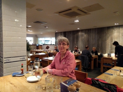 |
Rick Stein’s Fish
Position: -5 3.78, 50 9.08
After returning to Falmouth, we stopped in at Rick Stein’s Fish for an exceptional meal.
|

|
Click the travel log icon on the left to see these locations on a map, with the complete log of our cruise.
On the map page, clicking on a camera or text icon will display a picture and/or log entry for that location, and clicking on the smaller icons along the route will display latitude, longitude and other navigation data for that location. And a live map of our current route and most recent log entries always is available at http://mvdirona.com/maps. |

If your comment doesn't show up right away, send us email and we'll dredge it out of the spam filter.