Despite all our travels, Jennifer had never been to Mexico and James had only briefly visited once, years ago for a conference in Cancun. Jennifer finally reached America’s neighbor to the south early this year on a fabulous weekend trip to Cabo San Lucas at the southern tip of Mexico’s Baja California Peninsula. James started the trip in decidedly colder conditions, on a business trip to Minneapolis, and we met up in Los Angeles for the flight to Mexico.
We stayed in a beautiful suite overlooking the Pacific Ocean at the Waldorf Astoria. The hotel has several waterfront restaurants, and is an easy walk to the large marina and many more restaurants of Cabo San Lucas. Besides exploring the town, we also took in the ocean-side scenery and wildlife on a whale-watching tour. The winter months offer excellent whale-watching opportunities in Cabo San Lucas, when humpback whales begin their annual migrate north to Alaska and British Columbia after breeding in the warm waters of Baja California Sur.
Below are highlights from February 2-6, 2024. Click any image for a larger view, or click the position to view the location on a map. And a map with our most recent log entries always is available at mvdirona.com/maps.
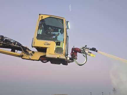 |
Deicing at Minneapolis
Position: 44°53.23’N, -93°13.67’W
Deicing the plane prior to James’ flight from Minneapolis to Los Angeles.
|
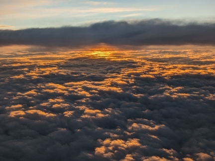 |
Sunrise Departing Seattle
Position: 46°50.92’N, -122°7.76’W
Sunrise over the clouds as Jennifer’s flight to Los Angeles departs the Seattle area.
|
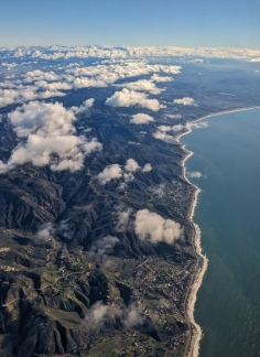 |
California Coast
Position: 34°6.48’N, -118°44.91’W
View to the California coast as Jennifer’s flight nears Los Angeles.
|
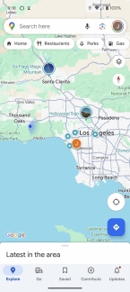 |
Nearing James
Position: 34°7.57’N, -118°43.69’W
We’re spending the weekend in Cabo San Lucas, Mexico and, with James away on business the three days prior, we’ll be meeting up in Los Angeles and continuing together from there. The orange circle with a ‘J’ inside shows James’ location, already at the Los Angeles airport, and the blue circle to the left is Jennifer’s location as her flight approaches.
|
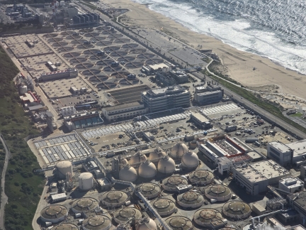 |
Hyperion Water Reclamation Plant
Position: 33°56.16’N, -118°25.83’W
Passing over the Hyperion Water Reclamation Plant as our flight takes off from Los Angeles for Cabo San Lucas. Operating since 1894, the plant is Los Angeles’ oldest and largest wastewater treatment facility. Why we would allocate ocean-front property to one of the least desirable uses of real estate escapes us.
|
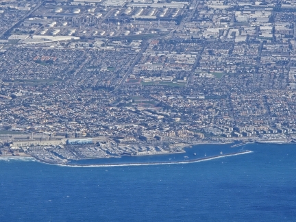 |
Redondo Beach
Position: 33°50.41’N, -118°31.08’W
View to Redondo Beach as our flight takes of from Los Angeles for Cabo San Lucas. The city is known for surfing and beach volleyball.
|
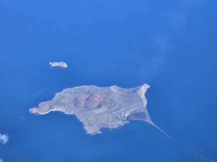 |
Isla San Luis
Position: 29°55.09’N, -114°32.20’W
Flying over uninhabited Isla San Luis, a Mexican island in the Gulf of California, en route to Cabo San Lucas.
|
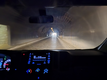 |
Hotel Tunnel
Position: 22°52.64’N, -109°54.78’W
The hotel we’re staying at in Cabo San Lucas, the Waldorf Astoria, is reached by a tunnel carved through Pedregal Mountain.
|
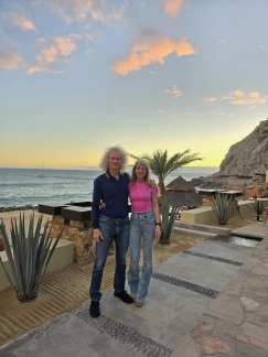 |
Dusk
Position: 22°52.47’N, -109°54.74’W
We arrived out our hotel, the Waldorf Astoria, just before dusk. Despite all our travels, this is Jennifer’s first time in Mexico. James visited Cancun years ago for a conference, but otherwise hasn’t spent any time here either.
|
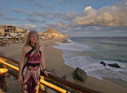 |
Champagne Terrace
Position: 22°52.43’N, -109°54.84’W
Looking across the beach in front of our hotel from The Champagne Terrace at El Farallon restaurant where we’ll be having dinner tonight. Visible in the distance is 442-ft (135m) Mt Solmar at Land’s End.
|
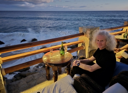 |
Surf
Position: 22°52.43’N, -109°54.84’W
Enjoying the view to the surf from The Champagne Terrace at El Farallon restaurant, with 20 different champagnes on offer by the glass.
|
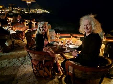 |
El Farallon
Position: 22°52.40’N, -109°54.85’W
An excellent meal at El Farallon restaurant in our hotel complex in Cabo San Lucas. We loved the view to the pounding surf below from our table at the edge of the terrace.
|
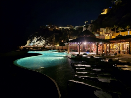 |
Pool
Position: 22°52.46’N, -109°54.74’W
One of the infinity pools at our hotel in Cabo San Lucas. Strung along the base of the cliff in the distance is the restaurant El Farallon, where we had dinner earlier this evening.
|
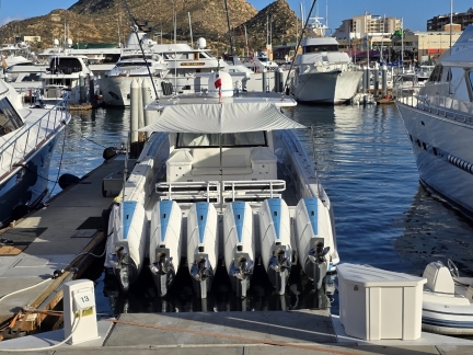 |
3,600 HP
Position: 22°52.86’N, -109°54.67’W
Six V12 Mercury Verado 600s sets the record for the most horsespower we’ve ever seen on the back of a sportsfisher. We thought the 2,508 hp we saw at the Miami Boat Show was already pretty out there. This combination at the Marina Cabo San Lucas is 3,600HP, 45.6 liters, 2,782 cubic inches, 72 cylinders, and 7,560 pounds (3,430 kg) for a hefty $450,780.
|
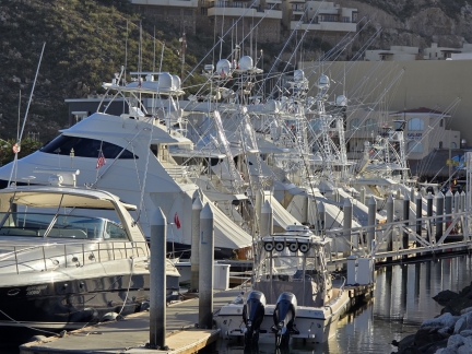 |
Sportsfishers
Position: 22°52.95’N, -109°54.61’W
Cabo San Luca is a popular fishing destination and the marina is full of large and beautifully-maintained sportsfishers.
|
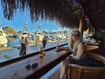 |
EcoBar
Position: 22°52.91’N, -109°54.64’W
Enjoying a Mexican Modelo while taking in the the scene along the boardwalk at Marina Cabo San Lucas.
|
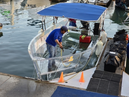 |
Clear boat
Position: 22°53.16’N, -109°54.65’W
Small boat tours are popular in Cabo San Lucas, and local company Envatours pioneered the completely clear tour boat to allow guests to enjoy the underwater life as well. The boats look quite innovative.
|
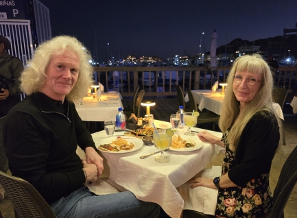 |
Vibrant
Position: 22°53.16’N, -109°54.64’W
A great meal at Vibrant restaurant overlooking Marina Cabo San Lucas.
|
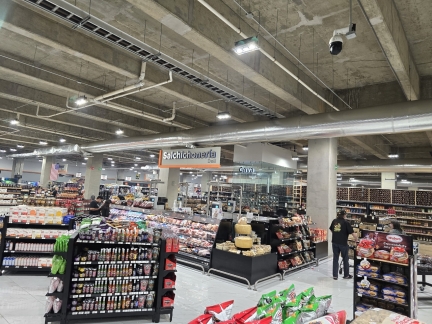 |
Urban Market
Position: 22°53.24’N, -109°54.54’W
Shopping at Urban Market in Cabo San Lucas to bring home a few provisions for our hotel room.
|
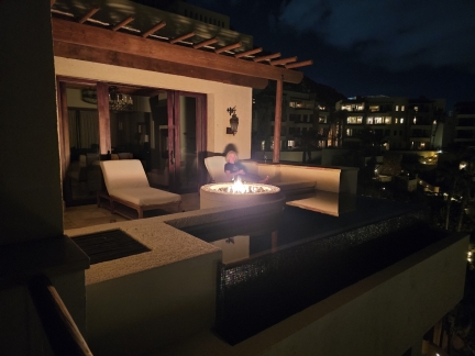 |
Fire pit
Position: 22°52.49’N, -109°54.71’W
Enjoying the evening at the fire pit on the deck of our room at the Waldorf Astoria in Cabo San Lucas.
|
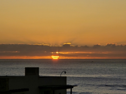 |
Sunrise
Position: 22°52.49’N, -109°54.71’W
Sunrise over the Pacific Ocean, viewed from the deck of our Cabo San Lucas hotel room.
|
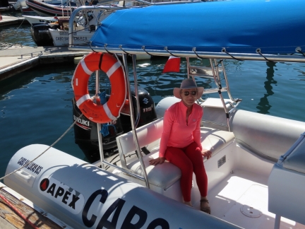 |
Cabo Expeditions
Position: 22°52.80’N, -109°54.49’W
At the Marina Cabo San Lucas for an excellent afternoon of whale-watching tour with Cabo Expeditions.
|
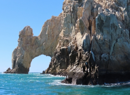 |
El Arco
Position: 22°52.63’N, -109°53.62’W
Passing the famous Arch of Cabo San Lucas, at the tip of Land’s End, on our whale-watching tour with Cabo Expeditions.
|
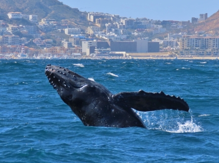 |
Humpback whale
Position: 22°52.51’N, -109°51.85’W
The winter months offer excellent whale-watching opportunities in Cabo San Lucas, when humpback whales begin their annual migrate north to Alaska and British Columbia after breeding in the warm waters of Baja California Sur.
|
 |
Orcas
Position: 22°50.48’N, -109°52.68’W
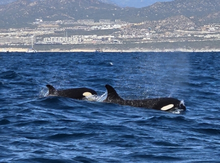
Orcas pods don’t migrate, but they do move large distances in search of food. Found most often in colder waters such as Alaska and Norway, some do live off Cabo San Lucas.
|
 |
Infinity pool
Position: 22°52.49’N, -109°54.71’W
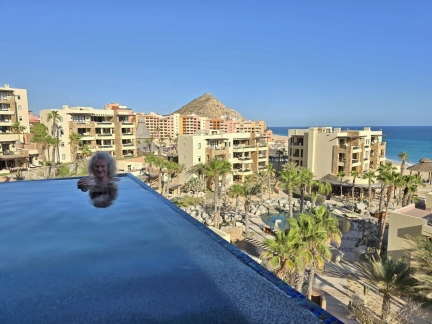
Cooling off in the infinity plunge pool on the deck of our Cabo San Lucas hotel room.
|
 |
Baja Brewing
Position: 22°53.21’N, -109°54.35’W
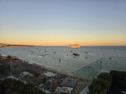
The sunset view from Baja Brewing looking across Medano Beach to boats moored off Cabo San Lucas, including the cruise ship Navigator of the Seas.
|
 |
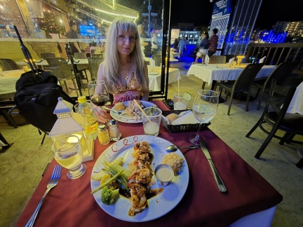
Tres Sirenas
Position: 22°53.26’N, -109°54.34’W
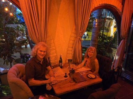
A delicious dinner at Tres Sirenas in Cabo San Lucas.
|
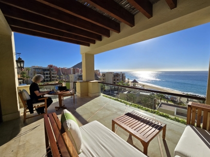 |
The Office
Position: 22°52.49’N, -109°54.72’W
Getting some work done on the deck of our Cabo San Lucas hotel room.
|
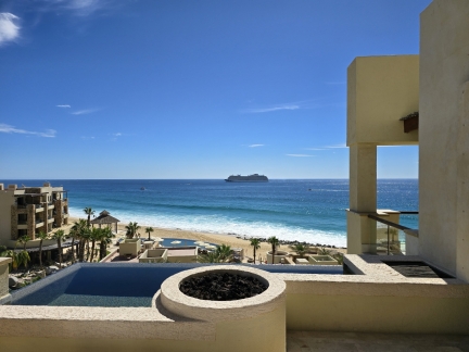 |
Cruise Ship
Position: 22°52.50’N, -109°54.72’W
One of a steady stream of cruise ships arriving and departing Cabo San Lucas. We very much enjoyed our room at the Waldorf Astoria, the Estrelle Suite, with its multiple decks and views to the ocean and the pounding surf. We often spotted migratory whales from here as well.
|
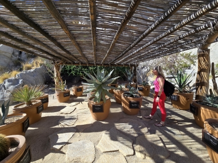 |
Cactus Garden
Position: 22°52.52’N, -109°54.72’W
Checking out the extensive cactus garden on the grounds of our Cabo San Lucas hotel.
|
 |
Pochos
Position: 22°53.16’N, -109°54.64’W
A fun evening at Pochos overlooking Marina Cabo San Lucas.
|
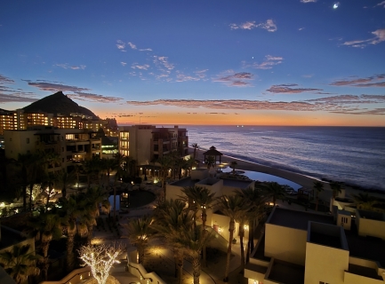 |
Dawn
Position: 22°52.49’N, -109°54.72’W
Dawn overlooking the Waldorf Astoria hotel complex, with 442-ft (135m) Mt Solmar at Land’s End visible in the distance at left.
|
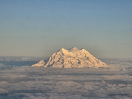 |
Mt. St. Helens
Position: 46°54.89’N, -122°35.31’W
A great view to Mt. St. Helens on our flight back to Seattle from Cabo San Lucas.
|

|
Click the travel log icon on the left to see these locations on a map. And a map of our most recent log entries always is available at mvdirona.com/maps. |

If your comment doesn't show up right away, send us email and we'll dredge it out of the spam filter.