November brought winter weather to Seattle, with heavy rainfall and temperatures that brushed around freezing. We escaped the cold weather, but not the rain, on an Amazon River cruise later in the month. Temperatures there were in the high 90s F (32 C), with the sporadic downpours typical of the tropics. Preparing for the trip influenced where we went earlier in the month, when we twice got travel inoculations at a pharmacy in the U-district (University of Washington) and stopped in at a nearby brewery for some late-season fresh hop beer.
Football season is far from over in November, but this month we attended our last live Seahawks game of the year as we’ll be out of town for the rest of the home games. We also attended a couple of Kraken hockey games. The team isn’t doing as well as last year, and we lost both games, but we still enjoyed attending.
Below are highlights from November 2 through 30th, 2023. Click any image for a larger view, or click the position to view the location on a map. And a map with our most recent log entries always is available at mvdirona.com/maps.
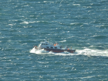 |
Swift Arrow
Position: 47°36.92’N, -122°20.66’W
The port tender Swift Arrow working to weather in Elliot Bay, where the winds are blowing a steady 18 knots with gusts to 30. During the storm, a container-laden barge broke loose from its mooring on Harbor Island and the wind blew it across Elliott Bay, where it crashed into the marina wall at Pier 66. Nobody was hurt, mostly due to the efforts of a King County fast ferry operator who used his vessel to keep the barge away from the Seattle Aquarium and nearby businesses.
|
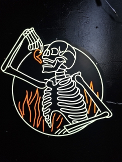 |
Vindicktive Wings
Position: 47°36.84’N, -122°20.83’W
We spend way too much time at Vindicktive Wings, but we love the food and vibe there. This is their awesome logo, done up in neon.
|
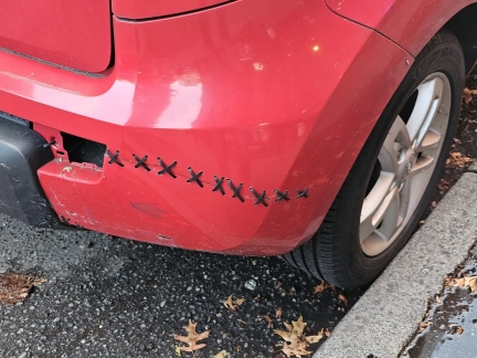 |
Drifters’ Stitch
Position: 47°36.83’N, -122°20.83’W
A “drifters’ stitch” is a way to fix a torn bumper with zip ties. It’s a creative solution to an expensive problem.
|
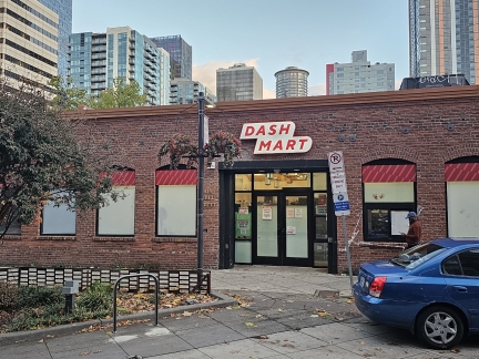 |
DashMart
Position: 47°36.94’N, -122°20.61’W
DashMarts are an expansion of the Door Dash restaurant meal delivery system. The private convenience store is for Door Dash deliverers only, and stock products from a variety of businesses to provide same-day local delivery of home essentials.
|
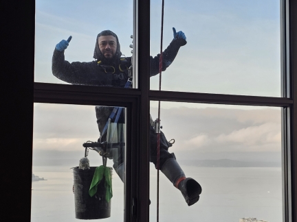 |
Window Cleaning
Position: 47°36.99’N, -122°20.58’W
A window cleaner striking a post for us, forty stories up, during the biannual window cleaning at our Seattle apartment building.
|
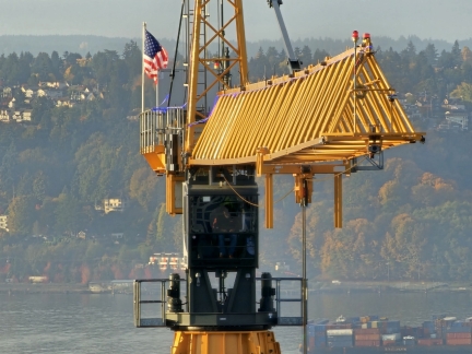 |
Crane Operator
Position: 47°36.99’N, -122°20.58’W
The crane operator at the Belltown 36 apartment complex under construction to our west just arrived into the cab and, after cleaning the windows, is ready to start his day.
|
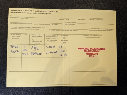 |
Vaccinations
Position: 47°40.10’N, -122°16.60’W
We’ll be heading to Peru for an Amazon River Cruise later this month, and today got three vaccinations at Katterman’s Sand Point Pharmacy: Yellow Fever, Typhoid and Rabies. Some countries require proof of vaccination against Yellow Fever to enter, so the shot comes with an International Certificate of Vaccination.
|
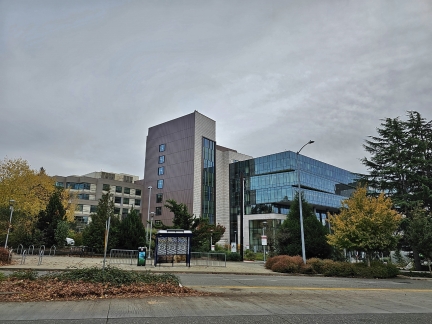 |
Seattle Children’s Hospital
Position: 47°39.82’N, -122°17.06’W
Passing the Seattle Children’s Hospital main campus in Sand Point as we walked from Katterman’s Sand Point Pharmacy after our travel vaccinations. The 407-bed facility is one of the top children’s hospitals in the country. The Oktoberfest charity event we attended a few weeks ago was to support families of children being treated here.
|
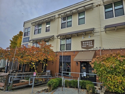 |
Burke-Gilman Brewing Co
Position: 47°39.68’N, -122°17.28’W
At Burke-Gilman Brewing Co in Sand Point for a post-vaccination pint of fresh hop IPA.
|
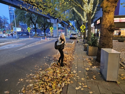 |
Leaves
Position: 47°37.05’N, -122°20.99’W
Jennifer never can resist wading through a pile of fall leaves.
|
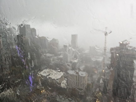 |
Storm
Position: 47°36.99’N, -122°20.59’W
A storm system is passing through the area today, bringing heavy rain and dark skies. So much rain is running down our apartment window that we can barely see through it.
|
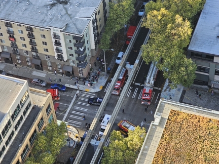 |
Emergency Vehicles
Position: 47°36.99’N, -122°20.59’W
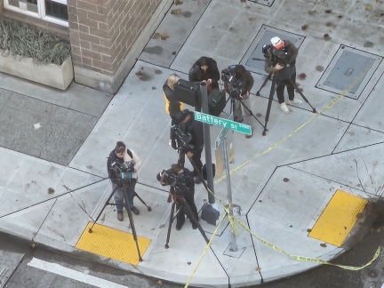
We noticed four fire trucks, at least eight ambulances, and multiple police cars blocking the intersection at 5th and Battery at the northwest corner of our apartment complex. It’s unusual to see that many trucks deployed. The bus visible at bottom right crashed into our apartment complex.
|
 |
News Cameras
Position: 47°36.99’N, -122°20.58’W
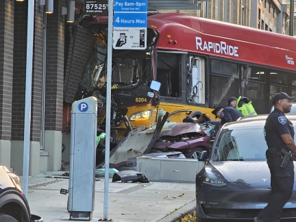
News cameras arrived soon after the fire trucks.
|
 |
Fatal Accident
Position: 47°37.10’N, -122°20.57’W
Walking to the Kraken game, we saw the accident site. The purple car had run a red light on 5th and hit the bus proceeding northeast on Battery. The bus crashed into the building, injuring several on board and killing a pedestrian. Rescue workers removed the roof of the car to extract the driver, who was also injured.
That’s pretty scary, as we frequently walk through that intersection. The only real lesson we can draw from this, however, is to be careful when crossing an intersection as Seattle drivers often run red lights. The driver has since been charged with vehicular homicide. |
 |
Seattle Kraken Banner
Position: 47°37.31’N, -122°21.25’W
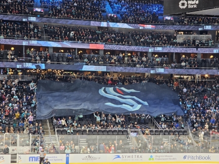
A large Kraken banner being passed over the fans as the Kraken take on the Calgary Flames. We enjoyed the game, but the Kraken lost to the Flames 6-3.
|
 |
Accident Scene
Position: 47°37.01’N, -122°20.66’W
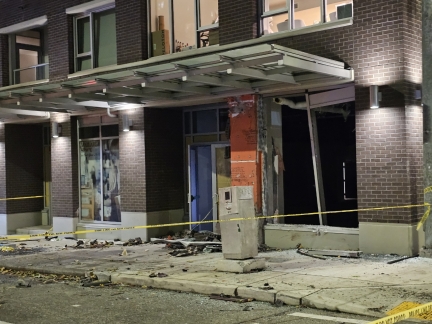
The bus and other vehicles had been towed from the accident scene by the time we walked by on our way home from the Kraken game. The street still is blocked to traffic. The building is fairly heavily damaged, but has been determined to be structurally sound.
|
 |
The Victor Tavern
Position: 47°36.92’N, -122°20.42’W
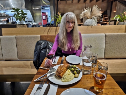
Sharing a half roast chicken at Victor Tavern. We really like the chicken, especially now that they’ve changed the side from grits to brussel sprouts and whipped potatoes. Even sharing it, this is a lot of food and we took some home for lunch tomorrow.
|
 |
Accident Scene
Position: 47°37.02’N, -122°20.66’W
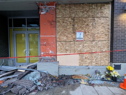
Flowers left at the accident scene in memory of the pedestrian that was killed. The street has now been reopened the day after the accident, and the building window boarded up, but a pile of debris still remains at the site.
|
 |
British Passport Renewal
Position: 47°36.86’N, -122°20.14’W
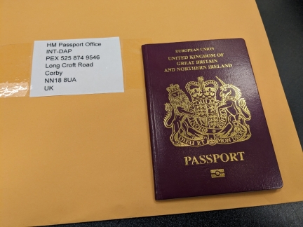
Jennifer was born in Manchester UK and in 2013 applied for her first UK passport when we were living in Hawaii. We thought it might come in handy during our travels, and it ended up being incredibly valuable during the four years we lived in Europe. As an EU citizen, Jennifer and her immediate family had Right of Free Movement and weren’t restricted to 90 out of 180 days in the Schengen immigration area that covers most of Europe.
The passport is less useful now post-Brexit, but it’s still worth renewing it for option value. |
 |
Climbing Formwork Disassembly
Position: 47°36.99’N, -122°20.58’W
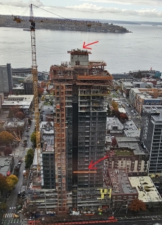
Many of the high-rises under construction in our neighborhood using a climbing formwork that hydraulically lifts up through the core of the building as each floor is completed (the core is the central structure of the building that provides primary support and houses the elevator supports). During construction, the core supports the climbing formwork and its hydraulic cement distribution boom, which is a wonderful invention where cement is pump up from street level and the boom distributes where needed one floor at a time.
Some climbing formworks can lift to the next floor in as little as 20 minutes. We never saw the climbing formwork actually move at the Belltown 36 apartment building to our west, but we’ve noticed it getting progressively higher with each floor. Today the climbing formwork is being disassembled now that the building has reached its maximum height. Our view to the cruise ship dock at Pier 66 is now partially blocked, but not as bad as we were expecting. |
 |
Crane Operator Descending
Position: 47°36.99’N, -122°20.58’W
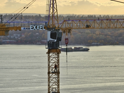
After two years of never seeing the crane operator entering or leaving the cab, we’ve caught him twice in a week.
|
 |
Souvenir
Position: 47°36.95’N, -122°20.61’W
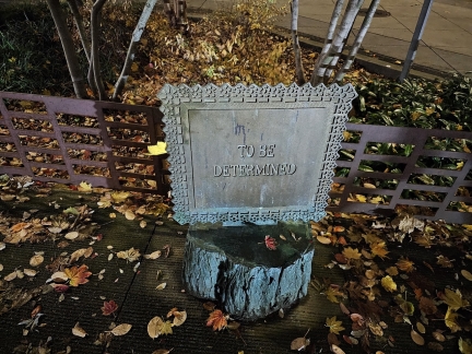
We rarely walk on the south side of Bell Street between 5th and 4th, so haven’t notice this installation of Sheila Klein’s artwork Souvenir. The work, installed in 2014, is inspired by her time renting an apartment among Belltown’s artist community in the 1980s. One piece is in each of the four blocks of Bell Street Park, a park-like corridor between 1st and 5th Avenues. We’ve noticed one other of the four sculptures, entitled “That was something we used to do”, between 2nd and 3rd. Given how frequently we walk through the area, it’s surprising we’ve not seen them all yet.
|
 |
Sunset
Position: 47°36.99’N, -122°20.59’W
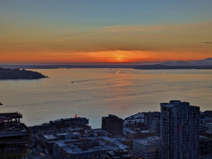
A beautiful sunset over calm waters in Elliott Bay. The days are getting shorter, and after daylight savings time the sun is now setting before 5pm.
|
 |
Construction Worker
Position: 47°36.92’N, -122°20.66’W
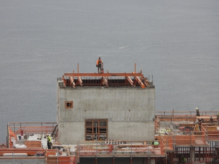
A construction worker perched high above the city at the Belltown 36 apartment building to our west. At first glance he appeared to wearing no safety equipment, but he actually is secured by a tether. It would be surprising if he wasn’t, as the construction company seems to be quite safety-conscious from what we’ve seen.
|
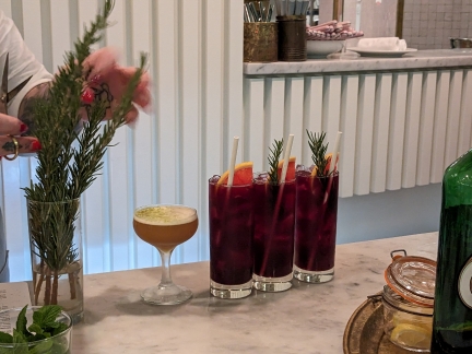 |
Ivy Crown
Position: 47°36.93’N, -122°20.38’W
Three Ivy Crown signature cocktails being prepared at Wilmott’s Ghost while we sat at the bar for dinner. The cocktail is made with Brovo American aperitivo, ginger, rosemary, grapefruit, and lambrusco.
|
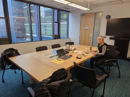 |
Lunch at James’ office
Position: 47°36.96’N, -122°20.42’W
Jennifer picked up some sushi for lunch and we had it in James’ office.
|
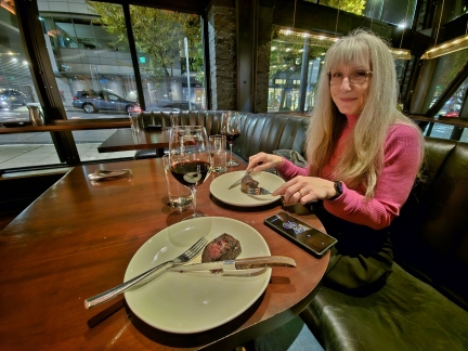 |
Butcher’s Table
Position: 47°37.03’N, -122°20.29’W
Winding down on a Friday night with dinner at Butcher’s Table, one of our favorite Seattle restaurants.
|
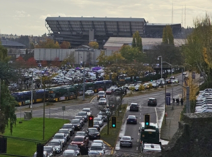 |
Husky Game
Position: 47°39.67’N, -122°18.07’W
The Washington Huskies college football team are taking on the Utah Utes today and traffic is a mess in the area. We’re heading back to Katterman’s Sand Point Pharmacy for our second rabies vaccination.
|
 |
Birke-Gilman Brewing Co
Position: 47°39.69’N, -122°17.29’W
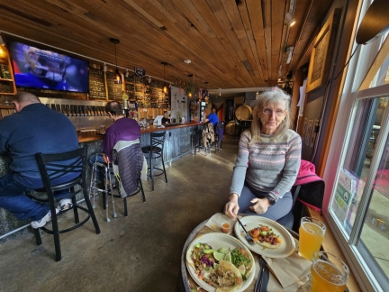
Lunch at Birke-Gilman Brewing Co before heading over to Katterman’s Sand Point Pharmacy for our second rabies vaccination. The brewery doesn’t have a kitchen, but allows any outside food. So we picked up some delicious tacos from the adjacent permanent food truck, El Camion.
|
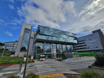 |
Seattle Children’s Hospital
Position: 47°39.78’N, -122°17.06’W
The Nordstrom and Gittinger Families Building at the Seattle Children’s Hospital campus in Sand Point. Anne Gittinger is the granddaughter of John W. Nordstrom, who co-founded the Nordstrom department store chain in 1901, and is the second-largest shareholder in the company.
|
 |
Buses
Position: 47°39.44’N, -122°18.09’W
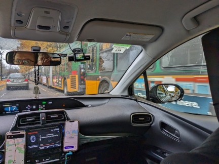
Passing dozens of buses lined up on Montlake Blvd E as we return back to Belltown from Katterman’s Sand Point Pharmacy. The buses are ready to pickup some of the 70,000+ attendees of the Washington Huskies college football game that will end in about an hour.
|
 |
Bambino’s
Position: 47°37.07’N, -122°20.87’W
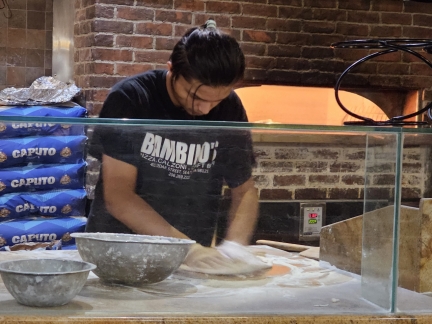
A pre-game snack at Bambino’s Pizzeria in Belltown.
|
 |
Kraken vs Oilers
Position: 47°37.32’N, -122°21.24’W
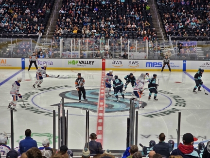
In a rather depressing first period, the Edmonton Oilers scored four unanswered goals against the Seattle Kraken. We eventually scored one goal to lose 4-1. We enjoyed the game, but the Kraken performance didn’t look like the work of a playoff contender.
|
 |
Sunch
Position: 47°36.91’N, -122°20.64’W
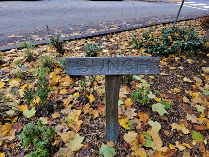
Sheila Klein’s artwork Souvenir, installed in 2014, is inspired by her time renting an apartment among Belltown’s artist community in the 1980s. One piece is in each of the four blocks of Bell Street Park, a park-like corridor between 1st and 5th avenues that we frequently walk past. We’ve noticed one other of the four sculptures, entitled “That was something we used to do”, between 2nd and 3rd a year ago, and recently saw another, “To be determined”, between 4th and 5th. Today we decided to find the other two. This is “Sunch” between 3rd and 4th.
|
 |
Toast
Position: 47°36.80’N, -122°20.78’W
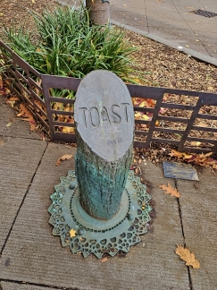
The fourth and final sculpture in Sheila Klein’s artwork Souvenir, in the Bell Street Park between 2nd and 3rd. We just spotted the third, Sunch, between 3rd and 4th.
|
 |
Abbey and Chris
Position: 47°36.83’N, -122°20.83’W
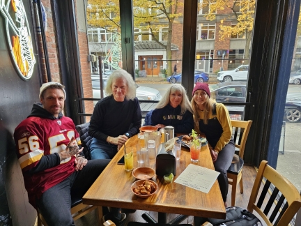
A great lunch at Vindicktive Wings with Abbey Daniel and Chris Briner, who we met on the Fall Crawl a few weeks back. The Seattle Seahawks are taking on the Washington Commanders this afternoon, and this is Abbey’s first live NFL game. Chris grew up in Washington and is a longtime Commanders fan.
|
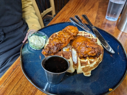 |
Chicken and Waffles
Position: 47°36.83’N, -122°20.83’W
Chicken and waffles is a decidedly southern-US dish. Buffalo chicken strips with waffles and syrup doesn’t sound very appealing, but it’s surprisingly tasty.
|
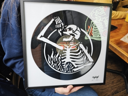 |
Vindicktive Wings Skylinyl
Position: 47°36.84’N, -122°20.82’W
While we were at Vindicktive Wings for lunch, co-owner Mike Morgan presented us with this gift of a Skylinyl with the Vindicktive Wings logo carved into a Guns N’ Roses album, to show appreciation for our being such big fans and supporters during the early days of Vindicktive. Local artist and studio drummer hand-cuts vinyl records with an exacto knife to create the pattern. He initially starting out doing city skylines from around the world, hence the name Skylinyl.
|
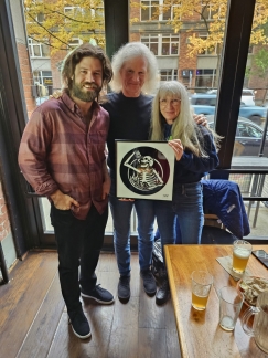 |
Mike Morgan
Position: 47°36.84’N, -122°20.83’W
With Vindicktive Wings co-owner Mike Morgan and his awesome Skylinyl gift to us. Thanks to Mike and the entire Vindicktive team for bringing high quality Wings to Seattle.
|
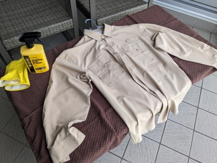 |
Permethrin
Position: 47°36.99’N, -122°20.58’W
Mosquito-borne diseases are prevalent in both the Amazon River, where we’ll be travelling next week, and the African bush, where we will be over Christmas as part of our trip to the South Pole. We’ve been vaccinated against Yello Fever and will be taking anti-malarial pills, but the best defense is to avoid mosquito bites. Here we are spraying down the clothes we will be wearing with Permethrin to deter any ticks, chiggers, mites and mosquitoes we might encounter.
|
 |
Polar Star
Position: 47°36.92’N, -122°20.66’W
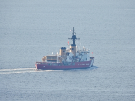
The US Coast Guard icebreaker Polar Star departing Seattle for Pearl Harbor, Hawaii en route to McMurdo Station in Antarctica. Every year, the ship leads Operation Deep Freeze, breaking miles of ice in support of US scientific interests in Antarctica.
|
 |
Air Mover
Position: 47°37.01’N, -122°20.72’W
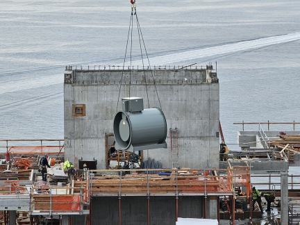
A large air mover being hoisted up to the apartment building under construction at 5th and Bell to our west.
|
 |
Amazon River Cruise
Position: -4°39.87’S, -73°58.26’W
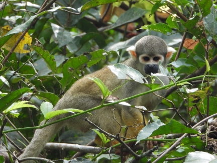
The Amazon River is the largest river in the world by discharge volume and second longest in the world (after the Nile). Originating in Peru, the Amazon flows 4,000 miles (6,400 km) eastward drain into to the Atlantic Ocean in Brazil. Over US Thanksgiving this year, we spent a fantastic seven nights cruising the Peruvian Amazon on board the Aqua Nera.
|
 |
All Lanes Closed
Position: 47°35.39’N, -122°15.14’W
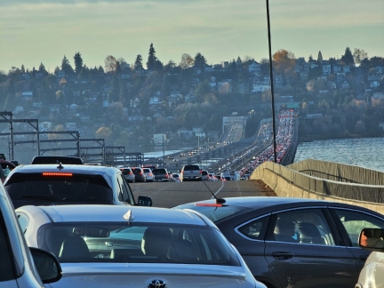
We had a fairly uneventful trip home from Peru, even with a 7-hour layover in Lima. But our luck ended as we attempted to cross the I-90 bridge after picking up Spitfire from Wagly Pet Campus in Bellevue. All lanes were closed due to a vehicle fire in the tunnel, with no ETA for reopening. The car at right is turning to exit on an entrance ramp. We did the same, along with dozens of our vehicles, and took SR-520 home instead.
|
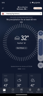 |
32 F
Position: 47°36.92’N, -122°20.66’W
Brrr. The temperature is right at freezing this morning, with a freezing fog warning. Freezing fog occurs when temperatures are at or below freezing and supercooled water droplets in fog freeze on exposed surfaces.
|
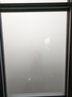 |
Thick Fog
Position: 47°36.99’N, -122°20.58’W
View at 7:20am from our 40th-floor apartment to the thick fog blanketing the region. The fog was so bad that SeaTac didn’t allow planes to land for three hours and delayed departing planes 15 to 30 minutes or more. And a crash on I-5 created a 10-mile backup near Kent, WA.
|
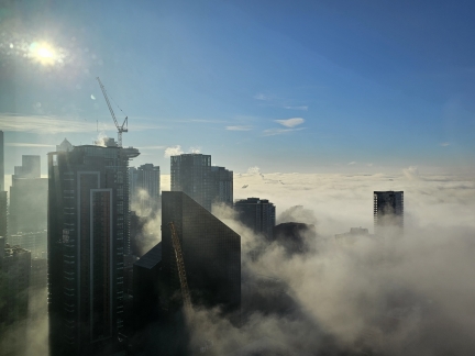 |
Fog Lifting
Position: 47°37.08’N, -122°20.57’W
Downtown Seattle begins to emerge from the thick fog at 10am. We couldn’t see any of the buildings all morning.
|
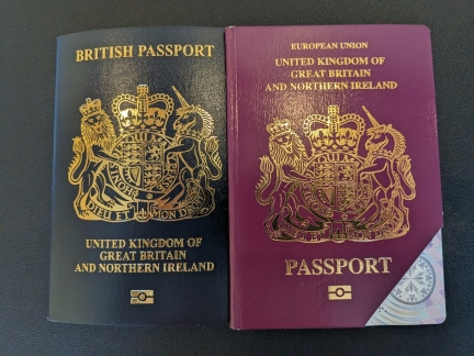 |
British Passport
Position: 47°36.99’N, -122°20.58’W
Jennifer’s new British passport just arrived, only three weeks after she sent it into the UK using the routine service. Technically she hasn’t had an EU passport since Brexit, but now the actual passport reflects that.
We wish the US Passport office was as efficient. Routine US passport renewals currently take 7-10 weeks, and expedited is still 3-5 weeks. We’ll need to renew our passports early next year, and will have to time it carefully to avoid impacting our travel plans. |
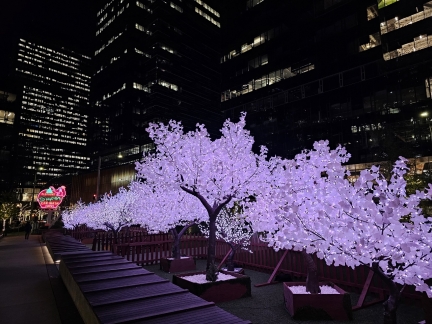 |
Nitro Enchanted Forest
Position: 47°37.00’N, -122°20.43’W
The Enchanted Forest winter light display in front of Amazon’s Nitro building in the South Lake Union Campus. At far left is the historic Elephant Car Wash neon sign. The car wash operated nearby for 60 years, but closed in 2020. The larger of its two iconic neon signs was donated to the local Museum of History and Industry and the smaller was given to Amazon.
|
 |
Click the travel log icon on the left to see these locations on a map. And a map of our most recent log entries always is available at mvdirona.com/maps. |

If your comment doesn't show up right away, send us email and we'll dredge it out of the spam filter.