We had a fantastic time on our week-long Danube River cruise aboard the AmaMagna. Stops along the way included Pecs in Hungary, Vukovar in Croatia, Novi Sad and Belgrade in Serbia, Vidin and Ruse in Bulgaria, and Bucharest in Romania. As with Budapest, these cities all date back to the Middle Ages and have suffered through much conflict, plus the poverty of the Soviet Era. Some of the conflict is not so ancient, with Croatia only gaining independence from Yugoslavia in a bloody conflict that ended in 1995. Shell-pocked buildings in Vukovar are a vivid reminder of this recent war.
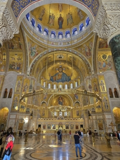
Centuries-old castles and fortresses dot the landscape along the Danube, and each city has its own unique architecture and flavor. The weather was unseasonably warm during our trip, drawing residents and visitors in droves to the outdoor cafes and bars overlooking public squares beneath striking historical architecture. We particularly enjoyed spending a sunny day exploring Belgrade, with its ancient fortress (pictured above) and opulent Serbian Orthodox church that is the largest in the world
The river scenery was wonderful, particularly the Iron Gates, a series of dramatic gorges that separates Serbia and Romania that also support one of the largest hydroelectric stations in Europe. We also really enjoyed spending time on the modern and spacious AmagMagna, with its double-wide beam, and will cover the ship in more detail in a separate post.
Below are highlights from April 29th through May 5th, 2024. Click any image for a larger view, or click the position to view the location on a map. And a map with our most recent log entries always is available at mvdirona.com/maps.
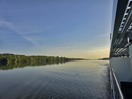 |
Danube River
Position: 46°39.00’N, 18°57.61’E
The view from the balcony of our cabin on the AmaMagna as we cruise the Hungarian Danube from Budapest to Mohacs on a calm, clear and warm day.
|
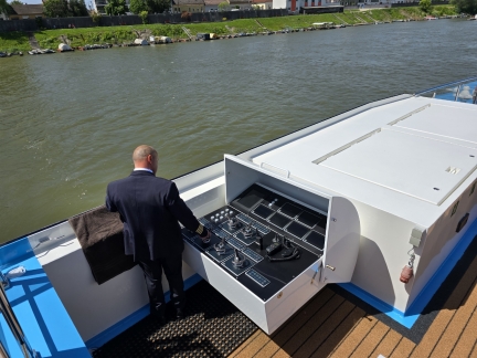 |
Docking at Mohacs, Hungary
Position: 45°59.86’N, 18°41.50’E
Captain Cristian Creteanu using a wing helm to bring the AmaMagna onto the dock at Mohacs, Hungary.
|
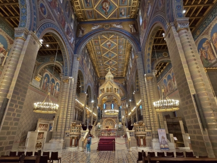 |
St. Peter’s Basilica
Position: 46°4.72’N, 18°13.40’E
The spectacular altar of St. Peter’s Basilica in Pecs, Hungary. The cathedral foundations date from the Roman occupation in the 1300s, and the church as been extensively expanded, renovated and repaired over the centuries.
|
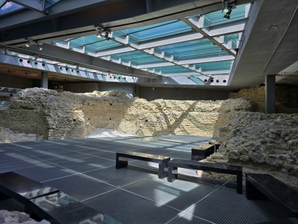 |
Christian Necropolis
Position: 46°4.67’N, 18°13.47’E
The Christian Necropolis in Pecs, Hungary is a series of decorated underground tombs created in the 4th century when the area was part of the Roman Empire and is one of the most significant Roman burial grounds outside Italy. The site was named a UNESCO World Heritage Site in 2000. The glass ceiling above is part of a public space that people can walk on to view the tombs from above.
|
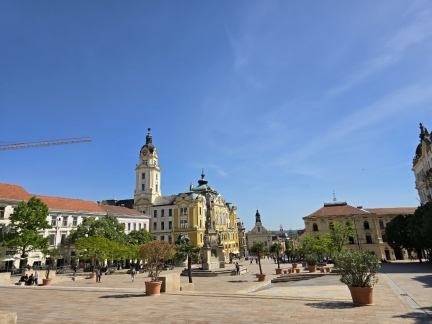 |
Szechenyi Square
Position: 46°4.61’N, 18°13.66’E
Szechenyi Square, the main square in the historic district Pecs, Hungary, was a market place during the Middle Ages. Today the cafe-lined square is full of historic buildings and statuary.
|
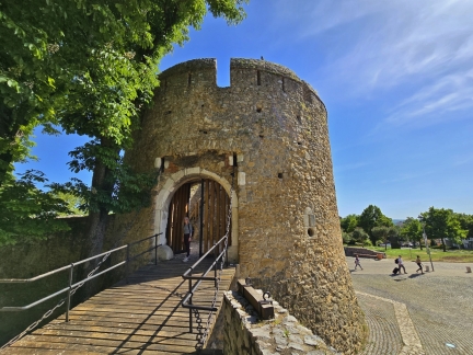 |
Barbican
Position: 46°4.68’N, 18°13.29’E
The 15th-century stone barbican in Pecs, Hungary was part of the wall system of the Bishop’s Palace.
|
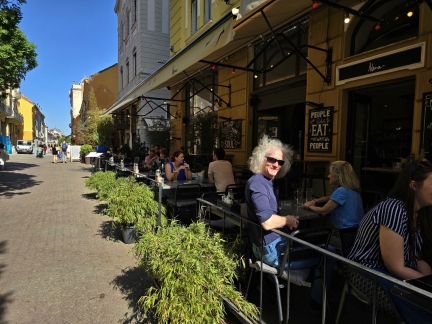 |
Nana
Position: 46°4.57’N, 18°13.73’E
Enjoying a drink streetside at Nana in Pecs, Hungary before returning to the AmaMagna.
|
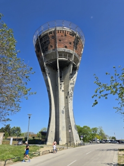 |
Vukovar Water Tower
Position: 45°20.61’N, 19°0.75’E
The Vukovar water tower was a symbol of the Croatian resistance during their successful War of Independence from Yugoslavia in 1991-1995. The city of Vukovar was bombarded for several months and eventually overrun in a siege that inflicted extensive damage. The tower itself was shelled over 600 times, but remained standing, and was kept in its damaged form as a memorial to the conflict and those who suffered in it.
|
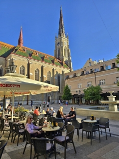 |
Holy Name of Mary
Position: 45°15.36’N, 19°50.72’E
Enjoying a refreshing cider in the plaza beside the Holy Name of Mary Catholic Church, the largest church in Novi Sad, Serbia.
|
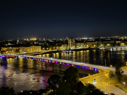 |
Novi Sad
Position: 45°15.21’N, 19°51.66’E
The evening view to Novi Sad, Serbia from the hilltop Petrovardian Fortress. Our river boat, the AmaMagna, is visible on the Danube at right.
|
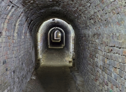 |
Petrovardian Fortress
Position: 45°15.20’N, 19°51.67’E
View into the underground tunnel system of Petrovardian Fortress in Novi Sad, Serbia. The initial fortress foundation were laid in the 17th century and it was completed in the late 1700s with 10 miles (16 km) of underground corridors.
|
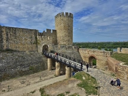 |
Kalemegdan Fortress
Position: 44°49.51’N, 20°27.08’E
Kalemegdan Fortress in Belgrade, Serbia is the city’s most popular attraction, with over 2 million visitors per year. The fortress, overlooking the confluence of the Danube and Sava (visible at right) rivers, was established in 279 BC and was extensively modified and expanded over the centuries to encompass 160 acres (66 hectares).
|
 |
St. Sava
Position: 44°47.88’N, 20°28.14’E
The opulent interior of the Cathedral of St. Sava, the largest Serbian Orthodox church in the world. We were astonished at the level of detail, all mostly done in mosaic.
|
 |
Skadarlija
Position: 44°49.05’N, 20°27.84’E
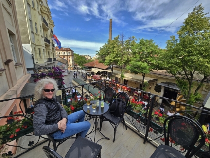
Skadarlija, Belgrade’s Old Town District, is full of restaurants and bars lining a centuries-old cobblestone street. We couldn’t resist stopping when we spied this balcony table.
|
 |
Sava & Danube Rivers
Position: 44°49.71’N, 20°26.73’E
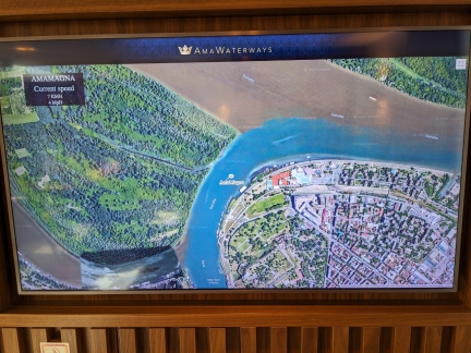
Satellite imagery showing the AmaMagna departing Belgrade along the Sava River to rejoin the Danube. Notice how muddy the Danube is compared to the Sava. Our departure from Belgrade was delayed for several hours because port authorities closed all navigation on the Danube River due to high winds.
|
 |
Smederevo Fortress
Position: 44°40.31’N, 20°55.28’E
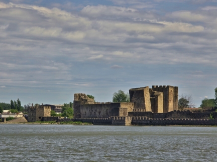
Passing Smederevo Fortress in Serbia, a UNESCO World Heritage Site and among the largest fortifications in southeast Europe. One of the Serbian military’s last great projects, construction began in 1427 to replace Belgrade after it came under the control of the Hungarians.
|
 |
Golubac Fortress
Position: 44°39.67’N, 21°40.71’E
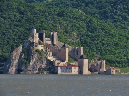
Golubac Fortress was built in the 14th century by the Medivial Serbian state. The fortress has changed hands many times over the centuries and has successfully repelled over 120 attacks. We were scheduled to stop here to tour the grounds, but had to skip it because we were delayed departing Belgrade due to high winds closing navigation.
|
 |
Iron Gates
Position: 44°37.12’N, 22°16.38’E
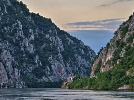
Passing throught the Iron Gates, a dramatic series of gorges on the Danube that separates Serbia and Romania.
|
 |
Dacian King Decebalus
Position: 44°38.33’N, 22°17.76’E
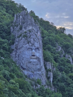
Massive 131×82-ft (40x25m) carving of the great Romanian folk hero Dacian King Decebalus. The inscription underneath reads “Decebalus Rex – Dragan Fecit”, which translate to “King Decebalus—Made by Dragan”. Dragan is not the artist as might be surmised, but rather the rich, and not notably humble, businessman who commissioned the carving in the 1990s.
|
 |
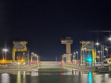
Iron Gate 1
Position: 44°39.95’N, 22°31.77’E
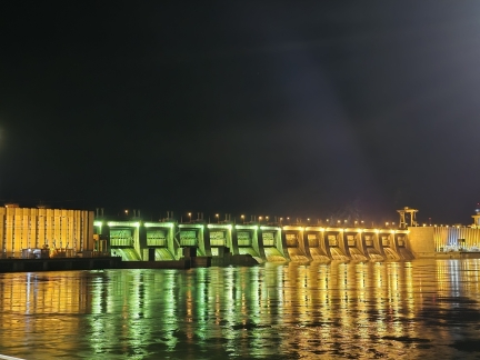
Iron Gate 1 is the largest dam on the Danube River and one of the largest hydroelectric stations in the world. The plant’s 12 turbines have a power generation capacity of 2,052 MW.
|
 |
Iron Gate 1 Lock
Position: 44°40.30’N, 22°31.18’E
Entering the Iron Gate 1 Lock, one of two locks spaced about 50 miles (80 km) apart along the Danube on either side of the Iron Gates.
|
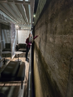 |
Lock Wall
Position: 44°40.02’N, 22°31.62’E
The AmaMagna uses very narrow fenders, and we can easily touch the wall from our stateroom as we pass through the Iron Gate I lock.
|
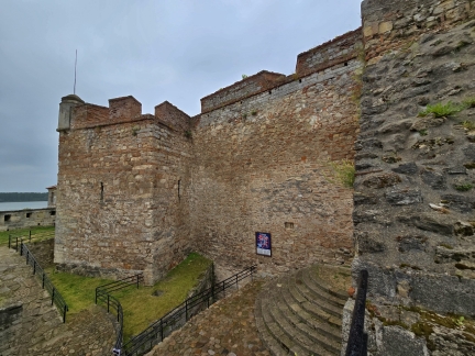 |
Baba Vida Fortress
Position: 43°59.59’N, 22°53.20’E
Baba Vida Fortress in Vidin, Bulgaria dates to the 10th century and is the only fully-preserved medieval fortress in Bulgaria.
|
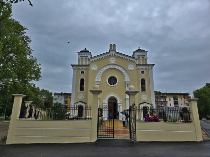 |
Vidin Synagogue
Position: 43°59.50’N, 22°53.06’E
When completed in 1894, neo-Gothic Vidin Synagogue was the second-largest in Bulgaria and reflected the prosperity of the burgeoning port community. The communist government seized the building after World War II and it fell into disrepair, particularly after the roof was removed in the 1980s during an aborted restoration project. Finally, a two-year restoration project completed at the end of 2023 brought the synagogue back to its former glory.
|
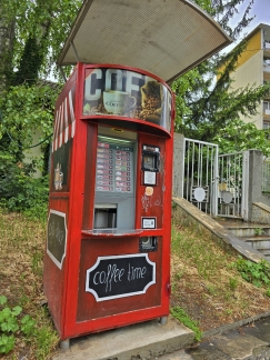 |
Coffee Machine
Position: 43°59.34’N, 22°52.93’E
Coin-operated coffee machines are quite popular in Bulgaria. We saw them frequently during our walks in the country.
|
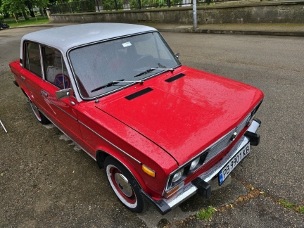 |
Lada
Position: 43°59.29’N, 22°52.86’E
A well-maintained, classic Lada in Vidin, Bulgaria. Russian-manufactured Ladas were originally built with considerable Fiat design influence but with an extra dash of Eastern Block reliability.
|
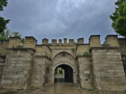 |
Stambol Kapiya
Position: 43°59.19’N, 22°52.68’E
The gate Stambol Kapiya was built in the 18th century when the city of Vidin was fortified. The gate links to Baba Vida Fortress that we visited earlier, about a mile upriver.
|
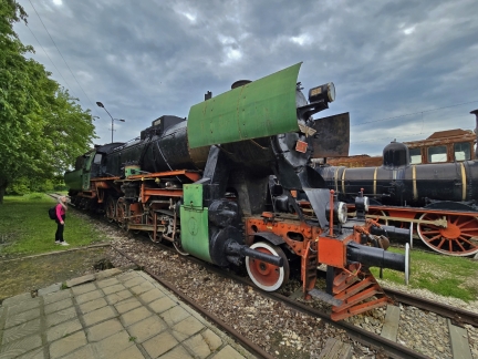 |
Musuem of National Transporation
Position: 43°51.64’N, 25°57.80’E
The Musuem of National Transporation in Ruse, Bulgaria highlights the region’s train transport system with displays including engines, luxury carriages, railroad maps and model trains and stations.
|
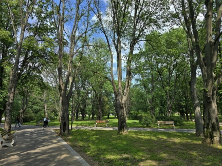 |
Renaissance Park
Position: 43°51.13’N, 25°57.70’E
Ruse is a beautiful, green city with much public art and many parks. Here we are walking along one of the many paths through Renaissance Park.
|
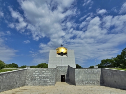 |
Pantheon of National Revival Heroes
Position: 43°51.03’N, 25°57.61’E
The Pantheon of National Revival Heroes holds the remains of revolutionaries who died fighting for Bulgaria’s independence from the Ottoman Empire in 1877-78. The Pantheon was completed in 1978 on the centennial of the revolution.
|
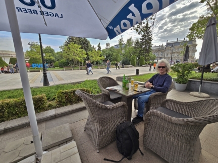 |
Svoboda Square
Position: 43°50.94’N, 25°57.16’E
Enjoying a cold cider overlooking Svoboda Square, one of the main squares in Ruse, Bulgaria.
|
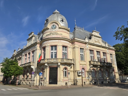 |
Regional Library
Position: 43°50.65’N, 25°56.92’E
Ruse, Bulgaria is known as the ‘Little Vienna’ for it’s 19th- and 20th-century Neo-Baroque and Neo-Rococo architecture. This is the Regional Library, established in 1888 and the oldest cultural center on the country.
|
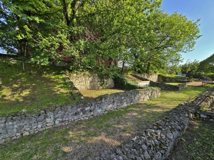 |
Roman Ruins
Position: 43°50.78’N, 25°56.69’E
Remains in Ruse, Bulgaria of the Roman settlement Sexaginta Prista, dating to the first century AD. The name implies a “city of sixty ships”, suggesting this was a major Roman military or trade center.
|
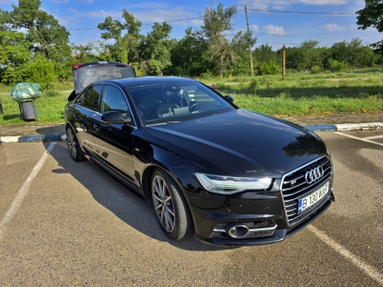 |
Daytrip.com
Position: 43°52.20’N, 25°57.94’E
Our transportation for the day, booked with Daytrip.com. The service worked well on our Switzerland trip for a transfer from Turano, Italy to Lugano, Switzerland. This time we’ll be transferring from Giurgiu, Romania at 9am to the Bucharest airport for a late afternoon flight. After an hour drive to Bucharest, we spent a few hours exploring the city on foot, then continued on to the airport, stopping at a few sites along the way. This arrangement worked out super-well, as we could leave our luggage in the car and travel lightly in Bucharest.
|
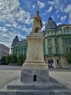 |
University Square
Position: 44°26.10’N, 26°6.04’E
Scholar George Lazar is one of four notable Romanians depicted in statues along University Square. Standing opposite the University of Bucharest, the square was the northern limit of the city in the 15th century.
|
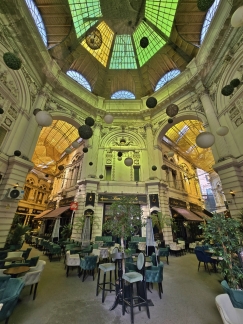 |
Macca-Villacrosse Passage
Position: 44°25.98’N, 26°5.93’E
19th century Macca-Villacrosse Passage was built to connect Bucharest Old Town with Victoriei Street, then the city’s main street. The striking passageway is lined with cafes that were just starting to open for the day as we arrived.
|
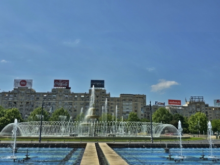 |
Bucharest Fountains
Position: 44°25.65’N, 26°6.15’E
Forty-four different fountains make up the Bucharest Fountains, constructed during the Soviet era. At night they are lit up in a spectacular computerized light display.
|
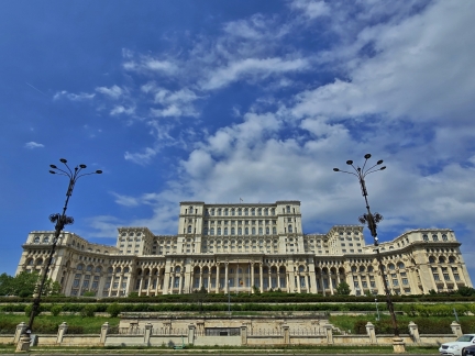 |
Palace of Parliament
Position: 44°25.64’N, 26°5.47’E
The Palace of Parliament, the seat of the Parliament of Romania, is the second largest administrative building in the world after the Pentagon. Created starting in 1984 at the behest of Romania’s former dictator Nicolae Ceausescu, the building has over 3,000 rooms and measures 3.5 million square feet (330,000 sq m). We were planning to take a tour of the building, but it was closed today due to a national holiday.
|
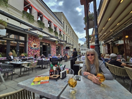 |
Arcade Cafe
Position: 44°25.84’N, 26°6.01’E
A delicious lunch at Arcade Cafe in Bucharest Old Town. The cafe was lightly filled when we arrived, but every table was taken by the time we finished.
|
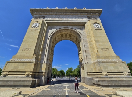 |
Triumphal Arch
Position: 44°28.02’N, 26°4.69’E
Bucharest’s Triumphal Arch was built in 1935 to commemorate Romania’s 1918 reunification following World War I. The 88-foot (27m) structure is about half the size of its Paris namesake.
|
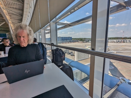 |
Bucharest Airport
Position: 44°34.25’N, 26°4.84’E
Getting a little work down at the Bucharest airport lounge before our flight to Amsterdam.
|
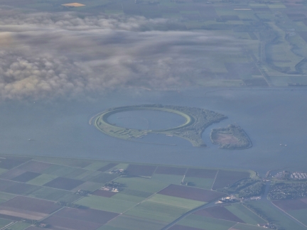 |
Ijsseloog, Netherlands
Position: 52°28.29’N, 5°43.67’E
Ijsseloog is an artificial island in the Netherlands used to decontaminate polluted sludge. We passed right by it in Dirona in 2019 shortly after passing under the Swifterbant Bridge, but it wasn’t nearly as obvious from the water as it is from the air on our flight to Amsterdam from Bucharest.
|
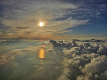 |
Sunset
Position: 52°26.25’N, 5°26.84’E
Sunset as our flight arrives into Amsterdam.
|
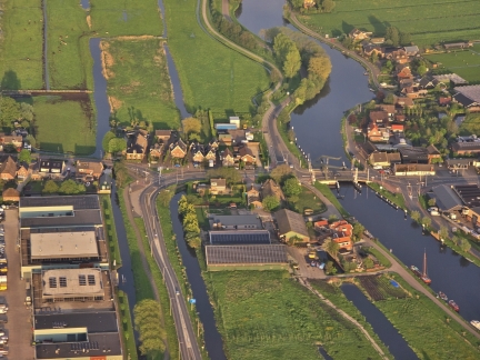 |
De Kwakel, Netherlands
Position: 52°13.92’N, 4°46.32’E
De Kwakel in the Netherlands reminded us very much of our trip through the canals in Dirona from Amsterdam to Antwerp.
|
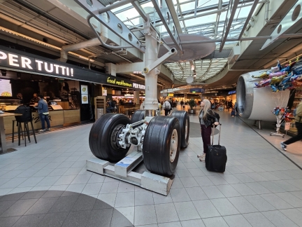 |
Landing Gear, Amsterdam Airport
Position: 52°18.59’N, 4°45.79’E
Jennifer checking out an aircraft landing gear in a KLM display at the Amsterdam airport.
|
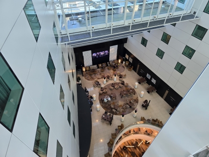 |
Sheraton Amsterdam
Position: 52°18.53’N, 4°45.60’E
The soaring atrium at the Sheraton Amsterdam where we’ll be staying for the night before our flight to Seattle the next morning. At center is a bar where we stopped in for a drink and a light snack.
|

|
Click the travel log icon on the left to see these locations on a map. And a map of our most recent log entries always is available at mvdirona.com/maps. |

Thanks for the report and terrific photos. The Danube cruise sounds like a scenically pretty and historically interesting trip. Lots of ancient fortifications.