Bainbridge Island, across the Puget Sound from Seattle, has had a robust Japanese community since immigrants first arrived there in the late 1800s. Their world was shattered following the air attack on Pearl Harbor, when President Franklin D. Roosevelt signed an executive order for the nation-wide internment of over 125,000 US residents of Japanese descent, the majority US-born citizens. Due to their proximity to the Puget Sound naval bases, the first to be interned were the 267 Japanese-American Bainbridge Island residents, who were forcibly removed from their homes in 1942 and not allowed to return until 1945.
In a tragedy that a 1970 presidential commission later concluded was based mostly on racism, most lost their homes, property, jobs, and invaluable personal items. The Bainbridge Island Japanese American Exclusion Memorial, opened in 2011, tells the story of the internees and the impact on their lives, with the motto of “Nidoto Nai Yoni (Let It Not Happen Again)”.
We visited the sobering memorial, pictured above, during a weekend trip to Bainbridge Island this spring. A 7-mile (11 km) walk, partially on the Eagle Harbor Waterfront Trail, took us from Winslow around to the memorial along the south side of Eagle Harbor, then on to Blakely Harbor and finally to Lynwood Center. We’d anchored in those harbors dozens of times when we boated in Seattle, but hadn’t ventured far inland when we went ashore, so the walk gave us a chance to explore some new territory.
Blakely Harbor looked much the same, but Lynwood Center had changed a lot since our list visit back in 2010, when we’d gone ashore from our “Unusual Puget Sound Anchorage” in Rich Passage. In the newly-developed Pleasant Beach Village, we enjoyed several whimsical animal sculptures and caught up with an old friend who lives nearby before returning back to Winslow for the night.
Below are highlights from April 5th and 6th, 2024. Click any image for a larger view, or click the position to view the location on a map. And a map with our most recent log entries always is available at mvdirona.com/maps.
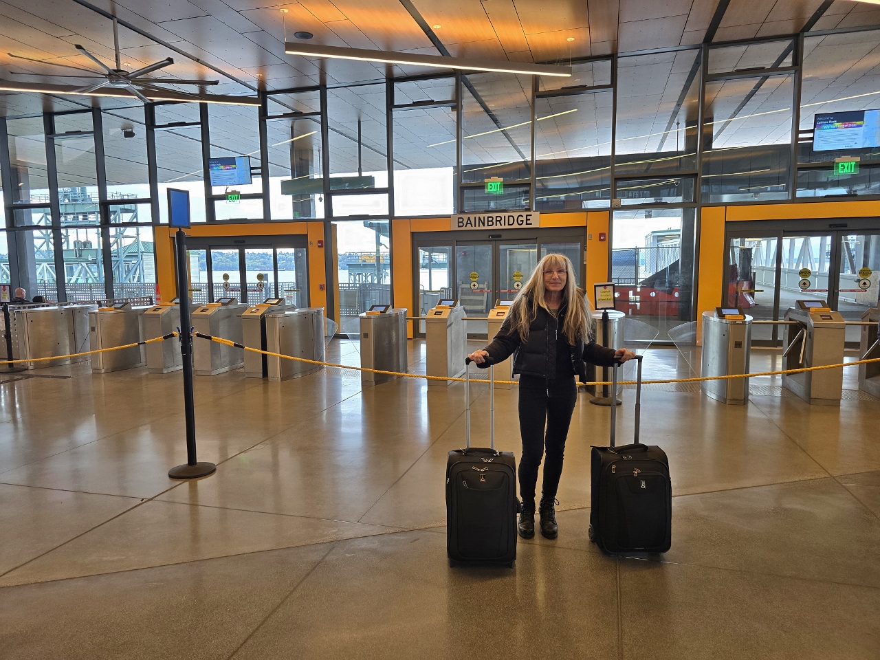 |
Coleman Dock, Seattle
Position: 47°36.14’N, -122°20.34’W
At Coleman Dock in Seattle, waiting for the ferry to Bainbridge Island. We’ll be spending the weekend there and don’t need a car, so walking on is the most efficient option.
|
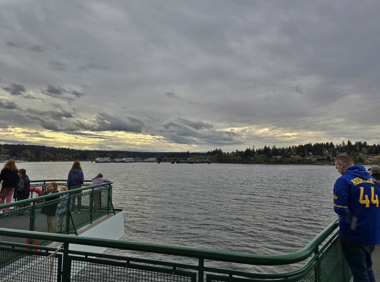 |
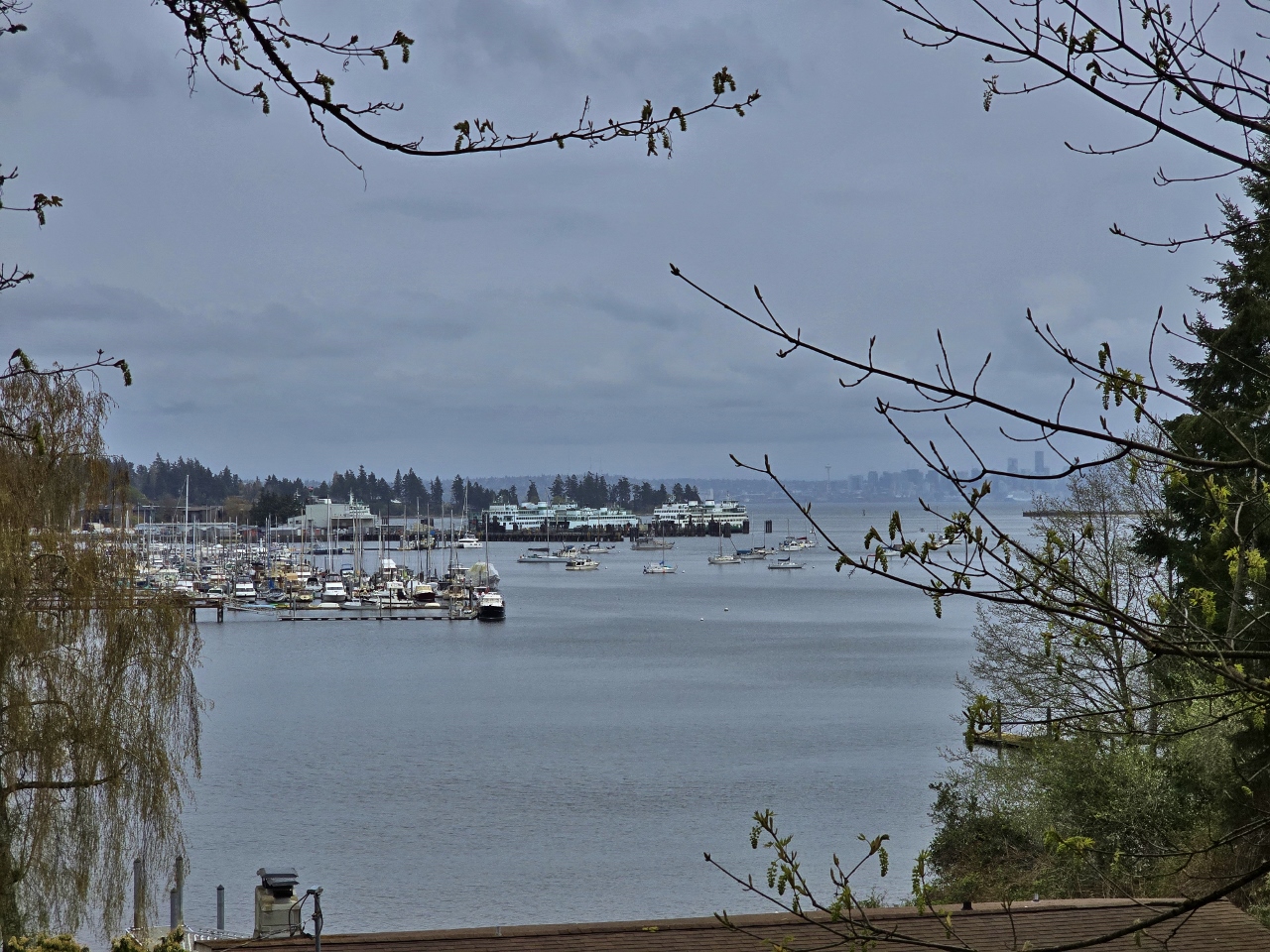
Eagle Harbor
Position: 47°37.19’N, -122°29.78’W
Entering Eagle Harbor, at the south end of Bainbridge Island, aboard the ferry Chimacum. The ferry terminal is dead ahead and to the three ferries visible at left are moored at the Washington State Ferry Maintenance Facility.
|
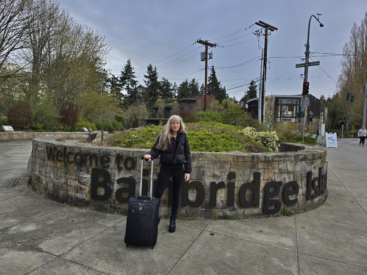 |
Welcome to Bainbridge Island
Position: 47°37.46’N, -122°30.85’W
We’ve not visited Bainbridge Island for years and are happy to be back.
|
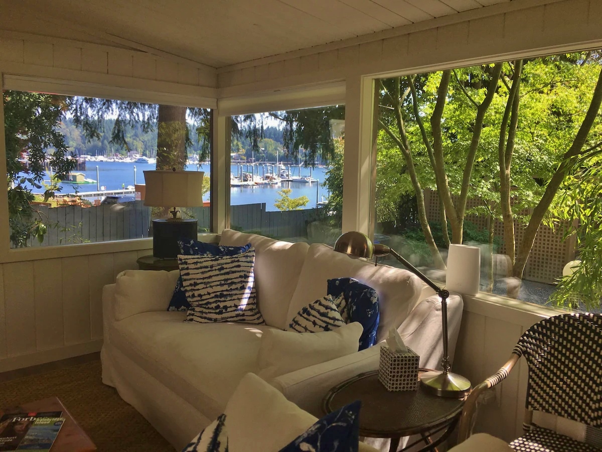 |
Eagle Harbor View Cottage
Position: 47°37.37’N, -122°31.14’W
The view from VRBO-rented Eagle Harbor View Cottage, where we’ll be staying for our weekend on Bainbridge Island. The cottage was an easy walk from the ferry and into town and made a great base for us.
|
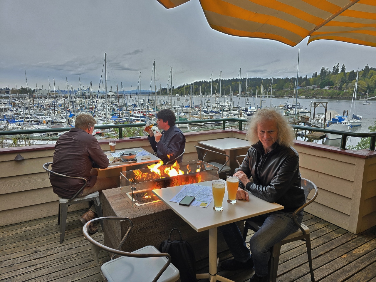 |
Harbor Public House
Position: 47°37.28’N, -122°31.38’W
Dinner on the patio at our favorite Bainbridge Island haunt, Harbor Public House. Despite the 45°F (7.2°C) temp, we were plenty warm sitting outside next to the fire pit.
|
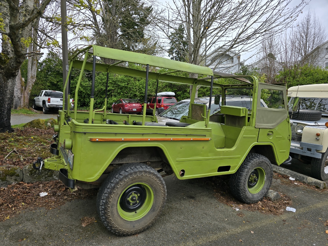 |
Volvo Laplander
Position: 47°37.36’N, -122°31.32’W
A 1960s Volvo Laplander military vehicle, parked near the Harbor Public House on Bainbridge Island. Just visible to the right is Land Rover military ambulance from the same period.
|
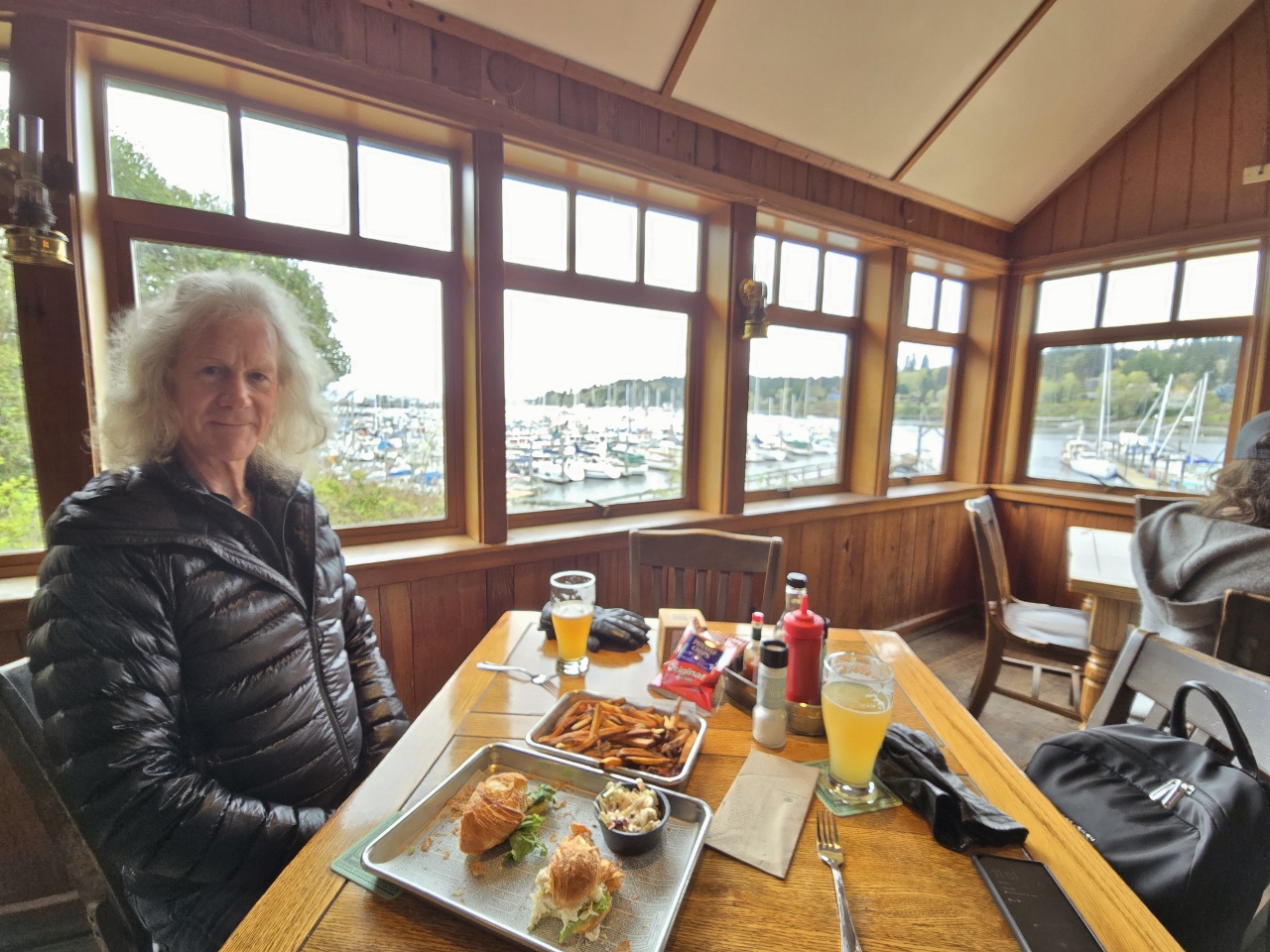 |
Harbor Public House
Position: 47°37.29’N, -122°31.37’W
Back at Harbor Public House for a delicious lunch. The temperature was a little cooler today, and the heaters weren’t on outside, so we sat inside.
|
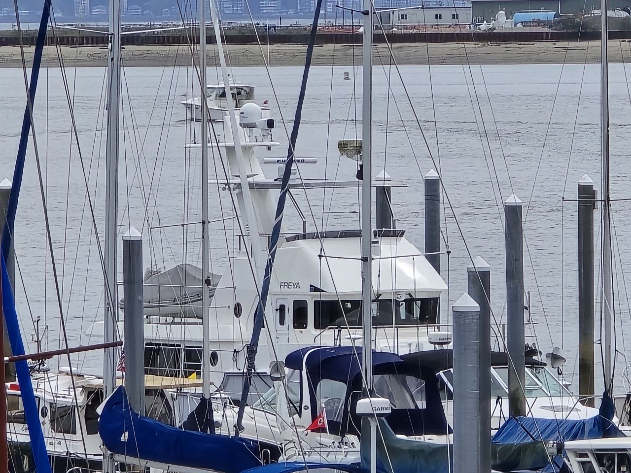 |
Nordhavn 475 Freya
Position: 47°37.29’N, -122°31.37’W
Nordhavn 475 Freya, viewed from Harbor Public House on Bainbridge Island.
|
 |
Cooks Wanted
Position: 47°37.29’N, -122°31.37’W
We were wondering why the Harbor Public House wasn’t open on Sunday.
|
 |
Town Way to Water Park
Position: 47°37.32’N, -122°31.57’W
The pocket park Town Way to Water near the head of Eagle Harbor, viewed on our way around the harbor to visit the Bainbridge Island Japanese American Exclusion Memorial on the south shore.
|
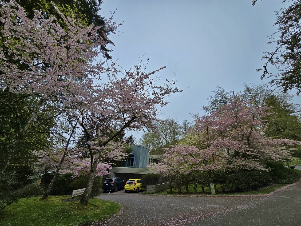 |
Cherry Blossoms
Position: 47°37.45’N, -122°31.57’W
Cherry trees in bloom on Bainbridge Island at Lowell Ave SW.
|
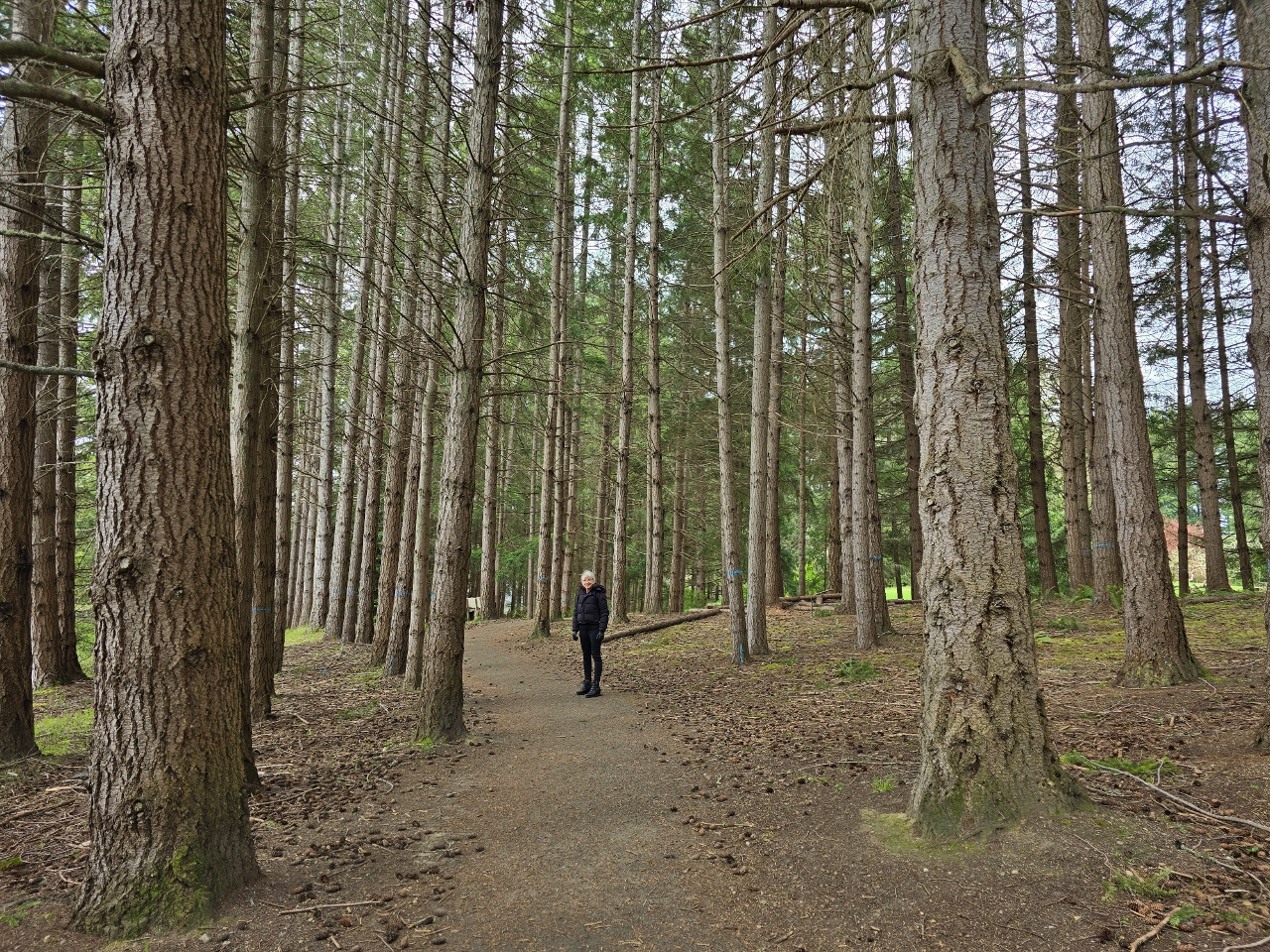 |
Moritani Preserve
Position: 47°37.50’N, -122°31.63’W
Walking through Moritani Preserve, established in 2017 as Bainbridge Island’s newest park. The property once was owned by the Japanese-American Moritani family, who farmed berries there.
|
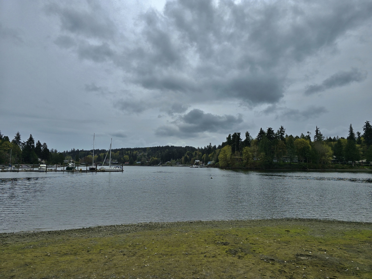 |
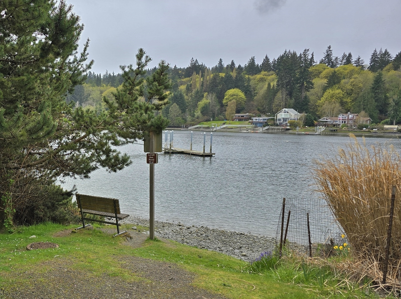
Strawberry Park
Position: 47°37.51’N, -122°31.85’W
Looking into the head of Eagle Harbor from Strawberry Park. We anchored here dozens of times in our first boat.
|
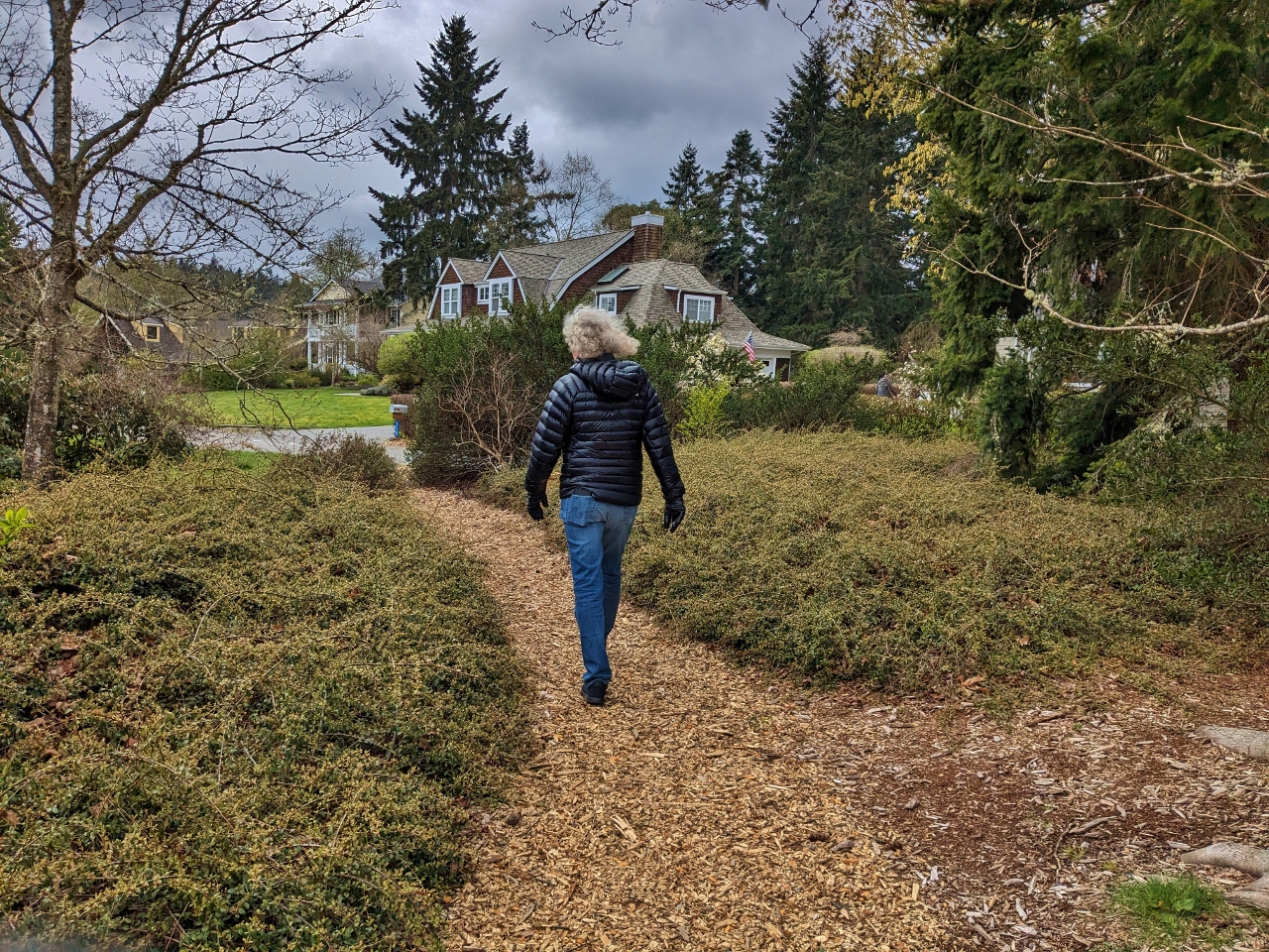 |
Waterfront Trail
Position: 47°37.58’N, -122°31.99’W
Walking a portion of the Waterfront Trail, a well-maintained network of trails, parks and roads that runs from the ferry dock to the head of Eagle Harbor. We’re just about at the end of it now.
|
 |
Eagle Harbor
Position: 47°37.15’N, -122°31.77’W
Looking back across Eagle Harbor from the south shore, with the ferry dock visible in the distance on the north shore.
|
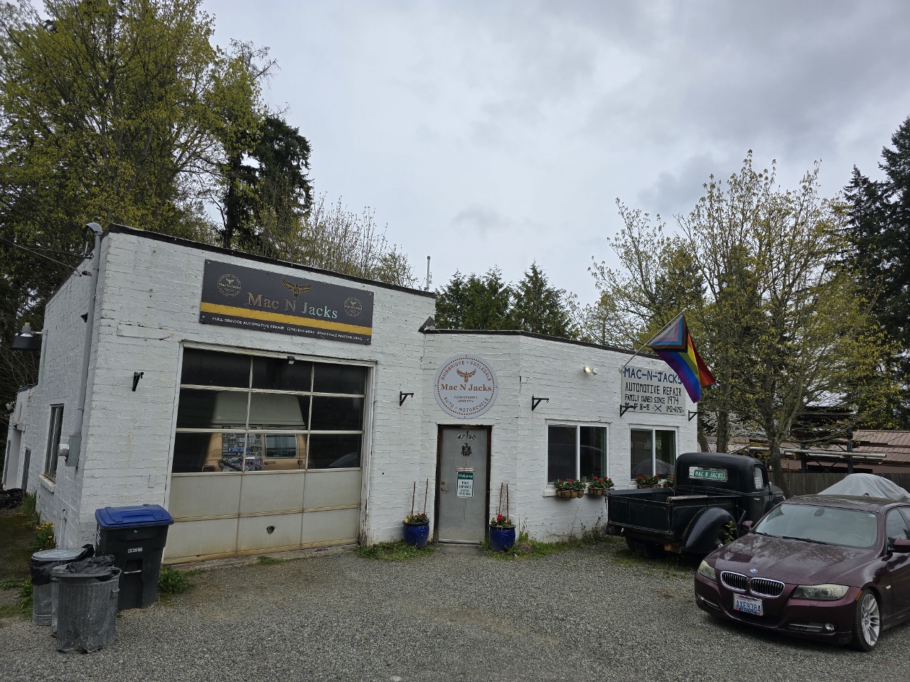 |
Mac n Jacks
Position: 47°36.85’N, -122°31.02’W
We were getting thirsty on our walk and were excited to see a sign advertising Mac n Jacks, a Redmond brewery. But the establishment turned out not to be a cafe, but an auto garage, presumably named after its owners.
|
|
|
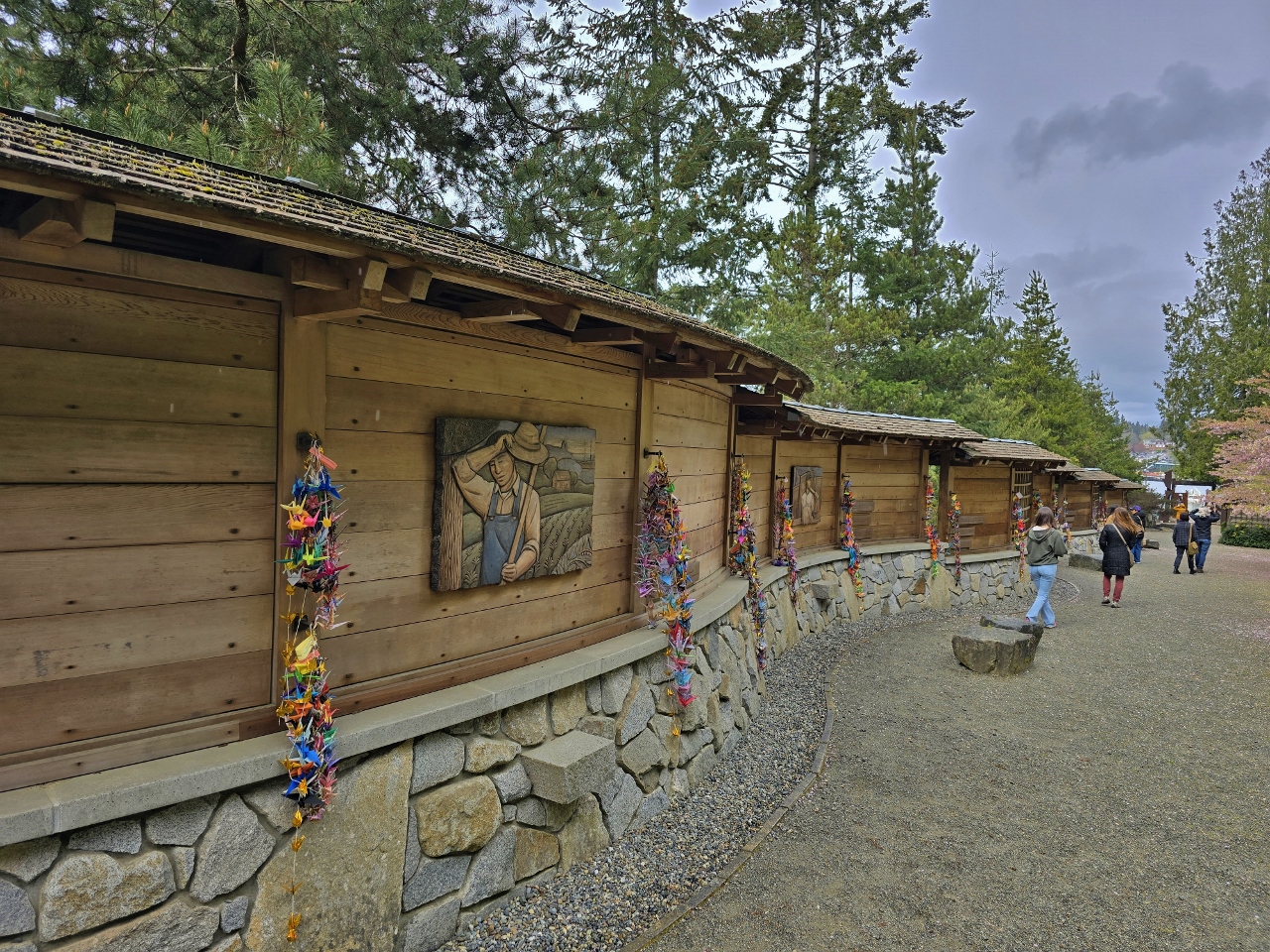
Japanese American Exclusion Memorial
Position: 47°36.90’N, -122°30.61’W
At the Bainbridge Island Japanese American Exclusion Memorial, in memory of the island’s 267 Japanese-American residents who were forcibly removed to internment camps in 1942. It was part of a larger nation-wide internment of over 125,000 US residents of Japanese descent, the majority US-born citizens, resulting from an executive order signed by President Franklin D. Roosevelt following the attack on Pearl Harbor. In a tragedy that a 1970 presidential commission later concluded was based mostly on racism, most lost their homes, property, jobs, and invaluable personal items.
|
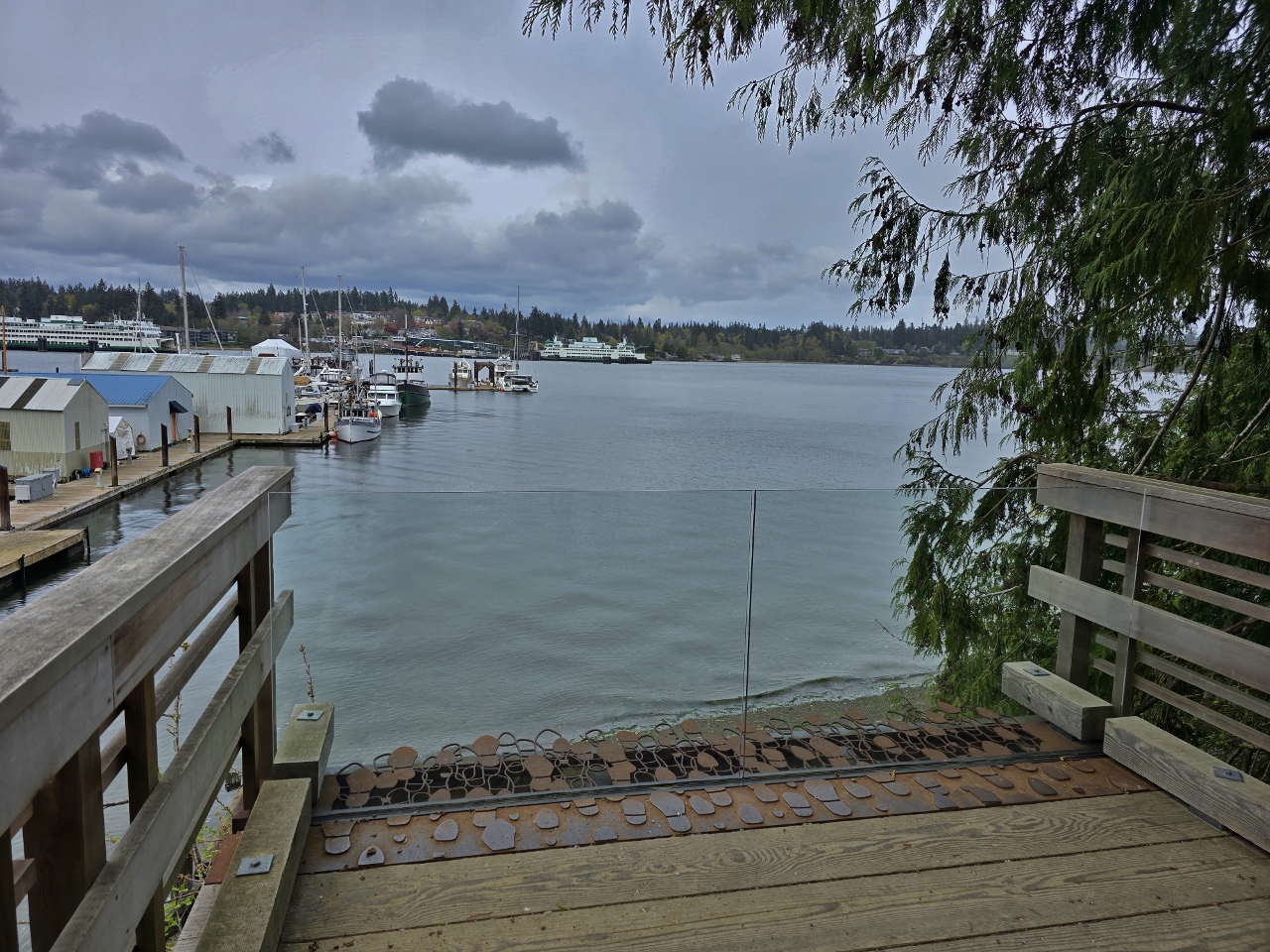 |
Departure Deck
Position: 47°36.95’N, -122°30.62’W
The Departure Deck of the Bainbridge Island Japanese American Exclusion Memorial is at the exact location of the Eagledale ferry dock, once a second stop on the Bainbridge Island ferry route, where all Japanese-Americans were ordered to report in 1942. Metal footsteps dramatically represent their final steps off the island before being deported to the camps.
|
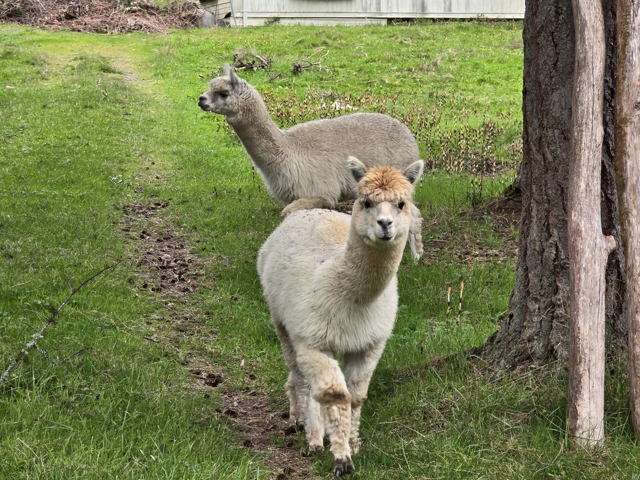 |
Alpaca
Position: 47°36.60’N, -122°30.62’W
Hopeful Alpaca, looking for a handout, as we walk south along Taylor Ave NE towards Blakely Harbor.
|
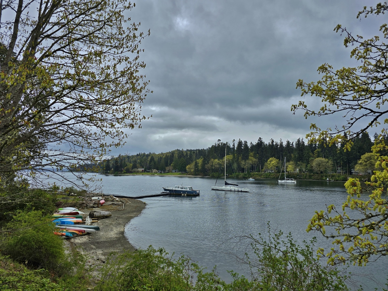 |
Blakely Harbor
Position: 47°35.82’N, -122°30.81’W
View into Blakely Harbor, another favorite anchorage of ours.
|
 |
Boys Night Out
Position: 47°36.28’N, -122°32.84’W
The whimsical sculpture Boys Night Out, by renowned Seattle artist Georgia Gerber, at Pleasant Beach Village. It is one of several commissioned by Pleasant Beach Village developer John Jacobi.
|
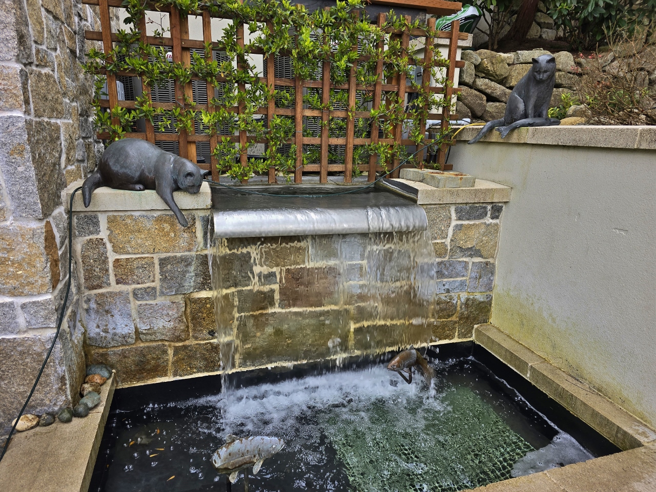 |
Cats Fishing
Position: 47°36.26’N, -122°32.84’W
An unnamed sculpture, of two cats fishing in a fountain, at Pleasant Beach Village.
|
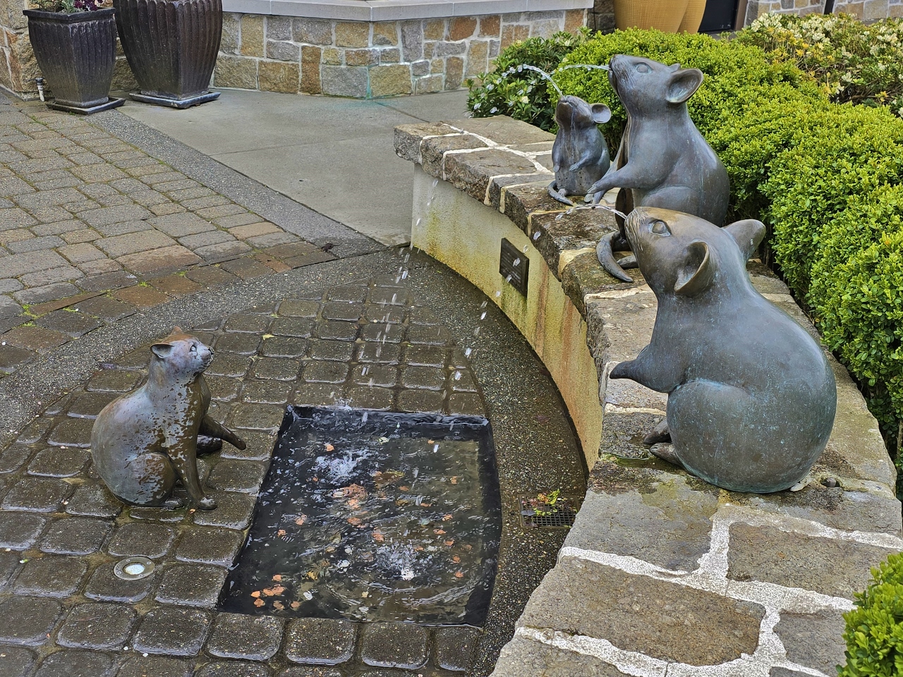 |
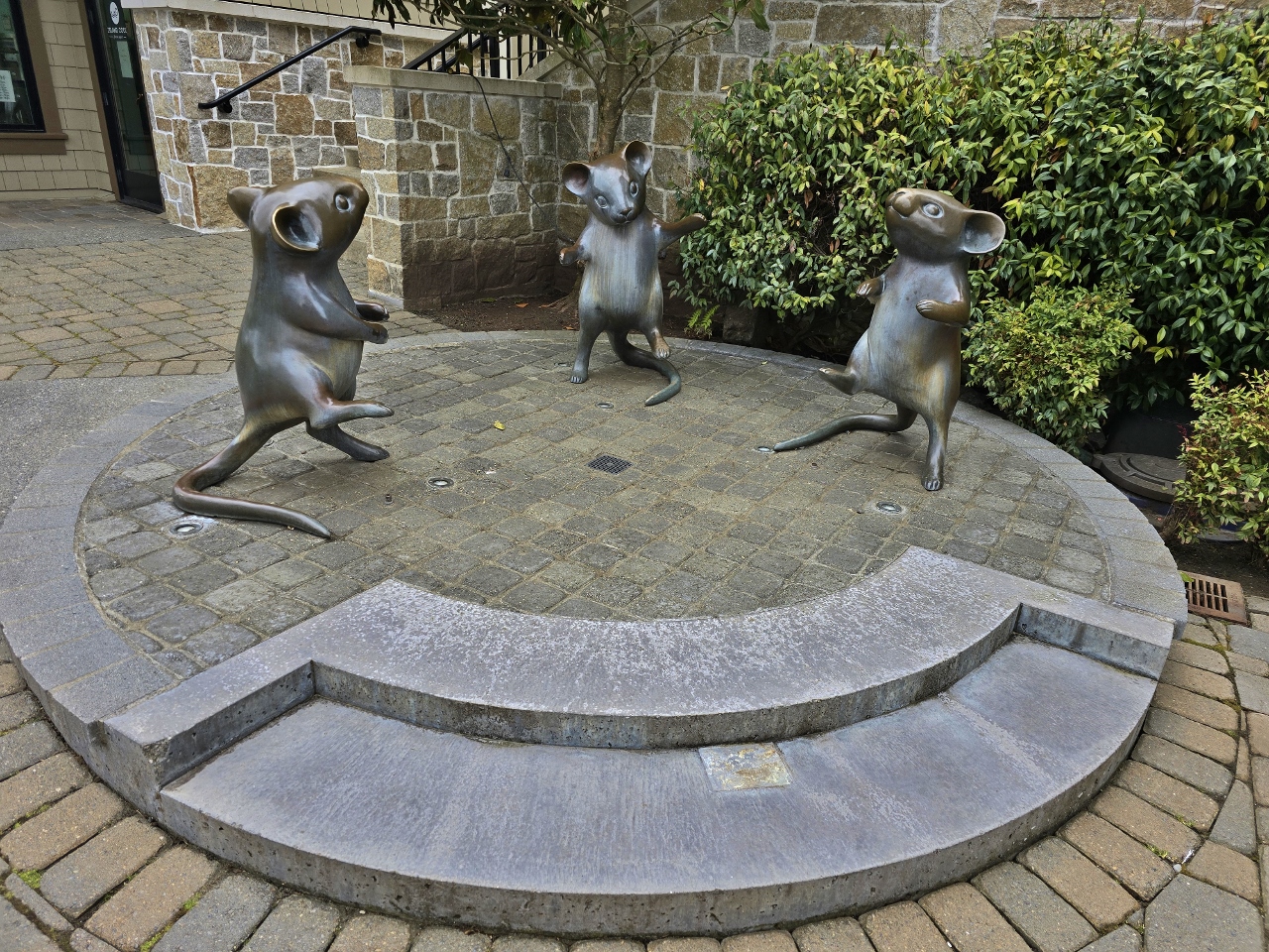
Mice Spitting
Position: 47°36.32’N, -122°32.84’W
This was our favorite of the three animal sculptures, showing three mice spitting water towards a rather flumoxed-looking cat.
|
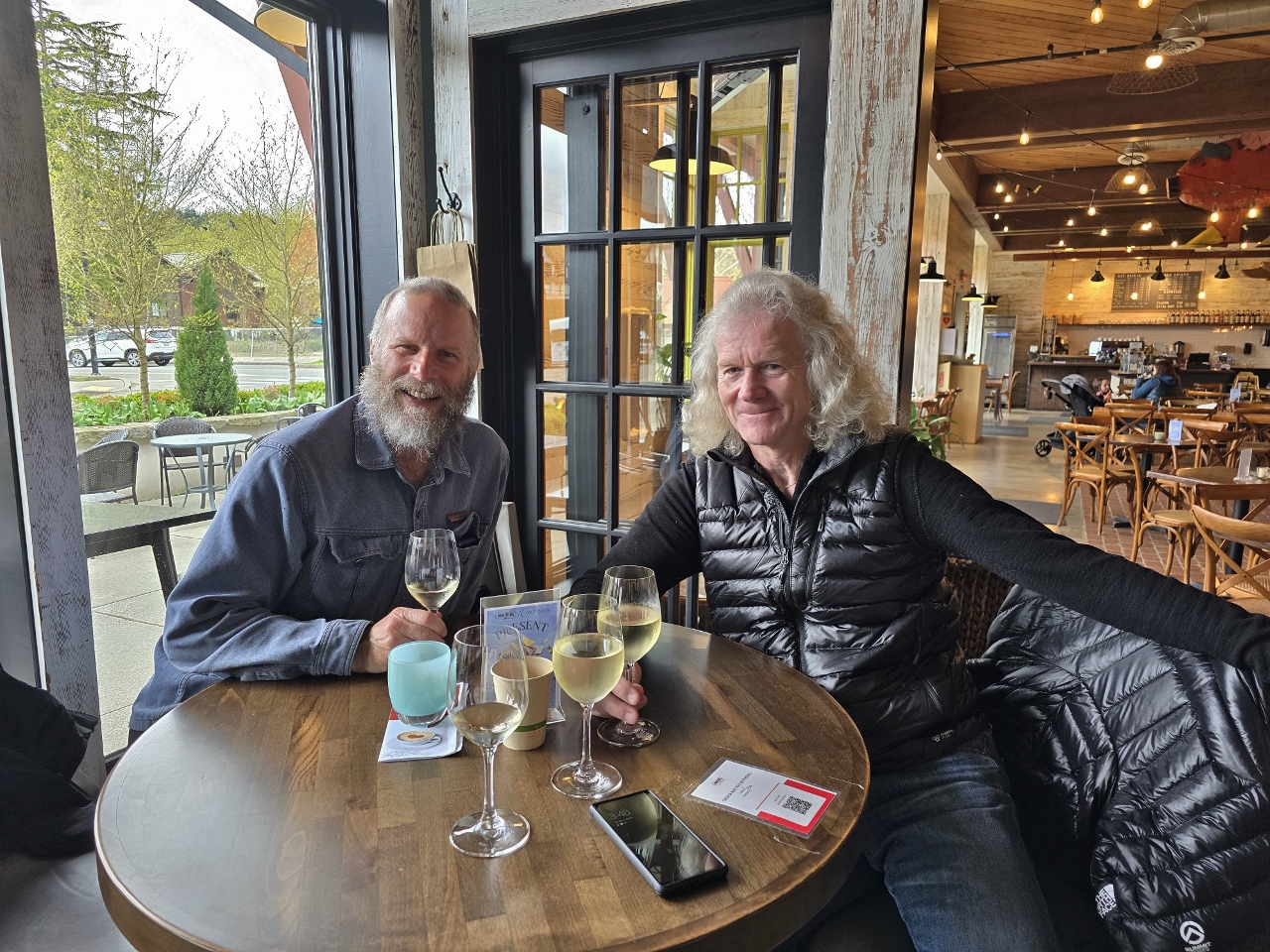 |
Peter Spiro
Position: 47°36.26’N, -122°32.83’W
During our walk, Bainbridge Island resident Peter Spiro spotted us on the road and we met up later at Earth & Vine Wine Bar. Peter and James worked together for years on Microsoft SQL Server and we haven’t seen him for ages. It was super-fun to get together and catch up.
|
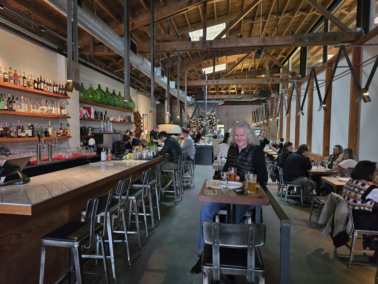 |
Bruciato
Position: 47°37.50’N, -122°31.16’W
We ended our Bainbridge Island day with an excellent pizza dinner at Bruciato back near the ferry dock.
|
 |
Doc’s Marina Grill
Position: 47°37.33’N, -122°31.27’W
A delicious lunch with a view to the harbor at Doc’s Marina Grill on Bainbridge Island.
|
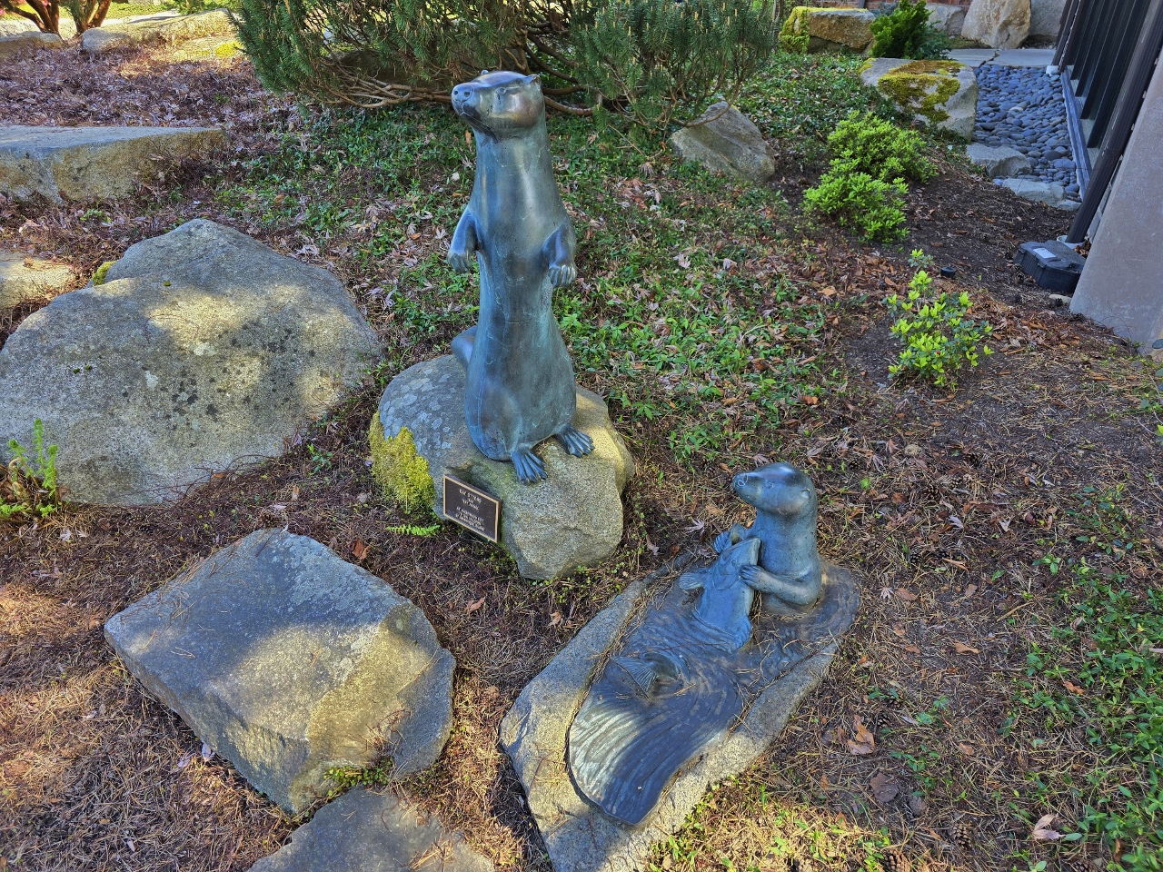 |
Bay Otters
Position: 47°38.12’N, -122°31.25’W
The sculpture Bay Otters, by tk, at the Bainbridge Island library.
|
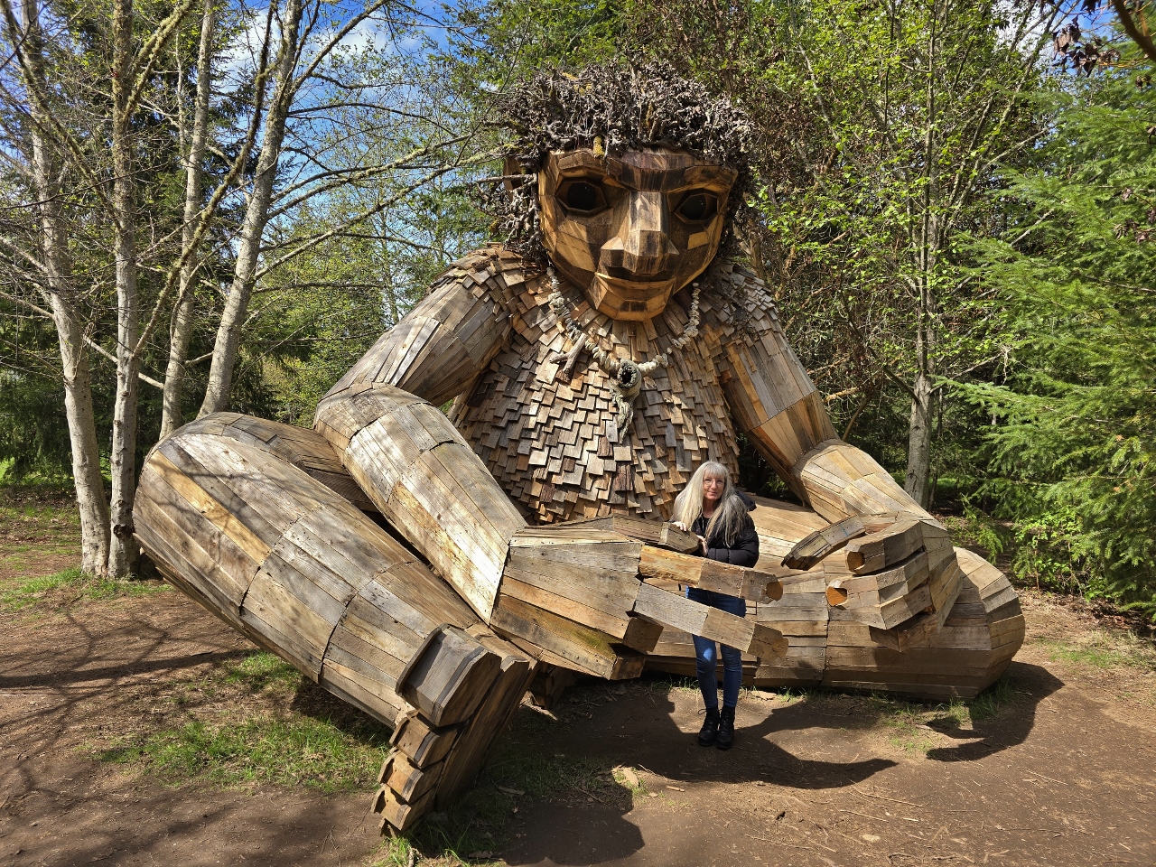 |
Pia the Peacekeeper
Position: 47°38.34’N, -122°31.21’W
Pia the Peacekeeper in Sakai Park on Bainbridge Island is the first of five giant trolls that Danish sculptor Thomas Dambo is creating in the Seattle area. The others locations are West Seattle, Issaquah, Vashon Island, and Fremont.
|
 |
Sakai Park
Position: 47°38.35’N, -122°31.09’W
|
 |
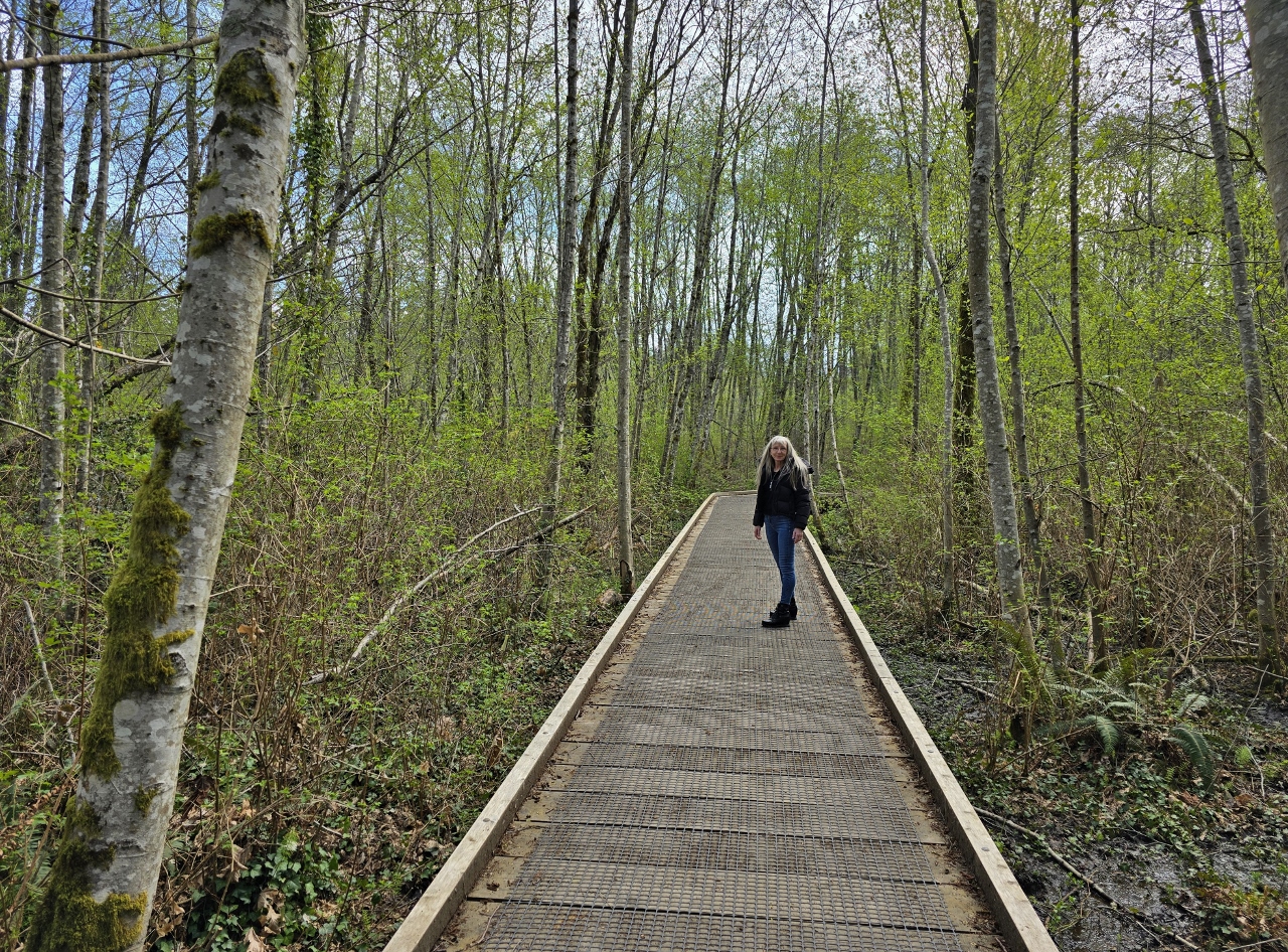
John Nelson Trail
Position: 47°37.91’N, -122°30.87’W
Walking the John Nelson trail alongside leafy Winslow Ravine. The short loop trail extends from the larger Sound to Olympics Trail.
|
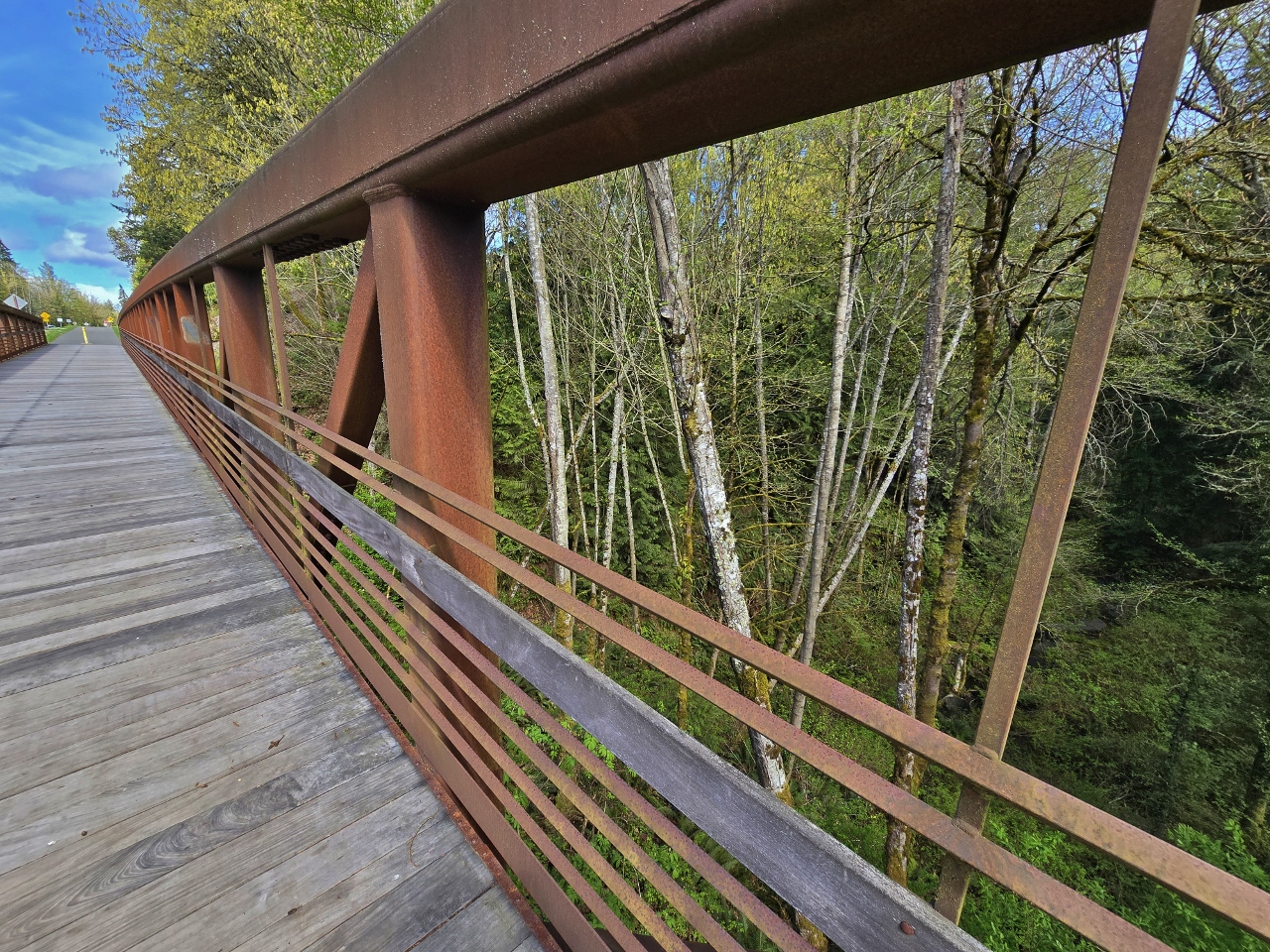 |
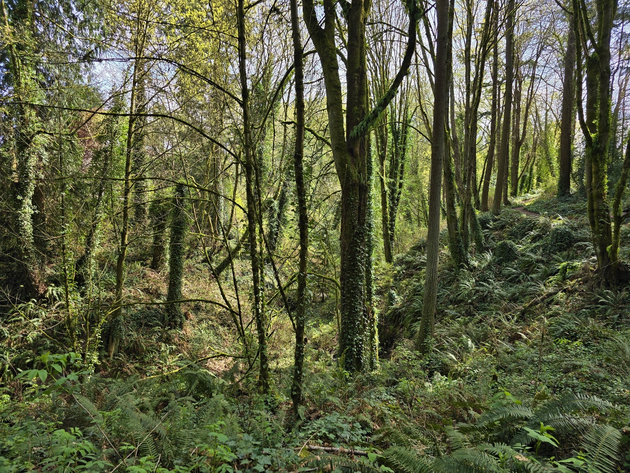
Sound to Olympics Trail
Position: 47°37.72’N, -122°30.90’W
Looking down into Winslow Ravine from a substantial pedestrian bridge as we walk south along the newly-built Sound to Olympics Trail. Part of the Great American Rail Trail, this is the starting segment of a planned 7-mile (11 km) trail that will extend from the Bainbridge Island ferry dock to the Hood Canal Bridge via the Agate Pass bridge and the Kingston Ferry terminal.
|
 |
Waterfront Trail
Position: 47°37.41’N, -122°30.89’W
Crossing a footbridge over the Winslow Ravine Creek estuary on the eastern portion of Bainbridge Island’s Waterfront Trail
|
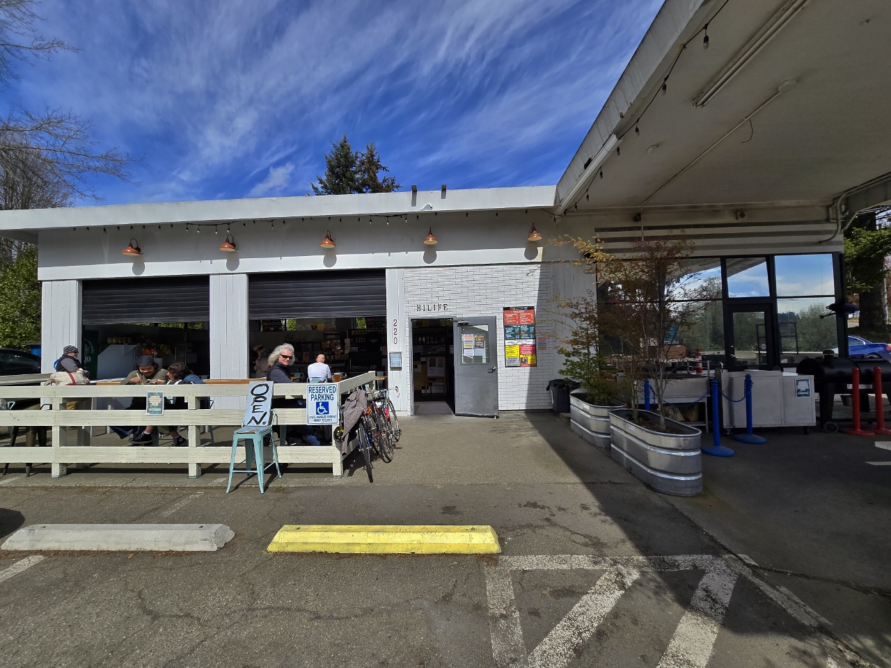 |
Hi-Life
Position: 47°37.44’N, -122°30.79’W
With some time to kill before our ferry to Seattle departed, we stopped in for a beer on the patio at the gas station-turned-poke restaurant Hi-Life.
|
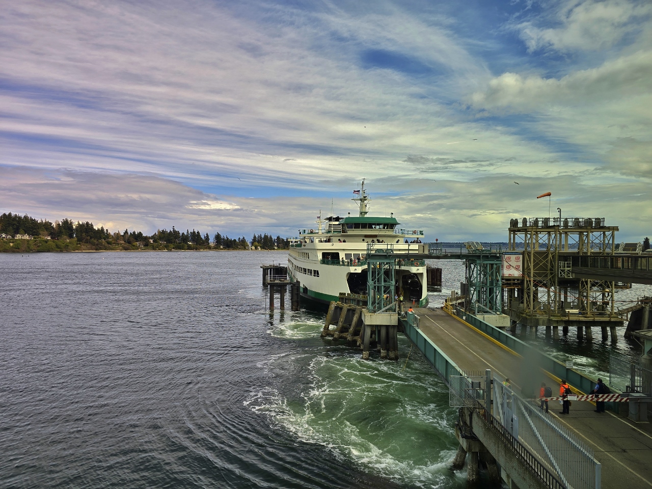 |
Tacoma Arriving
Position: 47°37.36’N, -122°30.62’W
Our ferry back to Seattle, the Tacoma, arriving at the Bainbridge Island dock.
|
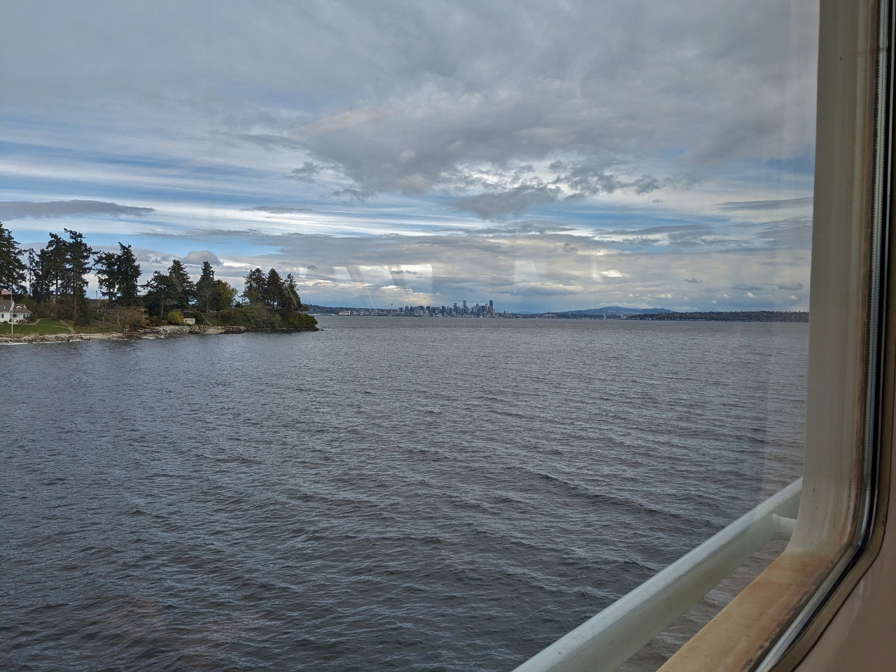 |
Seattle from Eagle Harbor
Position: 47°36.80’N, -122°30.67’W
View to downtown Seattle from the ferry Tacoma as we pass through Eagle Harbor. We’d had a great weekend on Bainbridge Island and particularly enjoyed the many parks and trails in the area.
|

|
Click the travel log icon on the left to see these locations on a map. And a map of our most recent log entries always is available at mvdirona.com/maps. |
We traveled on another AMA Waterways river boat on the Seine, from Paris to LeHavre and back. Wonderful trip. We booked it through BackRoads, a bicycle touring company that is superbly run. My wife went off with the BackRoads cyclists every day and I went off with normal folks on walking tours. Let me know if the Danube is scenic or commercial.
That sounds like a great cruise John. On your question, we found the Danube quite scenic and really enjoyed it.