The Portland Dragon Boat Festival was well underway as we departed our hotel on Sunday morning with a Portland fire boat demonstrating prior to the start. On our way to the train station, we stopped at Jake’s Famous Crawfish for a great seafood lunch with craft IPAs in view of the historic Weinhard Brewery Complex, completed in 1908.
We had an enjoyable train ride back to Seattle, retracing our route past several historic Portland buildings and back across the rivers, and had a surprisingly good pasta dinner delivered to our cabin.
Below are highlights from September 11, 2022. Click any image for a larger view, or click the position to view the location on a map. And a map with our most recent log entries always is available at mvdirona.com/maps.
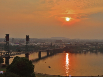 |
Sunrise
Position: 45°30.76’N, -122°40.56’W
Sunrise over the Willamette River through a hazy, smoke-filled sky.
|
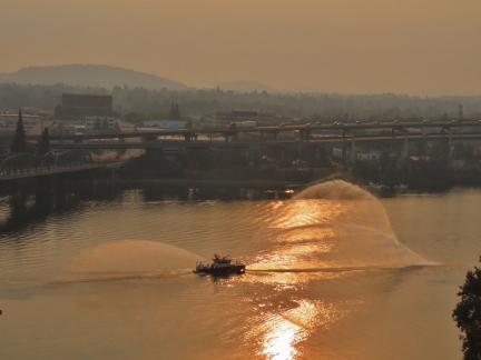 |
kwansum
Position: 45°30.76’N, -122°40.56’W
Portland fire boat 21, kwansum, doing a pump display before the start of the dragon boat races.
|
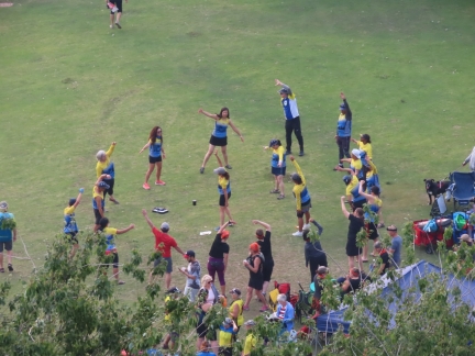 |
Stretching
Position: 45°30.76’N, -122°40.56’W
One of the dragon boat racing teams stretching together before the day’s event.
|
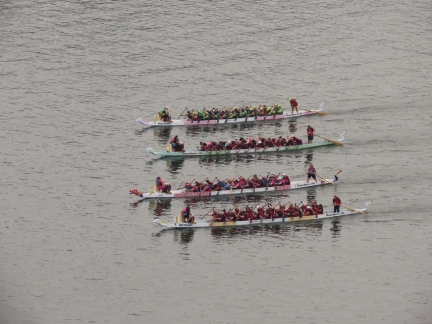 |
Semi-Finals
Position: 45°30.76’N, -122°40.56’W
A close contest in one of semi-finals of the Portland Dragon Boat Races.
|
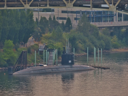 |
USS Blueback
Position: 45°30.76’N, -122°40.56’W
The USS Blueback, a Barbel-class diesel-electric submarine launched in 1959. This was the last non-nuclear submarine built for the US Navy and when decommissioned in 1990 made the US combat submarine fleet entirely nuclear. The vessel is now part of the Oregon Museum of Science and Industry, with guided tours available.
|
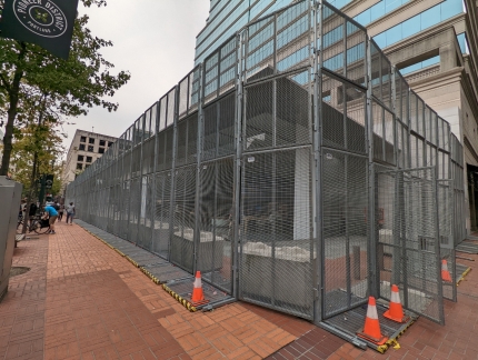 |
Apple Store
Position: 45°31.06’N, -122°40.69’W
A security fence around the Apple store in downtown Portland. In May of 2020, after rioters protesting the Minneapolis police killing of George Floyd smashed the store’s windows and stole product, the store was boarded up and closed. The fence was installed in February of 2021 as the store was re-opening, with plans currently in place to erect a less imposing barrier.
|
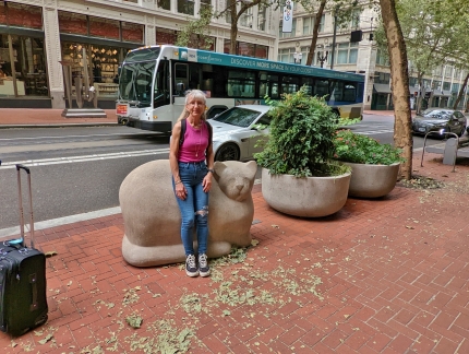 |
Cat in Repose
Position: 45°31.12’N, -122°40.65’W
Jennifer with the limestone sculpture Cat in Repose by artist Kathleen McCullough in 1977.
|
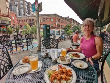 |
Jake’s
Position: 45°31.36’N, -122°41.00’W
A yummy lunch streetside, with craft IPAs, at Jake’s Famous Crawfish.
|
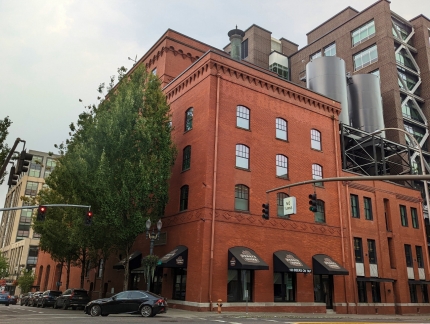 |
Weinhard Brewery
Position: 45°31.36’N, -122°41.00’W
We could see the large vats of the Weinhard Brewery Complex from our lunch table. The former brewery was completed in 1908 and now is on the National Register of Historic Places. Operations ceased in 1999 and the buildings were renovated into mixed-use area consisting of offices, retail, and condo towers called the Brewery Blocks.
|
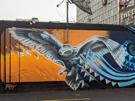 |
Owl on Lowbrow Lounge
Position: 45°31.63’N, -122°40.93’W
Fabulous painting by Ashley Montague of an owl on the side of the Lowbrow Lounge in Portland, viewed as we walk to the train station.
|
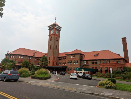 |
Union Station
Position: 45°31.68’N, -122°40.61’W
Back at Union Station for our train trip from Portland, Oregon back to Seattle.
|
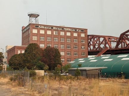 |
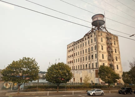
Albers Bros Milling Co
Position: 45°31.77’N, -122°40.59’W
The Albers Bros Milling Co building, erected in 1909, viewed as our train departs Union Station in Portland, Oregon. Headquartered here, the Albers brothers founded the largest flour and feed milling enterprise on the West Coast in the early 1900s. The building was listed on the National Register of Historic Places in 1984 and converted to office buildings in 1989.
|
 |
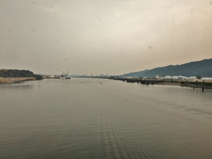
Centennial Mills
Position: 45°31.95’N, -122°40.81’W
The flour and feed mill is the only remaining of a complex of 12 that made up the Centennial Mills facility.
|
 |
Willamette River
Position: 45°34.39’N, -122°45.09’W
Recrossing the Willamette River by train on our way to Seattle from Portland, Oregon.
|
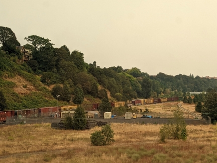 |
Freight Train
Position: 45°34.39’N, -122°45.09’W
Our train about to cross a bridge over tracks carrying a freight train east.
|
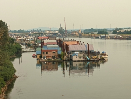 |
Class Harbor
Position: 45°36.71’N, -122°42.29’W
The Class Harbor floating home community along the Columbia River.
|
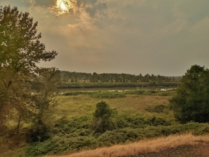 |
Vancouver Lake
Position: 45°41.13’N, -122°42.02’W
Vancouver Lake near Vancouver Washington. Lake River flow from the lake into the Columbia River but sometimes, due to seasonal variation in lake heights, the flow reverses and hte lake fills from the Columbia River.
|
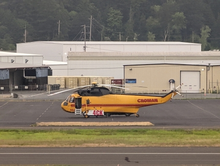 |
Sikorsky S-61
Position: 46°6.88’N, -122°53.79’W
A Sikorsky S-61 at Southwest Washington Regional Airport. This is one of 10 Sikorsky S-61 owned by heavy-lift specialist Croman.
|
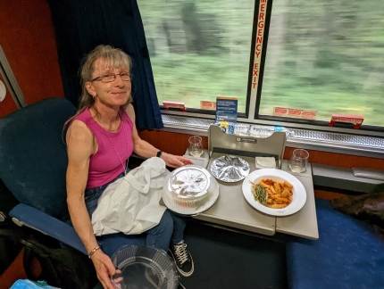 |
Dinner
Position: 46°34.74’N, -122°54.51’W
A surprisingly good pasta dinner on board our train to Seattle. We ordered it in the dining car and they delivered it to our cabin.
|
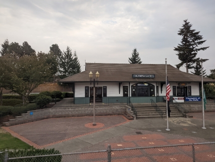 |
Lacey Station
Position: 46°59.29’N, -122°48.08’W
Passing Lacey Station, one of five stops our train makes in Washington.
|
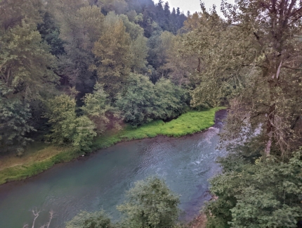 |
Nisqually River
Position: 47°3.40’N, -122°41.48’W
Our train crossing over the active Nisqually River near Olympia.
|
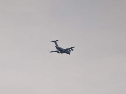 |
Military Cargo Plane
Position: 47°12.82’N, -122°29.18’W
A military cargo plane heading to Joint Base Lewis-McChord passing over our train just south of Tacoma.
|
 |
Click the travel log icon on the left to see these locations on a map. And a map of our most recent log entries always is available at mvdirona.com/maps. |

If your comment doesn't show up right away, send us email and we'll dredge it out of the spam filter.