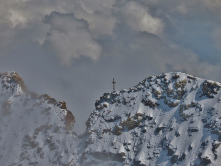
A metal cross at the summit of the Matterhorn is a memorial to the estimated 500 people who have died attempting or descending from the summit, including members of the first successful ascent team. Four of the seven-member team fell to their deaths on the descent in 1865. Currently about 3,000 people climb the mountain each year, with a maximum of 150 allowed per day.
After visiting Matterhorn Glacier Paradise, we boarded an Air Zermatt helicopter for a 40-minute high-altitude tour. We had an exceptional time. Getting close up to the Matterhorn and seeing climbers there was exciting, but we also loved the glacier views and the chance to see the many unique climber’s huts spread throughout the area
Below are highlights from July 3, 2022. Click any image for a larger view, or click the position to view the location on a map. And a map with our most recent log entries always is available at mvdirona.com/maps.
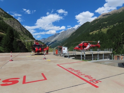 |
Air Zermatt
Position: 46°1.74’N, 7°45.23’E
From Furi, we hoofed it down to Air Zermatt for a helicoptor tour of the area.
|
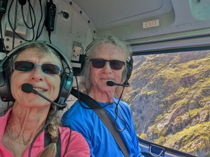 |
Takeoff
Position: 46°3.34’N, 7°45.88’E
Two happy Air Zermatt passengers shortly after takeoff.
|
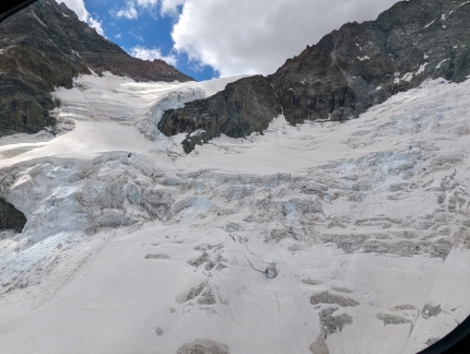 |
Schaligletscher
Position: 46°5.25’N, 7°43.25’E
The Schaligletscher (Schali Glacier) near 14,783-ft (4,506 m) Weisshorn. Routes to ascend Weisshorn typically cross the base of this glacier.
|
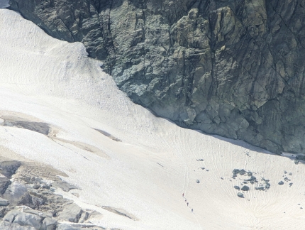 |
Hikers
Position: 46°4.19’N, 7°42.45’E
Alpine hikers, at lower right, crossing a glacier (click image for a larger view).
|
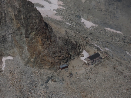 |
Rothorn Hut
Position: 46°2.64’N, 7°41.89’E
The 68-bed Rothorn Hut, at altitude 10,492 ft (3,198 m) was built in 1948 and is the starting point for a number of ascents in the area.
|
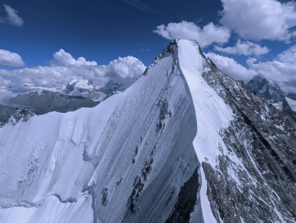 |
Ober Gabelhorn
Position: 46°2.56’N, 7°39.97’E
The steep and icy north face of 13,330 ft (4,063 m) Ober Gabelhorn.
|
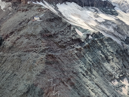 |
Hornli Hut
Position: 46°0.33’N, 7°40.04’E
The Hornli Hut at altitude 10,695-ft (3,260m) at the foot of the Matterhorn is the staring point of ascents to the summit. This is the one of the two sets of lights we could see from our room in Zermatt. Since the Swiss Alpine Club built their first hut here in 1880 with 17 beds, the structure has been rebuilt and expanded several times. The current building was inaugurated in 2015, on the 150th anniversary of the first Matterhorn ascent.
The newest hut has only 130 beds, compared to the 170 of its predecessor, to reduce overcrowding on several of the summit routes. About 3,000 reach the summit annually, and up to 150 might attempt on a good summer day (this picture shows how busy it can get at the summit). By reducing the number of beds and eliminating camping outside the hut, the Swiss hope to reduce the number of climbers by up to 30%. |
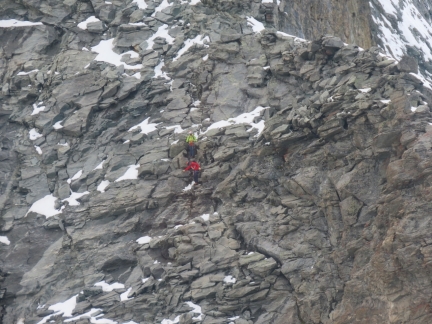 |
Climbers
Position: 45°59.70’N, 7°40.70’E
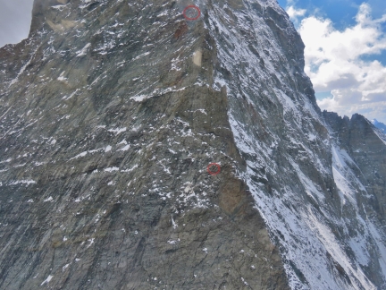
Climbers descending along the north flank of the Matterhorn.
|
 |
Climbers and Hut
Position: 45°59.70’N, 7°40.70’E
The climbers in the previous picture are circled at bottom, and the Solvay Hut is circled above them. At 13,133 ft (4,003m), it is Swiss Alpine Club’s highest hut and is for emergency use only (click image for a larger view).
|
 |
Matterhorn Summit
Position: 45°58.75’N, 7°38.46’E
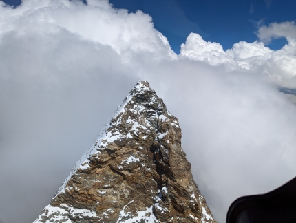
Even with the top of the Matterhorn at 15,012 ft (4,577 m).
|
 |
Cross
Position: 45°58.64’N, 7°38.78’E
A metal cross at the summit of the Matterhorn is a memorial to the estimated 500 people who have died attempting the summit, including members of the first successful ascent team. Four of the seven-member team fell to their deaths on the descent in 1865.
|
 |
Klein Matterhorn from Air
Position: 45°55.84’N, 7°42.28’E
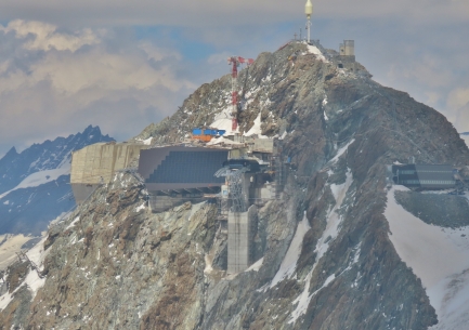
A view to the Klien Matterhorn peak and the Matterhorn Glacier Paradise station from the air.
|
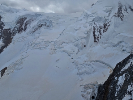 |
Schwaerzegletscher
Position: 45°55.71’N, 7°45.23’E
We believe this is the Schwaerzegletscher, east of Breithorn.
|
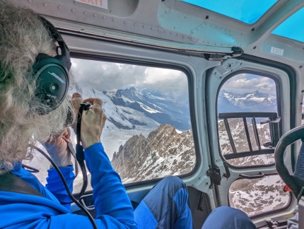 |
Helicopter View
Position: 45°55.94’N, 7°52.08’E
Having a fabulous time high above the Alps.
|
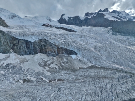 |
Gornergletscher from Air
Position: 45°56.54’N, 7°49.02’E
View to the Gornergletscher (Gorner Glacier) that we photographed earlier today from Gornergrat.
|
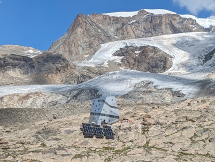 |
Monte Rosa Hut from Air
Position: 45°56.54’N, 7°49.02’E
An aerial view to the Monte Rosa Hut we saw from Gornergrat this morning.
|
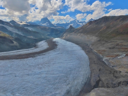 |
Gornergletscher and Matterhorn
Position: 45°56.51’N, 7°50.85’E
The Gornergletscher trailing off the northwest, with the partially cloud-covered Matterhorn visible in distance.
|
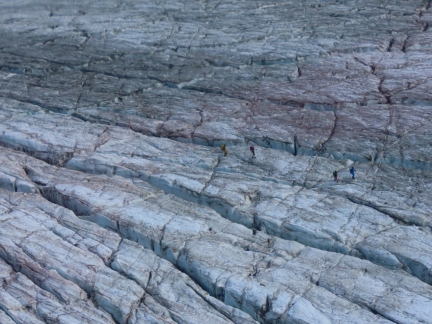 |
Climbers on Gornergletscher
Position: 45°56.83’N, 7°48.25’E
Climbers crossing Gornergletscher (click image for a larger view).
|
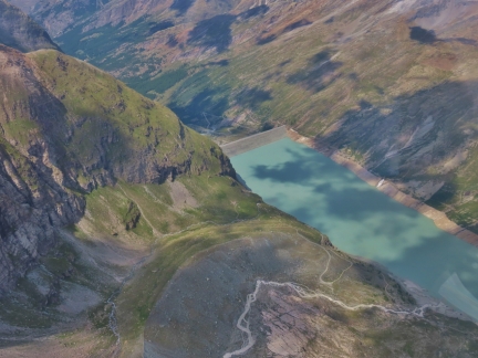 |
Mattmark Dam
Position: 46°2.13’N, 7°56.92’E
The Mattmark Dam was completed in 1967 to control flooding due to glacial melt.
|
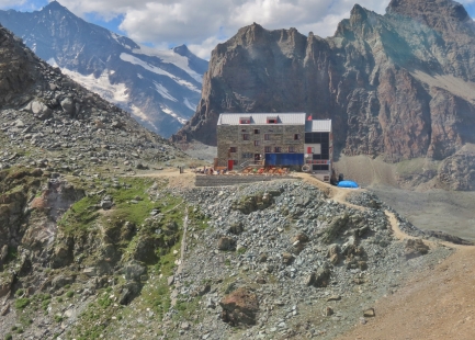 |
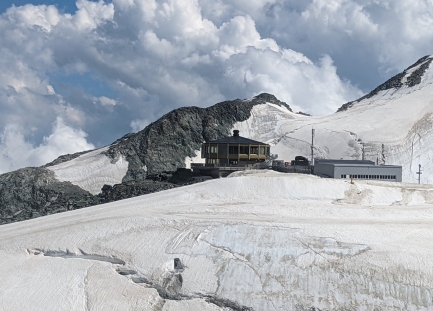
Britannia Hut
Position: 46°3.61’N, 7°56.16’E
The Britannia Hut was originally built in 1912 with funds contributed from British climbers and was extensively renovated in 1997.
|
 |
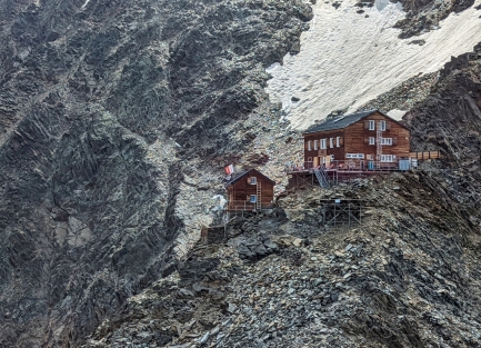
Mittelallalin
Position: 46°3.71’N, 7°54.26’E
The Mittelallalin summit, at 11,339 ft (3,456 m), is home to the world’s highest revolving restaurant. The summit can be reached via cableway.
|
 |
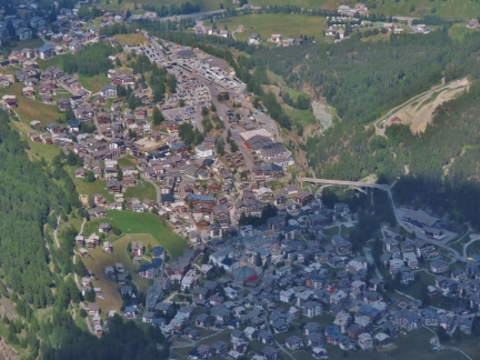
Mischabel Hut
Position: 46°6.59’N, 7°53.46’E
The Mischabel Hut opened in 1903 and is used to ascend Lenzspitze, the Nadelhorn and the Hohberghorn.
|
 |
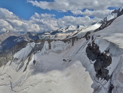
Saas-Fee
Position: 46°3.42’N, 7°53.65’E
The village of Saas-Fe lies at en elevation of 5,900 ft (1,800 m). Surrounded by 13 peaks over 13,123 ft (4,000 m), it is a popular winter skiing destination.
|
 |
Gros Bigerhorn
Position: 46°7.74’N, 7°53.27’E
The sheer cliff face along the east side of Gros Bigerhorn.
|
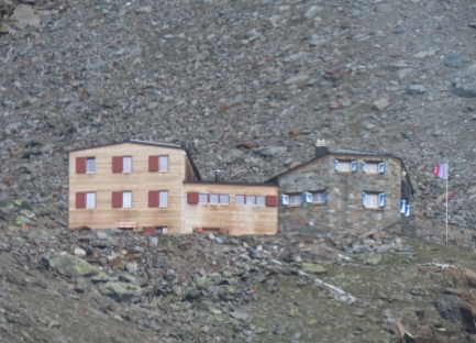 |
Dom Hut
Position: 46°9.10’N, 7°49.10’E
The 75-bed Dom Hut opened in 1890 and was extended and renovated several times, most recently in 2013.
|
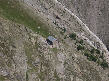 |
Kinhutte
Position: 46°5.38’N, 7°48.16’E
Kinhutte is a privately-owned shelter at altitude 8,477ft (2,584m) that provides meals and accommodation.
|
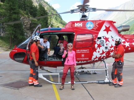 |
Aerospatiale AS-350 B3
Position: 46°2.21’N, 7°45.64’E
We had an absolutely amazing time in the Air Zermatt helicopter tour, on board their Aerospatiale AS-350 B3. We booked it somewhat last-minute on a whim and are really glad to have done it. The scenery was amazing and we really enjoyed seeing the varied mountain huts and shelters. And, of course, being nose-to-nose with the Matterhorn was exceptional.
|
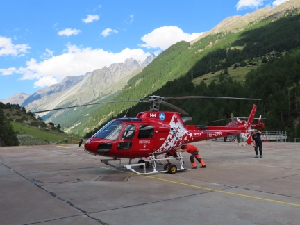 |
Wheeling by Hand
Position: 46°1.75’N, 7°45.18’E
We were on the last flight of the day, so the crew stowed the helicopters for the night. The craft are so light they can be wheeled into the hangar by hand.
|
 |
Spycher
Position: 46°1.18’N, 7°44.97’E
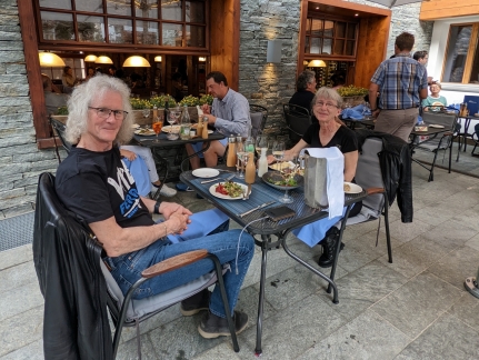
We broke our “it must have a Matterhorn view” rule for dinner at highly-rated Restaurant Spycher. And we’re glad we did. The meal was excellent and we enjoyed our conversation with the owner.
|
 |
Chalet Hotel Schonegg
Position: 46°1.30’N, 7°45.14’E
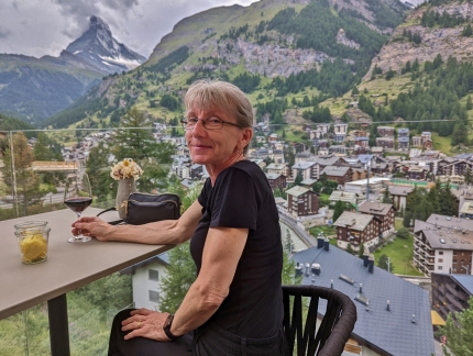
Getting another Matterhorn fix on the terrace of our Zermatt hotel, the Chalet Hotel Schonegg.
|
 |
Click the travel log icon on the left to see these locations on a map. And a map of our most recent log entries always is available at mvdirona.com/maps. |

If your comment doesn't show up right away, send us email and we'll dredge it out of the spam filter.