Snow Lake is the most popular summer hike in the Alpine Wilderness area of Wenatchee and Snoqualmie National Forests. The trailhead is just a one-hour drive from downtown Seattle, and reaching a viewpoint over the lake is an easy a 2.3-mile (3.7 km) hike from the trailhead with a modest elevation gain of 1,200 ft (365 m). The summer trail leads beneath several winter avalanche shutes, and a safer way to reach the lake in the winter is along the opposite side of the Snoqualmie River.
We made the snowshoe hike after a late-season snowfall with low avalanche risk. The scenery was spectacular, and we really enjoyed the hike and the views as snow continued to fall. The trail was surprisingly busy with back-country skiers taking advantage of what may be the last snow of the season, and we watched many climb up then ski down the steep slopes.
Below are highlights from April 9th, 2022. Click any image for a larger view, or click the position to view the location on a map. And a map with our most recent log entries always is available at mvdirona.com/maps.
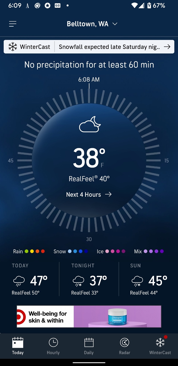 |
38 F
Position: 47°37.00’N, -122°20.69’W
Two days ago, the Belltown temperature was a near-record high of 73°F (22.8°C). This morning it’s swung the other way to 38°F (3.3°C), not far off the record low of 30°F (-1.1°C) set in 1920.
|
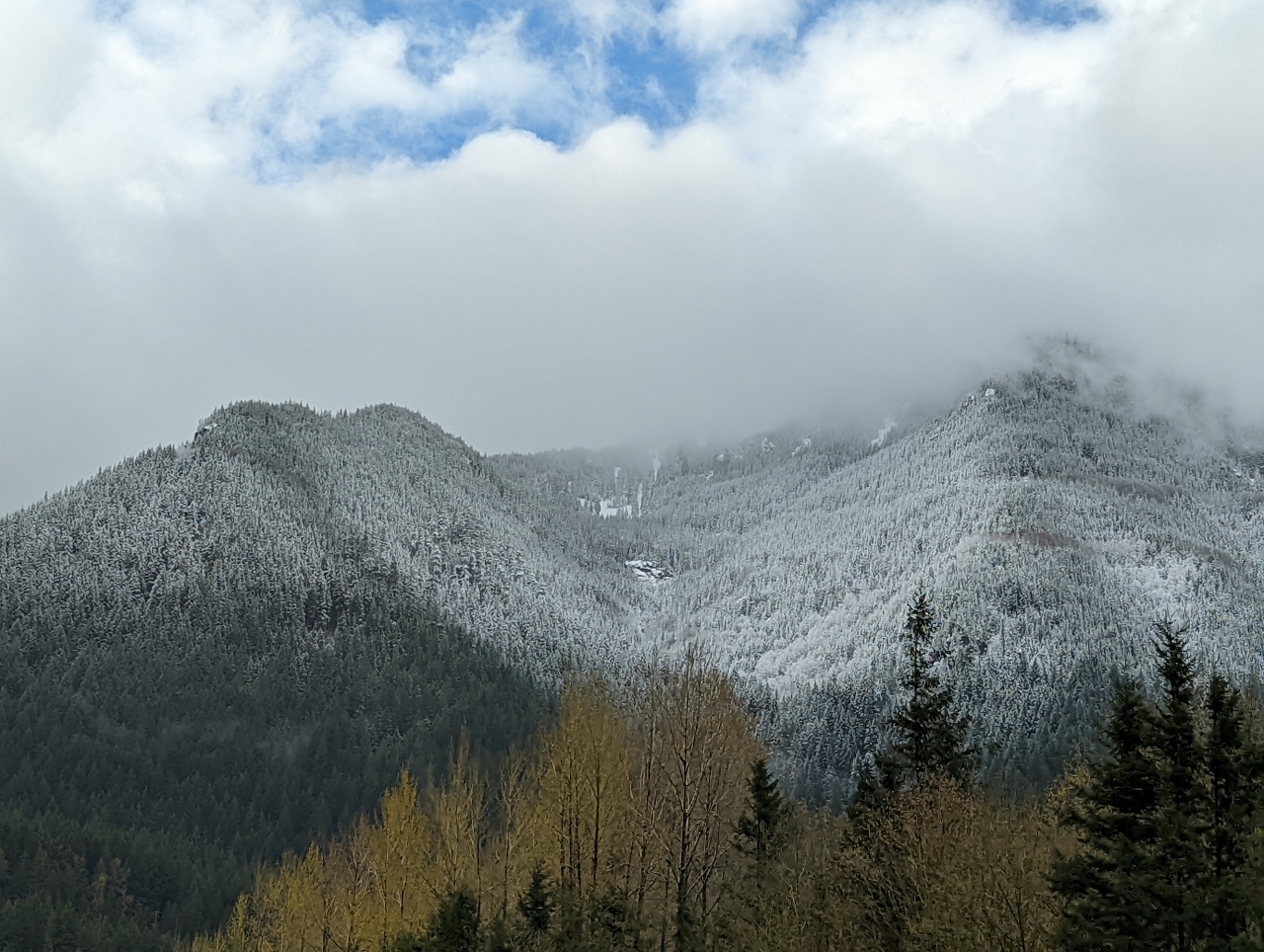 |
Fresh Snow
Position: 47°27.83’N, -121°42.75’W
A late-season fresh dusting of snows on the trees east of North Bend as we drive east on I-90 at altitude 607 ft (185 m) to snowshoe at Snoqualmie Pass.
|
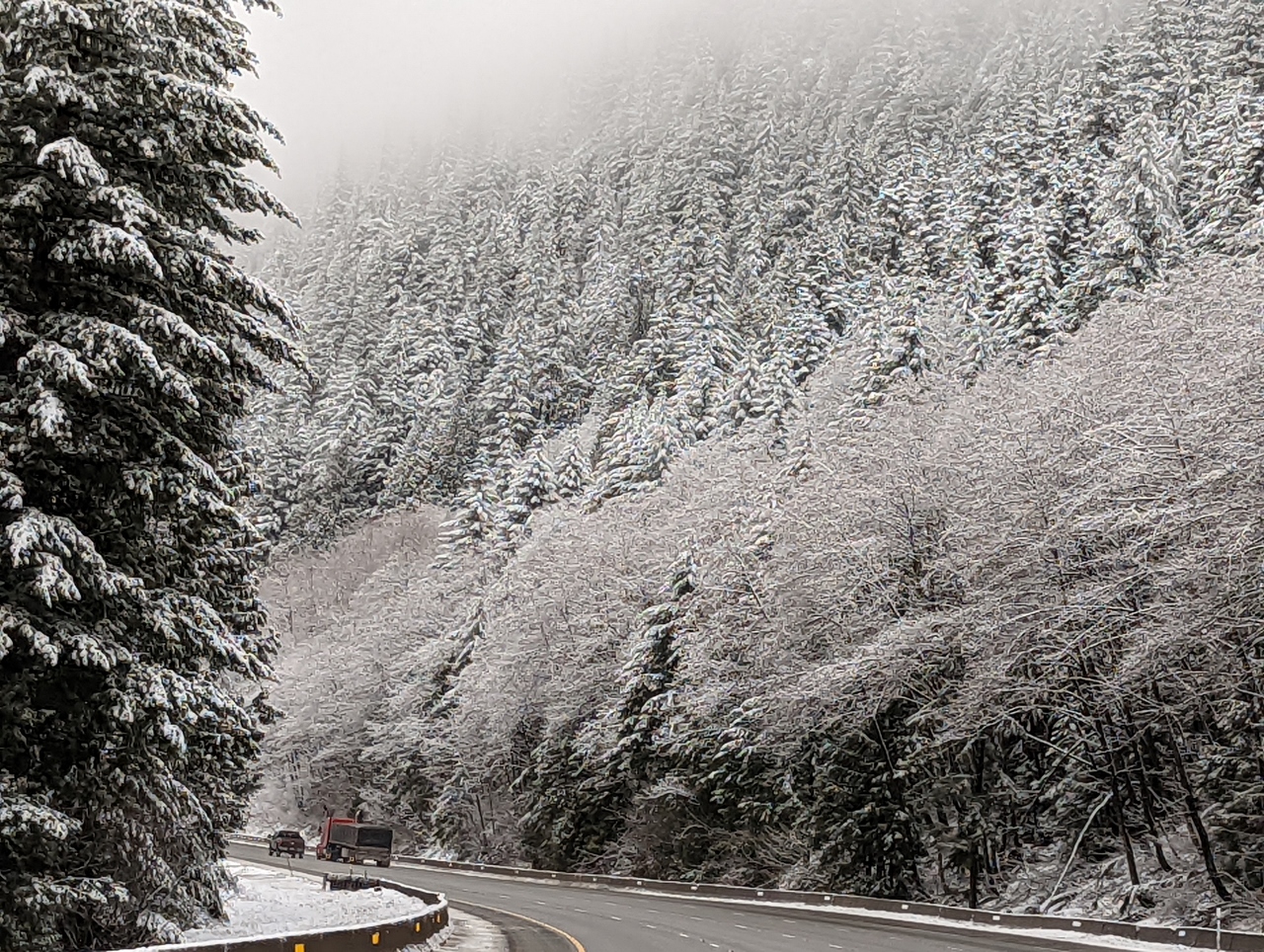 |
Snow-Covered Trees
Position: 47°23.86’N, -121°26.87’W
As we near Snoqualmie Pass at altitude 2,165 ft (660 m) the trees are covered with fresh snow, making a beautiful winter scene.
|
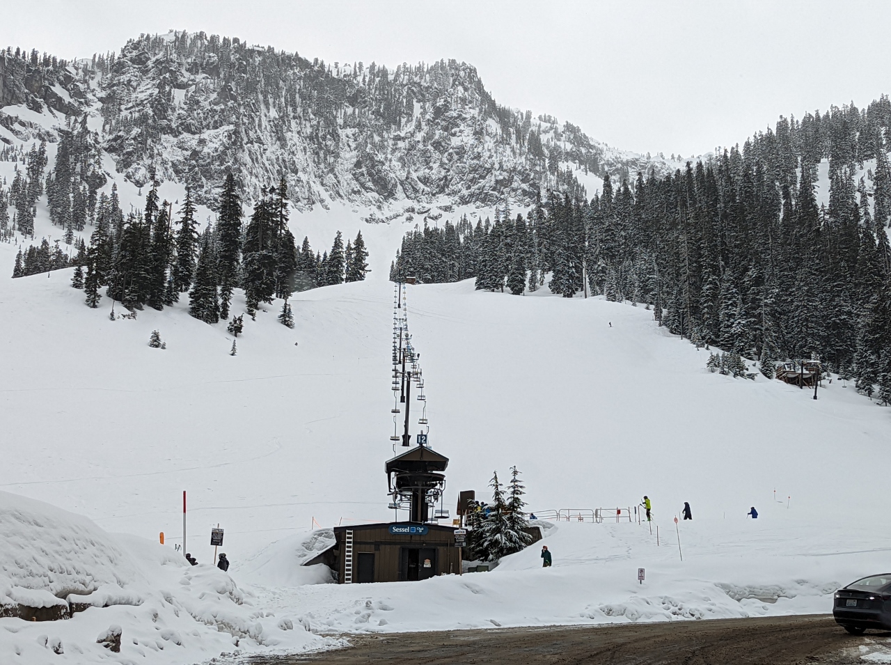 |
Alpental
Position: 47°26.75’N, -121°25.45’W
The Alpental ski base at Snoqualmie Pass received several inches of fresh snow last night.
|
 |
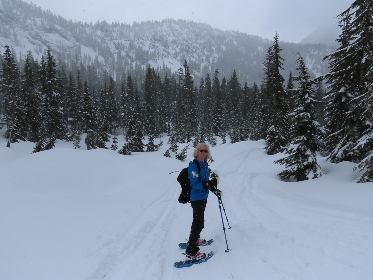
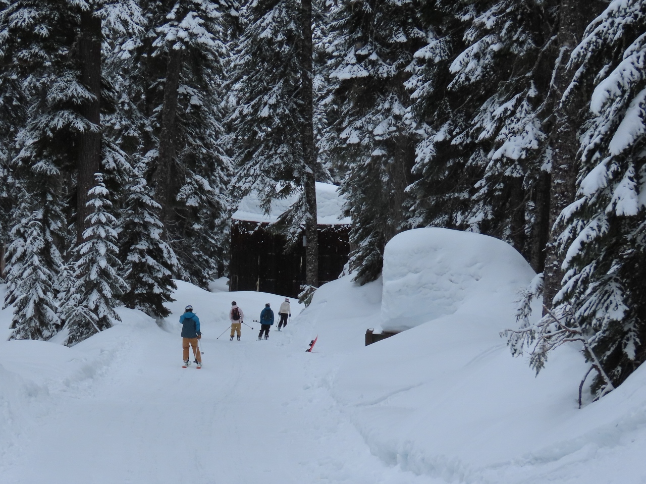
Trailhead
Position: 47°26.89’N, -121°25.89’W
Geared up and ready to snowshoe about 3 miles (4.8 km) up to Snow Lake north of the Alpental ski base.
|
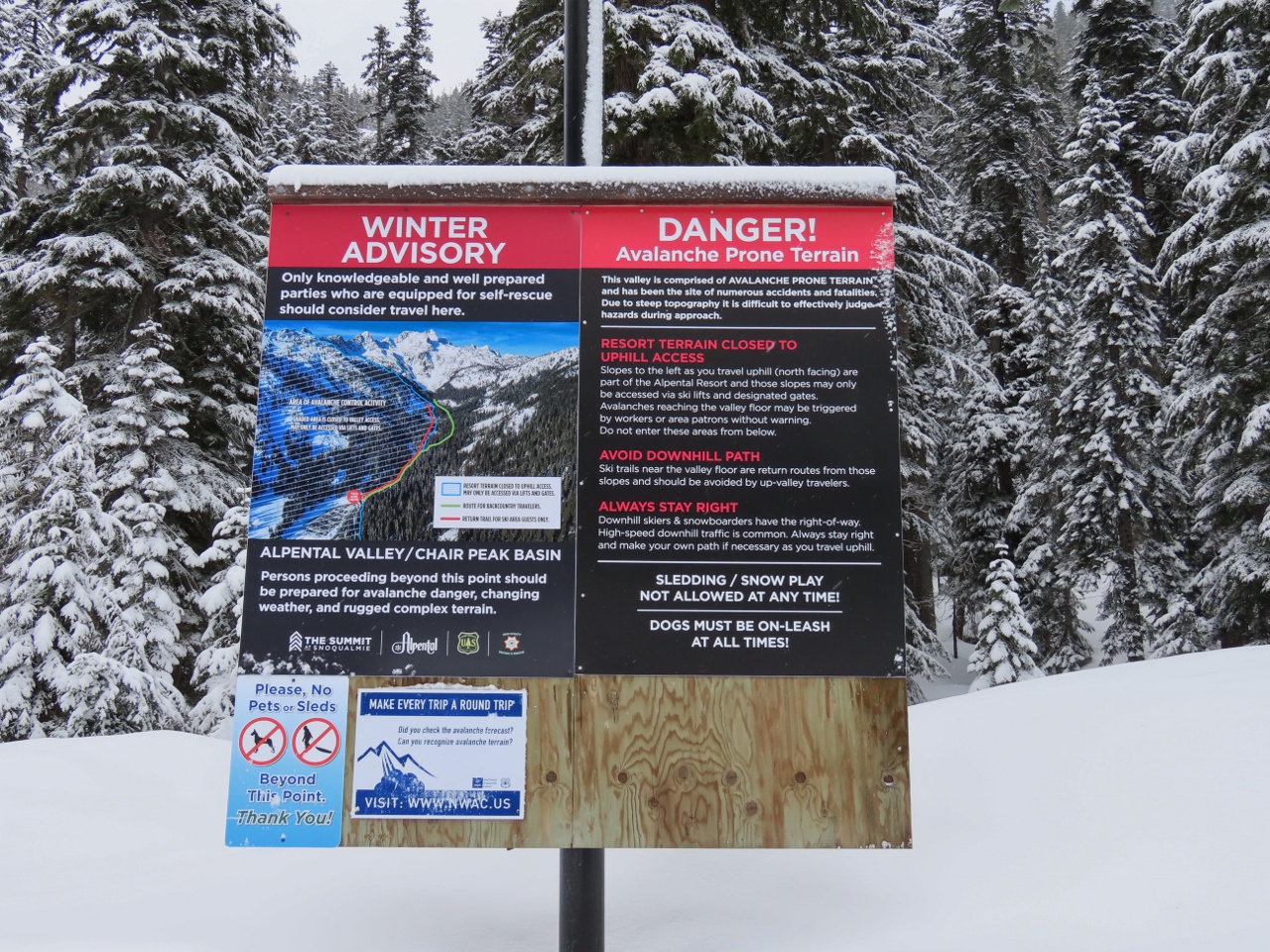 |
Avalanche Advisory
Position: 47°26.86’N, -121°25.86’W
Avalanche advisory sign at the trailhead to Snow Lake. We’ll be heading into the backcountry on this hike, but the avalanche risk today is low.
|
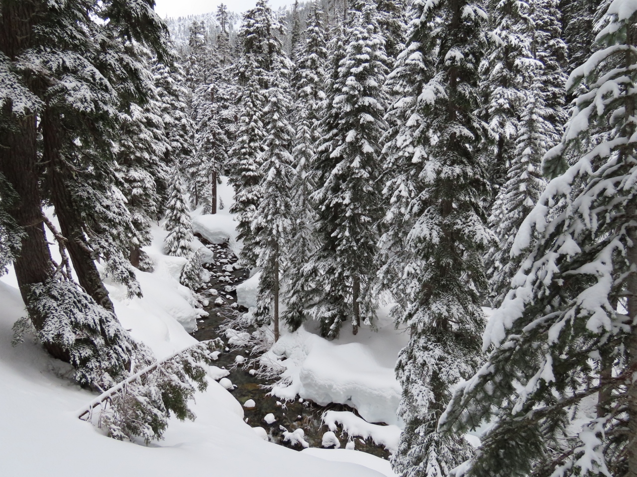 |
South Fork
Position: 47°26.97’N, -121°25.96’W
Fabulous winter scene looking north along the Snoqualmie River South Fork.
|
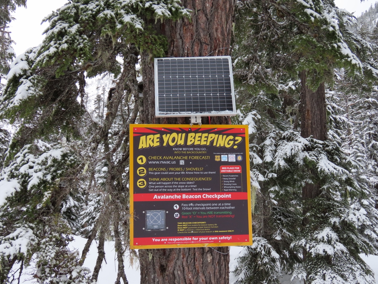 |
Beacon Checkpoint
Position: 47°27.01’N, -121°26.04’W
The trail we’re on leads to a popular back-country ski area in territory that can be avalanche-prone. For those carrying a search-and-rescue beacon, this checkpoint will confirm that their beacon is transmitting properly.
|
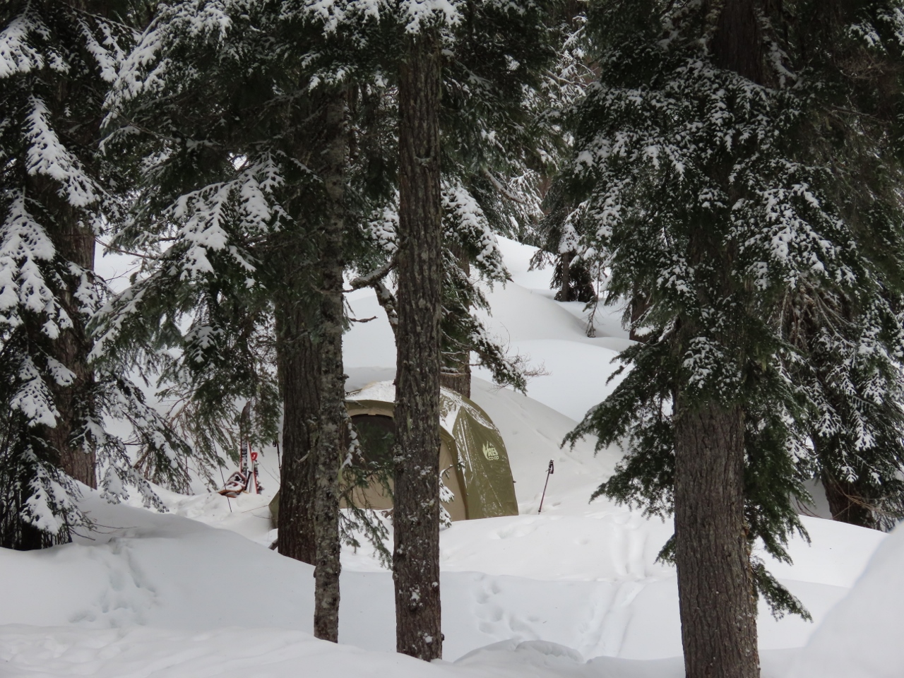 |
Winter Camp
Position: 47°27.03’N, -121°26.12’W
A snug winter campsite along the Snoqualmie River South Fork. These people have come up with a fairly innovative way to maximize their ski time. They pitched a tent just outside of the Alpental property. In the mornings they can ski down to the lift and in the evenings they can ski down to their tent.
|
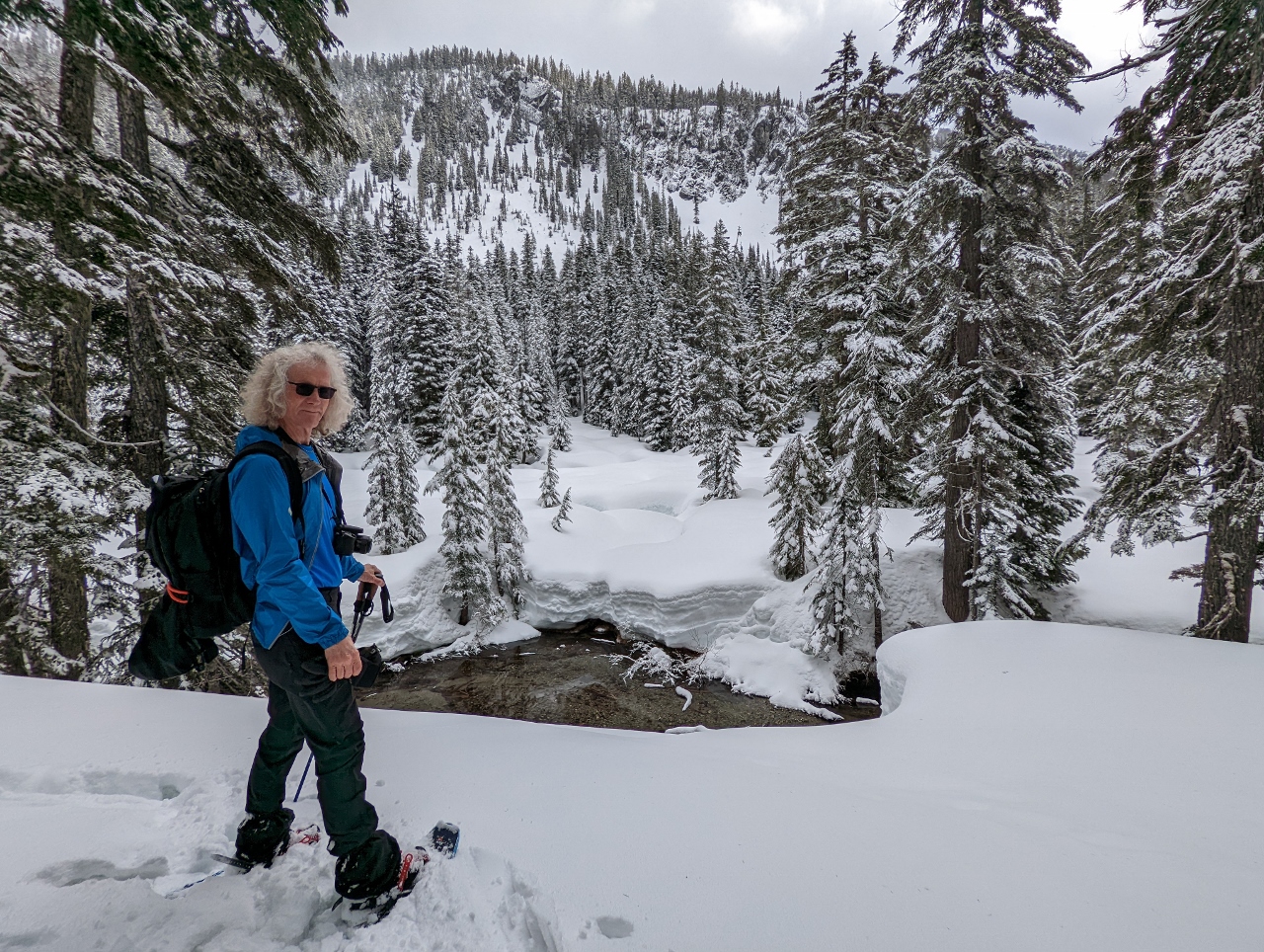 |
Snoqualmie Mountain
Position: 47°27.11’N, -121°26.31’W
Looking east across the Snoqualmie River South Fork to Snoqualmie Mountain in the distance.
|
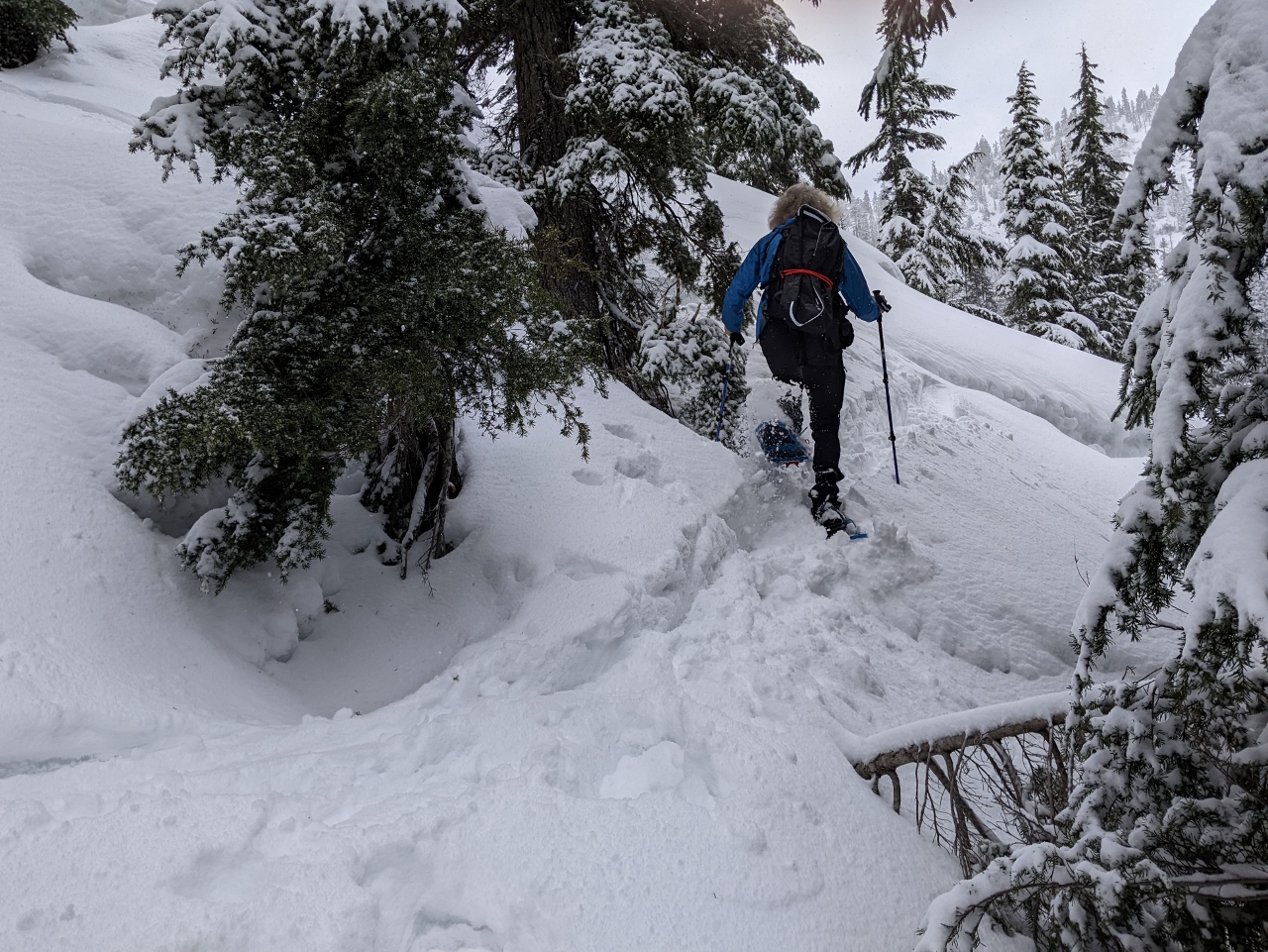 |
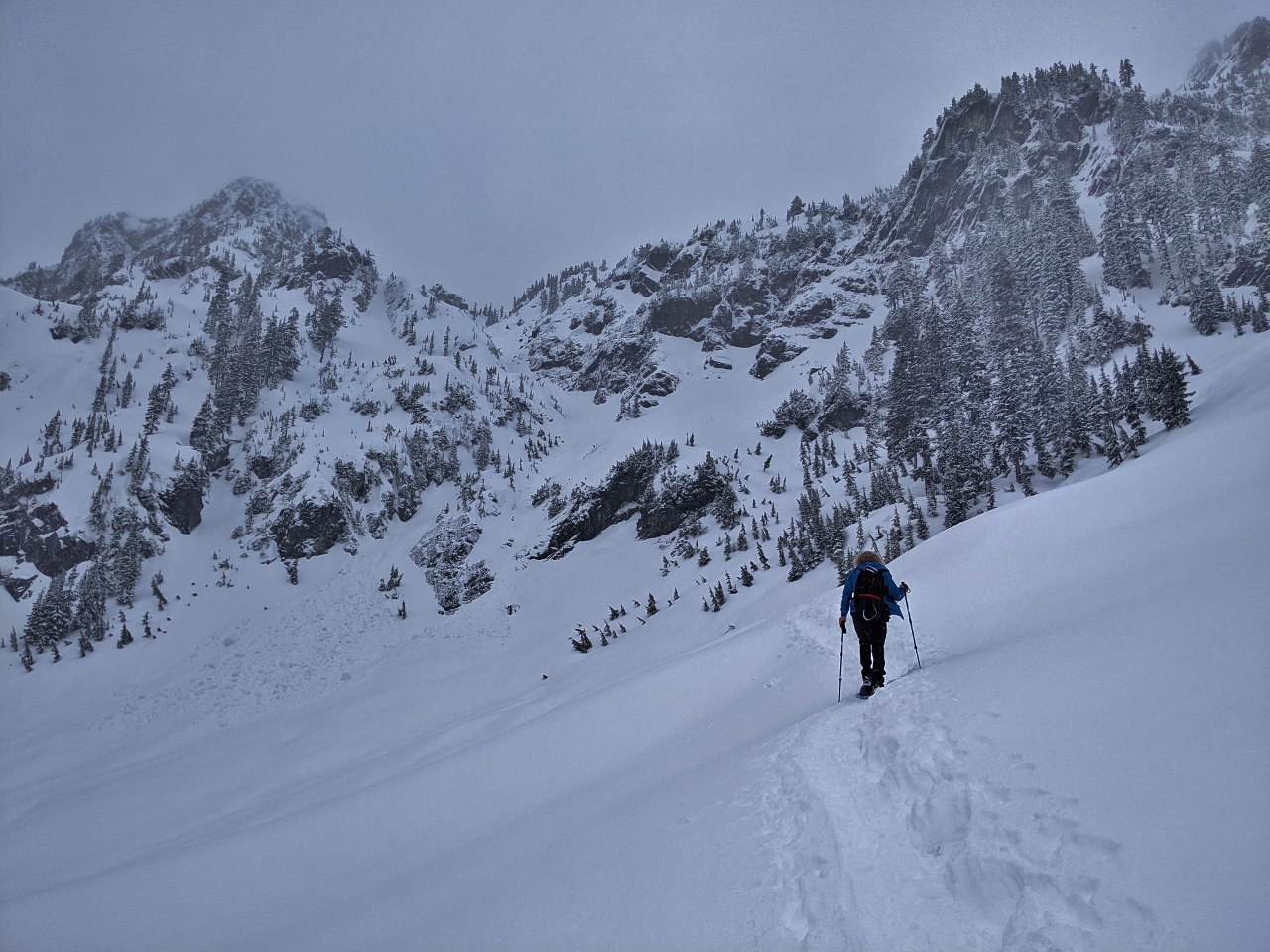
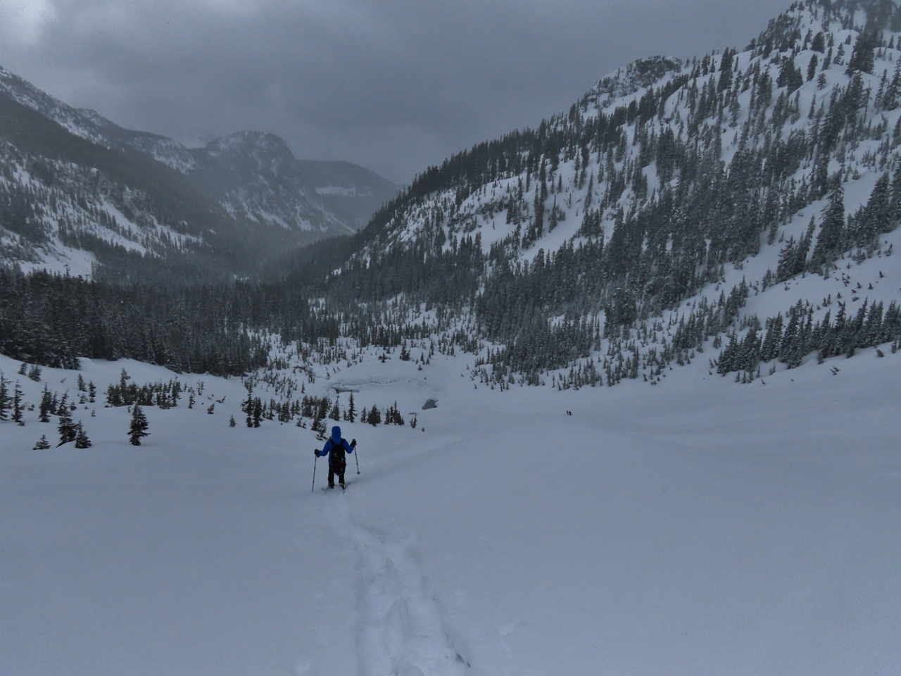
Steep
Position: 47°27.26’N, -121°26.74’W
Most of the route so far has been at a fairly easy grade, but it got a lot steeper as we reached the slope below Chair Peak.
|
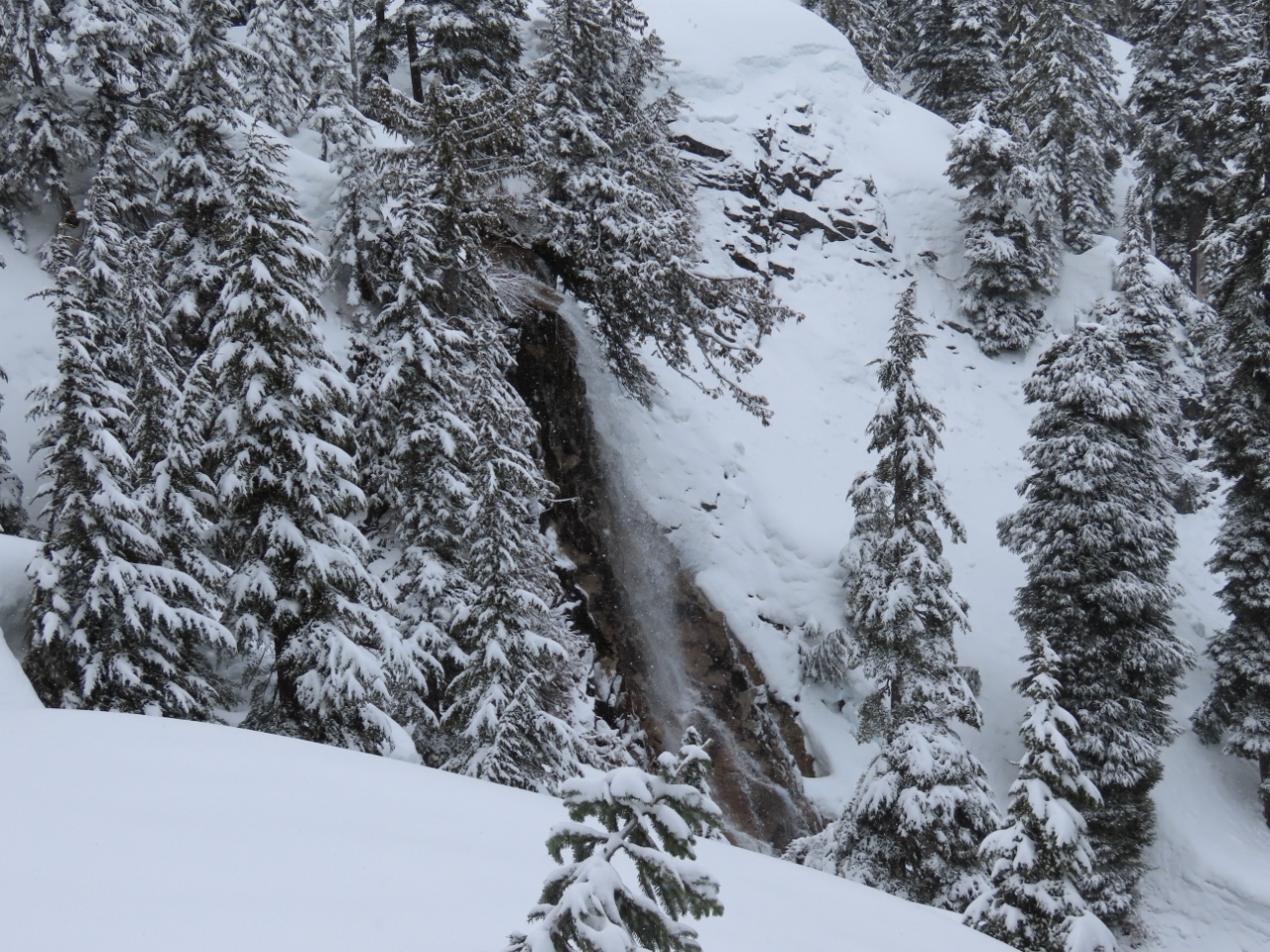 |
Waterfall
Position: 47°27.25’N, -121°26.74’W
Waterfall along the Snoqualmie River South Fork.
|
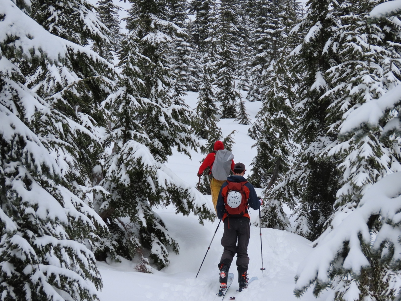 |
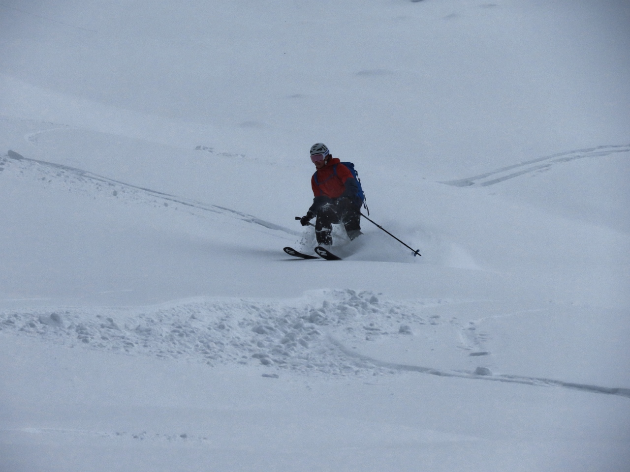
Skiers
Position: 47°27.24’N, -121°26.86’W
Few people were snowshoeing today, but dozens of skiers were taking advantage of what may be the last big snowfall of the season.
|
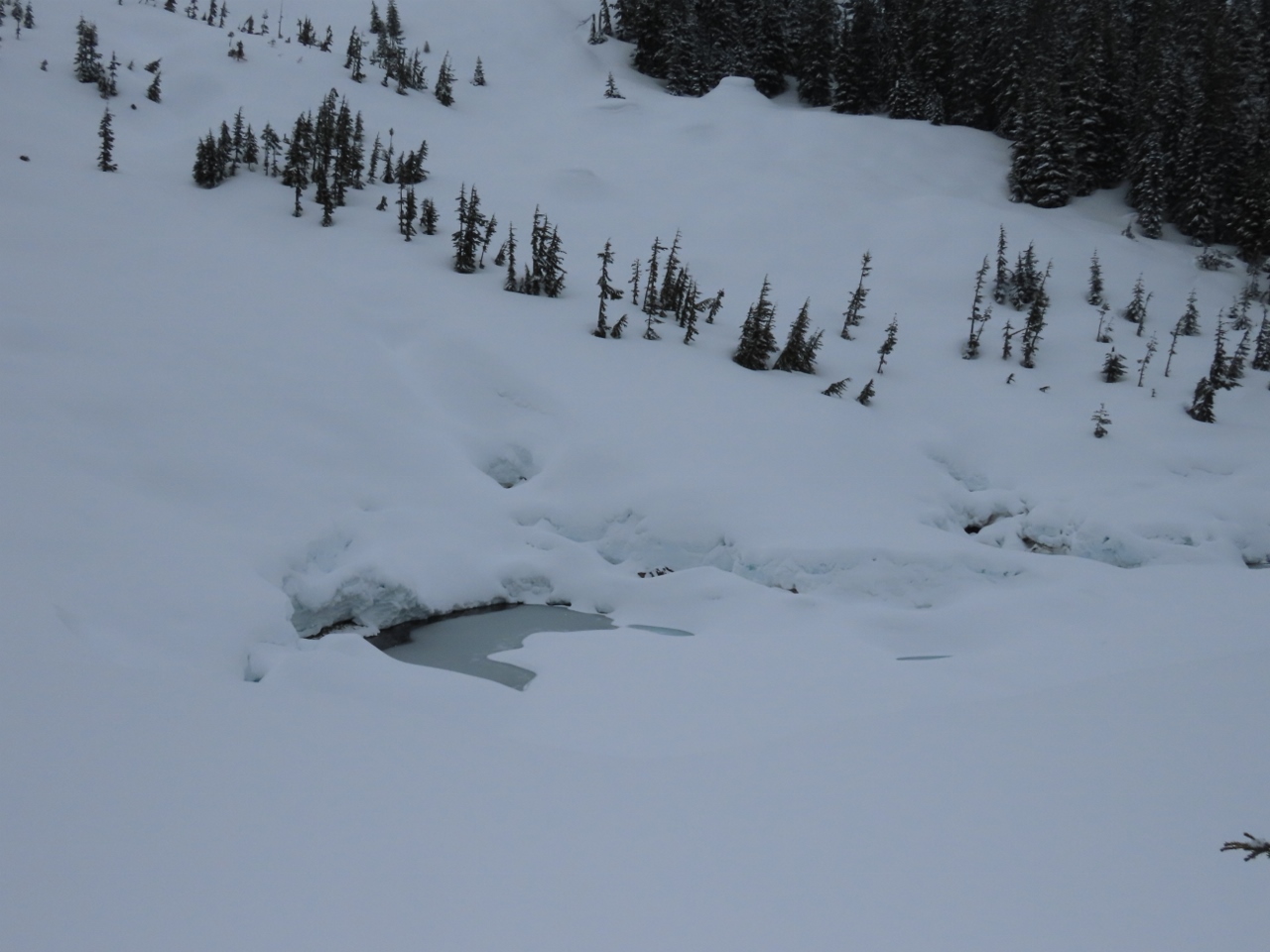 |
Source Lake
Position: 47°27.27’N, -121°27.07’W
Source Lake, the source of Snoqualmie River South Fork, nearly buried in snow.
|
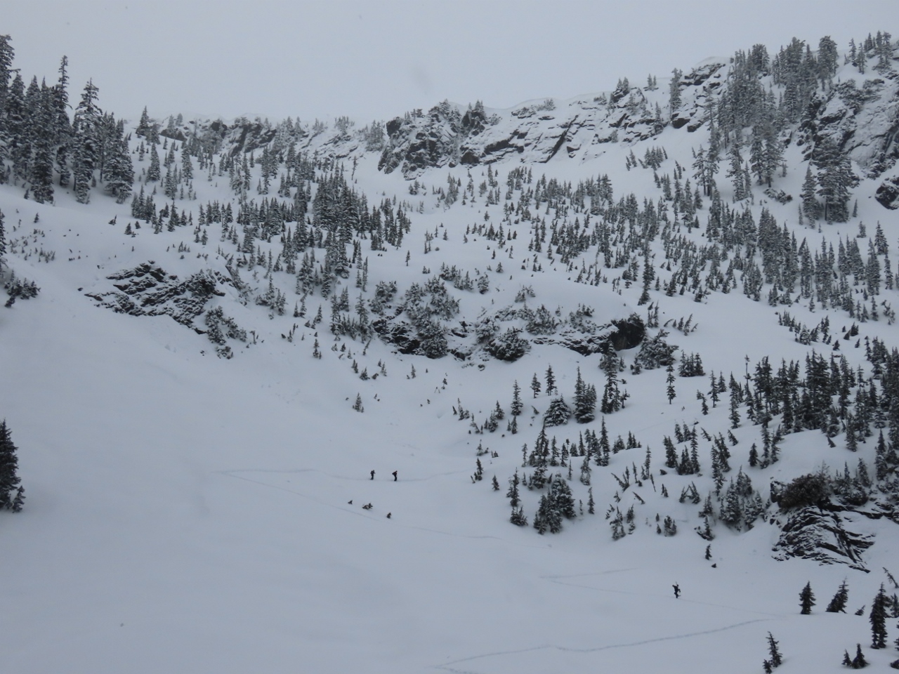 |
Zig-Zag Trail
Position: 47°27.29’N, -121°27.10’W
Skiers climbing the zig-zag trail that leads up the slope below Chair Peak to Snow Lake (click image for a larger view).
|
 |
Avalanche
Position: 47°27.32’N, -121°27.17’W
The remains of a micro-avalanche west of the trail.
|
 |
Climbing
Position: 47°27.39’N, -121°27.24’W
Making our way up the zig-zag trail towards Snow Lake. The going was fairly steep, but we enjoyed the climb.
|
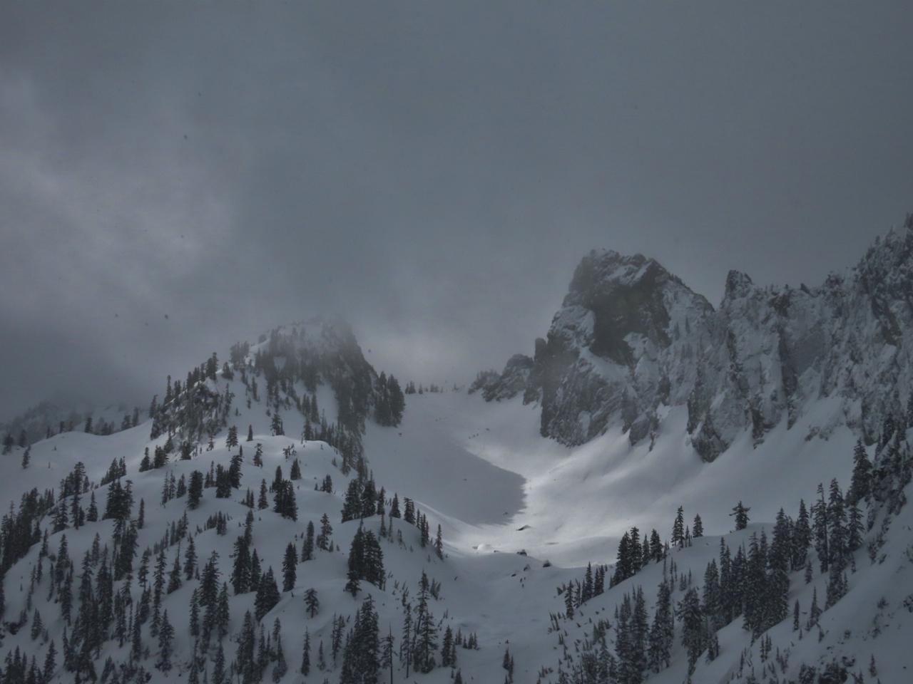 |
Chair Peak
Position: 47°27.49’N, -121°27.35’W
6,238-ft (1,901 m) Chair Peak, right of center, viewed from the trail up to Snow Lake. Even though the visibility was a bit poor, we still got some great mountain views.
|
 |
Snow Lake
Position: 47°27.62’N, -121°27.06’W
Enjoying a hot drink and a snack at altitude 4,480 ft (1,366 m), with a view to snow-covered Snow Lake. We saw several skiers cross the frozen lake.
|
 |
Snoqualmie Pass
Position: 47°27.45’N, -121°27.36’W
Descending back down the zig-zag trail towards Source Lake, with Snoqualmie Pass in the distance.
|
|
Skier
Position: 47°27.34’N, -121°27.23’W
One of many skiers we watched heading down-slope.
|
 |
Snowing
Position: 47°27.27’N, -121°27.07’W
A light snow started falling as we descended. It feels like the start of winter, not the end.
|
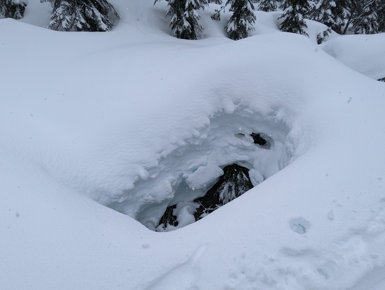 |
Hole
Position: 47°27.24’N, -121°26.84’W
A big hole in the snow above the Snoqualmie River South Fork.
|
 |
Ski Trail
Position: 47°27.03’N, -121°26.10’W
Walking along the ski trail return route that leads to the Alpental upper parking lot and nearby chair lifts. We didn’t see any skiers when we walked up a few hours earlier shortly after 9am, but many passed us on the descent.
|
 |
Explosives
Position: 47°27.01’N, -121°26.06’W
Storage for explosives used for avalanche control at the Alpental ski resort.
|
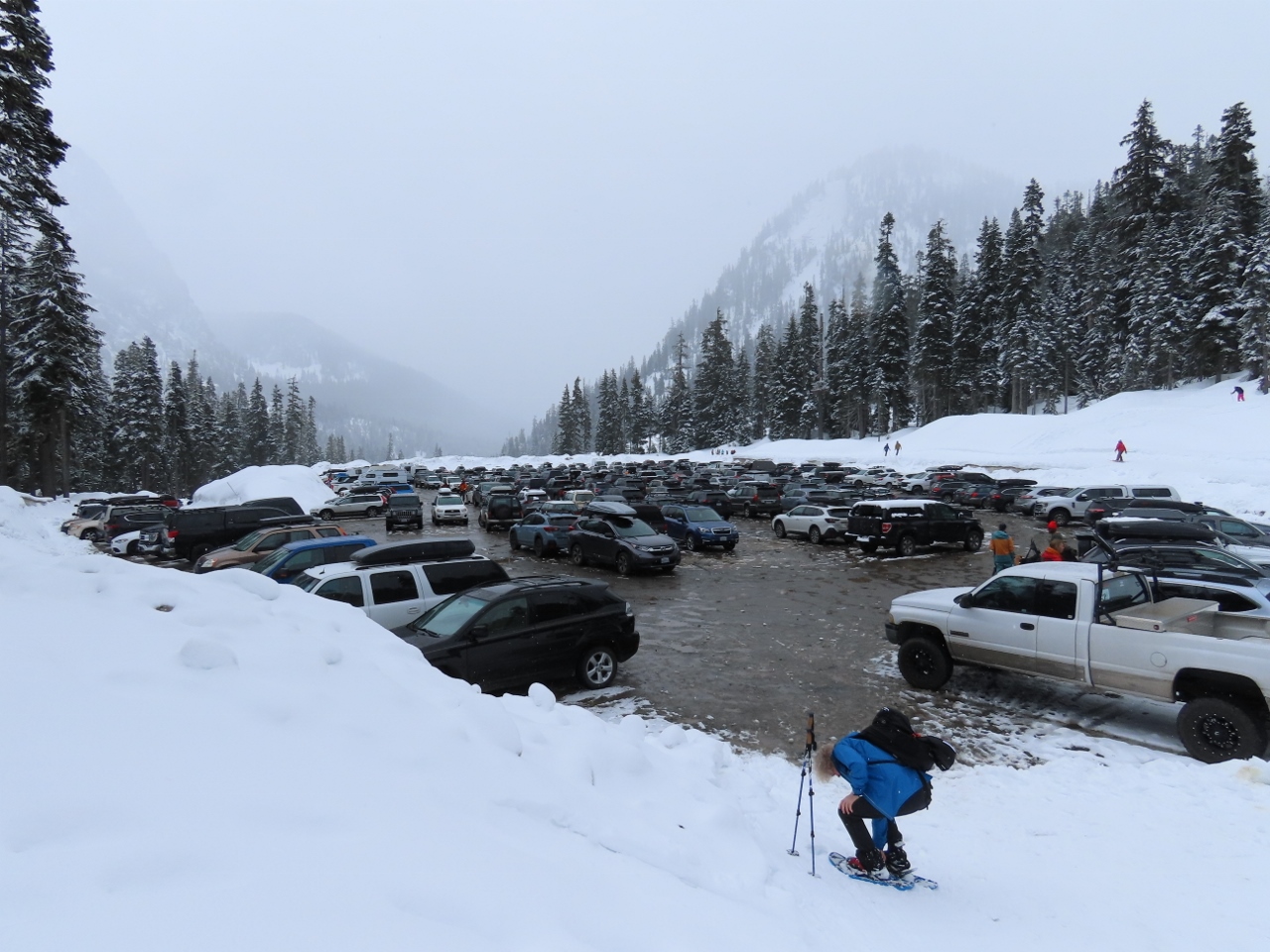 |
Parking Lot
Position: 47°26.97’N, -121°25.98’W
The Alpental upper parking lot still had plenty of space when we arrived at 9am, but it was filling fast. The lot was full three hours later when we returned from our hike.
|
 |
Wet Snow
Position: 47°26.59’N, -121°40.14’W
Wet snow falling at altitude 1,074 ft (328 m) as we near North Bend. That means more snow up in the mountains.
|
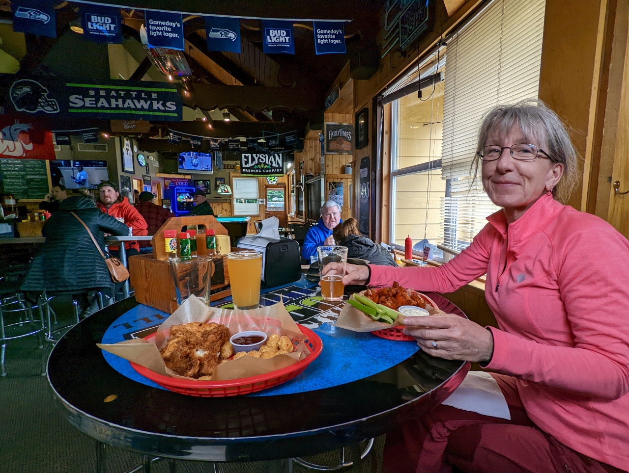 |
Pour House
Position: 47°29.79’N, -121°47.31’W
An enjoyable lunch at the Pour House Bar & Grill in North Bend.
|
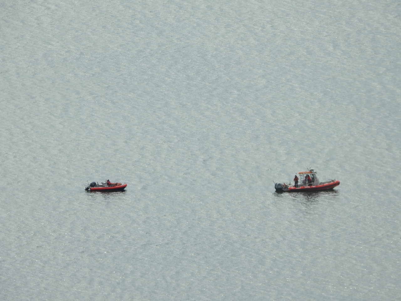 |
Seattle Fire Boats
Position: 47°37.00’N, -122°20.69’W
Two Seattle Fire Boats practicing in Elliott Bay.
|
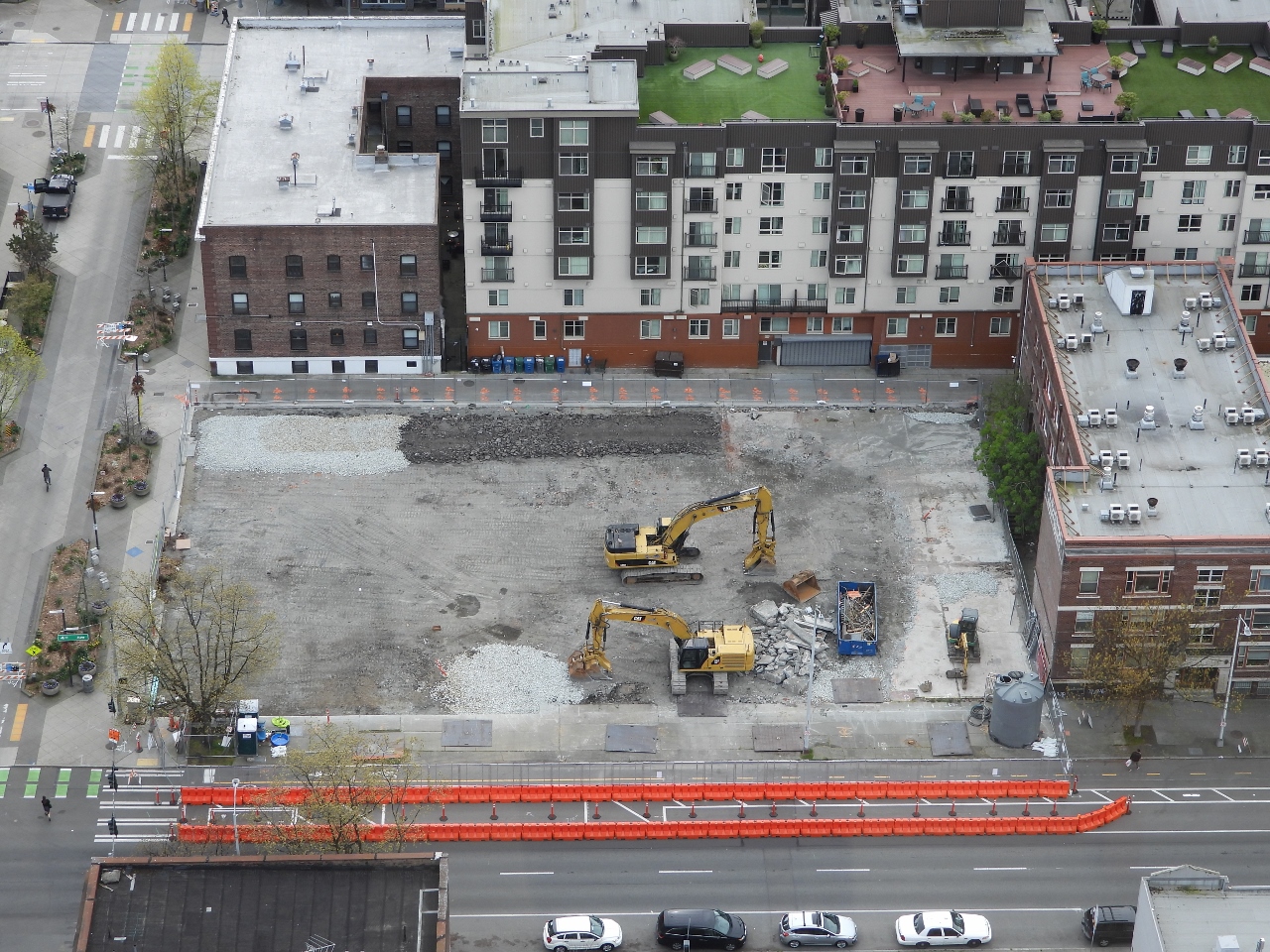 |
Fourth and Bell
Position: 47°37.00’N, -122°20.69’W
The concrete slab from the original structure at Fourth and Bell has now mostly been removed. On the near-side edge of the site, a ramp has been constructed to allow vehicle access from road grade. The gravel pad at the back of the site will support a wheeled hydraulic excavator.
|
 |
Thai Ginger
Position: 47°37.06’N, -122°20.35’W
A great meal along the window at our favourite table at Thai Ginger near our apartment. James’ office building is just out of the picture behind Jennifer.
|
 |
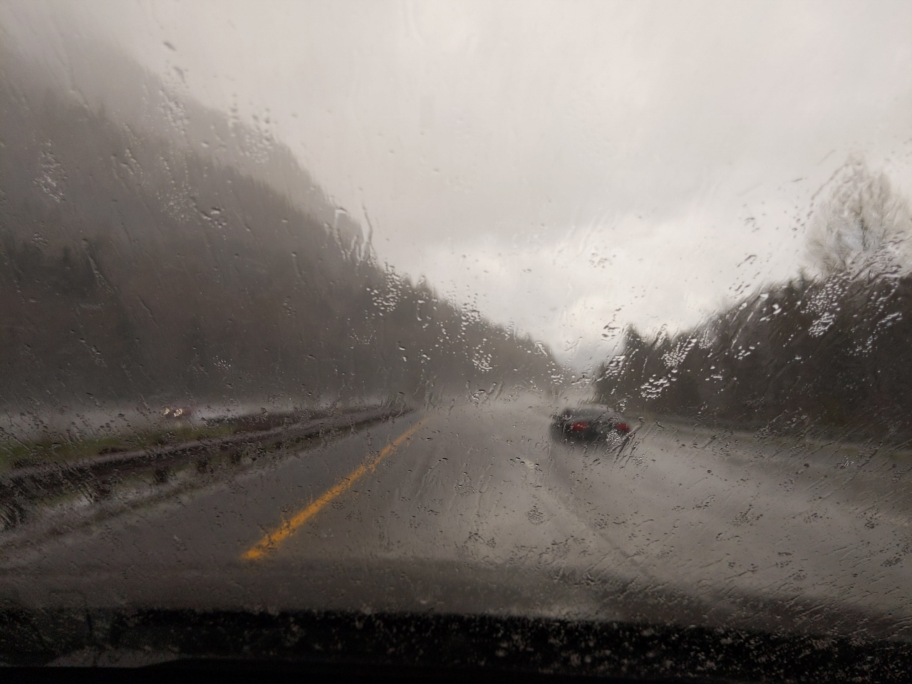
Rain
Position: 47°37.06’N, -122°20.35’W
As we finished our meal at Thai Ginger, an unusually heavy rain started falling, with drops so large you could see them bounce off the pavement. The restaurant manager poured us each a little more wine, insisting we couldn’t go out in that.
|
 |
Click the travel log icon on the left to see these locations on a map. And a map of our most recent log entries always is available at mvdirona.com/maps. |
So you’re looking for camping gear. May I suggest these camping chairs : we chose them because they are the smallest when folded (13 inches, I keep two of them in a 24lt. backpack.). We don’t do camping, just pic-nics and walks in the park, so our target was a couple of chairs comfortable, very light and portable in backpacks.
https://helinox.com/products/chair-one?variant=42132566638766
Hope it helps. (I think they are US made, too)
Nice chair selection — they are particularly small and light. Thanks for passing that reference along.