The Varistaipale and Taivallahti canals form the final two lock systems in the famed Heinavesi route and provide boat access to the monastary at Valamo. The Varistaipale Canal is notable in having a flight of four locks, the most of any Finnish canal.
The maximum draft for vessels to pass through is 1.8m, too shallow for Dirona‘s 2.1m draft, so we decided it take the tender instead. We only saw less than 2.1m once in the trip, in one of the locks, and probably could have brought Dirona. But the tender ended up being more of an adventure and, when crossing the long lakes, 32 kts is a nice speed.
Below are trip highlights from June 8th en route to and in Valamo, Finland. Click any image for a larger view, or click the position to view the location on a map. And a live map of our current route and most recent log entries always is available at mvdirona.com/maps.
 |
To Valamo
Position: 62°32.69’N, 28°38.33’E
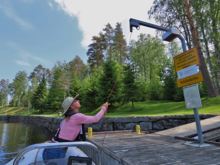
As with the other canals we passed through in Dirona yesterday along the Heinavesi route, the Varistaipale and Taivallahti are similarly self-service. Here Jennifer is pulling the rope to request an opening.
|
 |
Entering First Lock
Position: 62°32.76’N, 28°38.38’E
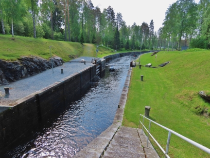
James running the tender into the first lock in the Varistaipale canal.
|
 |
Holding On
Position: 62°32.76’N, 28°38.38’E
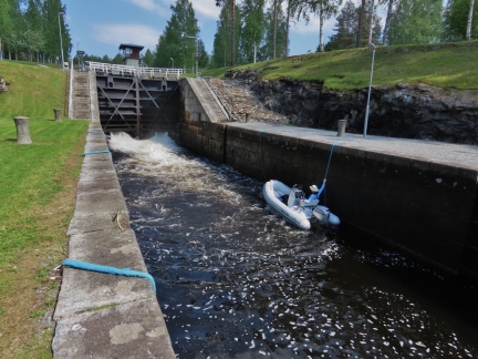
With the tender, we didn’t bother tying off to the side-ropes and instead just held on as the water level rose.
|
 |
Varistaipale Locks
Position: 62°32.76’N, 28°38.37’E
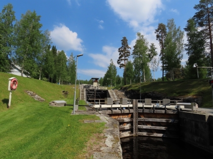
The Varistaipale Canal has a drop height of 48ft (14.5 m) and four locks, the most of any Finnish canal. This is looking from the bottom to the top, with James and the tender just visible through the top of the gate to the first lock.
|
 |
Gushing
Position: 62°32.78’N, 28°38.38’E
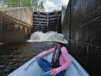
Water gushing into the basin as we ride up through the second lock in the Varistaipale Canal.
|
 |
Gates Opening
Position: 62°32.79’N, 28°38.39’E
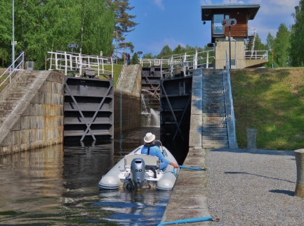
The gates opening to enter the third lock in the Varistaipale Canal. When the light in front of the control tower at top right goes green, we can proceed.
|
 |
Shallow
Position: 62°32.80’N, 28°38.39’E
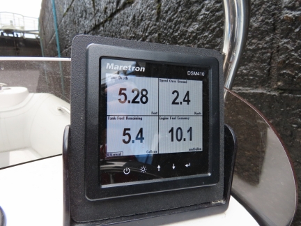
We read only 5.28ft (1.6m) along the side of the third lock in the Varistaipale Canal, so Dirona would have been resting on the bottom here.
|
 |
Flow
Position: 62°32.80’N, 28°38.38’E
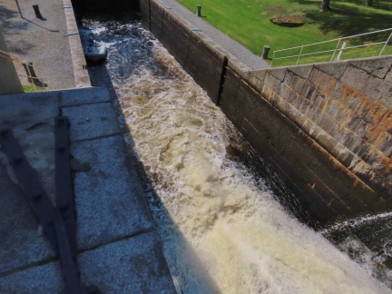
The water really flows hard into these locks on ascent, filling the air with mist. We learned to prefer the back of the lock where the turbulence and mist was reduced.
|
 |
Control Tower
Position: 62°32.80’N, 28°38.38’E
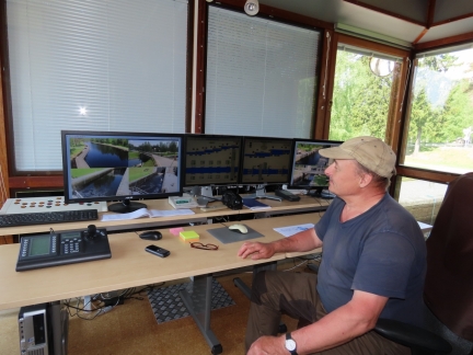
Entry to the Varistaipale canal locks is self-service, but the locks are managed from the control tower. Jennifer went up to verify the hours of the canal and the lock master invited her in for a look.
The four screens show the locks and their levels for the four-lock Varistaipale canal (leftmost) and the two-lock Taivallahti canal that we’ll pass through next. |
 |
Control Tower View
Position: 62°32.80’N, 28°38.38’E
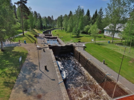
Looking down the Varistaipale canal locks from the control tower with James and the tender rising up in the third basin.
|
 |
Other Locks
Position: 62°32.80’N, 28°38.38’E
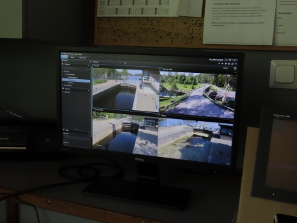
The control tower at the Varistaipale canal also monitors the other four Heinavesi route locks we passed through yesterday. Those are completely self-service though, and don’t require interaction from the lock master.
|
 |
Canoe
Position: 62°32.80’N, 28°38.38’E
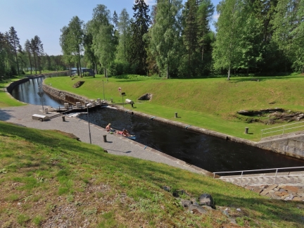
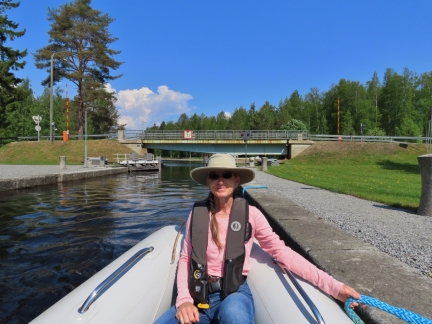
We were far from the smallest boat passing through the Varistaipale canal lock today—this canoe was on the way up.
|
 |
Waiting for Green
Position: 62°32.82’N, 28°38.40’E
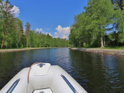
Waiting for a green light to exit the top lock in the Varistaipale canal. We were glad to have brought the tender up—it was super-exciting to pass through the locks in a small boat and get such a different perspective.
|
 |
Varistaipale Canal
Position: 62°32.92’N, 28°38.35’E
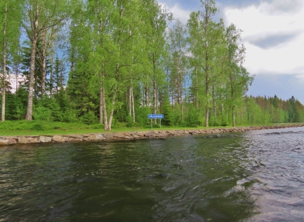
Entering the portion of the Varistaipale Canal above the locks on a warm and sunny day. We’re now another 48ft (14.5m) above sea level, for a total of 299ft (91.25m) including the Saimaa Canal.
|
 |
Valikanava
Position: 62°33.37’N, 28°38.74’E
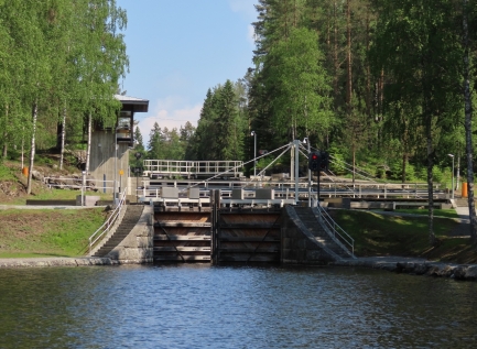
Passing through the Valikanava between the Varistaipale and Taivallahti canals.
|
 |
Taivallahti Locks
Position: 62°33.76’N, 28°40.14’E
Approaching the two-lock Taivallahti Canal.
|
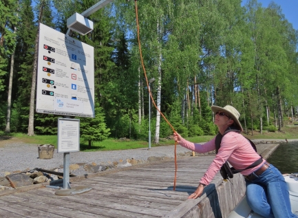 |
Self-Service
Position: 62°33.76’N, 28°40.14’E
Pulling the rope to request a locking cycle.
|
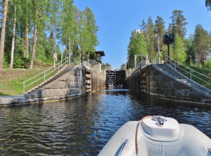 |
Green Light
Position: 62°33.78’N, 28°40.20’E
The gates opened within two minutes of our pulling the rope and we got a green light to enter the first lock.
|
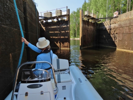 |
Gate Closing
Position: 62°33.78’N, 28°40.21’E
The gate closing behind us in the Taivallahti Canal.
|
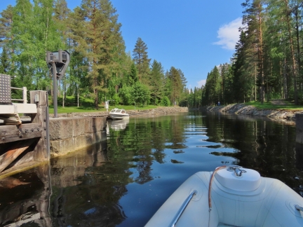 |
Taivallahti Canal
Position: 62°33.81’N, 28°40.30’E
Exiting the second lock to pass through the Taivallahti Canal. We’re now another 20ft (6m) above sea level, for a total of 319 ft (97.25m).
|
 |
Speed
Position: 62°34.40’N, 28°44.36’E
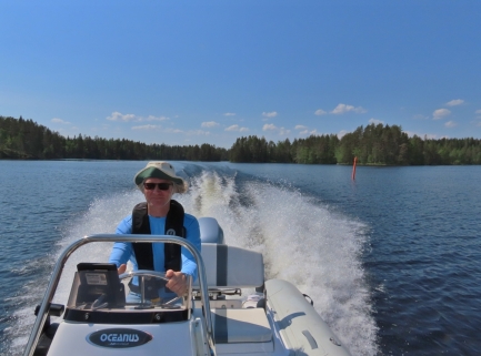
Another advantage of making the 15-mile run Valamo by tender is that we can easily do it in a day trip running at 30 kts much of the way.
|
 |
Monastery Dock
Position: 62°33.82’N, 28°47.18’E
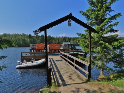
Our tender tied off at the Valamo Monastery dock alongside a tour boat that also made the trip up through the locks earlier today.
|
 |
Lunch
Position: 62°33.81’N, 28°47.43’E
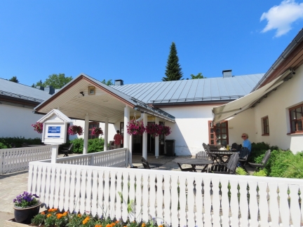
Lunch on the terrace at the Valamo Monastery cafe.
|
 |
Church
Position: 62°33.77’N, 28°47.41’E
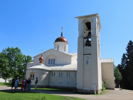
The monastic community was founded in the 14th century in an area that fell to the Soviets during the 1939-1940 Winter War. The monks hurriedly evacuated to the current location and re-established the community here.
|
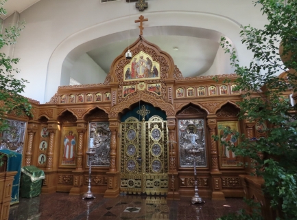 |
Iconostasis
Position: 62°33.77’N, 28°47.42’E
The spectacular iconostasis inside the Valamo Monastery church.
|
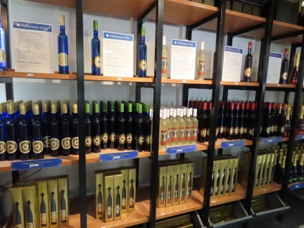 |
Wine
Position: 62°33.80’N, 28°47.44’E
The Valamo Monastery has a large gift shop selling a variety of religious items and also their home-made berry wine. We had some with our lunch and it was quite tasty.
|
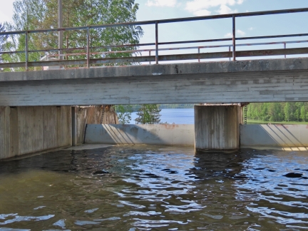 |
Dam
Position: 62°34.23’N, 28°38.31’E
On our return from the Valamo Monastery, we were hoping to visit the nearby Lintula Convent. But the bridge show on our charts turned out to be a dam with the next lake about thirty feet below.
|
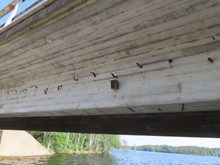 |
Geocache
Position: 62°34.23’N, 28°38.31’E
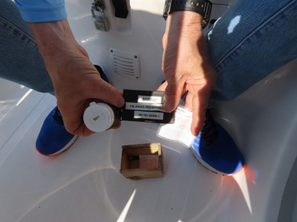
As we were looking over the dam, we saw a small box strung under the bridge and guessed it might be a geocache.
|
 |
Geocache Contents
Position: 62°34.22’N, 28°38.32’E
The geocache contents included a log book inside the cannister at left and a description in Finnish. The cache is a bit difficult to find, and in order to get to it you have to be silly enough to put your boat up against the spillway that presumably could open at any time. We passed the test. :)
|
 |
Traffic
Position: 62°33.82’N, 28°40.31’E
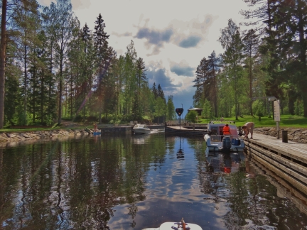
Lots of traffic at the top of the Taivallahti locks as we head back down. That canoe we saw earlier is on the left—they weren’t in any kind of a rush and had stopped for a swim.
|
 |
Lock Mate
Position: 62°33.80’N, 28°40.25’E
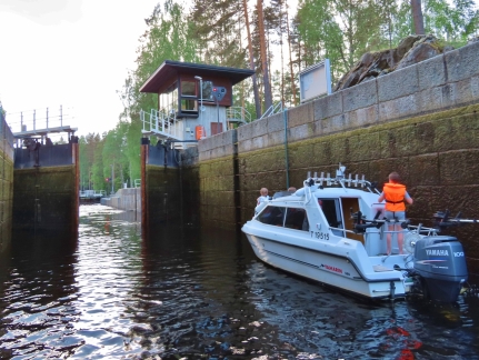
For the first time in any of the Heinavesi route locks, we passed through with another boat.
|
 |
Keeping Up
Position: 62°33.72’N, 28°39.25’E
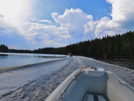
The boat we passed through the locks with was surprisingly fast. We were just barely able to keep up running flat out at just over 30 knots.
|
 |
Opposing Traffic
Position: 62°32.78’N, 28°38.38’E
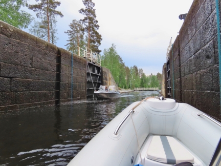
We’ve never been in a lock with opposing traffic entering from the next basin.
|
 |
Sahanlanti
Position: 62°34.14’N, 28°34.30’E
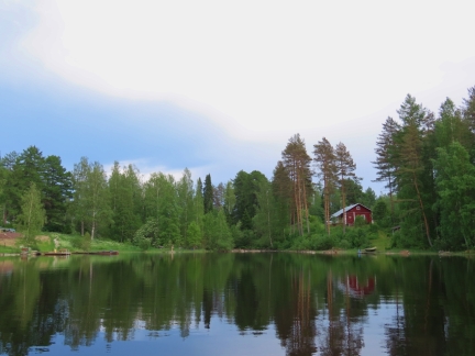
We tried running up Sahanlanti to reach reach the Lintula Convent from the west, but a boulder-strewn channel stopped our progress. The scenery was beautiful along the way though, with some very nice summer homes.
|
 |
Click the travel log icon on the left to see these locations on a map, with the complete log of our cruise.
On the map page, clicking on a camera or text icon will display a picture and/or log entry for that location, and clicking on the smaller icons along the route will display latitude, longitude and other navigation data for that location. And a live map of our current route and most recent log entries always is available at mvdirona.com/maps. |

If your comment doesn't show up right away, send us email and we'll dredge it out of the spam filter.