The Heinavesi route is a historic system of canals and locks built in the early 1900s in Finland’s Saimaa Lakes region. The waterway initially carried significant commercial traffic, but today is mainly used by pleasure craft and tour boats and is one of 27 “National Landscapes of Finland” selected for their great symbolic value and cultural or historical significance.
Passing through the locks and canals in a pleasure craft is a wonderful and unique experience. The locks are self-service and small, and the scenery is spectacular. From Linnansaari National Park, we spent a fabulous day running through the Oravi Canal and four of the six lock systems along The Heinavesi route.
Below are trip highlights from June 7th, in the Saimaa Lakes region of Finland. Click any image for a larger view, or click the position to view the location on a map. And a live map of our current route and most recent log entries always is available at mvdirona.com/maps.
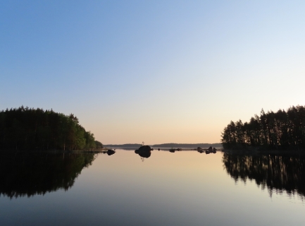 |
Morning Calm
Position: 62°6.23’N, 28°32.79’E
A beautiful calm morning as we get underway shortly before 5am from the anchorage at Linnansaari National Park.
|
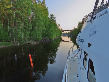 |
Oravi Canal
Position: 62°6.60’N, 28°36.37’E
Entering Oravi Canal, that we passed through in the tender yesterday. The canal dates from 1861.
|
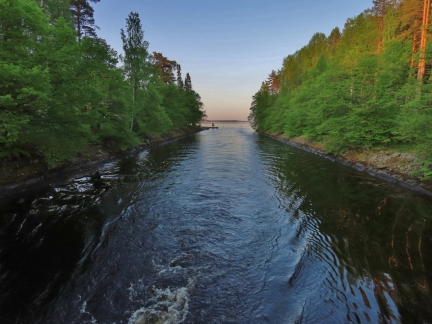 |
Looking Back
Position: 62°6.66’N, 28°36.39’E
Looking behind us as we pass through Oravi Canal.
|
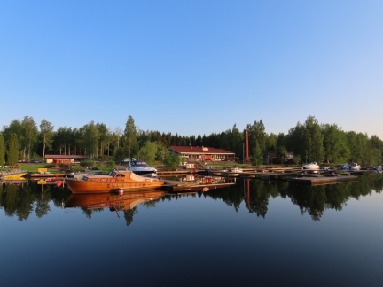 |
Oravi
Position: 62°6.79’N, 28°36.43’E
The village of Oravi aglow in the morning sun. We had lunch yesterday at Restaurant Ruukinranta, at the center of the picture.
|
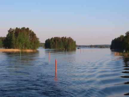 |
Buoys
Position: 62°7.37’N, 28°37.12’E
The maze of buoys we just passed through north of Oravi.
|
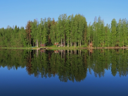 |
Reflections
Position: 62°11.96’N, 28°36.23’E
Wonderful lake reflections on this calm and sunny morning. It’s a great day to be out cruising.
|
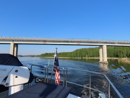 |
Vaaluvirran Bridge
Position: 62°18.17’N, 28°39.15’E
Passing under the 10.5m Vaaluvirran Bridge.
|
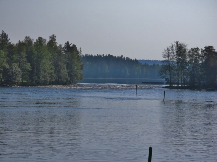 |
Pilpankoski
Position: 62°19.55’N, 28°45.22’E
The Pilpankoski rapids just off the main channel as we near the Pilppa Canal with the first of four locks that we’ll be passing through today.
|
 |
Operating Instructions
Position: 62°19.56’N, 28°45.63’E
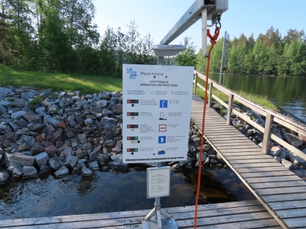
The locks on this route are all self-service, with instructions in Finnish and English. A flashing orange light indicates self-service is in effect. So you pull the rope to request an opening. The light changes to solid orange to indicate the locking process has begun, which could take up to 30 minutes. When the light goes green, we can enter the lock. And when the light within the lock goes green, we can exit.
|
 |
Self-Service
Position: 62°19.56’N, 28°45.63’E
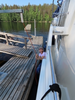
Jennifer pulling the rope to request that the locking process begin. The light immediately changed from flashing to solid orange.
|
 |
Waiting
Position: 62°19.56’N, 28°45.62’E
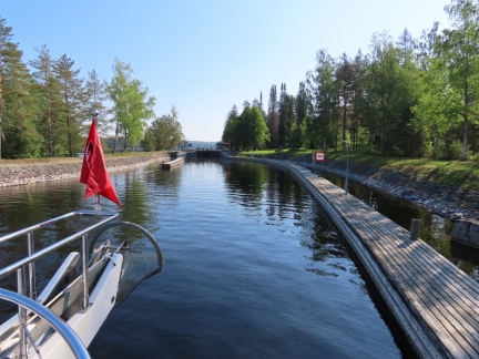
Waiting to enter the lock at Pilppa Canal. We got a green light within five minutes of pulling the rope.
|
 |
Pilppa Canal
Position: 62°19.60’N, 28°45.73’E
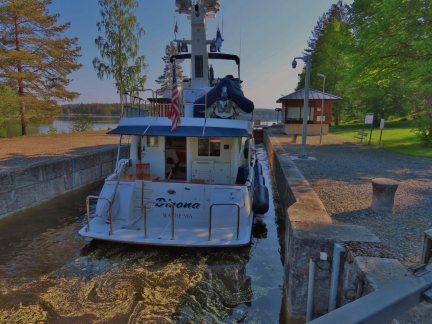
Locking through the Pilppa Canal. Completed in 1903, it is the southernmost on the famed Heinavesi route in the Saimaa Lakes, one of 27 “National Landscapes of Finland” selected for their great symbolic value and cultural or historical significance.
The lift is only 0.4-0.9m, so the duration from pulling the rope to exiting the lock was barely 20 minutes. The lock is 7.5m wide, 36m long and has a clearance depth of 2.1m, giving us 2.5m to spare with our 5m beam but barely enough room to float with our draw of just under 2.1m. |
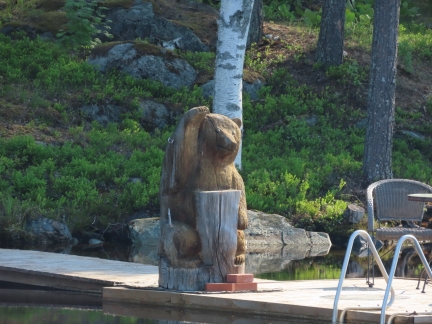 |
Carved Bear
Position: 62°21.16’N, 28°44.87’E
Chainsaw-carved wooden bears are very popular in the Saimaa Lakes region.
|
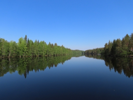 |
Still Waters
Position: 62°21.41’N, 28°44.23’E
Reflection in still waters in a channel north of Pilppa Canal.
|
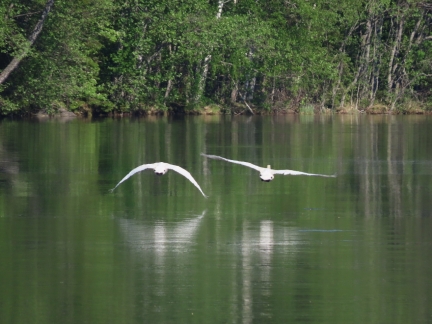 |
Swans
Position: 62°21.59’N, 28°44.00’E
Swans getting airborne ahead of us.
|
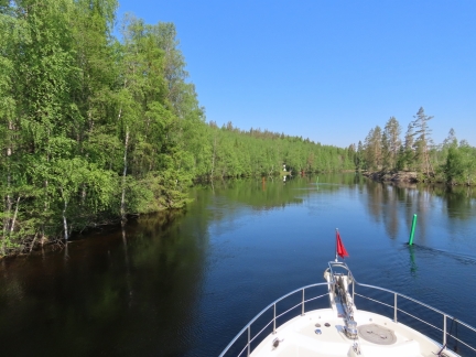 |
Current
Position: 62°21.91’N, 28°43.53’E
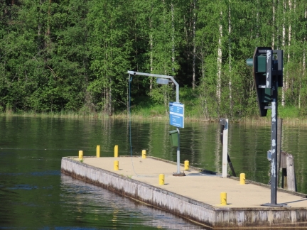
The current was quite strong in this narrow and winding section of the canal. We were only making 3.4 knots at 1300RPM when we’d normally do 6.5 kts at that RPM.
|
 |
Request Passage
Position: 62°23.18’N, 28°42.39’E
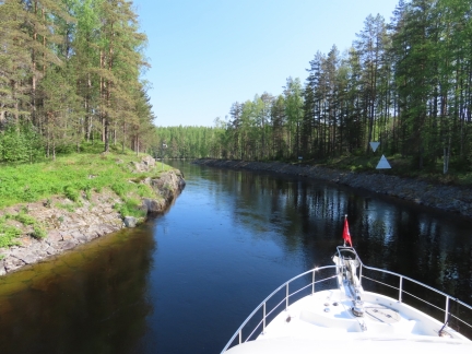
Pulling the cord to request passage through the single-lane Vaarakoski canal. The canal is 790ft (240m) long with a bend, making opposing traffic unable to see each other. At one point traffic was directed from a tower above the canal, but now it is controlled through lights using a similar self-serve scheme as the locks.
|
 |
Vaarakoski Canal
Position: 62°23.19’N, 28°42.47’E
Passing through the Vaarakoski Canal, completed in 1905 as part of the Heinavesi route.
|
 |
Vihovuonne Canal
Position: 62°23.77’N, 28°42.94’E
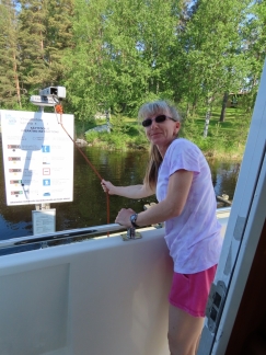
Pulling the rope to request an opening of the lock on the Vihovuonne Canal.
|
 |
Gates Opening
Position: 62°23.78’N, 28°42.95’E
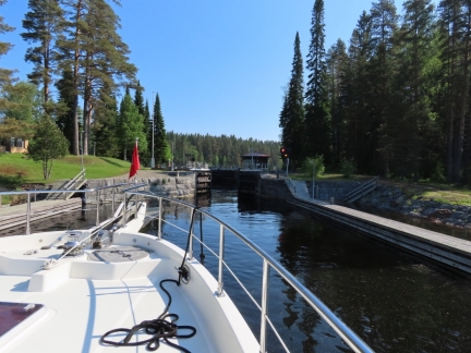
The lock gates began to open within a minute of our pulling the rope.
|
 |
Vihovuonne Canal Lock
Position: 62°23.80’N, 28°43.01’E
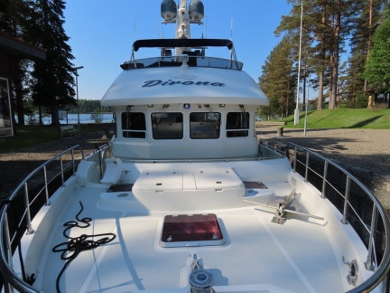
It sure doesn’t look like we have 2.5m to spare in the Vihovuonne Canal lock.
|
 |
Vihovuonne Rapids
Position: 62°23.69’N, 28°44.48’E
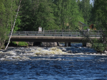
The Vihovuonne rapids near Vihovuonne canal and lock.
|
 |
9.5m
Position: 62°23.61’N, 28°45.01’E
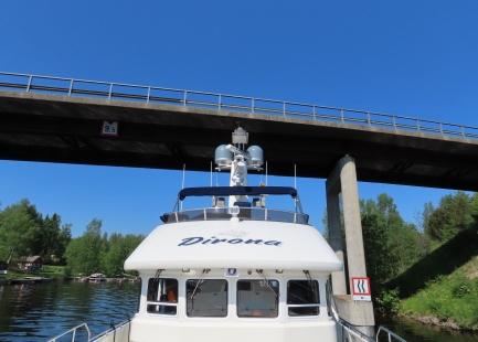
The maximum air draft for a boat to pass through the Heinavesi route is 9.5m, and this is the bridge that sets that restriction. With our 9.14m air draft, we had several feet to spare.
|
 |
Kerma Canal
Position: 62°23.58’N, 28°45.36’E
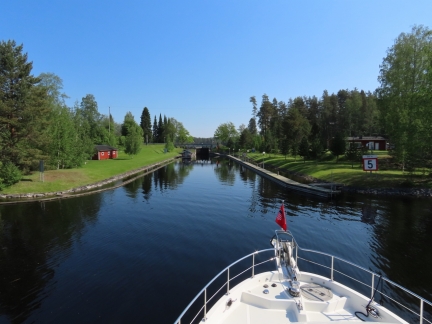
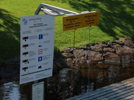
Approaching the lock through the Kerma Canal.
|
 |
Air Draft
Position: 62°23.63’N, 28°45.45’E
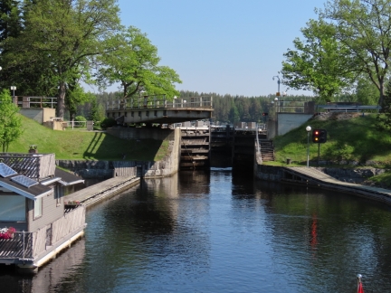
So far we’d just had a single rope to pull to request an opening, but the Kerma Canal had two ropes. If your vessel has an air draft of less than 4.4m, you pull the blue rope and the road bridge doesn’t open. If you pull the orange rope, the bridge opens with the lock gates.
Because the sign is in Finnish and we weren’t sure which rope does what, we guessed that the blue one requests a bridge opening and the orange one requests a lock opening, so we pulled both. Sadly, if you pull the blue one and then the orange one, the “punishment” is the locks will go through a full cycle without the bridge opening. You get to watch an empty lock going through a full cycle which gives ample time to figure out the two-rope model. And, locals who happened to be in the area explained it to us as well. We now pull the correct rope :-). |
 |
Bridge Opening
Position: 62°23.63’N, 28°45.44’E
The road bridge over the Kerma Canal finally opening for us to enter the lock after we pulled just the orange rope.
|
 |
Locking Through
Position: 62°23.67’N, 28°45.50’E
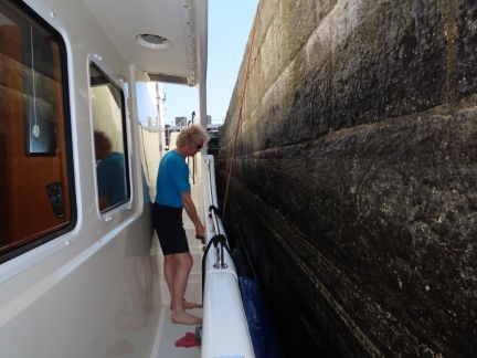
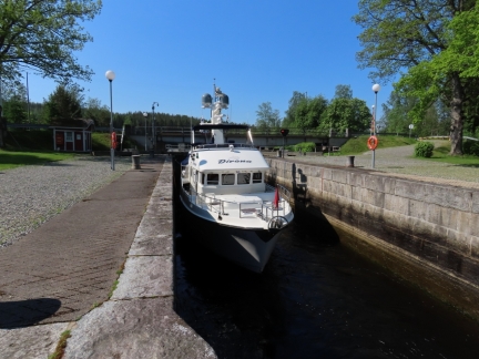
There are no tie off points in the locks but instead ropes hanging down from above. The ropes are big and easy to handle and the normal way to manage these is to grab a rope fore and aft and let out rope on the way down and pull in rope on the way up. For heavier boats like ours, we just tied off the rope to a cleat and let the boat move down the lock wall to take up the slack as the water rises. On the way down, we tied the rope off allowing sufficient slack to descend fully. Overall, the self-service locks work remarkably well across the board and the entire process is fairly easy.
|
 |
Rising
Position: 62°23.67’N, 28°45.50’E
Dirona staring the rise of about a meter in the Kerma Canal lock.
|
 |
Karvio Canal
Position: 62°30.64’N, 28°38.77’E
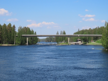
Approaching the final canal of the day, Karvio, with the Karvio Rapids rapids on the left.
|
 |
Gate Closing
Position: 62°30.88’N, 28°38.49’E
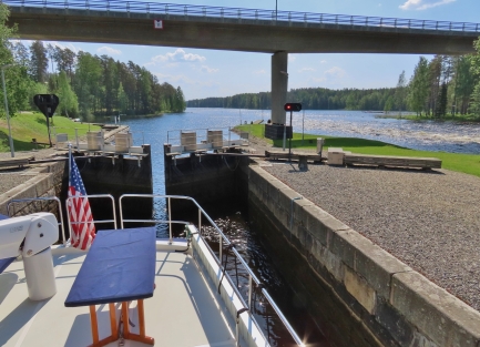
The gate closing behind us once we’re inside the lock.
|
 |
Karvio Rapids
Position: 62°30.88’N, 28°38.49’E
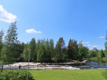
Looking to the Karvio Rapids rapids from the lock. They are a popular fishing spot and several fishers were there when we passed through.
|
 |
Tight
Position: 62°31.19’N, 28°37.95’E
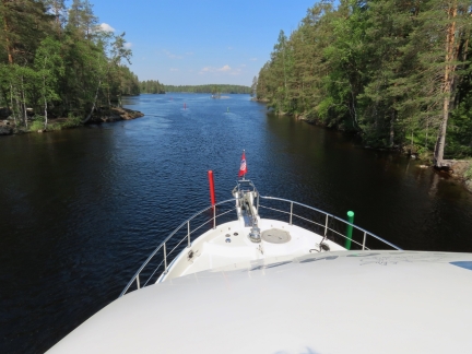
The channel just above the Karvio Canal is tight with the added bonus of strong current. We literally had to push the buoys out of the way in order to pass.
|
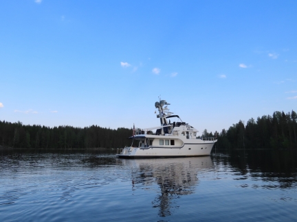 |
At Anchor
Position: 62°32.63’N, 28°37.13’E
At anchor near the Varistaipale Canal after a long, but most enjoyable day.
|
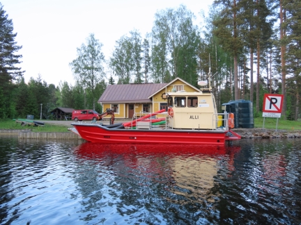 |
Alli
Position: 62°32.63’N, 28°38.09’E
Work boat Alli with a load of buoys on board near the Varistaipale Canal.
|
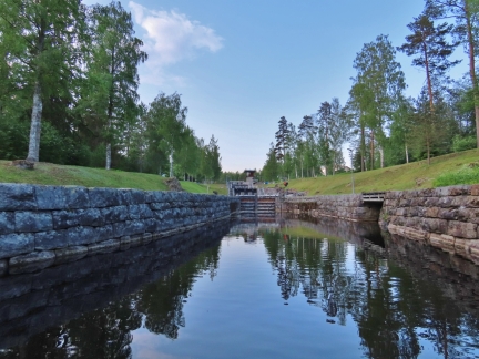 |
Varistaipale Canal
Position: 62°32.73’N, 28°38.37’E
The Varistaipale Canal has a drop height of 48ft (14.5 m) and four locks, the most of any Finnish canal. It’s also part of the Heinavesi route—we’ll be heading up tomorrow in the tender.
|
 |
Click the travel log icon on the left to see these locations on a map, with the complete log of our cruise.
On the map page, clicking on a camera or text icon will display a picture and/or log entry for that location, and clicking on the smaller icons along the route will display latitude, longitude and other navigation data for that location. And a live map of our current route and most recent log entries always is available at mvdirona.com/maps. |

what are the maximum boat dimensions for the route youre travelling?
Boats upwards of 100′ appear to do the locks. We draw 2.1m and had no concerns on depth but there was one place in the canal that was very narrow. The current was running hard so the navigation marks were vibrating several meters back and forth. We tried to gently push between them but the current is running so hard that we needed a bit of speed to maintain steerage. The buoys taped against the boat down both sides. The left side got hung up briefly on one of our stabilizer fins. Hopefully the fin isn’t worse for the contact. I suspect the current was likely running unusually hard at that point the day we passed through but, even with the current, not a problem. I just didn’t like having to push nav marks out of the way :-).
Other than that one tight spot, it’s easy on a boat of our dimensions and tour boats of around 100′ make the trip so all but quite large recreational boats should have no problem. The maximum air draft is 9.5m, so that might restrict some boats.