Tallinn, the capital of Estonia, was a German-dominated Hanseatic League port starting in the early 13th century and has a marvellously preserved Old Town, one of the best in Europe. The city also has an excellent maritime museum, a TV tower with great views and a wonderfully restored 18th-century Russian palace and grounds. And Tallinn also has some interesting, and sobering, remnants of the period from 1940 through 1991 when Estonia was under Soviet control.
Multiple big Baltic ferries daily make the 2-3-hour journey from Helsinki to Tallin, and the Estonian city also is a popular cruise ship stop. We took an early morning ferry from Helsinki, overnighted in Tallinn, and spent an excellent two days touring this fabulous city. We also quite enjoyed the ferry ride back and forth.
Below are trip highlights from May 15th and 16th, 2019 in Tallinn, Estonia. Click any image for a larger view, or click the position to view the location on a map. And a live map of our current route and most recent log entries always is available at mvdirona.com/maps.
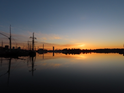 |
Dawn
Position: 60°10.18’N, 24°57.69’E
Dawn from our berth at Helsinki Marina
|
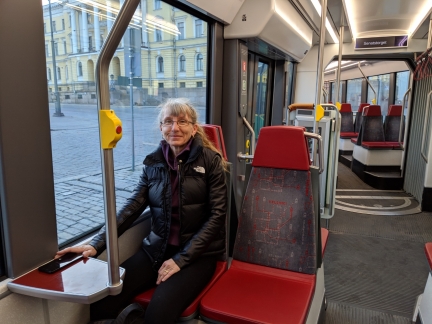 |
Tram
Position: 60°10.15’N, 24°56.74’E
On a 5:30am tram to the Helsinki ferry terminal for a 7:30am departure to Tallinn, Estonia.
|
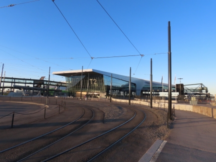 |
Terminal 2
Position: 60°9.04’N, 24°54.89’E
Striking Terminal 2 ferry building at the Port of Helsinki.
|
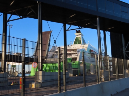 |
Star
Position: 60°9.01’N, 24°54.98’E
Our ride to Tallinn, the 610ft (186m) Tallink ferry Star. The ferry can do 27 knots and makes the 50-mile crossing from Helsinki to Tallinn in 2 hours.
|
 |
No Lines
Position: 60°8.96’N, 24°54.95’E
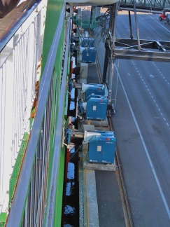
After boarding the Star we went to the outside section at the stern to watch the ramps come up and the lines be released. But, something wasn’t right. If you look closely, there are no mooring lines! The Tallink Star is resting against the dock while passengers and vehicles are being boarded without any mooring lines. It’s being held in place by the Cavotec Automated Mooring System. Cavotec also makes the battery electric charging system used on the ferries we saw near Loen, Norway last summer.
|
 |
Automated Mooring
Position: 60°8.86’N, 24°54.90’E
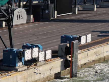
This is the Cavotec Automated Mooring System. The boat arrives and eases up against the dock and, when the captain gives the command, these automated docking pads move out towards the boat, seal up against it, apply a hard vacuum, and then apply a programmed force to hold the ship securely against the dock. When the ship is to leave, the captain gives the command, all the mooring systems release at once and the ship is free to sail.
It’s super fast and far less injury- and error-prone than dock line handling. In this case, when the 610′ Tallink Star arrives in Helsinki, there are no line handlers. The ship just arrives, is pulled up against the dock by the vacuum mooring system, the passenger and car ramps move into place and the ship unloads/loads and then reverses the process on exit. |
 |
Starbucks
Position: 60°1.08’N, 24°53.93’E
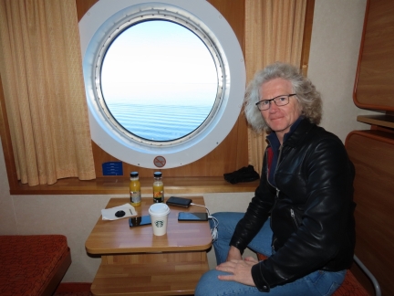
Enjoying a Starbucks coffee from a cafe on the Star as we cross the Baltic for Tallinn. We so much enjoyed having a cabin on the trip to Visby that we booked one for this run too. The cost is pretty reasonable: a basic one-way journey for two people costs 70 € and our cabin is a 35 € upgrade.
|
 |
Megastar
Position: 59°47.97’N, 24°47.88’E
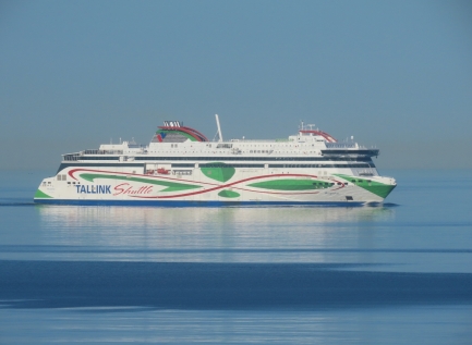
Passing Megastar, the other Tallink ferry that shuttles between Tallinn and Helsinki. We’ll be taking it on our return trip tomorrow evening. Conditions are wonderfully calm in the Baltic today, with a clear blue sky and almost no wind.
|
 |
Tallinn
Position: 59°28.39’N, 24°45.84’E
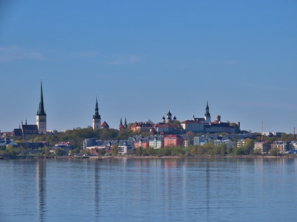
Our first view to Tallinn as we arrive into port. Tallinn was a German-dominated Hanseatic League port starting in the early 13th century and has a marvellously preserved Old Town, one of the best in Europe, that was designated a UNESCO World Heritage Site in 1997.
|
 |
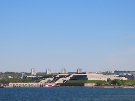
Linnahall
Position: 59°28.10’N, 24°46.06’E
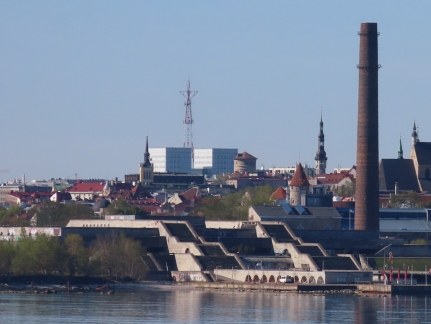
The large concrete staired structure in the foreground is Linnahall, a huge concert hall built for the 1980 Moscow Olympics when Estonia was part of the USSR. The crumbling complex is a prime example of post-Soviet decay and has heritage protection, making it difficult for the city to deal with.
|
 |
Cruise Ships
Position: 59°27.82’N, 24°46.28’E
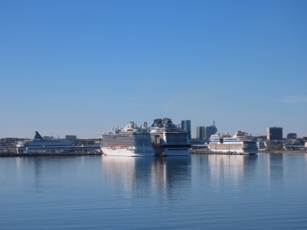
In the height of the season, up to six cruise ships can be in port at Tallinn at one time. Today there are “only” three, including the 4,500 MSC Meraviglia.
|
 |
Disembarking
Position: 59°26.64’N, 24°46.07’E
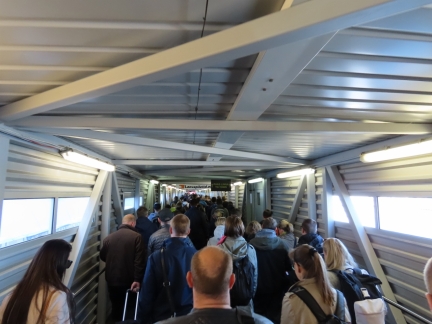
The Star can carry 2,080 passengers. It wasn’t full today, but many hundreds did get off with us at Tallinn.
|
 |
Old City Marina
Position: 59°26.51’N, 24°45.65’E
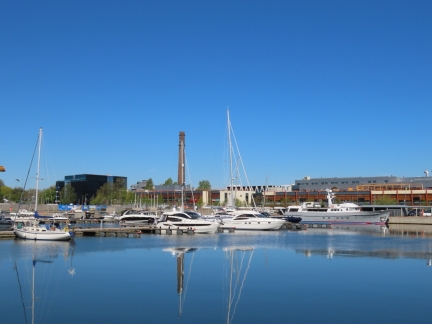
The Tallinn Old City Marina, right outside the Hotel Europa where we are staying. We really liked the room, but hardly spent any time there.
|
 |
Library
Position: 59°25.86’N, 24°44.35’E
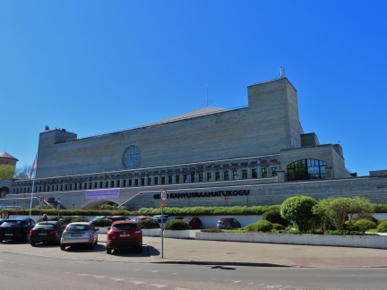
Construction on the Estonian National Library began in 1985 and completed in 1983, two year’s after Estonia’s independence from the USSR, making it one of Estonia’s first public buildings and a good example of Soviet architecture.
|
 |
Tallinn Town Wall
Position: 59°26.01’N, 24°44.17’E
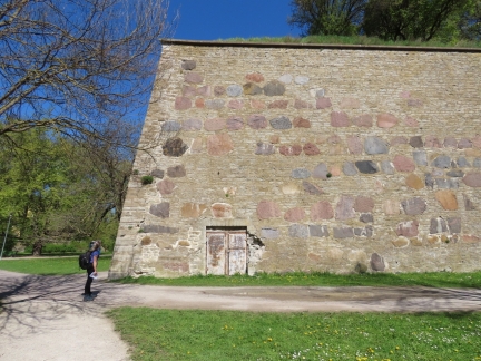
Jennifer standing beneath a portion of Tallinn’s medieval Old Town Wall in the park Harjumagi. It’s a beautiful spring day and warm enough to not need a coat.
|
 |
Pitka Memorial
Position: 59°26.01’N, 24°44.36’E
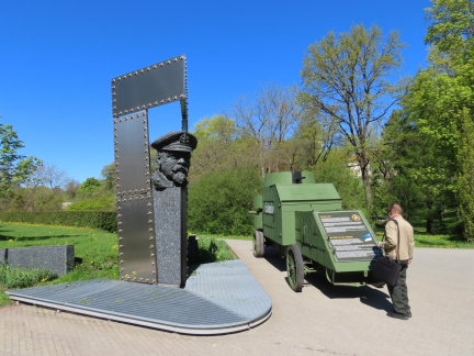
Memorial to Admiral Johan Pitka at one of the entrances to the park Harjumae. Pitka was one of the key organizers of the Estonian Defense Forces and as Commander of the navy, led it to victory in the 1918 Estonian War of Independence without losing a single ship.
|
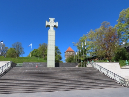 |
Estonian War of Independence
Position: 59°26.03’N, 24°44.62’E
Huge glass cross in Freedom Square commemorating the 1918 Estonian War of Independence from Russia following World War I.
|
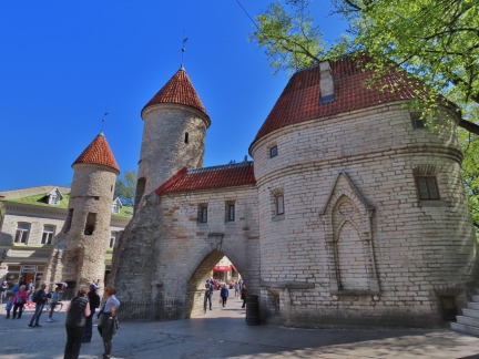 |
Viru Gate
Position: 59°26.19’N, 24°45.00’E
Viru Gate, built as part of the defense system for medieval Tallinn in the 14th century. The gate itself was later removed to provide wider access into Old Town for horse-draw trams, but the corner towers were preserved.
|
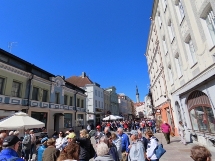 |
Tours
Position: 59°26.20’N, 24°45.00’E
Certain streets in Tallinn are packed with tour groups following their sign-or flag-wielding leader. It must be crazy busy here in the summer when six cruise ships are in town. Today we “only” have three.
|
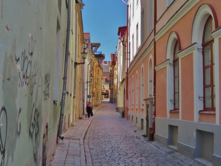 |
Sauna
Position: 59°26.21’N, 24°44.94’E
Looking down the cobblestone street Sauna, lined with pastel-colored buildings.
|
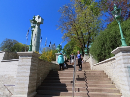 |
Mayer’s Staircase
Position: 59°26.06’N, 24°44.60’E
Jennifer on Mayer’s Staircase, completed in 1865 to provide access to Harjumae park from Toompea. Mayer was a wealthy merchant, and the major, who spearheaded and funded the project.
|
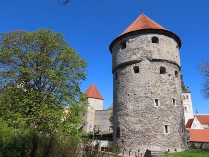 |
Kiek in de Kok
Position: 59°26.07’N, 24°44.45’E
15th-century Kiek in de Kok (German for ‘peek in the kitchen’), one of the 46 original towers in the Tallinn City Wall, viewed from Harjumae park. As the legend goes, soldiers liked to look down from the tower to the kitchens in the town below.
|
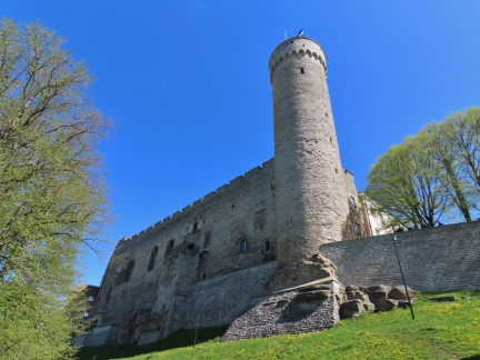 |
Toompea Castle
Position: 59°26.08’N, 24°44.19’E
Looking up to Toompea Castle, standing 50 meters above sea level, from Linda Hill. Wooden castles were believed to have stood here since the 10th century and the first stone castle was constructed in the 12th century. The tower, Pikk Hermann, was partially built in 1360-1370 and extended to 150 ft (45.6 m) in the 16th century.
|
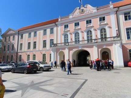 |
Castle Square
Position: 59°26.13’N, 24°44.32’E
The baroque interior facade of Toompea Castle, viewed from Castle Square. The building is now home to the Estonian Parliament.
|
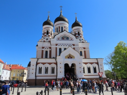 |
Alexander Nevsky Cathedral
Position: 59°26.14’N, 24°44.30’E
Magnificent Alexander Nevsky Russian Orthodox Cathedral, across Castle Square from Toompea Castle, was completed in 1900 as part of the Russian empire’s push to force its culture and language in its Baltic holdings.
|
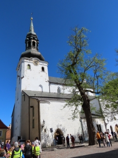 |
St. Mary’s Cathedral
Position: 59°26.20’N, 24°44.31’E
St. Mary’s Lutheran Cathedral was founded sometime before 1233, but much of the exterior was created in the 15th century and the tower in the late 18th century.
|
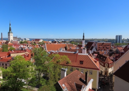 |
Kohtuotsa Lookout
Position: 59°26.27’N, 24°44.53’E
The fabulous view east from the Kohtuotsa lookout from Toompea Hill. The ferry and cruise ship terminal is just visible in the distance at center (click image for a larger view).
|
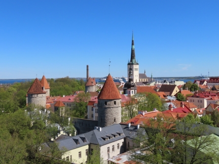 |
Patkul Lookout
Position: 59°26.31’N, 24°44.46’E
Another great view from Toompea Hill, this one northeast from the Patkul Lookout. Visible are seven towers of the nine connecting Lower Town Wall and the spire of St. Olaf’s Church that we plan to climb later in the day.
|
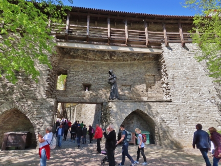 |
Danish King’s Garden
Position: 59°26.14’N, 24°44.45’E
The tranquil Danish King’s Garden next to Toompea Hill. Well, it would be tranquil if not packed with fifty tourists. One of three monks statues is standing above the west entrance gate.
|
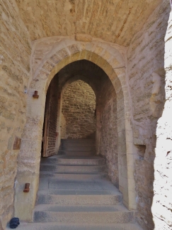 |
Short Leg Gate Tower
Position: 59°26.17’N, 24°44.46’E
The original oak gate at Short Leg Gate Tower. This was one of two gates that separated the upper town, where the Estonian rulers lived, from the lower town where the Hanseatic merchants lived and traded.
|
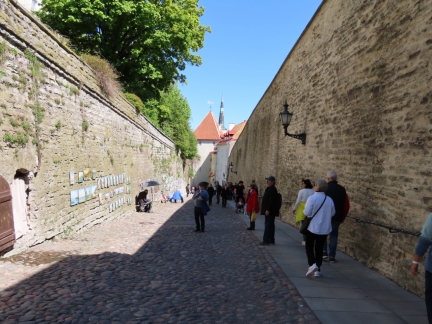 |
Long Leg
Position: 59°26.23’N, 24°44.52’E
Walking the Long Leg path, with the upper town on the left and the lower town wall on the right.
|
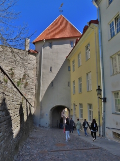 |
Long Leg Gate Tower
Position: 59°26.25’N, 24°44.55’E
Long Leg Gate Tower, dating from 1380, is the second of the two gates between the upper and lower towns.
|
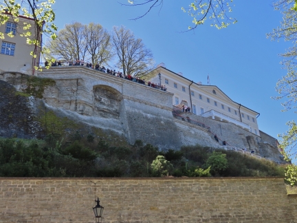 |
Patkul Lookout from Below
Position: 59°26.33’N, 24°44.48’E
Looking back up to crowded Patkul Lookout from Nunne street.
|
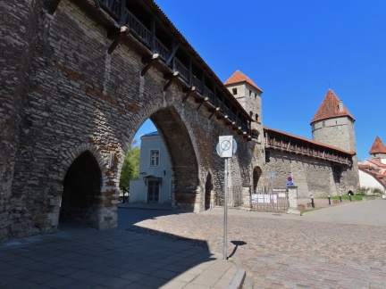 |
Kloostrivarav
Position: 59°26.35’N, 24°44.55’E
Kloostrivarav, or Monastery Gate, at one of the best-preserved sections of Tallinn’s Lower Town Wall.
|
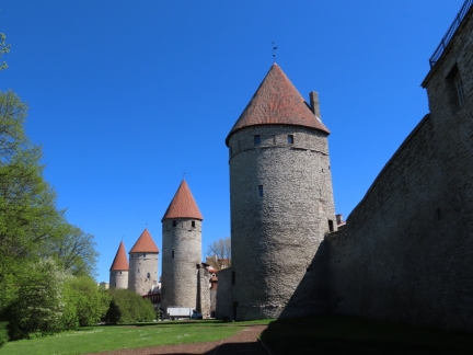 |
Lower Town Wall
Position: 59°26.44’N, 24°44.64’E
Four of the nine connected towers in Lower Town Wall, viewed from outside the city.
|
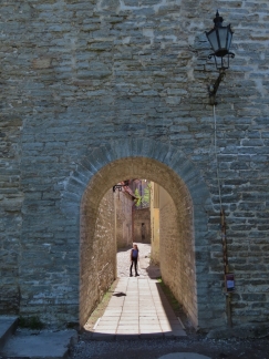 |
Arch
Position: 59°26.44’N, 24°44.64’E
Jennifer standing inside a small arched entry through the wall leading to Aida street.
|
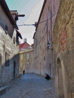 |
Aida
Position: 59°26.42’N, 24°44.65’E
Narrow Aida street winding through Lower Town.
|
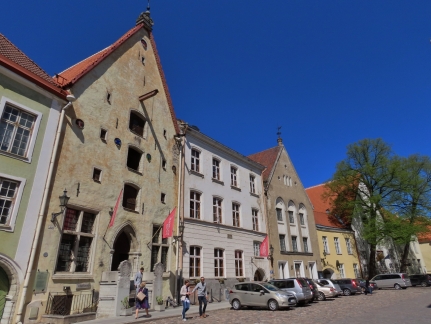 |
Merchant’s Houses
Position: 59°26.41’N, 24°44.73’E
German merchant’s houses on Lai (Wide Street), many built during the 15th century. The lower two floors were used for living and reception and the upper for storage.
|
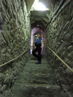 |
258 Steps
Position: 59°26.49’N, 24°44.84’E
Climbing the 258 steps to the viewpoint in the steeple of St. Olaf’s Church. The church is believed to have been built in the 12th century.
|
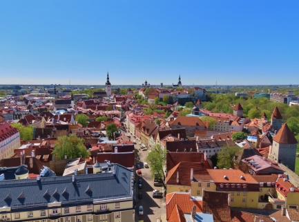 |
St. Olaf’s
Position: 59°26.47’N, 24°44.84’E
The fabulous view from the 406ft (124m) steeple of St. Olaf’s Church. When completed in 1549, the 532ft (159m) steeple made the church one of the tallest buildings in the world. The steeple burnt down in 1624 after being struck by lightening and was rebuilt shorter.
|
 |
Great Coast Gate
Position: 59°26.56’N, 24°44.96’E
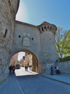
The dramatic Great Coast Gate at the north end of the Lower Town.
|
 |
KGB Headquarters
Position: 59°26.43’N, 24°44.86’E
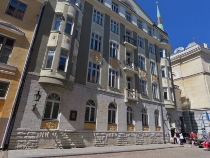
Estonia was under Soviet control from 1940 through 1991 and its fearsome security agency, the KGB, had a headquarters in this Tallinn building. Here “enemies of the state” were interrogated and tortured in the basement, and later executed or sent to the Gulag prison camps. The lower windows were bricked in to muffle the sounds of the suffering. According to Lonely Planet, locals joked that “the building had the best views in Estonia—from here you could see all the way to Siberia”.
|
 |
Cell
Position: 59°26.43’N, 24°44.85’E
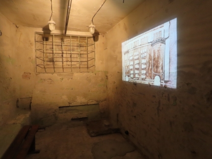
The interrogation cells in the former Tallinn KBG Headquarters are now open as a sobering museum, describing the interrogation methods used and the suffering of those subjected to it.
|
 |
Interrogation Guidelines
Position: 59°26.43’N, 24°44.85’E
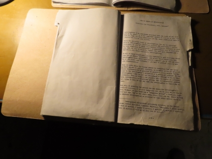
A book on the table in one of the former KGB Headquarters cells teaches dissidents how to behave during an interrogation. The first paragraph reads “Interrogation is an unpleasant procedure that may occur at any time and in any place. It is not important whether we like it or not. You must be ready for this; otherwise, you may cause inadvertent harm to yourself as well as your friends.” (Click image for a larger view.)
|
 |
Odessa
Position: 59°26.35’N, 24°44.82’E
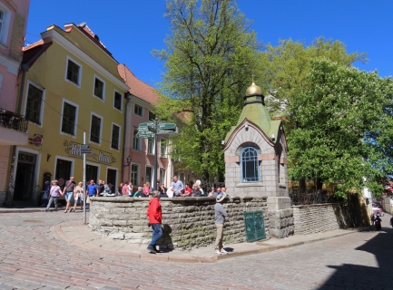
A light lunch on the tiny patio at Odessa Restaurant. The yellow building on the left is a famous bar called Hell Hunt (meaning “Gentle Wolf), that bills itself as the first Estonian Pub.
|
 |
Brotherhood of the Blackheads
Position: 59°26.33’N, 24°44.79’E
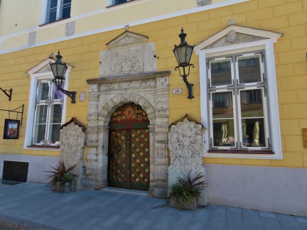
Ornate door at the 16th-century entry to the Brotherhood of the Blackheads, who followed an legendary African-born Roman soldier.
|
 |
Holy Spirit Church
Position: 59°26.28’N, 24°44.73’E
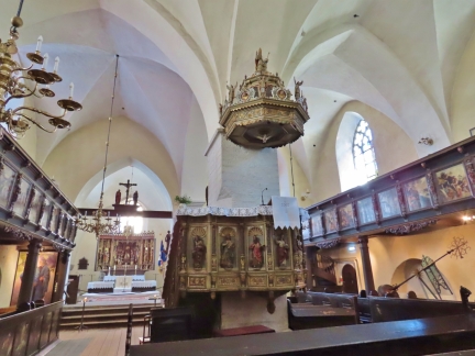
What the 13th-century Holy Spirit Lutheran Church lacks in size it makes up for in a spectacular wood-carved interior.
|
 |
Pulpit
Position: 59°26.29’N, 24°44.76’E
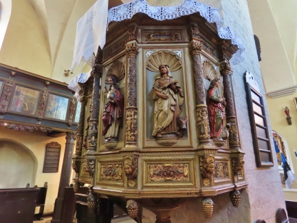
Amazing detail on the baroque 17th-century pulpit in Holy Spirit Lutheran Church.
|
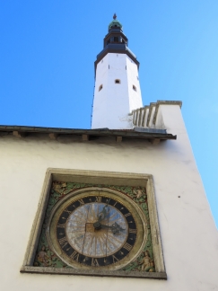 |
Oldest Clock
Position: 59°26.28’N, 24°44.73’E
The oldest clock in Tallinn, installed in 1684, on the exterior wall of the Holy Spirit Lutheran Church.
|
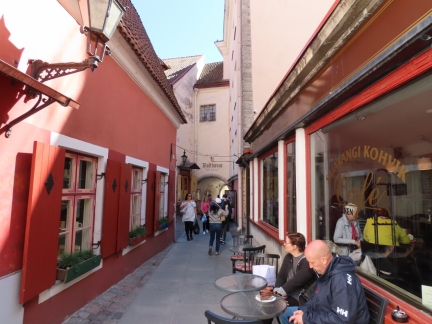 |
Saiakang
Position: 59°26.28’N, 24°44.73’E
Narrow Saiakang (“White Bread Passage”) leading between Holy Spirit Lutheran Church and Town Hall Square.
|
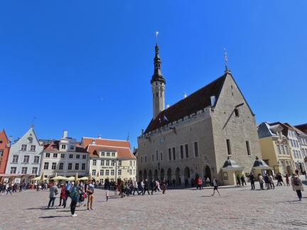 |
Town Hall
Position: 59°26.24’N, 24°44.69’E
Tallinn’s Town Hall, completed in 1404, is the only surviving Gothic town hall in northern Europe.
|
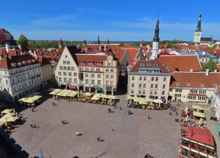 |
Town Hall Square
Position: 59°26.25’N, 24°44.75’E
Town Hall Square, viewed from Town Hall Tower, is bordered by colorful 15th-17th-century buildings and has been a meeting and market place since the 11th century.
|
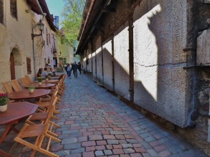 |
Tombstones
Position: 59°26.26’N, 24°44.93’E
19th-century tombstones lining the exterior wall of the Church of St. Catherine of Alexander along Katariina Kaik.
|
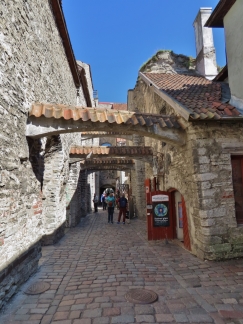 |
Katariina Kaik
Position: 59°26.26’N, 24°44.93’E
Looking east along picturesque Katariina Kaik.
|
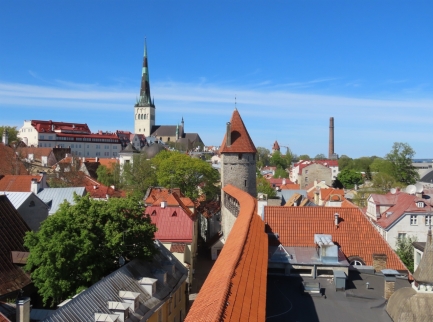 |
City Wall View
Position: 59°26.25’N, 24°44.95’E
One of the old sections of city wall was open for visitors to walk along, and climb up the two connecting towers. This is the view looking north, with the steeple of St. Olaf’s Church prominent in the distance.
|
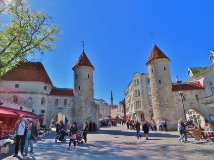 |
Viru Gate From Outside
Position: 59°26.19’N, 24°45.04’E
Looking back into town through Viru Gate, that we saw from the inside this morning.
|
 |
Hotel Viru
Position: 59°26.28’N, 24°45.26’E
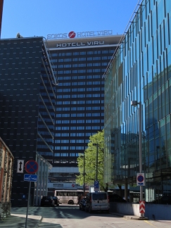
Tallin’s Hotel Viru was built in 1972, during the Soviet era, and was the only hotel in Tallinn that foreigners were allowed to stay in.
|
 |
KGB in Viru Hotel
Position: 59°26.19’N, 24°45.29’E
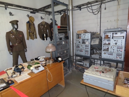
Hotel Viru in Tallin was designed to allow the KGB to monitor visiting foreigners, with the entire 23rd floor dedicated in secret to the security service. Here they monitored guests in their rooms and in the various public spaces throughout the hotel. To ensure access, it’s the only hotel foreigners were allowed to stay in.
We took an excellent guided tour through the KGB Museum now housed there. It’s hard to believe that era ended less than 30 years ago in 1991. |
 |
Hotel Viru View
Position: 59°25.86’N, 24°44.35’E
In addition to enjoying the KGB Museum, we loved the view to Tallinn from the 23rd-floor balcony of the Viru Hotel. Lower Town and the steeple of St. Olaf’s Church that we climbed is on the left, crumbling Linnahall is at center and the cruise ship and ferry terminal is on the right (click image for a larger view).
|
 |
Brewdog
Position: 59°26.33’N, 24°45.49’E
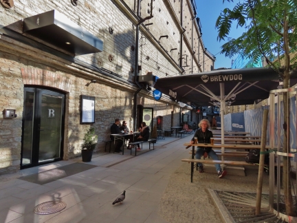
Relaxing outside at the BrewDog pub in Tallinn’s revitalized Rotermann quarter. We’ve been enjoying the Scottish brewery’s IPA throughout Europe.
|
 |
Vaike Rataskaevu
Position: 59°26.20’N, 24°44.57’E
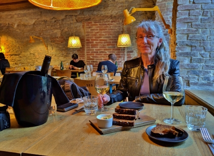
An exceptional meal at Vaike Rataskaevu. The restaurant has an interesting history where the Rataskaevu 16 has long been so popular that you can’t get a reservation unless booking weeks in advance, so they took the unusual option of opening a sister location only 100m away. The same “problem” is befalling the new location, and it too sells out quickly.
|
 |
Notes
Position: 59°26.20’N, 24°44.57’E
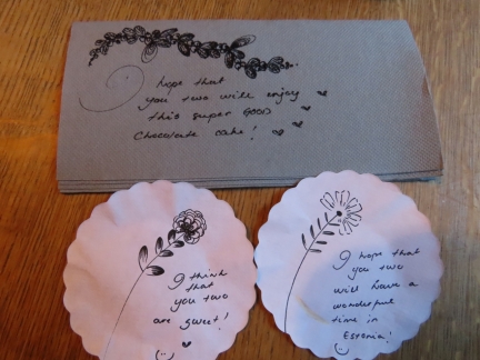
Our server at Vaike Rataskaevu was wonderful. We’re not sure how she finds time, but we often discovered artistic hand-written notes under a cup or with the dessert.
|
 |
Town Hall Square Evening
Position: 59°26.23’N, 24°44.70’E
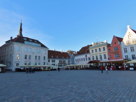
A much more chill Town Hall Square in the evening with the cruise ship traffic gone.
|
 |
Evening at Kohtuotsa Viewpoint
Position: 59°26.27’N, 24°44.53’E
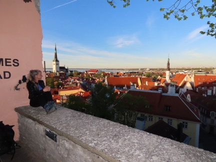
A tranquil evening at Kohtuotsa Viewpoint. We were one of only a half-dozen people there later in the day, but earlier there were probably two hundred.
|
 |
Evening at Patkul Lookout
Position: 59°26.32’N, 24°44.46’E
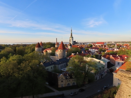
Lower Town Wall aglow in the evening sun, viewed from Patkul Lookout.
|
 |
Broken Line
Position: 59°26.54’N, 24°45.09’E
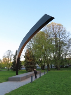
“Broken Line”, a memorial to the 852 people who died in the Estonia catastrophe, one of the worst maritime disasters in the 20th century. The 510ft, 2,000-passenger, 466-car Estonia was enroute from Tallinn to Stockholm in heavy seas when the bow visor parted, pulling the bow ramp ajar and causing severe flooding of the car deck. The large amount of water swirling around the car deck, known as the free surface effect, contributed greatly to the rapid listing. Wave action broke cabine windows and the large windows up on deck six, while water continued to rush into the car deck. The ship sank within a half-hour of issuing a MayDay and before any other vessels could reach it. 510ft, 2,000-passenger, 466-car Estonia.
|
 |
Scotland Yard
Position: 59°26.35’N, 24°45.26’E
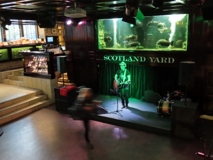
Our final stop for the day was at Scotland Yard, a pub Tallinn’s revitalized Rotermann quarter themed after the British police force. In a great example of “it’s a small world”, the singer pictured grew up in Victoria, Canada and his father attended Reynolds High School there, as did Jennifer.
|
 |
Crumbling
Position: 59°26.41’N, 24°46.38’E
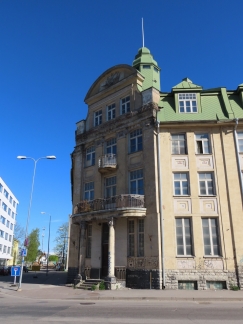
A crumbling building, likely Soviet-era construction, as we walk from our hotel to Kadriorg Park.
|
 |
Kumu
Position: 59°26.19’N, 24°47.90’E
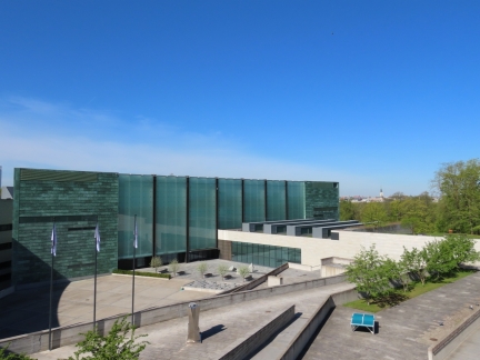
Looking across the dramatic Kumu art museum at the east end of Kadriorg Park with Tallinn’s Old Town visible in the distance.
|
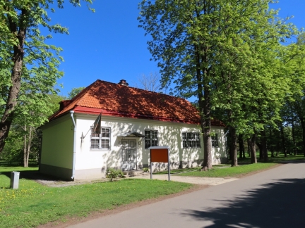 |
House of Peter I
Position: 59°26.24’N, 24°47.75’E
Cottage where Peter I stayed in the early 1700s while nearby Kadriorg Palace was under construction.
|
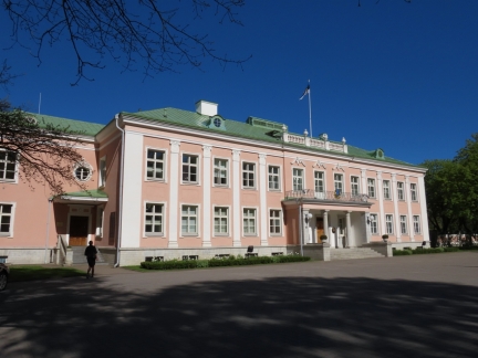 |
Presidential Palace
Position: 59°26.25’N, 24°47.64’E
The Presidential Palace was built in 1938 in Kadriorg Park to resemble the style of Kadriorg Palace and is the official residence of the Estonian president.
|
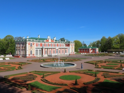 |
Kadriorg Palace
Position: 59°26.27’N, 24°47.50’E
Kadriorg Palace and its French-style formal garden, built by Peter the Great in the early 1700s. It now houses the Kadriorg Art Museum, containing 16th-18th-century Dutch, German and Italian paintings and 18th-20th-century Russian art.
|
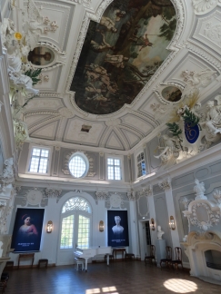 |
Main Hall
Position: 59°26.31’N, 24°47.47’E
The spectacular Main Hall in Kadriorg Palace was designed to impress visitors and reflect the stature and taste of Emperor Peter the Great.
|
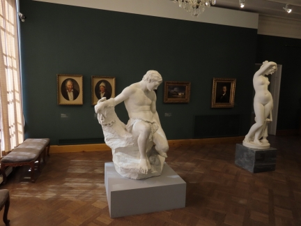 |
Estonian Art
Position: 59°26.31’N, 24°47.45’E
Marble statues by Estonian sculpture August Weizenberg with works from Estonian painter Johann Koler behind at the Kadriorg Art Museum. All date from the late 19th century.
|
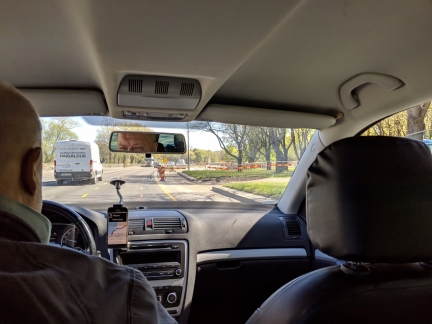 |
Uber
Position: 59°26.66’N, 24°47.83’E
Riding an Uber from Kadriorg Park to the Tallinn TV Tower. Tallinn is a high-tech city and the home of Skype, so we weren’t surprised to find good Uber service here.
|
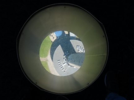 |
557 Feet Down
Position: 59°28.27’N, 24°53.25’E
Looking down 557 feet (170m) through a glassed-in hole in the floor in the Tallinn TV Tower viewing platform.
|
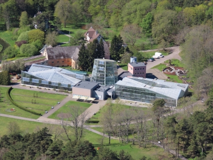 |
Botanical Gardens
Position: 59°28.28’N, 24°53.23’E
Tallinn Botanic Gardens, viewed from the Tallinn TV Tower.
|
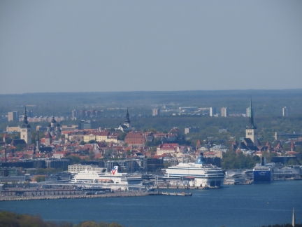 |
Tallinn View
Position: 59°28.28’N, 24°53.24’E
A great view to the city of Tallinn from the TV Tower.
|
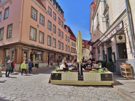 |
Clayhills
Position: 59°26.29’N, 24°44.70’E
We returned to Old Town for a great lunch street-side at Clayhills gastropub.
|
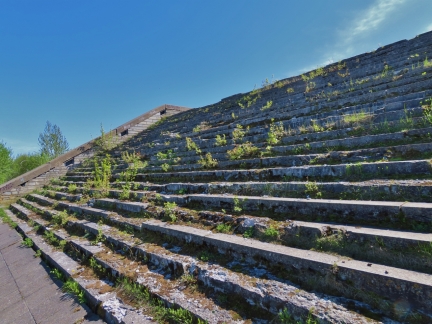 |
Linnahall
Position: 59°26.84’N, 24°45.20’E
Our next stop was a close-up view to Linnahall on the harbour just north of Old Town. Linnahall is a concert hall, built for the 1980 Moscow Olympics when Estonia was part of the USSR. The complex is crumbling to pieces everywhere, with walls sagging, and is a prime example of post-Soviet decay. Much of the facility is closed for construction, but a portion of the roof can still be accessed from the sea side.
|
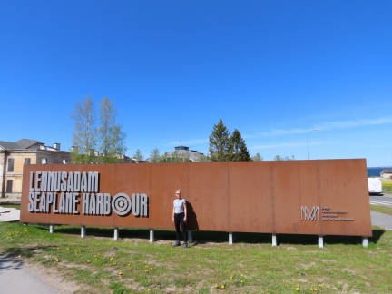 |
Lennusadam Seaplane Harbour
Position: 59°26.99’N, 24°44.35’E
At Lennusadam Seaplane Harbour, Tallinn’s excellent maritime museum, on the harbour just north of Old Town.
|
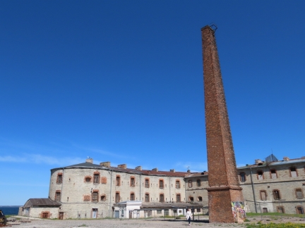 |
Patarei
Position: 59°27.04’N, 24°44.37’E
View to Patarei, between Linnahall and Lennusadam Seaplane Harbour. Patarei was built in 1840 as a sea fortress, it later become a prison. But is most known for being used by both the Soviets and the Nazis as a place of brutal interrogation, torture and executions.
|
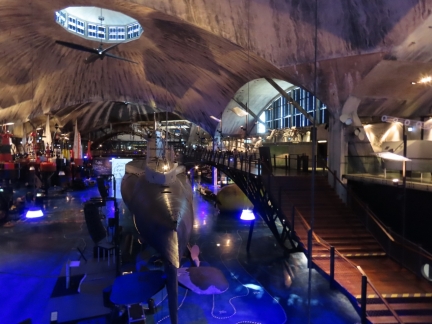 |
Seaplane Hangar
Position: 59°27.09’N, 24°44.30’E
The Lennusadam Seaplane Harbour maritime museum is housed in the 114x360ft (35x110m) Seaplane Hangar. The structure, completed in 1916, is considered an architectural marvel because of the massive spans of the arching concrete roofs. Prominent in the foreground is the 1930s-era 195-ft (59m) British-built submarine Lembet.
|
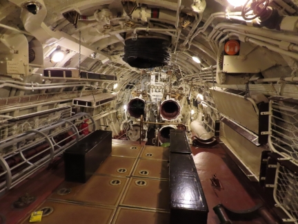 |
Lembet
Position: 59°27.11’N, 24°44.31’E
Inside the submarine 195-ft (59m) Lembit, built for Estonia in England in 1936. It was the oldest submarine still afloat in 2011 when it was hauled ashore for the museum.
|
 |
Linnahall View
Position: 59°27.18’N, 24°44.32’E
A view to massive Linnahall from outside the Lennusadam Seaplane Harbour maritime museum.
|
 |
Suur Toll
Position: 59°27.18’N, 24°44.35’E
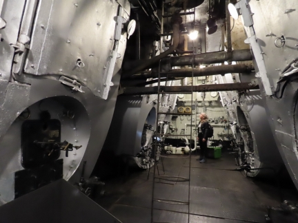
The huge boilers in the century-old 247 ft (75.4m) icebreaker Suur Toll, on display at the Lennusadam Seaplane Harbour maritime museum in Tallinn. The Suur Toll was among the world’s most powerful icebreakers and is one of three remaining early 20th-century Baltic Sea steam icebreakers.
|
 |
Megastar
Position: 59°26.68’N, 24°46.28’E
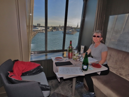
On board Megastar for our return trip to Tallinn. We had reserved a table for dinner and got a fabulous window table.
|
 |
TV Tower
Position: 59°27.58’N, 24°46.58’E
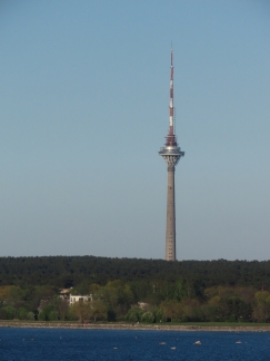
A view to the Tallinn TV Tower that we visited early today, viewed from the Megastar as we depart Tallinn for Helsinki.
|
 |
Maarjamae War Memorial
Position: 59°28.35’N, 24°46.15’E
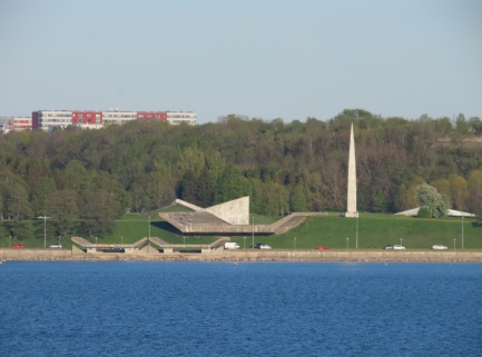
The distinctly Soviet Maarjamae War Memorial, completed in 1960 in memory of the Soviet soldiers killed in the 1918 war against Estonia. This was not a popular monument locally, particularly since the Soviets destroyed many Estonian war monuments when they came to power here.
|
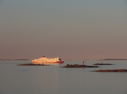 |
Dusk
Position: 60°8.21’N, 24°54.32’E
We returned back to Helsinki from Tallinn in the same wonderfully calm conditions that we’d left in the morning before.
|
 |
Click the travel log icon on the left to see these locations on a map, with the complete log of our cruise.
On the map page, clicking on a camera or text icon will display a picture and/or log entry for that location, and clicking on the smaller icons along the route will display latitude, longitude and other navigation data for that location. And a live map of our current route and most recent log entries always is available at mvdirona.com/maps. |

Very impressed by Tallinn — it looks like a wonderful agglomeration of old, picturesque alleys, ancient fortifications/gates/towers, and some delightful architecture. The Alexander Nevsky Cathedral exterior is fascinating.
I agree, Tallinn is a special city. We were really impressed and enjoyed the trip. The more time we spend in the Baltic region, the more we think we’re going to have to come back again in a couple of years.
Small world indeed Jennifer!
Christine and I both enjoy your posts and pics for several years now and she caught your reference to Victoria and Reynolds where I too lived and went to school. My Dad retired from the CDN Army in 1968 and we moved to Saanich which was when I started to attend Reynolds which had just opened and I was in the first graduating class. A few years later now (ahem!) Christine and I are busy building our newest boat mv Möbius with Naval Yachts here in Antalya Free Zone in Turkey. We hope our wakes will cross sometime after we launch in December this year and then we will watch for a chance to share an anchorage with Dirona and get to meet in person to discuss this wonderfully small world of ours.
Wow—two other Reynolds graduates in one month has got to be a record. We’re quite interested in cruising Turkey, possibly next summer, so perhaps our paths will cross. Good luck with the boat build.
Jennifer