During the Cold War, Sweden invested heavily in defense against a possible Soviet attack. One of the more ambitious projects was the Musko Naval Base, an underground base and shipyards on the island of Musko with docks designed for submarines and destroyers. To reach the island from the mainland, the navy built the 1.9-mile (3 km) Musko Tunnel that runs about 230 ft (70 m) below the water surface. Some amazing online pictures show submarines and vessels entering and inside the base. The whole concept is just incredible.
The Swedish Navy was headquartered at Musko from the 1500s up until the mid-1900. The base was closed in 2004 when the Swedish government decided to consolidate the Navy at the other two major bases and opened the underwater road tunnel to the public. Much of the area still is Navy-controlled with access restricted, but we did find a sheltered anchorage that made an excellent base to explore Musko and the nearby island of Uto.
Below are trip highlights from April 16, 2019 at Musko, Sweden. Click any image for a larger view, or click the position to view the location on a map. And a live map of our current route and most recent log entries always is available at mvdirona.com/maps
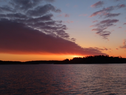 |
Sunrise
Position: 58°53.40’N, 18°8.25’E
5:33am sunrise from the anchorage at Nattaro. The days are getting longer and longer as summer approaches.
|
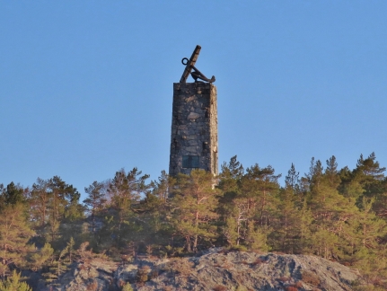 |
Alvsnabben
Position: 58°58.50’N, 18°11.34’E
Alvsnabben is a famous monument on the island of Kapellon off Musko. The large anchor was erected to commemorate the army that gathered here prior to a departure during the 30 Years War, a religious conflict fought in Norther Europe during the 17th century.
|
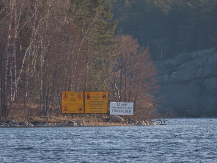 |
Stopp
Position: 58°58.58’N, 18°10.22’E
The Swedish Navy was headquartered at Musko from the 1500s up until the mid-1900s and much of the area still is Navy-controlled with access restricted. We’d originally planned to reach our intended anchorage at Musko from the east, through a narrow channel north of Kapellon. But access to the entire area is forbidden, so we approached from the west instead.
|
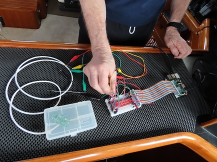 |
TV Lift Remote
Position: 58°59.67’N, 18°10.40’E
Some time back we installed a low cost ($18) remote control to control the TV lift. It continues to work great. Today James interfaced the remote with the boat control systems so it can be wound up and down with the central remote control. The stand alone remote still works as a backup. It’s amazing that $18 gives two remotes and one base station. We now have one remote as stand alone and one that is interfaced to the central control system. Here James is connecting one of the remotes to a Raspberry Pi.
|
 |
N26
Position: 58°59.67’N, 18°10.39’E
While in the Netherlands we also opened up an N26 account and it has become our primary credit card account. Germany-based N26 is one of the new breed of born-online banks. Having a PIN account is much more convenient than our US-based signature cards and it works much better for online payments. It’s not really a credit card per se—the account must have sufficient funds for the purchase to be approved.
One of the features we really like is that most online purchases over a certain minimum amount require approval in the mobile app before the transaction is accepted. This really reduces the potential for online fraud. We’re surprised this isn’t more prevalent in the US—none of our several Visa or Mastercard credit cards support it. |
 |
Musko Canal
Position: 59°0.88’N, 18°8.39’E
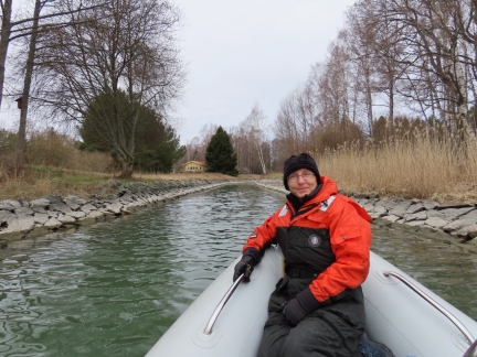
Bundled up in our Mustang 2175 work suits for a circumnavigation of Musko Island by tender. Here we are passing through the narrow and shallow Musko Canal between the islands of Musko and Herrstugan. The Russians built the first artificial canal here in 1719 as part of their campaigns in the area, but it gradually became less usable as water levels fell and had disappeared by the early 20th-century. The canal was re-excavated in the 1930s as part of a public works project to give 52 unemployed men a paid job and to save local fishermen hours of travel time between the fishing grounds and market.
|
 |
Musko Naval Base
Position: 59°0.02’N, 18°4.03’E
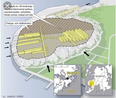
Musko Naval Base is an underground Swedish Navy base on the southwest corner of Musko, constructed between 1950 and 1969 and requiring the removal of about 1.5-million tons of rock. To reach the island from the mainland the navy built the 1.9-mile (3 km) Musko Tunnel that runs about 230 ft (70 m) below the water surface.
The base has underground shipyards with three docks designed for submarines and destroyers. Information about the base was highly confidential during the Cold War, and little was known about it. The base was closed in 2004 when the Swedish government decided to consolidate the Navy at the other two major bases of Karlskrona, in the south, and Berga, on the mainland just north of Musko. Some parts of the facility still are used by the navy, and private companies operate the underground shipyards. The underwater road tunnel is now open to the public, but access to the base and its waters is restricted to no closer than about 300m. |
 |
North Opening
Position: 58°59.79’N, 18°4.58’E
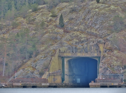
The northernmost of several openings from sea to the underground Musko Naval Base.
|
 |
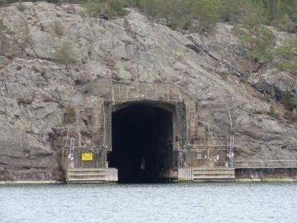
West Openings
Position: 58°59.04’N, 18°2.91’E
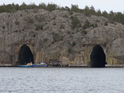
The two largest openings to the Musko Naval Base, on the west side of the facility. Some amazing online pictures show submarines and vessels entering and inside the base. The whole concept is just incredible.
|
 |
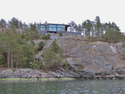
Southwest Opening
Position: 58°58.85’N, 18°3.12’E
A smaller opening into the Musko Naval Base from the southwest corner.
|
 |
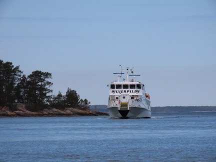
House
Position: 58°57.78’N, 18°2.76’E
Striking modern home, with a very long staircase to sea level, overlooking the channel between
|
 |
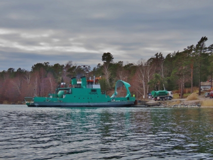
Silverpilen
Position: 58°57.57’N, 18°17.73’E
After circumnavigating Musko, we ran three miles across the channel to the island of Uto. We sure love the new tender—a stable, high-speed craft is a excellent complement to a slow-speed trawler.
|
 |
Hamdal
Position: 58°57.69’N, 18°17.74’E
We initially were planning to anchor at Uto off the south end of the island of Angsholmarna. But when we saw the ferry Silverpilen departing as we approached, decided to go to Musko instead as we didn’t want to anchor in a ferry route, and the anchorage at Musko looked nicer anyway. What we didn’t realize is that a second ferry dock was farther north, right about where we would have anchored, and that location would have blocked their entrance.
|
 |
Going Ashore
Position: 58°58.21’N, 18°19.55’E
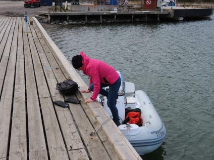
The orange Mustang 2175 work suits are great for keeping warm out in the tender, but are a little too bulky and hot for walking ashore unless it is truly cold. We locked them to the tender and put on normal coats to have a look through Uto.
|
 |
Uto Harbour
Position: 58°58.09’N, 18°19.76’E
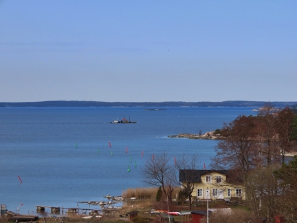
Looking west across the well-buoyed entrance to Uto Harbour. The area is full of bow-to moorings for pleasure craft.
|
 |
Uto Mines
Position: 58°57.98’N, 18°19.78’E
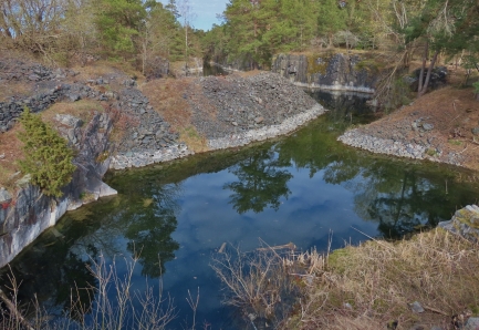
The iron mines on Uto are among the oldest in Sweden, dating from the 12th century. The Russians destroyed all structure and filled the mines with rocks in 1719. The mines were re-opened and continued to operate until 1878.
|
 |
Uto Windmill
Position: 58°58.04’N, 18°19.38’E
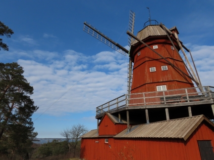
The Uto Windmill was built by a Dutchman in 1878 to serve the growing population of Uto. The mill quickly became a prominent seamark and was found on a nautical chart dating from 1791. The listed building was in service until 1927 and is a well-known symbol for Uto.
|
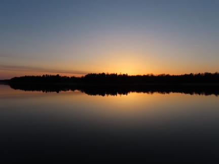 |
Sunset
Position: 58°59.67’N, 18°10.40’E
Sunset from the anchorage at Musko Island. We really liked the tranquil and secluded spot we found here.
|
 |
Click the travel log icon on the left to see these locations on a map, with the complete log of our cruise.
On the map page, clicking on a camera or text icon will display a picture and/or log entry for that location, and clicking on the smaller icons along the route will display latitude, longitude and other navigation data for that location. And a live map of our current route and most recent log entries always is available at mvdirona.com/maps. |

here is a link to an ex-pat’s sweden blog on a tour she did of thr base:
https://photosweden.wordpress.com/2008/08/20/swedens-navy-says-goodbye-to-its-most-excellent-large-hole-in-a-granite-island/
http://pavelhammer.smugmug.com/gallery/4429053_uKtKR/2#260230056
Thanks for your blog and have fun!!
Thanks for the blog links. That’s a visit we would have loved to have done. Loved the pictures inside the facility. Thanks!