Enkhuizen, Netherlands received city rights in 1355 and, as a Dutch East India Company harbour, was among the most important cities in the country. The city once bordered the saltwater bay Zuiderzee, with sea locks to protect the harbour and adjoining canals from flooding. The completion of the Afsluitdijk dam in 1932 transformed the Zuiderzee into a freshwater lake, renamed IJsselmeer, and locks at town such as Enkhuizen could be left permanently open.
While staying in Harlingen in April of this year, we’d cycled along the Afsluitdijk dam to the Kornwerderzand sea locks and watched the boats lock through. In late October, en route to Amsterdam, we passed through those locks into the IJsselmeer lake and spent the night at historic Enkhuizen.
Below are trip highlights from October 29th from Terschelling to Enkhuizen, Netherlands. Click any image for a larger view, or click the position to view the location on a map. And a live map of our current route and most recent log entries always is available at mvdirona.com/maps
 |
Friesland
Position: 53°21.18’N, 5°13.04’E
The vehicle ferry Friesland moored overnight at West-Terschelling as we depart just past 6am.
|
 |
Over Land
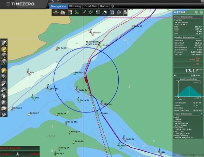
Position: 53°20.90’N, 5°12.41’E
The buoys in the channel to West-Terschelling have been moved to account for silting. Consequently, our older charts show us going over land as we followed the marked channel. We’re following our own known track back out, so we’re not too concerned. But it was a little unnerving as we arrived in the dark yesterday morning.
|
 |
Joining Route
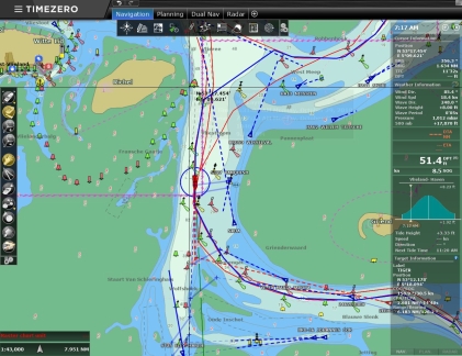
Position: 53°16.14’N, 5°10.04’E
Joining up with our route into Harlingen over six months ago.
|
 |
Sunrise
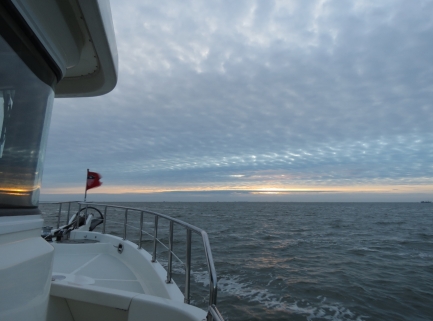
Position: 53°13.77’N, 5°13.37’E
Daylight savings time just ended, so the sun is rising at around 7:30am now.
|
 |
Vlieland
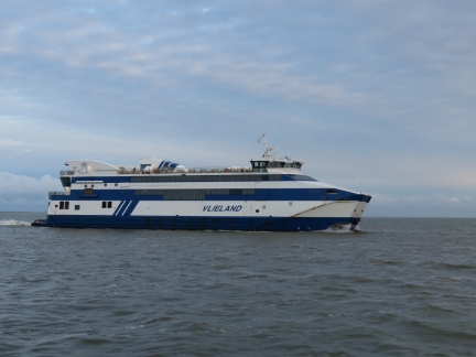
Position: 53°13.36’N, 5°17.12’E
The ferry Vlieland passing us from behind en route from Vlieland to Harlingen.
|
 |
Terschellinger Bank
Position: 53°12.61’N, 5°18.01’E
The ferry Terschellinger Bank aglow in the morning sun en route from Harlingen.
|
 |
Positive Current
Position: 53°10.76’N, 5°23.08’E
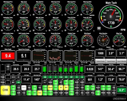
One of the reasons we left in the dark this morning was to take advantage of the flood current. We’re currently doing 10.8 knots at 1734 RPM, when normally we’d be making about 8 kts at that RPM.
|
 |
Harlingen
Position: 53°9.94’N, 5°23.36’E
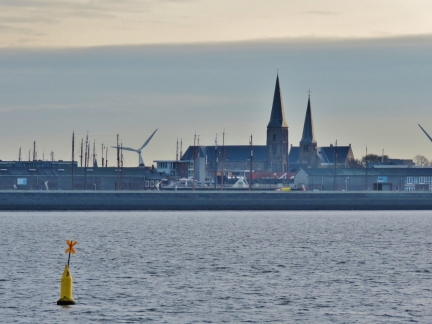
Passing Harlingen with St. Michael’s church prominent in the skyline. We berthed below the church earlier this year.
|
 |
Negative Current
Position: 53°9.77’N, 5°23.29’E
Once we exited the main channel to Harlingen, we hit a strong negative current and our speed halved to 5.1 knots.
|
 |
Chart Detail
Position: 53°8.99’N, 5°23.05’E
Our C-Map charts don’t have much detail for this area.
|
 |
Better Chart Detail
Position: 53°8.62’N, 5°22.87’E
When available, we purchase Navionics charts to run on our tablet and phone—they are particularly handy when out in the tender. Fortunately the Navionics charts have much better detail for this area.
|
 |
Fishboat
Position: 53°5.06’N, 5°20.32’E
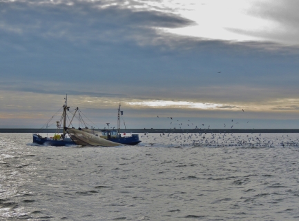
A fishboat with a cloud of seagulls following.
|
 |
Waiting
Position: 53°4.60’N, 5°19.97’E
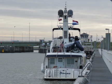
Moored behind a fishing vessel on the waiting pontoon at the Kornwerderzand lock, part of the 20-mile (32km) Afsluitdijk dam. We visited the lock by bicycle from Harlingen earlier this year, so it was particularly fun to be back here in Dirona.
|
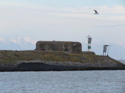 |
Fort Kornwerderzand
Position: 53°4.60’N, 5°19.97’E
Old Fort Kornwerderzand bunker on the entrance to the Kornwerderzand locks. Fort Kornwerderzand is famous for successfully holding off an attack during the 1940 German invasion of the Netherlands. The fort remained under Dutch control until the Netherlands surrendered to Germany.
|
 |
Commercial Traffic
Position: 53°4.50’N, 5°20.05’E
A barge at the far left is exiting the lock, while another is passing through the opened bridge to the right. Commercial traffic has priority in the locks, so we’ll follow behind the sailing canal boat in the foreground and the fishing boat visible beyond it at right.
|
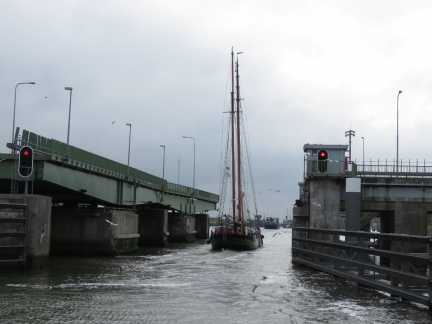 |
Bridge
Position: 53°4.33’N, 5°20.16’E
Passing through the opened road bridge behind the sailing canal barge.
|
 |
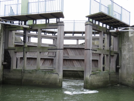
East Lock
Position: 53°4.18’N, 5°20.24’E
The large barge and the sailing canal barge went into the larger west lock. We followed the fishing vessel into the smaller east lock.
|
 |
Gates Closing
Position: 53°4.18’N, 5°20.24’E
The locks operate efficiently—we’d barely tied off before the gates started to close behind us.
|
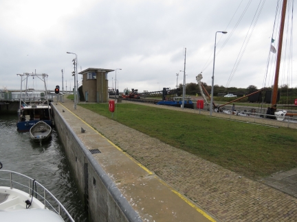 |
Dual Locks
Position: 53°4.18’N, 5°20.24’E
Looking south across the paired locks.
|
 |
Exiting Lock
Position: 53°3.94’N, 5°20.33’E
The skipper of fishing vessel ahead exited with a lot of power, so we were anticipating a bit of current. But there wasn’t much to contend with.
|
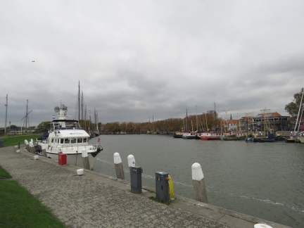 |
Buitenhaven
Position: 52°41.96’N, 5°17.58’E
Anchored for the night at Buitenhaven in Enkhuizen.
|
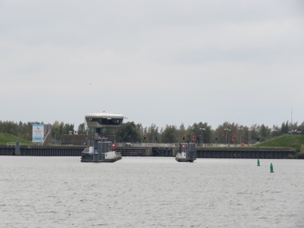 |
Naviduct
Position: 52°41.96’N, 5°17.58’E
Our berth at Enkhuizen is within sight the naviduct through the Houtribdijk. A naviduct is a special type of navigable aquaduct that also includes a lock. We’ll be passing through tomorrow—another first for us.
|
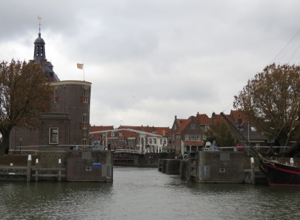 |
Enkhuizen Lock
Position: 52°41.97’N, 5°17.59’E
The town harbours along the former Zuiderzee saltwater bay once were all guarded by locks. The completion of Afsluitdijk Dam in 1932 transformed the Zuiderzee into a freshwater lake, renamed IJsselmeer, and locks at town such as Enkhuizen can be left permanently open.
|
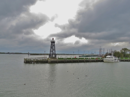 |
View East
Position: 52°42.02’N, 5°17.59’E
Looking east across our berth at Buitenhaven with the Naviduct in the distance on the left.
|
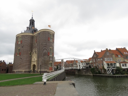 |
Drommedaris
Position: 52°42.03’N, 5°17.60’E
The 16th-century tower Drommedaris guarding the entrance to Enkhuizen’s old harbour. The tower name derives from the Latin word for camel, “dromedarius,” as the building’s shape resembles a camel’s hump.
|
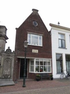 |
1626
Position: 52°42.10’N, 5°17.56’E
Enkhuizen received city rights in 1355 and, as a Dutch East India Company harbour, was among the most important cities in the Netherlands. So this building dating from 1626 is relatively modern.
|
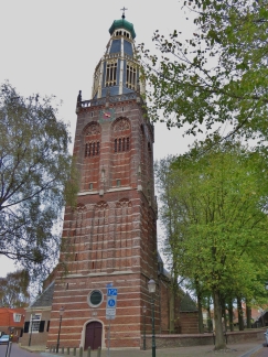 |
Zuiderkerk
Position: 52°42.22’N, 5°17.53’E
Construction of the Zuiderkerk began in the 1400s and the top of the tower was completed in 1524.
|
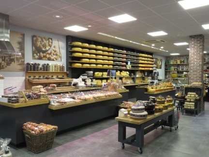 |
Dutch Cheese
Position: 52°42.25’N, 5°17.43’E
Cheese is very popular in The Netherlands.
|
 |
1616 Facade
Position: 52°42.21’N, 5°17.29’E
This building look old, but actually was built in 1906 using the facade of an orphanage from 1616 that once stood there.
|
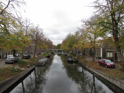 |
Canal
Position: 52°42.17’N, 5°17.07’E
Looking down one of Enkhuizen’s many tranquil canals.
|
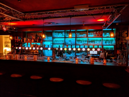 |
Herberg De Compagnie
Position: 52°42.06’N, 5°17.39’E
The large tap selection at Herberg De Compagnie enticed us, so we stopped in for a drink.
|
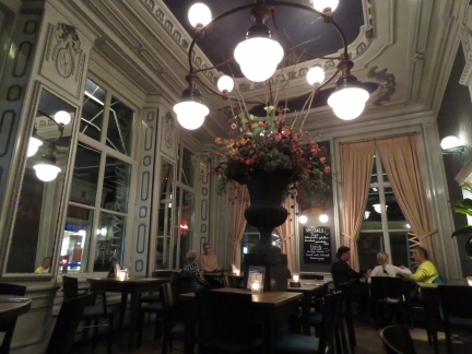 |
Restaurant van Bleiswijk
Position: 52°42.24’N, 5°17.42’E
The ornate interior of Restaurant van Bleiswijk, where we had a nice dinner.
|
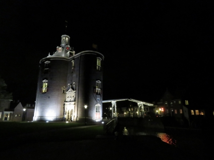 |
Drommedaris at Night
Position: 52°42.01’N, 5°17.58’E
Drommedaris and a pedestrian bridge over the harbor at right look great lit up at night.
|
 |
Dutch Customs
Position: 52°41.97’N, 5°17.55’E
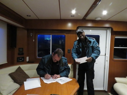
Dutch Customs knocked on the boat around 8:30 that night to check our paperwork and the boat’s VAT status. They had come by earlier in the day, but we weren’t on board. They’d actually come up from Amsterdam in response to a report of an American boat in the harbour since Enkhuizen has no Customs office, so they stayed in town and tried again later. And they mentioned that Customs at West-Terschelling had also tried to visit when we were there, but we weren’t on board then either. We expressed concern for having brought them so far and kept them waiting around, but they were quite friendly and didn’t seem at all bothered.
As non-EU residents, we can bring Dirona into the EU VAT-free for a maximum of 18-months at a time. We contacted Danish Customs prior to entering the EU from Norway at Denmark, but they didn’t require an inspection. And most EU countries we’ve contacted don’t require us to check in with Customs or Immigration on further movement within the EU. Notable exceptions are the UK and Ireland, who maintain control of their borders. But any country we visit within the EU, or outside, can of course choose to inspect us. |

|
Click the travel log icon on the left to see these locations on a map, with the complete log of our cruise.
On the map page, clicking on a camera or text icon will display a picture and/or log entry for that location, and clicking on the smaller icons along the route will display latitude, longitude and other navigation data for that location. And a live map of our current route and most recent log entries always is available at mvdirona.com/maps. |

Great photos from last three posts. I loved the architecture in Enkhuizen — the Zuiderkerk and 1616 facade are charming structures.
Thank you John. One of the things we’ve really been enjoying about the Netherlands is the interesting and unique architecture and scenery.