Cheese has been a major economy in Edam since the town’s cheese market began in the 16th century—at peak times 250,000 rounds of cheese were sold annually. An enjoyable one-hour bicycle ride brought us from Hoorn to Edam, where we toured the scenic town and sampled the product it’s famous for.
Below are trip highlights from October 31, 2018 in Hoorn and Edam, Netherlands. Click any image for a larger view, or click the position to view the location on a map. And a live map of our current route and most recent log entries always is available at mvdirona.com/maps
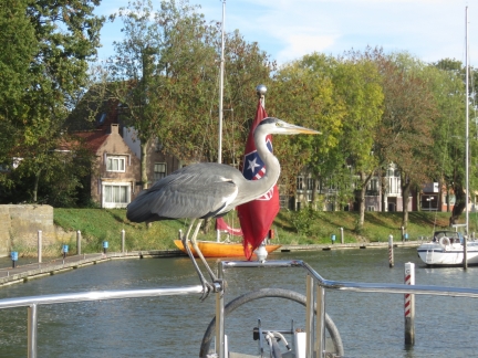 |
Heron
Position: 52°38.26’N, 5°3.89’E
Spitfire just about blew a gasket when this heron landed on our railing.
|
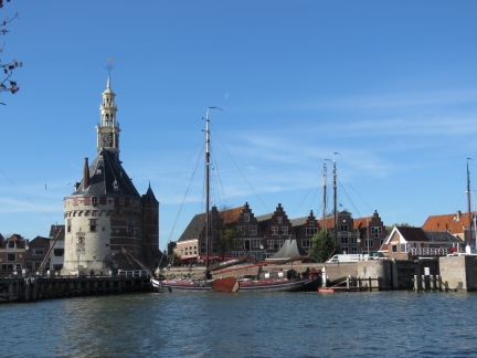 |
Hoofdtoren
Position: 52°38.22’N, 5°3.89’E
Looking across Binnenhaven to Hoofdtoren as we head out to enjoy the sunshine.
|
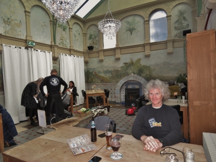 |
Winter Garden
Position: 52°38.37’N, 5°3.59’E
We had a good lunch at the Winter Garden in Restaurant Cafe Ridderikhoff along Hoorn’s main square.
|
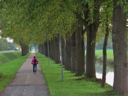 |
F21
Position: 52°37.26’N, 5°0.42’E
On the wonderful National Bike Route F21 from Hoorn to Edam. The 12mi (20km) ride took about an hour.
|
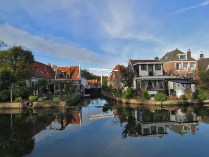 |
Scheppenmakersdjik
Position: 52°30.66’N, 5°2.72’E
Our first view to beautiful Edam along Scheppenmakersdjik.
|
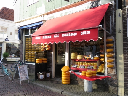 |
Edammer Kaaswinkel
Position: 52°30.75’N, 5°2.89’E
A wide variety of cheese for sale at Edammer Kaaswinkel. Cheese has been a major economy in Edam since the town’s cheese market began in the 16th century. At peak times, 250,000 rounds of cheese were sold annually.
|
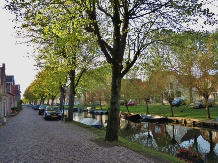 |
Voorhaven
Position: 52°30.80’N, 5°3.31’E
Tranquil scene along Voorhaven in Edam.
|
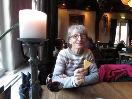 |
Edam in Edam
Position: 52°30.74’N, 5°2.93’E
Enjoying some Edam at the L’Auberge Damhotel in Edam. We didn’t see cheese on the menu, and asked if we could have a small plate of cheese with our glass of wine. The response was a polite and friendly “Of course”, but we felt a bit like we’d asked a bartender if we could get a drink.
|
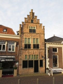 |
Edams Museum
Position: 52°30.76’N, 5°2.96’E
Edams Museum is housed in the town’s oldest building, dating from 1540. The cellar floats up and down with the groundwater level to decrease pressure on the structure, a building technique in the Netherlands exclusive to towns with high and non-stabilized groundwater levels. Basements often would burst as the groundwater levels changed due to tides and storm floods.
Floating cellars were commonly built in Amsterdam during the major 17th- and 18th-century growth periods when the cost of digging down generally was less expensive than purchasing land. These structures no longer were needed after 1871 when Amsterdam stabilized the groundwater levels with locks. |
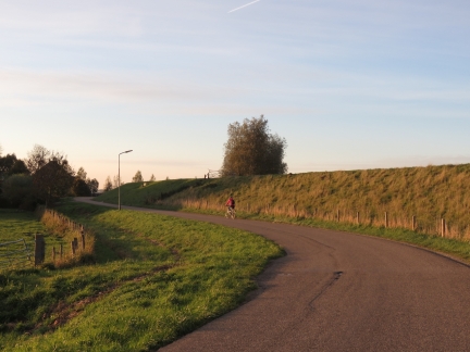 |
Dike
Position: 52°32.21’N, 5°3.44’E
We returned to Hoorn from Edam along the old dike, no longer needed now that locks stabilize the outside water levels.
|
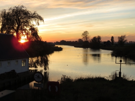 |
Dusk
Position: 52°35.70’N, 5°1.04’E
Wonderful dusk scene at Schardam on our bike ride back to Hoorn.
|
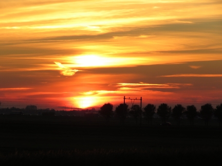 |
Sunset
Position: 52°36.12’N, 5°0.85’E
Spectacular sunset just south of Hoorn.
|
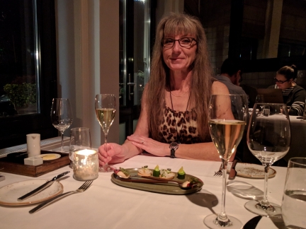 |
Lucas Rive
Position: 52°38.26’N, 5°3.89’E
A birthday dinner for Halloween baby Jennifer at Michelin-starred Lucas Rive in Hoorn. We normally don’t order a fixed menu, but the tasting samples included with all the meals (pictured) were so impressive that we decided to put ourselves in the chef’s hands for both food and wine. We’re glad we did—the evening was truly exceptional.
|
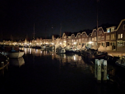 |
Binnenhaven
Position: 52°38.26’N, 5°3.89’E
Binnenhaven at night as we return to the boat from Lucas Rive.
|

|
Click the travel log icon on the left to see these locations on a map, with the complete log of our cruise.
On the map page, clicking on a camera or text icon will display a picture and/or log entry for that location, and clicking on the smaller icons along the route will display latitude, longitude and other navigation data for that location. And a live map of our current route and most recent log entries always is available at mvdirona.com/maps. |

If your comment doesn't show up right away, send us email and we'll dredge it out of the spam filter.