Our third day on the Kiel Canal was the longest and the most exciting. After an aborted first attempt due to fog and traffic movement restrictions in the canal, we made a 36-mile run from Rendsburg to Brunsbuttel at the western canal entrance. During the transit, we ran at wide-open-throttle for a time in order to pass a slightly-slower 528ft (161m) ship, whose bow wake generated a 2-knot negative current in the confined canal waters.
Our berth for the night in Brunsbuttel was adjacent to the sea lock entry—we could almost reach out and touch the passing ships. While there, we visited the Atrium Museum at the Locks and spent ages watching ships pass, both from Dirona and the lock observation decks.
Below are trip highlights from October 19th on the Kiel Canal, Germany. Click any image for a larger view, or click the position to view the location on a map. And a live map of our current route and most recent log entries always is available at mvdirona.com/maps
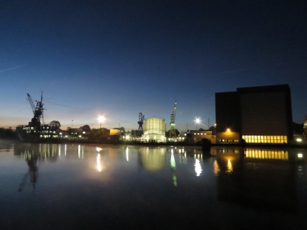 |
Nobiskrug
Position: 54°18.74’N, 9°42.12’E
Passing the Nobiskrug superyacht yard shortly past dawn at 7am. Recreational craft are only allowed on the canal during prescribed daylight hours which at this time of year are between 7am and 7:30pm.
|
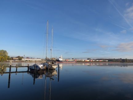 |
Clear and Sunny
Position: 54°18.40’N, 9°40.31’E
Recreational craft cannot be underway on the canal in poor visibility. As we were about to enter the waterway, the Kiel Canal authority ordered us by radio to not proceed and return to Lake Obereider due to poor visibility farther west. As you can see, the visibility is quite good here, but the canal is predictably non-negotiable, so we’ll need to wait until they believe it is safe for recreational craft.
|
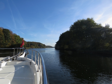 |
Underway Again
Position: 54°18.68’N, 9°41.55’E
Three and a half hours after we first got underway, we’ve been given permission to proceed.
|
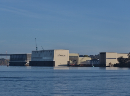 |
Lurssen
Position: 54°18.82’N, 9°42.55’E
Another view to the Lurssen yard as we enter the Kiel Canal.
|
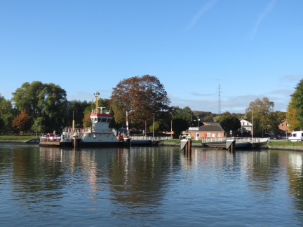 |
Nobiskrug Ferry
Position: 54°18.32’N, 9°42.59’E
The Nobiskrug Ferry arriving at the north shore.
|
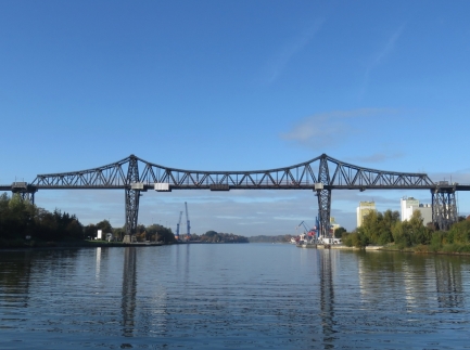 |
Rendsburg High Bridge
Position: 54°17.64’N, 9°41.03’E
Approaching the Rendsburg High Bridge.
|
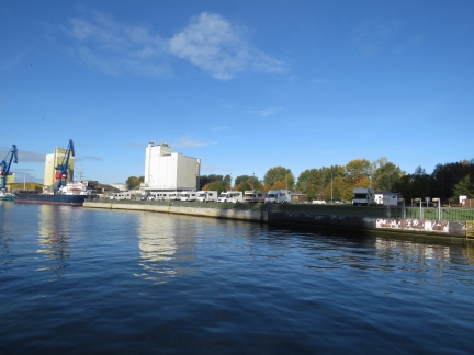 |
RVs
Position: 54°17.56’N, 9°40.59’E
One of several RV parks alongside the canal.
|
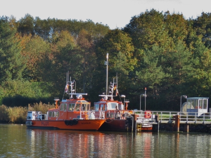 |
Schulp and Rusterbergen
Position: 54°14.36’N, 9°36.61’E
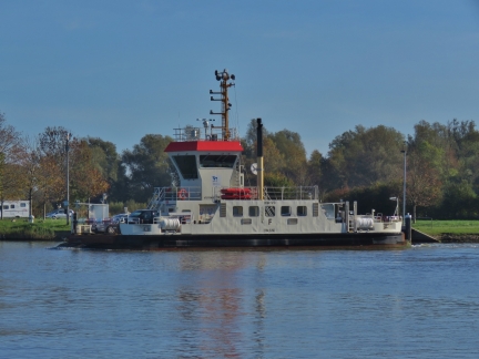
The pilot boats Schulp and Rusterbergen moored near Rendsburg.
|
 |
Breiholz Ferry
Position: 54°12.27’N, 9°33.87’E
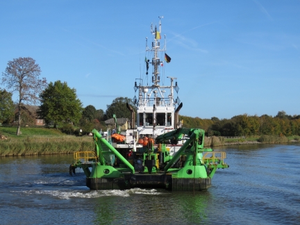
The Breiholz Ferry departing the south shore.
|
 |
Dhamra
Position: 54°11.12’N, 9°29.76’E
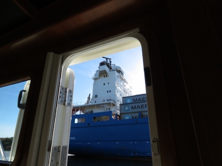
The dredger Dhamra working the south side of the canal.
|
 |
Passing Suderoog
Position: 54°10.89’N, 9°28.62’E
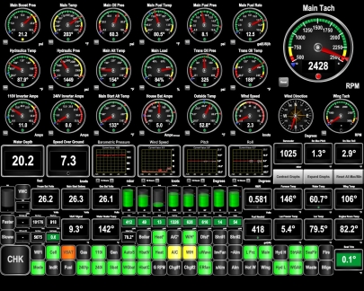
The 528ft (161m) container ship Suderoog is running at 7kts, and we’re passing on the right at 8 kts. It feels remarkably close.
|
 |
Current
Position: 54°10.85’N, 9°28.43’E
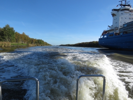
The Suderoog is running at 7kts, we’re running at 8kts, and to pass we increased to wide-open-throttle to minimize the time we spent beside the big boat. Wide-open-throttle should have us at 9.5kts, but a super-interesting effect becomes apparent as we approach the bow of the Suderoog. Because the ship takes such a big percentage of the overall area of the canal, the water rushing past from its bow to its stern is suprisingly powerful as we near the bow of the boat and we could actually only make 7.3 kts. Ironically, at 2.5kts faster through the water than the Suderoog is travelling, we only barely have the speed to pass in the high-speed current.
This is another reason we’re glad to have upgraded our main engine from the then-standard 163HP Lugger to the 266HP Deere. With the lower-powered engine we’d be in the ironic position of being 1 knot faster than the Suderoog and yet 1.5 kts too slow to be able to pass. |
 |
Nordhavn Rooster Tail
Position: 54°10.77’N, 9°28.04’E
About as close to we’ll get to a rooster tail behind our Nordhavn. Here we’re doing 9.5 knots through the water, but actually only making 7.3 knots over ground working through the bow wave of the Suderoog.
|
 |
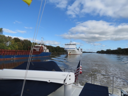
Gieselau Canal
Position: 54°10.29’N, 9°26.29’E
The entry to the 1.8mi (2.9 km) Gieselau Canal, linking the Kiel Canal with the River Eider.
|
 |
Friedrich Russ
Position: 54°8.82’N, 9°21.25’E
The 503ft (153.4m) Ro-Ro/container carrier Friedrich Russ (rightmost) pulled off on a siding with the 295-ft (90m) cargo ship Spanaco Simplicity. Commercial ships are placed into groups by dimension and the siding signals indicate which groups must pull over to allow vessels to pass within the siding. We’re permitted to exit the siding, but the commercial vessels have to wait.
|
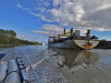 |
Gerardus Mercator
Position: 54°8.44’N, 9°20.52’E
Passing the 501ft (153m) hopper/dredger Gerardus Mercator with the Ro-Ro/container carrier Friedrich Russ visible in the distance waiting so the ships can pass within the siding.
|
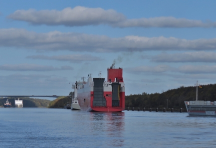 |
Seine Highway
Position: 54°1.75’N, 9°18.03’E
The 485ft (148m) vehicle carrier Seine Highway following behind Gerardus Mercator with the 360ft (110m) general cargo ship Maasborg bringing up the rear. They are pulled over to the right to allow room to pass the oncoming Friedrich Russ and Spanaco Simplicity within the siding area.
|
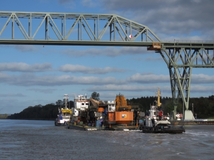 |
Goliath
Position: 54°0.60’N, 9°17.70’E
The tugs Dutch Pearl and Rostock guiding the barge Goliath under the Hochdonn railway bridge.
|
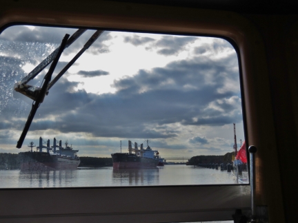 |
Oncoming Traffic
Position: 53°56.61’N, 9°13.45’E
Three more large oncoming ships on the Kiel Canal. Here you can see the smaller commercial vessel on the right is permitted to proceed and so is passing the larger vessel who is prohibited from proceeding until the oncoming traffic clears. There’s still rooom for us to slip by on the right.
|
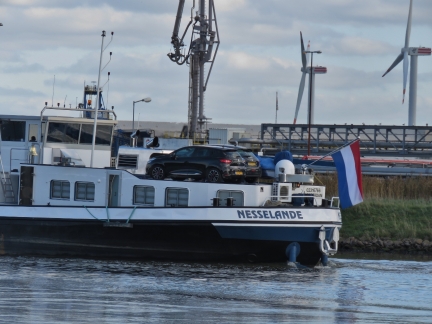 |
Nesselande
Position: 53°54.88’N, 9°10.96’E
The barge Nesselande carrying two car “tenders”.
|
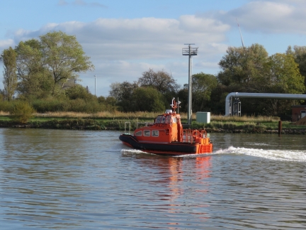 |
Hanse 1
Position: 53°54.04’N, 9°9.39’E
Hanse 1 is among the smallest pilot boat we’ve ever seen.
|
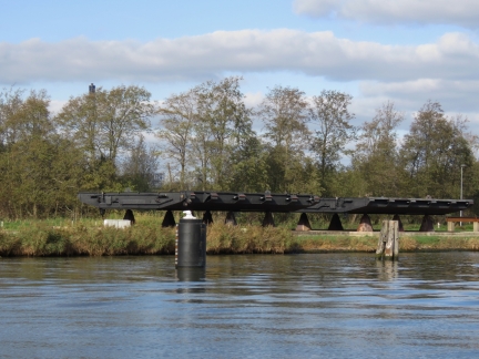 |
Lock Gates
Position: 53°53.94’N, 9°9.22’E
Lock gates mounted ashore north of Brunsbuttel.
|
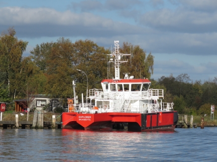 |
Explorer
Position: 53°53.84’N, 9°9.03’E
The pilot boat Explorer moored off the Brunsbuttel inner harbour. The SWASH (Small Waterplane Area Single Hull) vessel has a torpedo-shaped float at center containing the engines and two outriggers for stability. The Seimens-powered vessel is the first hybrid pilot boat in the world, with an electric hybrid motor in addition to the drive motor and auxiliary diesel motor.
|
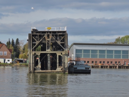 |
Lock Door
Position: 53°53.80’N, 9°8.91’E
Another lock door, perhaps for the new Brunsbuttel lock currently under construction.
|
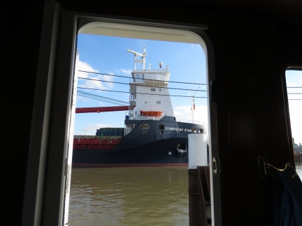 |
Symphony Star
Position: 53°53.76’N, 9°8.85’E
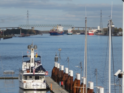
The recreational craft moorage at Brunsbuttel is adjacent to the lock entries. Shortly after we’d tied off, this was our view out the pilot house door of Symphony Star entering the locks. Wow, what an awesome place to be.
|
 |
Dirona
Position: 53°53.71’N, 9°8.77’E
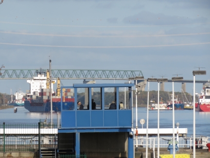
Looking across our moorage from the eastern viewing platform to ships approaching along the Kiel Canal. The large U-shaped harbour had power on the other pontoon, but not where we are. The advantage of our location is we can see right into the locks and watch ships enter and leave.
|
 |
Viewing Platform
Position: 53°53.64’N, 9°8.62’E
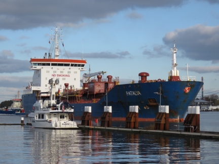
The eastern viewing platform over the Brunsbuttel locks seen from the western viewing platform. Dirona‘s grey domes are just visible at bottom left.
|
 |
Patalya
Position: 53°53.73’N, 9°8.77’E
The 472ft (145m) oil/chemical tanker Patalya towering over Dirona as it approaches the Brunsbuttel locks.
|
 |
Lock Model
Position: 53°53.74’N, 9°8.71’E
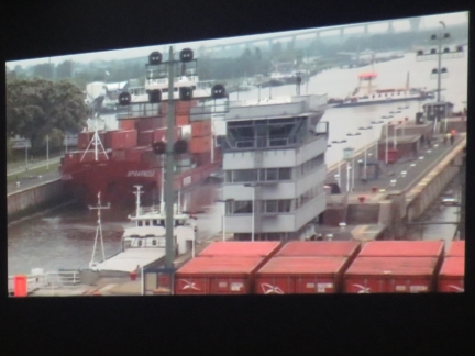
A model of the northernmost Brunsbuttel lock with the recreational craft moorage at top left at the Atrium museum at the Locks. The small museum was packed with excellent displays and models like this one, but everything was in German, so we couldn’t glean much on the details.
|
 |
Movie
Position: 53°53.73’N, 9°8.71’E
The museum at the locks had an excellent 10-minute video, available in English, that included great footage of large ships transiting the Kiel Canal.
|
 |
Aerial of Locks
Position: 53°53.73’N, 9°8.71’E
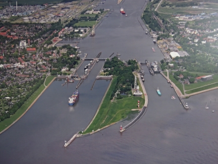
An aerial photograph of the Brunsbuttel locks showing the original locks on the right, completed in 1895, and the newer, larger locks completed in 1914. A fifth lock currently is under construction between the two sets. When this is complete, the two larger locks will be closed for renovations and upgrades.
|
 |
Accidents
Position: 53°53.67’N, 9°8.67’E
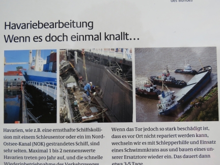
The Kiel Canal is one of the most travelled man-made shipping lanes worldwide. They’re very careful about safety, but there’s no escaping that large commercial vessels in close quarters carry risk, and there have been many problems over the years. The older locks at the Kiel-Holtenau end currently are closed for repairs after a ship rammed the gate. These photographs show two of the more major incidents at the Brunsbettel end.
|
 |
The Braake
Position: 53°53.85’N, 9°7.97’E
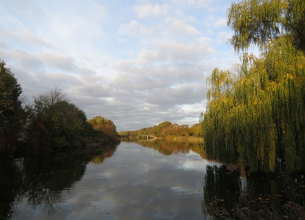
Looking north along the Braake in Brunsbuttel. The waterway was created by the break of the Elbe dike during the 1717 Christmas flood that killed over 10,000 people in Germany, Denmark and the Netherlands.
|
 |
Pick Your Favourite
Position: 53°53.77’N, 9°8.55’E
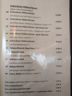
English is less prevalent in Germany than most places we’ve visited, but we’re usually able to get an English menu or get help translating from the server. But the server at China Bistro Hoa Mai spoke no English and the German menu was pretty impenetrable. We were about to try Google translate when patrons at the next table offered to translate for us. We had a good meal.
|
 |
Suderdoog
Position: 53°53.72’N, 9°8.75’E
Suderdoog, the ship we were slow to pass earlier today, locking through at 7pm. They were travelling only a knot slower than us, but larger ships have significant delays waiting for oncoming traffic that doesn’t slow us.
|

|
Click the travel log icon on the left to see these locations on a map, with the complete log of our cruise.
On the map page, clicking on a camera or text icon will display a picture and/or log entry for that location, and clicking on the smaller icons along the route will display latitude, longitude and other navigation data for that location. And a live map of our current route and most recent log entries always is available at mvdirona.com/maps. |

Hi James
The lock door you have seen in Brunsbüttel is a spare part for the existing locks.
The new lock will be ready when we see ice on the Panama Canal
Yours
Kay Rupp
Could be a while before the new lock is operational huh? :-)
Love the description and photos of the Kiel Canal. It must be great fun to watch a nonstop array of huge and medium commercial vessels passing at close quarters.
Too bad you didn’t see one of the astonishing megayachts built by Lurssen and Nobisrkug in the Canal. In fact, I’ve been surprised at the paucity of yachts in your recent cruising areas, although it is getting quite late in the season for yachting.
Most of the super yachts are usually heading for warmer climates later in the year so there are less around as winter sets in. In many ways, we probably have more fun studying the larger commercial vessels but we’re interested in them all.