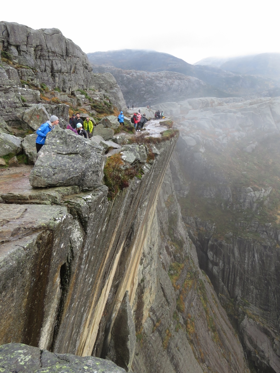
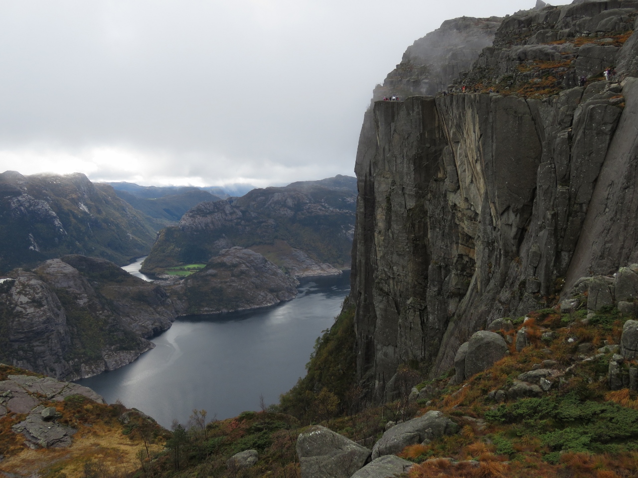
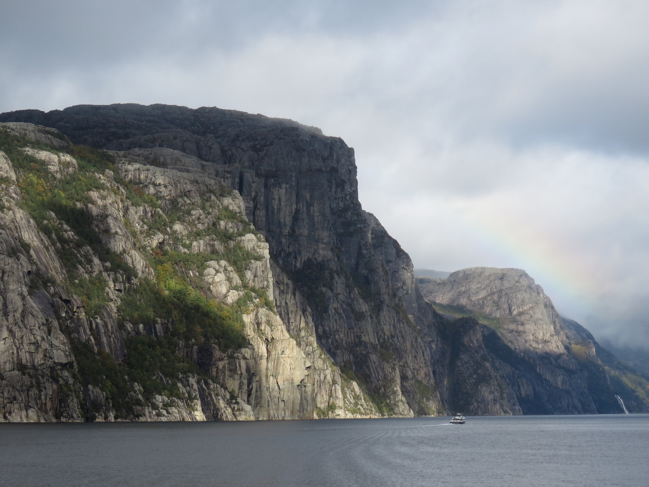
The hike to iconic Pulpit Rock is immensely popular. The spectacular formation juts out over Lyseford with a vertical drop of nearly 2,000 ft (600m), creating a dramatic photo opportunity for those willing to perch on the fenceless edge.
The trail is fairly tame by Norwegian standards at 2.3-mile (3.8km) long with an altitude gain of 1,666ft (508m), and busloads of tourist arrive daily to make the trek. We’ve never seen so many people on a Norwegian trail, nor so many warnings about appropriate attire and the hike conditions.
Below are trip highlights from October 1st on a road trip to Pulpit Rock, Norway. Click any image for a larger view, or click the position to view the location on a map. And a live map of our current route and most recent log entries always is available at mvdirona.com/maps
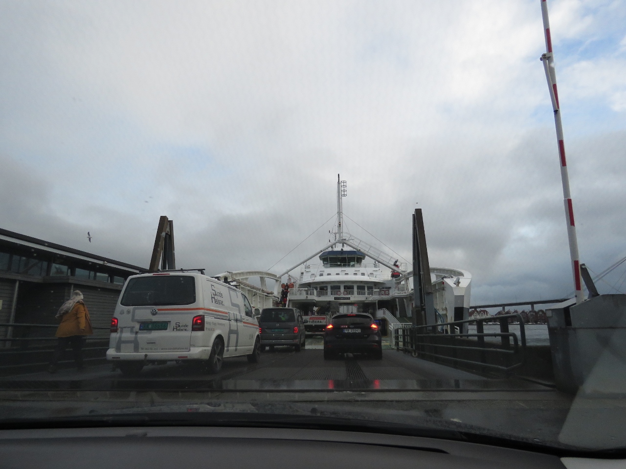 |
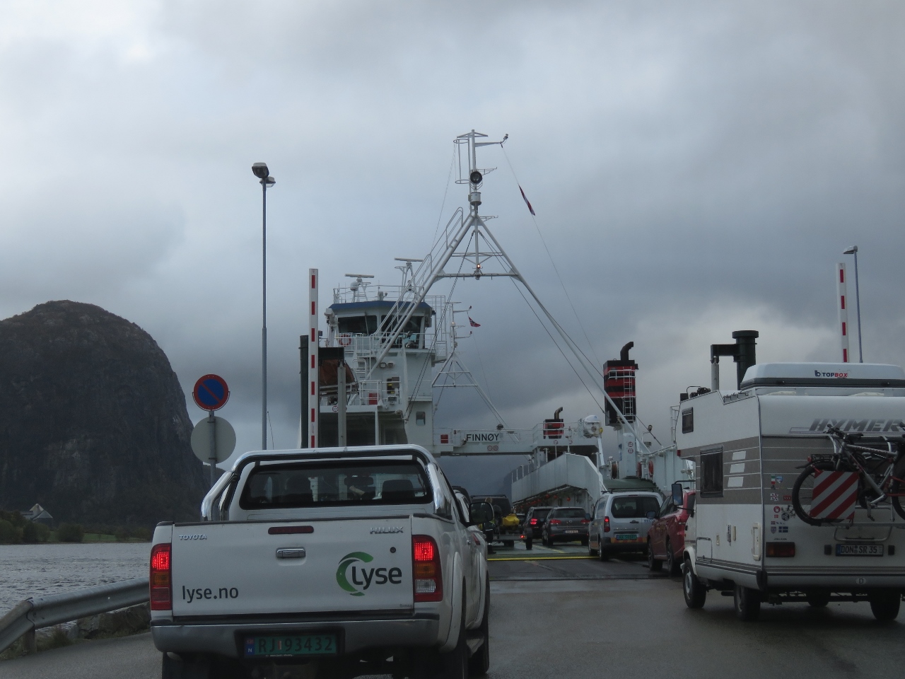
Ferry
Position: 58°58.35’N, 5°44.43’E
Boarding the ferry from Stavanger to Tau on a road trip to hike Pulpit Rock. The ferries in Norway operate efficiently, but we were amazed at the turnaround time in Stavanager. The ferry landed at 8:57 am, unloaded about 60 cars, reloaded and was underway again by 9:03.
|
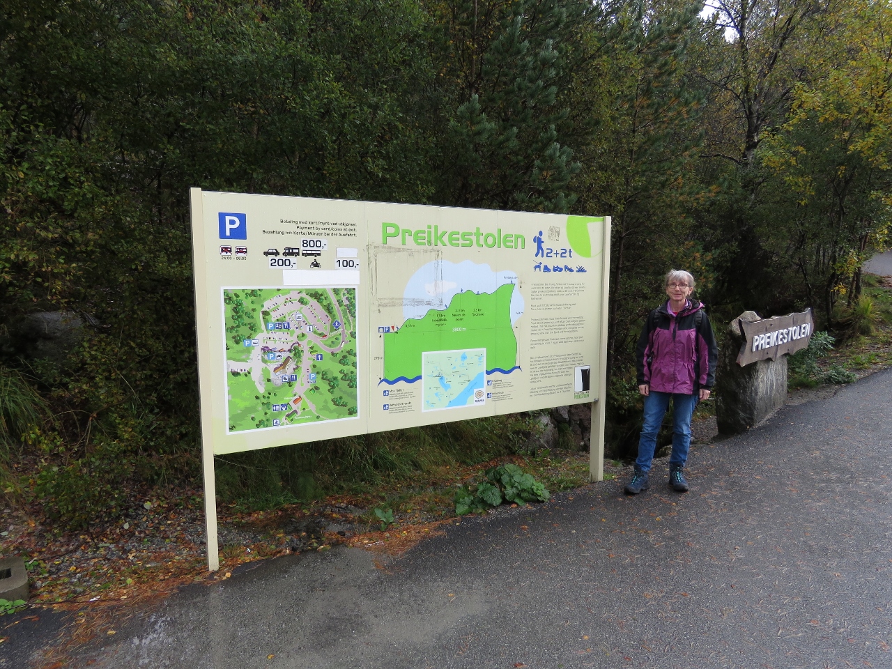 |
Trailhead
Position: 58°59.50’N, 6°8.31’E
At the Preikestolen (Pulpit Rock) trailhead. The trial is 2.3 miles long (3.8km) with an altitude gain of 1,666ft (508m). This is much tamer than many of the trails we’ve recently hiked, but we’ve never seen so many warnings about appropriate attire and the hike conditions. When they advise against high heels, you know you’re on a tough trail. :)
|
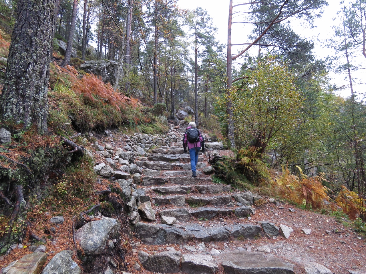 |
Steps
Position: 58°59.54’N, 6°8.44’E
Stone steps at the start of the hike.
|
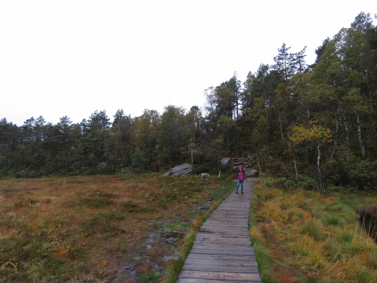 |
Boardwalk
Position: 58°59.38’N, 6°9.32’E
Boardwalk crossing a boggy area. Rain has been falling much of the morning, but we expect clearer conditions soon.
|
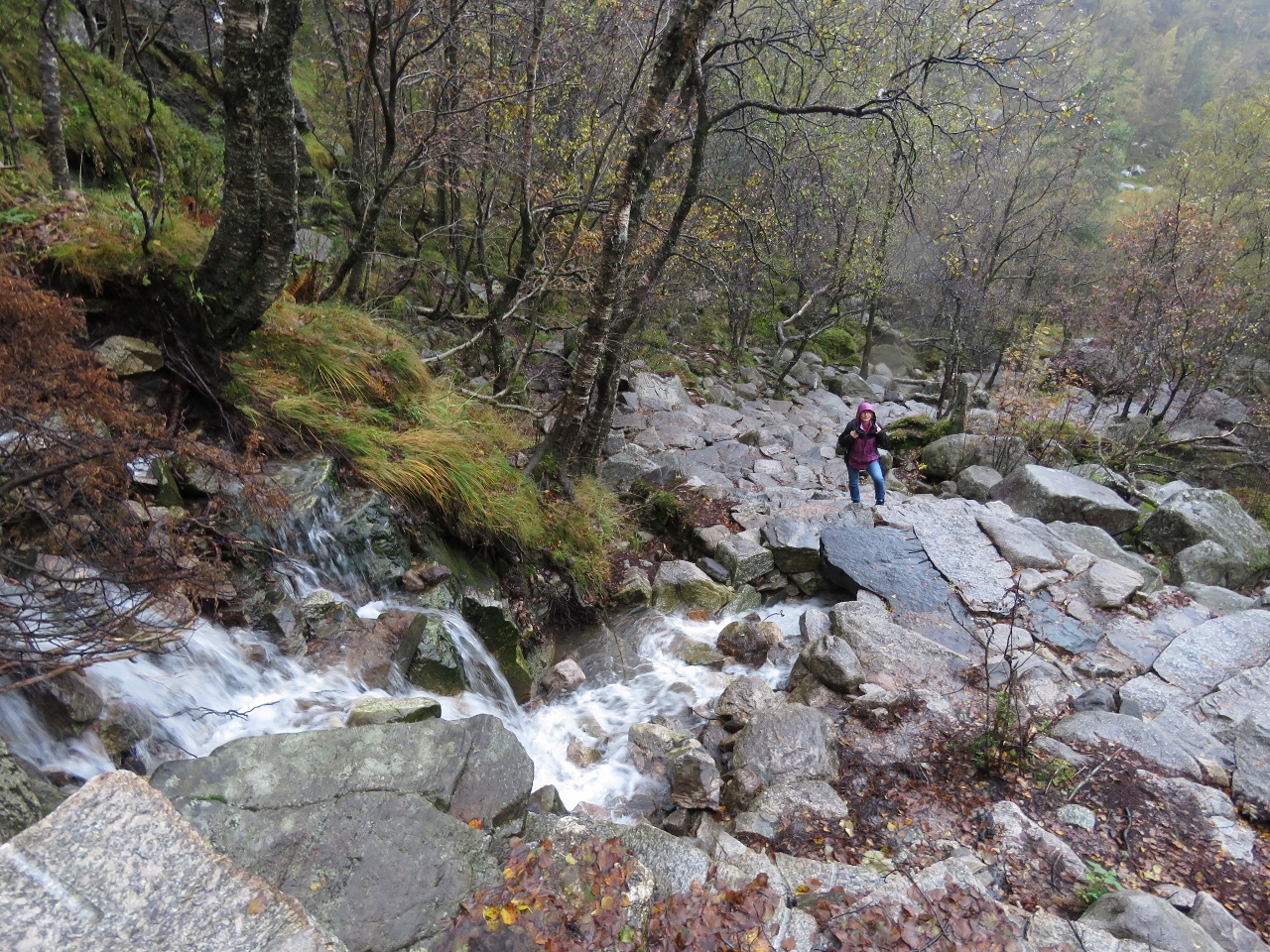 |
Waterfall
Position: 58°59.44’N, 6°9.73’E
Stone steps passing a small waterfall. The trail is wonderfully built.
|
 |
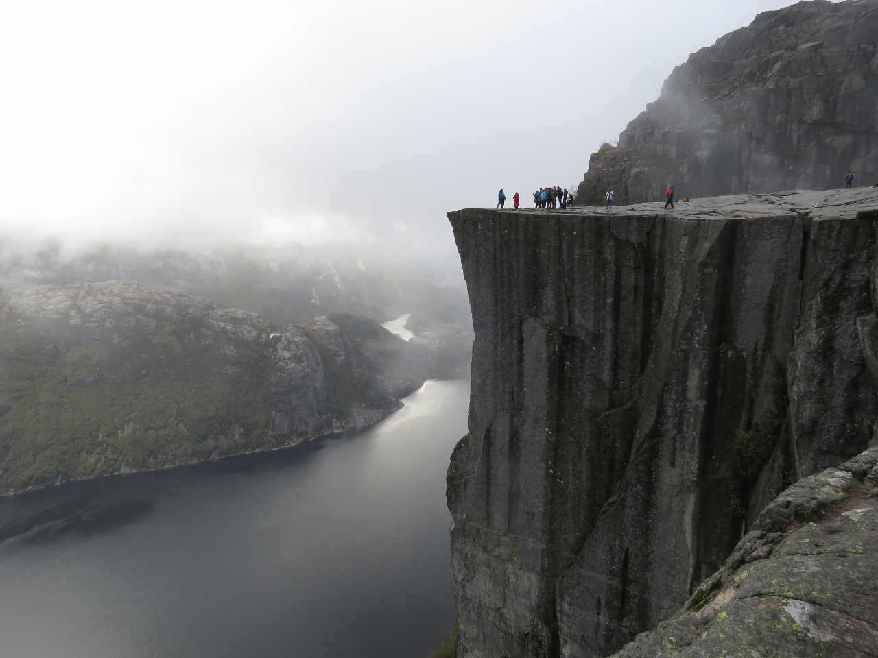
Pulpit Rock
Position: 58°59.21’N, 6°11.34’E
Dramatic Pulpit Rock soaring above Lyseford.
|
 |
Overhang
Position: 58°59.21’N, 6°11.34’E
Looking back on the trail to a sheer overhanging cliff.
|
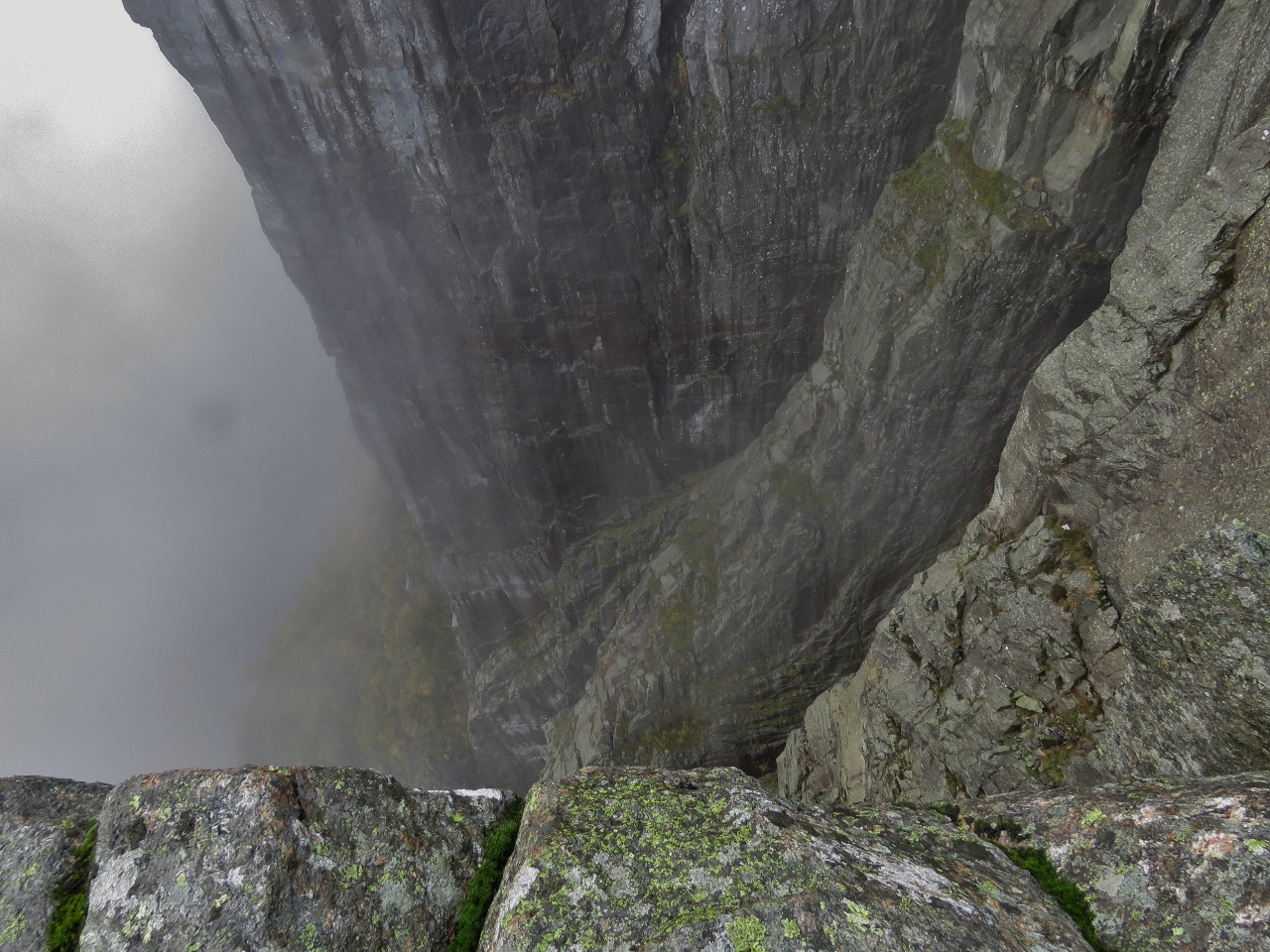 |
Heights
Position: 58°59.18’N, 6°11.30’E
It’s pretty much straight down for 2,000 ft (600m). We’ve been near many cliff edges, but this one has a special way of backing you up.
|
 |
Lunch
Position: 58°59.20’N, 6°11.29’E
We found a perch to have lunch and enjoy the setting. Despite the overcast conditions and the lateness in the year, the trail was busy. We passed dozens en route with many more already there and a constant stream arrived.
|
 |
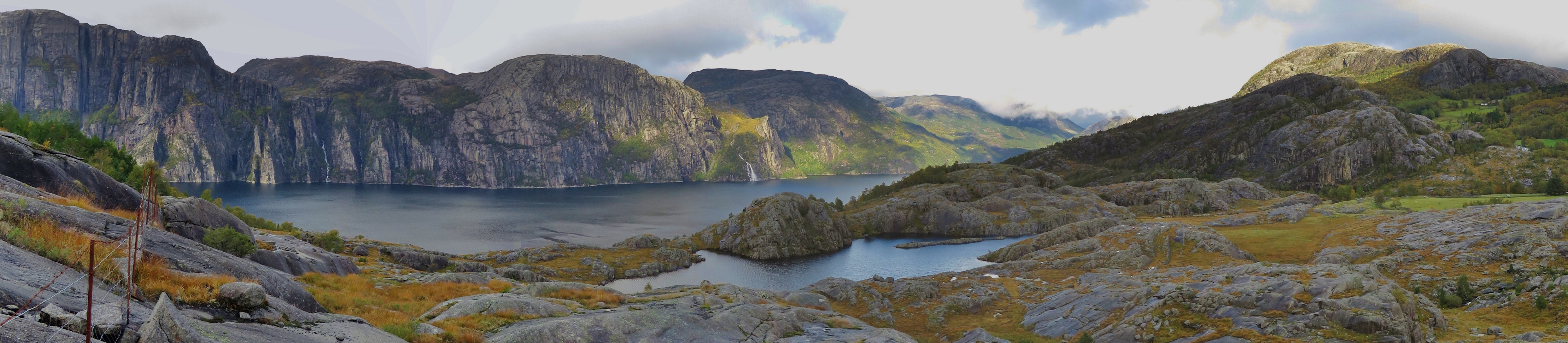
View South
Position: 58°59.30’N, 6°11.43’E
A view of Pulpit Rock and Lyseford extending to the south.
|
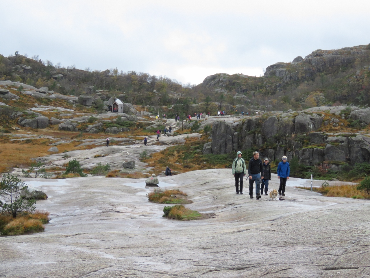 |
Crowds
Position: 58°59.35’N, 6°10.78’E
We passed dozens and dozens more hikers on the way back. Imagine what it’s like in the busy season.
|
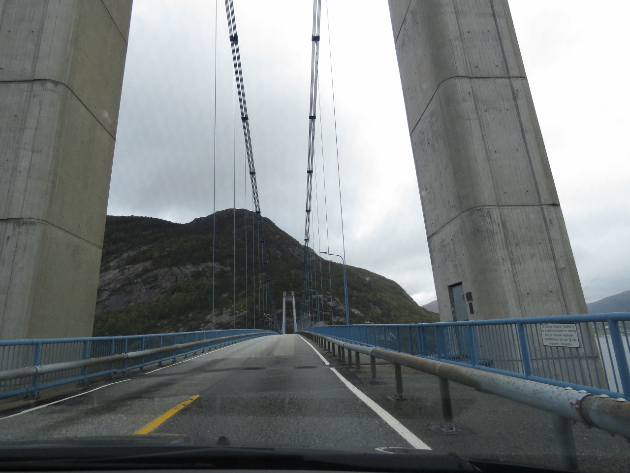 |
Crossing Bridge
Position: 58°55.68’N, 6°5.79’E
From the road to Pulpit Rock we continued south and crossed the Lysefjord Bridge that we could see from our anchorage at Bergsholmen.
|
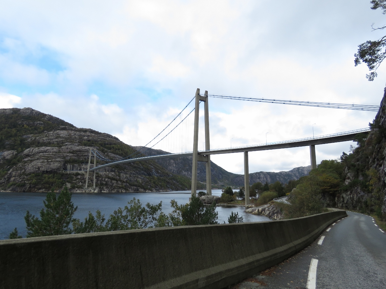 |
FV496
Position: 58°55.22’N, 6°6.07’E
After crossing Lysefjord Bridge, we followed narrow FV496 along the east shore of Lyseford north under the bridge.
|
 |
Coastal Road
Position: 58°56.98’N, 6°8.80’E
The drive along FV496 was beautiful. The road is visible curving around steep cliffs just above the water in the distance.
|
 |
Ferry
Position: 58°57.30’N, 6°8.87’E
Ferry running north through Lysefjord. The waterfall in the distance is Hengjanefossen.
|
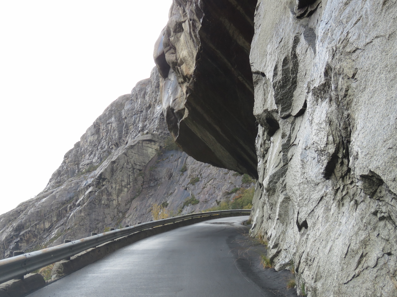 |
Overhang
Position: 58°57.72’N, 6°13.03’E
FV496 is mostly one lane and doesn’t even have that much headroom here.
|
 |
Footbridge
Position: 58°58.39’N, 6°13.68’E
Near the end of the road at Fossmark, we hiked out from the road to get a view of Lysefjord. There’s beautiful little paths and trails everywhere.
|
 |
Lysefjord
Position: 58°58.44’N, 6°13.55’E
The sweeping view to Lysefjord near Fossmark.
|
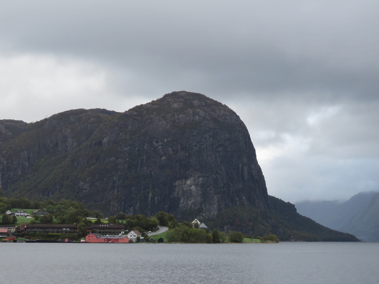 |
Forsand
Position: 58°54.56’N, 6°4.62’E
Looking from the ferry dock at Oanes across the mounth of Lysefjord to Forsand beneath 1,443ft (440m) Uburen.
|
 |
Finnoy
Position: 58°54.56’N, 6°4.62’E
Boarding the ferry Finnoy for our return to Stavenger. As with this morning’s trip, the unload and load process was super-efficient and we were underway seemingly within seconds of boarding.
|
 |
Tronds Lift 7
Position: 58°58.26’N, 5°43.82’E
When we returned from Pulpit Rock, all the ships in front of us had departed. This was a bit disappointing as 56-knot northerly winds were forecast and they would have given us some protection. So we were happy to see Tronds Lift 7 return around 9pm.
|
 |
Click the travel log icon on the left to see these locations on a map, with the complete log of our cruise.
On the map page, clicking on a camera or text icon will display a picture and/or log entry for that location, and clicking on the smaller icons along the route will display latitude, longitude and other navigation data for that location. And a live map of our current route and most recent log entries always is available at mvdirona.com/maps. |
Looks like you had a nice, but crowdy hike to the pulpit rock. All the warning signs are unfortunately required, due to inexperienced people/ tourists. It is amazing what some wear for that hike, regardless of weather conditions. I have seen some wear clothes more suitable on the dance floor or in a pub. (Including the highest heels you can imagine). And the rescue service teams are pretty tired of going up there to help tourists back down.
Seems like some tourists are determined to do that hike at all costs.
I’ll bet you are right about the “no high heel” warning at the start of the hike being the result of the rescue service having seen that mistake made multiple times.
It’s not a difficult hike but it wasn’t all that warm the day we went and there were a lot of very cold people dressed in the clothing that I’m sure was quite comfortable on the tour bus :-).
Despite living in Stavanger for several years this is one of my biggest regrets in never reaching the pulpit rock. Once it was one person in our group couldn’t make the hike (we didn’t realize there was a hike – this was pre internet years) so we we decided to nobody go rather than leave one in the parking area). The second attempt was about a week before I was to leave Norway. We got half way there but one of the ferries had broken down and we were forced to turn back.
One day…
There are many places worth visiting in Norway so it’s well worth the trip to do Pulpit Rock and a few others. However, it’s about as far from home for you as possible on this planet :-).
It is but one day I’ll be back. I’ll be the old guy that everyone points at and says “he’s a bit old to be doing this hike!” :)
I have heard about several in their 90’s have done the hike. It is never to late :)