1,381ft (421m) Mt. Storsteinen dominates the skyline east of Tromsø. An easy half-hour walk from the guest harbour leads to the cable car Fjellheisen, where we rode to the top for sweeping views of the area.
Below are trip highlights from June 13th, 2018 in Tromsø, Norway. Click any image for a larger view, or click the position to view the location on a map. And a live map of our current route and most recent log entries always is available at mvdirona.com/maps
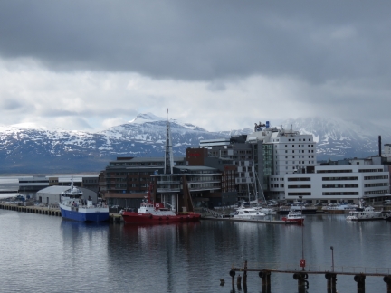 |
Bridge South
Position: 18°58.19’E,69°39.19’N
Looking south across the Tromsø commercial port from the Tromsø Bridge on a walk over to the mainland side. Dirona is at the far right of the picture.
|
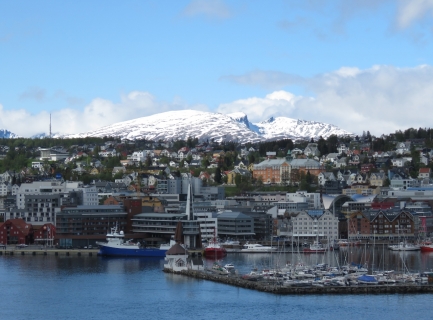 |
Bridge West
Position: 18°58.90’E,69°39.03’N
The view eastward from the Tromsø Bridge to the Tromsø waterfront with snow-covered mountains peaks visible beyond. Dirona‘s stack is just visible behind the large white powerboat.
|
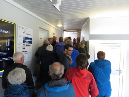 |
Queue
Position: 18°59.16’E,69°38.46’N
In the queue to ride the cable car Fjellheisen to the top of 1,381ft (421m) Mt. Storsteinen.
|
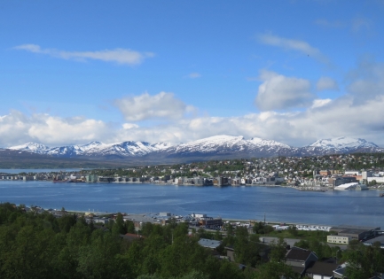 |
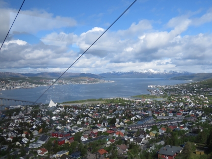
Cable Car East
Position: 18°59.45’E,69°38.31’N
The view looking east as we ride up the cable car.
|
 |
Cable Car North
Position: 18°59.45’E,69°38.31’N
The view north from the cable car.
|
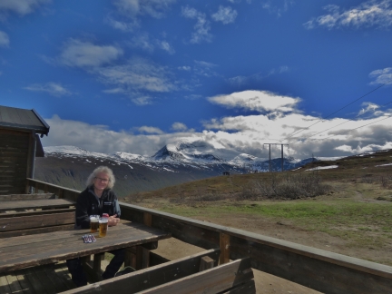 |
Lunch
Position: 18°59.76’E,69°38.15’N
Lunch outside at Mt. Storsteinen with 4,061 ft (1,238 m) snow-covered Tromsdalstinden providing a fabulous backdrop.
|
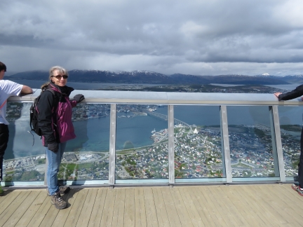 |
Storsteinen Viewing Platform
Position: 18°59.71’E,69°38.16’N
Looking down on Tromsø from the Storsteinen viewing platform.
|
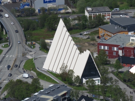 |
Cathedral from Fjellheisen.
Position: 18°59.71’E,69°38.16’N
The Arctic Cathedral viewed from Storsteinen.
|
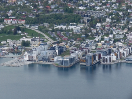 |
Waterfront Development
Position: 18°59.71’E,69°38.16’N
The waterfront development that we walked through yesterday.
|
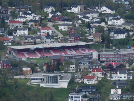 |
Alfheim Stadion
Position: 18°59.71’E,69°38.16’N
Alfheim Stadion is home to the professional football club Tromsø Idrettslag.
|
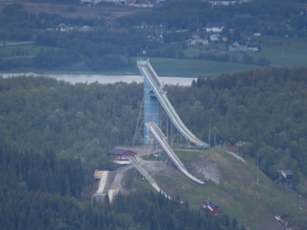 |
Ski Jumps
Position: 18°59.71’E,69°38.16’N
Tromsø’s popular skip jumps, just north of the city, were built in 1993. The Norwegian government rejected the cities request to bid for the 2014 and 2018 games.
|
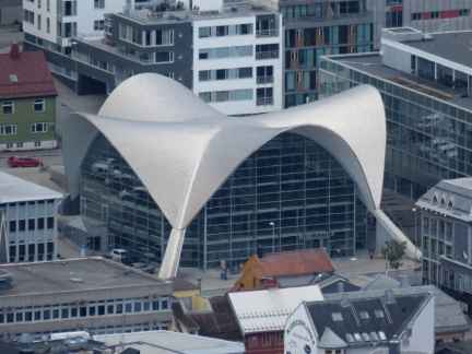 |
Library
Position: 18°59.73’E,69°38.15’N
The Tromsø library viewed from 1,381ft (421m) Mt. Storsteinen.
|
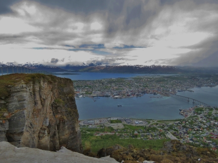 |
Cliff
Position: 18°59.59’E,69°38.10’N
Cliff with snow in front at Storsteinen. It was pretty cold up top compared to the Tromsø waterfront.
|
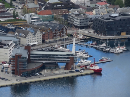 |
Harbor from Storsteinen
Position: 18°59.72’E,69°38.16’N
The Ishavshotel and guest harbour. Dirona is just off the right end of the hotel.
|
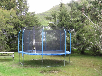 |
Trampoline
Position: 18°59.19’E,69°38.61’N
We’re not sure if trampolines are just a popular form of entertainment, or if some use them to train for freestyle sking, snowboarding and other aerial events. But there are an amazing number of them. In the two-block walk through the residential area on the way to the cable car base, we saw eight trampolines. And for fun, we shifted a block over on the way back and counted another twelve.
|
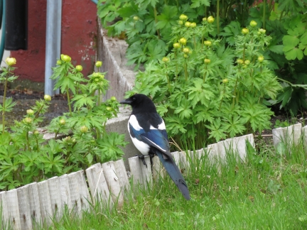 |
Magpie
Position: 18°59.25’E,69°38.72’N
Eurasian Magpie on our walk down from the cable car.
|
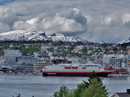 |
Nordkapp
Position: 18°59.22’E,69°38.89’N
The Hurtigruten Nordkapp just arrived into Tromsø.
|
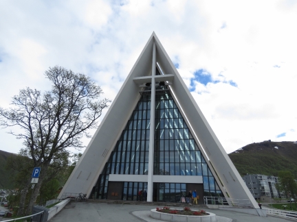 |
Arctic Cathedral
Position: 18°59.23’E,69°38.91’N
Outside the striking Arctic Cathedral, dedicated in 1965.
|
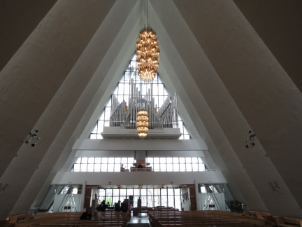 |
Organ
Position: 18°59.25’E,69°38.88’N
The Arctic Cathedral’s organ was built in 2005. It has 2940 pipes ranging in size from 0.2 inches (5mm) to 32 feet (9.6 m).
|
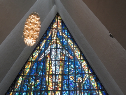 |
Glass Mosaic
Position: 18°59.26’E,69°38.88’N
The spectacular glass mosaic on the eastern side of the cathedral was added in 1972.
|
 |
Shelter
Position: 18°59.24’E,69°38.88’N
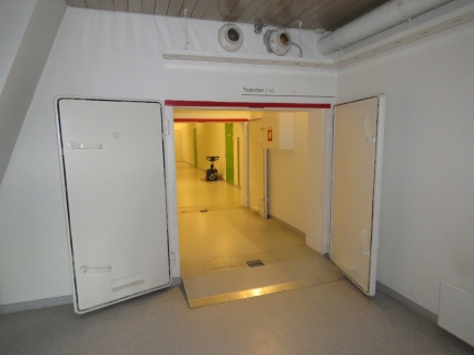
When the cathedral was built, all public buildings in Norway were required to have an air-raid shelter. These are the two large steel doors enclosing the shelter in the basement of the cathedral.
|
 |
Bunker Oil
Position: 18°58.25’E,69°39.17’N
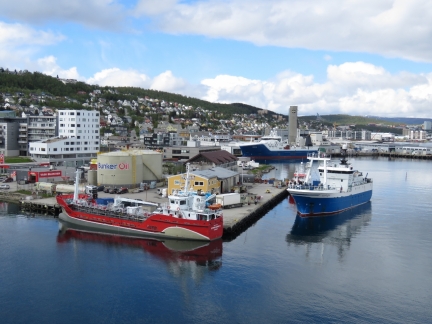
A Russian fishing vessel arriving at the Bunker Oil dock, about where we moored a few days ago. The facility seems to do an excellent business.
|
 |
SAR
Position: 18°57.64’E,69°39.09’N
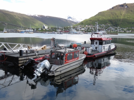
Norwegian Search and Rescue (SAR) Service boats moored at their Tromsø base.
|
 |
Fiskekompaniet
Position: 18°57.59’E,69°39.00’N
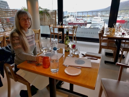
An excellent seafood dinner at Fiskekompaniet with a view to Dirona moored in the guest harbour.
|
 |
Evening Drink
Position: 18°57.72’E,69°39.03’N
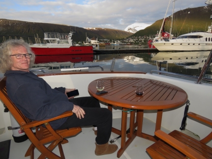
Enjoying a warm evening on the back deck.
|
 |
Evening Light
Position: 18°57.72’E,69°39.03’N
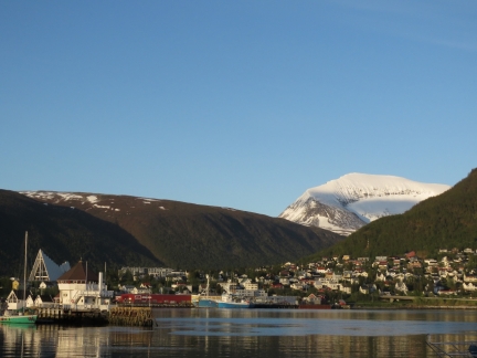
The view to Tromsdalstinden at 10:40pm. The sun doesn’t set in Tromsø between May 20th and July 22nd.
|

|
Click the travel log icon on the left to see these locations on a map, with the complete log of our cruise.
On the map page, clicking on a camera or text icon will display a picture and/or log entry for that location, and clicking on the smaller icons along the route will display latitude, longitude and other navigation data for that location. And a live map of our current route and most recent log entries always is available at mvdirona.com/maps. |

If your comment doesn't show up right away, send us email and we'll dredge it out of the spam filter.