The 20-mile (32km) Afsluitdijk dam, completed in 1932, protects the Netherlands coast from flooding and provides an important source of freshwater by transforming the saltwater bay Zuiderzee into a freshwater lake renamed IJsselmeer. The dam also provides an important road link between the provinces of Friesland, where Harlingen is, and North Holland. An easy bike ride from Harlingen along the Afsluitdijk brought us to Kornwerderzand, where there are sea locks, World War II fortifications and the Afsluitdijk Visitor Center.
Below are trip highlights from April 21st in Harlingen, NL. Click any image for a larger view, or click the position to view the location on a map. And a live map of our current route and most recent log entries always is available at mvdirona.com/maps
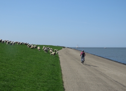 |
Afsluitdijk
Position: 5 23.43, 53 6.71
Jennifer cycling past sheep along the Afsluitdijk.
|
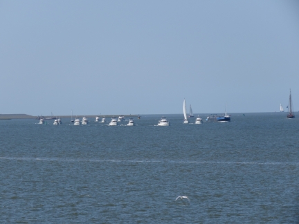 |
Convoy
Position: 5 22.87, 53 5.84
Our destination today is the Afsluitdijk visitor center and the sea lock at Kornwerderzand. This group of trawlers likely just passed through the sea lock together.
|
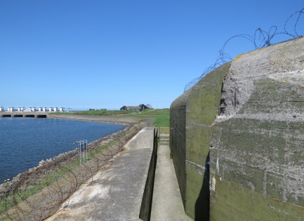 |
Fort Kornwerderzand
Position: 5 20.06, 53 4.28
Fort Kornwerderzand is famous for successfully holding off an attack during the 1940 German invasion of the Netherlands. The fort remained under Dutch control until the Netherlands surrendered to Germany.
|
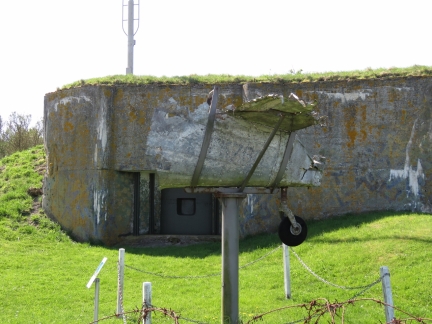 |
Lockheed Hudson FK790
Position: 5 20.16, 53 4.17
The tail of a Lockheed Hudson FK790 that was shot down over German-held Kornwerderzand while on a sabotage mission.
|
 |
Barge
Position: 5 20.16, 53 4.39
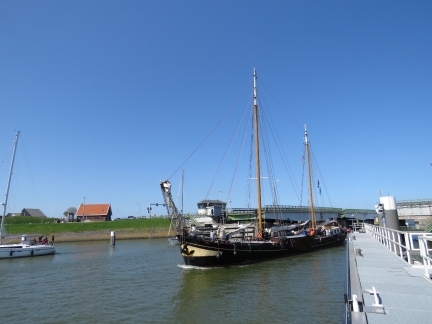
A Dutch sailing canal barge passing through the opened bridge along the Afsluitdijk en route to the sea lock.
|
 |
Kornwerderzand Lock
Position: 5 20.25, 53 4.19
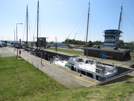
Looking southwest across the the two Kornwerderzand Lock basins as both fill with vessels ranging from large commercial barges to small recreational craft.
|
 |
Crowds
Position: 5 20.25, 53 4.19
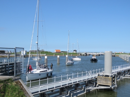
The Kornwerderzand Lock is busy and filled completely, with some boats having to wait for the next opening.
|
 |
Dike Construction
Position: 5 20.29, 53 4.21
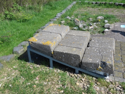
A display near the Kornwerderzand Lock showed the various materials and technology used to build the Afsluitdijk dam. These stones are cast with a slight incline and a lip to prevent waves from washing them away.
|
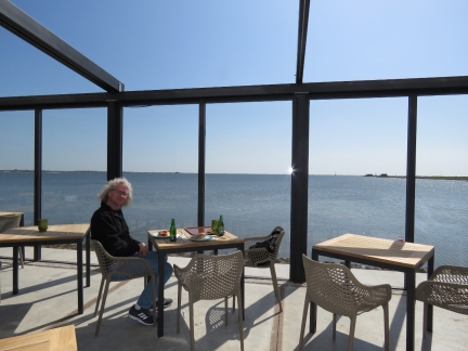 |
IJsselmeer
Position: 5 20.41, 53 4.41
A fabulous view over freshwater IJsselmeer at the Afsluitdijk visitor center cafe.
|
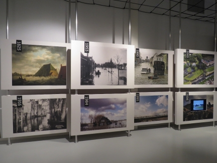 |
Visitor Center
Position: 5 20.40, 53 4.41
The Afsluitdijk Visitor Center details the past and future of the Afsluitdijk and the constant battle against flooding in the Netherlands.
|
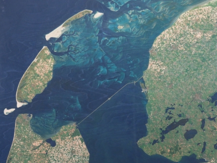 |
Afsluitdijk Overview
Position: 5 20.40, 53 4.41
This satellite shot at the Afsluitdijk Visitor Center shows the entirety of the Afsluitdijk (sea dam). We are at Kornwerderzand, visible just offshore from the northern end.
|
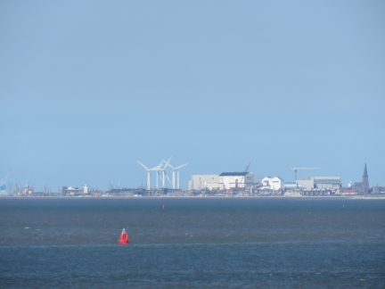 |
Harlingen
Position: 5 20.42, 53 4.42
The rooftop deck on the Afsluitdijk Visitor Center has sweeping views of the area. This is looking north to Harlingen. St. Michael’s Church, adjacent to our berth, is prominent at the right of the photo.
|
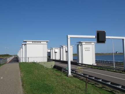 |
Lorenz Sluizen
Position: 5 19.58, 53 4.38
The Lorenz Sluizen are one of two sets of sluice gates that control the water levels inside the Afsluitdijk.
|
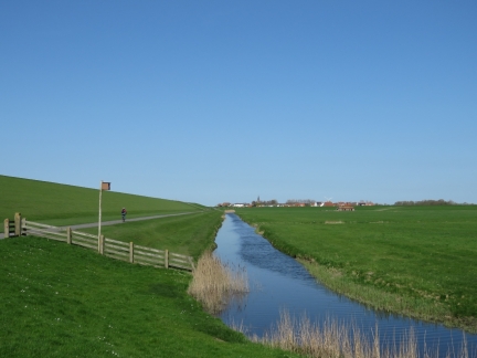 |
Canal
Position: 5 22.98, 53 6.52
We’d cycled out to Kornwerderzand along the outside of the dike and returned inside for a change of scenery. The small town in the distance is Zurich. We’d been seeing highway signs indicating we were near Zurich and were a little confused until we arrived in the town a few minutes later.
|

|
Click the travel log icon on the left to see these locations on a map, with the complete log of our cruise.
On the map page, clicking on a camera or text icon will display a picture and/or log entry for that location, and clicking on the smaller icons along the route will display latitude, longitude and other navigation data for that location. And a live map of our current route and most recent log entries always is available at mvdirona.com/maps. |

If your comment doesn't show up right away, send us email and we'll dredge it out of the spam filter.