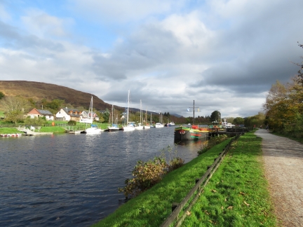
On our fifth day along the Caledonian Canal, we travelled 15 miles from Laggan through Loch Lochy, passing through two bridges and only one lock. We stopped for two nights at Banavie Top Basin above the famous Neptune’s Staircase and within two miles of the southern terminus of the canal. Banavie Basin is only four miles from Fort William, where we had overnighted earlier in the year on our West Highland Line train trip to Malaig. That sure seemed like a long time ago, but it was only three months past.
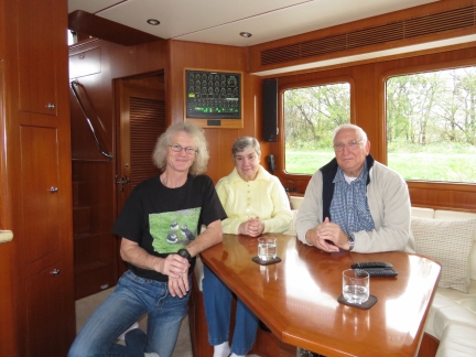
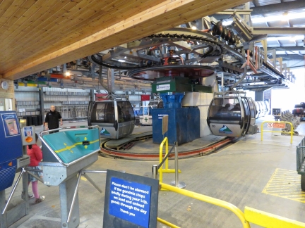
Fort William residents Sandra and Barry Kempster, who had been monitoring our progress since our North Atlantic crossing, were on hand to greet us when we arrived at Banavie and took us on a tour of the best view sites in the area. We had a wonderful afternoon, and particularly enjoyed the Nevis Range Mountain Gondola with its sweeping views.
Below are trip highlights from October 18th and 19th on the Caledonian Canal, Scotland. Click any image for a larger view, or click the position to view the location on a map. And a live map of our current route and most recent log entries always is available at http://mvdirona.com/maps
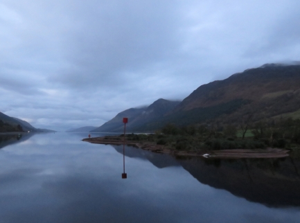 |
Loch Lochy
Position: -4 49.83, 57 1.11
Beautiful calm conditions looking ahead into Loch Lochy as we depart Laggan.
|
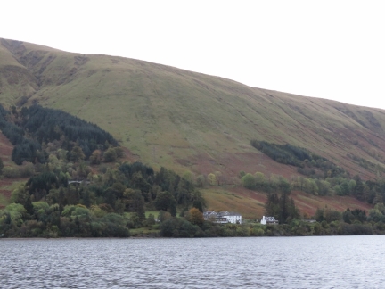 |
Letterfinlay Lodge
Position: -4 53.23, 56 58.97
The Letterfinaly Lodge on Loch Lochy, where we had lunch yesterday.
|
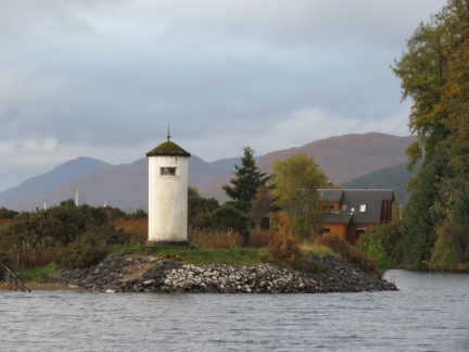 |
Gairlochy Light
Position: -4 59.26, 56 55.04
The Gairlochy Light at the south end of Loch Lochy, where we will return back into the Caledonian Canal proper until we exit at Fort William.
|
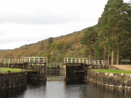 |
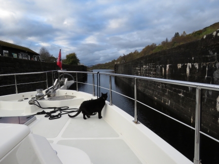
Gairlochy Lock
Position: -4 59.59, 56 54.87
We waited about 15 mintues for the Gairlochy Lock to open shortly before 9am.
|
 |
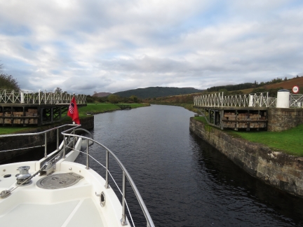
Gairlochy Bridge
Position: -4 59.84, 56 54.78
Spitfire checking clearances as we pass through the Gairlochy Bridge.
|
 |
Moy Bridge
Position: -5 1.15, 56 53.91
Passing through the Moy Bridge, our second and last bridge of the day. The bridges in this area aren’t as busy as at Fort William and Inverness, and don’t have restricted opening times.
|
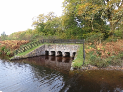 |
Aqueduct
Position: -5 3.68, 56 52.22
Aqueduct where Allt Sheangain joins the Caledonian Canal.
|
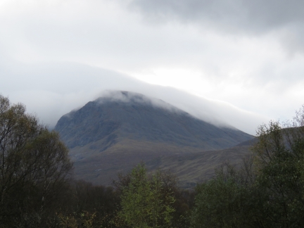 |
Ben Nevis
Position: -5 4.95, 56 51.12
Slightly cloud-shrouded Ben Nevis is the tallest mountain in the British Isles at 4,412ft (1,345m).
|
 |
Sandra & Barry Kempster
Position: -5 5.32, 56 50.95
Fort William residents Sandra and Barry Kempster have been monitoring our progress since our North Atlantic crossing, and were on hand to greet us when we arrived at the Banavie Top Basin to moor for a couple of nights. They also carried with them some parts and mail that they’d accepted on our behalf, and some treats for Spitfire.
|
 |
Banavie Top Basin
Position: -5 5.42, 56 50.89
Looking north across Banavie Top Basin, above the famous Neptune’s Staircase. Dirona is just visible on the right beyond the colorful barge.
|
 |
Mountain Gondola
Position: -4 59.93, 56 51.14
Sandra and Barry Kempster are season ticket holders for the Nevis Range Mountain Gondola and drove us there for a ride to the top.
|
 |
Gondola View
Position: -4 59.48, 56 50.86
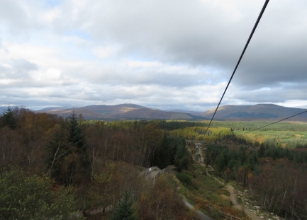
We’re only partway up and the views from the gondola are excellent.
|
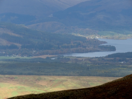 |
Gairlochy
Position: -4 58.44, 56 50.13
|
 |
Lochs
Position: -4 59.24, 56 49.98
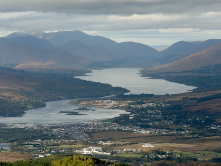
The view west from the Nevis Range to Loch Linnhe (foreground) and Loch Eil, with The Narrows running between them. The village of Corpach is at the head of Loch Linnhe on the right, where the Caledonian Canal exits to sea.
|
 |
Allt a Mhuillinn
Position: -4 59.24, 56 49.98
Allt a Mhuillinn running between 4,412ft (1,345m) Ben Nevis on the left and (1,220m) Carn Mor on the right. The bodies of water in the center distance are Loch Linnhe (left) and Loch Eil.
|
 |
View
Position: -4 59.32, 56 50.05
The fabulous view from the Nevis Range. The Caledonian Canal runs between Loch Linnhe on the left and Loch Lochy on the right. (Click picture for a better view).
|
 |
Deer
Position: -4 59.20, 56 49.97
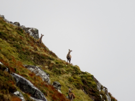
Cautious deer atop the Nevis Range.
|
 |
Commando Memorial
Position: -4 56.63, 56 53.87
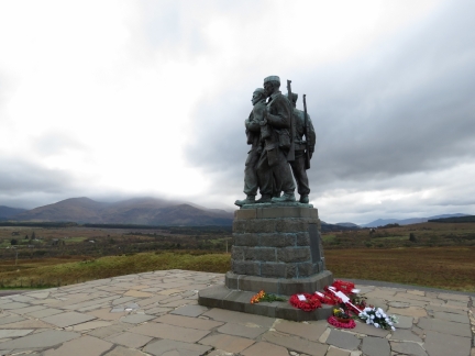
Sandra and Barry Kempster spoiled us silly and took us to another great viewpoint to the Nevis Range at the Commando Memorial. The memorial is dedicated to the British Special Forces members of World War II who trained nearby starting in 1942.
|
 |
Garden of Remembrance
Position: -4 56.64, 56 53.90
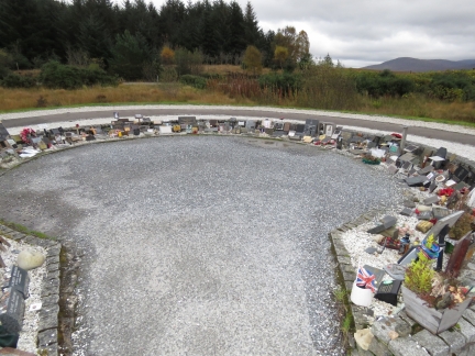
The Garden of Remembrance, adjacent to the Commando Memorial, contains tributes to those Commando members who died in more modern conflicts such as the Falklands War and Afghanistan.
|
 |
Blarmacfoldach Viewpoint
Position: -5 7.08, 56 48.09
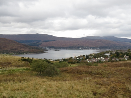
The view northwest to Loch Linnhe from the Blarmacfoldach Viewpoint
|
 |
Caledonian Canal
Position: -5 6.60, 56 48.77
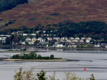
Sandra and Barry Kempster have a lovely home overlooking Loch Linnhe and the terminus of the Caledonian Canal. The white building in the center foreground is the Corpach Basin Sea Lock office. At the right of the picture is the distinct Hjalmar Bjorge, that we’d seen in Loch Maddy. (Click image for a larger view).
|
 |
Banavie Top Basin
Position: -5 5.32, 56 50.95
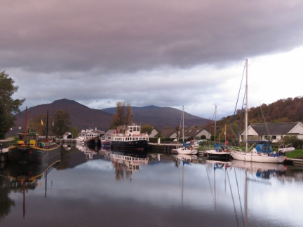
Morning calm at the Banavie Top Basin above Neptune’s Staircase on the Caledonian Canal.
|
 |
Plumbing Part
Position: -5 5.32, 56 50.95
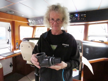
As part of the post mortem from Alarms at 1:15am, we decided we needed a reliable, high-capacity, automatic bilge pump added to our main bilge. We have a Jabsco 34600-0010, but it’s really just a bilge-drying pump, not offering the volume we want. Nor is it sufficiently reliable.
We had ordered all the parts we need to install this pump when we returned to Seattle earlier this year, but we ran into a rare ordering snafu from Amazon and the 2″ to 1 1/2″ plumbing bushing came in as 1″ to 1/2″. For the lack of a tiny part worth only $9.62, we weren’t able to take on the project of adding a high capacity bilge pump in the lower bilge. Barry and Sandra Kempster knew we would be cruising near where they lived in Fort William, Scotland and they offered to hold some packages for us. We ordered a bunch of things we needed. But, the most welcome of the group, was that last part needed for the bilge pump project. Here is the part we were missing, adapting a 1 1/2″ pipe nipple to a 2″ elbow. In the UK, British Standard Thread (BST) is the standard tapered pipe thread, whereas the parts we’re using are National Pipe Thread (NPT), the tapered pipe thread used in North America. NPT parts are available in the UK, but they are rare and poorly-stocked, so this one had to come from the US. Barry Kempster did the research to figure out this difference and help us avoid starting the job with an easy-to-get BST part that wouldn’t have fit properly. |
 |
Complete Unit
Position: -5 5.32, 56 50.95
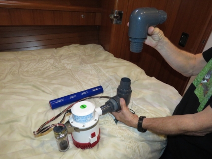
Now that we have all the parts, we’re finally ready to install the additional high capacity bilge pump. We have elected to install a Rule 3700 which has sufficient capacity to completely pump the water we had flowing into the boat in Alarms at 1:15am. We are taking a two-step defense, where we first prevent the inflow and then put enough pump capacity into the system that the inflow can be easily handled without the pump running anywhere close to 100% cycle.
This a simple design where the Rule 3700 will be mounted in the bilge aft of the engine, and the blue hose will connect the two large grey 90-degree fittings that mate up with a 2-inch hose for dumping overboard. What makes this installation challenging is the pump doesn’t fit. We’re preparing the design outside of the bilge but will have to assemble it like a ship-in-a-bottle in the main bilge. It’ll be tedious but the flow from this pump is so phenomenally different from the current Jabsco 34600-0010 that it’s worth the time. |
 |
Flir One Pro
Position: -5 5.32, 56 50.95
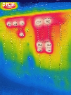
We picked up a Flir One Pro Thermal Camera from Amazon. It’s only USD$200 and operates as an extension to an Android phone (IOS also supported on similar hardware) with an on-phone application. This picture shows the AC electrical panel on Dirona. The bright orange sections are the 10 LED voltage and amperage displays. Above and to the left is the Furuno FA150 AIS glowing brightly (under the FLIR logo). There is electrical load on the system but no heat around any other breaker or transfer switch, so we can see the system is healthy and operating with low resistance.
We also took the obligatory pet picture and found that Spitfire is pretty well insulated except for heat leaks at the ears and face area. :) |
 |
Crannog
Position: -5 6.89, 56 49.01
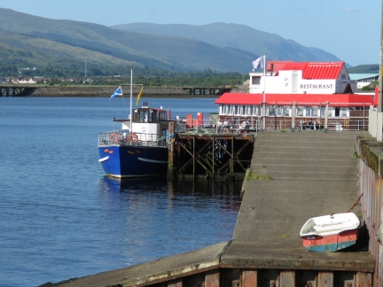
We had an excellent dinner at the Crannog Restaurant on the Fort William waterfront with Barry and Sandra Kempster.
|
 |
Click the travel log icon on the left to see these locations on a map, with the complete log of our cruise.
On the map page, clicking on a camera or text icon will display a picture and/or log entry for that location, and clicking on the smaller icons along the route will display latitude, longitude and other navigation data for that location. And a live map of our current route and most recent log entries always is available at http://mvdirona.com/maps. |

If your comment doesn't show up right away, send us email and we'll dredge it out of the spam filter.