The airport on Barra Island is reported to be the only one worldwide with scheduled beach landings. We anchored in aptly-named Castle Bay off 15-century Kisimul Castle for a few days and did a bicycle tour of the island, including taking in a beach landing.
Trip highlights from August 25th through 28th, 2017 on Barra Island in Scotland’s Outer Hebrides follow. Click any image for a larger view, or click the position to view the location on a map. And a live map of our current route and most recent log entries always is available at http://mvdirona.com/maps
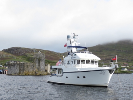 |
Castle Bay
Position: -7 29.26, 56 57.04
Anchored in Castle Bay, Barra Island off Kisimul Castle, the ancestral home of the MacNeils clan.
|
 |
Ashore
Position: -7 29.27, 56 57.23
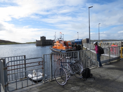
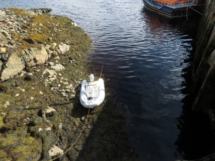
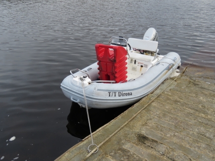
We ran the bikes ashore to tour Barra Island and moored the tender off the RNLI lifeboat Edna Windsor.
|
 |
Ferry Dock
Position: -7 29.31, 56 57.31
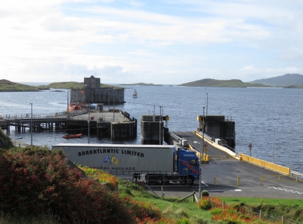
Looking down to the ferry dock from the village of Castlebay.
|
 |
Pier Road
Position: -7 29.17, 56 57.31
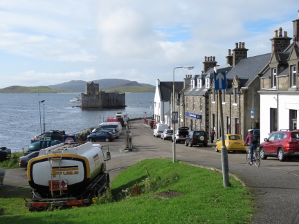
Jennifer riding down Pier Road with Dirona and Kisimul Castle in the background. We noticed a convenient fuel station on the left, and planned to return later to buy some gasoline for the tender.
|
 |
Haliman Bay
Position: -7 31.09, 56 58.57
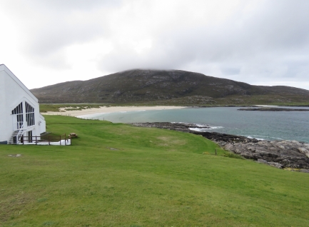
Looking to Haliman Bay from the Isle Of Barra Beach Hotel. The Shah of Iran’s children, whose nurse was from Barra Island, hid at the hotel when the Iranian Revolution began.
|
 |
Bench
Position: -7 30.60, 56 59.37
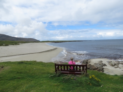
Jennifer taking in the view from a bench perched above the sand. The slope of 1,092ft (333m) Ben Tangaval is visible in the distance on the left.
|
 |
Greian Head
Position: -7 30.12, 57 0.08
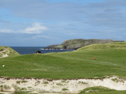
Cows grazing with sand dunes in the foreground and Greian Head in the distance. Somehow cows and sand dunes seem like an odd combination.
|
 |
Graveyard
Position: -7 30.12, 57 0.08
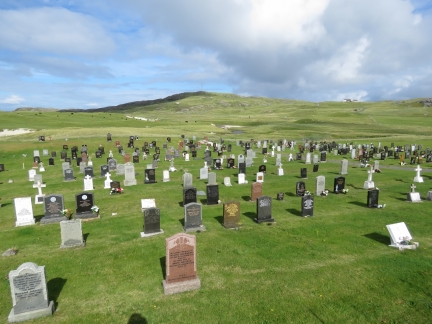
This large graveyard off the single-lane road was right below a corner that was blind in both directions, yet marked with a “passing section” sign. We wondered if the two were related.
|
 |
Barra Airport
Position: -7 26.87, 57 1.29
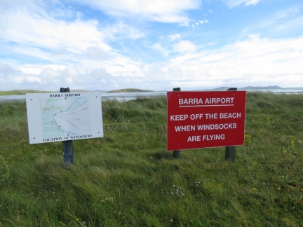
At the Barra Airport at the northeast corner of the island, reported to be the only airport in the world with scheduled beach landings. The sign on the left shows the various runways and the sign on the right prohibits beach access when wind socks have been installed. We’d arrived 30 minutes before the first landing, and the wind sock were already out and flying.
|
 |
Tractor
Position: -7 26.85, 57 1.28
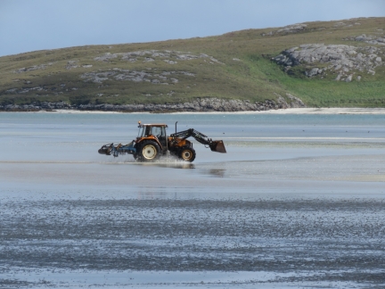
Two flights were scheduled for today, just before and after low tide. About ten minutes before the plane landed, a worker drove a tractor out across the airstrip and got out several times to remove any potentially damaging debris from the landing area.
|
 |
Beach Landing
Position: -7 26.85, 57 1.28
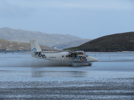
The beach landing was exciting to watch. The plane slowly dropped toward the sand with the wheels disappearing in the spray as it landed.
|
 |
At the Terminal
Position: -7 27.00, 57 1.49
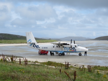
The arriving flight at the terminal. There actually is a proper terminal to the left, but passengers have to walk across the beach between the plane and the building.
|
 |
Baggage Handling Facility
Position: -7 26.98, 57 1.52
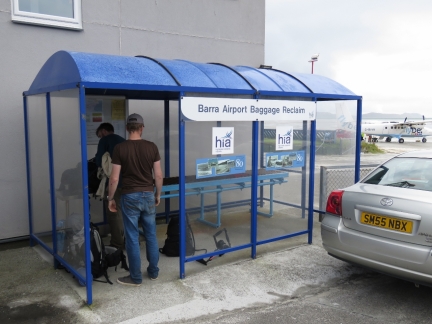
The baggage handling facility at Barra Airport is a simple one: bags come off the plane and are placed at the right end of the 12-in “baggage conveyer” and passagers wait in the bus shelter at the left end of the conveyer.
|
 |
Fish Boats
Position: -7 25.58, 57 0.06
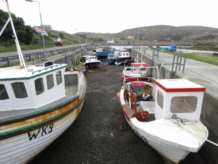
Fish boats in the drying harbor off North Bay at low tide.
|
 |
Heathbank
Position: -7 25.21, 56 59.87
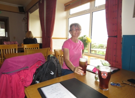
We had an excellent lunch overlooking the water with pints of McEwans Scottish Ale at the Heathbank Hotel.
|
 |
Telephone Booth
Position: -7 24.69, 56 59.20
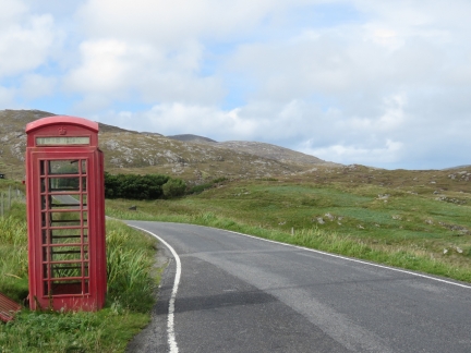
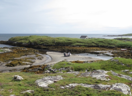
Red telephone booths out in the middle of nowhere are a common sight as we cycle around the countryside.
|
 |
Ocean Spray
Position: -7 25.24, 56 58.60
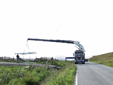
The fishing vessel Ocean Spray perched on drying sands off Earsary.
|
 |
Crane
Position: -7 27.75, 56 57.60
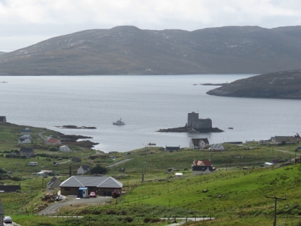
We were impressed with the reach of the crane on this truck. The cab was pretty nice too.
|
 |
Castle Bay from North
Position: -7 27.98, 56 57.58
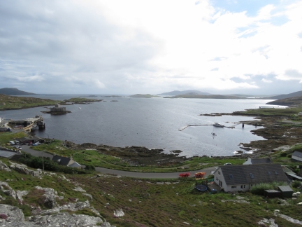
The view to Castle Bay from the road above town, with Dirona visible to the left of Kisimul Castle, .
|
 |
Castle Bay from West
Position: -7 29.46, 56 57.40
We climbed the rocks west of town and got some great views back across Castle Bay.
|
 |
Low Tide
Position: -7 29.27, 56 57.23
It will be a while yet before we can get back to Dirona. :)
|
 |
Craigard Hotel
Position: -7 29.07, 56 57.29
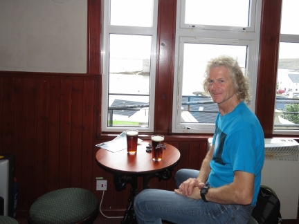
We stopped in for a pint and the view at the Craigard Hotel. Dirona is just visible through the window beyond the table.
|
 |
Isle of Lewis
Position: -7 29.31, 56 57.27
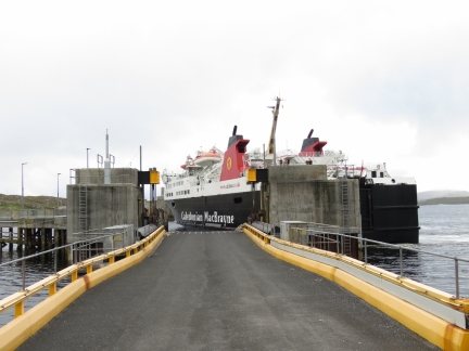
We stopped off to watch the ferry Isle of Lewis arrive. There isn’t much room to turn, so the captain brings the ferry towards the far end of the dock near the castle, then swings the stern to port to bring it onto the dock and even with the loading ramp.
|
 |
Refueling
Position: -7 29.20, 56 57.24
We ran one of our 29-gallon boat deck gasoline tanks over to the local fueling station to top off our gasoline. We’ve not been using the dinghy much recently—our last gasoline purchase was in Daytona Beach in February.
|
 |
Kisimul Castle
Position: -7 29.18, 56 57.17
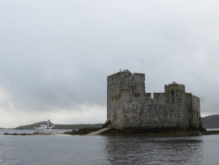
One final view to Kisimul Castle before we return to Dirona.
|
 |
Isle of Lewis
Position: -7 29.27, 56 57.04
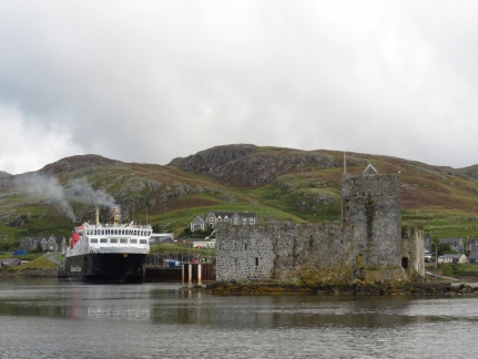
Smoke pouring from the stacks as the ferry Isle of Lewis prepares to get underway from Castle Bay with Kisimul Castle in the foreground.
|
 |
Water Leak
Position: -7 29.27, 56 57.05
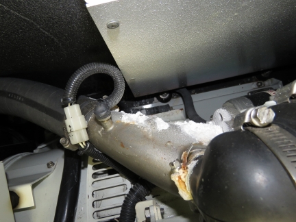
We noticed a water leak at the generator muffler where water had been running down the exhaust hose and and traced it back to the exhaust mixing elbow. This is looking down at the elbow between the generator and the starboard fuel tank.
|
 |
Exhaust Elbow
Position: -7 29.26, 56 57.06
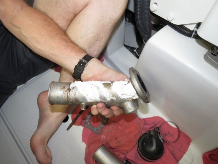
The exhaust mixing elbow has numerous leaks due to apparent porosity in the stainless steel. We replaced it with a spare and cleaned up the mess.
|
 |
Ground
Position: -7 29.26, 56 57.06
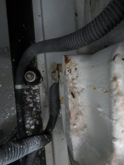
The generator ground is below the elbow and was showing sings of corrosion. We’ve been seeing some unreliable temperature readings recently and this was the source of the problem. We removed the ground, wire brushed it shiny, and reinstalled it. The temperature now is reading correctly.
|
 |
Edna Windsor
Position: -7 29.24, 56 57.06
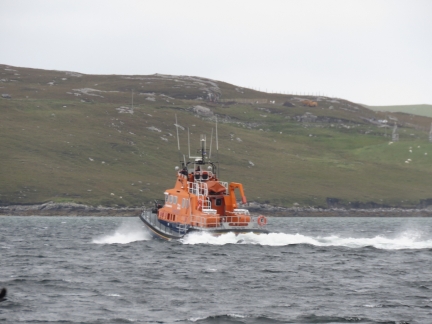
The RNLI lifeboat Edna Windsor heading out of Castle Bay on a training exercise.
|
 |
Wind
Position: -7 29.21, 56 57.05
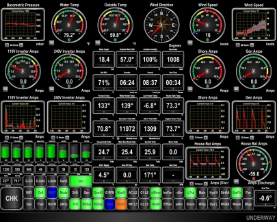
A low-pressure system is passing through and the winds have steadily picked up over the past 24 hours to steady 25 knots with gusts to near 40.
|
 |
Isle of Lewis
Position: -7 29.21, 56 57.05
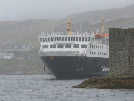
The ferry Isle of Lewis departing Castle Bay in high winds with the starboard-side anchor lowered and ready to deploy in an emergency. It has to maneuver awfully close to Kisimul Castle.
|

|
Click the travel log icon on the left to see these locations on a map, with the complete log of our cruise.
On the map page, clicking on a camera or text icon will display a picture and/or log entry for that location, and clicking on the smaller icons along the route will display latitude, longitude and other navigation data for that location. And a live map of our current route and most recent log entries always is available at http://mvdirona.com/maps. |

Hi ,I was on Barra when you were anchored near the castle, I remember thinking ” I hope he’s got a good hold with his anchor” , as it was certainly blowing that day. I’ve got some photos I took with my phone must look them out. Wish I’d been able to say hello.Hope you enjoyed your stay on Barra,where I was born.
We had a great stay on Bara Island. The anchorage beside Kisimul Castle was one of our favorites. As you said, we did see quite a bit of wind. At one anchorage in the Outer Hebrides we saw 62 kts while at anchor.
If you do find your pictures, we would love to see them.
Do you use a fuel stabilizer in your 29 gallon tanks?
Yes, we always stabilize all gasoline on board. It might get used quickly but more often than not, it’ll be around for 6 months so we just stabilize all gas as we bring it on board.