The Isle of Mull gave us our first taste of the dramatic Scottish coastal scenery we’d been hearing so much about. In just one morning we saw spectacular waterfalls, a striking sea arch and imposing cliffs.
After exiting the Crinan Canal, we sped north in the high-current Sound of Jura and anchored at Loch Spelve on the Isle of Mull for two nights while a weather system passed through. Then we took in the impressive scenery along the south coast of Mull en route to the Sound of Iona.
Trip highlights from Aug 18th through 20th, 2017 follow. Click any image for a larger view, or click the position to view the location on a map. And a live map of our current route and most recent log entries always is available at http://mvdirona.com/maps
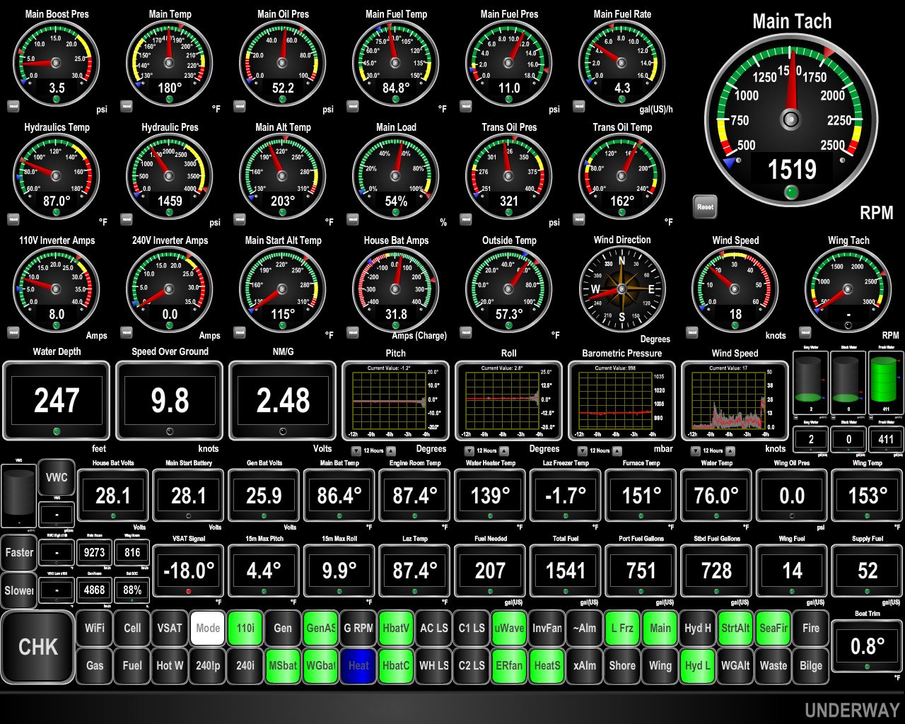 |
9.8 knots
Position: -5 39.61, 56 7.41
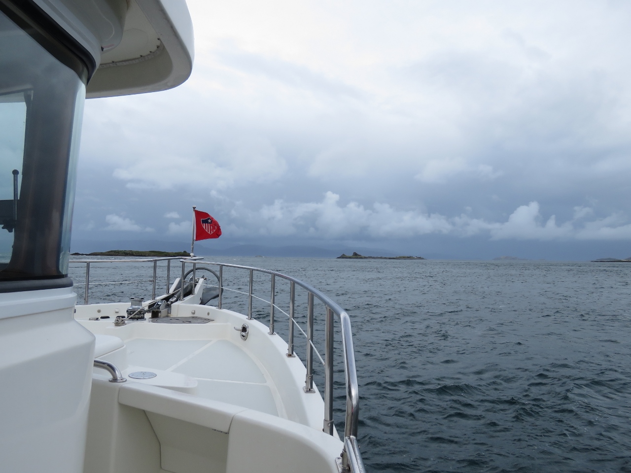
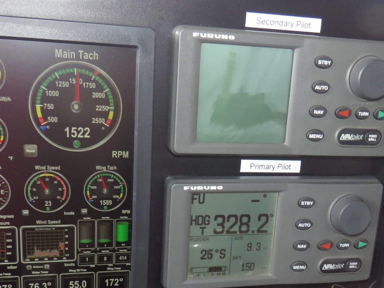
Currents run swiftly in the Sound of Jura. We’re doing 9.8 knots at 1,500 RPM when normally we’d be doing about 7.5 kts at that RPM and the current isn’t running very strongly right now. We’re close to the famed Gulf of Corryvreckan, between Jura and Scarba Islands, where 8.5-knot spring currents generate dangerous whirlpools and overfalls. When a west-bound current meets and opposing large Atlantic swell, conditions make the passage nearly impassable.
Slack water at the gulf was early this morning, before the locks begin operation, or mid-afternoon, later than we’d prefer to pass through. So we’ll continue north through the Sound of Luing to reach the Firth of Lorn. In larger tides, the Gulf of Corryvreckan is a tourist attraction. Hopefully we’ll have a chance to see it in full force later in October after we pass south through the Caledonian Canal. |
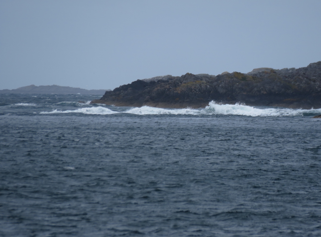 |
Standing Waves
Position: -5 40.11, 56 11.85
Current-formed standing waves in the narrow passage between Lunga and Scarba Islands. Our charts are full of warnings about strong tidal currents in the area. We’re riding the last half of a neap flood tide north, and still currents are extremely strong. It must be pretty exciting here during a large spring tide.
|
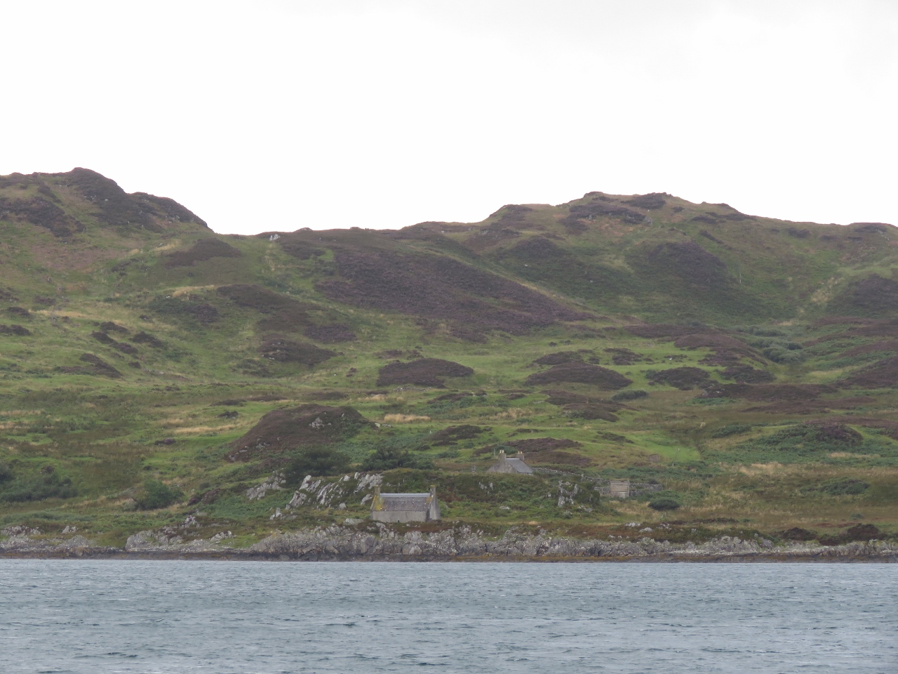 |
Lunga Island
Position: -5 40.60, 56 13.09
Houses at the base of green hills looking east to Lunga Island.
|
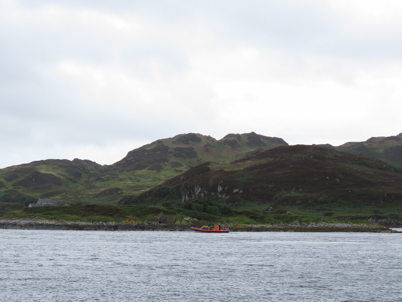 |
Eilean Nan Ceann
Position: -5 40.92, 56 13.44
High speed RIB with a load of tourists on board off Eilean Nan Ceann (eilean means island in Gaelic). The boat was playing in the current between Lunga and Scarba Islands earlier.
|
 |
Upwelling
Position: -5 41.26, 56 13.54
The current through the gap between Lunga and Scarba Islands is strong enough to produce upwellings well to the northeast.
|
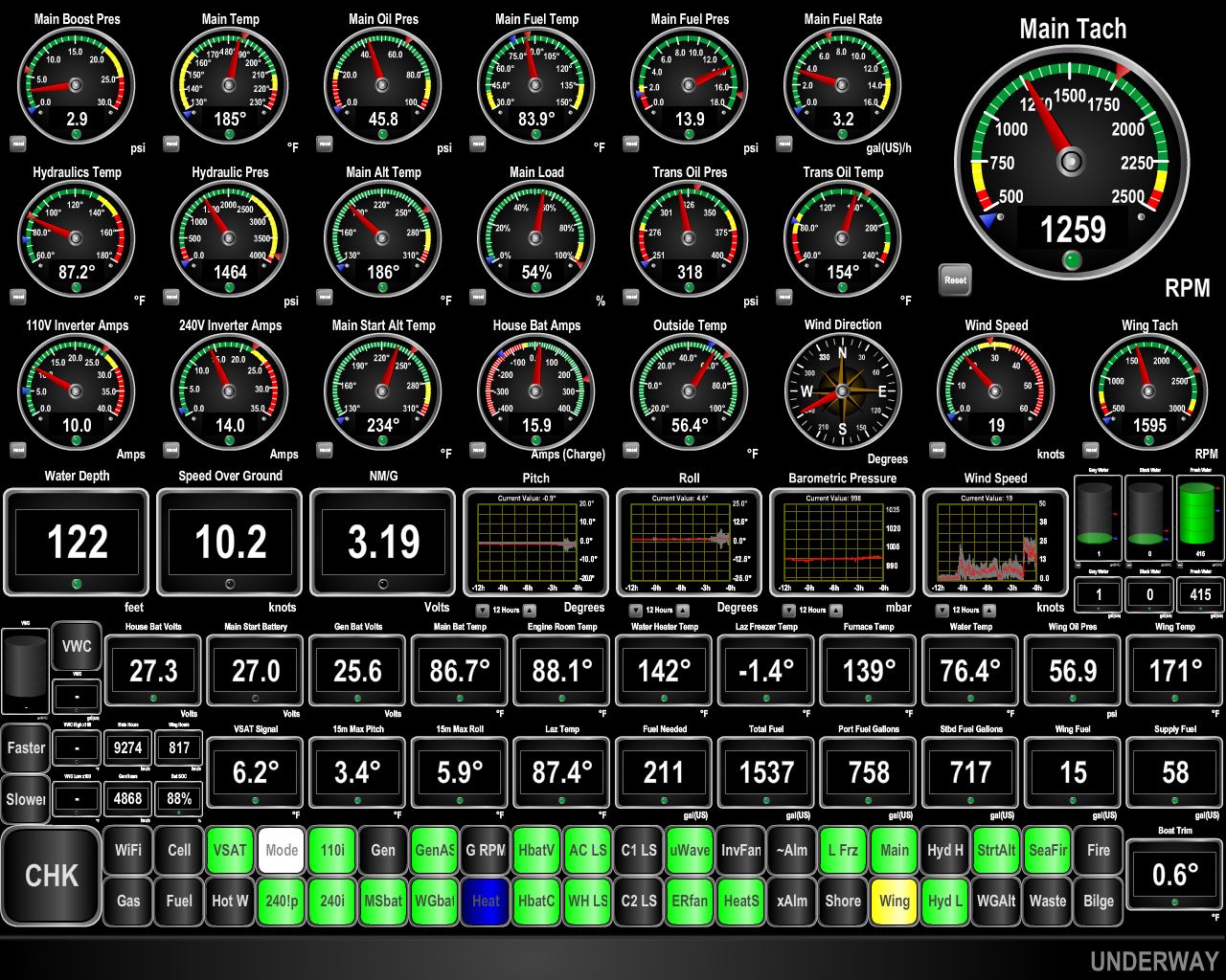 |
10.2 knots
Position: -5 41.29, 56 13.98
We’re two hours before the end of a neap flood and still are doing 10.2 knots as we near the north end of Lunga Island. At 1259 RPM, we’d typically be doing 6.25 knots.
|
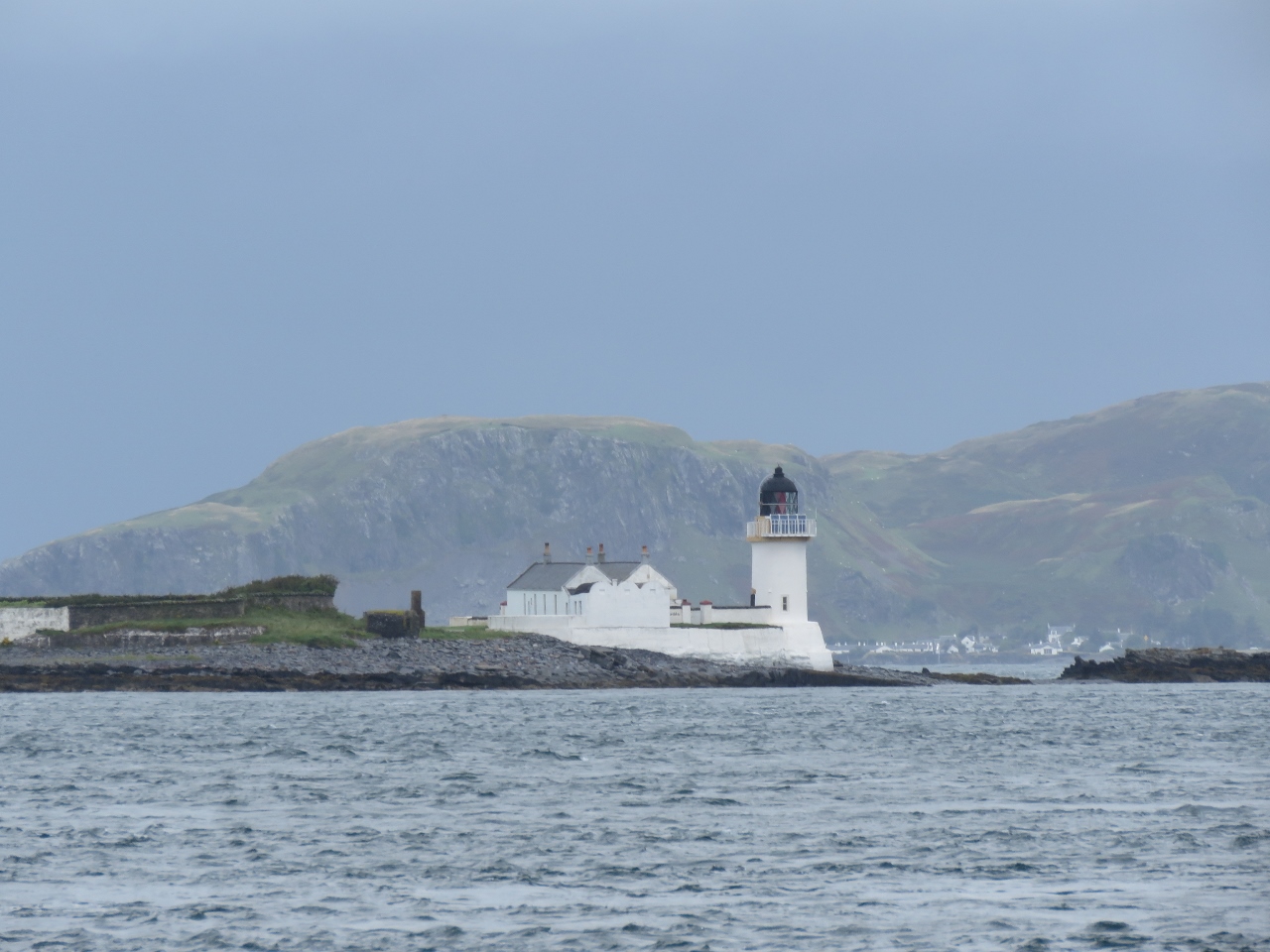 |
Fladda Lighthouse
Position: -5 41.29, 56 14.14
The lighthouse on Fladda Island was built in 1860. The island originally had no grass or soil—the lighthouse keepers grew a garden using peat brought from Ireland.
|
 |
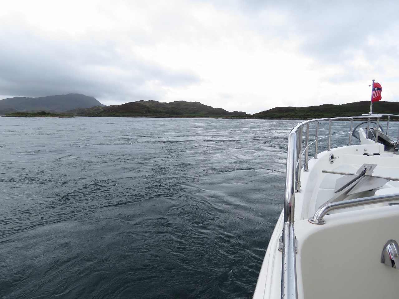
Firth of Loin
Position: -5 41.29, 56 14.14
Looking north to the Firth of Loin as we exit the Sound of Luing. The current was running swiftly here, but with mostly laminar flow and no whirlpools or upwellings.
|
 |
Balnahua Island
Position: -5 41.51, 56 14.62
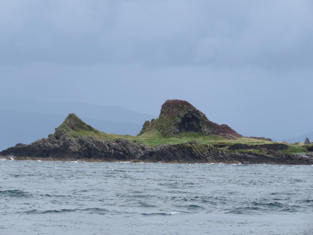
Looking north to dramatic formations on the west end of Balnahua Island as we exit the Sound of Luing.
|
 |
25 degrees
Position: -5 41.69, 56 14.90
We started to see upwelling and whirlpools just west of Balnahua Island. They weren’t difficult to navigate through, but James did have to apply a fair bit of rudder on occasion. Here we’re got 25 degrees of starboard turn in.
|
 |
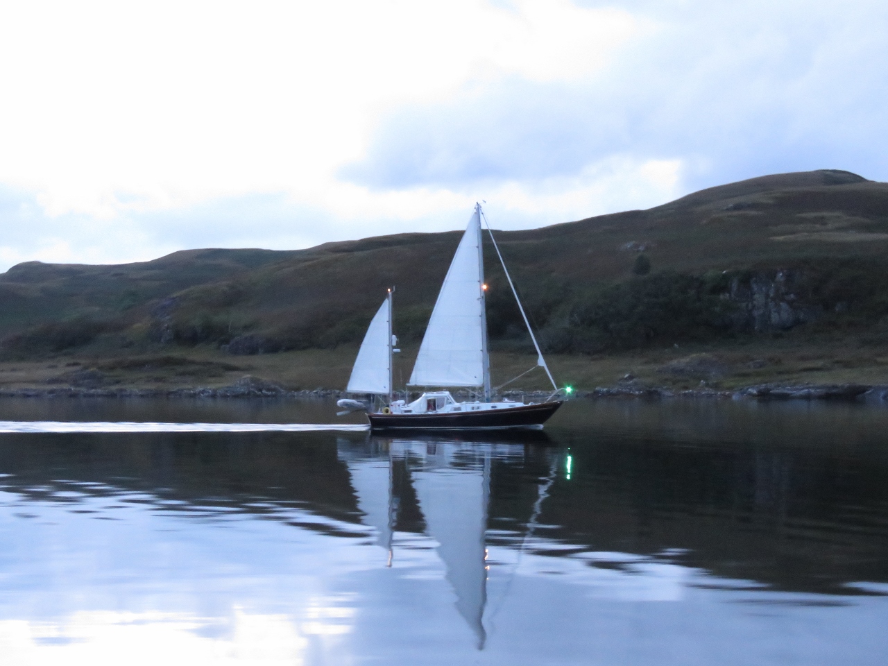
Sarina
Position: -5 41.66, 56 18.41
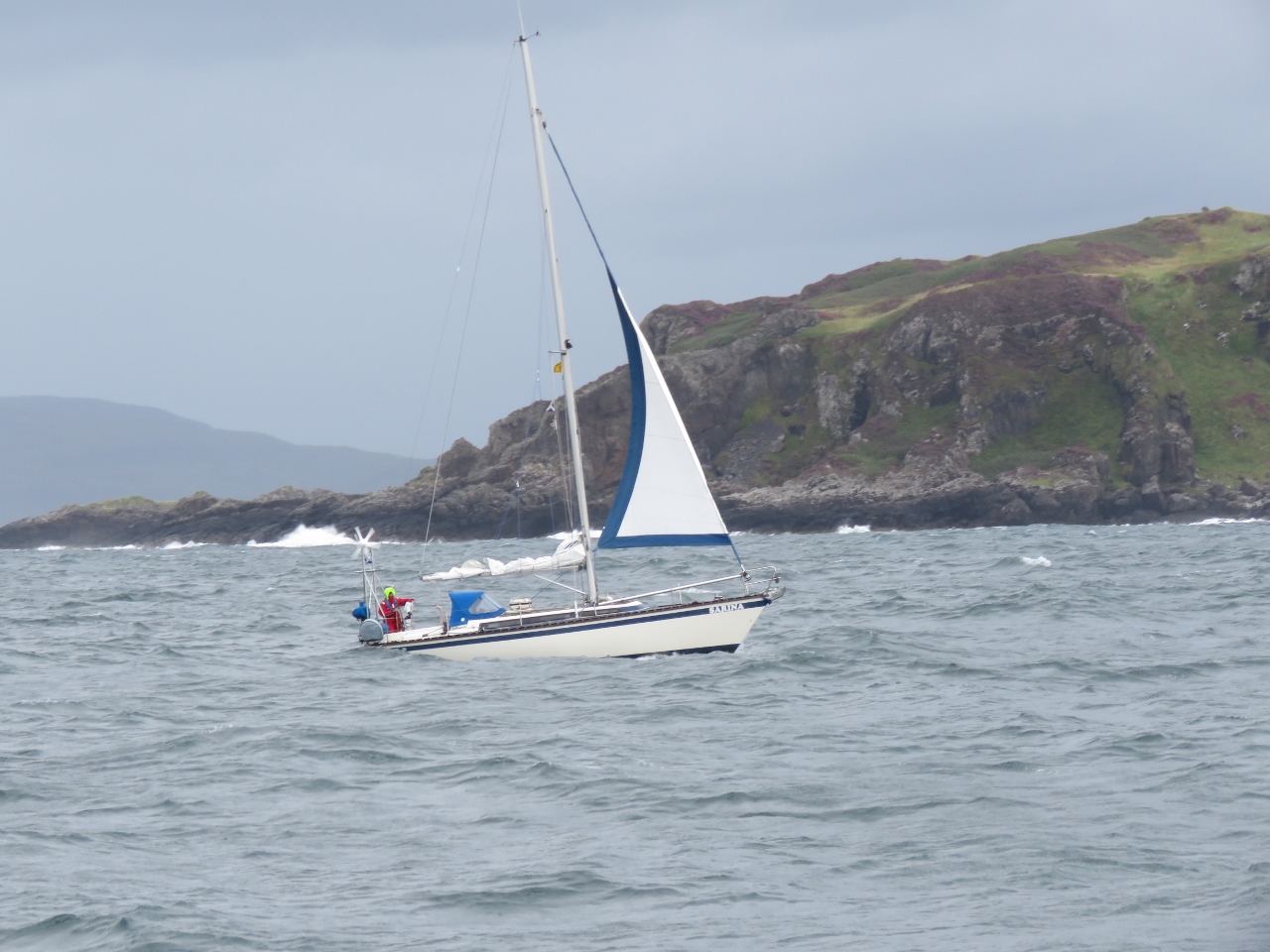
Sailing vessel Sarina heading south off Insh Island with minimal sail. The winds are picking up now for a storm we expect will last a couple of days.
|
 |
Loch Spelve
Position: -5 42.76, 56 23.16
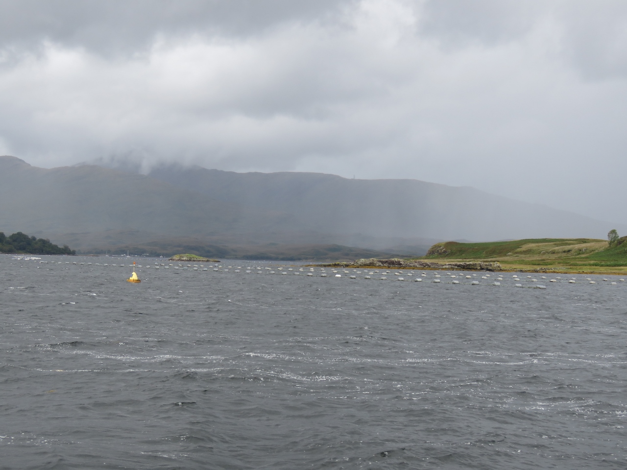
Aquaculture at the entrance to Loch Spelve. Our cruising guide described the entry as a little difficult, with shallows on each side, and 3.5-4 kt currents on spring tides. We’d arrived about three hours before high water slack and were expecting to encounter some current in the entrance. But the entry was straightforward with no obvious current on this neap exchange.
|
 |
Bilge Pump
Position: -5 45.08, 56 23.10
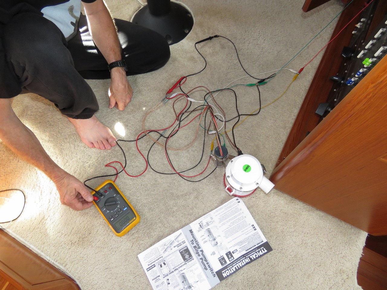
James completed the physical design and layout on the new primary bilge pump system. We have all the parts we need except a 2″ male to 1.5″ female PVC bushing. (We’d ordered the correct parts and picked them up in Seattle, but were sent .5″ parts instead of 1.5″).
|
 |
Winds
Position: -5 45.09, 56 23.06
One of the reasons we stopped at Loch Spelve is we’re expecting strong winds from the southwest through northwest and it’s one of the few anchorages in the area with protection from all those directions. We tucked away against the west shore with plenty of rode out and enjoyed the storm as the winds came up.
|
 |
USB Hubs
Position: -5 45.08, 56 23.08
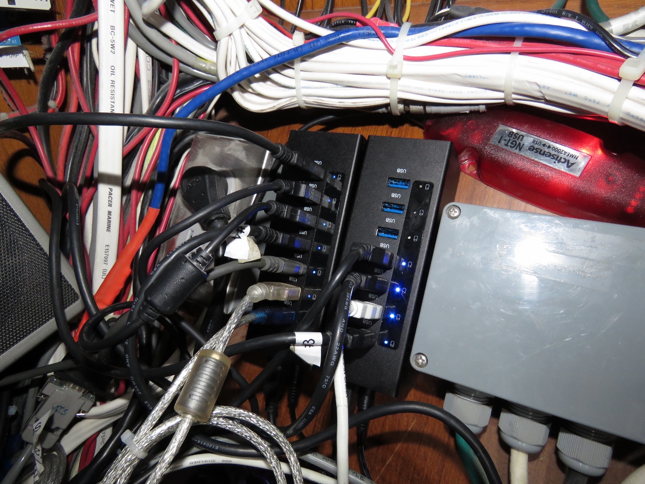
Over the last few months, we have seen several instances of the nav computer locking up and have fixed several known hardware issues. Our nav computer is redundant and all navigation data is available on the Furuno MFD black-box, and we have a complete set of spares for all hardware components. But many of the control systems on Dirona, including the critical generator auto-start, are hosted only on the nav computer, so we really don’t want it down. We’re still seeing roughly weekly lockup issues, but the automatic reboot support we implemented in Newport RI mitigates the problem. However, we’d like to see it running without issue for many weeks at a time.
We drive a lot of connections through the computer via USB and one final possible hardware issue is the USB hubs. In Loch Spelve we upgraded the existing 14-port USB hub to two 7-port hubs we brought back from Seattle.The new hubs are all Gen 3 ports supporting Multiple Transaction Translators (MTT). Unlike the previous hub, these support all devices and none need to be directly connected to the nav computer. |
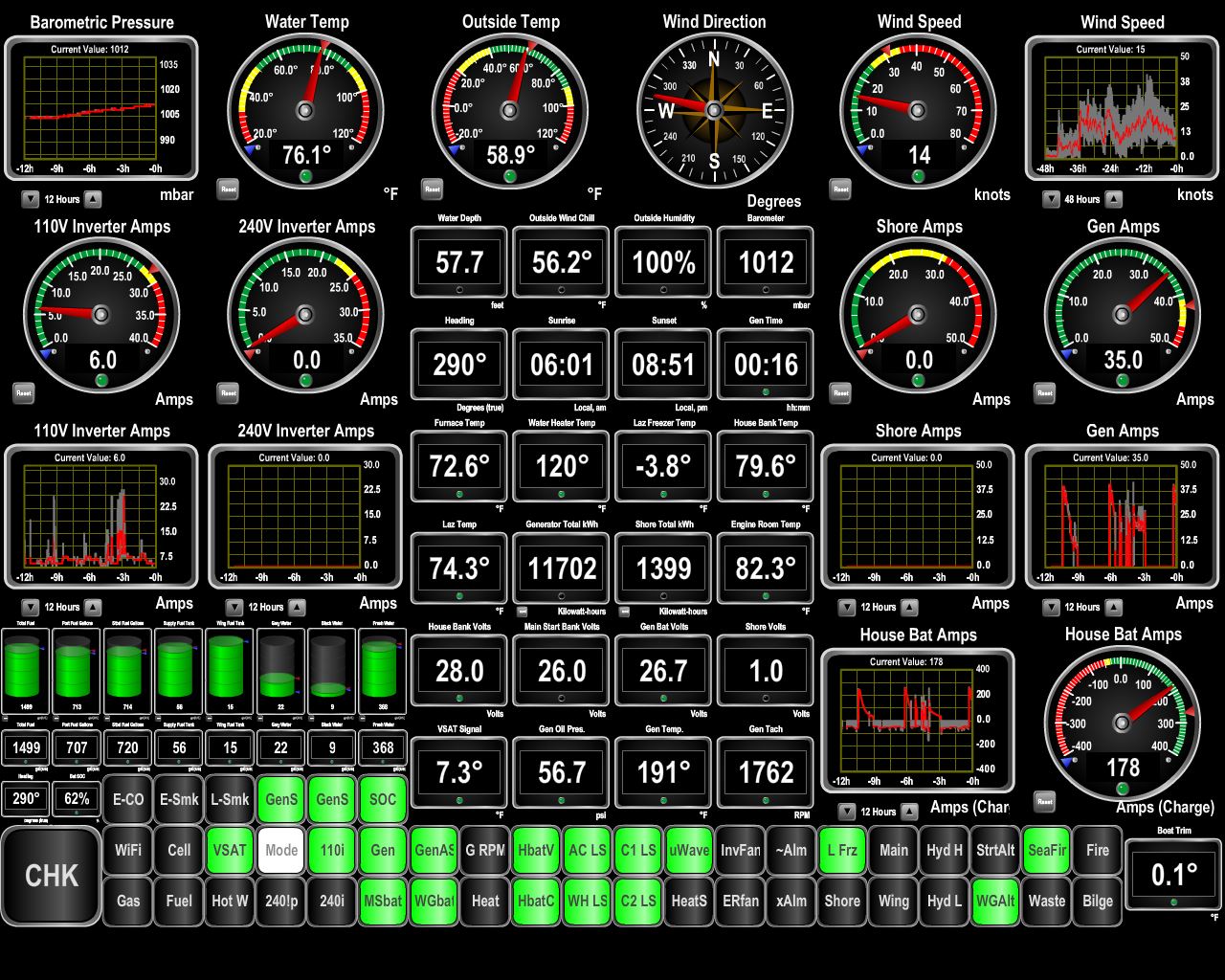 |
Wind
Position: -5 45.08, 56 23.08
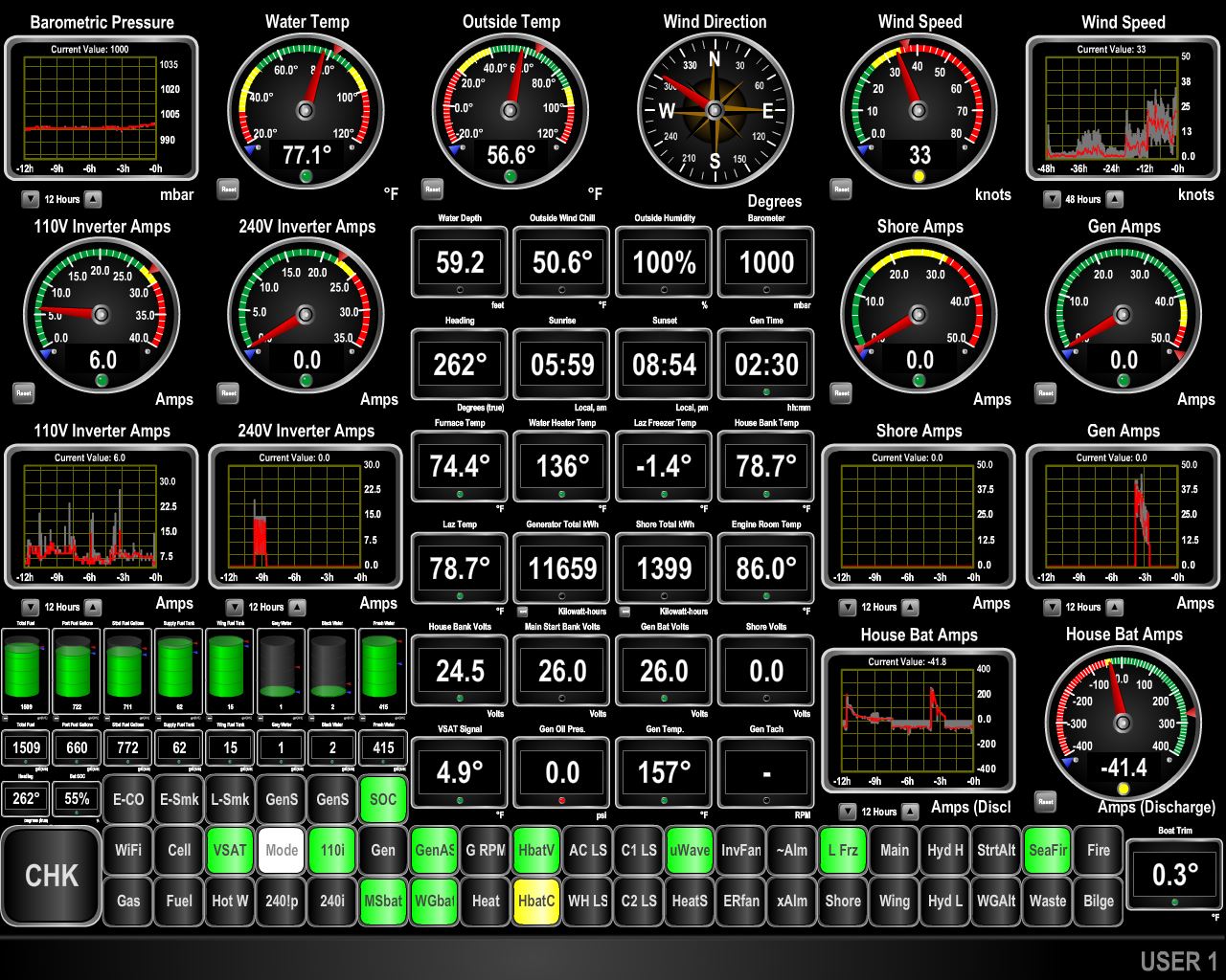
As expected, the winds came up and have been gusting into the 40s for the past day. We expect calmer conditions tomorrow.
|
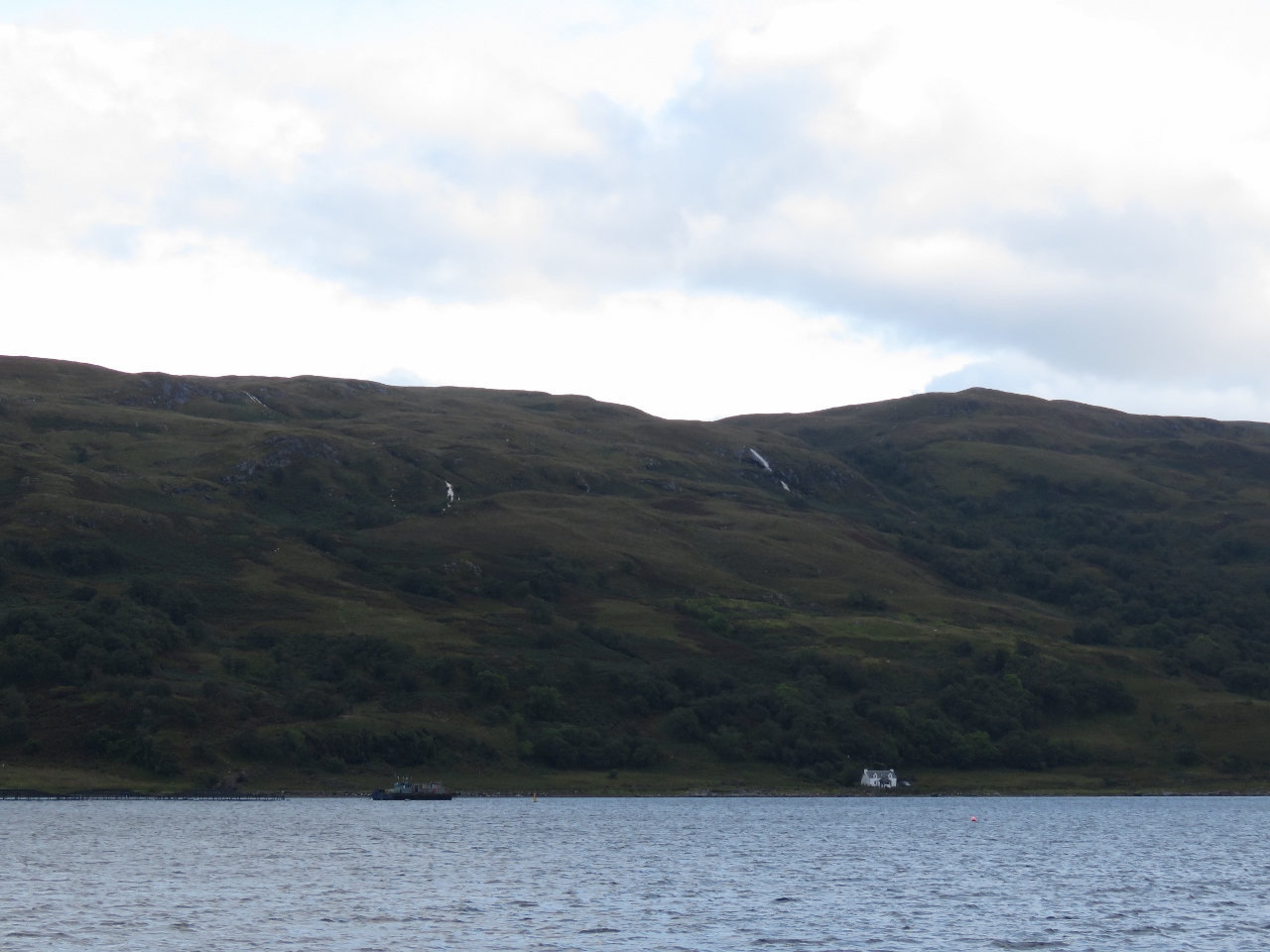 |
Waterfalls
Position: -5 45.08, 56 23.07
After a day of storms and rain, waterfalls are flowing across Loch Spelve from our anchorage.
|
 |
Exiting
Position: -5 42.39, 56 23.16
Conditions have settled down and we exited Loch Spelve near high-water slack. We weren’t the only boat with that idea.
|
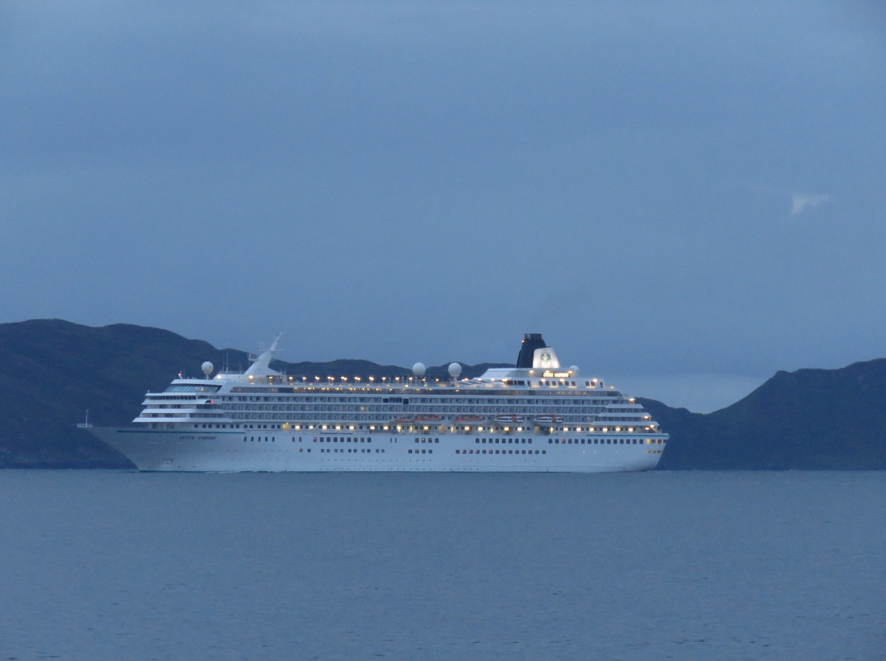 |
Crystal Symphony
Position: -5 41.09, 56 22.19
The cruise ship Crystal Symphony heading north in the Firth of Loin.
|
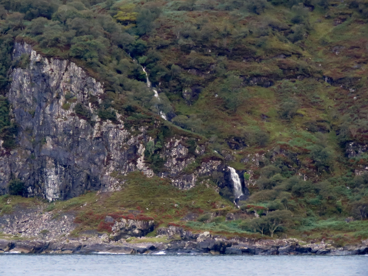 |
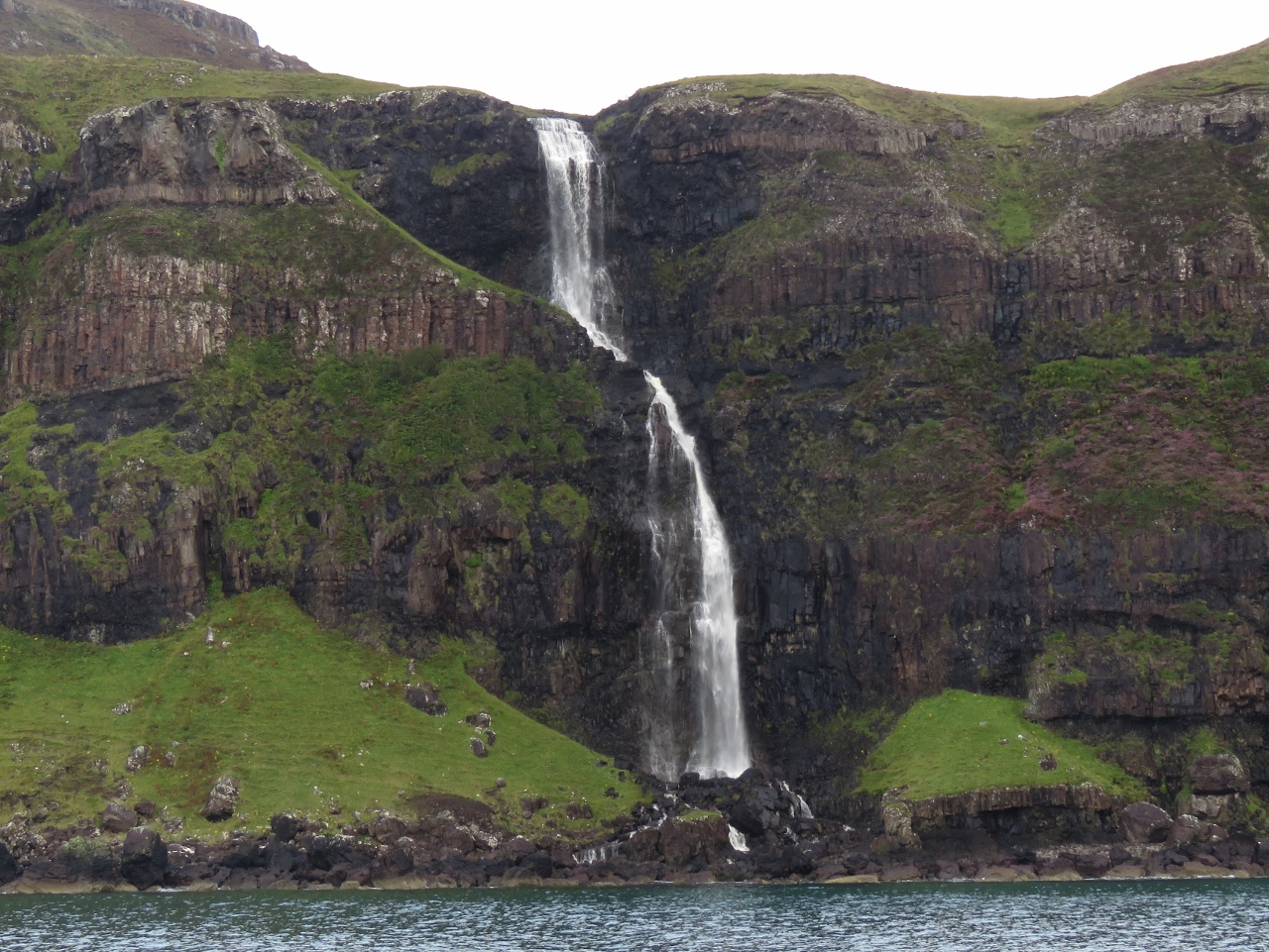
Waterfall I
Position: -5 42.95, 56 21.02
The reward for the past few days of rain is spectacular waterfalls along the south of coast of Mull.
|
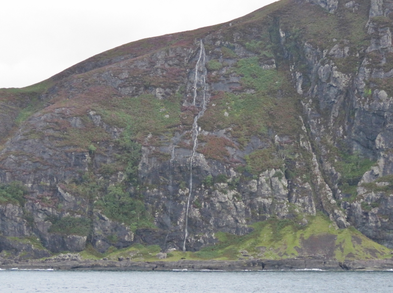 |
Waterfall II
Position: -5 45.67, 56 19.72
Another dramatic Isle of Mull waterfall.
|
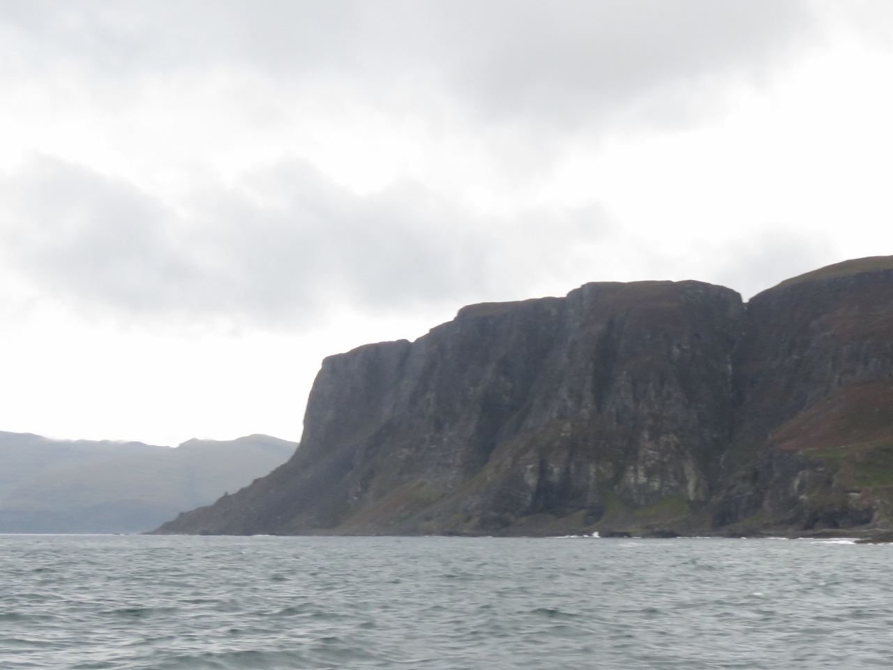 |
Rubha na Faoilinn
Position: -5 50.26, 56 18.25
The bold headland of Rubha na Faoilinn just south of Loch Buie.
|
 |
Waterfall III
Position: -5 59.69, 56 18.53
Another impressive waterfall, this one just south of Carsaig Bay.
|
 |
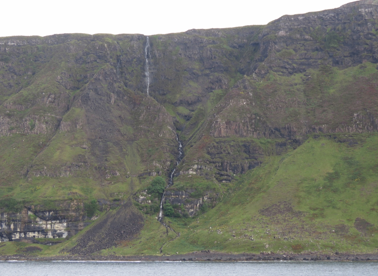
Waterfall IV
Position: -6 0.50, 56 18.32
A three-level waterfall, also just south of Carsaig Bay.
|
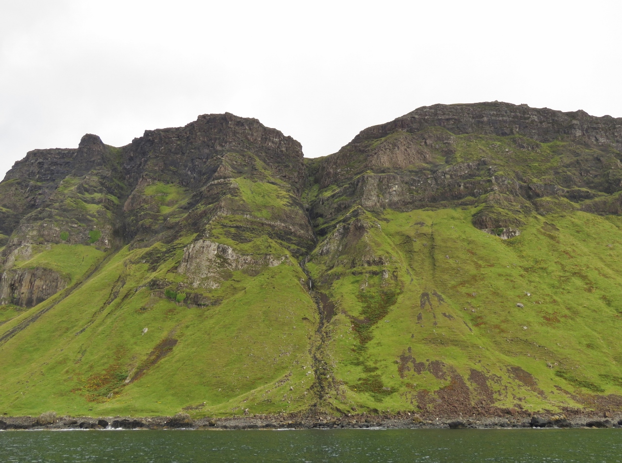 |
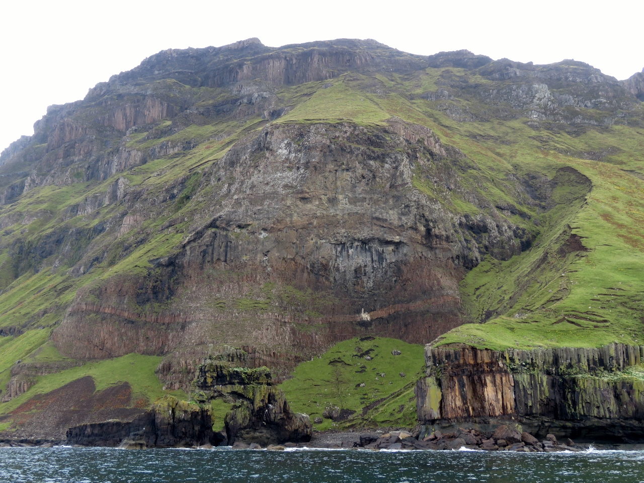
Cliffs
Position: -6 1.70, 56 17.79
The shore between Carsaig Bay and Malcolm’s Point along the south coast of Mull is particularly striking, with soaring cliffs atop steep grass-covered slopes. We didn’t think anything could rival the spectacular scenery along Ireland’s west coast, but Scotland is really impressing us.
|
 |
Carsaig Arches
Position: -6 3.23, 56 17.46
The Carsaig Arches in front of 220m cliffs at Malcolm’s Point. A somewhat oval-shaped arch is just above the waterline in the rock left of center, with green grass visible through it. A spire stands slightly to the left atop the arch roof.
|
|
|
Best Waterfall
Position: -6 4.63, 56 17.96
This waterfall just west of the Carsaig Arches was the most beautiful of the day. We were tempted to anchor there for breakfast.
|

|
Click the travel log icon on the left to see these locations on a map, with the complete log of our cruise.
On the map page, clicking on a camera or text icon will display a picture and/or log entry for that location, and clicking on the smaller icons along the route will display latitude, longitude and other navigation data for that location. And a live map of our current route and most recent log entries always is available at http://mvdirona.com/maps. |
10.13.2017
Is a voice recorder used to narrate what the camera see’s as you tour each area?? Photo recollection is exquisite! Well done. The weather/
water worn cliffs are transformed into an interesting art formation!
Yes, we agree. The natural beauty of Ireland and Scotland is truly impressive. We really have been enjoying this area.
You were asking about the voice narration on the videos. We add it later once we chose what we are going to put into the video.
10.14.2017
Hi!
It’s just amazing that you can remember which locations & descriptions of each photo shoot taken there are so many! What’s your secret?
Here’s a suggestion on a software solution to track pictures and location that Paul made in the general comments section: If you want to create trip tracks like James & Jennifer with GPS data logging. I use an app on my phone called Geotag Photos which is available on Android. It’s a user friendly solution which works very well for cameras that don’t have GPS technology built in. It records your trip as a GPX file which you can export and load into Google maps.
We do something similar using a no longer supported application called My Tracks.