In our second day along the ICW we travelled 38 miles from Great Bridge, Virgina to Coinjock in North Carolina. We passed five bridges, but only needed to have two opened for us. Depths generally were at least 10ft, with a few brief drops to about 8.5ft.
A video of our transit between Great Bridge and Coinjock on Dec. 20th, 2016 is at https://youtu.be/6HPSaY_uFO4 and trip highlights follow. Click any image for a larger view, or click the position to view the location on a map. And a live map of our current route and most recent log entries always is available at http://mvdirona.com/maps
 |
Great Bridge
Position: -76 14.24, 36 43.24
A beautiful calm morning at Great Bridge. The Chesapeake Expressway Bridge, with a a 65ft clearance, is visible to our south.
|
|
|
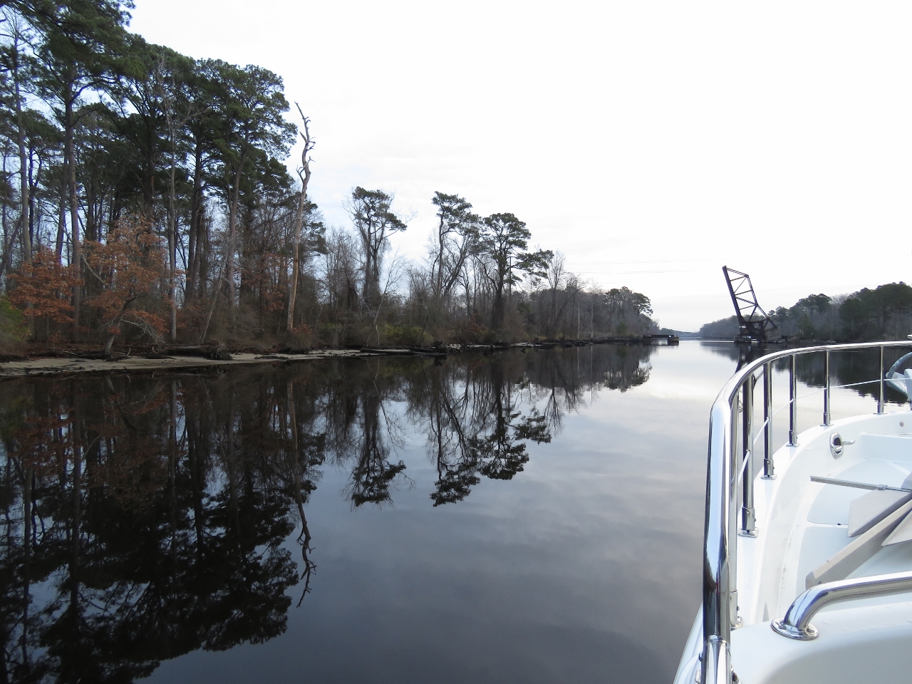
Reflections
Position: -76 12.72, 36 43.32
In light winds and a protected channel, the trees reflect almost perfectly in the water surface. In the distance is the second bridge we’ll pass through today, the normally-open Albermarle & Chesapeake Railroad Bridge.
|
 |
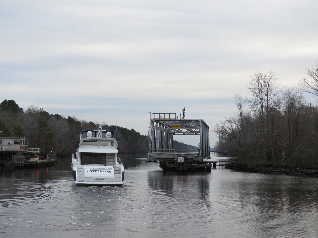
Enterprise
Position: -76 12.24, 36 43.35
Enterprise passed through the Great Bridge Bascule Bridge shortly after we departed this morning and quickly caught up with us.
|
 |
Centerville Turnpike Swing Bridge
Position: -76 11.23, 36 43.42
We caught back up with Enterprise watiting for an opening at the Centerville Turnpike Swing Bridge. The bridge opens on the half-hour, but the first opening is not until 8:30 in the morning on non-holiday weekdays.
|
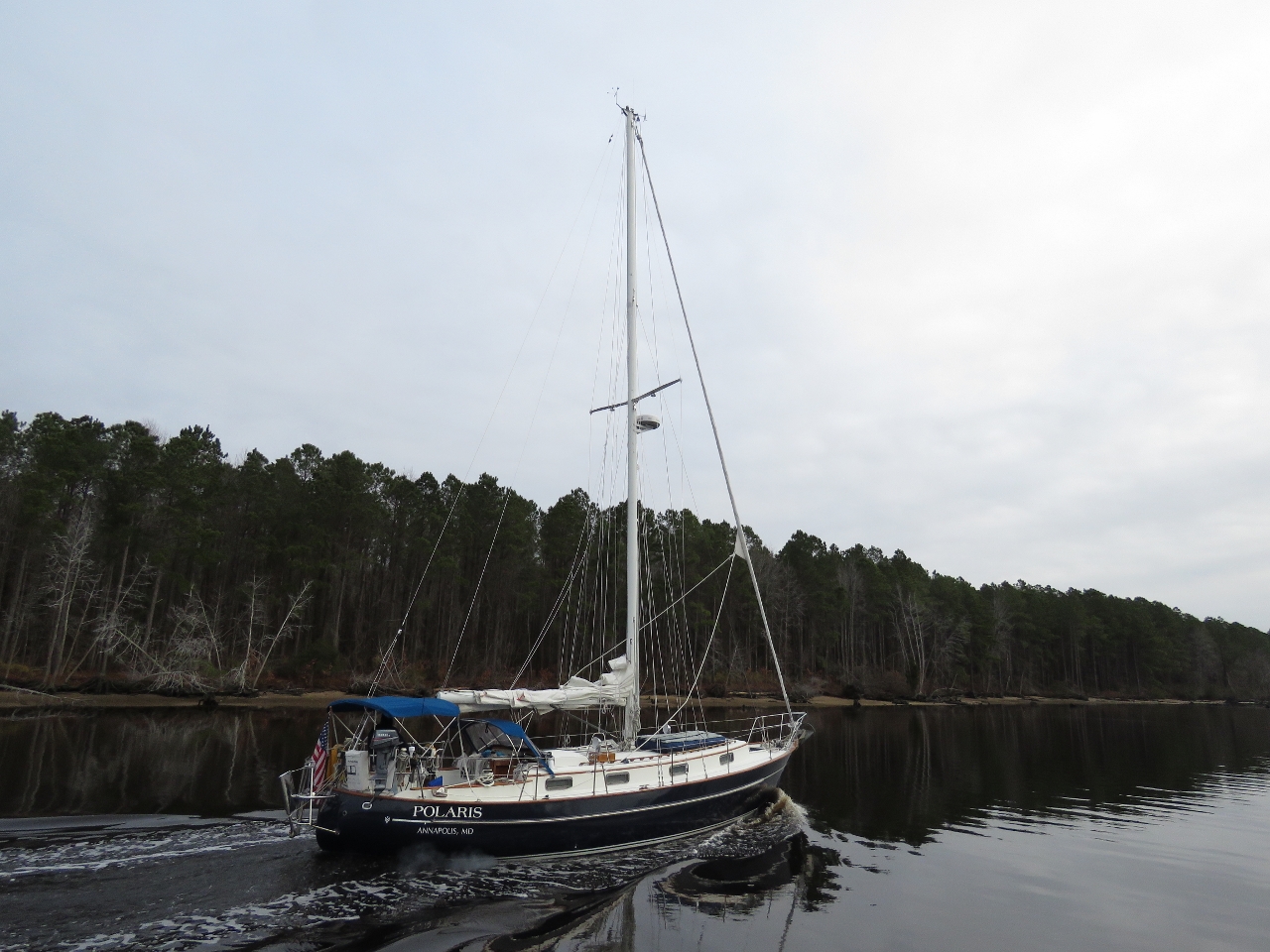 |
Polaris
Position: -76 8.24, 36 43.41
Polaris was moored between the Great Bridge lock and the bridge overnight. They followed Enterprise through the Great Bridge Bascule Bridge opening and passed us about an hour later. We didn’t see much other traffic for the rest of the day, except for a tug pushing a barge north.
|
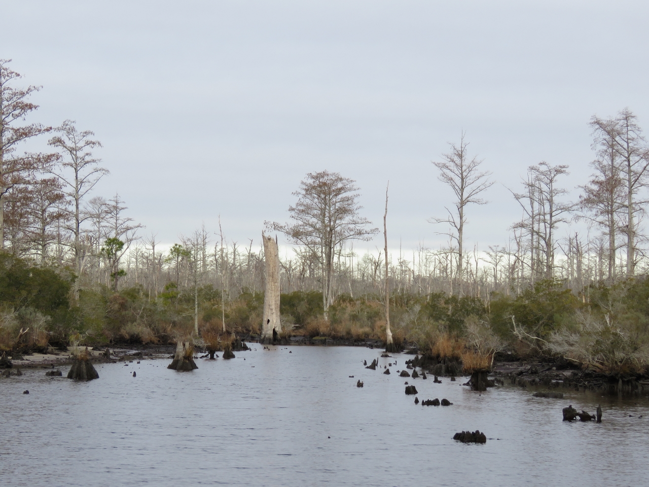 |
Swamp
Position: -76 6.68, 36 43.40
We’re definitely in swamp country.
|
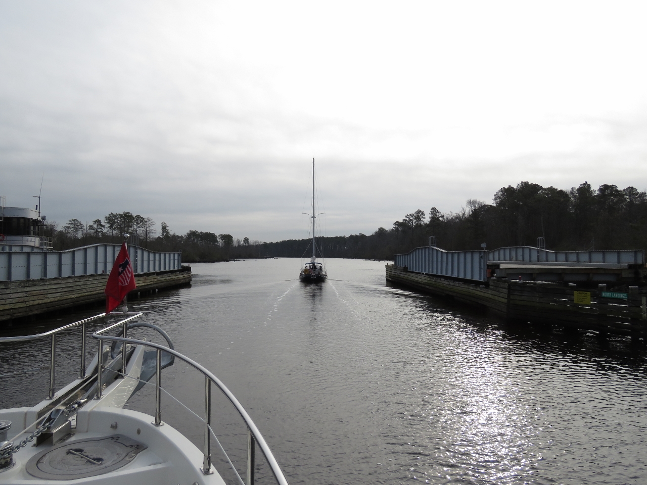 |
North Landing Swing Bridge
Position: -76 6.01, 36 43.06
We caught up with Polaris at the North Landing Swing Bridge, also on a half-hour opening schedule. We have only one more bridges to pass today, but it has a 65ft clearance.
|
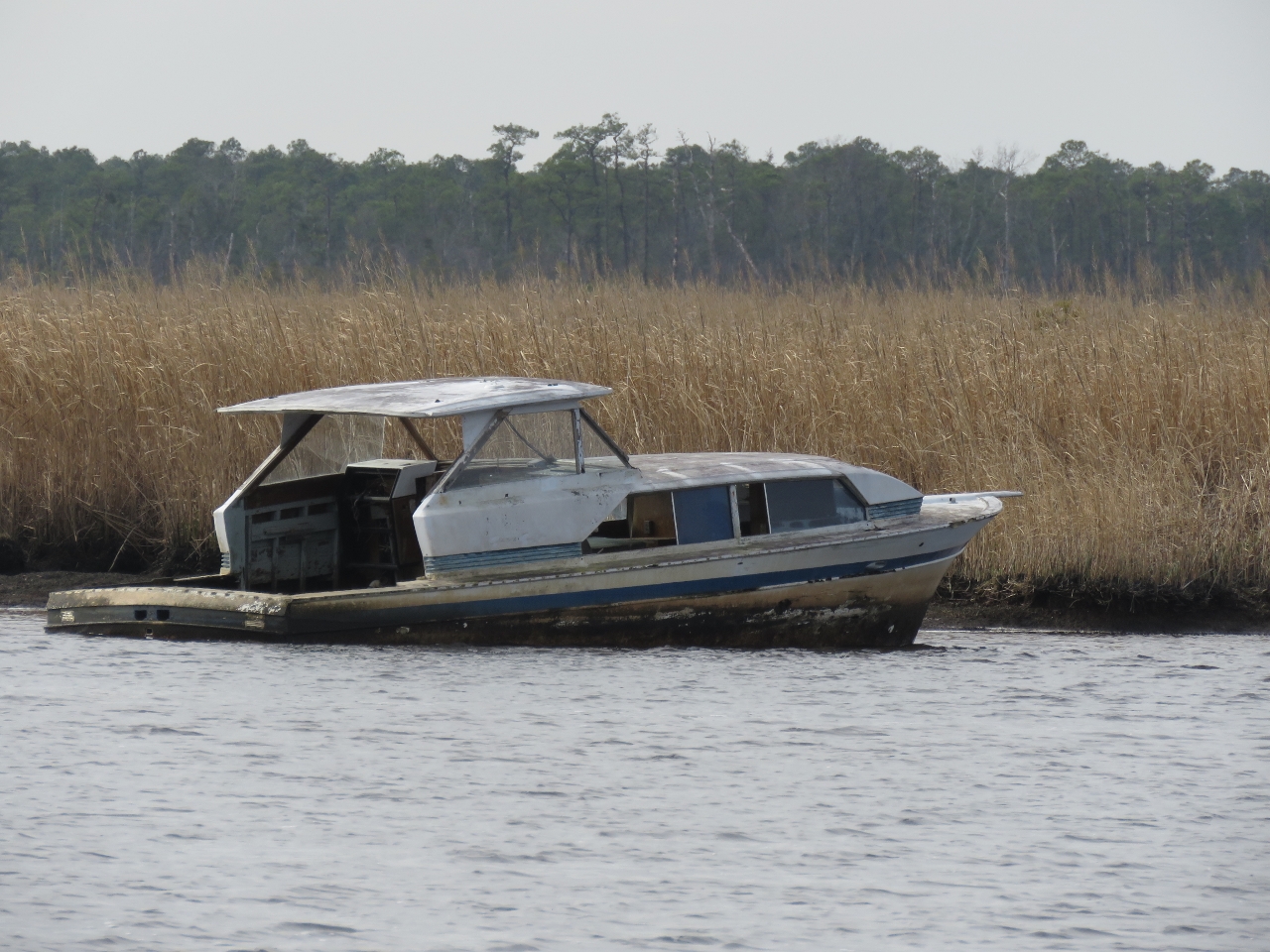 |
Wreck
Position: -76 3.13, 36 38.13
A wreck alongside the channel just north of the Pungo Ferry Bridge.
|
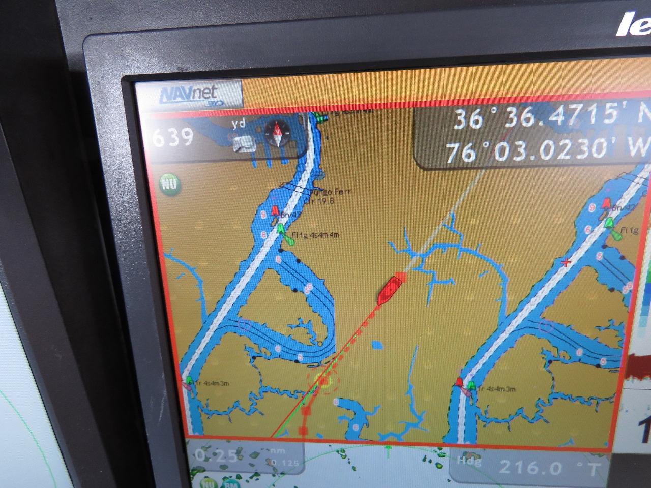 |
Chartplotter Issue
Position: -76 3.41, 36 36.39
We’ve started seeing a strange charplotter issue if we zoom more than about two miles in on our NavNet 3D system. The charts are displayed two aside with our boat positioned in the middle. We’re hoping this is just a local chart issue and will resolve itself when we leave the area.
|
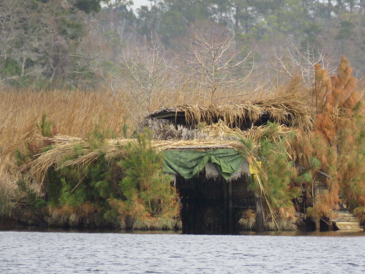 |
Blind
Position: -76 3.42, 36 35.63
Waterfowl hunting is very popular here. This blind looks almost like a small cabin.
|
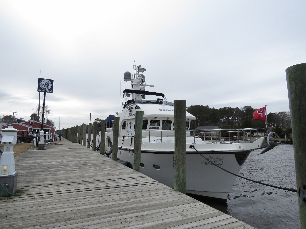 |
Coinjock Marina
Position: -75 56.92, 36 20.94
We have stopped for the night at Coinjock Marina across the state line in North Carolina. The depths along this run generally were shallower than the previous day, particularly in Currituck Sound where shoaling and the persistent north winds we’ve had over the past few days can drop the water level by 2-3 ft.
The channel is charted at 12ft, but we typically saw 9-10ft through Currituck Sound and occasionally as low as 8.2ft. The winds also affect the current in North Carolina Cut where Coinjock Marina is. The tidal range is minimal, but the afternoon we arrived the current was running a half knot southbound and when we left the next morning it was running a knot northbound. Video highlights from today’s run are at https://youtu.be/6HPSaY_uFO4. |
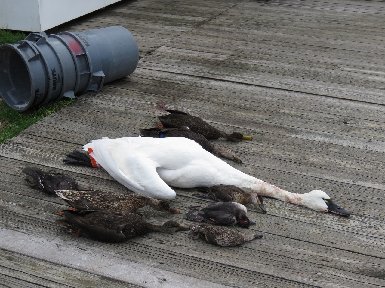 |
Catch
Position: -75 56.92, 36 20.94
A few sets of waterfowl hunting catch were laid out along the dock at the marina. Several hunting dogs were running loose, so we were careful to keep our cat Spitfire confined inside the boat.
|
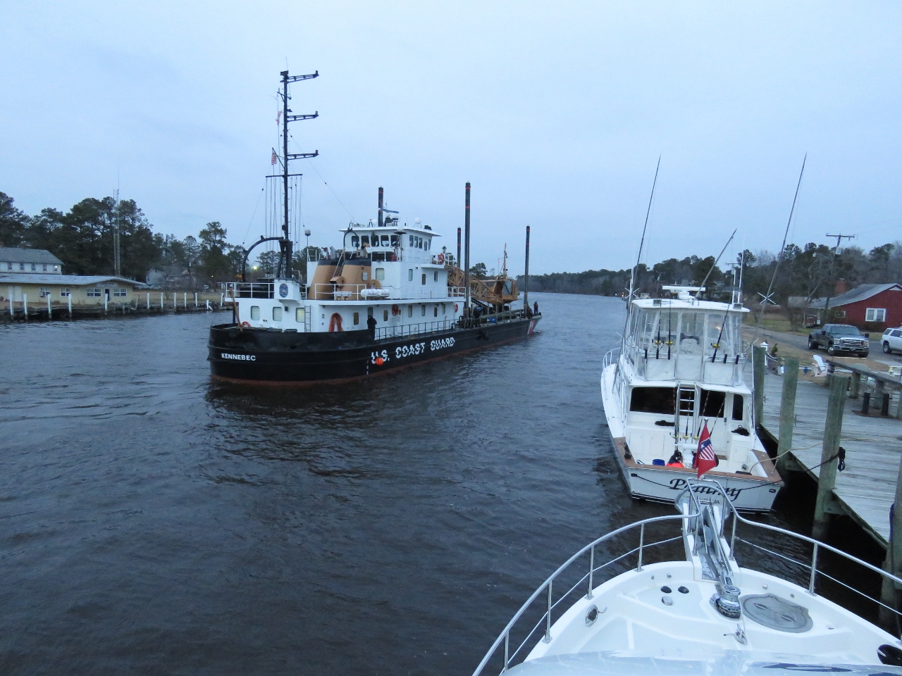 |
USCGC Kennebec
Position: -75 56.92, 36 20.94
The USCG inland constructor tender Kennebec arrived this evening and tied off at the far north end of the dock. We’re told they come in twice a year and the crew has dinner at the marina restaurant.
|

|
Click the travel log icon on the left to see these locations on a map, with the complete log of our cruise.
On the map page, clicking on a camera or text icon will display a picture and/or log entry for that location, and clicking on the smaller icons along the route will display latitude, longitude and other navigation data for that location. And a live map of our current route and most recent log entries always is available at http://mvdirona.com/maps. |
If your comment doesn't show up right away, send us email and we'll dredge it out of the spam filter.