
From Newport, RI we made a 350-mile 3-night trip from Newport, Rhode Island to Baltimore, Maryland. This run had more than the usual timing considerations. Frequent weather systems were in play this time of year. A front passed through the day after we arrived in Newport and another was expected 3-4 days later, but we had a good departure window with 10-15kt N-NW winds expected for most of the offshore portion of the trip.
We timed our arrival at the mouth of Delaware Bay two nights later at first light on the end of the ebb tide. The flood tide carried us north through Delaware Bay to the east entrance of the C&D Canal as it turned to westbound ebb that afternoon. Then we ran with the ebb through the canal, anchored for the night outside the west end of the canal around dusk, and continued to Baltimore Monday morning.
Trip highlights from November 4th through 7th, 2016 follow. Click any image for a larger view, or click the position to view the location on a map. And a live map of our current route and most recent log entries always is available at http://mvdirona.com/maps
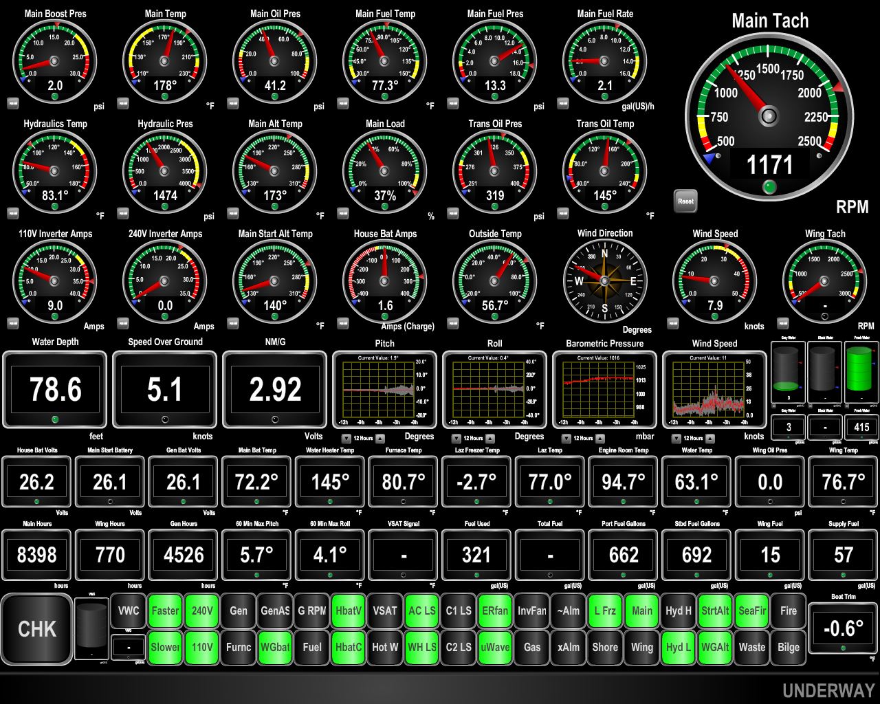 |
Underway
Position: -71 34.64, 41 6.52
We’ve just made our final turn out of Rhode Island Sound and now have 36 hours of straight running to arrive at the mouth of Delaware Bay. Currently winds are less than 10 knots from the northwest. We’re travelling at barely 5 knots to arrive at the mouth of Delaware Bay at daylight Sunday morning. We could have left Newport later in the day and run a faster, but leaving earlier saves us some fuel and allows us to transit Rhode Island Sound in daylight and be offshore for most of our night running.
|
 |
Southeast Light
Position: -71 29.02, 41 12.60
The brick keeper’s cottage and attached light on Mohegan Bluffs at the southeastern corner of Block Island, Rhode Island. Built in 1874, the structure was designated a National Historic Landmark as one of the most architecturally sophisticated lighthouses 19th-century US lighthouses.
|
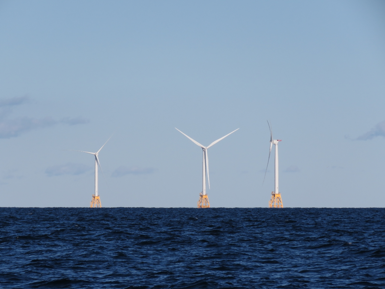 |
Block Island Wind Farm
Position: -71 31.88, 41 8.40
The Block Island Wind Farm, about 4 miles east of Block Island, is the first offshore wind farm in the nation and is designed to withstand a Cat 3 storm with sustained winds of up to 112 kts. Construction began in 2015 and the facility is expected to be operational in late 2016. Pictured are three of the five GE wind turbines that combined will produce 30 megawatts of energy.
|
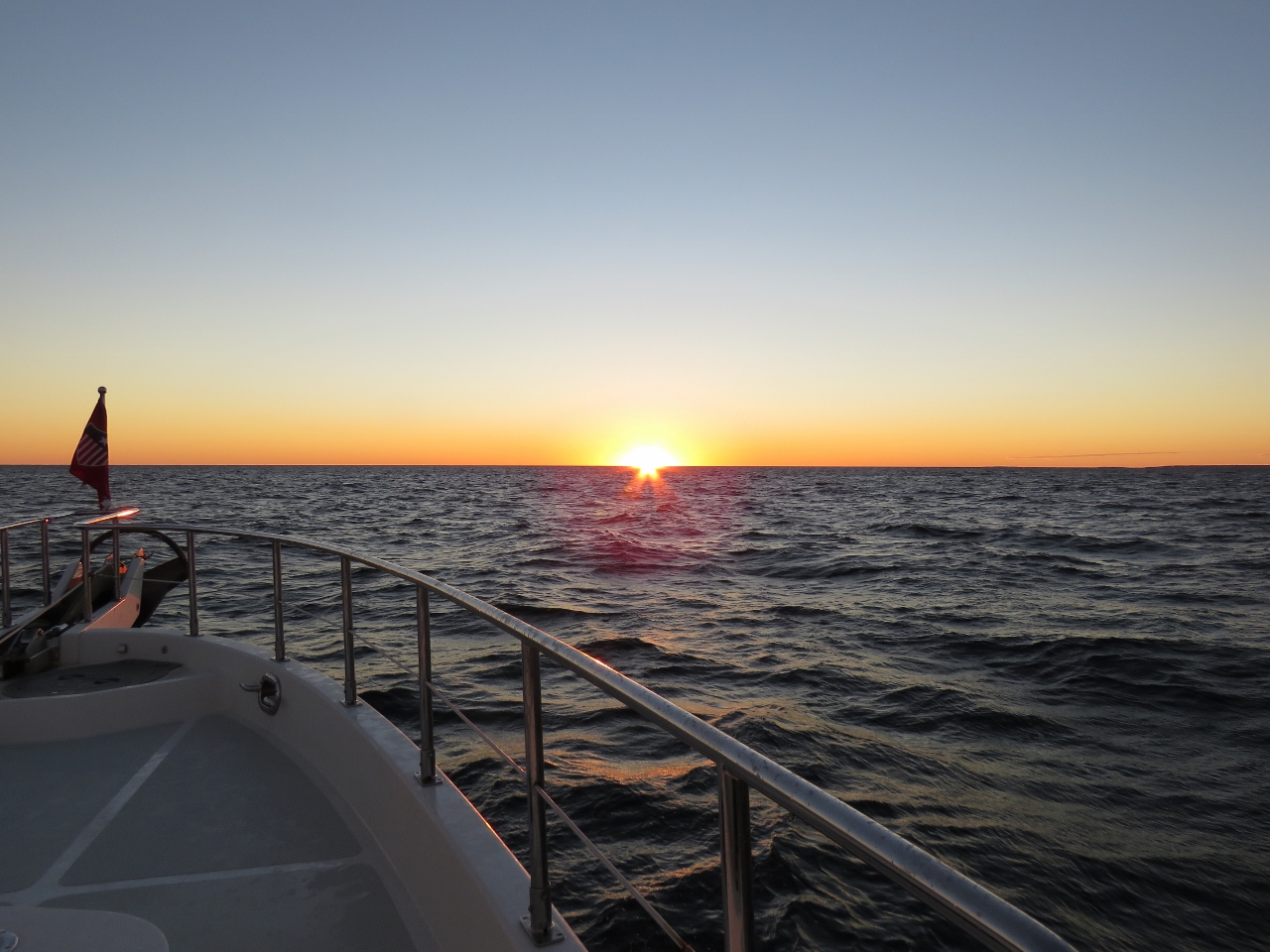 |
Long Island
Position: -71 40.81, 41 2.30
Sunset in calm conditions off the eastern tip of Long Island. We had considered stopping in New York on our way south, but decided to push farther south to spend time in Chesapeake Bay instead.
|
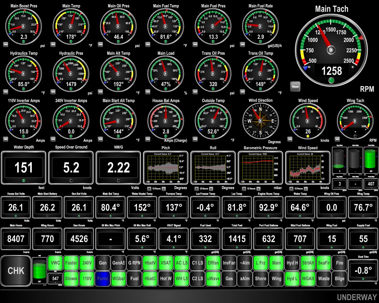 |
Conditions
Position: -72 15.16, 40 38.67
We were expected 10-20 knots of wind from the N-NW, but have been seeing a steady 20-30 knots from the NNW instead (12-hour wind display is rightmost graph in 4th row). Even though the winds are partly behind us, the waves are forward enough of our beam to generate 10 degrees of pitch (12-hour pitch display is leftmost graph in 4th row).
|
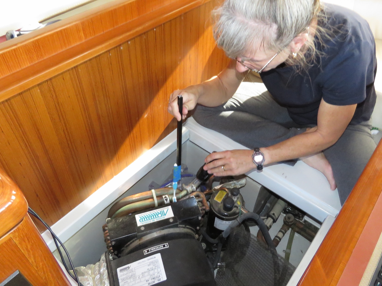 |
HVAC
Position: -73 9.86, 40 0.81
On stabilizing a loose part that was rattling with the boat motion, we noticed that the HVAC air filter and evaporator were coated in dust. We pulled out the mesh air filter to clean it, but needed to use a toothbrush taped to a long handle to clean the evaporator.
|
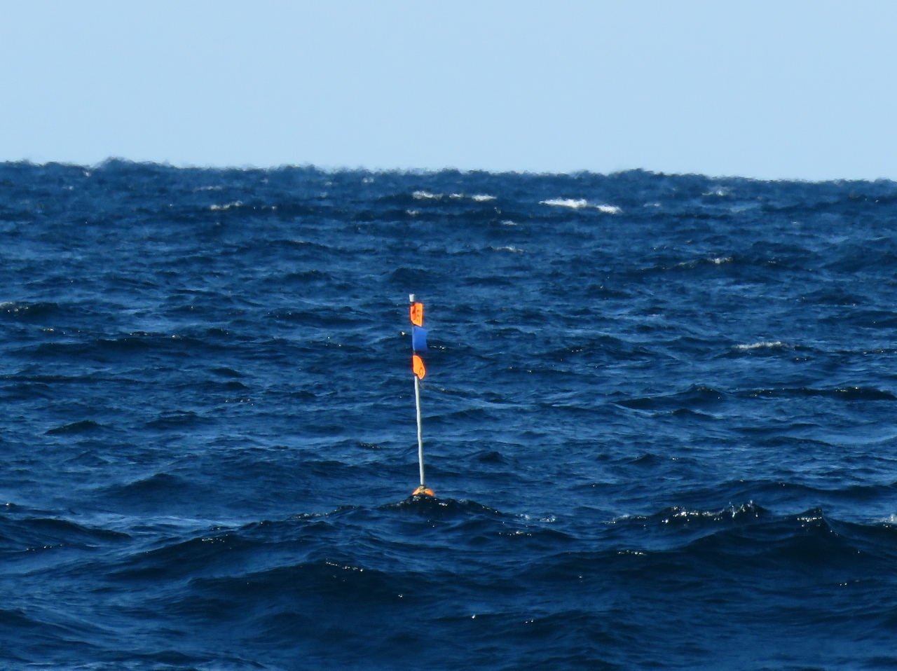 |
Float
Position: -73 11.39, 39 59.76
We didn’t see much in the way of floats, or anything else, in the water through Rhode Island Sound. We did pass a small field of floats like this one today. Unlike the big field we passed through at night en route to Boston earlier in the year, these were not marked with radar reflectors, but were quite visible during the day. At night, invisible.
|
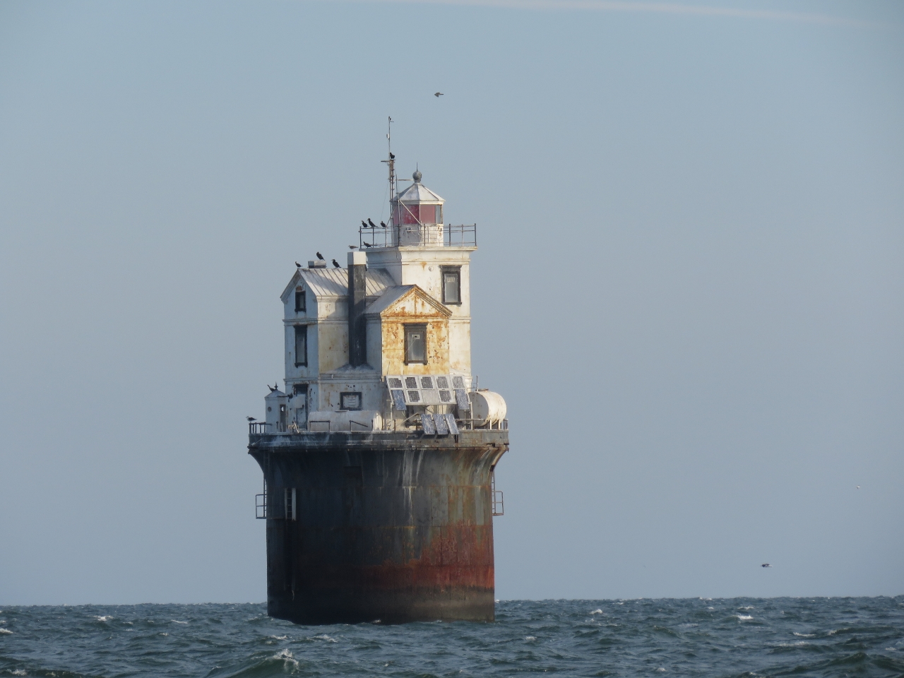 |
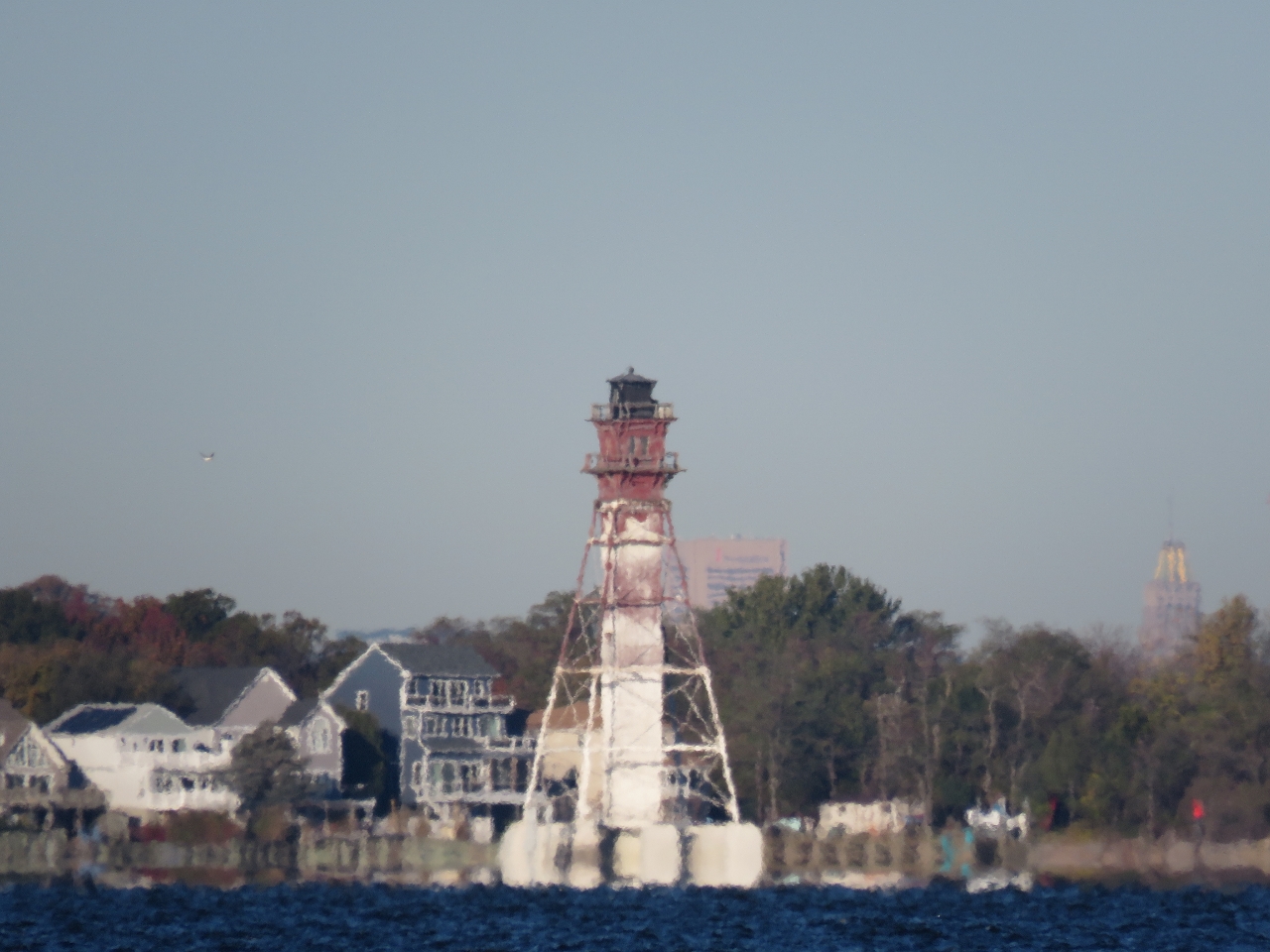
Fourteen Foot Bank
Position: -75 11.09, 39 2.51
The Fourteen Foot Bank Light was completed in 1886 and was the the first lighthouse built with a pneumatic caisson. A cassion is a water-tight retaining structure used for underwater work, while a pneumatic caisson also is airtight and filled with compressed air for working in soft mud. “The wooden caisson structure was excavated to a depth of 23 feet (7.0 m) below the seabed, then filled with 2,000 cubic yards (1,500 m3) of concrete. A cast iron base was meanwhile erected on the caisson as it sank. A house-like structure was built on top of the base, designed by H.A. Ramsay and Son of Baltimore. … It was added to the National Register of Historic Places in 1989.” (wikipedia.com)
|
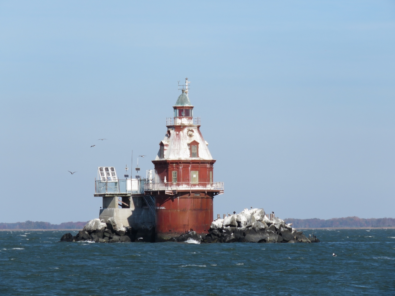 |
Ship John Shoal
Position: -75 22.56, 39 18.09
The Ship John Shoal and nearby Cross Ledge lights were originally planned to be built over pilings screwed into the sea bed. But ice carried away the entire Cross Ledge Light during it’s construction in 1856, and both were instead built using the new cassion construction technique. The Ship John Shoal light was completed in 1870 and was surrounded with 2,000 tons of riprap to protect it from ice damage. The light was automated in 1973.
|
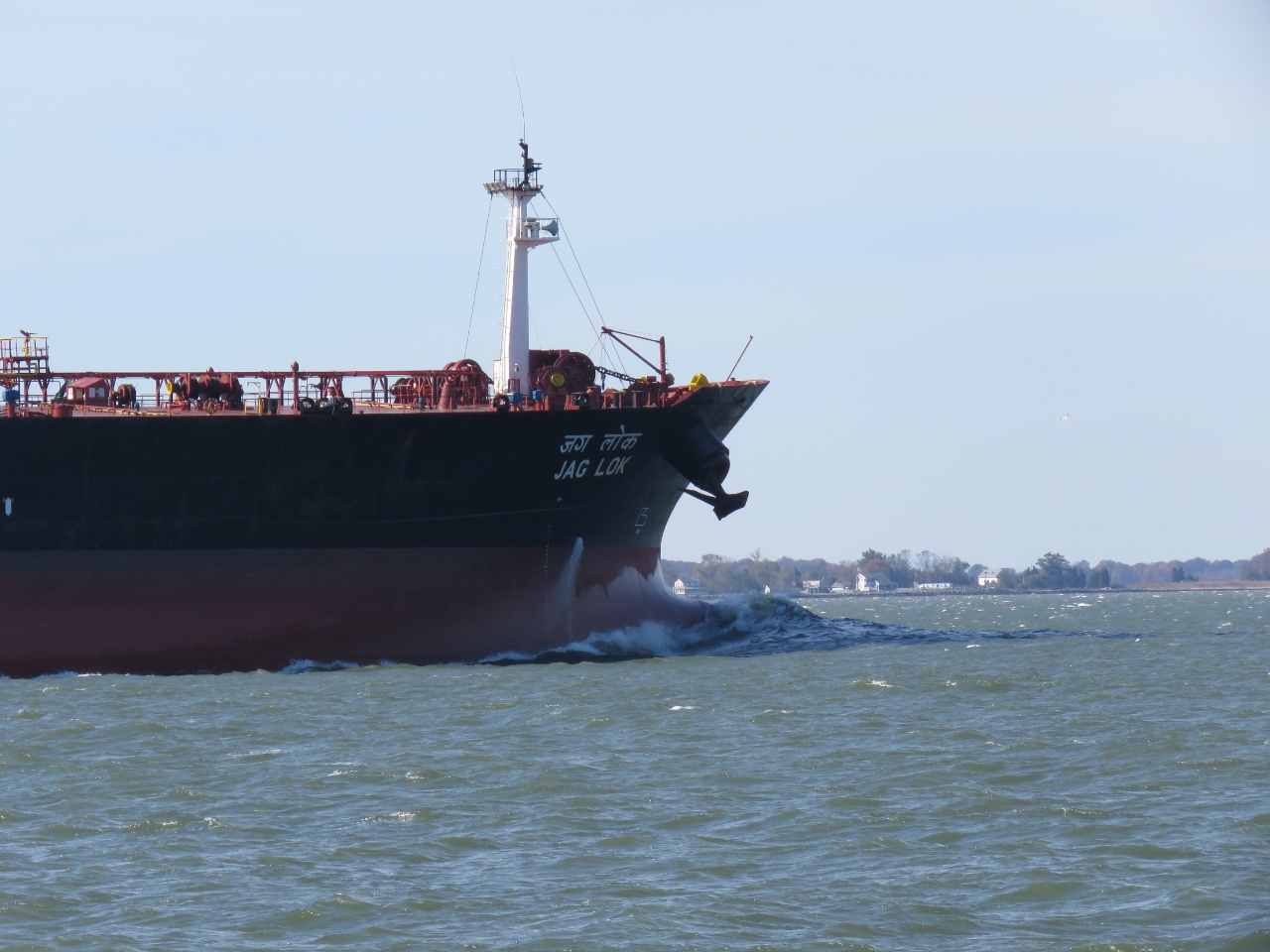 |
Jag Lok
Position: -75 25.52, 39 20.69
The 900ft crude oil tanker Jag Lok passing us en route to Philadelphia. The boat appeared to be running lightly-loaded with its bulbous bow showing.
|
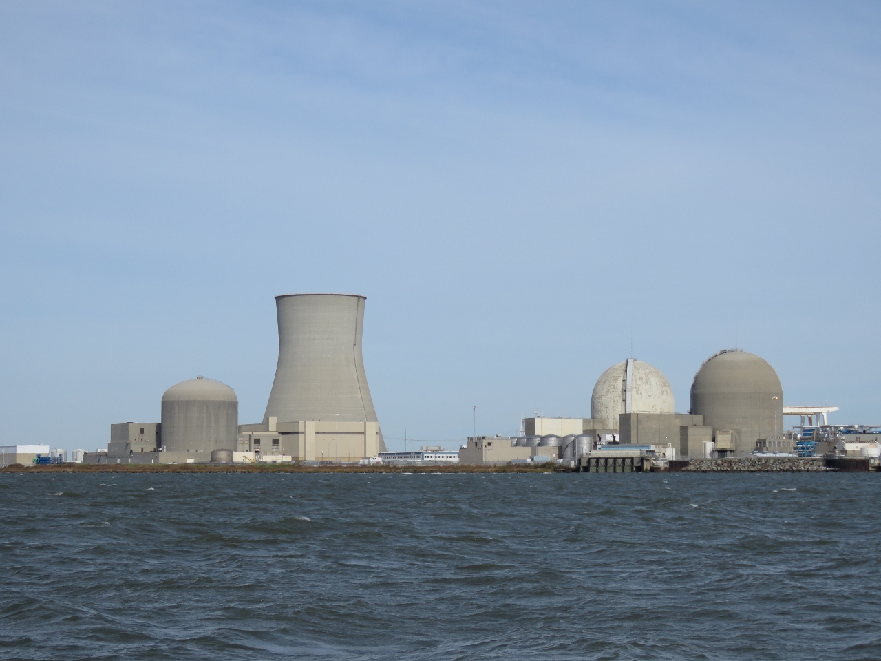 |
Nuclear Power
Position: -75 32.44, 39 27.21
The Hope Creek Nuclear Generating Station (left) and the Salem Nuclear Power Plant share Artificial Island along the east side of Delaware Bay. Hope Creek came online in 1986 and the two Salem units began operating in 1977 and 1981. Both use Delaware Bay for cooling and together the plants produce 3,572 megawatts, the largest nuclear generating facility in the Eastern United States and the second largest nationwide. As a scale callibration point, the monstrous Bonneville hydro plant on the Columbia River has a total nominal output of “only” 526.7 megawatts and an overload capacity of 577 megawatts.
|
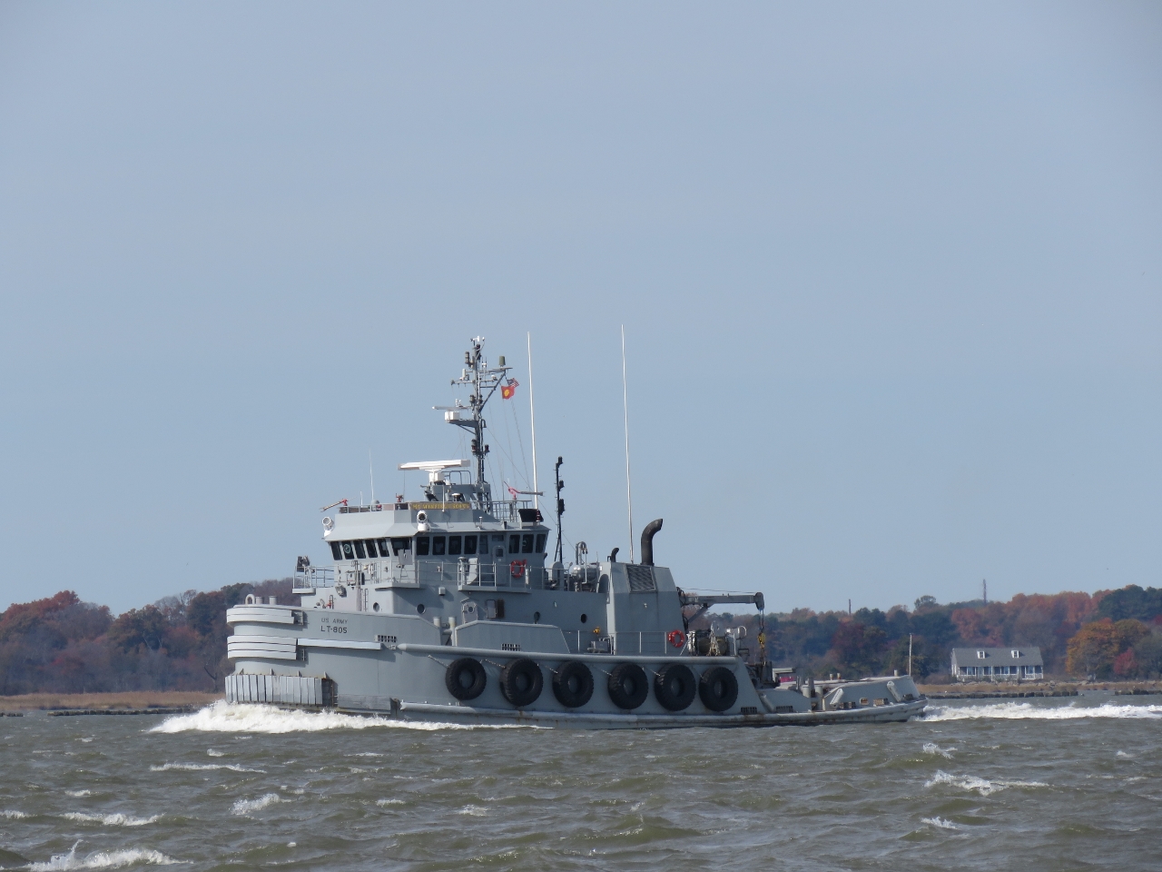 |
MG Winfield Scott
Position: -75 33.46, 39 28.72
The 128ft US Army tug MG Winfield Scott, named for Major General Winfield Scott, was built in 1993. The tug has a range of 5,000nm at 13.5kts when light or 12kts when loaded. We’re near the location where Nordhavn 47 Ghost Rider struck a rock jetty and sunk earlier this year.
|
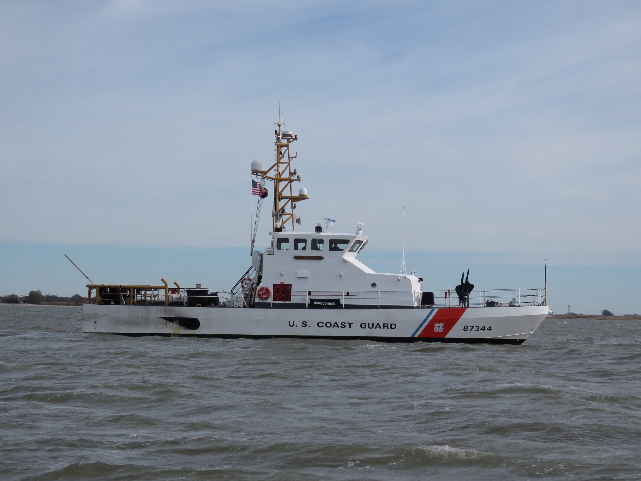 |
Heron
Position: -75 33.07, 39 32.82
The Coast Guard cutter Heron anchored just south of the east entrance to the C&D Canal.
|
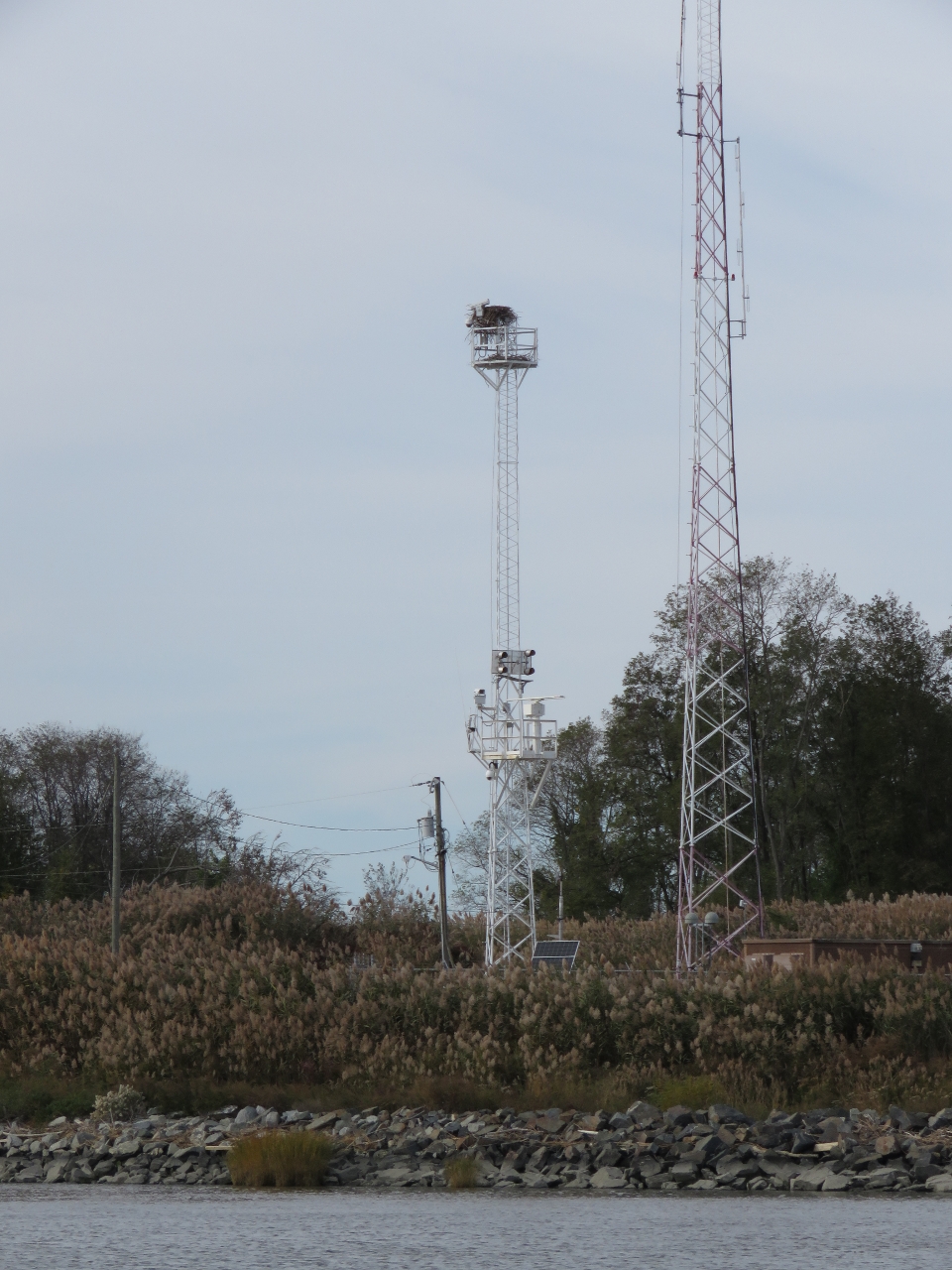 |
C&D Canal
Position: -75 34.00, 39 33.63
Traffic control tower at the east entrance to the C&D Canal (Chesapeake and Delaware Canal). When the lights are flashing, small craft must contact the canal dispatcher for permission to pass.
The C&D Canal is a 12-mile cut that connects Delaware and Chesapeake bays. The canal originally opened in 1829 with four locks and six-mule teams to pull boats through. The modern canal has no locks and passes under six bridges, a gas pipeline and power lines. All bridges are fixed, with a minimal clearance of 132ft, except for the Conrail Lift Bridge that is normally open but has a 45ft clearance when closed. The maximum current through the canal generally is about 2 knots, with 2.5 knots on the flood at the east entrance. We timed our arrival at the mouth of Delaware Bay at dawn for the flood current to carry us north to arrive at the C&D Canal mid-afternoon for the westbound ebb to carry us through. After a lumpy two-night run from Newport, RI to Cape May and choppy seas in Delaware Bay, it was wonderful to be in the calm, protected waters of the canal. We were hoping to see a large RO/RO or other ship in the waterway, but only saw a few pleasure craft in the canal proper and a tugboat pulling a large petroleum barge at the west entrance. Our C&D Canal video starts in Delaware Bay where we pass several anchored ships and barges, including the Coast Guard cutter Heron, shortly before we arrive at the canal entrance. The last bridge we pass under is the Chesapeake City Bridge at Chesapeake City. Beyond that bridge is the Delaware Responder at the Marine Spill Response Corporation’s Chesapeake Bay station. |
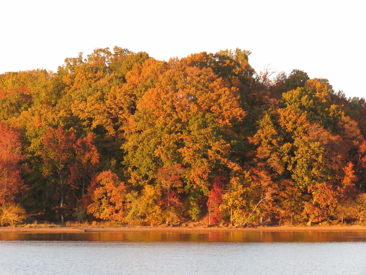 |
Fall Colors
Position: -76 0.68, 39 22.91
After passing through the C&D Canal, we anchored off the north shore of the Sassafras River just as the late afternoon sun put the trees aglow. This was a wonderfully calm and sheltered anchorage. We had drinks on the back deck then watched the Baltimore Ravens Sunday home game from earlier that day on NFL Gamepass.
|
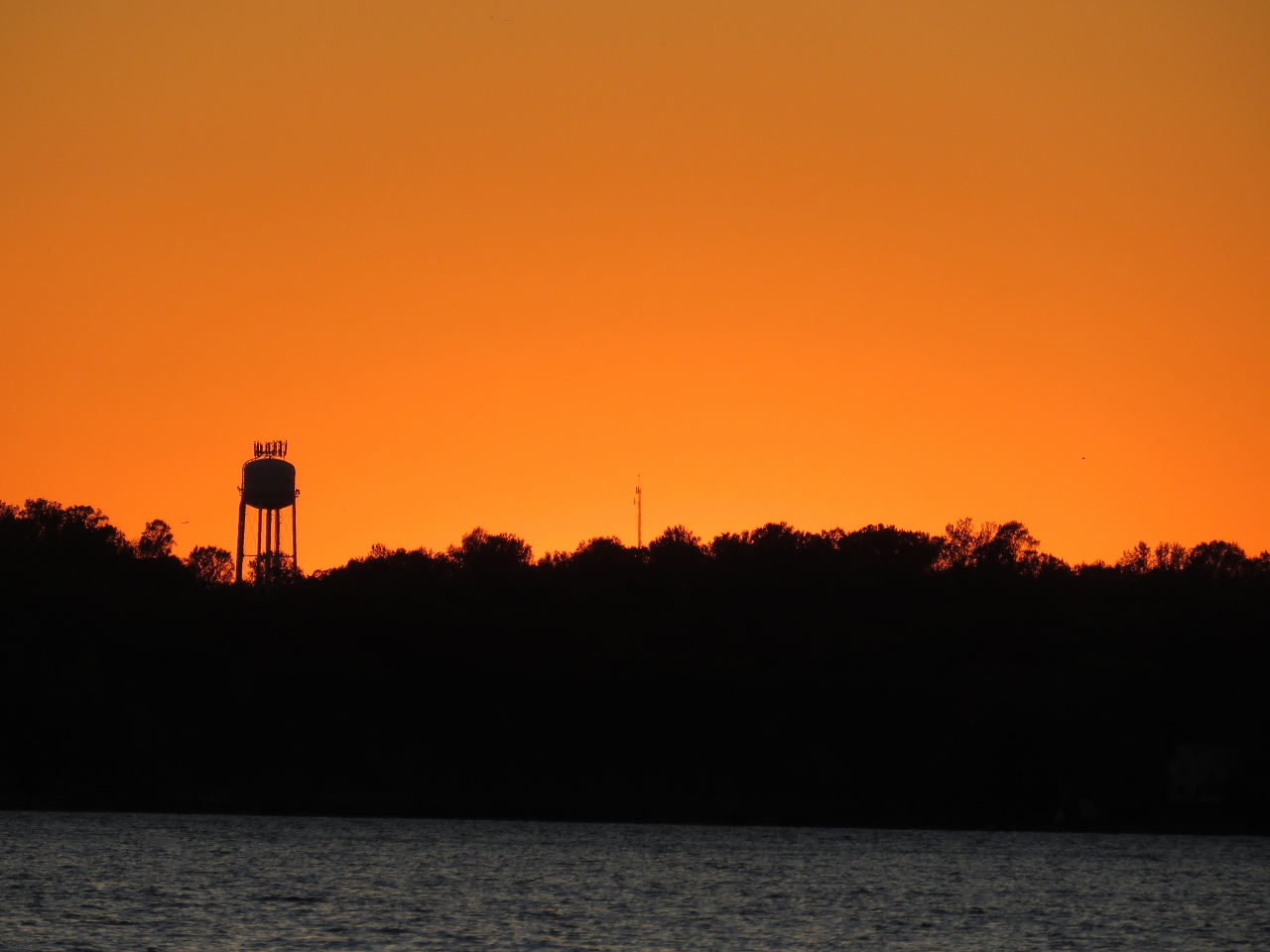 |
Sunset
Position: -76 0.68, 39 22.91
A gorgeous sunset looking south from our anchorage along the Sassafras River.
|
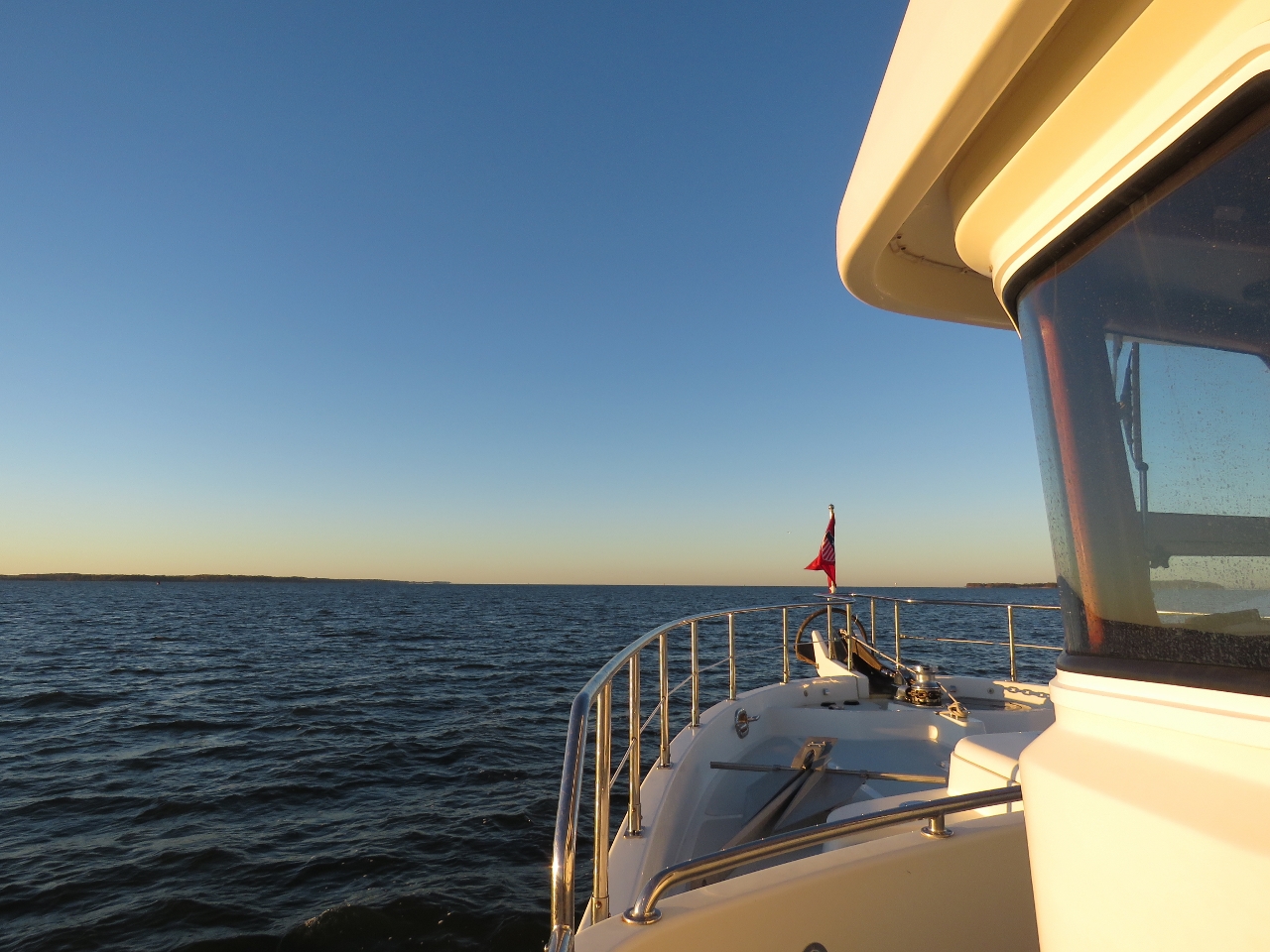 |
Morning
Position: -76 12.92, 39 18.27
Conditions were wonderfully clear and calm as we made our way from our anchorage at the Sassafras River to Baltimore.
|
 |
Craighill Channel Lighthouse
Position: -76 21.51, 39 13.05
The Craighill Channel Lower Range Light Rear 1.5 miles to our north is the rear light of the lower range-mark pair that guides ships through Craighill Channel. the front light of the pair is just under a mile to our south. The rear light was constructed in 1873 in a style unique for the Chesapeake Bay and is the tallest light in Maryland at 105ft.
|
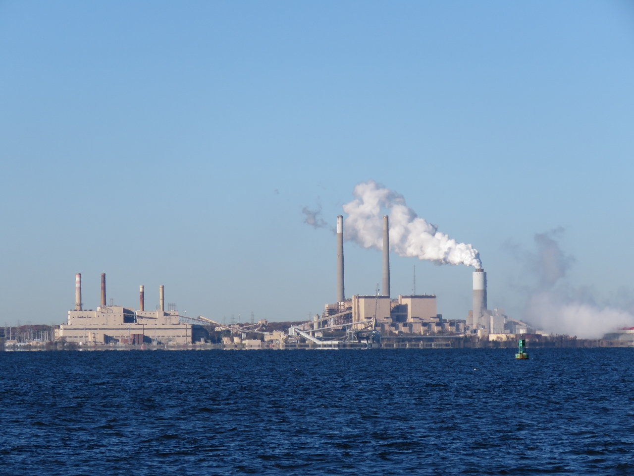 |
Generating Stations
Position: -76 27.63, 39 11.23
The Herbert A. Wagner (left) and Brandon Shores electric generating stations at the mouth of the Cox River to our south. The H. A. Wagner station began operation in 1956 and with an oil-fired unit. Two coal-fired units and one fueled by natural gas have since been added for a total capacity of 1,040MWe. The Brandon Shores plant began operating in 1981 and has a 1370MWe capacity. Its 700ft exhaust and 400ft flue-gas desulfurization system stacks dominate the site.
|
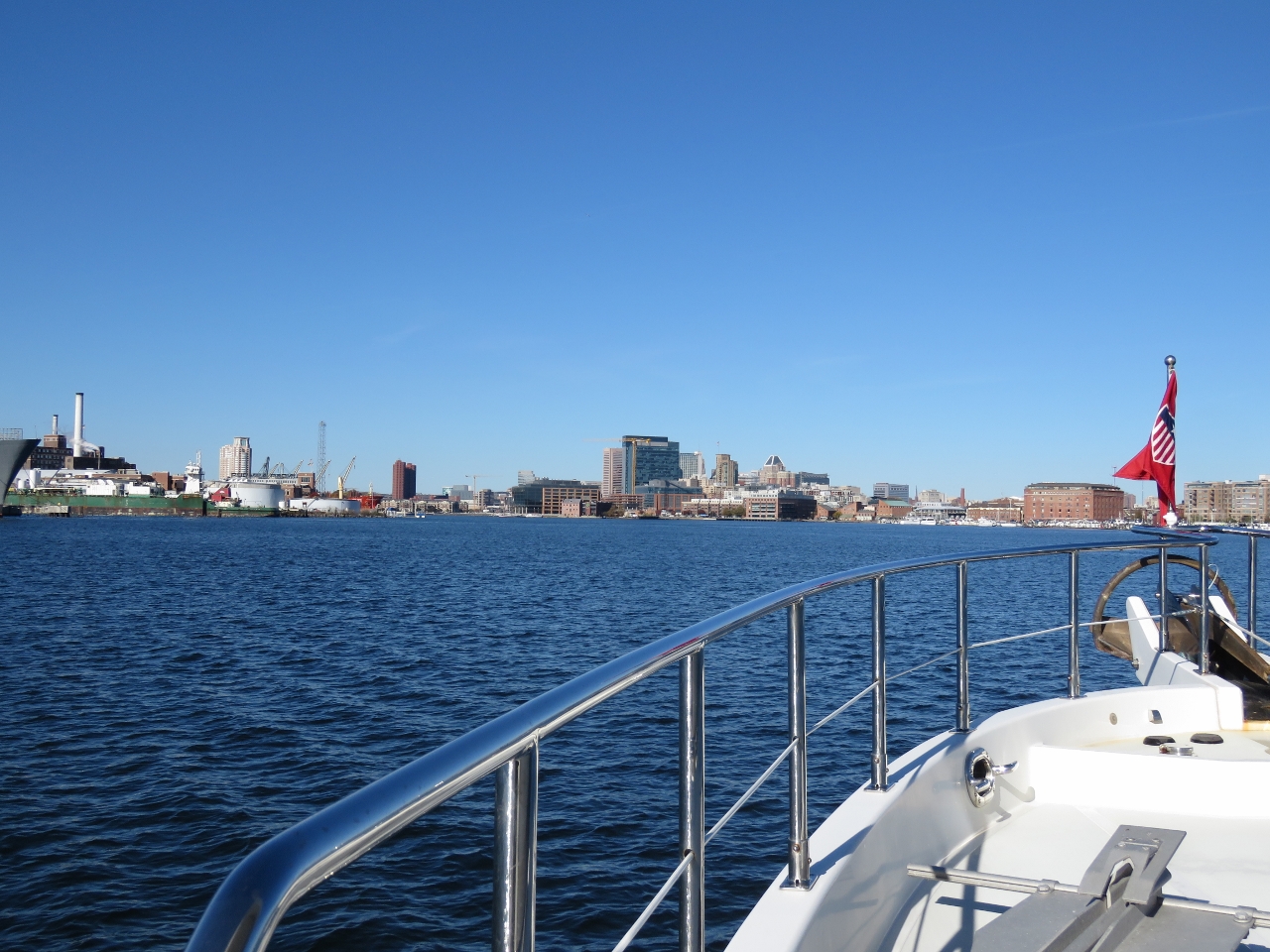 |
Baltimore Arrival
Position: -76 35.05, 39 16.50
Baltimore has a beautiful inner harbor ringed with marinas, commercial docks and interesting architecture. This video https://youtu.be/OLVfYkA43AQ shows the view from the pilot house as we cruise up the Patapsco River from Lazaretto Point near Fort McHenry, travel through Baltimore Inner Harbor, enter the marina, and bring the boat into the slip to complete docking.
|
|
|
Inner Harbor
Position: -76 36.51, 39 16.81
The view to our slip at Baltimore Marine Center Inner Harbor, taken from Federal Hill Park just south of the marina. Nearly every boat in the marina is a power boat, with Carver, Meridian, Bayliner and SeaRay making up the majority. Dirona is slightly to the right of center, roughly in line with a large cylindrical concrete structure on the opposite shore (click image to view larger).
The 130ft Westport yacht farther to the right is Winning Drive, owned by Steve Bisciotti who also owns the Baltimore Ravens NFL team. Bisciotti keeps the boat in Annapolis, and brings it to Baltimore for game day. Since the Ravens have two games only five days apart (yesterday and this Thursday) he kept the boat here. We’ve got tickets to the Thursday night game and are looking forward to seeing an NFL game live. We had season’s tickets for the Seattle Seahawks for more than a decade and are suffering from withdrawal. |

|
Click the travel log icon on the left to see these locations on a map, with the complete log of our cruise.
On the map page, clicking on a camera or text icon will display a picture and/or log entry for that location, and clicking on the smaller icons along the route will display latitude, longitude and other navigation data for that location. And a live map of our current route and most recent log entries always is available at http://mvdirona.com/maps. |
If your comment doesn't show up right away, send us email and we'll dredge it out of the spam filter.