From Lunenburg, Nova Scotia we made a 225-mile overnight run to Southwest Harbor, Maine. We initially were planning to stay at least another night in Lunenburg, but the weather models showed a storm system arriving earlier than previously indicated with several more following, so we decided to leave a day early.
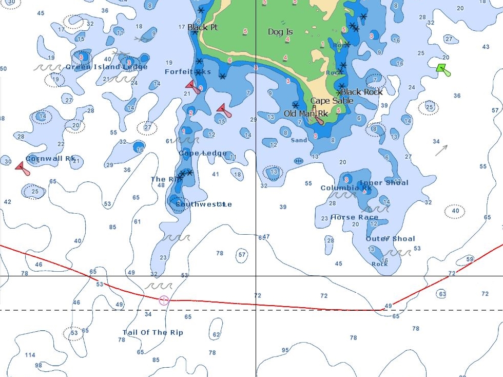
We timed our Southwest Harbour arrival for the afternoon to avoid navigating in the dark through the masses of lobster traps that we’ve been warned litter the Maine coast. That plan had us rounding Cape Sable, at the southern top of Nova Scotia, against a 2-kt ebb current. This is a nasty area where strong currents against big winds in shallow waters can generate dangerous conditions. The chart is full of warnings about tide rips. Conditions were calm when we passed through, so we only had to put up with the loss of speed and/or fuel economy.
Trip highlights from September 22nd and 23rd, 2016 follow. Click any image for a larger view, or click the position to view the location on a map. And a live map of our current route and most recent log entries always is available at http://mvdirona.com/maps
 |
En Route to Maine
Position: -64 15.90, 44 13.20
We’re about 90 minutes out of Lunenburg and have calm seas with winds less than 15kts. We expect those conditions the duration of the run. We’re running about 7 kts and aiming to arrive at Southwest Harbour tomorrow afternoon.
|
 |
Positive Current
Position: -64 44.81, 43 48.77
We’re getting a nice push from a positive current and making nearly 8 kts at a fuel economy of 1.6nm/gallon. Conditions are wonderfully calm with winds less than five knots.
|
 |
Little Hope
Position: -64 45.87, 43 48.04
Little Hope Rock, barely showing above the surface at the left of the photo, looks like a real hazard.
|
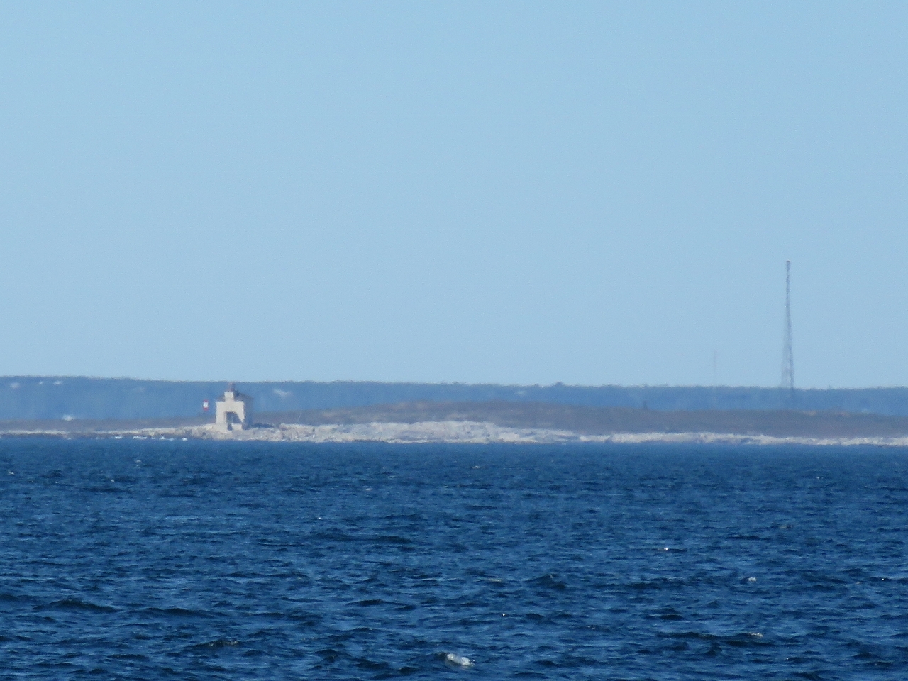 |
Gull Rock
Position: -65 1.48, 43 38.54
The first light on tiny, bare Gull Rock to our west was completed in 1853. The current structure was built in 1955. The light is mounted atop a two-story square dwelling with reinforced concrete walls 17 inches (43cm) thick. The lighthouse was destaffed in 1987 and currently is at risk of collapse.
|
 |
Lockeport
Position: -65 3.27, 43 37.53
We’re just passing south of Lockeport, where we cleared into Canada over eight weeks ago.
|
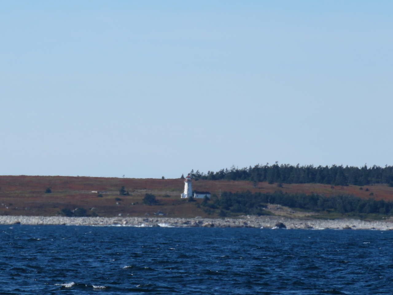 |
Cape Negro Island
Position: -65 18.75, 43 29.19
Nova Scotia has over 150 lighthouses. This one is on Cape Negro island to our northwest.
|
 |
The Salvages
Position: -65 21.93, 43 27.48
The Salvages are a line of rocks, about 1.5nm long, with hardly any exposed land. The combined light house and dwelling is build high above the rocks to protect it from pounding waves and is a conspicuous landmark miles away.
|
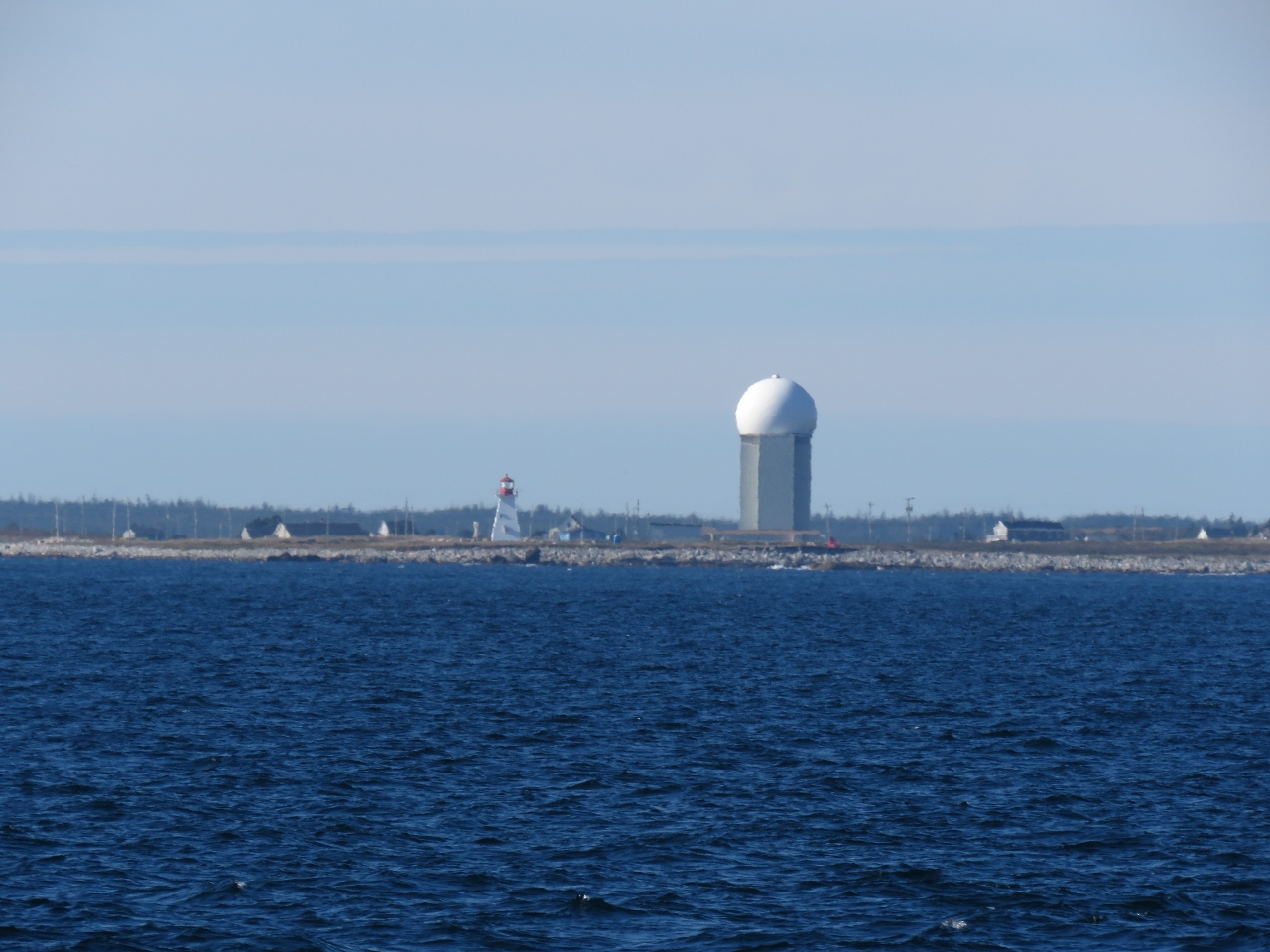 |
CFS Barrington
Position: -65 26.68, 43 25.20
The radar tower at decommissioned Canadian Forces Base (CFS) Barrington. The station was built as part of the Pinetree Line in the 1950s to provide early warning of a Soviet attack during the Cold War. The radar tower dwarfs the 45ft Baccaro Point light house on the left.
|
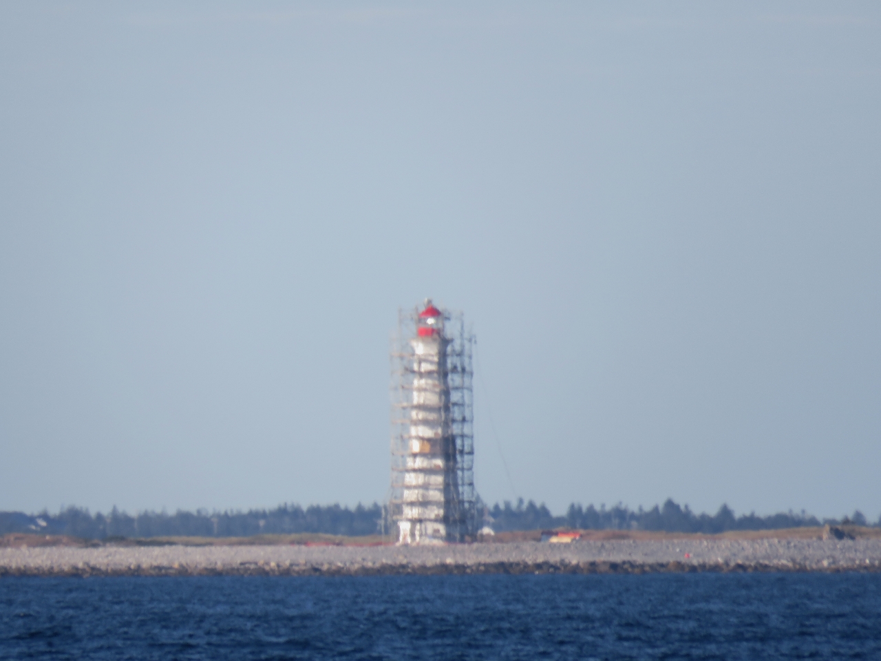 |
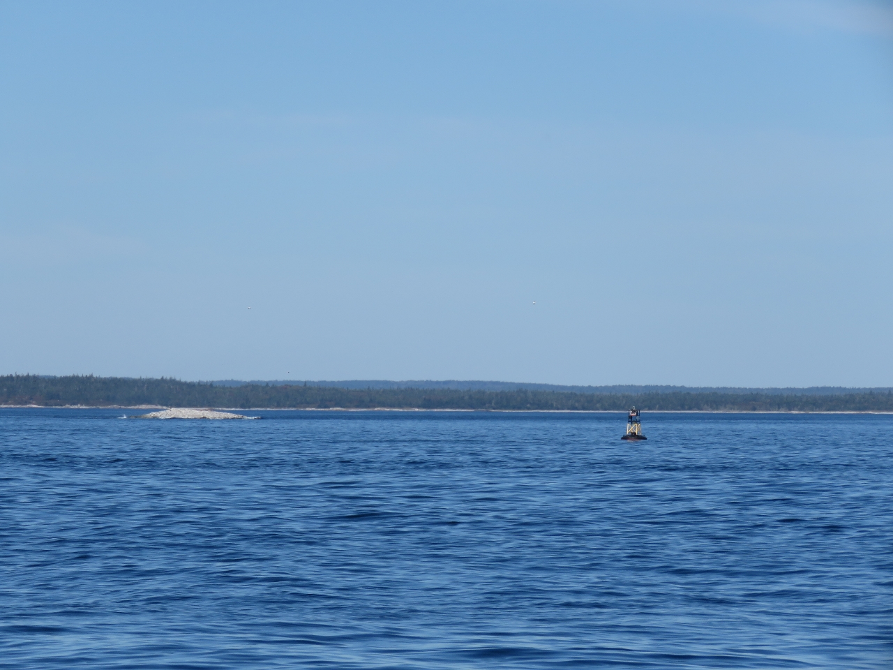
Cape Sable
Position: -65 30.31, 43 23.64
The light at Cape Sable wrapped in scaffolding. The “Friends of the Cape Sable Lighthouse” society has an annual fund-raising event to restore the lighthouse and make it more accessible to the public. This is a nasty area where strong currents against big winds in shallow waters can generate dangerous conditions. The chart is full of warnings about tide rips. Conditions are so calm right now that we’re able to pass through the area called Tail of the Rip with hardly any noticeable boat motion.
|
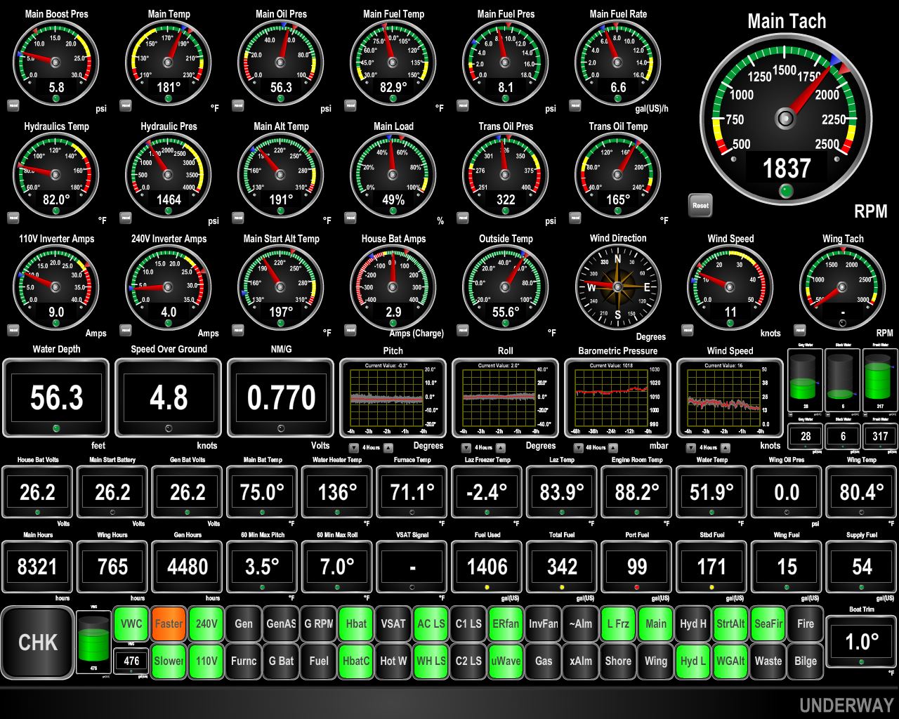 |
Negative Current
Position: -65 38.13, 43 21.29
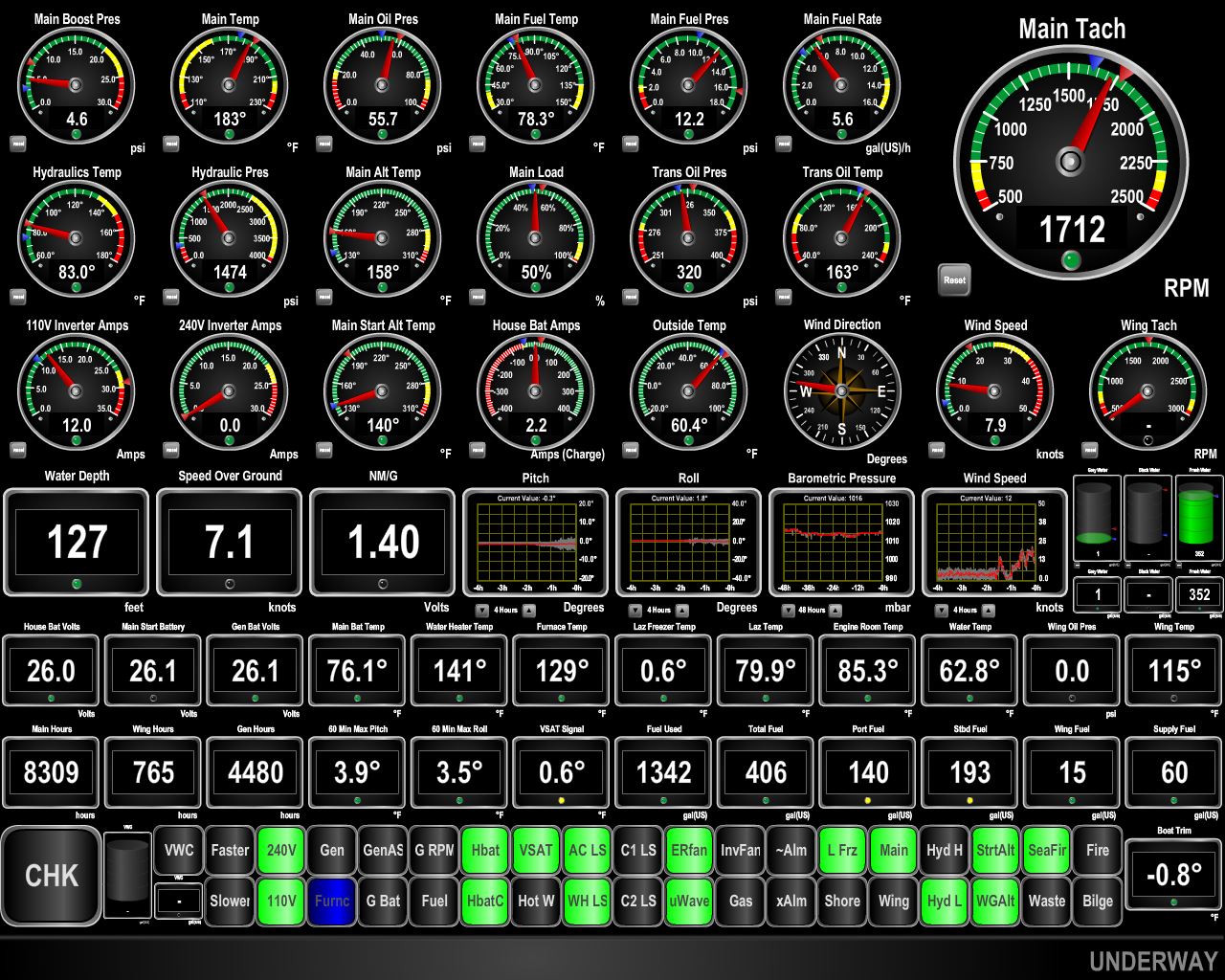
As expected, we’re rounding Cape Sable at maximum ebb, with 2.3kts of current against us. We’re making less than five knots at a fuel economy of 0.770 nm/g. At 1800 RPM in flat water, we’d be doing about 7.6 knots. We expect this to last about 3-4 hours until the current turns to flood. We’re “driving to the lights” to reach Southwest Harbor in the afternoon, and the Maretron display is showing orange indicating we should speed up to meet our deadline. We expect to get a push from the current later, so rather than burn fuel needlessly to meet the speed goal, we’ll just put up with the slow speed and expect to gain the time back later.
|
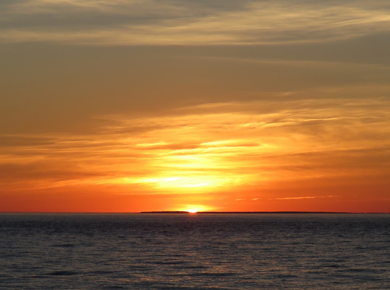 |
Sunset
Position: -65 41.84, 43 21.89
Beautiful sunset at sea.
|
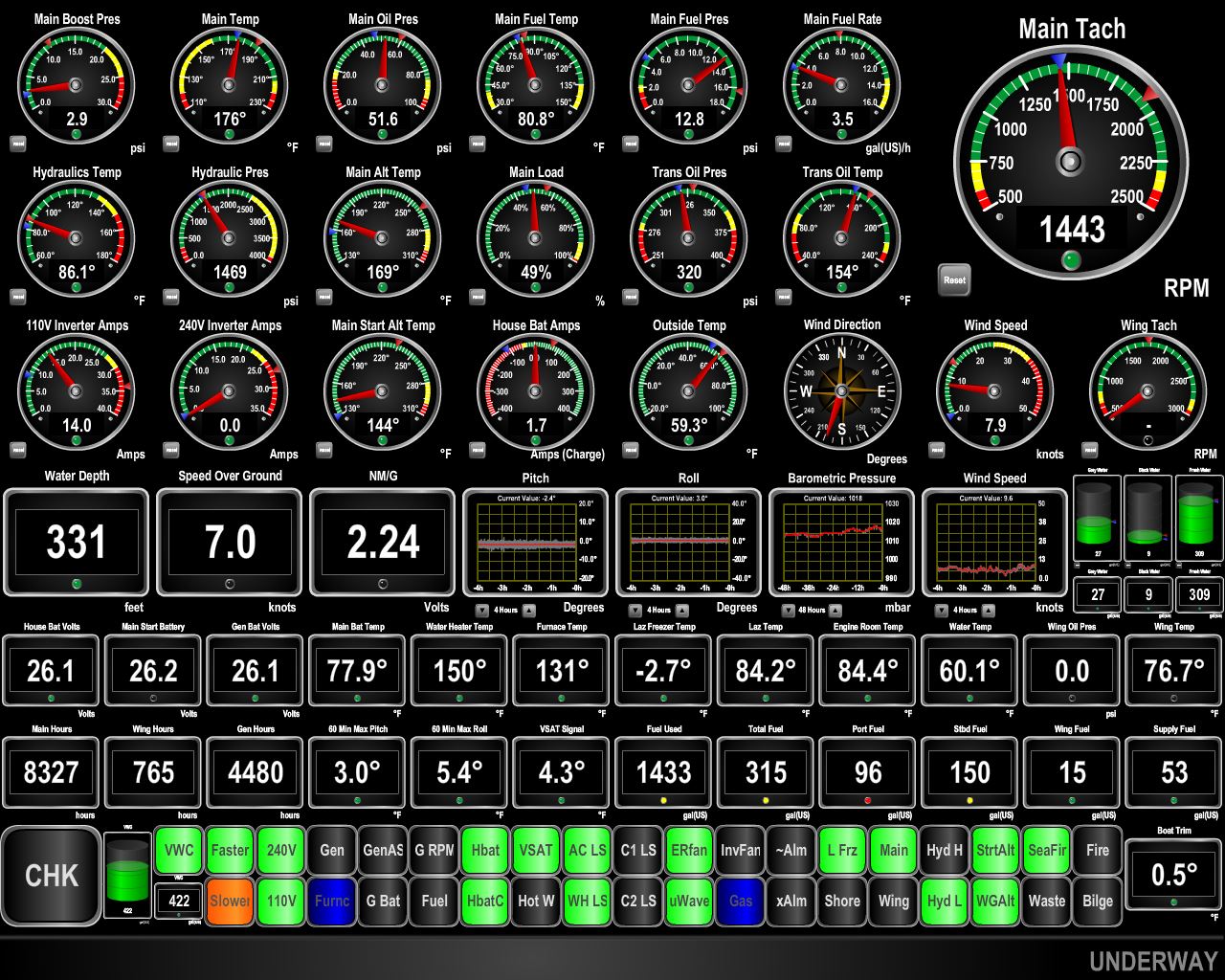 |
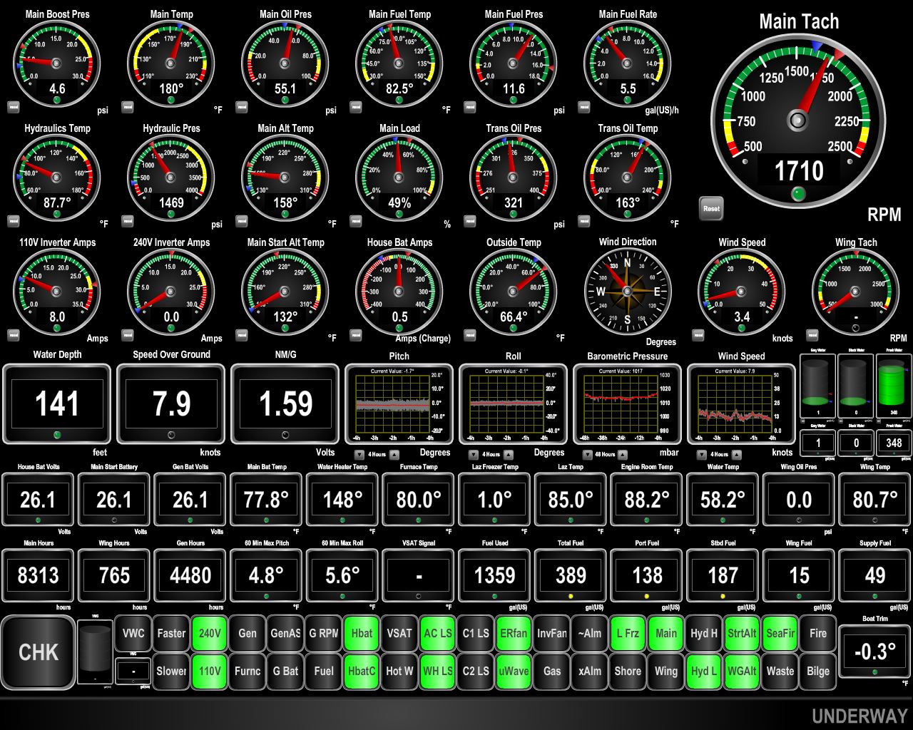
Flood
Position: -66 21.53, 43 34.54
We’ve finally escaped the negative current and are getting a nice push again. The “driving to the lights” gauge now indicates we should slow down to meet our 2:30pm deadline. The fuel dock only has 6ft of water at low tide which is around 11am, so we need to arrive a bit later to have ample water. We’re driving to schedule right now and aiming for the harbor entrance at 2:30 and the fuel dock shortly thereafter. We last fueled in Boston nearly 2 months and 290 engine hours back so we are running fairly light with 336 gallons left on board in all four tanks.
|
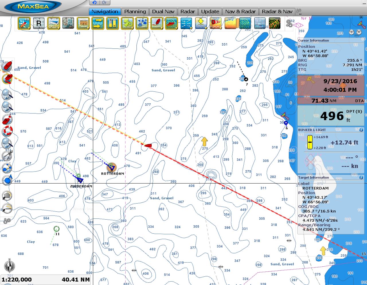 |
Cruise Ships
Position: -66 50.54, 43 45.54
Around 2:30 this morning, the two cruise ships Zuiderdam and Rotterdam passed us about 4.5 miles away. Both ships were en route to Bar Harbour. It’s going to be crowded there today for sure.
|
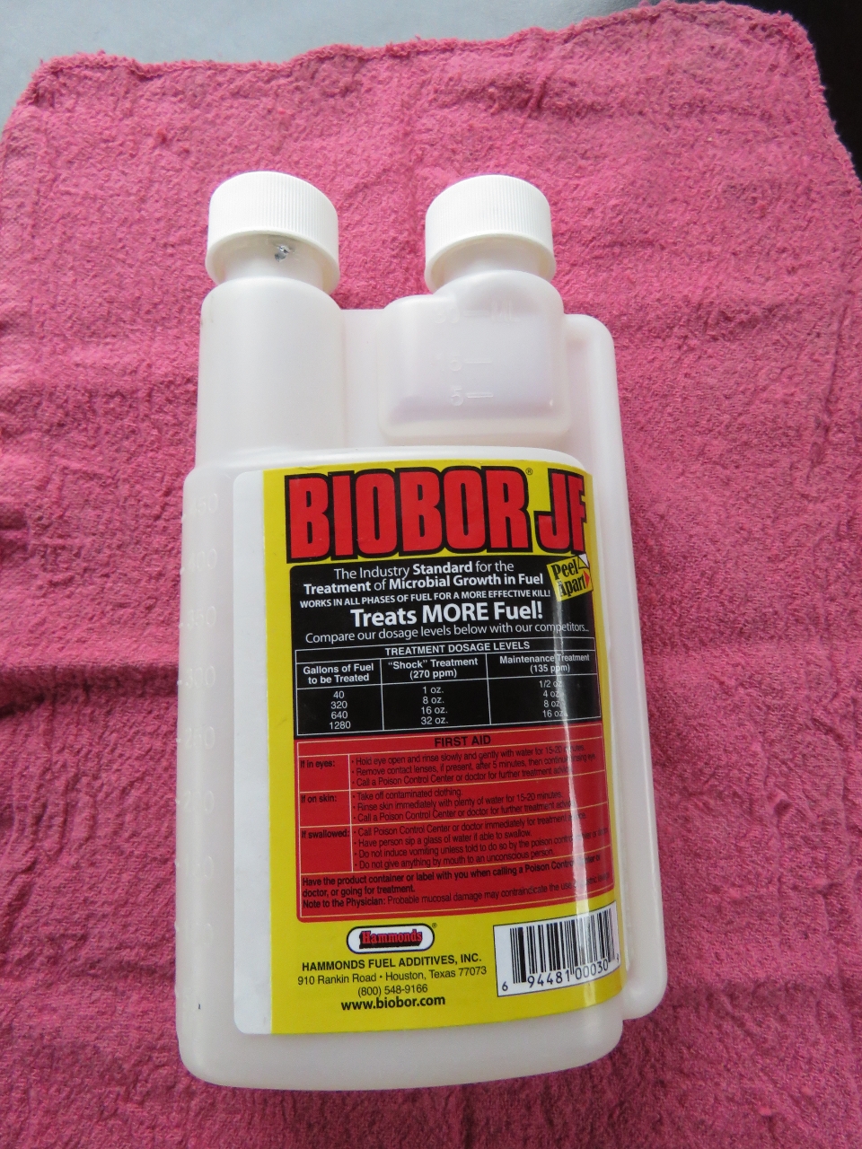 |
Fuel Treatment
Position: -67 28.24, 43 59.63
We treated both fuel tanks with 8 oz Biobar JF each. We do this every six months. This is a good shock treatment since we always use the same 16 oz on each treatment, but there is currently only 215 gallons in the two tanks. We also replaced the fuel in wing engine day tank with treated fuel and drained the supply tank, refilled it with treated fuel, then pumped it back down to fifteen gallons and polished that fuel in the bottom of tank for thirty minutes.
|
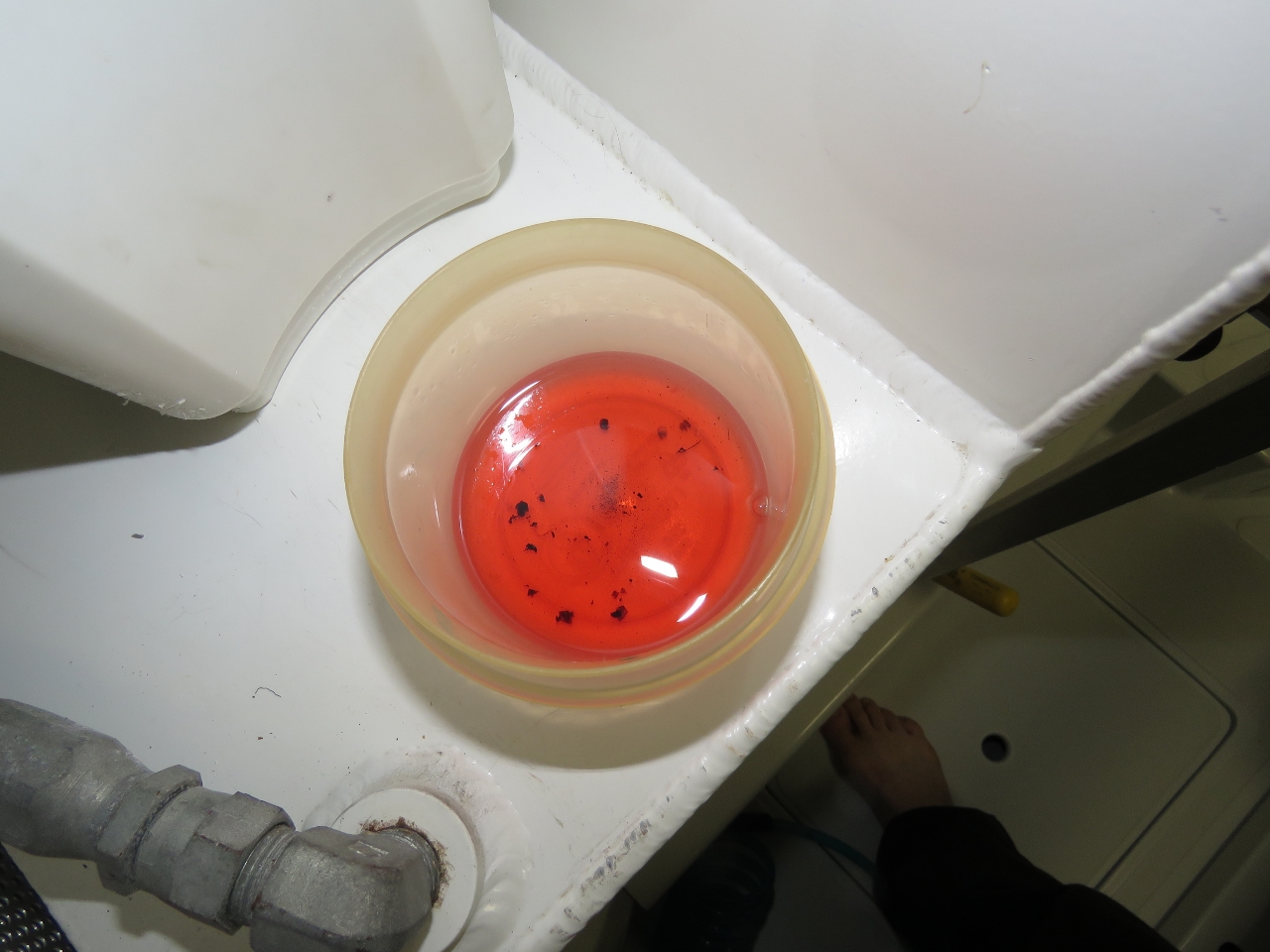 |
Fuel Debris
Position: -68 3.63, 44 12.63
After having pumped off the bottom of all four tanks and completely changing the fuel in two of them, we took a sample in the bottom of the fuel transfer filter to check for water. As usual, no water was found, but there was a surprising amount of rust and debris.
|
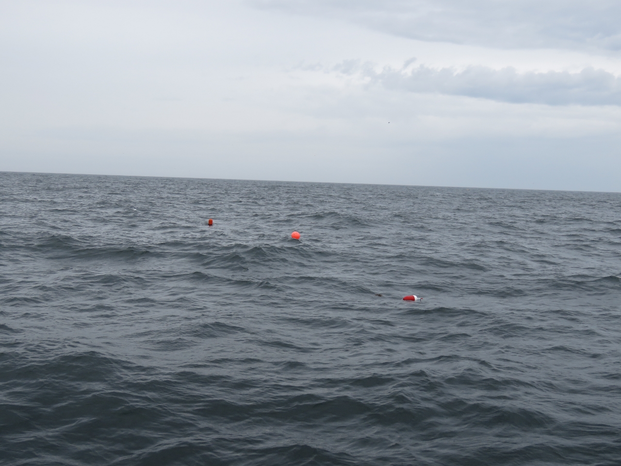 |
Trap
Position: -67 50.29, 44 7.54
We saw our first lobster trap as we got into shallower water about 25 miles out of Southwest Harbor. The pots became more frequent the closer we got. Initially we had to steer around one every ten minutes or so, but as we neared the harbor we constantly were steering around pots. They weren’t quite as thick as we were expecting—we’d heard stories of people having to push the traps out of the way they were so thick with no way to avoid them. But we definitely wouldn’t want to approach or leave at night.
|
 |
Clearing Through
Position: -67 53.92, 44 8.93
James on the phone with US Customs to clear us through. Before we left Lunenburg we’d filed a float plan using the Small Vessel Reporting System and were asked only a cursory few questions before being given clearance.
|
 |
Wind
Position: -68 17.04, 44 16.22
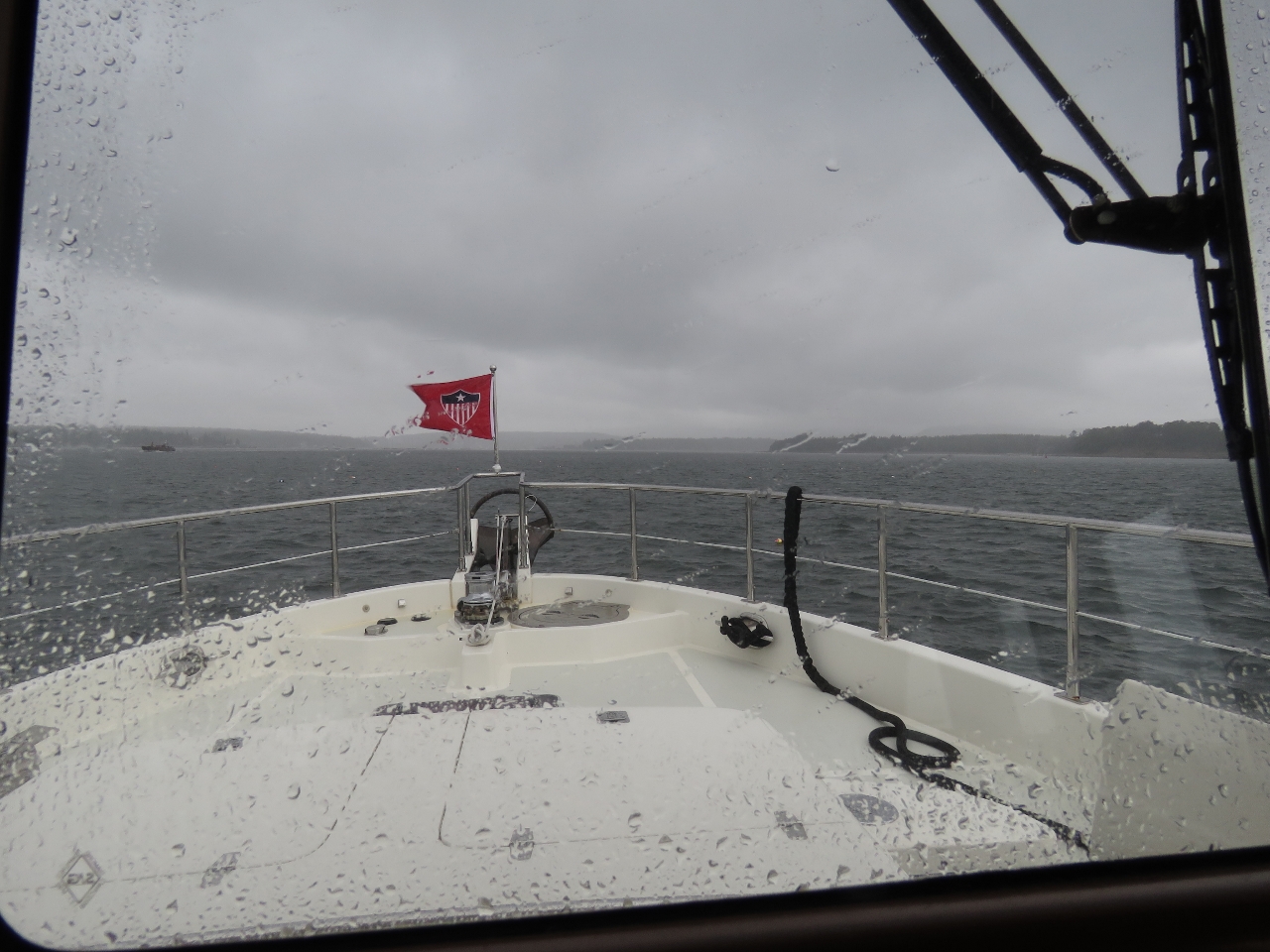
As we entered Southwest Harbor, the winds picked up to twenty knots with rain and poor visiblity making those lobster traps harder to see.
|
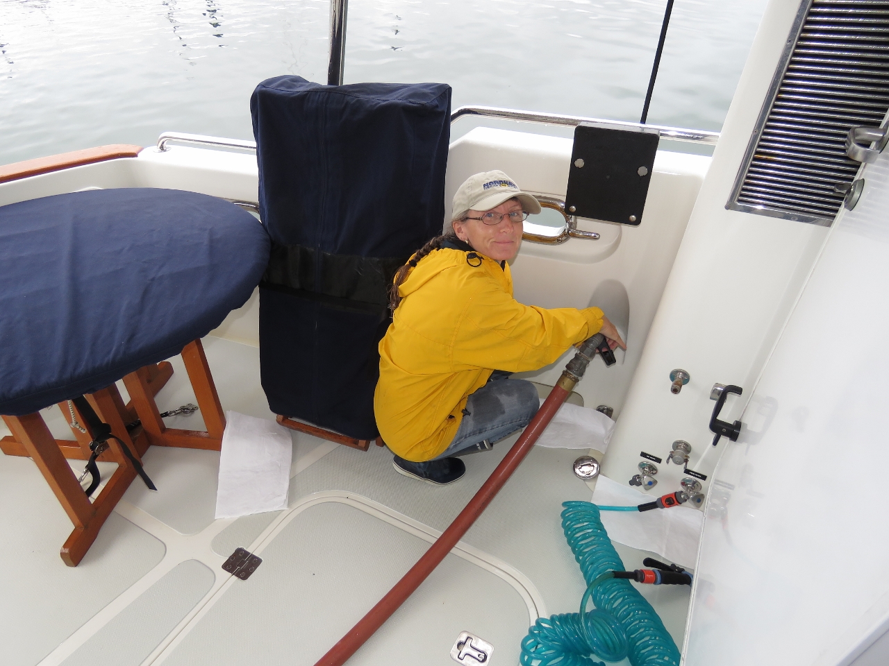 |
Fueling
Position: -68 19.38, 44 16.46
We took on 1,490 gallons in our first fueling since Boston on July 31st.It’s great that we can be out and running the generator or engine every day and still be able to go two months between fuelings. Admittedly, we were starting to get fairly low on fuel with only 262 gallons total on board. It gets uncomfortable when dropping down below 400 gallons but we remind ourselves that 400 gallons is nearly twice the fuel capacity of our first boat and is nearly one quarter of the capacity of this one. It’s really not THAT low. And it’s important that we be confident in our systems and have many redundant checks on fuel levels since, when crossing oceans, we will routine aim to finish the trip with only 10% reserve which is 175 gallons remaining. At the end of this run we had 262 gallons left so it’s more than we would expect to have after a long run at sea.
We have 3 redundant checks: 1) the sight gauges on the side of the tanks showing fuel level, 2) the Maretron FPM100 fuel level sensors which are are primary measures, and 3) the engine ECU fuel consumed data point. Between them all, we have a lot of data and when we fill it’s normal that our measures be within 2 to 3% and its usually closer to 0. Over time we have developed confidence in the system but we fully admit to there always being a chance we will get it wrong and it still has our attention when we are running at lower fuel levels. By the way, the savings in filling up in Maine rather than Nova Scotia was just over $3,000. Just this one trip paid for the cost of the fuel measuring sensors many times over. |

|
Click the travel log icon on the left to see these locations on a map, with the complete log of our cruise.
On the map page, clicking on a camera or text icon will display a picture and/or log entry for that location, and clicking on the smaller icons along the route will display latitude, longitude and other navigation data for that location. And a live map of our current route and most recent log entries always is available at http://mvdirona.com/maps. |
If your comment doesn't show up right away, send us email and we'll dredge it out of the spam filter.