We’d never seen flocks of eagles before, but that was practically the scene at Indian Island at the head of Wyhcocomagh Bay. We anchored in the pristine Washabuck River and ran the tender twenty-five miles up Wyhcocomagh Bay. As we rounded the southwest point of Indian Island, we saw an eagle in a tree, then another, and another and another. At least half-dozen were in the tree, with a similar number in the next tree over and many more farther along the island. We stopped counting after about fifty. We’d never seen so many eagles in one place, not even in Alaska.
Trip highlights from September 3rd, 2016 follow. Click any image for a larger view, or click the position to view the location on a map. And a live map of our current route and most recent log entries always is available at http://mvdirona.com/maps
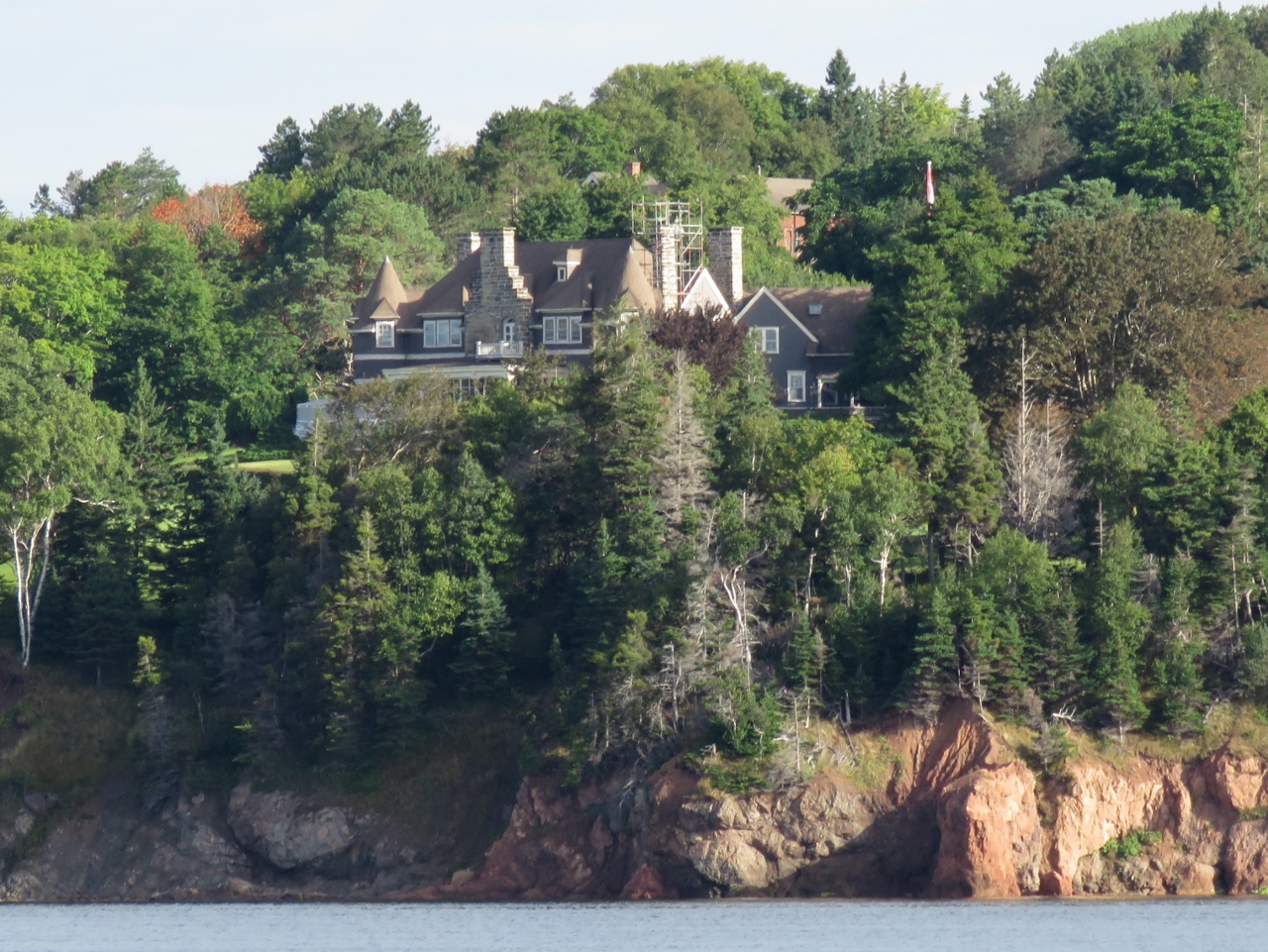 |
Beinn Bhreagh
Position: -60 42.98, 46 5.05
We got a better view to Beinn Bhreagh, Alexander Graham Bell’s summer retreat, with clear weather and a little more distance from the point.
|
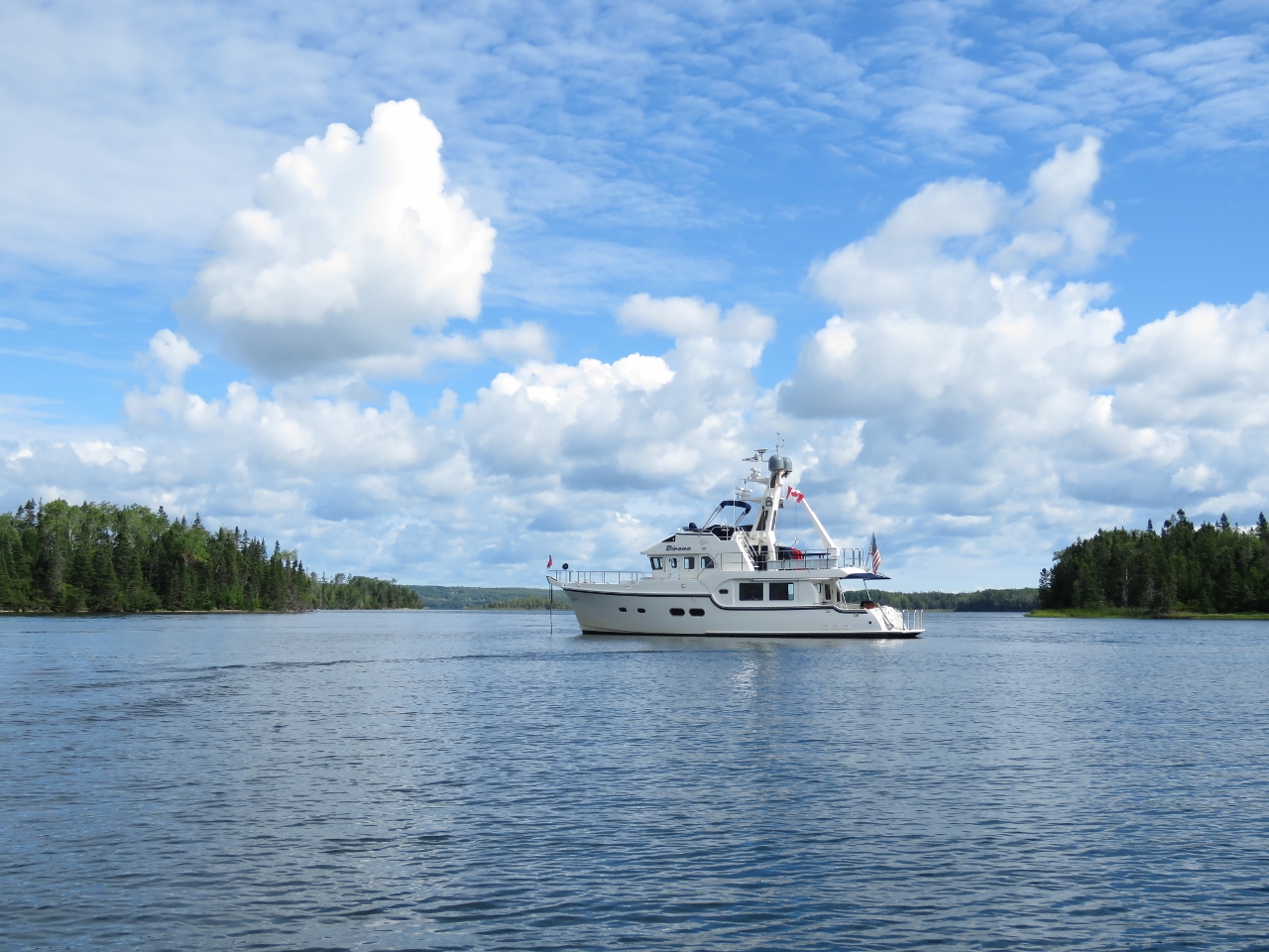 |
Washabuck River
Position: -60 51.26, 46 1.97
The Washabuck River is a lovely, pristine place to anchor, with plenty of sheltered coves to tuck into and little evidence of people anywhere. Apparently members of the Cruising Club of America own much of the surrounding land and have kept it in its natural state.
|
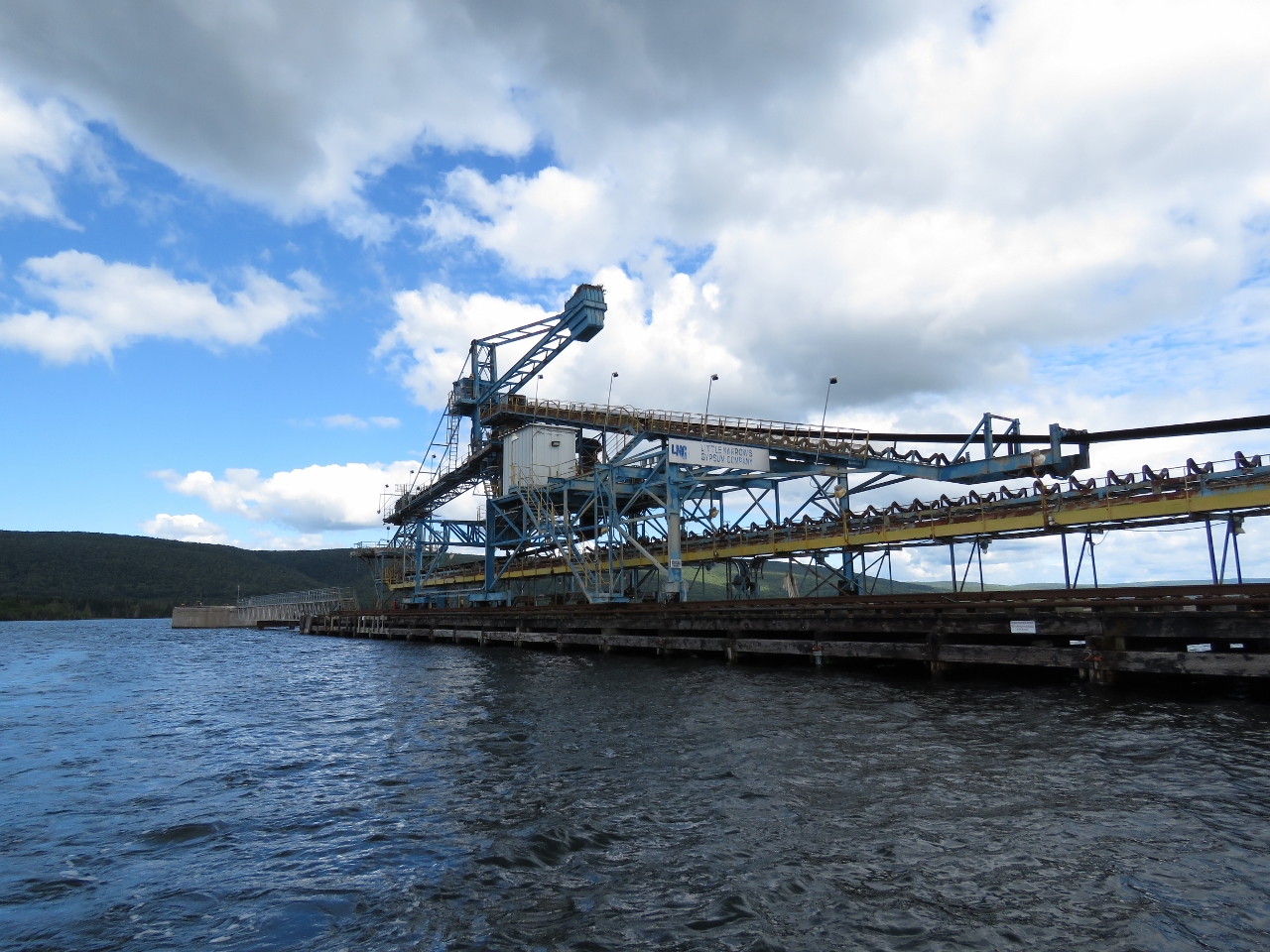 |
LNGC
Position: -60 57.58, 46 0.13
We took the tender on a 50-mile (return) trip to the head of Wyhcocomagh Bay. The route through St. Patrick’s Channel was incredibly well-buoyed with range markers as well. When we reached the other side, we found out why. The Little Narrows Gypsum Company (LNGC) has their large commercial loading facility there. That also explains why the entry to Great Bras d’Or channel is so well marked—large commercial ships are passing through en route to and from the LNGC dock. The quarry has yielded gypsum and natural rock since 1935 and has traditionally shipped the product down the Eastern Seaboard, but has not operated since last summer due to poor markets for their product.
|
 |
Buoys
Position: -60 57.53, 46 0.17
Judging by the the large sea buoys ashore, the Little Narrows Gypsum Company is responsible for maintaining or at least supplying some of the buoys to guide ships to and from their docks.
|
 |
Cable Ferry
Position: -60 59.05, 45 59.53
At the tightest point in Little Narrows, we had to wait for the cable ferry to pass. When it is safe for us to proceed, the operator changes a light onshore from red to green.
|
 |
Aquaculture
Position: -61 7.27, 45 57.04
We toured around the village of Wyhcocomagh, but didn’t see anywhere interesting to go ashore, so continued around Indian Island. Tucked off the southwest corner were several active fish pens. This seemed like an unusual choice of locations, as there would be minimal water flow and the waters likely would become polluted fairly quickly.
|
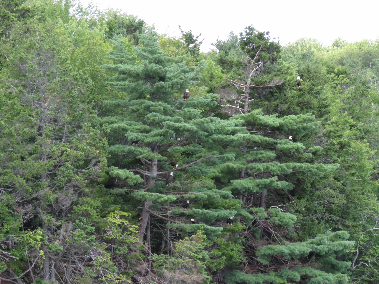 |
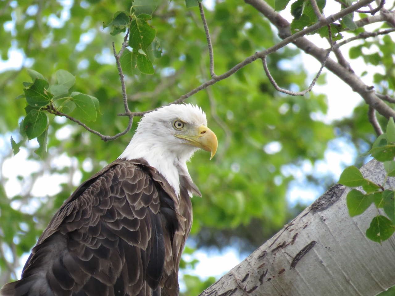
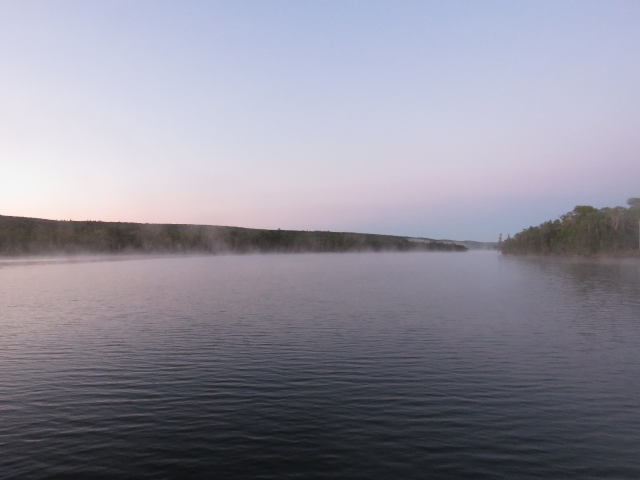
Eagles!
Position: -61 7.10, 45 57.15
As we rounded the southwest point of Indian Island, we saw an eagle in a tree, then another, and another and another. At least half-dozen were in the tree, with a similar number in the next tree over and many more farther along the island. We stopped counting after about fifty. We’d never seen so many eagles in one place, not even in Alaska.
|
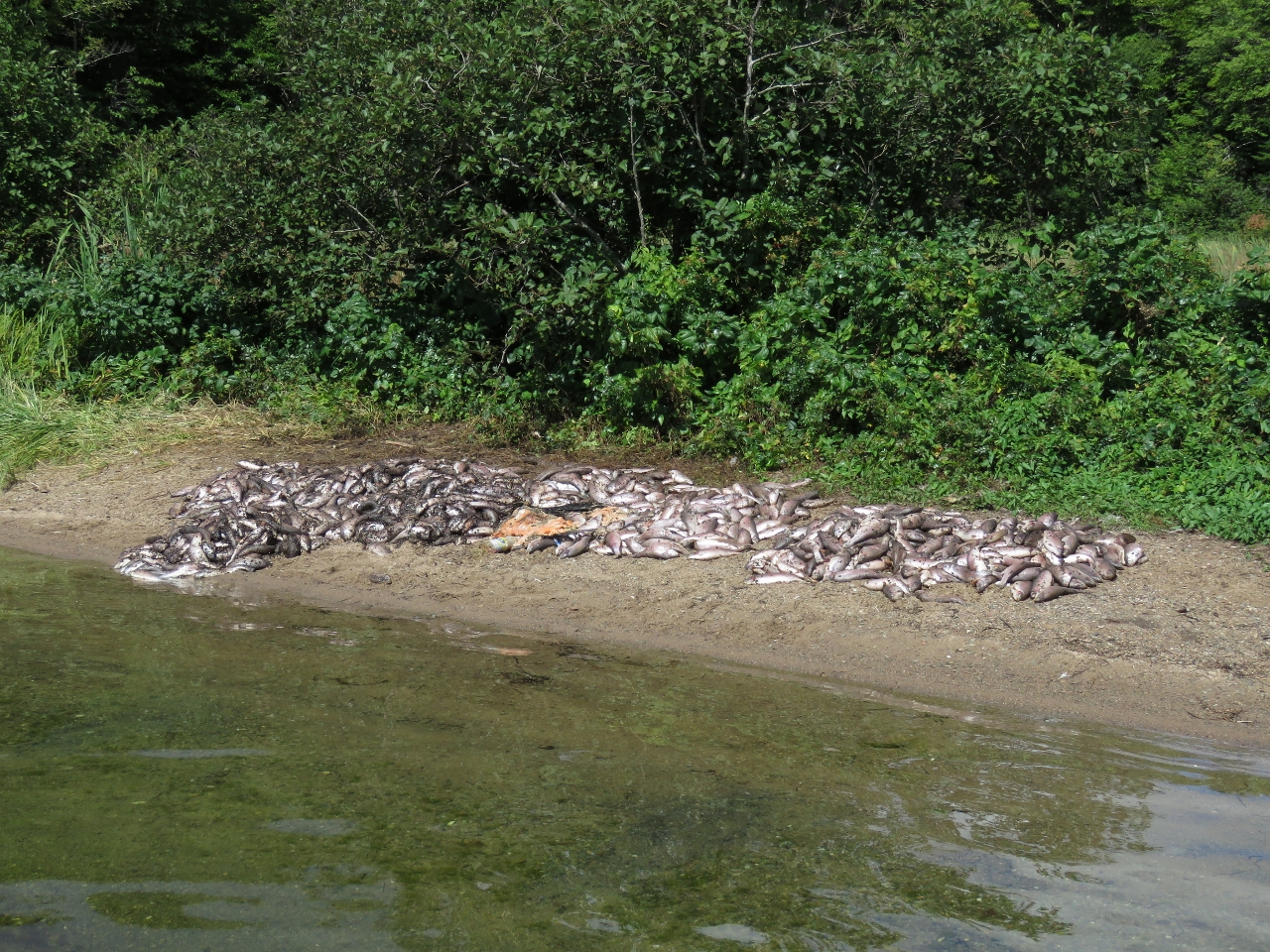 |
Fish
Position: -61 7.08, 45 57.19
Indian Island is a breeding ground for bald eagles. It looked like someone had been encouraging them with a fish feed as well, perhaps from the aquaculture operation.,
|
|
|
Close-up
Position: -61 6.98, 45 57.17
So far all the eagles we’ve seen in Newfoundland and Nova Scotia are quite skittish and won’t let us get within hundreds of feet. The eagles at Indian Island were surprisingly unconcerned about our presence and let us get quite near for some excellent close-ups.
|
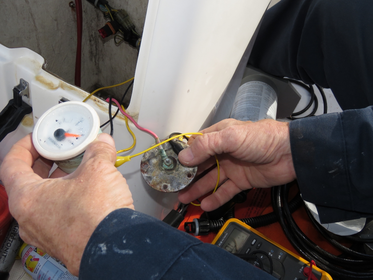 |
Fuel Gauge
Position: -60 51.19, 46 2.01
The fuel gauge in our tender failed sometime around the time we made our Sydney run and always read full. We’re lucky we didn’t run out of fuel on that run. We took it apart and the sending unit is operating fine, but nearly rusted through, so we’ll probably replace it as well. The guage no longer functions, so we’ll have to live without it and buy a new one. Fortunately they are fairly standard and reasonably inexpensive.
|
 |
Sea Smoke
Position: -60 51.20, 46 2.02
We woke up to a clear, but cold morning, with sea smoke drifting across the bay. This is looking north out of the anchorage toward Baddeck.
|
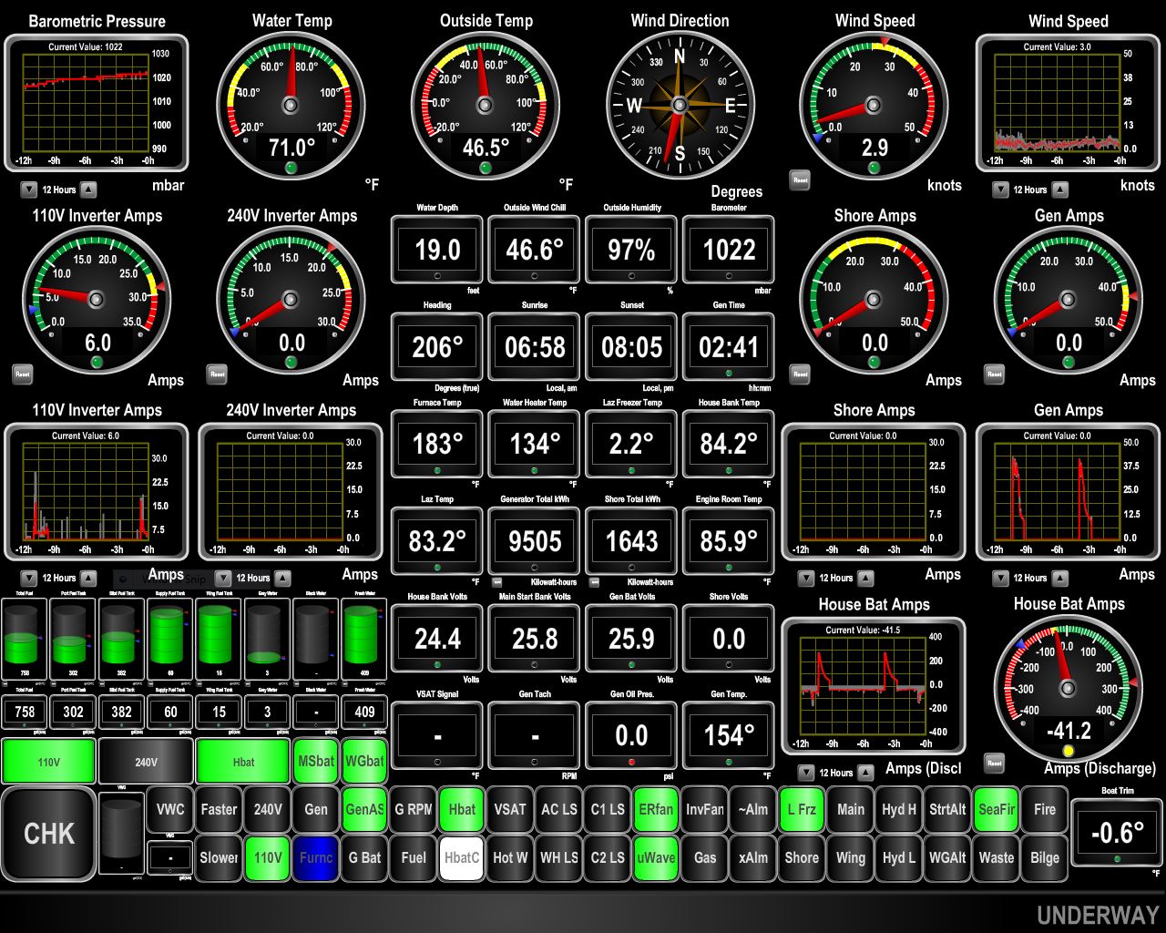 |
Brrrr!
Position: -60 51.20, 46 2.02
No wonder we had sea smoke. The air temperature was 46.5F this morning, compared to a water temperature of 71F (leftmost circular gauges in top row).
|
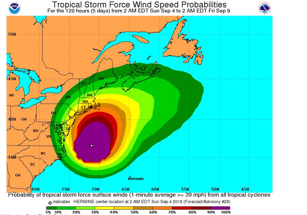 |
Hermine
Position: -60 51.20, 46 2.02
We’ve been keeping an eye on tropical storm Hermine the past few days. The area we’re in is showing in the dark green zone for the first time since we’ve been checking. This means that there is a 5% probability we’ll see 1-minute average winds of greater than 38mph over the next 5 days.
|

|
Click the travel log icon on the left to see these locations on a map, with the complete log of our cruise.
On the map page, clicking on a camera or text icon will display a picture and/or log entry for that location, and clicking on the smaller icons along the route will display latitude, longitude and other navigation data for that location. And a live map of our current route and most recent log entries always is available at http://mvdirona.com/maps. |
If your comment doesn't show up right away, send us email and we'll dredge it out of the spam filter.