We entered La Hune Bay past a stubby light perched above a helicopter service pad on a steep, barren cliff. The light and the abandoned community of Cape La Hune gave the place an even more remote feel than some of our other anchorages, as if nobody had been there for a very long time. The scenery was as grand though, despite overcast skies during much of our stay, with diverse wildlife.
Trip highlights from August 25th follow. Click any image for a larger view, or click the position to view the location on a map. And a live map of our current route and most recent log entries always is available at http://mvdirona.com/maps
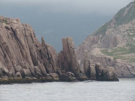 |
Wild Cove
Position: -56 50.32, 47 31.81
Weather-formed rock pillars in Wild Cove to our north.
|
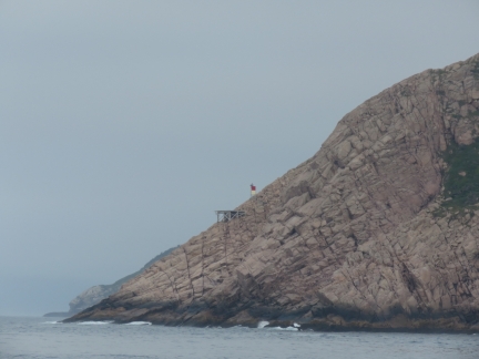 |
Cape La Hune Light
Position: -56 51.67, 47 31.44
The navigation light and helicopter perched in the edge of a cliff at Cape La Hune.
|
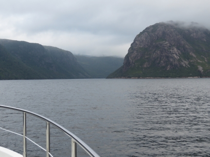 |
La Hune Bay
Position: -56 52.26, 47 36.53
Steep hills at the head of La Hune Bay.
|
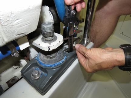 |
Engine Mounts
Position: -56 52.10, 47 38.04
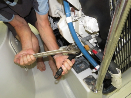
In Boston we noticed that our forward engine mounts were starting to deteriorate. We did purchase replacements, but expected the current ones to last for months yet. Suddenly, they’ve started to deteriorate badly and over the past couple of weeks the isolation material has been just crumbling away in a pile around the mount. This morning we picked up a fair bit of vibration in the drive line. Measuring the rear-mounts, we can see that the front mounts as they’ve crumbled away have allowed the engine to settle 0.250″ inches. We will need to change the mounts fairly urgently and realign the drive line but, in the interim, we decided to lift the engine back the 0.250″ that the mount has allowed the engine to fall.
|
 |
Loosening
Position: -56 52.09, 47 38.04
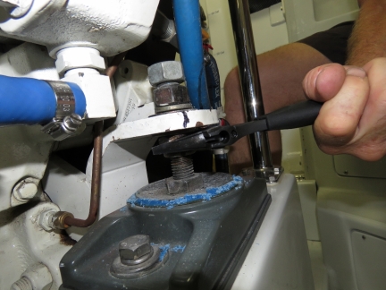
Loosening the top bolts holding the engine support to the mounts so that we can adjust the engine up.
|
 |
Aligning
Position: -56 52.10, 47 38.04
Adjusting the engine up 0.250″ and re-tightening the mounts. Amazingly, this highly primitive procedure eliminated the vibration. We will need to change the two front mounts very soon.
|
 |
Deadman Cove
Position: -56 51.08, 47 33.54
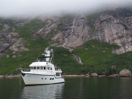
The anchorage at the head of La Hune Bay was great, but here in Newfoundland, great doesn’t cut it. Deadman Cove that we’d just gone past had a beautiful waterfall and we decided that’s where we needed to be. So, after adjusting the engine mounts, we got back underway.
|
 |
Caribou?
Position: -56 51.28, 47 33.49
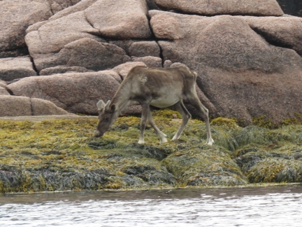
This hoofed animal was eating kelp at the southern point off the anchorage. Its ears seem too small for a moose, so perhaps it is a caribou?
|
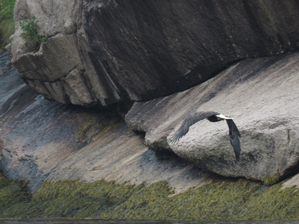 |
Eagle
Position: -56 51.83, 47 34.00
Several adult and juvenile eagles were at the cliffs along the west shore of La Hune Bay.
|
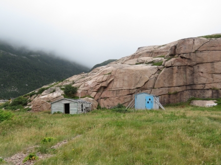 |
Cabins
Position: -56 52.44, 47 33.23
Cabins at the abandoned village of Cape La Hune opposite the anchorage.
|
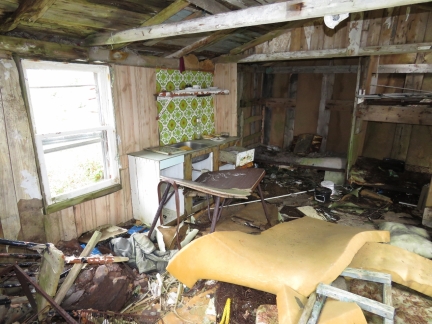 |
Mess
Position: -56 52.46, 47 33.22
The interior of the leftmost of the two cabins was a real mess. It was hard to tell if weather, vandalism or hard-livin’ was the cause.
|
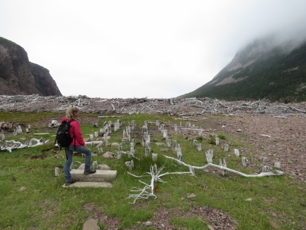 |
Steps
Position: -56 52.56, 47 33.24
All that remained of several other houses at Cape La Hune were the pilings that once supported them and concrete steps leading up.
|
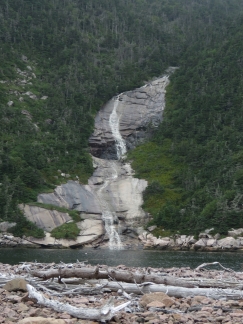 |
Mitchell Cove
Position: -56 52.54, 47 33.25
A large waterfall spilling into Mitchell Cove at the abandoned village of Cape La Hune.
|
 |
Anchorage
Position: -56 50.90, 47 33.55
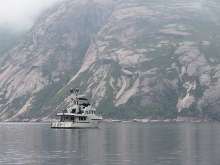
The cliffs on the opposite side of La Hune Bay from our anchorage were as impressive as the ones we’d anchored under.
|
 |
Depth Sounder
Position: -56 51.07, 47 33.57
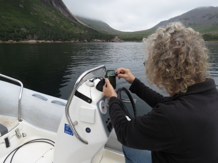
The dinghy depth sounder has continued to work well since James rewired it in St. Lucia to eliminate a corroded connection. It recently started having keyboard faults and sporadically beeping. It appears to be unrelated to the connection issue, but we think this depth sounder is close to needing replacement. We gave it one more try with contact cleaner on the printed circuit board and it actually is working again, but we don’t expect it to have more than months or weeks to go.
|
 |
Kelp Knife
Position: -56 51.07, 47 33.57
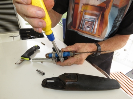
The knife we use on the end of our boat hook for cutting kelp away from the anchor broke. It’s really handy to have, so we built a new attachment with a stronger knife.
|
 |
Cliffs
Position: -56 51.06, 47 33.57
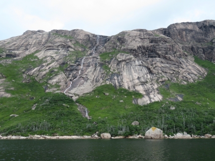
The clouds lifted later in the afternoon and we got to see the top of the cliffs above our anchorage at Deadman Cove.
|
 |
Gannet
Position: -56 51.05, 47 33.57
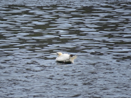
A lone Northern Gannet swam in the anchorage for a couple of hours. These birds are the largest member of the Gannet family. One of the three major breeding colonies in North America is at Cape St. Mary’s Ecological Reserve on the southeast coast of Newfoundland.
|

|
Click the travel log icon on the left to see these locations on a map, with the complete log of our cruise.
On the map page, clicking on a camera or text icon will display a picture and/or log entry for that location, and clicking on the smaller icons along the route will display latitude, longitude and other navigation data for that location. And a live map of our current route and most recent log entries always is available at http://mvdirona.com/maps. |

Indeed a caribou ;-)
Thanks for confirming our Caribou sighting in La Hume Bay Newfoundland.
So far you seem to have lucked out with weather conditions. Is it starting to feel cool there now that summer is over? Does the frequency of harsh weather start to increase after August?
The scenery is incredible.
Do you even consider trying to fish for fresh fish?
Yes, weather has been excellent. We just love cruising the shoulder periods on both ends of the busy season. It’s far less busy but the weather is still quite good.
For sure weather will slowly start to worsen and, as you said, the frequency of big weather will start to climb. It is the North Atlantic and winter storms here can be agressive.
You asked about fishing as well. There is no question we should but I find that between working full time, taking care of the boat, and having time for fun, fishing just doesn’t seem like a priority. Our version of “fishing” is reaching way down into the laz freezer and hooking a Salmon for dinner :-).