Fenway Park, built in 1912, is the oldest park in Major League Baseball and catching a game there is on most “Top Ten Things to do in Boston” lists. We spent an exciting evening visiting the park and watching the Red Sox play at this historic venue.
Highlights from our Fenway Park trip follow. Click any image for a larger view, or click the position to view the location on a map. And a live map of our current route and most recent log entries always is available at http://mvdirona.com/maps
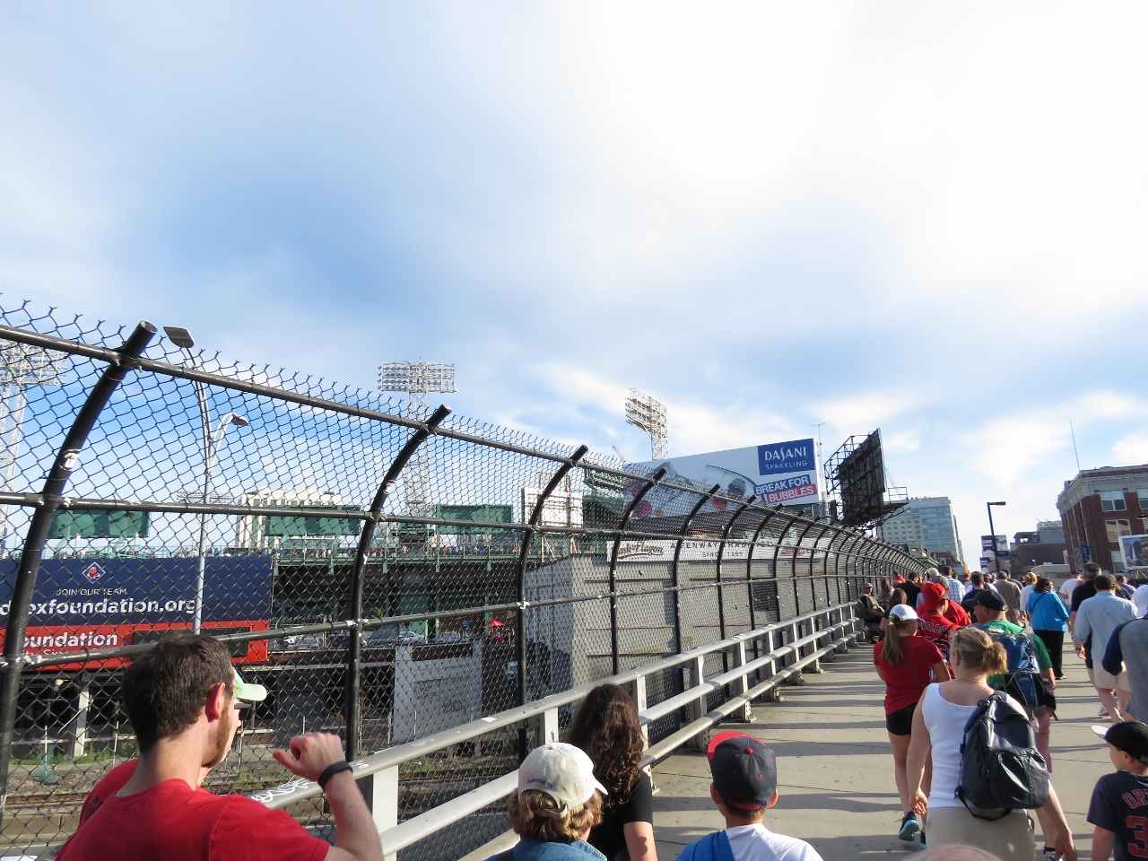 |
Crowds
Position: -71 5.87, 42 20.87
Following the crowds into historic Fenway Park to take in a Boston Red Sox baseball game.
|
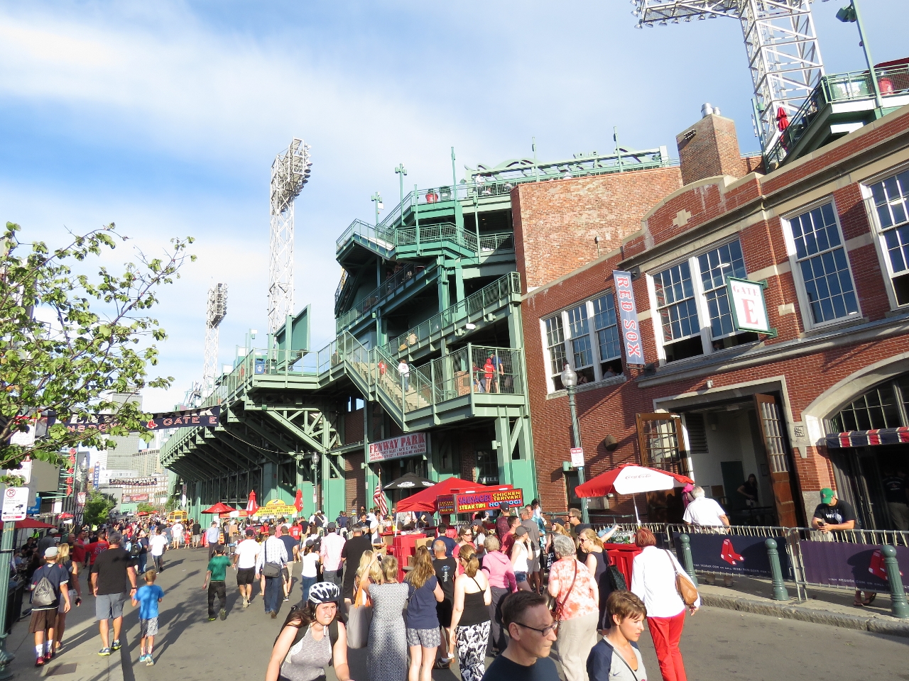 |
Landsdowne St
Position: -71 5.90, 42 20.84
Looking down Landsdown Street behind the outfield. The stadium actually extends over the road.
|
 |
Green Monster
Position: -71 5.83, 42 20.76
The 37’2″ “Green Monster” left field wall at Fenway Park. Designed to hide the field from external viewers and reduce easy home runs to left field, the wall was part of the original park construction and is the highest in Major League Baseball.
|
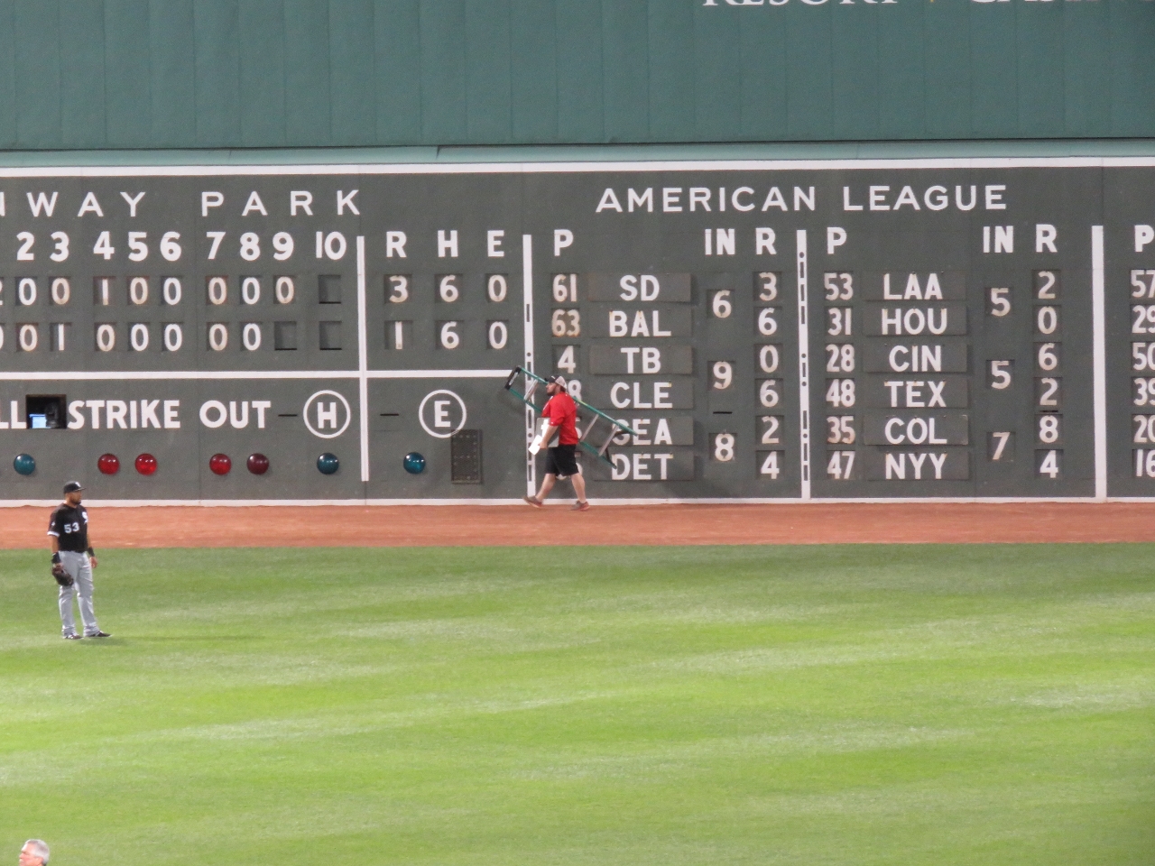 |
Scoreboard
Position: -71 5.83, 42 20.75
The scoreboard embedded in the wall still is updated by hand. Home game and American League scores are updated from behind the wall, and National League scores from the front of the wall. In the picture, the score keeper is returning back behind the wall through a door after updating the National league scores between innings.
|
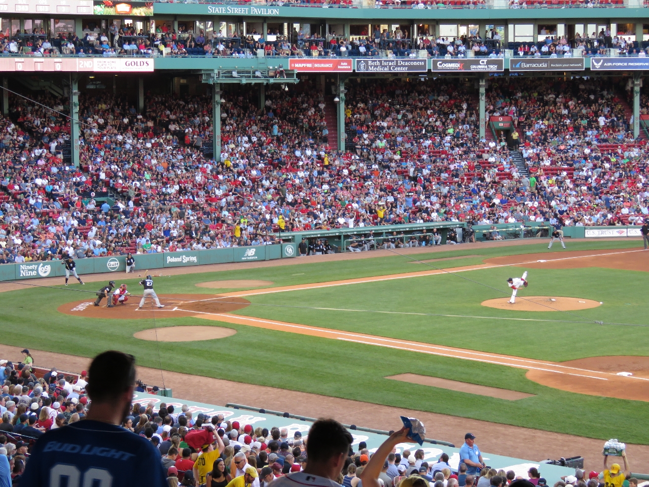 |
Pitch
Position: -71 5.83, 42 20.76
In this pitch from Red Sox Clay Buchholz to White Sox catcher Dioner Navarro the ball is just barely visible as a white streak between the third-to-home base line and the left end of the visitor’s dugout.
|
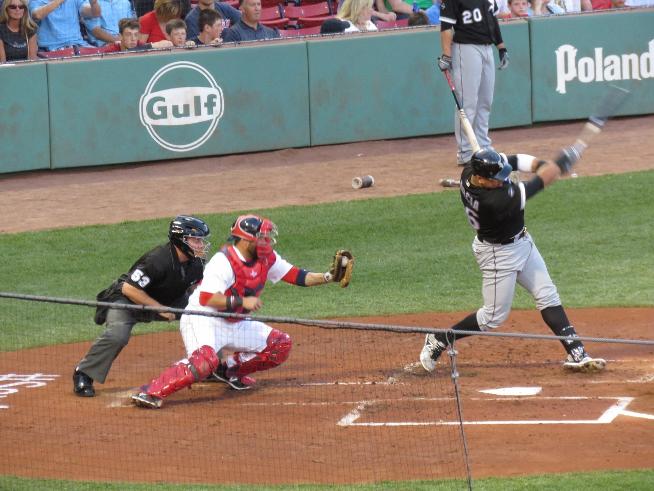 |
Strike
Position: -71 5.83, 42 20.76
White Sox designated hitter Avisail Garcia swings through a pitch.
|
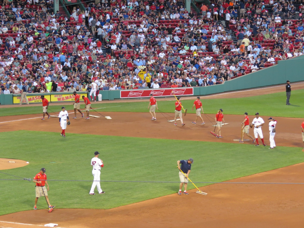 |
7th Inning Stretch
Position: -71 5.83, 42 20.76
After the first half of the seventh inning, the grounds keepers cleaned the field while the fans stretched to the tune of the traditional “7th inning stretch” song, “Take Me Out to the Ball Game”
|
|
|
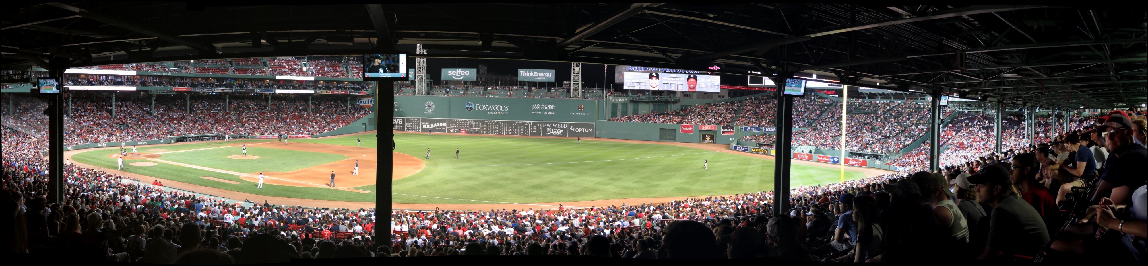
Fenway
Position: -71 5.83, 42 20.76
The view from our seats. The Red Sox didn’t win, but we had a super-fun evening.
|

|
Click the travel log icon on the left to see these locations on a map, with the complete log of our cruise.
On the map page, clicking on a camera or text icon will display a picture and/or log entry for that location, and clicking on the smaller icons along the route will display latitude, longitude and other navigation data for that location. And a live map of our current route and most recent log entries always is available at http://mvdirona.com/maps. |
If your comment doesn't show up right away, send us email and we'll dredge it out of the spam filter.