Our first stop after leaving the Palm Beach area was at Cape Lookout in North Carolina, just south of Cape Hatteras. We’d stopped there en route to Boston mainly to wait out a storm that would be passing through the Boston area, but it turned out to be an excellent anchorage. We toured the Cape Lookout National Seashore, climbed the light house there, and generally enjoyed being out on anchor again. Amazingly, our anchor hadn’t been down for over six months—not since Plettenberg Bay on the east coast of South Africa. That’s double the longest time we’ve not been at anchor in the last sixteen years.
Trip highlights from June 10th through 13th follow. Click any image for a larger view, or click the position to view the location on a map. And a live map of our current route and most recent log entries always is available at http://mvdirona.com/maps
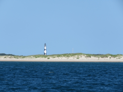 |
Cape Lookout
Position: -76 34.02, 34 37.29
The distinctive light at Cape Lookout is prominent in the background as we near the anchorage.
|
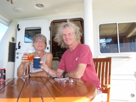 |
At anchor
Position: -76 32.79, 34 37.77
It’s great to be back out on the hook again. We’re in North Carolina now, having skipped Georgia and South Carolina—we’ll visit them on our return trip south later this year. The last time we spent a night in North Carolina was way back in 1991 for “Racing at the Rock” at the now-closed Rockingham Motor Speedway, our then-favourite NASCAR track.
|
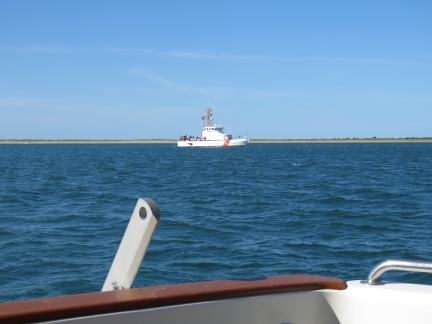 |
Cochito
Position: -76 32.80, 34 37.77
We saw the Coast Guard patrol boat Cochito standing off Beaufort Inlet as we approached Cape Lookout. Not long after we arrived, the 87-ft Marine Protector class vessel slowly came through the channel into the bay and anchored to our south.
|
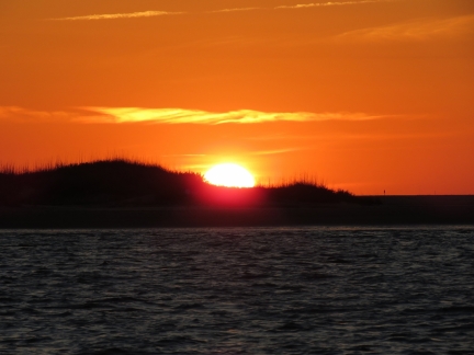 |
Sunset
Position: -76 32.82, 34 37.77
A fabulous sunset to accompany our first night at anchor this year.
|
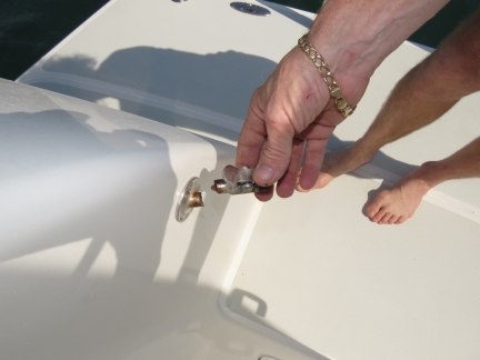 |
Latch
Position: -76 32.80, 34 37.77
We opened the cockpit door this morning to a strange thumping sound. The cockpit door latch had broken off. It looks like this angled latch was fabricated by taking a straight latch and welding it an an angle, and it appears the weld has failed.
|
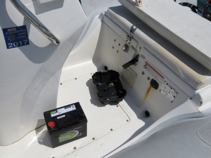 |
Battery
Position: -76 32.80, 34 37.77
The tender battery was discharged and wouldn’t accept a charge, so we put the spare in.
|
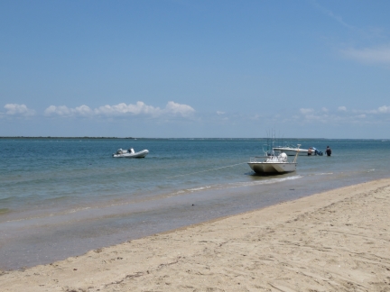 |
Landed
Position: -76 31.35, 34 37.55
We landed the tender off the beach using the Anchor Buddy, effectively a bungee-cord attached to an anchor, off the stern with a bow line ashore.
|
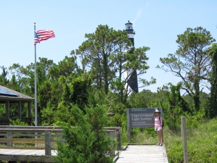 |
Light Station
Position: -76 31.42, 34 37.44
The Cape Lookout Light Station is part of the Cape Lookout National Seashore. The light house still is operational, and the tower is open to the public for tours. You can see the light turning and an incredible 365° views from 163ft in the sky.
|
 |
Boardwalk
Position: -76 31.43, 34 37.42
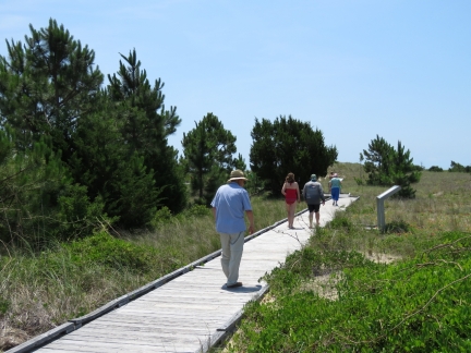
The light station has a sturdy boardwalk leading around the site and to the ocean.
|
 |
South Core Banks
Position: -76 31.25, 34 37.28
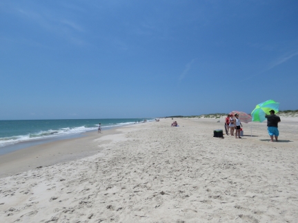
The beach along the South Core Banks was filling fast with visitors.
|
 |
Light house
Position: -76 31.47, 34 37.39
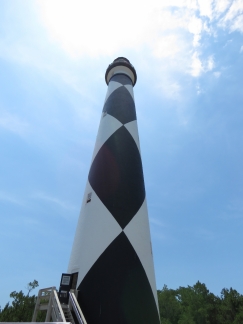
The Cape Lookout Lighthouse was built in 1857 and stands 163ft high. The diamond pattern painted daymark distinguishes it visually from other lighthouses in the area, and also indicates direction—the black diamonds point north-south and the white diamonds east-west.
|
 |
Steps
Position: -76 31.47, 34 37.37
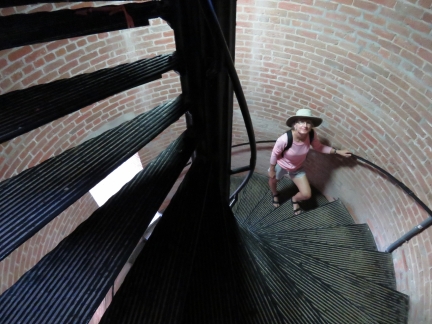
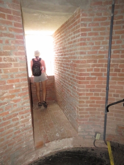
Climbing the 207 steps to the top of the Cape Lookout lighthouse.
|
 |
Landing
Position: -76 31.47, 34 37.37
The lighthouse walls taper from 9ft at the base to 1ft 7in at the top. The lighthouse is built with double walls that are separate at the bottom, but join higher up.
|
 |
View
Position: -76 31.47, 34 37.36
Hard to beat the view from the top of the lighthouse. This is looking south to Cape Lookout on the left, our anchorage in Cape Lookout Bight is left of center, Shackleford Banks are in the center, Barden Inlet is to the right of center, and the South Core Banks extend to the right. Shackleford Banks were originally connected to the South Core Banks, but a 1933 hurricane opened up Barden Inlet to Cape Lookout Bight.
|
 |
Anchorage
Position: -76 31.47, 34 37.36
Dirona visible at anchor way in the distance to the northwest of the lighthoust.
|
 |
Tender
Position: -76 31.47, 34 37.36
Our tender is just visible moored outermost of most of the other boats at the top of the picture.
|
 |
Beacon
Position: -76 31.47, 34 37.36
The lighthouse originally had a 6ft diameter Fresnel lens that in 1979 was replaced by two 1000-watt electrict lights.
|
 |
Museum
Position: -76 31.48, 34 37.39
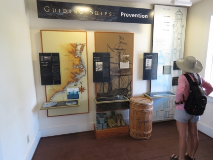
The old lightkeeper’s house is now a compact museum with excellent displays on the history and geology of the area.
|
 |
Lunch
Position: -76 33.07, 34 38.12
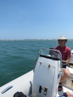
We moored the tender off the spit at the anchorage entrance and had lunch amongst the local boats. Dirona is a white speck in the background in the center left third of the photo.
|
 |
Fishboat
Position: -76 31.39, 34 40.14
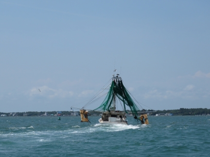
Following a fishboat through Barden Inlet. Underway, the fishboats leave the nets hanging from up high, with trawl doors extended from each side, while underway.
|
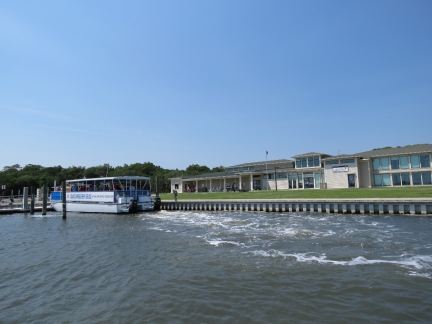 |
Harkers Island
Position: -76 31.58, 34 41.11
The main visitor center for the Cape Lookout National Seashore is on Harkers Island. The is the ferry that runs to the light station.
|
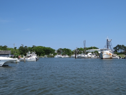 |
Marshallberg
Position: -76 31.26, 34 43.29
The fishboat we were following went into this tiny marina off Marshallberg.
|
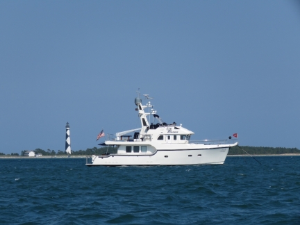 |
Dirona
Position: -76 32.90, 34 37.81
At anchor with the lighthouse in the background. We’re really enjoying the anchorage and the view to sand dunes all around. It reminds us of the area north of the Gold Coast in Australia.
|
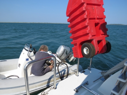 |
Refueling
Position: -76 32.80, 34 37.77
Refueling the tender from our deck fuel. We have two 29-gallons portable gasoline tanks that we keep stored on the boat deck, starboard of the stack.
|
 |
Horses
Position: -76 32.80, 34 37.77
Wild horses inhabit Shackleford Banks. Their origin is not known–perhaps they landed there as part of some long-ago shipwreck.
|
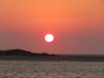 |
Sunset
Position: -76 32.79, 34 37.77
Another beautiful sunset. We’re really enjoying the anchorage.
|
 |
ARPA
Position: -76 32.79, 34 37.76
We rely heavily on ARPA (Automatic Radar Plotting Aid), particularly on the MaxSea chartplotter display. ARPA is a RADAR feature that allows us to flag multiple targets, track them and know closest point of approach (CPA). With MaxSea, we can track an ARPA target via a continuously updated always-visible sidebar that we find convenient. When we upgraded the nav computer to 64-bit and reinstalled MaxSea, we configured NavNet and NavNet Fast Heading, but neglected to setup NavNet ARPA, so ARPA targets weren’t displaying on MaxSea. We figured that out today and got it working again. It’s sooo nice to have it back.
|
 |
Line parted
Position: -76 32.78, 34 37.74
The aft line holding our dinghy to the swimstep parted this morning, probably due to the wake of one of the big sports fishers thundering by.
|
 |
Generator over-temperature
Position: -76 32.80, 34 37.76
The generater was running just barely over temperature at high loads last night (it never reached the 205F shutdown temperature). This morning James checked the impeller and found it needed replacing.
|
 |
Impeller
Position: -76 32.80, 34 37.76
The failure mode we’re used to with tired impellers is that they break apart and throw blades into the cooling system that must be retrieved. These Globe impellers seem to have a much nicer failure mode of just weakening without actually coming apart. This one lasted 18 months with 734 hours of use. What particularly impresses us is this impeller is actually in very rough condition, with all the blades broken and the hub turning and yet the generator still didn’t overheat and there’s no rubber parts to go chase in the cooling system.
|

|
Click the travel log icon on the left to see these locations on a map, with the complete log of our cruise.
On the map page, clicking on a camera or text icon will display a picture and/or log entry for that location, and clicking on the smaller icons along the route will display latitude, longitude and other navigation data for that location. And a live map of our current route and most recent log entries always is available at http://mvdirona.com/maps. |
If your comment doesn't show up right away, send us email and we'll dredge it out of the spam filter.

I think Dinghies should look a little rough. Certainly not all shiny white, pristine, and unused looking, like the one I just bought :)
I agree Tim. A weather beaten, well worn tender is a badge of honor. It’s been to some amazing places.
Lawn mower battery? The dingy is looking a but rough!
Yes, the tender starts using a lawn mower (or wheel chair) battery. And, yes, it is a bit rough. We got the tender a year before we got Dirona so it’s 7 years old and it’s done a lot of miles and lived a tough life seeing some horrendous weather and years of punishing sun. The important ingredient is that 40 HP electronically injected Honda. It’s rock solid, always starts, and has never even hinted at a problem.