On our fourth day at St. Helena, we learned more about the island’s history, geology and ecology at the excellent St. Helena museum, and visited St. James Church, the oldest Anglican church in the Southern Hemisphere. We also walked a track around Munden’s Point to Rupert’s Bay to see the new wharf and port facilities under construction there, and checked out some World War II and other ruins along the way.
Trip highlights from January 7th follow. Click any image for a larger view, or click the position to view the location on a map. And a live map of our current route and most recent log entries always is available at http://mvdirona.com/maps
 |
Cannon
Position: -5 43.09, -15 55.50
A cannon outside the St. Helena museum. We’re not sure how many cannons are on the island, but we saw at least a dozen during our stay there.
|
 |
St. Helena Museum
Position: -5 43.11, -15 55.50
The St. Helena museum is housed in a beautifully-restored 19th century building and does a great job of detaling the island’s history, geology and ecology.
|
 |
St. James Church
Position: -5 43.09, -15 55.51
Dating from 1774, St. James Church is the oldest Anglican church in the Southern Hemisphere. Dedication plaques along the walls provide a snapshot into the island’s past social structure, health and current events.
|
 |
James Bay
Position: -5 43.03, -15 55.34
Looking down to the port and James Bay from the track to Rupert’s Bay. The cliffs are sheathed in chain mail to capture falling rocks, similar to what we saw in Reunion.
|
 |
Munden’s Point
Position: -5 42.92, -15 55.19
Besides Napolean, the British held a variety of prisoners of war on remote St. Helena, including Bahraini princes, South African Chief Dinizulu, and 6,000 Boers. These prison buildings along Munden’s Point we believe were used to hold the Bahraini prisoners.
|
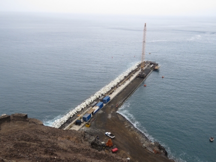 |
Rupert’s Wharf
Position: -5 42.88, -15 55.14
A new wharf is under construction at Rupert’s Bay to berth cargo and cruise ships. When the wharf is complete, port operations will transfer here from James Bay.
|
 |
Latrines
Position: -5 43.02, -15 55.18
Latrines in the prison buildings at Munden’s Point. We expected them to empty directly into the ocean, but they had plumbing that fed eventually to the water.
|
 |
Munden’s Battery
Position: -5 43.04, -15 55.16
Munden’s Battery is a fair-sized World War II military facility. A series of ladders lead from the main battery down nearly to the shoreline.
|
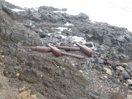 |
Cannons
Position: -5 43.04, -15 55.16
More cannons, of different vintages, were piled along the shore near the bottom of the ladders.
|
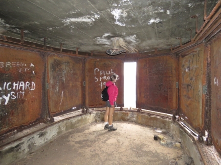 |
Enclosure
Position: -5 43.04, -15 55.16
The battery had several enclosures like this one, with wheeled metal walls that rolled back on either side and a mount in the ceiling. The sliding walls provide protection, while offering an ability to see or shoot through 180 degrees.
|
 |
Battery
Position: -5 43.03, -15 55.17
We kept thinking we’d seen the whole battery, but found more. This section has been carved out of the cliff.
|
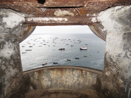 |
Frame
Position: -5 43.04, -15 55.19
James Bay framed in one of the cliffside lookouts at Munden’s Battery.
|
 |
Swell
Position: -5 43.04, -15 55.19
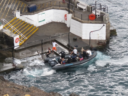
We watched this dive boat offload from above. You can see the impact of the swell and why everyone just uses the harbour ferry rather than try to land and secure a tender. Once the passengers and gear were offloaded, the dive boat operator moored in the harbour and took the ferry back to shore.
|
 |
Breakwater
Position: -5 43.03, -15 55.32
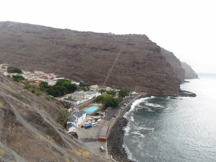
Looking across the Jamestown harbour front and breakwater. Jacob’s Ladder extends up to Ladder Hill in the distance. The pleasure craft moorings are just outside the top right of the photo.
|
 |
Sea Rescue
Position: -5 43.06, -15 55.27
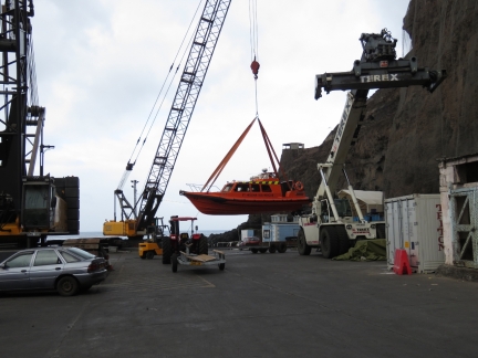
St. Helena has several Sea Rescue vessels that are kept ashore and craned in and out of the water. When the new facilities at Ruperts Bay are complete, Sea Rescue also will transfer there and use a ramp instead of a crane to launch and retrieve their vessels.
|

|
Click the travel log icon on the left to see these locations on a map, with the complete log of our cruise.
On the map page, clicking on a camera or text icon will display a picture and/or log entry for that location, and clicking on the smaller icons along the route will display latitude, longitude and other navigation data for that location. And a live map of our current route and most recent log entries always is available at http://mvdirona.com/maps. |

If your comment doesn't show up right away, send us email and we'll dredge it out of the spam filter.