Imatrankoski, the rapids on the Vuoksi River, have been a tourist attraction since the late 1700s and are one of 27 “National Landscapes of Finland” selected for their great symbolic value and cultural or historical significance. Since 1929 the rapids have been blocked by the Imatra Hydroelectric Plant, but the dam is regularly opened in July and August as a tourist attraction. Imatra is easily visited by boat and we really wanted to see the rapids, but none of the four shows in June fit our schedule. One did coincide with our time in Punkaharju, however, and we could easily reach Imatra by train from there.
As is often the case with our trip plans, one event led to several others. The rapids show was being held in conjunction with Imatramojo, an International Road Racing Championship (IRRC) motorcycle racing event. So we bought tickets and arrived early in the afternooon to take in some of the racing. And the train station we’d leave from in Punkaharju was right next to Lusto, the excellent Finnish national forestry museum that was on our todo list. We could visit Lusto in the morning prior to taking the train to Imatra. And we happened to arrive at Lusto during Forest Culture Days, a biennial event celebrating the historic and present forestry industry in the Saimaa Lakes region. It ended up being a packed and long, but very fun day. And we did get to see the rapids as well.
Below are trip highlights from June 15th in Lusto and Imatra, Finland. Click any image for a larger view, or click the position to view the location on a map. And a live map of our current route and most recent log entries always is available at mvdirona.com/maps.
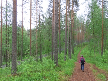 |
Trail
Position: 61°47.93’N, 29°18.61’E
Walking the Punkaharju Ridge trail near the Hotel Punkaharju en route to to visit the Lusto Forestry museum.
|
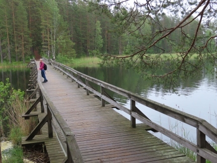 |
Pususilta Bridge
Position: 61°47.86’N, 29°18.83’E
Crossing the Pususilta Bridge that we took a photo of yesterday from Runeberg’s Hill.
|
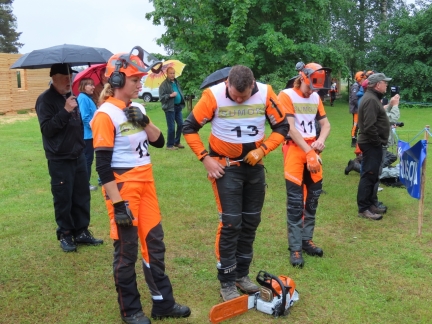 |
Forest Culture Days
Position: 61°47.86’N, 29°19.32’E
As we neared the Lusto museum shortly before their 10am opening, the parking lot was packed and people were out directing cars for where to park up and down the street. We’d were a little surprised that the museum was that popular, but it turned out we’d arrived for the Forest Culture Days. The biennial event celebrates the historic and present forestry industry in the Saimaa Lakes region and attracts over 6,000 people. We even saw a tour bus from Russia
We had a great time walking through the displays and watching some of the competitions. Pictured are several competitors in the chainsaw competitions where in a timed event they saw the end off a log and the cut is measured for precision. The event reminded us of All Sooke Days, a logging sports event held in British Columbia, Canada from 1934-2002 that included chainsaw competitions as well as other more unusual sports as the caber toss and log rolling. |
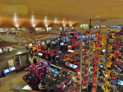 |
Lusto
Position: 61°47.94’N, 29°19.26’E
We spent much of the morning at Lusto, the Finnish national forestry museum. The museum covers forestry techniques in the country throughout the centuries with excellent descriptive displays. This is looking across the “Time of the Machines” display that covers the mechanization of forestry. The chainsaw tower in the foreground includes 120 different models of chainsaws, all individually identified.
|
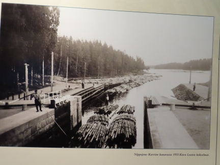 |
Log Transport
Position: 61°47.94’N, 29°19.33’E
A great photo in the Lusto forestry museum of logs being transported through the Saimaa Lakes via canal.
|
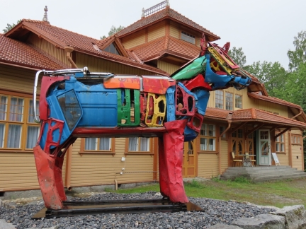 |
Lusto Station
Position: 61°48.03’N, 29°19.33’E
Cow sculpture outside Lusto Station where we’re waiting for a train to Imatra.
|
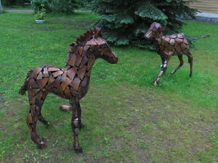 |
Metal Sculpture
Position: 61°48.04’N, 29°19.32’E
The Lusto train station has been turned into an art gallery of sorts, with beautiful metal sculptures throughout the grounds.
|
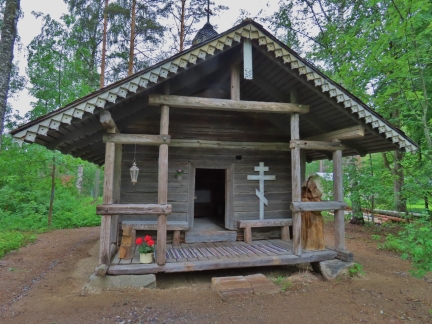 |
Church
Position: 61°48.00’N, 29°19.35’E
This tiny church near the Lusto train station.
|
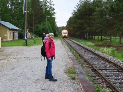 |
Here Comes the Train
Position: 61°48.03’N, 29°19.34’E
A happy Jennifer with our train arriving in the background from Savonlinna.
|
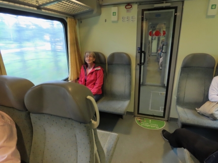 |
On Board
Position: 61°48.04’N, 29°19.34’E
On board the train south to Imatra via Parikkala. The people sitting on the opposite side of the carriage said they’d seen us in the newspaper that morning.
|
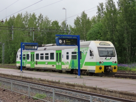 |
Parikkala
Position: 61°33.52’N, 29°30.16’E
We transferred trains at Parikkala for Imatra. This is the tiny, single-car train we just arrived on.
|
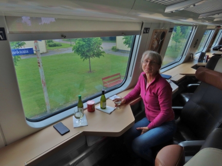 |
Upper Deck
Position: 61°33.54’N, 29°30.16’E
The train from Parikkala Imatra has a double-decker car with reservable single seats facing the windows for fabulous views. It was a great experience and the 40-minute ride was over much too quickly.
|
 |
Vuoksi River
Position: 61°11.86’N, 28°46.89’E
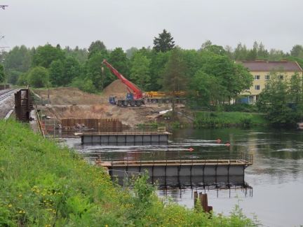
Strong current along the Vuoksi River at Imatra.
|
 |
Imatranajo
Position: 61°10.93’N, 28°47.51’E
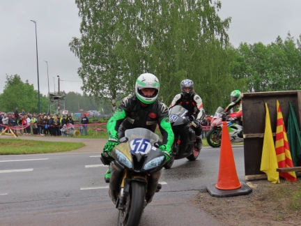
The main reason we’d come to Imatra was to view the rapids show that evening. But this weekend an International Road Racing Championship (IRRC) motorcycle racing event, Imatramojo, was being held in town. So we came early to take in some of the racing. Here some of the competitors are leaving the track for the paddock area after qualifying.
|
 |
Paddock
Position: 61°10.38’N, 28°47.23’E
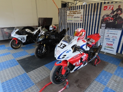
Before we went to our seats, we walked through the paddock area where the bikes were either being worked on or on display. These are the open suberbikes of Perttu Juntunen (#78) Topi Komujarvi (#19), and Marko Sinkkonen (#33) open Suberbike. JRH: Add something?
|
 |
Sidecars
Position: 61°10.20’N, 28°47.16’E
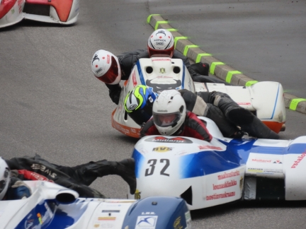
Sidecar motorcycle races was one of the four classes of events at Imatranajo. As the motorcycles came into the corner opposite our seats during qualifying, the passengers leaned way out to stabilize the bike. It looked a little crazy with the passengers only inches above the pavement.
|
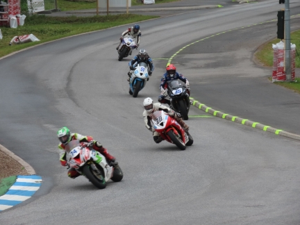 |
IRRC SSP
Position: 61°10.20’N, 28°47.15’E
The leaders in the IRRC SSP (International Road Racing Supersport) race heading towards our seats into the Lyseo Turn. Eventual race-winner Matthieu Lagrive (#45) is behind third-place finisher Sami Penna (#28) and in front of fourth-place finisher Anssi Koski (#51). Sixth-pace finisher Ilja Calijouw (#14) is at far left.
|
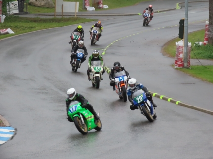 |
ICGP
Position: 61°10.20’N, 28°47.16’E
Riders on the track in the IGCP (International Classic Grand Prix) race. The series includes bikes manufactured from 1974-1984 that have previously competed in the MotoGP World Championship.
|
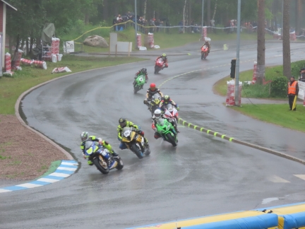 |
IRRC SBK
Position: 61°10.20’N, 28°47.16’E
Steady rain had been falling by the time the IRRC SSB (International Road Racing Superbike) race got underway. Several bikes slid off the track in the slick conditions and Swiss rider Mathias Gnagi died following a crash that stopped the race on lap six.
|
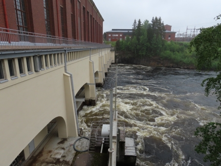 |
Imatra Hydroelectric Plant
Position: 61°10.03’N, 28°46.40’E
The initial reason we’d come to Imatra was to see Imatrankoski, the rapids on the Vuoksi River. They are one of 27 “National Landscapes of Finland” selected for their great symbolic value and cultural or historical significance, and have been a tourist attraction since 1772 when Empress Catherine II of Russia visited.
Since 1929 the rapids have been blocked by the Imatra Hydroelectric Plant, but the dam is regularly opened in July and August as a tourist attraction. Only four shows were scheduled for June, one coinciding with Imatranajo. |
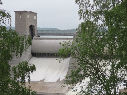 |
Sluice Opening
Position: 61°10.15’N, 28°46.47’E
The sluice opening to start the rapids show, viewed from the bridge south of the gorge.
|
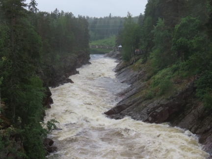 |
Imatrankoski
Position: 61°10.19’N, 28°46.39’E
Looking along the Imatrankoski rapids from the bridge across the gorge.
|
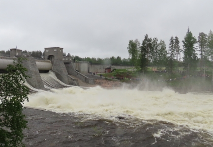 |
Rapids
Position: 61°10.23’N, 28°46.48’E
The rapids are really running now as we take in the view north of the gorge.
|
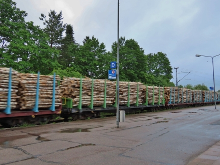 |
Logs
Position: 61°11.76’N, 28°46.59’E
A train of logs passing Imatra station as we wait for our train back to Dirona.
|
 |
Sunset
Position: 61°45.23’N, 29°23.45’E
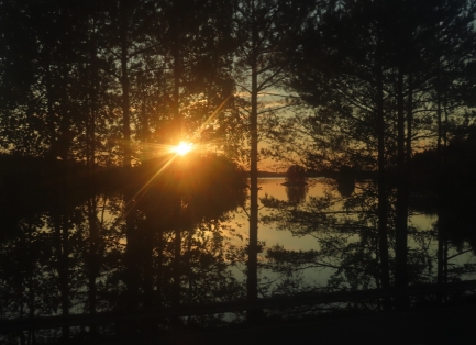
The lakes aglow in a golden sunset at 10pm, viewed from our train to Lusto.
|
 |
Click the travel log icon on the left to see these locations on a map, with the complete log of our cruise.
On the map page, clicking on a camera or text icon will display a picture and/or log entry for that location, and clicking on the smaller icons along the route will display latitude, longitude and other navigation data for that location. And a live map of our current route and most recent log entries always is available at mvdirona.com/maps. |

Actually there are tires designed specifically for racing in the rain, and just about any other condition https://www.dunlopracing.com/product/rains/. Matching the correct tire for the conditions combined with the computerized suspension of the newer superbikes (which the classic racing James described don’t have) makes it no more dangerous than the entire sport in general. The biggest problem is keeping your vision clear.
As usual, I learned some interesting facts from your blog. First, forestry is so big in Finland that there is a museum devoted to it. For some reason I had never thought of forestry as such an important and historic activity that it would merit a museum, but I get it and Lusto looks like an interesting place to tour.
I had no idea motorcycle racers were daft enough to race in sidecars and to race in rain. Racing in sidecars seems to eliminate leaning in corners that makes riding a motorcycle so much fun.
Racing on slick, wet surfaces would seem to eliminate the basic ability of a tire to grip the road surface, thereby turning every competitor’s motorcycle into a near-certain accident candidate. Oh well, it must have been pretty exciting to watch!