The Old Head of Kinsale was a welcome sight for us at the completion of our 2,800nm passage from Newport, RI to Kinsale, Ireland. With a sunny weather forecast, we took the opportunity to make the 8-mile bike ride to get a closer look and take in the sweeping view from the restored signal tower.
Trip highlights from June 4th, 2017 in Kinsale, Ireland follow. Click any image for a larger view, or click the position to view the location on a map. And a live map of our current route and most recent log entries always is available at http://mvdirona.com/maps
 |
Quarry Point
Position: -8 33.04, 51 38.45
This is a small boat harbour north of Quarry Point as we neared the Old Head. We’ve been finding cycling in Ireland easier than we expected, given the narrowness of the roads. Passing cars give us plenty of space and the roads are in good condition. That didn’t make the hilly ride any less strenuous—we were pooped by the time we arrived.
|
 |
Speckled Door
Position: -8 33.04, 51 38.38
We passed the Speckled Door pub as we neared our destination. We’ll be back for lunch.
|
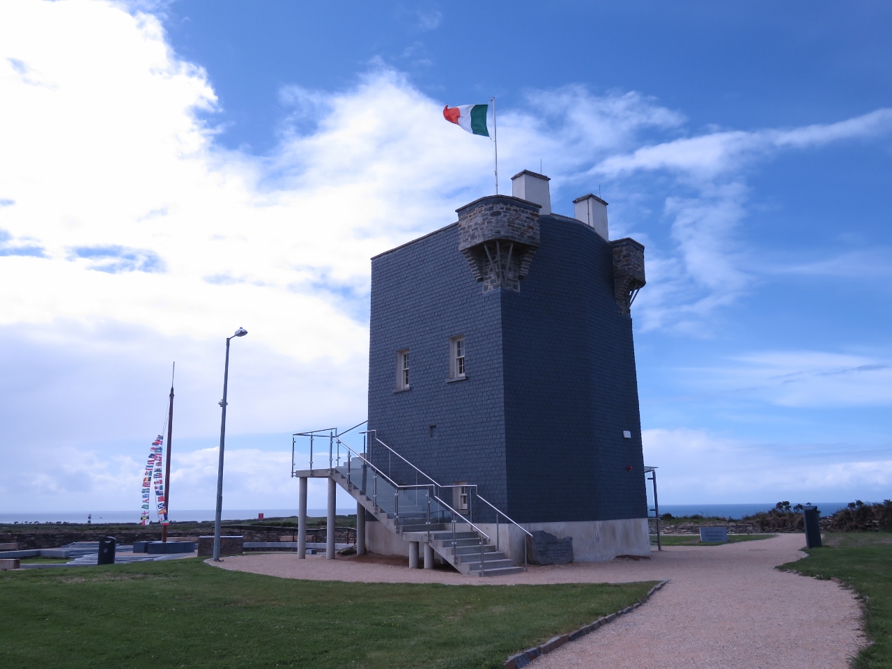 |
Signal Tower
Position: -8 32.56, 51 37.21
The Old Head Signal Tower is the highest point on the head—we could see it from a mile or two away as we approached. The tower was built in 1804 as part of a coastal military defense against a possible French Napoleonic invasion. The tower was the 25th in a series of 81 such towers along Ireland’s coast. The towers were in sight of each other and messages could be quickly passed along the coast through visual signal codes using flags and balls. The tower has since been renovated and now houses a Lusitania Museum, detailing the ship and its sinking off the Old Head following a German submarine attack in 1915
|
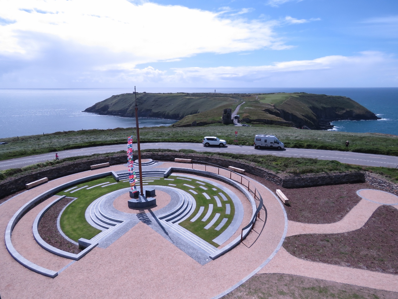 |
Old Head
Position: -8 32.56, 51 37.20
The Parapet Walk at the top of the Signal Tower has sweeping views all around. This is looking across the Lusitania Memorial Garden, opened only a month ago, across to the Old Head of Kinsale. The lighthouse we passed as we neared landfall in Ireland is visible in the distance.
|
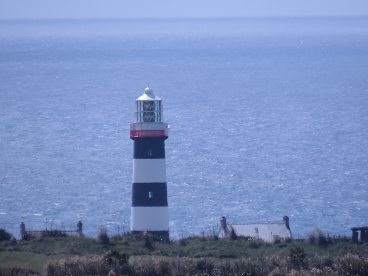 |
Lighthouse
Position: -8 32.56, 51 37.21
Close-up to the Old Head Lighthouse. The structure is not generally open to the public, partly for safety reasons and partly because a private golf course, Old Head Golf Links, operates on the head and allows access only to members or guests. The clubhouse has an ordinary publican’s license, which requires them to provide public access to the clubhouse, but they remain quite comfortable refusing non-member access.
|
 |
Old Head Castle
Position: -8 32.56, 51 37.20
The de Courcy family built a castle at the narrowest point of the headland in the 12th century AD. The ruins of the tower house and medieval wall are incorporated into the entrance to the Old Head Golf Links.
|
|
|
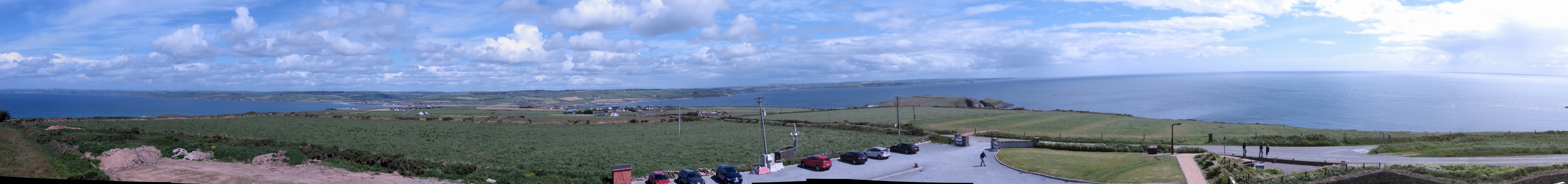
View East
Position: -8 32.56, 51 37.21
The panoramic view east from the Signal Tower. Dirona‘s route into Kinsale is along the right portion of the photo, with the entrance to Kinsale Harbour in the distance roughly above where the cars are parked.
|
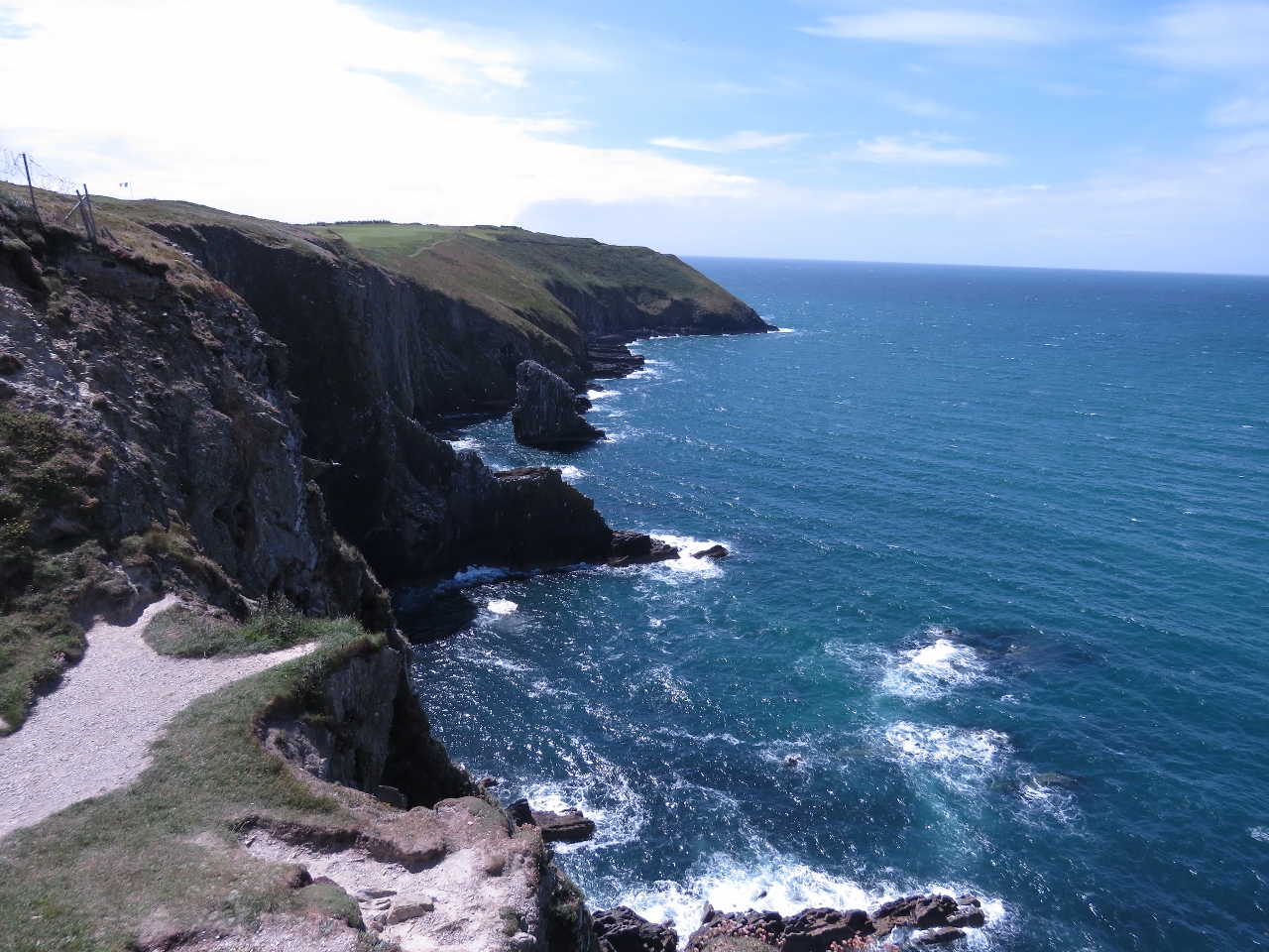 |
Coastline
Position: -8 32.56, 51 37.08
The spectacular but forbidding coastline along the western portion of the headland, viewed from the narrow neck.
|
 |
Erosion
Position: -8 32.55, 51 37.08
Wind and waves have carved the offshore rocks into narrow, razor-like projections.
|
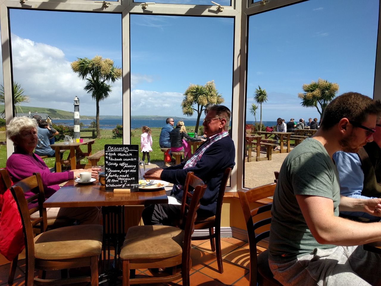 |
Lunch
Position: -8 33.02, 51 38.39
The Speckled Door may look traditional from the entrance, but the restaurant has a modern floor-to-ceiling glass wall with sweeping views to sea.
|
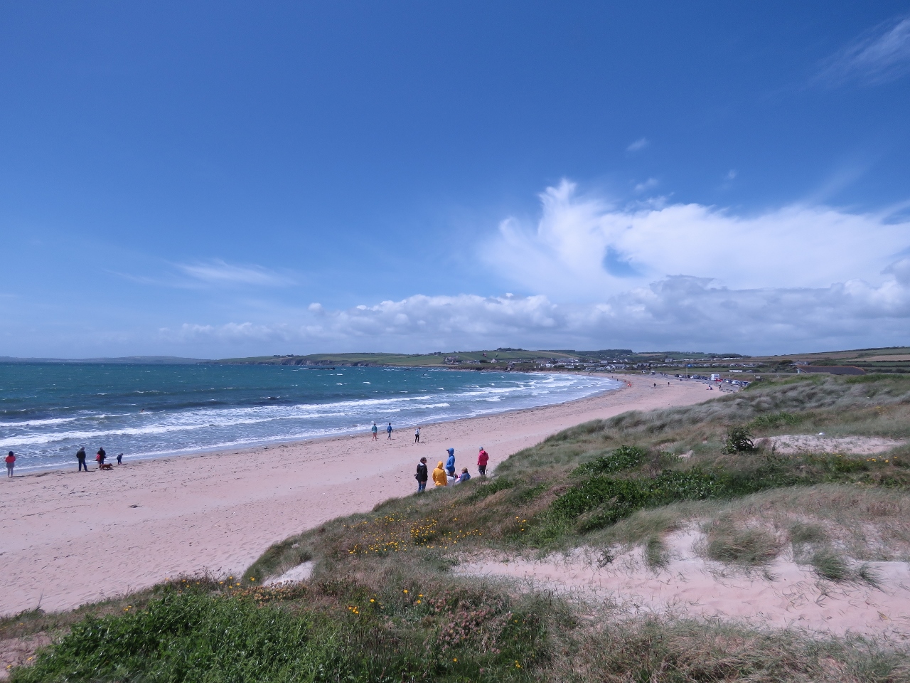 |
Garrettstown Beach
Position: -8 33.73, 51 38.32
From the Speckled Door we took Route 604 west toward Ballinspittle. Despite the windy day, plenty of people were out enjoying Garrettstown Beach on this sunny Sunday afternoon.
|
 |
Kitesurfers
Position: -8 33.73, 51 38.32
As we approached Garrettstown Beach, we could see kites high in the air well before we could see the beach or these kitesurfers. There even were a few people out swimming.
|
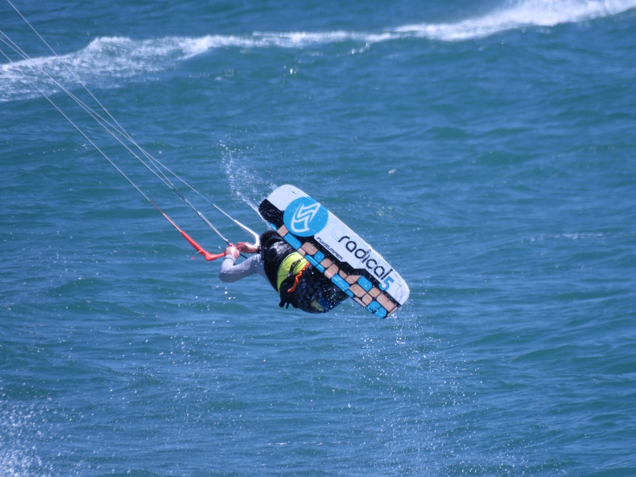 |
Airborne
Position: -8 34.30, 51 38.49
One of the kitesurfers was particularly good. He’d run northwest, parallelling the shore, and just when it looked like he’d crash into the cliff, he’d execute a leap, spin or tumble.
|
 |
Hurleys
Position: -8 35.75, 51 39.97
Enjoying a Bulmers Irish cider on the patio at Hurleys pub in Ballinspittle, about halfway back to Kinsale from the Old Head.
|

|
Click the travel log icon on the left to see these locations on a map, with the complete log of our cruise.
On the map page, clicking on a camera or text icon will display a picture and/or log entry for that location, and clicking on the smaller icons along the route will display latitude, longitude and other navigation data for that location. And a live map of our current route and most recent log entries always is available at http://mvdirona.com/maps. |
Great location and sailing in Kinsale :-)