Charleston, SC was founded in 1670 and has done an excellent job of preserving its heritage and historic sites and buildings. On a surprisingly cold and frosty morning, we did a bicycle tour along the city’s historic waterfront.
Trip highlights from January 8th, 2017 in Charleston, SC follow. Click any image for a larger view, or click the position to view the location on a map. And a live map of our current route and most recent log entries always is available at http://mvdirona.com/maps
 |
Brrr
Position: -79 57.14, 32 46.65
The cold weather has caught up with us. The temperature was 29.2°F (-1.5°C) when we got up this morning. At least the water hasn’t been shut off yet.
|
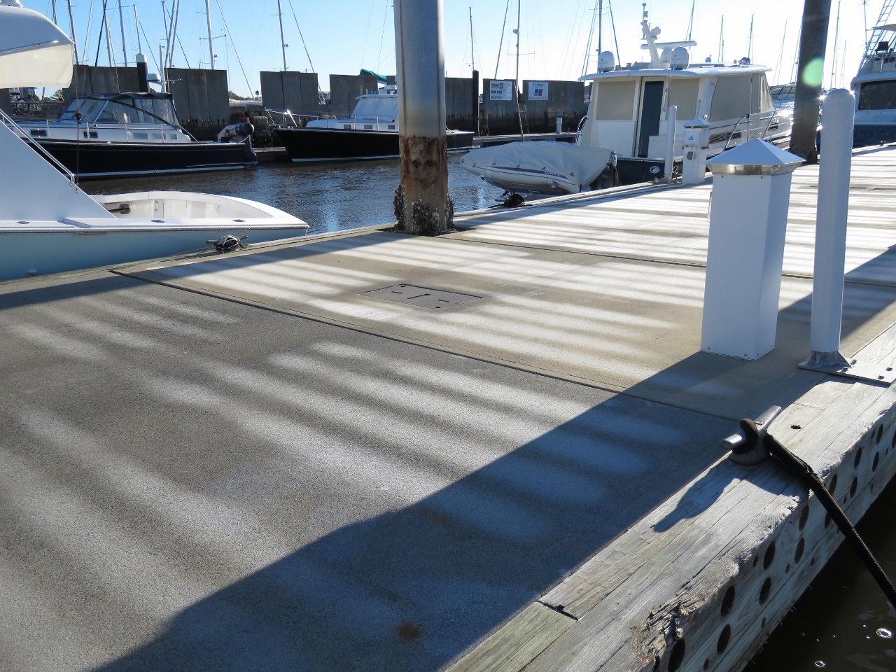 |
Frost
Position: -79 57.14, 32 46.65
A layer of frost covered the marina docks this morning, with sea smoke at the water surface. I guess we spoke too soon about the warmer weather further south. We’re still above the frost line. Locals tell us we’ve now experienced the entire South Carolina winter. :)
|
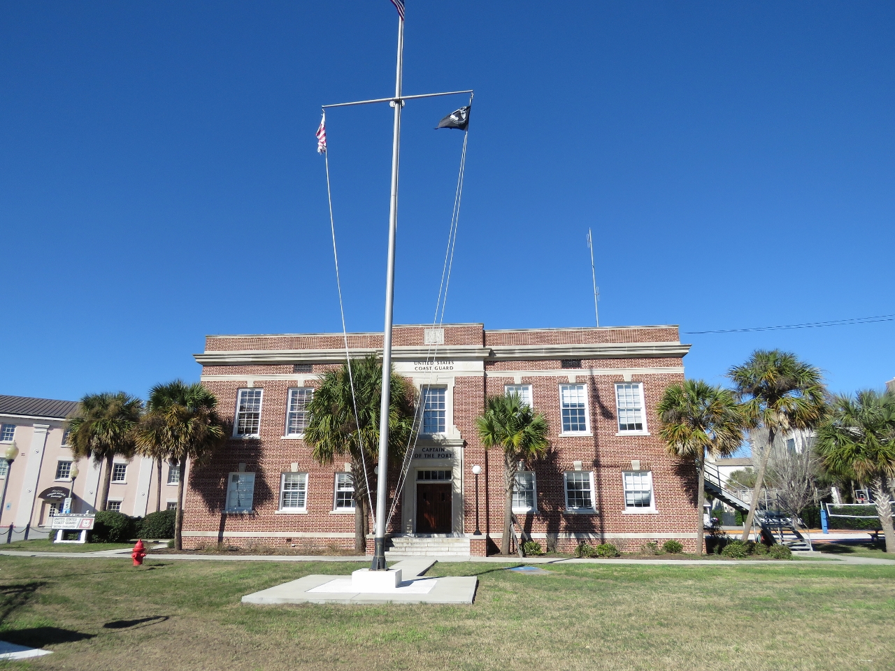 |
Captain of the Port
Position: -79 56.57, 32 46.40
On a bike ride around the Charleston waterfront we passed the Coast Guard. The Captain of the Port building was constructed in 1934 and previously was the Sixth Lighthouse District headquarters. The Lighthouse Service emblem of two torches on either side of a lighthouse is visible at the top center of the building (click image for larger view).
|
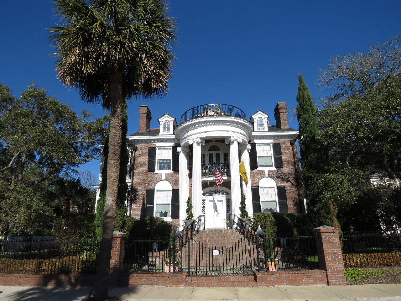 |
Mansion
Position: -79 56.39, 32 46.28
One of many multi-million-dollar waterfront mansions along Murray Blvd. This one was built in 1914.
|
 |
White Point Garden
Position: -79 55.81, 32 46.17
White Point Garden at the southern tip of Charleston was first used as a public garden in 1837. The park also houses many historic military artifacts and memorials. Charleston citizens gathered here On April 12, 1861 to watch Confederate soldiers fire the first shots of the American Civil War on Union-held Fort Sumter.
|
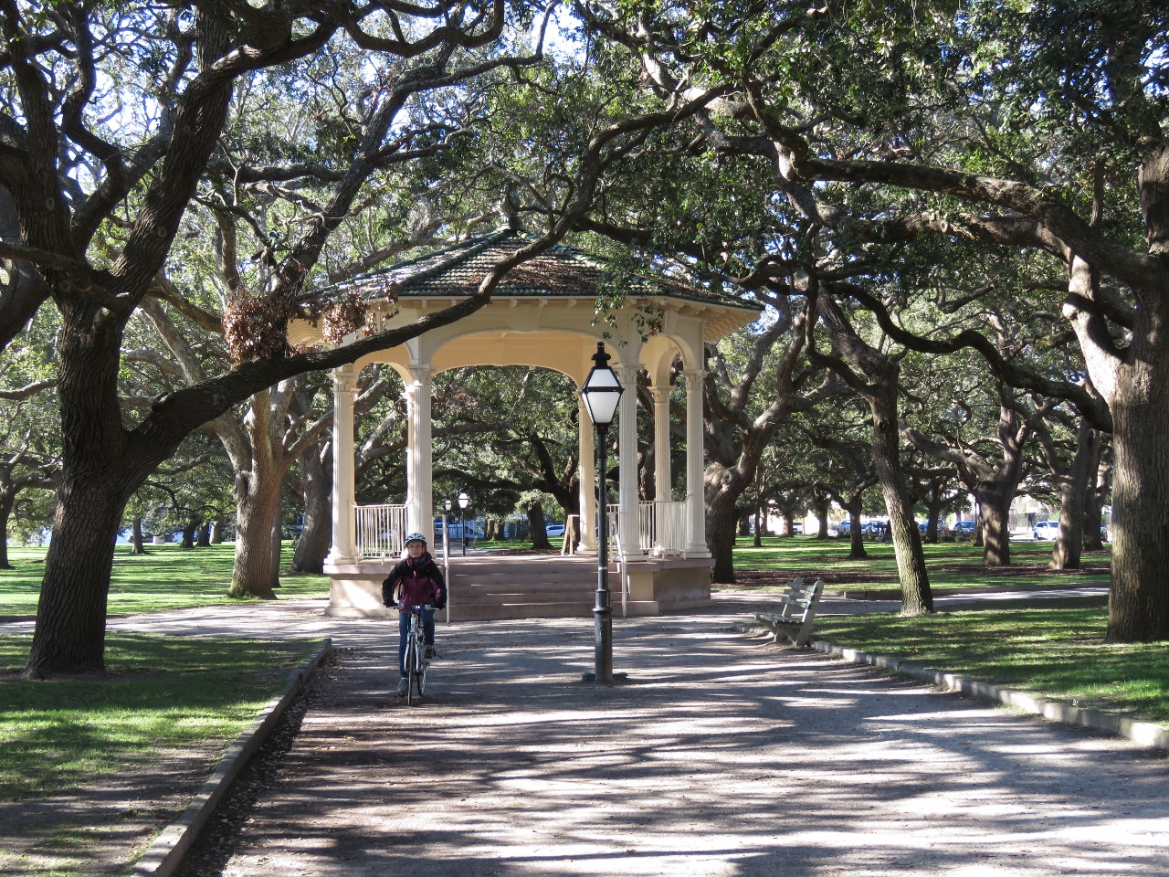 |
Bandstand
Position: -79 55.79, 32 46.19
The bandstand in White Point Garden was built in in 1907. Outdoor concerts were held here until 1978 when they were outlawed due to neighbor complaints about the noise and commercial activity.
|
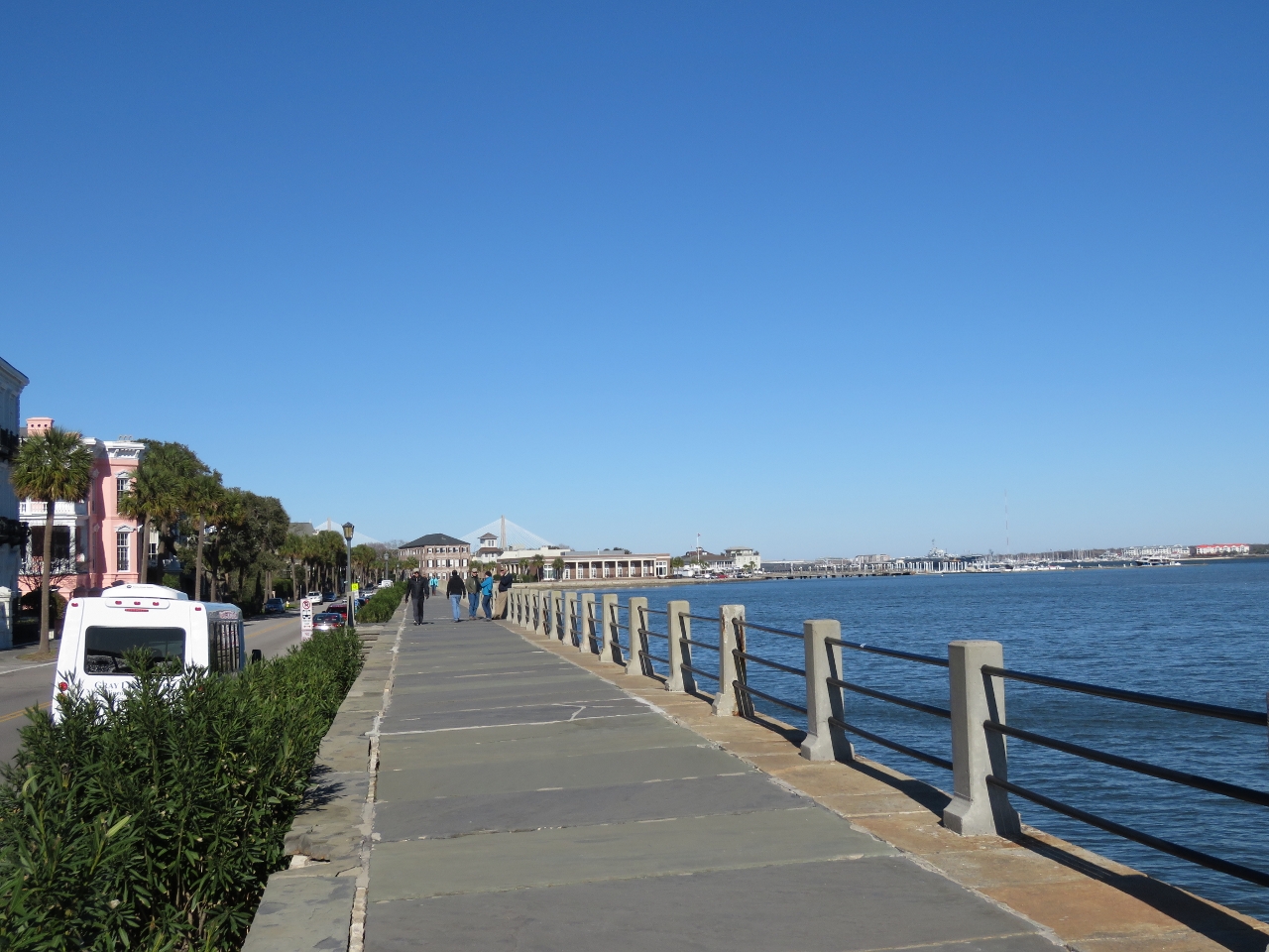 |
Promenade
Position: -79 55.72, 32 46.18
Waterfront promenade across the road from White Point Garden.
|
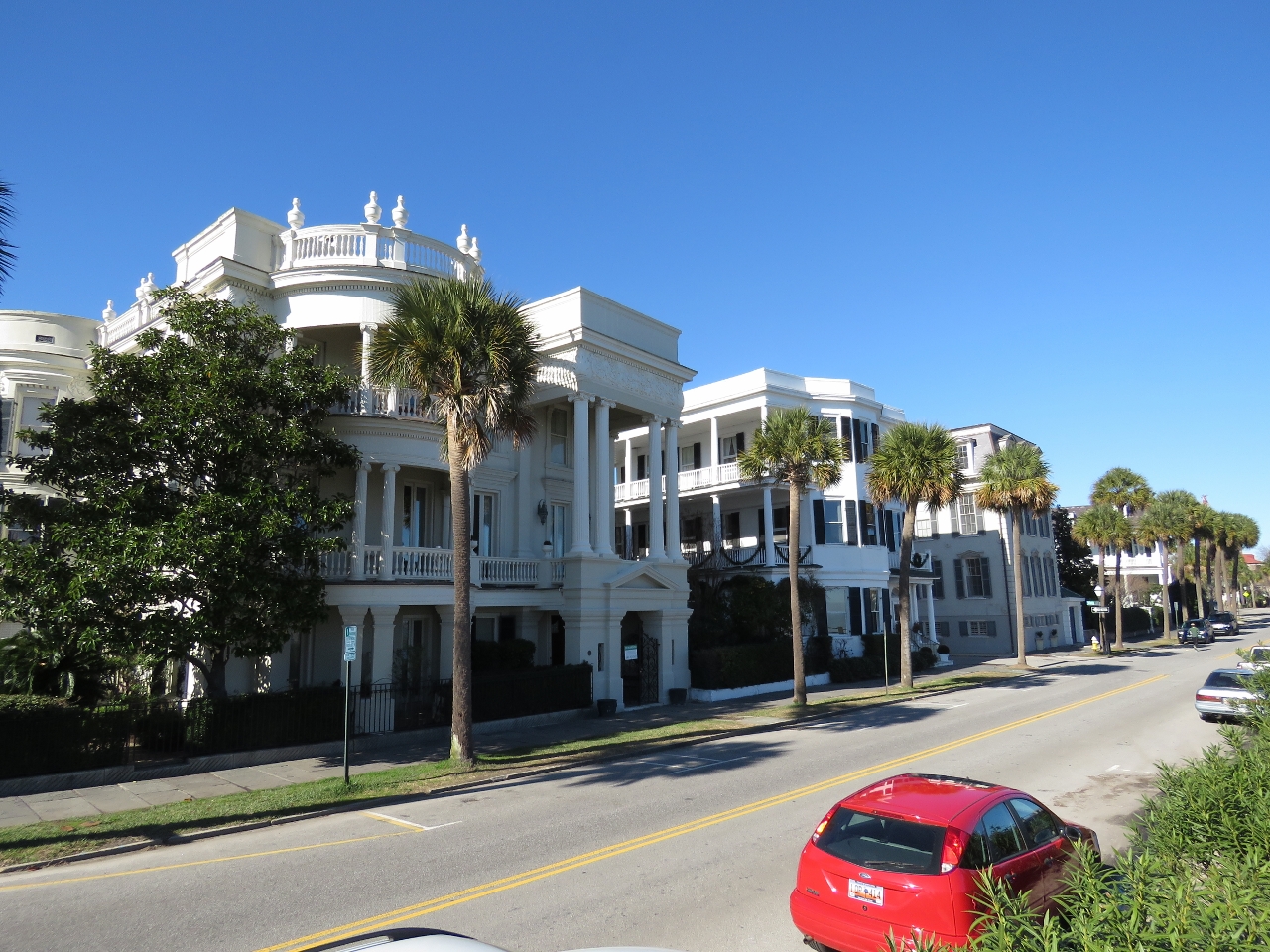 |
Antebellum Homes
Position: -79 55.66, 32 46.34
The area around White Park Garden is famous for its pre-revolutionary-war plantation homes and mansions built in the Georgian, Neo-classical, and Greek Revival style.
|
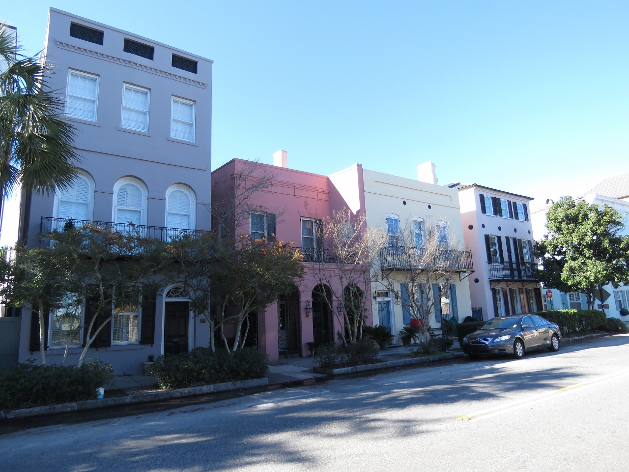 |
Rainbow Row
Position: -79 55.63, 32 46.44
Rainbow Row is a series of 13 houses built on 79-107 East Bay Street that are the longest cluster of Georgian row houses in the United States. The newest was built in 1845. The name Rainbow Row derives from the colorful pastel colors they were painted when restored in the 1930s and 1940s. The houses pictured are just south of Rainbow Row, but follow the same style.
|
|
|
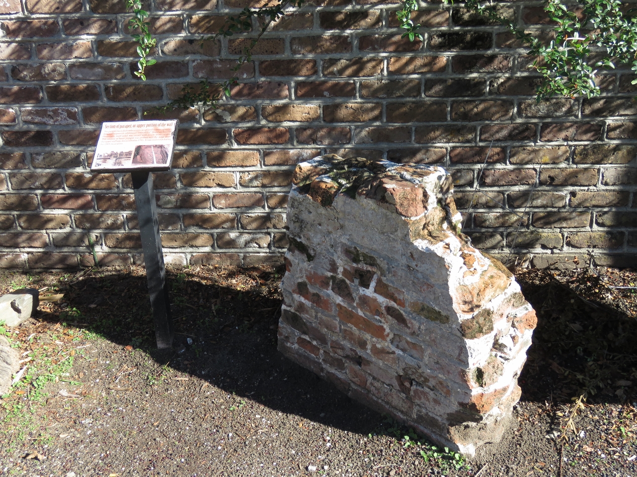
Wall
Position: -79 55.63, 32 46.50
In the 1700s, Charleston was a walled city, the only British walled city built in North America. A 6-ft-wide seawall was built of brick and extended about 15ft above the low tide line. An earth wall, believed to be about 8-10ft high, protected the land side. By the 1730s, most of the earthen walls were demolished to allow for city expansion and the harbor-side fortifications were demolished or buried some time after the civil war. The wall and its location weren’t rediscovered until the 1920s. This is a section of a parapet, or upper portion of the wall recovered in 2008.
|
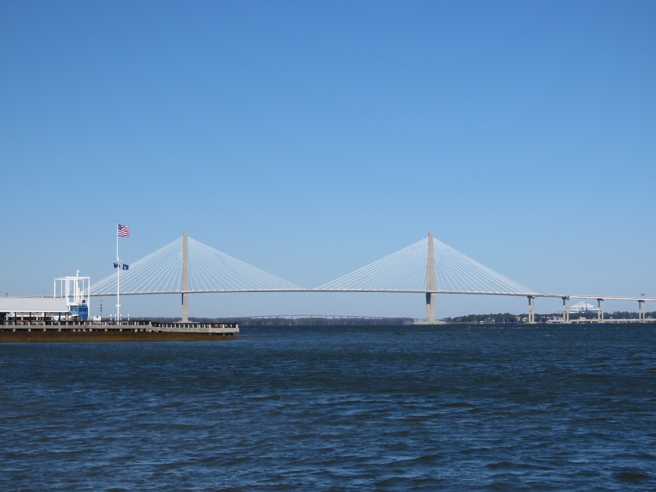 |
Bridge
Position: -79 55.48, 32 46.54
A great view to the Arthur Ravenel Jr. Bridge from the Charleston waterfront.
|
 |
Henry’s
Position: -79 55.73, 32 46.87
We stopped in for a drink at Henry’s. Opened in 1930, Henry’s is the oldest continuously operating restaurant in the state of South Carolina.
|

|
Click the travel log icon on the left to see these locations on a map, with the complete log of our cruise.
On the map page, clicking on a camera or text icon will display a picture and/or log entry for that location, and clicking on the smaller icons along the route will display latitude, longitude and other navigation data for that location. And a live map of our current route and most recent log entries always is available at http://mvdirona.com/maps. |
If your comment doesn't show up right away, send us email and we'll dredge it out of the spam filter.