Charles Fort was completed in 1682 at Kinsale and is one of the largest military installations in Ireland. The fort is open to the public and receives over 85,000 visitors a year. It’s an easy 45-minute waterfront walk from the marina, with two pubs along the way.
Trip highlights from May 27th in Kinsale, Ireland follow. Click any image for a larger view, or click the position to view the location on a map. And a live map of our current route and most recent log entries always is available at http://mvdirona.com/maps
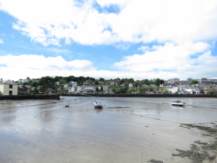 |
Low Tide
Position: -8 31.10, 51 42.34
The view across the head of Kinsale Harbour at low tide on our way to Charles Fort.
|
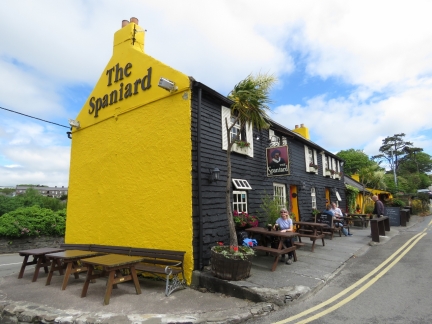 |
The Spaniard
Position: -8 31.02, 51 42.30
The Spaniard Pub was built on the ruins of an old castle around 1650 and has been a well-known pub ever since. We pretty much had to stop there for a pint of Murphy’s.
|
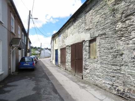 |
Lower Road
Position: -8 30.85, 51 42.31
Narrow Lower Road with a mix of old and new architecture.
|
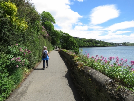 |
Scilly Walk
Position: -8 30.75, 51 42.32
Scilly Walk follows the harbour and out to Charles Fort with great views along the way. The name derives from the Kinsale-area settlers from the Isles of Scilly off the British Cornish Coast.
|
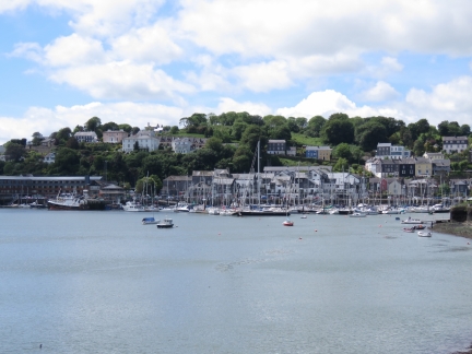 |
Kinsale Yacht Club
Position: -8 30.72, 51 42.32
Looking back to the Kinsale Yacht Club from the Scilly Walk.
|
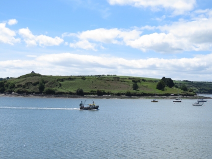 |
Alice Again
Position: -8 30.48, 51 42.30
The fishing vessel Alice Again returning to port with James Fort at center in the background.
|
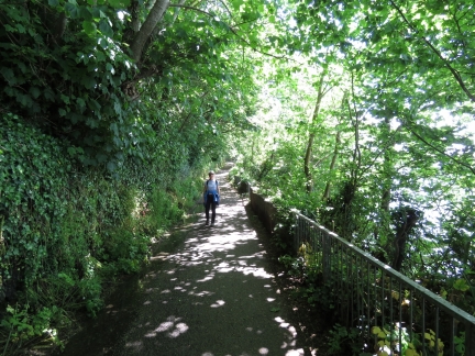 |
Greenery
Position: -8 30.43, 51 42.28
We really enjoyed the view and the nature along Scilly Walk.
|
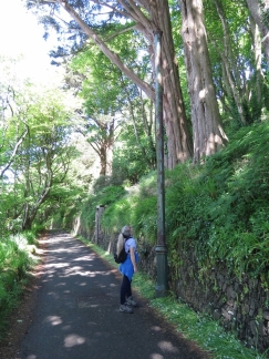 |
Lamp Post
Position: -8 30.33, 51 42.23
An old lamp post along Scilly Walk. The path likely was once the main road into town, and actually still is used as a road for some of the harbour-front houses.
|
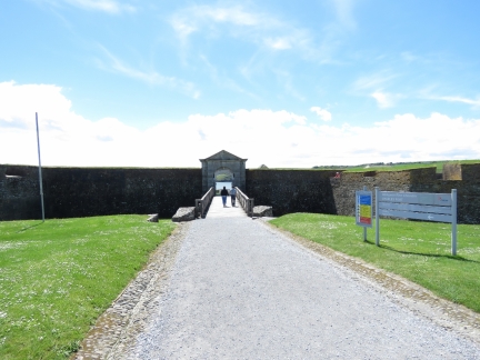 |
Charles Fort
Position: -8 29.93, 51 41.84
Charles Fort was completed in 1682 and is one of the largest military installations in Ireland. The fort is open to the public and receives over 85,000 visitors a year. The parking lot was packed with cars and tour-buses when we arrived.
|
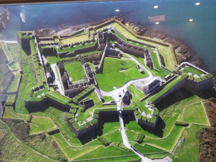 |
Aerial Photo
Position: -8 29.91, 51 41.82
Charles Fort is a classic example of a star-shaped fort and has five bastions, two to seaward and three landward.
|
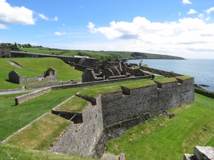 |
Seaward Bastions
Position: -8 30.00, 51 41.80
Looking across the seaward bastions with the white lighthouse on the point between them.
|
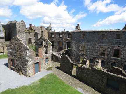 |
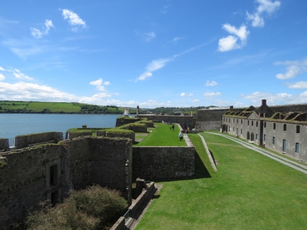
Ruins
Position: -8 29.97, 51 41.74
During the Irish Civil War in 1922, forces opposed to the Anglo-Irish treaty burned the fort during their retreat. But much of the brick structures remain.
|
 |
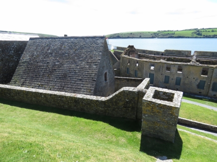
Battery
Position: -8 29.87, 51 41.78
Looking west across one of the gun batteries to the lighthouse and Kinsale Harbour
|
 |
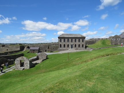
Magazine
Position: -8 29.95, 51 41.79
The powder magazine was specially constructed to avoid sparks with a wall around it to contain an explosion.
|
 |
Governor’s House
Position: -8 29.95, 51 41.79
The Governor of Kinsale was a military officer who commanded the garrison at Kinsale and Charles Fort. This is the Governor’s House inside the fort.
|
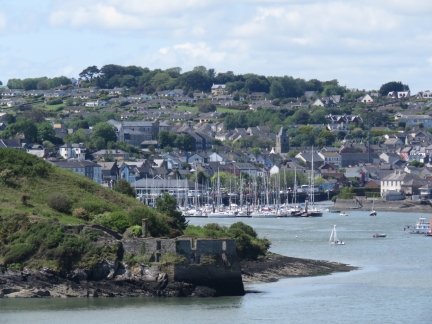 |
James Fort
Position: -8 29.95, 51 41.83
Looking across to Kinsale with part of James Fort is at center in the foreground.
|
 |
Water Tanks
Position: -8 29.93, 51 41.82
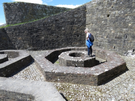
These octagonal structures at Charles Fort were built to support large water tanks.
|
 |
Bulman Pub
Position: -8 29.99, 51 42.00
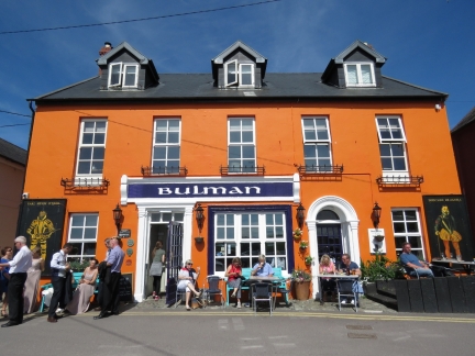
We’d walked past the Bulman Pub on our way to Charles Fort, but it was completely packed. We were able to get a spot on our return and had a great late lunch. On sunny days, the pub apparently is packed most of the time, particularly outside. Even a wedding party, at left of photo, stopped by for a pint.
|
 |
Lower Cove Harbour Walk
Position: -8 29.82, 51 41.69
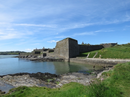
After lunch, we decided to do a little more walking. This is the view back to Charles Fort from the Lower Cove Harbour Walk.
|
 |
Kinsale Boatyard
Position: -8 29.59, 51 41.38
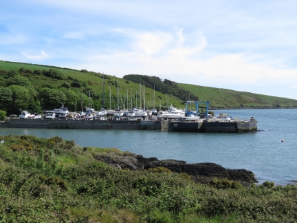
The Kinsale Boatyard looked busy. The yard area ahead was full of boats, with many more not visible to the left of the photo. The boating season is just starting up here, so likely many are getting ready for the summer.
|
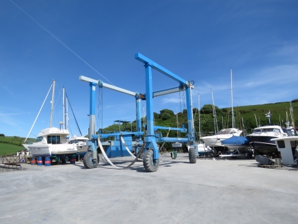 |
Boat Lift
Position: -8 29.61, 51 41.31
We couldn’t see a weight rating on this boat lift, but it looked about 20-30 tons. Much too light for Dirona‘s 55 tons. Fortunately we have no need of a lift.
|
 |
High Road
Position: -8 30.69, 51 42.37
We returned to Kinsale along the High Road with its sweeping harbour view. Charles Fort is at the far left, Kinsale Boatyard is right of and just beyond Charles Fort, James Fort is at center, Castlepark Marina is right of James Fort, Compass Hill is across the water to the right, and Kinsale Yacht Club is on the far right.
|

|
Click the travel log icon on the left to see these locations on a map, with the complete log of our cruise.
On the map page, clicking on a camera or text icon will display a picture and/or log entry for that location, and clicking on the smaller icons along the route will display latitude, longitude and other navigation data for that location. And a live map of our current route and most recent log entries always is available at http://mvdirona.com/maps. |

If your comment doesn't show up right away, send us email and we'll dredge it out of the spam filter.