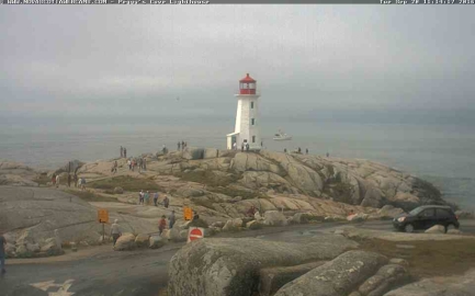
Peggy’s Cove is about 35nm by water and less than an hour’s drive from Halfiax. The lighthouse there is one of the most accessible, well-known and photographed in Canada. We spent two final days in Halifax and attended a Davis Cup tennis match, then stopped off at Peggys Cove en route to Lunenbug to add our photograph to the collection. The satellite imagery shows a huge parking lot that was full of buses and cars. And that’s exactly how we found it when we came by. And someone even caught an image of Dirona passing by on their webcam.
Trip highlights from September 18 through 20th in Nova Scotia follow. Click any image for a larger view, or click the position to view the location on a map. And a live map of our current route and most recent log entries always is available at http://mvdirona.com/maps
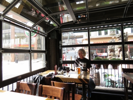 |
The Split Crow
Position: -63 34.46, 44 38.96
A sunny spot in the corner of the Split Crow pub. We had a good lunch there and have now tried most of the local craft beers. Halifax is a very cool town.
|
 |
Davis Cup
Position: -63 34.63, 44 38.89
The first Davis Cup tennis match took place in 1900 between the USA and Great Britain and now is the world’s largest annual team competition in sport, with 135 countries entered in 2016. Notable Davis Cup competitors include Jimmy Connors, Bjorn Borg, John McEnroe, Boris Becker, Andre Agassi, Pete Sampras and Roger Federer. We bought tickets for the final singles matches between Canada and Chile today. Pictured is Canada’s Dennis Shapovalov on the right serving to Christian Garin. The level of play was excellent, with Shapovalov ranked 248th in the world and Garin 266th. Shapovalov won the match and Canada won the play-off round 5 to 0. Canadian Frank Dancevic defeated Chilean Gonzolo Lama in the next match, but Canada had already won the play-off at that point.
|
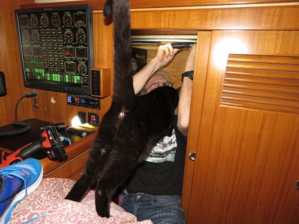 |
Bad Cable
Position: -63 34.18, 44 38.85
We took out what we thought was a faulty DSM250 and it tested out fine. The monitor wasn’t at fault. A poorly-fabricated field-installable cable between the main bus and the DSM250 was causing the errors. That is two connection problems in the last six months. The other was a loose knurled connection between a tee fitting and the power lower inserter. With Spitfire inspecting, James is reassembling a locker in the stateroom after removing the DSM250. We needed to remove the hanging rail and some shelves in order to access the monitor in order to remove it. We’re no longer using the DSM250, and instead are using the 19″ N2kView display mounted above. We will need to figure out what to do with the mounting hole left behind.
|
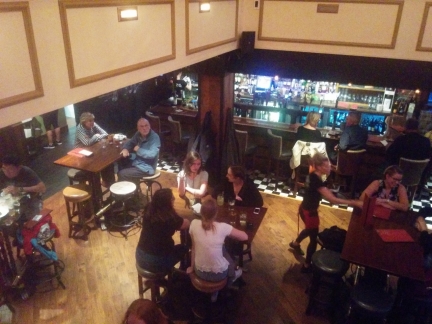 |
Stubborn Goat
Position: -63 34.47, 44 38.74
We had an excellent meal upstairs at the Stubborn Goat Gastro Pub.
|
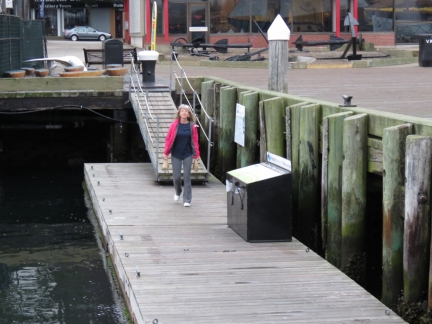 |
Tim Hortons
Position: -63 34.18, 44 38.85
Jennifer returning with our daily Tim Hortons fix. The donut store is about a five-minute walk from our berth.
|
 |
Finished Product
Position: -63 34.18, 44 38.85
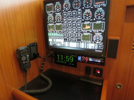
We now have a bedside clock where the DSM250 used to be.
|
 |
Antifreeze Leak
Position: -63 34.18, 44 38.85
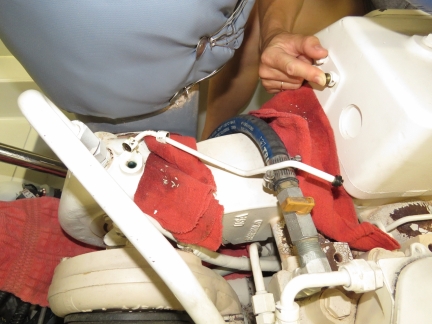
We corrected an antifreeze leak at the top of turbocharger housing. Jennifer is plugging the hole in the turbo housing after we removed the connecting pipe lying on the rag. Cleaning up the pipe connections and putting Teflon tape on the NPT fitting at the turbo housing fixed the leak.
|
 |
Fuel Filters
Position: -63 34.18, 44 38.85
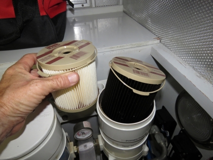
We last changed the main engine primary fuel filter 414 hours and six months ago. We replace the filters when the vacuum gauge shows 5″ of mercury, or we cross 1 year, or we pass 1,000 hours.
|
 |
Rock Bottom
Position: -63 34.76, 44 38.56
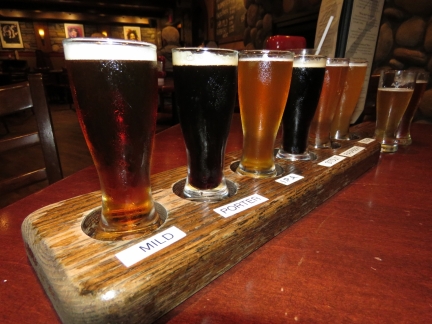
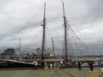
A tasting flight of excellent craft beer at the Rock Bottom Brewery in the Dalhousie University district. From left to right are their Dark Mild, Baltic Porter, IPA, Oatmeal Stout, Raspberry Wheat, American Sour, Wheat and ESB. Stouts, porters or fruit-based beers generally don’t appeal to us, but we liked every single beer in the selection. The food was delicious too.
|
 |
Bluenose II
Position: -63 34.18, 44 38.85
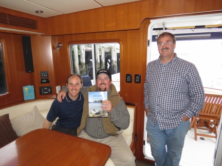
The Bluenose II of Lunenburg arrived onto the museum docks today, displacing Theadore Too. The Bluenose II, launched in 1963, is a working replica of the famous Canadian Grand Banks fishing and racing schooner featured on the Canadian dime. The original Bluenose was launched in Lunenburg in 1921 and was the undefeated champion of the International Fisherman’s Race for 18 years. Working commercially off Haiti, the ship struck a reef in 1946 and sank. Many of the people who had worked on the original vessel built the Bluenose II at the same shipyard in Lunenburg.
|
 |
Seakids Six
Position: -63 34.18, 44 38.85
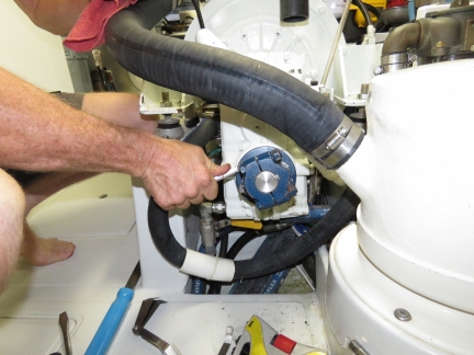
Nova Scotia residents Sebastien, Frederik and Yvan dropped by today with a copy of our guide, Cruising the Secret Coast, to sign. We didn’t ever expect to see a copy of our guide on Canada’s east coast. We had a great time showing them around Dirona and talking boats. These folks are super-knowledgable boaters who cruise extensively on Seakids Six, a boat they built themselves.
|
 |
Wing Alignment
Position: -63 34.18, 44 38.85
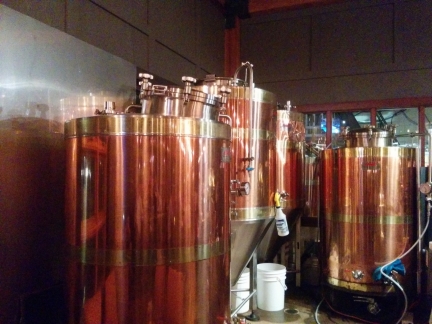
We traced an intermittent small saltwater drip along the port side of the main engine up to the wing packless shaft seal (PSS). The shaft vibrates enough to cause a slight trickle at the shaft seal. A small flex in the shaft prevented the alignnment from being any more precise than 0.002″. That’s well within specifications and it’s now very smooth without a leak.
|
 |
Gahan House
Position: -63 34.33, 44 39.02
Having spent time with our visitors, we didn’t finish the wing engine alingment job until 7pm. We went out for dinner at Gahan House brew pub. This was the only pub repeat visit we made, mainly because it was convenient for a late meal.
|
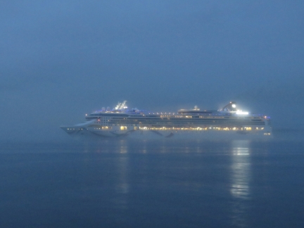 |
Norwegian Dawn
Position: -63 33.49, 44 37.81
The cruise ship Norwegian Dawn glowing through the fog as we depart Halifax Harbour.
|
 |
Sambro Lighthouse
Position: -63 33.03, 44 25.65
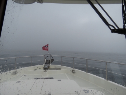
We were planning to pass by Sambro Island to check out Sambro Lighthouse whose Fresnel lens we saw at the Maritime Museum in Halifax. The lighthouse was built in 1758 and is the oldest surviving lighthouse in North America. Since we could barely see the front of our boat in the thick fog, we didn’t feel like navigating through the rock-strewn channel around the island when we wouldn’t likely be able to see much anyway.
|
 |
Peggy’s Cove
Position: -63 54.78, 44 29.28
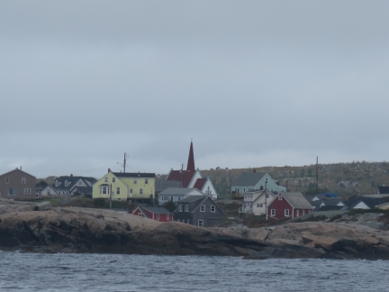
We continued on to Peggy’s Cove, hoping the fog would lift. And luckily it did. This is the fishing village of Peggy’s Cove, nestled along the sea.
|
 |
Peggy’s Point Lighthouse
Position: -63 55.34, 44 29.35
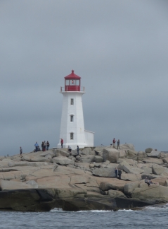
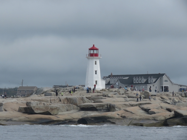
The lighthouse on Peggy’s Point is one of the most accessible, well-known and photographed in Canada. The satellite imagery shows a huge parking lot that was full of buses and cars. And that’s exactly how we found it when we came by.
|
 |
Dirona
Position: -63 55.34, 44 29.35
Al on the Nordhavn Dreamers Yahoo group noticed our passing by on the Peggy’s Cove Lighthouse webcam. Dirona is just visible to the right of the lighthouse.
|

|
Click the travel log icon on the left to see these locations on a map, with the complete log of our cruise.
On the map page, clicking on a camera or text icon will display a picture and/or log entry for that location, and clicking on the smaller icons along the route will display latitude, longitude and other navigation data for that location. And a live map of our current route and most recent log entries always is available at http://mvdirona.com/maps. |
If your comment doesn't show up right away, send us email and we'll dredge it out of the spam filter.