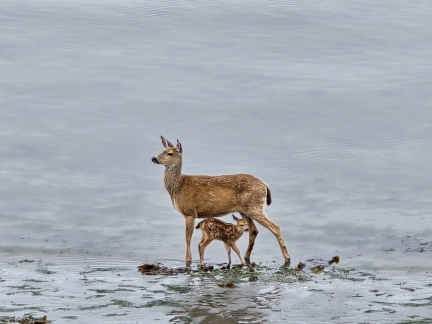
Port Townsend, WA is a Victorian-era waterfront city with a vibrant artist and maritime community. Its Wooden Boat Festival, held annually for nearly a half-century, is the largest in the continent and last year drew 10,000 attendees. We have anchored off Port Townsend many times in the past, enjoying the view to the city’s many 19th-century buildings. On our first time back in over a decade, our room at Tides Inn was so close to the water’s edge and the anchorage that we felt transported back to those times, as if we too were on a boat at anchor. A deer and her fawn, pictured above, were among the many creatures we saw foraging at low tide just outside our window.
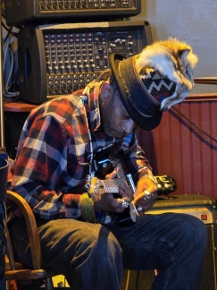
We spent a weekend enjoying the many city’s many restaurants and pubs, including an evening at Sirens Pub where we watched the excellent guitar work of Seattle-based artist BluMeadows. We also made two more rucking excursions (walking carrying weights) to local parks. We’ve come to quite enjoy the activity and plan to invest in purpose-made gear.
Below are highlights from May 24th through 28th, 2024. Click any image for a larger view, or click the position to view the location on a map. And a map with our most recent log entries always is available at mvdirona.com/maps.
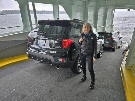 |
Ferry to Bainbridge Island
Position: 47°36.16’N, -122°20.47’W
Our Honda Passport back on a ferry ramp, this one from Seattle to Bainbridge Island to spend the Memorial Day weekend in Port Townsend. The most expedient way to get there is by ferry further north from Mukilteo to Kingston, but we suspected it might be busy on a long-weekend Friday afternoon, so instead opted for slightly-less efficient route via ferry from Seattle to Bainbridge Island. If that was full, we could take the ferry from the same terminal to Bremerton, and if both those failed, we could drive through Tacoma. The route through Tacoma is actually the fastest, but spending so much time driving on busy I-5 is less appealing.
|
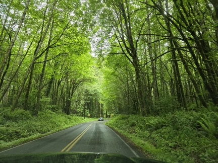 |
Woods
Position: 47°44.18’N, -122°34.06’W
An archway through sunlit new foliage as we pass through the Port Madison Reservation en route to Port Townsend.
|
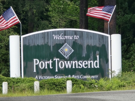 |
Port Townsend
Position: 48°6.00’N, -122°48.81’W
Port Townsend describes itself as “A Victorian Seaport & Arts Community”. The city has many late 19th-century Victorian buildings dating from its prime as a major shipping port in the area. Today Port Townsend supports a thriving art scene and is home to many world-renowned marine trades craftspeople, particularly for wooden boats. The annual Port Townsend Wooden Boat Festival is one of the largest of its kind in the world, drawing about 30,000 people annually.
|
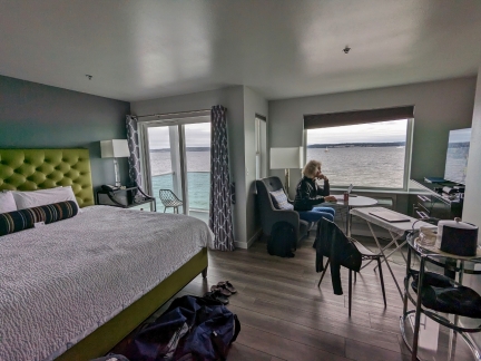 |
Tides Inn, Port Townsend
Position: 48°6.60’N, -122°45.98’W
Our slightly aging room with a world-class view at the Tides Inn in Port Townsend for the Memorial Day weekend.
|
 |
La Cocina, Port Townsend
Position: 48°6.88’N, -122°45.42’W
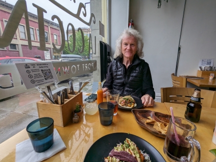
Delicious tacos for dinner at La Cocina in Port Townsend.
|
 |
Tides Inn
Position: 48°6.61’N, -122°45.95’W
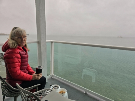
Breakfast on the deck of our room at Tides Inn in Port Towsend.
|
 |
Deer
Position: 48°6.61’N, -122°45.95’W
A deer and her fawn were among the many creatures foraging at low tide just outside our hotel room at Tides Inn in Port Townsend.
|
 |
Anchorage
Position: 48°6.61’N, -122°45.95’W
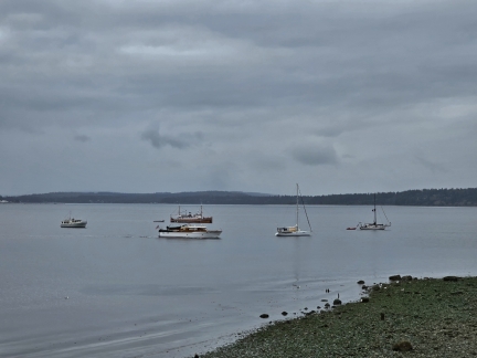
We’ve several times anchored off Tides Inn in Port Townsend, and our room was so close that we felt transported back to those times, as if we too were on a boat at anchor.
|
 |
Uptown Pub
Position: 48°7.05’N, -122°45.67’W
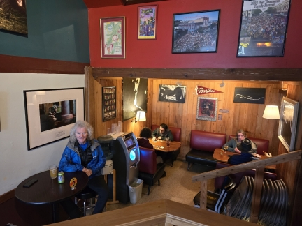
A great lunch at the Uptown Pub in Port Townsend. Everyone seemed to know everyone else in this welcoming neighborhood pub.
|
 |
Fort Townsend Historical State Park
Position: 48°4.63’N, -122°47.50’W
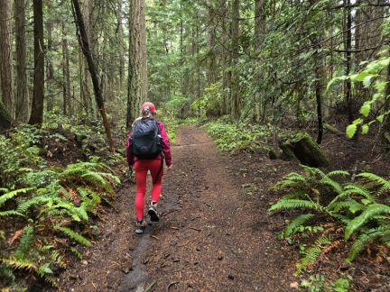
We enjoyed our first rucking hike and are taking another, this time at Fort Townsend Historical State Park. Rucking is walking carrying a weighted backpack, to improve strength, balance and cardiovascular capacity in a low impact way.
|
 |
Torpedo Tower
Position: 48°4.66’N, -122°47.66’W
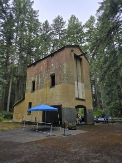
The torpedo x-ray tower at Fort Townsend Historical State Park was built for the a World War II US Navy Explosive Laboratory used to inspect enemy submarine torpedoes and sea mines. The facility used a 2 million-volt x-ray machine, later moved to Bremerton Naval Shipyard, that could penetrate through 10 inches of steel.
|
 |
Haller Fountain
Position: 48°6.91’N, -122°45.43’W
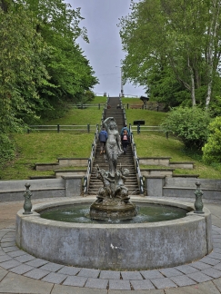
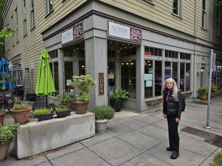
The Haller Fountain is a 1993 bronze replica, donated by Theodore N. Haller, of the original 1903 Galatea Fountain. The 138-step Terrace Steps behind the fountain connect downtown and uptown Port Townsend.
|
 |
Alchemy
Position: 48°6.91’N, -122°45.43’W
Dinner at Alchemy in Port Townsend next to the Haller Fountain. The restaurant has recently changed owners and didn’t live up to its positive reviews, but we had an enjoyable evening.
|
 |
BluMeadows, Sirens Pub
Position: 48°6.86’N, -122°45.35’W
We stopped into Sirens Pub on the Port Townsend waterfront for an after-dinner drink and ended up staying for hours to watch the excellent guitar work of Seattle-based artist BluMeadows. We had a fabulous evening, and got to know several locals and some of the staff at Sirens.
|
 |
Rucking Gear
Position: 48°6.61’N, -122°45.95’W
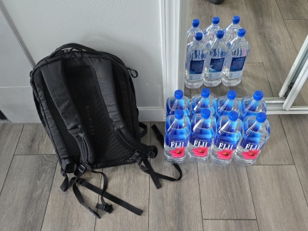
To get started with rucking (walking carrying weight), we are carrying bottles of water in our regular hiking pack. We increased the weight a bit since our first time and James now is carrying 27.2 pounds (12.3 kg) in 8 bottles of water and Jennifer is carrying 20.4l bs (9.3 kg) in 6 bottles. We’re liking the activity quite a bit, so likely will invest in specialized rucking gear.
|
 |
Anderson Lake State Park
Position: 48°1.18’N, -122°48.32’W
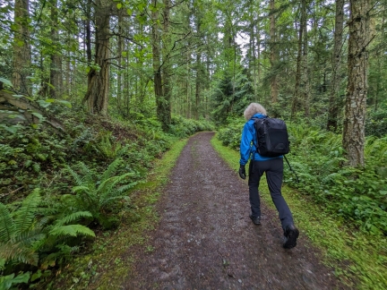
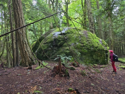
Out rucking (walking carrying weight) in Anderson Lake State Park near Port Townsend. Besides the exercise advantages of rucking, we’re enjoying being out on trails that otherwise would feel a little tame if we were just walking without weight. We’ve been finding plenty of well-maintained and appealing trails that are ideal for rucking.
|
 |
Big Rock
Position: 48°1.40’N, -122°47.71’W
Jennifer inspecting a very large rock during our ruck at Anderson Lake State Park.
|
 |
Doc’s Marina Grill
Position: 48°7.03’N, -122°45.01’W
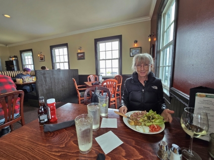
A delicious ahi tuna nicoise salad for lunch at Doc’s Marina Grill in Port Townsend. We’d been to their Bainbridge Island location a few weeks back, and the food here also very good.
|
 |
Pourhouse
Position: 48°6.54’N, -122°46.26’W
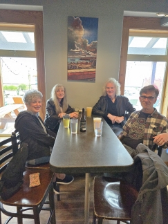
An excellent afternoon in great company at the Pourhouse in Port Townsend with Paul and Kris Leathers. Paul worked with Jennifer on her last team at Microsoft, the Chakra Javascript engine, and now lives in Port Townsend.
|
 |
Sofa Kings
Position: 48°6.86’N, -122°45.35’W
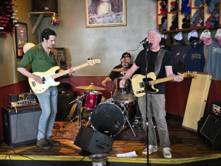
We stopped in at Sirens Pub for dinner and one last bit of live music before returning to Seattle. The featured band tonight was the Sofa Kings, made up of Sirens employees, several of whom we’d chatted with the previous night while watching BluMeadows.
|
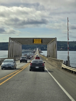 |
Hood Canal Bridge
Position: 47°52.01’N, -122°38.21’W
Returning back across the Hood Canal Bridge on our return from Port Townsend to Seattle. Today is Memorial Day and traffic is quite heavy.
|
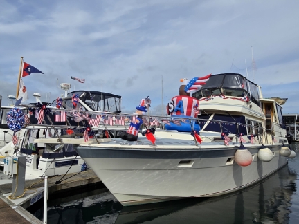 |
Memorial Day
Position: 47°47.70’N, -122°29.80’W
On our return from Port Townsend, we crossed the Puget Sound by ferry from Kingston to Edmonds. While waiting for the ferry, we walked the docks at popular Kingston marina. The Bremerton Yacht Club was holding Memorial Day long-weekend rendezvous, with some of their boats heavily decorated for the occasion.
|
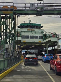 |
Ferry Spokane
Position: 47°47.71’N, -122°29.70’W
Boarding the ferry Spokane as we return to Seattle from spending Memorial Day weekend in Port Townsend.
|
Our routes through Port Townsend are shown on the interactive map below. Click here for a full-page map.

|
Click the travel log icon on the left to see these locations on a map. And a map of our most recent log entries always is available at mvdirona.com/maps. |

If your comment doesn't show up right away, send us email and we'll dredge it out of the spam filter.