We enjoyed our first weekend at Point Ruston so much that we returned for another earlier this year. We love the rooms at the Point Ruston Waterfront hotel, with sweeping views to Commencement Bay, where we can get a little work done by the window and see what’s happening outside, both on land and the water. On our last trip, we explored along the waterfront towards the ferry terminal and Dune Peninsula Park. This time we walked up into the town of Ruston to check out a local pub and got some great views across Commencement Bay from the Wilson Way Pedestrian Bridge that connects Dune Peninsula Park and Point Defiance. And we discovered some more appealing public art in the Point Ruston area.
Below are highlights from January 19 and 20th, 2024. Click any image for a larger view, or click the position to view the location on a map. And a map with our most recent log entries always is available at mvdirona.com/maps.
 |
Position: 47°16.13’N, -122°26.94’W
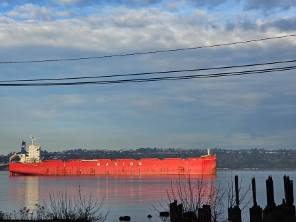
The cargo ship Navios Herakles I at anchor off Tacoma after arriving in from Nantong, China earlier in the week. We passed the vessel on our way to Point Ruston for a weekend stay.
|
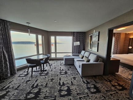 |
Point Ruston Waterfront
Position: 47°18.05’N, -122°30.36’W
Our room at the Point Ruston Waterfront hotel, with sweeping views to Commencement Bay. We really enjoyed our stay here over a year ago, and felt it was time to return.
|
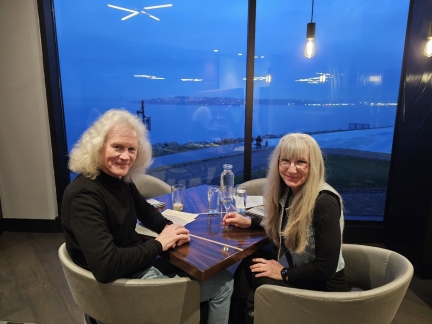 |
Copper & Salt
Position: 47°18.05’N, -122°30.36’W
We had an excellent dinner, with a wonderful view, at Copper & Salt restaurant in our hotel at Point Ruston.
|
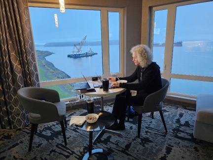 |
The Office
Position: 47°18.05’N, -122°30.36’W
James getting some work done Saturday morning in our hotel room at Point Ruston. We love this spot by the window where we can work and see what’s happening outside, both on land and the water.
|
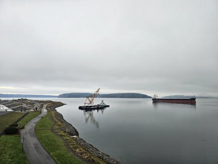 |
Dune Peninsula
Position: 47°18.06’N, -122°30.36’W
Looking down Dune Peninsula park at Point Ruston, named in honor of local author Frank Herbert. The Tacoma Yacht Club is partially visible at left in the distance.
|
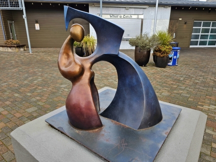 |
Unification
Position: 47°17.98’N, -122°30.30’W
Unification in bronze by Pacific Northwest artist by Edward Korolak is one of many public art displays at Point Ruston.
|
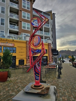 |
Ole
Position: 47°17.97’N, -122°30.30’W
The sculpture Ole by Enumclaw stained-glass artist John Casey and metal artist Anita Schuller on display at Point Ruston.
|
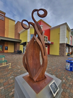 |
Sprite
Position: 47°17.92’N, -122°30.28’W
Another Point Ruston sculpture, this one Sprite by Washington artist Kris Vermeer.
|
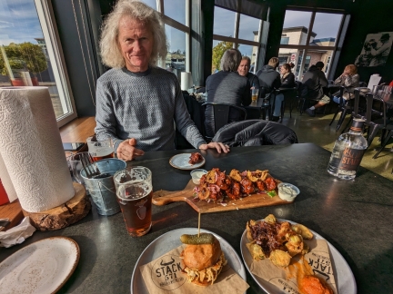 |
Stack 571, Point Ruston
Position: 47°17.94’N, -122°30.29’W
Lunch at Stack 571 at Point Ruston. James ordered the appetizer wings and there was enough there for both of us. Stack 571 is named after the 571-ft (174 m) smokestack, demolished in 1993, that was part of the ASARCO copper smelter at Point Ruston. 571 feet is taller than our 40-story apartment building, and the stack was the highest in the world when completed in 1917. The foul-smelling smoke that spewed from the factory, once one of the most polluted Superfund sites in the country, was the inspiration for local author Frank Herbert’s epic science-fiction novel Dune.
|
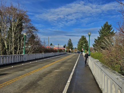 |
Winifred Street Bridge
Position: 47°17.85’N, -122°30.78’W
Jennifer looking down to the railroad tracks from the Winifred Street Bridge in Ruston on an afternoon walk from our hotel at Point Ruston.
|
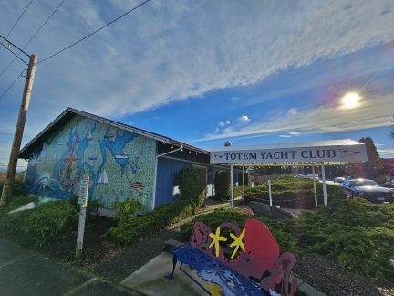 |
Totem Yacht Club, Ruston
Position: 47°17.88’N, -122°30.85’W
The clubhouse for the Totem Yacht Club in Ruston. The club was founded in 1955 to “encourage the sport of yachting, to stimulate a greater interest in boating, to promote the science of seamanship and navigation, and to provide a forum for the exchange of boating information and member fellowship.”
|
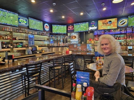 |
North End on Pearl, Ruston
Position: 47°17.86’N, -122°30.91’W
Watching the Houston Texans take on the Baltimore Ravens during in an NFL wildcard games. The game was close for the first half, with score tied at 10-10 at half-time. But the Ravens rallied in the second half to win 34-10.
|
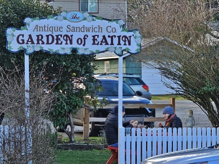 |
Garden of Eatin, Ruston
Position: 47°17.91’N, -122°30.94’W
Patrons of the Antique Sandwich Co. enjoying a winter lunch in the “Garden of Eatin”.
|
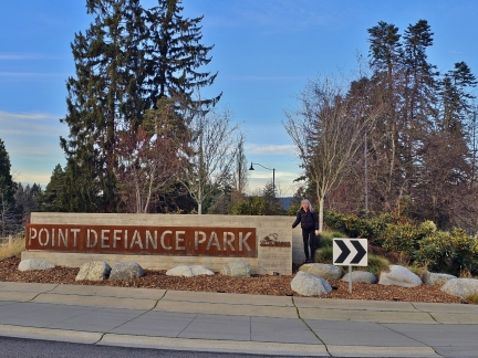 |
Point Defiance Park
Position: 47°18.10’N, -122°30.93’W
Jennifer at the entrance to the Point Defiance Park. The 760-acre (307 ha) green space juts into Puget Sound, and visitors can tour the park either on a ring road or on one of several walking trails. The park incorporates the smaller Dune Peninsula park, and the Fort Nisqually Living History Museum and surrounds the Point Defiance Zoo and Aquarium.
|
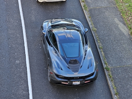 |
McLaren 720S
Position: 47°18.27’N, -122°30.85’W
A spectacular McLaren 720S waiting in the line at Point Defiance for the ferry to Vashon Island, viewed from the Wilson Way Pedestrian Bridge.
|
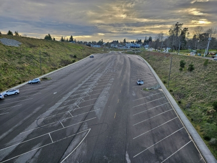 |
Point Defiance Boat Launch
Position: 47°18.26’N, -122°30.82’W
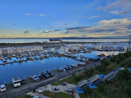
The parking capacity of the Point Defiance Boat Launch indicates how popular it must be in the summer.
|
 |
Tacoma Yacht Club
Position: 47°18.26’N, -122°30.80’W
Looking across the Tacoma Yacht Club from the Wilson Way Pedestrian Bridge connecting Dune Peninsula and Point Defiance.
|
 |
Ruston Way Waterwalk
Position: 47°18.03’N, -122°30.30’W
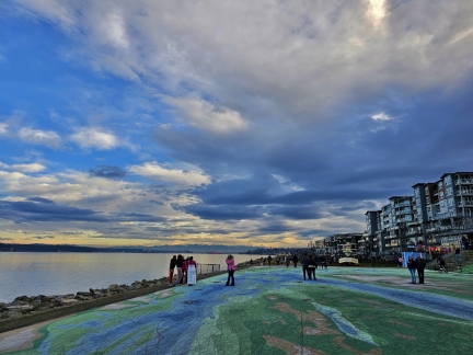
One of several mosaics, this one just outside our hotel, on the Ruston Way Waterwalk along Commencement Bay.
|
 |
Ice Cream Social
Position: 47°17.99’N, -122°30.35’W
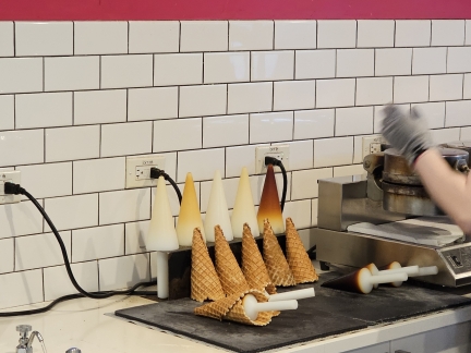
Handmade ice cream cones, freshly made, at the Ice Cream Social in Point Ruston where we stopped to satisfy our sweet tooth.
|
 |
Dusk, Commencement Bay
Position: 47°18.05’N, -122°30.36’W
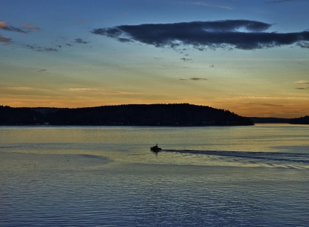
A small Coast Guard vessel streaking across Commencement Bay at dusk.
|
 |
Click the travel log icon on the left to see these locations on a map. And a map of our most recent log entries always is available at mvdirona.com/maps. |

If your comment doesn't show up right away, send us email and we'll dredge it out of the spam filter.