Washington’s Mountain Loop Scenic Byway traverses Barlow Pass in the North Cascade Mountains to connect the towns of Granite Falls and Darrington. Despite its name, the 55-mile (88km) roadway is not actually a loop at all, but a U-shaped route that wraps around several major Cascade Mountain peaks. Ranging in elevation from 5,723 ft (1,744 m) to 6,850 ft (2,090 m), these include Mount Dickerman, Mount Forgotten, Three Fingers, and Whitehorse Mountain.
The byway is a major summer recreation area, with many camp and picnic sites. Dozens of day hike and backpacking trails also extend from either side of the byway, many offering sweeping mountain views. Last summer we spent a holiday long weekend exploring three of these trails and had a fabulous time.
We based ourselves in a rented cabin in Granite Falls, where the highway begins. Our cabin was compact but comfortable, on a private lot backing onto Canyon Creek, and was convenient to town and many excellent hiking trails.
The town of Granite Falls, with a population of 4,800, supports a surprising number of decent restaurants and pubs. We had a good meal every evening, and enjoyed checking out the town.
Our first hike of the weekend was from a 9.3-mile (15km) trek with an elevation gain of 3,146 ft (958 m) Barlow Pass to Gothic Basin and Foggy Lake at elevation 5,221 ft (1,591 m). Even in the middle of summer, snow still covered much of the trail about halfway up, starting around 3,700 ft (1,127 m). But the weather was warm and sunny, so we stripped off most of our layers as we ascended. Foggy Lake was still frozen and snow-covered when we arrived, making a striking backdrop to our picnic lunch.


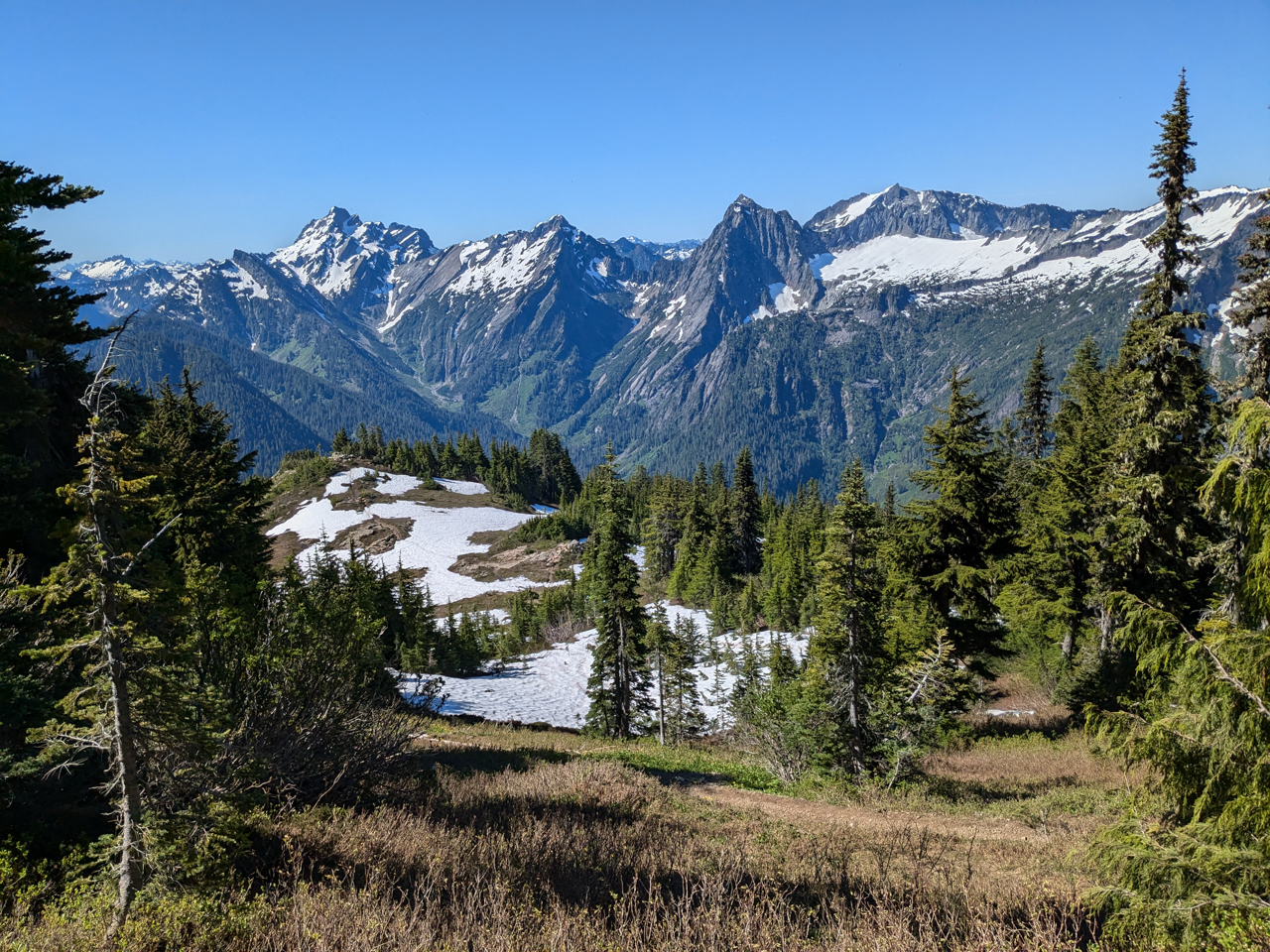
For our second hike, we ascended a sequence of steep switchbacks on a 7.9-mile (12.7km) hike with an elevation gain of 3,877 ft (1,181 m) to the summit of 5,720-ft (1,746 m) Mount Dickerman. With another clear day, the 360-degree view from the top was spectacular. The dozens of visible peaks included 6,858 ft (2,090 m) Three Fingers, 10,525 ft (3,207 m) Glacier Peak, 10,786 ft (3,287m) Mt. Baker, and (14,411 ft (4,392m) Mt. Rainier.


Our final hike of the weekend was a shorter one, 5.2 miles (8.4 km) with an elevation gain of 2,152 ft (656 m), to the forest fire lookout atop 5,344-ft (1,628 m) Mount Pilchuck. The lookout, originally built in 1921, has been restored as a hiker’s hut and is full of historical pictures of the site while outside the views are incredible in all directions. This is a very popular hike in the area, and the parking lot was jammed by the time we returned to our car.
Besides the fabulous mountain views, we also enjoyed the many wildflowers in their brief alpine blooming period, including dogwood, phlox, penstemon, Indian paintbrush, columbine, and asters.


In between hikes, we also explored the falls along the Stillaguamish River, just off the Mountain Loop Scenic Byway, that the town of Granite Falls is named after. We passed the falls each day en route to and from our hikes. The 40-foot-long (tk m) falls gush through a narrow, scenic gorge that in 1954 became the site of the world’s longest fish ladder. The 540-foot (160 m) fish ladder and accompanying 280-foot (85 m) tunnel help salmon and steelhead reach their spawning grounds upriver. While beautiful, the falls can also be deadly, with two drownings since the start of year due to slipping and falling in. Sadly, one occurred the day we hiked Mount Pilchuk, and several emergency vehicles were at the falls parking lot as we passed en route back to our cabin.


Our routes around Granite Falls are shown on the interactive map below. Click here for a full-page map.
If your comment doesn't show up right away, send us email and we'll dredge it out of the spam filter.