Kumlinge is a group of about 800 islands in the northeastern Aland archipelago. Besides the complexity of islands to explore, a major attraction for us was an old Finnish coast guard station, now converted to a resort and marina, with a 130ft (40m) observation tower that provides sweeping views over the area.
Below are trip highlights from May 5th and 6th at Kumlinge, Aland. Click any image for a larger view, or click the position to view the location on a map. And a live map of our current route and most recent log entries always is available at mvdirona.com/maps
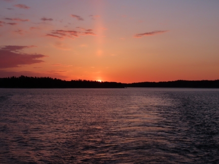 |
Sunrise
Position: 60°13.66’N, 20°17.73’E
Sunrise as we depart the anchorage at Bomarsund.
|
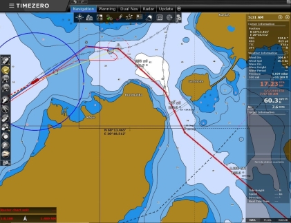 |
Detour
Position: 60°13.80’N, 20°18.35’E
We were planning round the north end of Tofto en route to the Kumlinge Islands, but hadn’t noticed a 24ft (7.3m) fixed bridge when drawing our route. The bridge isn’t very obvious on the chart the way it is drawn with two thin parallel lines. Fortunately the bridge was right at the start of our route and the detour only cost about 15 minutes.
|
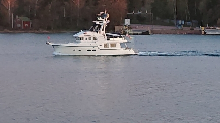 |
Prasto Sund
Position: 60°12.09’N, 20°16.20’E
Seppo Kytomaki sent us this photo taken by Prasto Sund cable ferry skipper Greger Granlund as we passed heading south.
|
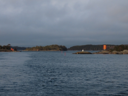 |
Navigation Marks
Position: 60°12.89’N, 20°24.50’E
The channel we just came through is relatively narrow and very well marked with two sets of range markers and several buoys.
|
 |
Alfageln
Position: 60°12.99’N, 20°24.61’E
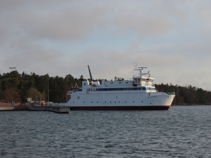
The 171ft (52m) ferry Alfageln at the Hummelvik ferry dock.
|
 |
Start Battery Low
Position: 60°17.35’N, 20°45.37’E
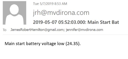
When the main start battery drops down below 50%, we get a warning light and email. In this case, the cause was the engine was left in the on position which causes the stack fan to run. We had turned on the ignition to set the start battery alternator regulator but forgot to shut it off. It’s nice to get a warning before the batteries are damaged. We’ve now got a warning if the enigne is on but not running for more than 15 min.
|
 |
Kumlinge Islands
Position: 60°17.33’N, 20°45.41’E
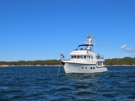
At anchor south of Baro in the Kumlinge Islands as we set out on a tour by tender.
|
 |
Coast Guard Station
Position: 60°18.25’N, 20°44.64’E
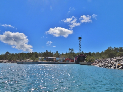
The old coast guard station at the north side of Baro Island. The facility has since been converted into a the appealing-looking Glada Laxen restaurant, resort, conference facility and marina. Glada Laxen doesn’t open until June 1, but we mainly came to take in the views from the top of the old watchtower.
|
 |
Street Clothes
Position: 60°18.22’N, 20°44.62’E
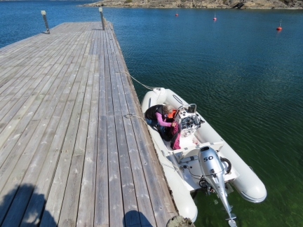
We wore our Mustang 2175s for the tender run, partly for warmth but also for safety in case we hit any rough water. We weren’t sure if we could pass through the shallows east of Baro and might have to run along the west shore, exposed to today’s high winds.
|
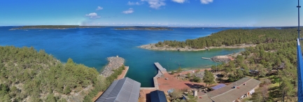 |
View from Tower
Position: 60°18.19’N, 20°44.53’E
The views from the top of the of the (40m) watchtower were incredible in all directions. This is looking north across the Glada Laxen complex.
|
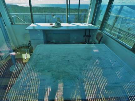 |
Lookout Office
Position: 60°18.19’N, 20°44.52’E
The old office at the top of the watchtower. From here you could see any approaching ship miles away.
|
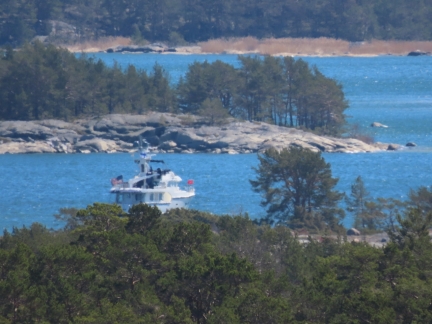 |
Dirona
Position: 60°18.19’N, 20°44.53’E
Dirona moored south of Baro, viewed a mile away from the top of the old coast guard watchtower on Baro.
|
 |
Ferry
Position: 60°18.19’N, 20°44.53’E
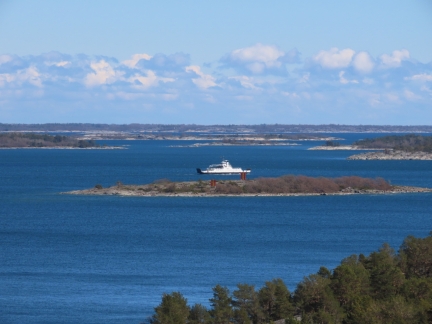
Ferry passing through the Kumlinge Islands, seen from the Baro watchtower.
|
 |
Breakwater
Position: 60°16.49’N, 20°45.30’E
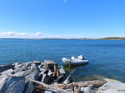
Our next stop on today’s tender trip was the main island of Kumlinge to visit the church there. We tied the tender off to a breakwater at the end of a local road.
|
 |
Ashore
Position: 60°16.43’N, 20°45.58’E
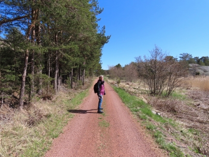
Walking a red dirt road on Kumlinge.
|
 |
Steer
Position: 60°16.37’N, 20°45.84’E
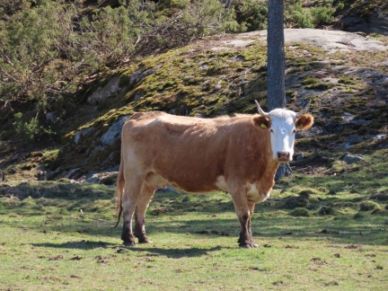
A watchful steer kept a close eye on us as we passed a field full of cattle.
|
 |
Kumlinge Kyrka
Position: 60°16.07’N, 20°46.41’E
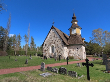
Kumlinge Kyrka, built in the 1300s. The interior is covered with spectacular and unique Francescan-style paintings dating from about 1500, but it appears the church is only open during the summer months.
|
 |
Dishwasher
Position: 60°17.34’N, 20°45.41’E
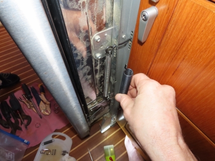
The dishwasher door jammed this morning when we opened it, so we pulled it out and decided to replace the broken spring with a spare spring. This spare is actually used to hold the exhaust cladding on and is not nearly as strong as the one used in the dishwasher, but it’s enough to keep the dishwasher working well. We’ll get the proper replacement on our next visit to North America.
|
 |
Click the travel log icon on the left to see these locations on a map, with the complete log of our cruise.
On the map page, clicking on a camera or text icon will display a picture and/or log entry for that location, and clicking on the smaller icons along the route will display latitude, longitude and other navigation data for that location. And a live map of our current route and most recent log entries always is available at mvdirona.com/maps. |

I’ve never seen a female steer before :)
Well, that’s what she claimed :-)