Loch Ness is one of the top three tourist destinations in Scotland, along with Edinburgh and the Isle of Skye. Second to Nessie, a major draw of Loch Ness is 13th-century Urquhart Castle. One of the largest castles in Scotland, Urquhart attracted some 400,000 visitors in 2016.
On our third day in the Caledonian Canal, we travelled 23 miles from Dochgarroch to Fort Augustus and passed through six locks en route. For most of the run, we were outside the man-made portion of the canal as we cruised 20 miles through the famous Loch Ness. We did take in Urquhart Castle, but there was no sign of Nessie.
Below are trip highlights from October 16th in the Caledonian Canal, Scotland. Click any image for a larger view, or click the position to view the location on a map. And a live map of our current route and most recent log entries always is available at http://mvdirona.com/maps
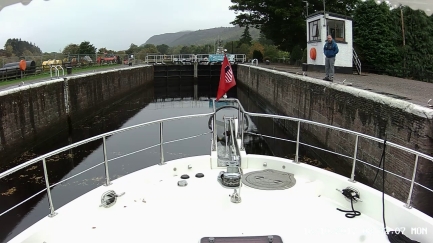 |
Dochgarroch Lock
Position: -4 18.14, 57 25.98
Entering the Dochgarroch Lock at 8:32am. We’d spoken to the canal staff yesterday to arrange an 8:30am opening and the gates opened exactly on time.
|
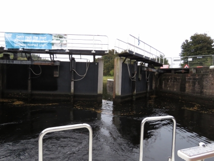 |
Gate Closing
Position: -4 18.14, 57 25.98
The Dochgarroch Lock gate closing behind us.
|
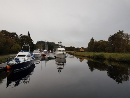 |
Underway
Position: -4 18.39, 57 25.87
Dirona underway through the Caledonian Canal after passing through the Dochgarroch Lock. Neil White took this photo as we passed the Glen Tarsan, moored for the night upstream of the lock.
|
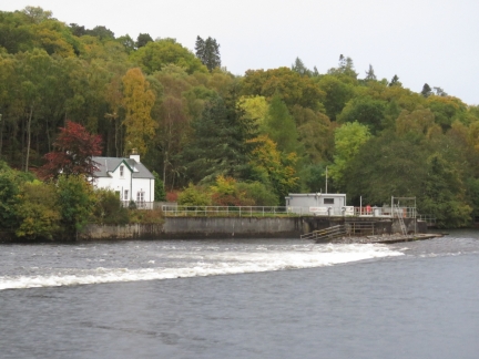 |
Weir
Position: -4 18.79, 57 25.52
Passing the weirs where the Caledonian Canal joins the River Ness.
|
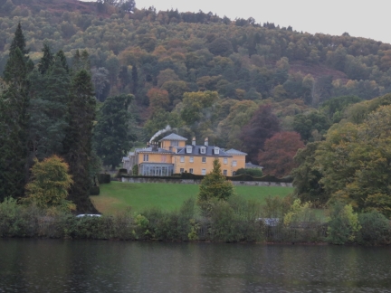 |
Dochfour House
Position: -4 19.35, 57 25.17
Dochfour House above Loch Dochfour. The current house was built around 1780 and includes an extensive series of terraced gardens cut into the sloping land.
|
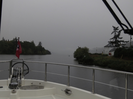 |
Loch Ness
Position: -4 19.68, 57 24.49
Our first view to Loch Ness felt like a typical Scottish scene. Although in reality, we’ve not seen much fog during our time in Scotland.
|
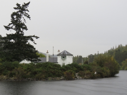 |
Bona Lighthouse
Position: -4 19.82, 57 24.41
Bona Lighthouse at the northern end of Loch Ness is one of only two inland lighthouses in Scotland.
|
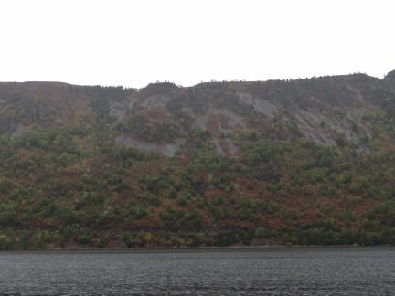 |
Scenery
Position: -4 21.47, 57 23.29
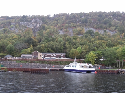
The fog lifted as we entered Loch Ness and we got a chance to enjoy the striking scenery. No sign of Nessie though.
|
 |
Jacobite
Position: -4 23.50, 57 21.80
Loch Ness is one of the top three tourist destinations in Scotland, along with Edinburgh and the Isle of Skye, and Loch Ness cruises are a big business. This is the Jacobite dock midway along, with room for several vessels.
|
 |
Grant Tower
Position: -4 26.45, 57 19.51
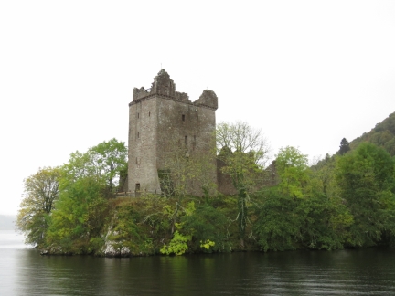
Second to Nessie, a major draw of Loch Ness is Urquhart Castle. Founded in the 13th century, Urquhart Castle was involved in numerous conflicts during it’s 500 years as a medieval fortress. The prominent five-story Grant Tower stands at the north end of the castle above the water.
|
 |
Dirona and Castle
Position: -4 26.43, 57 19.49
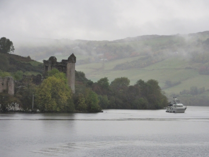
The Glen Tarsan left Dochgarroch after we did and caught up with us at Urquhart Castle. Neil took this picture of Dirona off the castle as they passed.
|
 |
Urquhart Castle
Position: -4 26.41, 57 19.40
Full view to Urquhart Castle and its enclosures, with Grant Tower on the right. The castle one of the largest in Scotland.
|
 |
Ophelia
Position: -4 34.12, 57 13.01
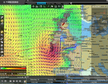
Hurricane Ophelia shows up as a big orange ball in the weather model visualization via our chartplotter Timezero. We don’t expect big winds where we are in the Caledonian Canal, but we’re keeping an eye on it.
|
 |
Cruising Loch Ness
Position: -4 36.46, 57 11.27
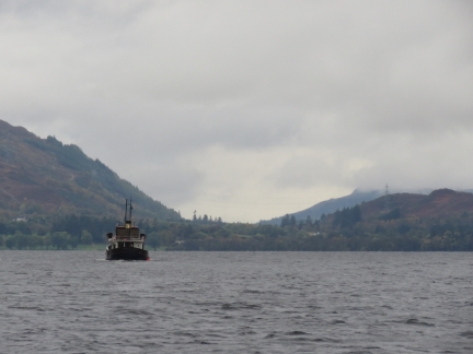
Cruising through the southern end of Loch Ness with the Glen Tarsan.
|
 |
Waterfalls
Position: -4 36.95, 57 10.92
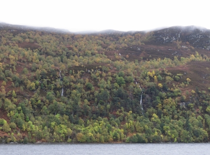
Waterfalls along the east shore of Loch Ness. Despite the overcast conditions, the scenery is fabulous.
|
 |
Manor
Position: -4 40.10, 57 8.93
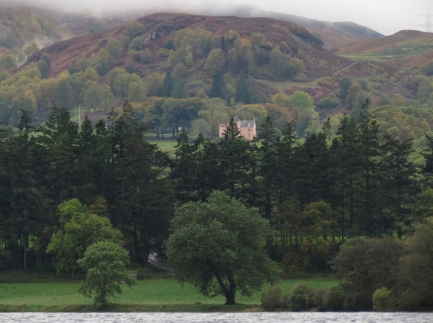
A manor high in the hills above Loch Ness.
|
 |
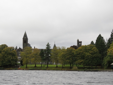
Barometer
Position: -4 40.25, 57 8.83
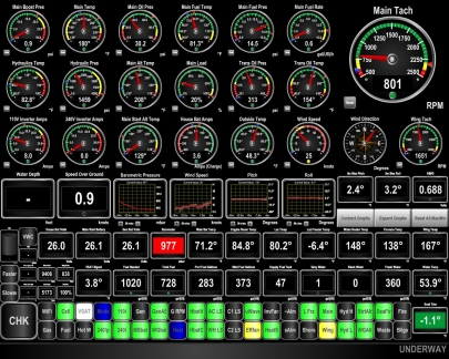
The barometer has been plummeting today and is now down to 977mb as Ophelia approaches. The winds were calm as we started across Loch Ness, but had reached steady 20 kts with gusts into the 30s by the time we reached Fort Augustus at the south end.
|
 |
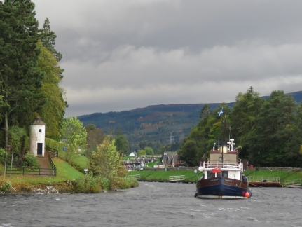
St Benedict’s Abbey
Position: -4 40.26, 57 8.77
St. Benedict’s Abbey, in Fort Augustus as the south end of Loch Ness, was completed in 1880 and was a Benedictine monastery until 1998. In 2013, the BBC Scotland program The Sins of Our Fathers reported allegations that the monastery was used as a dumping ground for monks accused of sexual abuse elsewhere in the world.
|
 |
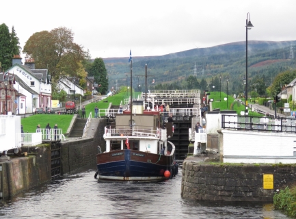
Fort Augustus Light House
Position: -4 40.43, 57 8.79
The Fort Augustus light house, known locally as the “pepper pot”, was built in 1822. At 3 metres in diameter and 7 meters tall, it is believed to be the smallest lighthouse in the UK.
|
 |
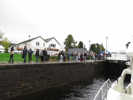
Flight
Position: -4 40.81, 57 8.70
The Glen Tarsan entering the first of five locks in the Fort Augustus flight. Each lock is 180ft (54.9m) long and 40ft (12.2m) wide, and the flight will raise Dirona and Glen Tarsan 40ft (12.2m) from Loch Ness to the Kytra reach.
|
 |
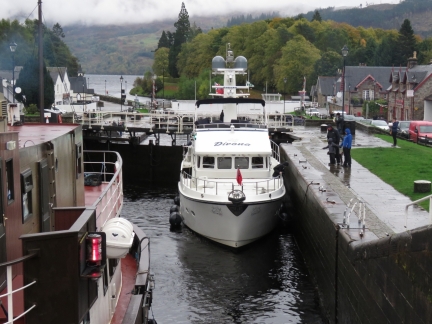
Crowds
Position: -4 40.87, 57 8.69
Crowds of tourists watching us lock through. Another major difference between the Crinan Canal and the Caledonian Canal is the number of people around, even this late in the season.
|
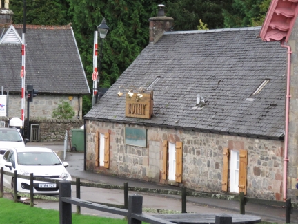 |
The Bothy
Position: -4 40.92, 57 8.69
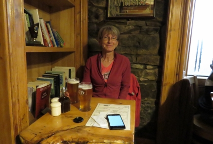
We’ll be stopping for the night at the top of the flight and are scoping out pubs for lunch. The Bothy is one good possibility.
|
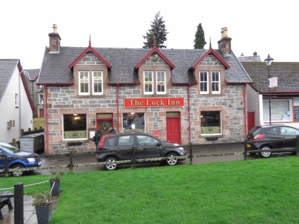 |
The Lock Inn
Position: -4 40.92, 57 8.69
The Lock Inn is another possible pub for lunch. Yet another major difference from the Crinan Canal is that the towns along the Caledonian Canal generally are much larger, so we have multiple choices for a meal.
|
 |
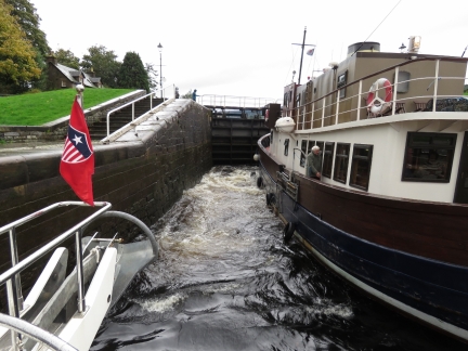
Third Lock
Position: -4 40.97, 57 8.68
Ascending the third lock behind the Glen Tarsan, with Loch Ness visible in the distance.
|
 |
Flow
Position: -4 41.03, 57 8.68
The canal staff brought us through the flight quickly, partly by rapidly raising the water level. This is the surge as the sluice gates are opened.
|
 |
Fort Augustus
Position: -4 41.14, 57 8.67
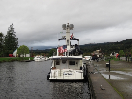
Moored for the night at the top of the flight in Fort Augustus.
|
 |
Bent
Position: -4 40.96, 57 8.68
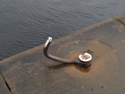
The attachment points for lines alongside the lock run parallel to the ground, but this one had been bent up. That must have taken considerable force.
|
 |
Lunch
Position: -4 40.92, 57 8.68
|
 |
Islander
Position: -4 40.88, 57 8.70
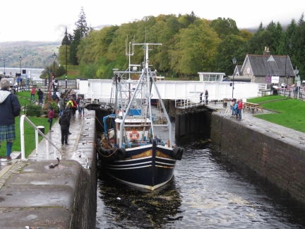
The commercial fishing vessel Islander locking through the Fort Augustus flight. We were surprised to see several commercial fishing vessels passing through the canal, but the route is so much more protected than through the Pentland Firth and around Cape Wrath, so if they aren’t in a rush it’s an easier option.
|

|
Click the travel log icon on the left to see these locations on a map, with the complete log of our cruise.
On the map page, clicking on a camera or text icon will display a picture and/or log entry for that location, and clicking on the smaller icons along the route will display latitude, longitude and other navigation data for that location. And a live map of our current route and most recent log entries always is available at http://mvdirona.com/maps. |

The opening photo of Dirona & Castle is worthy of a Scottish Shortbread tin lid!
The picture was taken from quite a distance so it’s not the clearest picture but it’s very cool to have one of our boat at the Castle. It was nice of Neil White to both take it and send it our way.